SlideShare une entreprise Scribd logo
1  sur  29
Télécharger pour lire hors ligne
October 24th, 2016
International Delft Software Days 2016
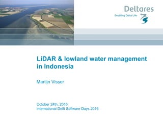
LiDAR & lowland water management
in Indonesia
Martijn Visser
1 januari 2008
Clay / sand
ΔL
Peat swamp
Stream
channel
Stream
channel
Carbon
What is peatland and why is it important
1 januari 2008
Waterlevel
Peat dome
Stream
channel
Stream
channel
Carbon
What is peatland and why is it important
1 januari 2008
What is peatland and why is it important
1 januari 2008
Carbon & Smoke / Haze
What is peatland and why is it important
1 januari 2008
What is peatland and why is it important
Can take over a century of fires
and haze until all peat is lost
Big data?
Big area Big problems
Medium data Small team
Aljosja Hooijer
Ronald Vernimmen
Martijn Visser
Dirk Eilander
Dedi Mulyadi
Angga Trysa Yuherdha
Photo: AP
CARTO map
1 januari 2008
LiDAR application in Indonesia
Overview map of all
LiDAR data applied by
Deltares in projects in
Sumatra and Borneo
(Indonesia and Brunei).
Projects using LiDAR are:
► 2010-14: KFCP; Central
Kalimantan; Ausaid
funded.
► 2013-15: SPPC; SE Asia;
with WI and UGM; NORAD
funded.
► 2014-15: BAP; Brunei;
with WI; Shell funded.
► 2014-15: PBPMP;
Indonesia; APP funded.
LiDAR / Airborne Laser Scanning
Using LiDAR strips to identify the peat domes
Coastal cross section,
covering coastal peat of
East Sumatra;
identification of peat
domes
3D elevation model
Made with ParaView
N
0 10km
3D version of Kampar Peninsula (Riau)
DTM showing forest 2012 (green; as mapped by
Margono et al., 2014), forest that was burnt or partly burnt since
2012, as indicated by MODIS hotspots (red) and canals + logging tracks (blue).
1 januari 2008
Peat mapping training in Joint Cooperation Program
- Training in the “LiDAR strip approach method” to develop peat surface elevation
models (24-27 Aug 2015; 33 participants) and from that MINIMUM peat thickness
maps (3-5 Nov 2015; 24 participants).
- Participants from BIG, BPPT, PusAir, LAPAN, MoEF, Bappenas, IPB, UGM,
UNPAD, UNDIP, WRI
Canopy height and degradation from LiDAR
1 januari 2008
Canopy height and degradation from LiDAR
Example of the height distribution in forest canopy as a function of distance to plantation
perimeter canal on very deep peat (>10m).
1 januari 2008
Canal water levels from LiDAR
Example of the water
levels upstream and
downstream of a dam in
an Acacia plantation on
peat.
TOP: 3D image of location
combining LiDAR data and
orthophoto.
BOTTOM: Profile over
dam, showing a water
level difference across the
dam of 0.9 m.
1 januari 2008
Canal water levels from LiDAR
LiDAR pulses can reflect
in canals for different
reasons.
1 januari 2008
Subsidence over time
LiDAR derived peat surface elevation over a peat dome in West Kalimantan, before and
after plantation development (forest clearing and drainage) in a previously intact area.
Plantation
developed
2011-2012
Orthophoto
10 cm horizontal
resolution
Up the peat
dome
DTM in meters
above mean sea
level
Forest
disturbance
Highlighted by the
density of ground
returns
Single source – multiple maps
Logging tracks can be identified from LiDAR
Zooming in
Visualization of oil palm height from point clouds
Points colored by height above ground, up to 10 meter
Micro
topography
DTM in meters
above mean sea
level
Oil palm height
in meters above
ground level
Single source – multiple maps
Oil Palm productivity
Note that this area is
classified as ‘mature oil
palm plantation’, and it
is indeed all planted
with OP, but nearly all
OP is dead or dying.
This plantation is not
mature and not
productive.
Flooded Acacia
Flooded Oil Palm
Old river
Flooding maps
Peatland subsidence and flooding projection (assuming 3.5 cm/yr in
current plantations
Preventing excess drainage with dams
Peatland water management improvement: plantations
Methods
We are using open source software
• PDAL - Point Data Abstraction Library
• Displaz - A hackable LiDAR viewer
• Potree – Web based LiDAR viewer
Most processing is done in self developed Julia
scripts, with reusable parts shared with the
community on GitHub.
Methods
Julia is a high-level, high-performance dynamic
programming language for technical
computing.
Computationally heavy to process point clouds.
One language for prototyping and large scale
application.
Easy to develop your own fast algorithms.
juliageo.org
Conclusions
LiDAR data, even if not full coverage, can provide a tremendous
amount of insight into the water management issues in the
peatlands of Indonesia.
Based on this data measures can be taken to prevent further
degradation.
More info:
aljosja.hooijer@deltares.nl
martijn.visser@deltares.nl
1 november 2016

Contenu connexe

En vedette

DSD-INT 2016 A crowd-sourced spatial database can change the way we work - Va...
DSD-INT 2016 A crowd-sourced spatial database can change the way we work - Va...DSD-INT 2016 A crowd-sourced spatial database can change the way we work - Va...
DSD-INT 2016 A crowd-sourced spatial database can change the way we work - Va...Deltares
 
DSD-INT 2016 Real-time flood extent maps based on social media - Van Loenen
DSD-INT 2016 Real-time flood extent maps based on social media - Van LoenenDSD-INT 2016 Real-time flood extent maps based on social media - Van Loenen
DSD-INT 2016 Real-time flood extent maps based on social media - Van LoenenDeltares
 
DSD-INT 2016 OpenEarth components in Data Science, some examples - Hendriksen
DSD-INT 2016 OpenEarth components in Data Science, some examples - HendriksenDSD-INT 2016 OpenEarth components in Data Science, some examples - Hendriksen
DSD-INT 2016 OpenEarth components in Data Science, some examples - HendriksenDeltares
 
DSD-INT 2016 (Open) Data science in SWITCH-ON - Boot
DSD-INT 2016 (Open) Data science in SWITCH-ON - BootDSD-INT 2016 (Open) Data science in SWITCH-ON - Boot
DSD-INT 2016 (Open) Data science in SWITCH-ON - BootDeltares
 
Characterizing Forest Degradation and Carbon Biomass Assessment in Tropical P...
Characterizing Forest Degradation and Carbon Biomass Assessment in Tropical P...Characterizing Forest Degradation and Carbon Biomass Assessment in Tropical P...
Characterizing Forest Degradation and Carbon Biomass Assessment in Tropical P...CIFOR-ICRAF
 
Characterizing Forest Degradation and Carbon Biomass Assessment in Tropical ...
Characterizing Forest Degradation and Carbon Biomass Assessment  in Tropical ...Characterizing Forest Degradation and Carbon Biomass Assessment  in Tropical ...
Characterizing Forest Degradation and Carbon Biomass Assessment in Tropical ...CIFOR-ICRAF
 
DSD-INT 2016 Urban water modelling - Meijer
DSD-INT 2016 Urban water modelling - MeijerDSD-INT 2016 Urban water modelling - Meijer
DSD-INT 2016 Urban water modelling - MeijerDeltares
 
DSD-INT 2016 Assessment of hydrologic alterations using floodplain connectivi...
DSD-INT 2016 Assessment of hydrologic alterations using floodplain connectivi...DSD-INT 2016 Assessment of hydrologic alterations using floodplain connectivi...
DSD-INT 2016 Assessment of hydrologic alterations using floodplain connectivi...Deltares
 
DSD-INT 2016 Calibration and scenario generation of hydrodynamics and water -...
DSD-INT 2016 Calibration and scenario generation of hydrodynamics and water -...DSD-INT 2016 Calibration and scenario generation of hydrodynamics and water -...
DSD-INT 2016 Calibration and scenario generation of hydrodynamics and water -...Deltares
 
DSD-INT2016 Mathematical modeling of the influence of a navigable sea channel...
DSD-INT2016 Mathematical modeling of the influence of a navigable sea channel...DSD-INT2016 Mathematical modeling of the influence of a navigable sea channel...
DSD-INT2016 Mathematical modeling of the influence of a navigable sea channel...Deltares
 
DSD-INT 2016 Keynote Lecture 2016: From global to local: the latest developme...
DSD-INT 2016 Keynote Lecture 2016: From global to local: the latest developme...DSD-INT 2016 Keynote Lecture 2016: From global to local: the latest developme...
DSD-INT 2016 Keynote Lecture 2016: From global to local: the latest developme...Deltares
 
DSD-INT 2016 Hydrodynamic modeling and resource-device suitability analysis o...
DSD-INT 2016 Hydrodynamic modeling and resource-device suitability analysis o...DSD-INT 2016 Hydrodynamic modeling and resource-device suitability analysis o...
DSD-INT 2016 Hydrodynamic modeling and resource-device suitability analysis o...Deltares
 
Digital Mapping of Peat soils in Indonesia
Digital Mapping of Peat soils in IndonesiaDigital Mapping of Peat soils in Indonesia
Digital Mapping of Peat soils in IndonesiaBudiman Minasny
 
Penulisan mengikut format apa
Penulisan mengikut  format apaPenulisan mengikut  format apa
Penulisan mengikut format apaNorlasbtintah
 
Indoor Point Cloud Processing
Indoor Point Cloud ProcessingIndoor Point Cloud Processing
Indoor Point Cloud ProcessingPetteriTeikariPhD
 
DSD-INT 2016 My Deltares - Compute As A Service Cloud computing and HPC - Leupe
DSD-INT 2016 My Deltares - Compute As A Service Cloud computing and HPC - LeupeDSD-INT 2016 My Deltares - Compute As A Service Cloud computing and HPC - Leupe
DSD-INT 2016 My Deltares - Compute As A Service Cloud computing and HPC - LeupeDeltares
 
DSD-INT 2016 Delft3D Flexible Mesh Suite 2017 in a nutshell - Melger
DSD-INT 2016 Delft3D Flexible Mesh Suite 2017 in a nutshell - MelgerDSD-INT 2016 Delft3D Flexible Mesh Suite 2017 in a nutshell - Melger
DSD-INT 2016 Delft3D Flexible Mesh Suite 2017 in a nutshell - MelgerDeltares
 
DSD-INT 2016 Mixing of a thermal plume in a highly stratified artificial urba...
DSD-INT 2016 Mixing of a thermal plume in a highly stratified artificial urba...DSD-INT 2016 Mixing of a thermal plume in a highly stratified artificial urba...
DSD-INT 2016 Mixing of a thermal plume in a highly stratified artificial urba...Deltares
 
Justiça manda suspender propaganda da reforma da Previdência
Justiça manda suspender propaganda da reforma da PrevidênciaJustiça manda suspender propaganda da reforma da Previdência
Justiça manda suspender propaganda da reforma da PrevidênciaAquiles Lins
 

En vedette (19)

DSD-INT 2016 A crowd-sourced spatial database can change the way we work - Va...
DSD-INT 2016 A crowd-sourced spatial database can change the way we work - Va...DSD-INT 2016 A crowd-sourced spatial database can change the way we work - Va...
DSD-INT 2016 A crowd-sourced spatial database can change the way we work - Va...
 
DSD-INT 2016 Real-time flood extent maps based on social media - Van Loenen
DSD-INT 2016 Real-time flood extent maps based on social media - Van LoenenDSD-INT 2016 Real-time flood extent maps based on social media - Van Loenen
DSD-INT 2016 Real-time flood extent maps based on social media - Van Loenen
 
DSD-INT 2016 OpenEarth components in Data Science, some examples - Hendriksen
DSD-INT 2016 OpenEarth components in Data Science, some examples - HendriksenDSD-INT 2016 OpenEarth components in Data Science, some examples - Hendriksen
DSD-INT 2016 OpenEarth components in Data Science, some examples - Hendriksen
 
DSD-INT 2016 (Open) Data science in SWITCH-ON - Boot
DSD-INT 2016 (Open) Data science in SWITCH-ON - BootDSD-INT 2016 (Open) Data science in SWITCH-ON - Boot
DSD-INT 2016 (Open) Data science in SWITCH-ON - Boot
 
Characterizing Forest Degradation and Carbon Biomass Assessment in Tropical P...
Characterizing Forest Degradation and Carbon Biomass Assessment in Tropical P...Characterizing Forest Degradation and Carbon Biomass Assessment in Tropical P...
Characterizing Forest Degradation and Carbon Biomass Assessment in Tropical P...
 
Characterizing Forest Degradation and Carbon Biomass Assessment in Tropical ...
Characterizing Forest Degradation and Carbon Biomass Assessment  in Tropical ...Characterizing Forest Degradation and Carbon Biomass Assessment  in Tropical ...
Characterizing Forest Degradation and Carbon Biomass Assessment in Tropical ...
 
DSD-INT 2016 Urban water modelling - Meijer
DSD-INT 2016 Urban water modelling - MeijerDSD-INT 2016 Urban water modelling - Meijer
DSD-INT 2016 Urban water modelling - Meijer
 
DSD-INT 2016 Assessment of hydrologic alterations using floodplain connectivi...
DSD-INT 2016 Assessment of hydrologic alterations using floodplain connectivi...DSD-INT 2016 Assessment of hydrologic alterations using floodplain connectivi...
DSD-INT 2016 Assessment of hydrologic alterations using floodplain connectivi...
 
DSD-INT 2016 Calibration and scenario generation of hydrodynamics and water -...
DSD-INT 2016 Calibration and scenario generation of hydrodynamics and water -...DSD-INT 2016 Calibration and scenario generation of hydrodynamics and water -...
DSD-INT 2016 Calibration and scenario generation of hydrodynamics and water -...
 
DSD-INT2016 Mathematical modeling of the influence of a navigable sea channel...
DSD-INT2016 Mathematical modeling of the influence of a navigable sea channel...DSD-INT2016 Mathematical modeling of the influence of a navigable sea channel...
DSD-INT2016 Mathematical modeling of the influence of a navigable sea channel...
 
DSD-INT 2016 Keynote Lecture 2016: From global to local: the latest developme...
DSD-INT 2016 Keynote Lecture 2016: From global to local: the latest developme...DSD-INT 2016 Keynote Lecture 2016: From global to local: the latest developme...
DSD-INT 2016 Keynote Lecture 2016: From global to local: the latest developme...
 
DSD-INT 2016 Hydrodynamic modeling and resource-device suitability analysis o...
DSD-INT 2016 Hydrodynamic modeling and resource-device suitability analysis o...DSD-INT 2016 Hydrodynamic modeling and resource-device suitability analysis o...
DSD-INT 2016 Hydrodynamic modeling and resource-device suitability analysis o...
 
Digital Mapping of Peat soils in Indonesia
Digital Mapping of Peat soils in IndonesiaDigital Mapping of Peat soils in Indonesia
Digital Mapping of Peat soils in Indonesia
 
Penulisan mengikut format apa
Penulisan mengikut  format apaPenulisan mengikut  format apa
Penulisan mengikut format apa
 
Indoor Point Cloud Processing
Indoor Point Cloud ProcessingIndoor Point Cloud Processing
Indoor Point Cloud Processing
 
DSD-INT 2016 My Deltares - Compute As A Service Cloud computing and HPC - Leupe
DSD-INT 2016 My Deltares - Compute As A Service Cloud computing and HPC - LeupeDSD-INT 2016 My Deltares - Compute As A Service Cloud computing and HPC - Leupe
DSD-INT 2016 My Deltares - Compute As A Service Cloud computing and HPC - Leupe
 
DSD-INT 2016 Delft3D Flexible Mesh Suite 2017 in a nutshell - Melger
DSD-INT 2016 Delft3D Flexible Mesh Suite 2017 in a nutshell - MelgerDSD-INT 2016 Delft3D Flexible Mesh Suite 2017 in a nutshell - Melger
DSD-INT 2016 Delft3D Flexible Mesh Suite 2017 in a nutshell - Melger
 
DSD-INT 2016 Mixing of a thermal plume in a highly stratified artificial urba...
DSD-INT 2016 Mixing of a thermal plume in a highly stratified artificial urba...DSD-INT 2016 Mixing of a thermal plume in a highly stratified artificial urba...
DSD-INT 2016 Mixing of a thermal plume in a highly stratified artificial urba...
 
Justiça manda suspender propaganda da reforma da Previdência
Justiça manda suspender propaganda da reforma da PrevidênciaJustiça manda suspender propaganda da reforma da Previdência
Justiça manda suspender propaganda da reforma da Previdência
 

Similaire à DSD-INT 2016 LiDAR & lowland water management in Indonesia - Visser

Birds, Bats and Beyond. What’s that got to do with Water? - Nick Elderfield (...
Birds, Bats and Beyond. What’s that got to do with Water? - Nick Elderfield (...Birds, Bats and Beyond. What’s that got to do with Water? - Nick Elderfield (...
Birds, Bats and Beyond. What’s that got to do with Water? - Nick Elderfield (...Stephen Flood
 
DSD-INT 2015 - EO-related projects at deltares - Jaap Kwadijk
DSD-INT 2015 - EO-related projects at deltares - Jaap KwadijkDSD-INT 2015 - EO-related projects at deltares - Jaap Kwadijk
DSD-INT 2015 - EO-related projects at deltares - Jaap KwadijkDeltares
 
Application packaging and systematic processing in earth observation exploita...
Application packaging and systematic processing in earth observation exploita...Application packaging and systematic processing in earth observation exploita...
Application packaging and systematic processing in earth observation exploita...terradue
 
IRJET - Remote Sensing, GIS and Geophysical Techniques to Find Suitable Sites...
IRJET - Remote Sensing, GIS and Geophysical Techniques to Find Suitable Sites...IRJET - Remote Sensing, GIS and Geophysical Techniques to Find Suitable Sites...
IRJET - Remote Sensing, GIS and Geophysical Techniques to Find Suitable Sites...IRJET Journal
 
DSD-INT 2014 - Delft-FEWS Users Meeting - Welcome, Jaap Kwadijk, Deltares
DSD-INT 2014 - Delft-FEWS Users Meeting - Welcome, Jaap Kwadijk, DeltaresDSD-INT 2014 - Delft-FEWS Users Meeting - Welcome, Jaap Kwadijk, Deltares
DSD-INT 2014 - Delft-FEWS Users Meeting - Welcome, Jaap Kwadijk, DeltaresDeltares
 
Aopting and adapting SeaDataNet services for EMODnet Chemistry
Aopting and adapting SeaDataNet services for EMODnet ChemistryAopting and adapting SeaDataNet services for EMODnet Chemistry
Aopting and adapting SeaDataNet services for EMODnet ChemistryEUDAT
 
LPS19 ExtremeEarth Project
LPS19 ExtremeEarth ProjectLPS19 ExtremeEarth Project
LPS19 ExtremeEarth ProjectExtremeEarth
 
GFW Partner Meeting 2017 - Parallel Discussions 3: Monitoring Beyond Forests
GFW Partner Meeting 2017 - Parallel Discussions 3: Monitoring Beyond ForestsGFW Partner Meeting 2017 - Parallel Discussions 3: Monitoring Beyond Forests
GFW Partner Meeting 2017 - Parallel Discussions 3: Monitoring Beyond ForestsWorld Resources Institute (WRI)
 
Snow Monitoring for Water Availability and Irrigation
Snow Monitoring for Water Availability and IrrigationSnow Monitoring for Water Availability and Irrigation
Snow Monitoring for Water Availability and IrrigationExtremeEarth
 
DSD-SEA 2023 Innovations in hydro modelling software - Brinkman
DSD-SEA 2023 Innovations in hydro modelling software - BrinkmanDSD-SEA 2023 Innovations in hydro modelling software - Brinkman
DSD-SEA 2023 Innovations in hydro modelling software - BrinkmanDeltares
 
EODATASERVICE.ORG - Digital Earth Platform to enable Muti-disciplinary Geospa...
EODATASERVICE.ORG - Digital Earth Platform to enable Muti-disciplinary Geospa...EODATASERVICE.ORG - Digital Earth Platform to enable Muti-disciplinary Geospa...
EODATASERVICE.ORG - Digital Earth Platform to enable Muti-disciplinary Geospa...EUDAT
 
Drought monitoring, Precipitation statistics, and water balance with freely a...
Drought monitoring, Precipitation statistics, and water balance with freely a...Drought monitoring, Precipitation statistics, and water balance with freely a...
Drought monitoring, Precipitation statistics, and water balance with freely a...AngelosAlamanos
 
Use of Remote Sensing to Investigate Striking Challenges on W R in Lebanon, A...
Use of Remote Sensing to Investigate Striking Challenges on W R in Lebanon, A...Use of Remote Sensing to Investigate Striking Challenges on W R in Lebanon, A...
Use of Remote Sensing to Investigate Striking Challenges on W R in Lebanon, A...NENAwaterscarcity
 
The National Elevation Data Framework
The National Elevation Data FrameworkThe National Elevation Data Framework
The National Elevation Data Frameworkfungis
 
Workshop usgs brasil_2015_01
Workshop usgs brasil_2015_01Workshop usgs brasil_2015_01
Workshop usgs brasil_2015_01Terra-i
 
2019 02-12 eosc-hub for eo
2019 02-12 eosc-hub for eo2019 02-12 eosc-hub for eo
2019 02-12 eosc-hub for eoEGI Federation
 
KnowH2O_Brussels_CAD_20221110_3.pptx
KnowH2O_Brussels_CAD_20221110_3.pptxKnowH2O_Brussels_CAD_20221110_3.pptx
KnowH2O_Brussels_CAD_20221110_3.pptxSBO TURQUOISE
 
DSD-INT 2019 - Global Data Services and Analysis Frameworks - Twigt
DSD-INT 2019 - Global Data Services and Analysis Frameworks - TwigtDSD-INT 2019 - Global Data Services and Analysis Frameworks - Twigt
DSD-INT 2019 - Global Data Services and Analysis Frameworks - TwigtDeltares
 

Similaire à DSD-INT 2016 LiDAR & lowland water management in Indonesia - Visser (20)

Birds, Bats and Beyond. What’s that got to do with Water? - Nick Elderfield (...
Birds, Bats and Beyond. What’s that got to do with Water? - Nick Elderfield (...Birds, Bats and Beyond. What’s that got to do with Water? - Nick Elderfield (...
Birds, Bats and Beyond. What’s that got to do with Water? - Nick Elderfield (...
 
Spce technologies for disaster in thailand
Spce technologies for disaster in thailandSpce technologies for disaster in thailand
Spce technologies for disaster in thailand
 
DSD-INT 2015 - EO-related projects at deltares - Jaap Kwadijk
DSD-INT 2015 - EO-related projects at deltares - Jaap KwadijkDSD-INT 2015 - EO-related projects at deltares - Jaap Kwadijk
DSD-INT 2015 - EO-related projects at deltares - Jaap Kwadijk
 
Application packaging and systematic processing in earth observation exploita...
Application packaging and systematic processing in earth observation exploita...Application packaging and systematic processing in earth observation exploita...
Application packaging and systematic processing in earth observation exploita...
 
IRJET - Remote Sensing, GIS and Geophysical Techniques to Find Suitable Sites...
IRJET - Remote Sensing, GIS and Geophysical Techniques to Find Suitable Sites...IRJET - Remote Sensing, GIS and Geophysical Techniques to Find Suitable Sites...
IRJET - Remote Sensing, GIS and Geophysical Techniques to Find Suitable Sites...
 
DSD-INT 2014 - Delft-FEWS Users Meeting - Welcome, Jaap Kwadijk, Deltares
DSD-INT 2014 - Delft-FEWS Users Meeting - Welcome, Jaap Kwadijk, DeltaresDSD-INT 2014 - Delft-FEWS Users Meeting - Welcome, Jaap Kwadijk, Deltares
DSD-INT 2014 - Delft-FEWS Users Meeting - Welcome, Jaap Kwadijk, Deltares
 
Aopting and adapting SeaDataNet services for EMODnet Chemistry
Aopting and adapting SeaDataNet services for EMODnet ChemistryAopting and adapting SeaDataNet services for EMODnet Chemistry
Aopting and adapting SeaDataNet services for EMODnet Chemistry
 
LPS19 ExtremeEarth Project
LPS19 ExtremeEarth ProjectLPS19 ExtremeEarth Project
LPS19 ExtremeEarth Project
 
GFW Partner Meeting 2017 - Parallel Discussions 3: Monitoring Beyond Forests
GFW Partner Meeting 2017 - Parallel Discussions 3: Monitoring Beyond ForestsGFW Partner Meeting 2017 - Parallel Discussions 3: Monitoring Beyond Forests
GFW Partner Meeting 2017 - Parallel Discussions 3: Monitoring Beyond Forests
 
Snow Monitoring for Water Availability and Irrigation
Snow Monitoring for Water Availability and IrrigationSnow Monitoring for Water Availability and Irrigation
Snow Monitoring for Water Availability and Irrigation
 
DSD-SEA 2023 Innovations in hydro modelling software - Brinkman
DSD-SEA 2023 Innovations in hydro modelling software - BrinkmanDSD-SEA 2023 Innovations in hydro modelling software - Brinkman
DSD-SEA 2023 Innovations in hydro modelling software - Brinkman
 
EODATASERVICE.ORG - Digital Earth Platform to enable Muti-disciplinary Geospa...
EODATASERVICE.ORG - Digital Earth Platform to enable Muti-disciplinary Geospa...EODATASERVICE.ORG - Digital Earth Platform to enable Muti-disciplinary Geospa...
EODATASERVICE.ORG - Digital Earth Platform to enable Muti-disciplinary Geospa...
 
Drought monitoring, Precipitation statistics, and water balance with freely a...
Drought monitoring, Precipitation statistics, and water balance with freely a...Drought monitoring, Precipitation statistics, and water balance with freely a...
Drought monitoring, Precipitation statistics, and water balance with freely a...
 
Use of Remote Sensing to Investigate Striking Challenges on W R in Lebanon, A...
Use of Remote Sensing to Investigate Striking Challenges on W R in Lebanon, A...Use of Remote Sensing to Investigate Striking Challenges on W R in Lebanon, A...
Use of Remote Sensing to Investigate Striking Challenges on W R in Lebanon, A...
 
The National Elevation Data Framework
The National Elevation Data FrameworkThe National Elevation Data Framework
The National Elevation Data Framework
 
Thailand flood v1
Thailand flood v1Thailand flood v1
Thailand flood v1
 
Workshop usgs brasil_2015_01
Workshop usgs brasil_2015_01Workshop usgs brasil_2015_01
Workshop usgs brasil_2015_01
 
2019 02-12 eosc-hub for eo
2019 02-12 eosc-hub for eo2019 02-12 eosc-hub for eo
2019 02-12 eosc-hub for eo
 
KnowH2O_Brussels_CAD_20221110_3.pptx
KnowH2O_Brussels_CAD_20221110_3.pptxKnowH2O_Brussels_CAD_20221110_3.pptx
KnowH2O_Brussels_CAD_20221110_3.pptx
 
DSD-INT 2019 - Global Data Services and Analysis Frameworks - Twigt
DSD-INT 2019 - Global Data Services and Analysis Frameworks - TwigtDSD-INT 2019 - Global Data Services and Analysis Frameworks - Twigt
DSD-INT 2019 - Global Data Services and Analysis Frameworks - Twigt
 

Plus de Deltares

DSD-INT 2023 Hydrology User Days - Intro - Day 3 - Kroon
DSD-INT 2023 Hydrology User Days - Intro - Day 3 - KroonDSD-INT 2023 Hydrology User Days - Intro - Day 3 - Kroon
DSD-INT 2023 Hydrology User Days - Intro - Day 3 - KroonDeltares
 
DSD-INT 2023 Demo EPIC Response Assessment Methodology (ERAM) - Couvin Rodriguez
DSD-INT 2023 Demo EPIC Response Assessment Methodology (ERAM) - Couvin RodriguezDSD-INT 2023 Demo EPIC Response Assessment Methodology (ERAM) - Couvin Rodriguez
DSD-INT 2023 Demo EPIC Response Assessment Methodology (ERAM) - Couvin RodriguezDeltares
 
DSD-INT 2023 Demo Climate Stress Testing Tool (CST Tool) - Taner
DSD-INT 2023 Demo Climate Stress Testing Tool (CST Tool) - TanerDSD-INT 2023 Demo Climate Stress Testing Tool (CST Tool) - Taner
DSD-INT 2023 Demo Climate Stress Testing Tool (CST Tool) - TanerDeltares
 
DSD-INT 2023 Demo Climate Resilient Cities Tool (CRC Tool) - Rooze
DSD-INT 2023 Demo Climate Resilient Cities Tool (CRC Tool) - RoozeDSD-INT 2023 Demo Climate Resilient Cities Tool (CRC Tool) - Rooze
DSD-INT 2023 Demo Climate Resilient Cities Tool (CRC Tool) - RoozeDeltares
 
DSD-INT 2023 Approaches for assessing multi-hazard risk - Ward
DSD-INT 2023 Approaches for assessing multi-hazard risk - WardDSD-INT 2023 Approaches for assessing multi-hazard risk - Ward
DSD-INT 2023 Approaches for assessing multi-hazard risk - WardDeltares
 
DSD-INT 2023 Dynamic Adaptive Policy Pathways (DAPP) - Theory & Showcase - Wa...
DSD-INT 2023 Dynamic Adaptive Policy Pathways (DAPP) - Theory & Showcase - Wa...DSD-INT 2023 Dynamic Adaptive Policy Pathways (DAPP) - Theory & Showcase - Wa...
DSD-INT 2023 Dynamic Adaptive Policy Pathways (DAPP) - Theory & Showcase - Wa...Deltares
 
DSD-INT 2023 Global hydrological modelling to support worldwide water assessm...
DSD-INT 2023 Global hydrological modelling to support worldwide water assessm...DSD-INT 2023 Global hydrological modelling to support worldwide water assessm...
DSD-INT 2023 Global hydrological modelling to support worldwide water assessm...Deltares
 
DSD-INT 2023 Modelling implications - IPCC Working Group II - From AR6 to AR7...
DSD-INT 2023 Modelling implications - IPCC Working Group II - From AR6 to AR7...DSD-INT 2023 Modelling implications - IPCC Working Group II - From AR6 to AR7...
DSD-INT 2023 Modelling implications - IPCC Working Group II - From AR6 to AR7...Deltares
 
DSD-INT 2023 Knowledge and tools for Climate Adaptation - Jeuken
DSD-INT 2023 Knowledge and tools for Climate Adaptation - JeukenDSD-INT 2023 Knowledge and tools for Climate Adaptation - Jeuken
DSD-INT 2023 Knowledge and tools for Climate Adaptation - JeukenDeltares
 
DSD-INT 2023 Coupling RIBASIM to a MODFLOW groundwater model - Bootsma
DSD-INT 2023 Coupling RIBASIM to a MODFLOW groundwater model - BootsmaDSD-INT 2023 Coupling RIBASIM to a MODFLOW groundwater model - Bootsma
DSD-INT 2023 Coupling RIBASIM to a MODFLOW groundwater model - BootsmaDeltares
 
DSD-INT 2023 Create your own MODFLOW 6 sub-variant - Muller
DSD-INT 2023 Create your own MODFLOW 6 sub-variant - MullerDSD-INT 2023 Create your own MODFLOW 6 sub-variant - Muller
DSD-INT 2023 Create your own MODFLOW 6 sub-variant - MullerDeltares
 
DSD-INT 2023 Example of unstructured MODFLOW 6 modelling in California - Romero
DSD-INT 2023 Example of unstructured MODFLOW 6 modelling in California - RomeroDSD-INT 2023 Example of unstructured MODFLOW 6 modelling in California - Romero
DSD-INT 2023 Example of unstructured MODFLOW 6 modelling in California - RomeroDeltares
 
DSD-INT 2023 Challenges and developments in groundwater modeling - Bakker
DSD-INT 2023 Challenges and developments in groundwater modeling - BakkerDSD-INT 2023 Challenges and developments in groundwater modeling - Bakker
DSD-INT 2023 Challenges and developments in groundwater modeling - BakkerDeltares
 
DSD-INT 2023 Demo new features iMOD Suite - van Engelen
DSD-INT 2023 Demo new features iMOD Suite - van EngelenDSD-INT 2023 Demo new features iMOD Suite - van Engelen
DSD-INT 2023 Demo new features iMOD Suite - van EngelenDeltares
 
DSD-INT 2023 iMOD and new developments - Davids
DSD-INT 2023 iMOD and new developments - DavidsDSD-INT 2023 iMOD and new developments - Davids
DSD-INT 2023 iMOD and new developments - DavidsDeltares
 
DSD-INT 2023 Recent MODFLOW Developments - Langevin
DSD-INT 2023 Recent MODFLOW Developments - LangevinDSD-INT 2023 Recent MODFLOW Developments - Langevin
DSD-INT 2023 Recent MODFLOW Developments - LangevinDeltares
 
DSD-INT 2023 Hydrology User Days - Presentations - Day 2
DSD-INT 2023 Hydrology User Days - Presentations - Day 2DSD-INT 2023 Hydrology User Days - Presentations - Day 2
DSD-INT 2023 Hydrology User Days - Presentations - Day 2Deltares
 
DSD-INT 2023 Needs related to user interfaces - Snippen
DSD-INT 2023 Needs related to user interfaces - SnippenDSD-INT 2023 Needs related to user interfaces - Snippen
DSD-INT 2023 Needs related to user interfaces - SnippenDeltares
 
DSD-INT 2023 Coupling RIBASIM to a MODFLOW groundwater model - Bootsma
DSD-INT 2023 Coupling RIBASIM to a MODFLOW groundwater model - BootsmaDSD-INT 2023 Coupling RIBASIM to a MODFLOW groundwater model - Bootsma
DSD-INT 2023 Coupling RIBASIM to a MODFLOW groundwater model - BootsmaDeltares
 
DSD-INT 2023 Parameterization of a RIBASIM model and the network lumping appr...
DSD-INT 2023 Parameterization of a RIBASIM model and the network lumping appr...DSD-INT 2023 Parameterization of a RIBASIM model and the network lumping appr...
DSD-INT 2023 Parameterization of a RIBASIM model and the network lumping appr...Deltares
 

Plus de Deltares (20)

DSD-INT 2023 Hydrology User Days - Intro - Day 3 - Kroon
DSD-INT 2023 Hydrology User Days - Intro - Day 3 - KroonDSD-INT 2023 Hydrology User Days - Intro - Day 3 - Kroon
DSD-INT 2023 Hydrology User Days - Intro - Day 3 - Kroon
 
DSD-INT 2023 Demo EPIC Response Assessment Methodology (ERAM) - Couvin Rodriguez
DSD-INT 2023 Demo EPIC Response Assessment Methodology (ERAM) - Couvin RodriguezDSD-INT 2023 Demo EPIC Response Assessment Methodology (ERAM) - Couvin Rodriguez
DSD-INT 2023 Demo EPIC Response Assessment Methodology (ERAM) - Couvin Rodriguez
 
DSD-INT 2023 Demo Climate Stress Testing Tool (CST Tool) - Taner
DSD-INT 2023 Demo Climate Stress Testing Tool (CST Tool) - TanerDSD-INT 2023 Demo Climate Stress Testing Tool (CST Tool) - Taner
DSD-INT 2023 Demo Climate Stress Testing Tool (CST Tool) - Taner
 
DSD-INT 2023 Demo Climate Resilient Cities Tool (CRC Tool) - Rooze
DSD-INT 2023 Demo Climate Resilient Cities Tool (CRC Tool) - RoozeDSD-INT 2023 Demo Climate Resilient Cities Tool (CRC Tool) - Rooze
DSD-INT 2023 Demo Climate Resilient Cities Tool (CRC Tool) - Rooze
 
DSD-INT 2023 Approaches for assessing multi-hazard risk - Ward
DSD-INT 2023 Approaches for assessing multi-hazard risk - WardDSD-INT 2023 Approaches for assessing multi-hazard risk - Ward
DSD-INT 2023 Approaches for assessing multi-hazard risk - Ward
 
DSD-INT 2023 Dynamic Adaptive Policy Pathways (DAPP) - Theory & Showcase - Wa...
DSD-INT 2023 Dynamic Adaptive Policy Pathways (DAPP) - Theory & Showcase - Wa...DSD-INT 2023 Dynamic Adaptive Policy Pathways (DAPP) - Theory & Showcase - Wa...
DSD-INT 2023 Dynamic Adaptive Policy Pathways (DAPP) - Theory & Showcase - Wa...
 
DSD-INT 2023 Global hydrological modelling to support worldwide water assessm...
DSD-INT 2023 Global hydrological modelling to support worldwide water assessm...DSD-INT 2023 Global hydrological modelling to support worldwide water assessm...
DSD-INT 2023 Global hydrological modelling to support worldwide water assessm...
 
DSD-INT 2023 Modelling implications - IPCC Working Group II - From AR6 to AR7...
DSD-INT 2023 Modelling implications - IPCC Working Group II - From AR6 to AR7...DSD-INT 2023 Modelling implications - IPCC Working Group II - From AR6 to AR7...
DSD-INT 2023 Modelling implications - IPCC Working Group II - From AR6 to AR7...
 
DSD-INT 2023 Knowledge and tools for Climate Adaptation - Jeuken
DSD-INT 2023 Knowledge and tools for Climate Adaptation - JeukenDSD-INT 2023 Knowledge and tools for Climate Adaptation - Jeuken
DSD-INT 2023 Knowledge and tools for Climate Adaptation - Jeuken
 
DSD-INT 2023 Coupling RIBASIM to a MODFLOW groundwater model - Bootsma
DSD-INT 2023 Coupling RIBASIM to a MODFLOW groundwater model - BootsmaDSD-INT 2023 Coupling RIBASIM to a MODFLOW groundwater model - Bootsma
DSD-INT 2023 Coupling RIBASIM to a MODFLOW groundwater model - Bootsma
 
DSD-INT 2023 Create your own MODFLOW 6 sub-variant - Muller
DSD-INT 2023 Create your own MODFLOW 6 sub-variant - MullerDSD-INT 2023 Create your own MODFLOW 6 sub-variant - Muller
DSD-INT 2023 Create your own MODFLOW 6 sub-variant - Muller
 
DSD-INT 2023 Example of unstructured MODFLOW 6 modelling in California - Romero
DSD-INT 2023 Example of unstructured MODFLOW 6 modelling in California - RomeroDSD-INT 2023 Example of unstructured MODFLOW 6 modelling in California - Romero
DSD-INT 2023 Example of unstructured MODFLOW 6 modelling in California - Romero
 
DSD-INT 2023 Challenges and developments in groundwater modeling - Bakker
DSD-INT 2023 Challenges and developments in groundwater modeling - BakkerDSD-INT 2023 Challenges and developments in groundwater modeling - Bakker
DSD-INT 2023 Challenges and developments in groundwater modeling - Bakker
 
DSD-INT 2023 Demo new features iMOD Suite - van Engelen
DSD-INT 2023 Demo new features iMOD Suite - van EngelenDSD-INT 2023 Demo new features iMOD Suite - van Engelen
DSD-INT 2023 Demo new features iMOD Suite - van Engelen
 
DSD-INT 2023 iMOD and new developments - Davids
DSD-INT 2023 iMOD and new developments - DavidsDSD-INT 2023 iMOD and new developments - Davids
DSD-INT 2023 iMOD and new developments - Davids
 
DSD-INT 2023 Recent MODFLOW Developments - Langevin
DSD-INT 2023 Recent MODFLOW Developments - LangevinDSD-INT 2023 Recent MODFLOW Developments - Langevin
DSD-INT 2023 Recent MODFLOW Developments - Langevin
 
DSD-INT 2023 Hydrology User Days - Presentations - Day 2
DSD-INT 2023 Hydrology User Days - Presentations - Day 2DSD-INT 2023 Hydrology User Days - Presentations - Day 2
DSD-INT 2023 Hydrology User Days - Presentations - Day 2
 
DSD-INT 2023 Needs related to user interfaces - Snippen
DSD-INT 2023 Needs related to user interfaces - SnippenDSD-INT 2023 Needs related to user interfaces - Snippen
DSD-INT 2023 Needs related to user interfaces - Snippen
 
DSD-INT 2023 Coupling RIBASIM to a MODFLOW groundwater model - Bootsma
DSD-INT 2023 Coupling RIBASIM to a MODFLOW groundwater model - BootsmaDSD-INT 2023 Coupling RIBASIM to a MODFLOW groundwater model - Bootsma
DSD-INT 2023 Coupling RIBASIM to a MODFLOW groundwater model - Bootsma
 
DSD-INT 2023 Parameterization of a RIBASIM model and the network lumping appr...
DSD-INT 2023 Parameterization of a RIBASIM model and the network lumping appr...DSD-INT 2023 Parameterization of a RIBASIM model and the network lumping appr...
DSD-INT 2023 Parameterization of a RIBASIM model and the network lumping appr...
 

Dernier

The Top App Development Trends Shaping the Industry in 2024-25 .pdf
The Top App Development Trends Shaping the Industry in 2024-25 .pdfThe Top App Development Trends Shaping the Industry in 2024-25 .pdf
The Top App Development Trends Shaping the Industry in 2024-25 .pdfayushiqss
 
AI Mastery 201: Elevating Your Workflow with Advanced LLM Techniques
AI Mastery 201: Elevating Your Workflow with Advanced LLM TechniquesAI Mastery 201: Elevating Your Workflow with Advanced LLM Techniques
AI Mastery 201: Elevating Your Workflow with Advanced LLM TechniquesVictorSzoltysek
 
10 Trends Likely to Shape Enterprise Technology in 2024
10 Trends Likely to Shape Enterprise Technology in 202410 Trends Likely to Shape Enterprise Technology in 2024
10 Trends Likely to Shape Enterprise Technology in 2024Mind IT Systems
 
OpenChain - The Ramifications of ISO/IEC 5230 and ISO/IEC 18974 for Legal Pro...
OpenChain - The Ramifications of ISO/IEC 5230 and ISO/IEC 18974 for Legal Pro...OpenChain - The Ramifications of ISO/IEC 5230 and ISO/IEC 18974 for Legal Pro...
OpenChain - The Ramifications of ISO/IEC 5230 and ISO/IEC 18974 for Legal Pro...Shane Coughlan
 
ManageIQ - Sprint 236 Review - Slide Deck
ManageIQ - Sprint 236 Review - Slide DeckManageIQ - Sprint 236 Review - Slide Deck
ManageIQ - Sprint 236 Review - Slide DeckManageIQ
 
Shapes for Sharing between Graph Data Spaces - and Epistemic Querying of RDF-...
Shapes for Sharing between Graph Data Spaces - and Epistemic Querying of RDF-...Shapes for Sharing between Graph Data Spaces - and Epistemic Querying of RDF-...
Shapes for Sharing between Graph Data Spaces - and Epistemic Querying of RDF-...Steffen Staab
 
call girls in Vaishali (Ghaziabad) 🔝 >༒8448380779 🔝 genuine Escort Service 🔝✔️✔️
call girls in Vaishali (Ghaziabad) 🔝 >༒8448380779 🔝 genuine Escort Service 🔝✔️✔️call girls in Vaishali (Ghaziabad) 🔝 >༒8448380779 🔝 genuine Escort Service 🔝✔️✔️
call girls in Vaishali (Ghaziabad) 🔝 >༒8448380779 🔝 genuine Escort Service 🔝✔️✔️Delhi Call girls
 
%in Stilfontein+277-882-255-28 abortion pills for sale in Stilfontein
%in Stilfontein+277-882-255-28 abortion pills for sale in Stilfontein%in Stilfontein+277-882-255-28 abortion pills for sale in Stilfontein
%in Stilfontein+277-882-255-28 abortion pills for sale in Stilfonteinmasabamasaba
 
Software Quality Assurance Interview Questions
Software Quality Assurance Interview QuestionsSoftware Quality Assurance Interview Questions
Software Quality Assurance Interview QuestionsArshad QA
 
Right Money Management App For Your Financial Goals
Right Money Management App For Your Financial GoalsRight Money Management App For Your Financial Goals
Right Money Management App For Your Financial GoalsJhone kinadey
 
Chinsurah Escorts ☎️8617697112 Starting From 5K to 15K High Profile Escorts ...
Chinsurah Escorts ☎️8617697112  Starting From 5K to 15K High Profile Escorts ...Chinsurah Escorts ☎️8617697112  Starting From 5K to 15K High Profile Escorts ...
Chinsurah Escorts ☎️8617697112 Starting From 5K to 15K High Profile Escorts ...Nitya salvi
 
Unlocking the Future of AI Agents with Large Language Models
Unlocking the Future of AI Agents with Large Language ModelsUnlocking the Future of AI Agents with Large Language Models
Unlocking the Future of AI Agents with Large Language Modelsaagamshah0812
 
Unveiling the Tech Salsa of LAMs with Janus in Real-Time Applications
Unveiling the Tech Salsa of LAMs with Janus in Real-Time ApplicationsUnveiling the Tech Salsa of LAMs with Janus in Real-Time Applications
Unveiling the Tech Salsa of LAMs with Janus in Real-Time ApplicationsAlberto González Trastoy
 
Exploring the Best Video Editing App.pdf
Exploring the Best Video Editing App.pdfExploring the Best Video Editing App.pdf
Exploring the Best Video Editing App.pdfproinshot.com
 
Define the academic and professional writing..pdf
Define the academic and professional writing..pdfDefine the academic and professional writing..pdf
Define the academic and professional writing..pdfPearlKirahMaeRagusta1
 
Optimizing AI for immediate response in Smart CCTV
Optimizing AI for immediate response in Smart CCTVOptimizing AI for immediate response in Smart CCTV
Optimizing AI for immediate response in Smart CCTVshikhaohhpro
 
Azure_Native_Qumulo_High_Performance_Compute_Benchmarks.pdf
Azure_Native_Qumulo_High_Performance_Compute_Benchmarks.pdfAzure_Native_Qumulo_High_Performance_Compute_Benchmarks.pdf
Azure_Native_Qumulo_High_Performance_Compute_Benchmarks.pdfryanfarris8
 
AI & Machine Learning Presentation Template
AI & Machine Learning Presentation TemplateAI & Machine Learning Presentation Template
AI & Machine Learning Presentation TemplatePresentation.STUDIO
 
%in kaalfontein+277-882-255-28 abortion pills for sale in kaalfontein
%in kaalfontein+277-882-255-28 abortion pills for sale in kaalfontein%in kaalfontein+277-882-255-28 abortion pills for sale in kaalfontein
%in kaalfontein+277-882-255-28 abortion pills for sale in kaalfonteinmasabamasaba
 

Dernier (20)

The Top App Development Trends Shaping the Industry in 2024-25 .pdf
The Top App Development Trends Shaping the Industry in 2024-25 .pdfThe Top App Development Trends Shaping the Industry in 2024-25 .pdf
The Top App Development Trends Shaping the Industry in 2024-25 .pdf
 
AI Mastery 201: Elevating Your Workflow with Advanced LLM Techniques
AI Mastery 201: Elevating Your Workflow with Advanced LLM TechniquesAI Mastery 201: Elevating Your Workflow with Advanced LLM Techniques
AI Mastery 201: Elevating Your Workflow with Advanced LLM Techniques
 
10 Trends Likely to Shape Enterprise Technology in 2024
10 Trends Likely to Shape Enterprise Technology in 202410 Trends Likely to Shape Enterprise Technology in 2024
10 Trends Likely to Shape Enterprise Technology in 2024
 
OpenChain - The Ramifications of ISO/IEC 5230 and ISO/IEC 18974 for Legal Pro...
OpenChain - The Ramifications of ISO/IEC 5230 and ISO/IEC 18974 for Legal Pro...OpenChain - The Ramifications of ISO/IEC 5230 and ISO/IEC 18974 for Legal Pro...
OpenChain - The Ramifications of ISO/IEC 5230 and ISO/IEC 18974 for Legal Pro...
 
ManageIQ - Sprint 236 Review - Slide Deck
ManageIQ - Sprint 236 Review - Slide DeckManageIQ - Sprint 236 Review - Slide Deck
ManageIQ - Sprint 236 Review - Slide Deck
 
Shapes for Sharing between Graph Data Spaces - and Epistemic Querying of RDF-...
Shapes for Sharing between Graph Data Spaces - and Epistemic Querying of RDF-...Shapes for Sharing between Graph Data Spaces - and Epistemic Querying of RDF-...
Shapes for Sharing between Graph Data Spaces - and Epistemic Querying of RDF-...
 
CHEAP Call Girls in Pushp Vihar (-DELHI )🔝 9953056974🔝(=)/CALL GIRLS SERVICE
CHEAP Call Girls in Pushp Vihar (-DELHI )🔝 9953056974🔝(=)/CALL GIRLS SERVICECHEAP Call Girls in Pushp Vihar (-DELHI )🔝 9953056974🔝(=)/CALL GIRLS SERVICE
CHEAP Call Girls in Pushp Vihar (-DELHI )🔝 9953056974🔝(=)/CALL GIRLS SERVICE
 
call girls in Vaishali (Ghaziabad) 🔝 >༒8448380779 🔝 genuine Escort Service 🔝✔️✔️
call girls in Vaishali (Ghaziabad) 🔝 >༒8448380779 🔝 genuine Escort Service 🔝✔️✔️call girls in Vaishali (Ghaziabad) 🔝 >༒8448380779 🔝 genuine Escort Service 🔝✔️✔️
call girls in Vaishali (Ghaziabad) 🔝 >༒8448380779 🔝 genuine Escort Service 🔝✔️✔️
 
%in Stilfontein+277-882-255-28 abortion pills for sale in Stilfontein
%in Stilfontein+277-882-255-28 abortion pills for sale in Stilfontein%in Stilfontein+277-882-255-28 abortion pills for sale in Stilfontein
%in Stilfontein+277-882-255-28 abortion pills for sale in Stilfontein
 
Software Quality Assurance Interview Questions
Software Quality Assurance Interview QuestionsSoftware Quality Assurance Interview Questions
Software Quality Assurance Interview Questions
 
Right Money Management App For Your Financial Goals
Right Money Management App For Your Financial GoalsRight Money Management App For Your Financial Goals
Right Money Management App For Your Financial Goals
 
Chinsurah Escorts ☎️8617697112 Starting From 5K to 15K High Profile Escorts ...
Chinsurah Escorts ☎️8617697112  Starting From 5K to 15K High Profile Escorts ...Chinsurah Escorts ☎️8617697112  Starting From 5K to 15K High Profile Escorts ...
Chinsurah Escorts ☎️8617697112 Starting From 5K to 15K High Profile Escorts ...
 
Unlocking the Future of AI Agents with Large Language Models
Unlocking the Future of AI Agents with Large Language ModelsUnlocking the Future of AI Agents with Large Language Models
Unlocking the Future of AI Agents with Large Language Models
 
Unveiling the Tech Salsa of LAMs with Janus in Real-Time Applications
Unveiling the Tech Salsa of LAMs with Janus in Real-Time ApplicationsUnveiling the Tech Salsa of LAMs with Janus in Real-Time Applications
Unveiling the Tech Salsa of LAMs with Janus in Real-Time Applications
 
Exploring the Best Video Editing App.pdf
Exploring the Best Video Editing App.pdfExploring the Best Video Editing App.pdf
Exploring the Best Video Editing App.pdf
 
Define the academic and professional writing..pdf
Define the academic and professional writing..pdfDefine the academic and professional writing..pdf
Define the academic and professional writing..pdf
 
Optimizing AI for immediate response in Smart CCTV
Optimizing AI for immediate response in Smart CCTVOptimizing AI for immediate response in Smart CCTV
Optimizing AI for immediate response in Smart CCTV
 
Azure_Native_Qumulo_High_Performance_Compute_Benchmarks.pdf
Azure_Native_Qumulo_High_Performance_Compute_Benchmarks.pdfAzure_Native_Qumulo_High_Performance_Compute_Benchmarks.pdf
Azure_Native_Qumulo_High_Performance_Compute_Benchmarks.pdf
 
AI & Machine Learning Presentation Template
AI & Machine Learning Presentation TemplateAI & Machine Learning Presentation Template
AI & Machine Learning Presentation Template
 
%in kaalfontein+277-882-255-28 abortion pills for sale in kaalfontein
%in kaalfontein+277-882-255-28 abortion pills for sale in kaalfontein%in kaalfontein+277-882-255-28 abortion pills for sale in kaalfontein
%in kaalfontein+277-882-255-28 abortion pills for sale in kaalfontein
 

DSD-INT 2016 LiDAR & lowland water management in Indonesia - Visser

  • 1. October 24th, 2016 International Delft Software Days 2016 LiDAR & lowland water management in Indonesia Martijn Visser
  • 2. 1 januari 2008 Clay / sand ΔL Peat swamp Stream channel Stream channel Carbon What is peatland and why is it important
  • 3. 1 januari 2008 Waterlevel Peat dome Stream channel Stream channel Carbon What is peatland and why is it important
  • 4. 1 januari 2008 What is peatland and why is it important
  • 5. 1 januari 2008 Carbon & Smoke / Haze What is peatland and why is it important
  • 6. 1 januari 2008 What is peatland and why is it important Can take over a century of fires and haze until all peat is lost
  • 7. Big data? Big area Big problems Medium data Small team Aljosja Hooijer Ronald Vernimmen Martijn Visser Dirk Eilander Dedi Mulyadi Angga Trysa Yuherdha Photo: AP CARTO map
  • 8. 1 januari 2008 LiDAR application in Indonesia Overview map of all LiDAR data applied by Deltares in projects in Sumatra and Borneo (Indonesia and Brunei). Projects using LiDAR are: ► 2010-14: KFCP; Central Kalimantan; Ausaid funded. ► 2013-15: SPPC; SE Asia; with WI and UGM; NORAD funded. ► 2014-15: BAP; Brunei; with WI; Shell funded. ► 2014-15: PBPMP; Indonesia; APP funded.
  • 9. LiDAR / Airborne Laser Scanning
  • 10. Using LiDAR strips to identify the peat domes Coastal cross section, covering coastal peat of East Sumatra; identification of peat domes
  • 11. 3D elevation model Made with ParaView N 0 10km 3D version of Kampar Peninsula (Riau) DTM showing forest 2012 (green; as mapped by Margono et al., 2014), forest that was burnt or partly burnt since 2012, as indicated by MODIS hotspots (red) and canals + logging tracks (blue).
  • 12. 1 januari 2008 Peat mapping training in Joint Cooperation Program - Training in the “LiDAR strip approach method” to develop peat surface elevation models (24-27 Aug 2015; 33 participants) and from that MINIMUM peat thickness maps (3-5 Nov 2015; 24 participants). - Participants from BIG, BPPT, PusAir, LAPAN, MoEF, Bappenas, IPB, UGM, UNPAD, UNDIP, WRI
  • 13. Canopy height and degradation from LiDAR
  • 14. 1 januari 2008 Canopy height and degradation from LiDAR Example of the height distribution in forest canopy as a function of distance to plantation perimeter canal on very deep peat (>10m).
  • 15. 1 januari 2008 Canal water levels from LiDAR Example of the water levels upstream and downstream of a dam in an Acacia plantation on peat. TOP: 3D image of location combining LiDAR data and orthophoto. BOTTOM: Profile over dam, showing a water level difference across the dam of 0.9 m.
  • 16. 1 januari 2008 Canal water levels from LiDAR LiDAR pulses can reflect in canals for different reasons.
  • 17. 1 januari 2008 Subsidence over time LiDAR derived peat surface elevation over a peat dome in West Kalimantan, before and after plantation development (forest clearing and drainage) in a previously intact area. Plantation developed 2011-2012
  • 18. Orthophoto 10 cm horizontal resolution Up the peat dome DTM in meters above mean sea level Forest disturbance Highlighted by the density of ground returns Single source – multiple maps Logging tracks can be identified from LiDAR
  • 20. Visualization of oil palm height from point clouds Points colored by height above ground, up to 10 meter
  • 21. Micro topography DTM in meters above mean sea level Oil palm height in meters above ground level Single source – multiple maps Oil Palm productivity Note that this area is classified as ‘mature oil palm plantation’, and it is indeed all planted with OP, but nearly all OP is dead or dying. This plantation is not mature and not productive.
  • 25. Flooding maps Peatland subsidence and flooding projection (assuming 3.5 cm/yr in current plantations
  • 26. Preventing excess drainage with dams Peatland water management improvement: plantations
  • 27. Methods We are using open source software • PDAL - Point Data Abstraction Library • Displaz - A hackable LiDAR viewer • Potree – Web based LiDAR viewer Most processing is done in self developed Julia scripts, with reusable parts shared with the community on GitHub.
  • 28. Methods Julia is a high-level, high-performance dynamic programming language for technical computing. Computationally heavy to process point clouds. One language for prototyping and large scale application. Easy to develop your own fast algorithms. juliageo.org
  • 29. Conclusions LiDAR data, even if not full coverage, can provide a tremendous amount of insight into the water management issues in the peatlands of Indonesia. Based on this data measures can be taken to prevent further degradation. More info: aljosja.hooijer@deltares.nl martijn.visser@deltares.nl 1 november 2016