2. Letter from the Editor
S H O RT TA K E S
By Paul Brickett, Communications Director
I
n case you missed the last issue of THE SURVIVOR and did not attend the Annual General Meeting last October, I have been
elected Communications Director, a position which includes editorship. Jessica Rothaar, who held the post for the previous two
years, had declined to continue. In recognition of Jessica's excellent work over the past several years the Board of Directors unani-
mously voted her the Desert Survivor's Activist Award with which she was presented at the Winter Solstice party. Jessica will certainly be
tough to follow as Communications Director.
I also need to report that the graphic designer, Hall Newbegin, has discontinued his vol-
unteer position. Hall is responsible for designing the sophisticated format of THE
SURVIVOR starting with the Spring 2002 issue and has done an outstanding job with
both graphic design and layout. Hall has had to hand off the graphic designer duties
due to increasing demands from his company, Juniper Ridge Western Wild Goods. Any
member wishing to help with the graphic design tasks, particulary scanning harcopy art-
Paul Brickett
work, is encouraged to contact the editor. Until recently I thought “picas” were little
animals often seen in the mountains. Starting with the current issue I am responsible
for all errors in formatting and layout, as well as all the other errors in spelling, gram-
mar, and diction. Especially as I learn more about this job, I encourage members to
write me with comments, corrections, and ideas related to THE SURVIVOR. Editor, breezy day on Kelso dunes
Erratum
In the Winter 2003 issue on page 22 the person pictured in the Black Rock Hot Spring was incorrectly identified.. The correct identifica-
tion should be Julie Donohue.
Contribute to The Survivor
Deadline for submissions for the Summer 2004 issue is July 15, 2004. Submissions may include letters-to-the-editor, feature articles,
trip reports, special reports, desert issues, articles on natural history, book reviews, backpacking/camping recipes, and original art, includ-
ing prose, poetry, drawings and photography. All submissions will be considered for publication which relate to the mission of Desert
Survivors. Recipes must not include any endangered species as ingredients. Letters should be 200 words or less, trip reports 2000 words
or less, and features 4000 words or less unless specifically approved otherwise. All submissions will be subject to editing for length, for-
mat and content.. All text must be submitted electronically, since the editor has very limited typing skills. Please send text as an attached
file. Formats currently accepted (in order of preference) are: Word (.doc), WordPerfect (.wpd), Rich Text Format (.rtf) and text (.txt).
Please include your full name, city and state of residence and phone number with the submission. For photographs, please identify the
people and locations shown. Preferably, illustrations will be sent in digital form accompanying the text. Alternately, original art (draw-
ings, slides, negatives) may be sent to the editor for scanning: Paul Brickett 509 Hull Ave., San Jose, CA 95125.
Mission Statement for Desert Survivors:
Desert Survivors is an affiliation of desert lovers committed to experiencing, sharing and protecting desert wilderness wherever we find
it. We recognize the places we love to explore will not remain wild unless we give others the opportunity to experience them as we do
and unless we remain vigilant and active in our efforts to monitor and preserve them.
Desert Survivor E-Mail
Desert Survivors has two e-mail lists for members. "DSEM" allows members to receive all regular mailings, except for the Survivor
newsletter, by e-mail. "DSOL" is our listserv, which allows members to communicate with each other about desert issues, travel and
other common concerns. Members may subscribe to either by e-mailing tortoise@desert-survivors.org. For the subject use "subscribe
regular mailings" for "DSEM", and "subscribe listserv" for "DSOL". Don't include the quotation marks. Unfortunately we don't yet
have a completely automated system, and Tortoise can be a little slow, so it might take several days.
How To Reach Us
Editor: Paul Brickett (408)-279-3129, pbrickett@earthlink.net
Membership Inquiries: Steve Tabor (510) 769-1706, StevTabor@aol.com
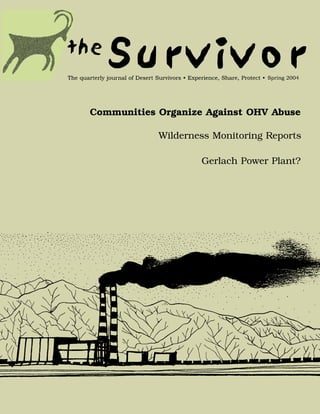
Cover illustration: Proposed coal-fired power plant near Gerlach, NV (see Letters to the Editor) by Michael S. Moore
2 The Survivor Spring 2004
3. Letters to the Editor There have been stories in the Reno website to coordinate information, raise
S H O RT TA K E S
Gazette Journal as well ("Gerlach to fight money for legal expenses, and locate allies.
Coalfired Power for SoCal in the High plant plan", mid February, and "Precursor Any help, advice, or noise the Survivors
Desert to power plant approved", March 4). could lend us would be most welcome.
Although there is opposition at the local Persons interested can reach me at ill-
19 March, 2004 level and even, it is rumored, at the state, in mostro@earthlink.net until mid May, when
between we have the county, merrily rub- I go back to Wall Spring and have no inter-
I live near Gerlach part of the year, so berstamping permits for (possibly inade- net. By then I hope a website exists, but
Steve's Black Rock walk in the last issue quate) air monitoring stations and, more snailmail always gets forwarded:
was particularly resonant. Been there, … ominously, our fossil fuel fools at the
always love going back. Survivors should feds.A few activist neighbors, myself Mike S. Moore, 120 W. H. St., Benicia, CA,
know about the two hanging playas above among them, are working to oppose this, 94510.
Black Rock Hots if they don't and demanding the county commissioners
review the planning commission's March Editor's Note: The additional letters
already...sweet. People in the area are
2nd approval of the air monitoring station. below were received after the Desert
increasingly concerned about Sempra
Where we live on the Smoke Creek, we see Survivor's Alert message on this topic
Energy's proposed 1450 megawatt coal-
lots of wind-blown dust headed for from 25 Feb was forwarded to Mr.
fired power plant at the base of the
Gerlach, the Black Rock, and points east. Moore.
Granites, upwind of the Black Rock
National Conservation Area (NCA) and The Sempra plant, though in sight of us if
it happens, is downwind (most of the 20 Mar 2004
with enough pollution potential that even
Utah is keeping an eye on it ("Power play: time), but all those tons of particulates will
be heading for Utah right over the NCA …I was thrilled to see the Friends letter
energy project may add to Utah's pollu- and Steve's follow-up - the more good
tion", Salt Lake Tribune, March 4, 2004). and a whole lot of other country we all
love. We are thinking about setting up a allies the better! A couple of points on
Steve's note; he's right about the coal -
BLM sez (unofficially) it will come by rail
from Delta, Utah (and a new eight or so
mile long railway spur from Phil Siding
across the north end of the Smoke Creek
running 200 carloads daily). Did I mention
Sempra tried to get approval for a similar
scheme in Mexico that was shot down? My
neighbor David Rumsey, who is among
other things a digital map guy
(www.davidrumsey.com), is being a major
force in fighting this on the legal front.
Mike S. MooreBenicia CA / Gerlach NV25
Mar 2004 David Rumsey's appeal of the
planning commission's approval of the air
monitoring station will be heard on April
27th in Reno. Minutes of the March 2
Planning Commission meeting are available
on the Washoe County website:
http://www.co.washoe.nv.us/comdev/boar
ds_commissions/pc/pc_agenda_minutes_i
ndex.htm. I'm planning to attend along
with David, his lawyer, and some of our
most impacted neighbors from the Smoke
Creek. If any Survivors want to show up
that would be great.
Mike S. MooreBenicia CA / Gerlach NV
22 Apr 2004
Michael S. Moore
Help fight the proposed Gerlach Power
Plant - come to an appeal hearing next
Tuesday, April 27, at 5:15 pm at the
Washoe County Commission meeting
rooms at 1001 E. Ninth Street in Reno.
Location of proposed power plant in NW Nevada
The Survivor Spring 2004 3
4. Join us in speaking against the permit that -- Don't buy into the new jobs and taxes much larger and more ominous project.
S H O RT TA K E S
the Washoe Planning Department issued argument in favor of the plant. Sempra Health issues and costs, environmental and
on March 2 for the Power Plant's Air states only 100 permanent jobs will be pro- otherwise, were repeatedly addressed.
Monitoring Tower. This was the first step duced, and the added tax revenue is small
in approving an eventual 1,450 megawatt, consolation for the huge environmental The appellants then made their case for
coal fired, water cooled (16,000 acre feet) costs. overturning the permit. Lawyers Jennifer
facility that, if built, will be the largest Yturbide and Bill Shaw of Minden outlined
power plant in Nevada, and certainly one There are other arguments. Come to the alleged irregularities within the law and
of the biggest sources of pollution in the hearing and learn more. county guidelines at the previous hearing.
State. Here are some of the key Dr. Phyllis Fox elucidated shortcomings in
arguments against the Air the proposed monitoring pro-
Monitoring Tower and the tocols and their lack of confor-
Power Plant: mity to EPA guidelines.
Finally, David Rumsey utilized
-- The Air Monitoring Tower is a a colorful map to show exactly
blot on the environment, over which wilderness and other
160 feet tall, makes lots of noise, protected locations will be
and according to our experts, is impacted by various hideous
not configured correctly by the pollutant streams. Shortly after
Plant developers to measure all his presentation, and having
pollution impacts the Plant will spoken earlier on both the haz-
have on the environment. Why ards of hydrocarbons, inade-
even approve an air monitoring quacies of the tower, and beau-
tower when the only purpose of ties of the surrounding territo-
the tower is to enable a Power ry, I slipped out. This morning
Plant that never should be built I called Rachel Bogard at
next to the Black Rock Desert Planet X, one of the most
National Conservation Area and active locals, to find out where
over 20 Wilderness Areas? it went after I split.
Apparently, Sempra presented
Michael S. Moore
-- The Power Plant will consume its case, continuing to dismiss
over 16,000 acre feet of water the future use as irrelevant.
per year, more than the annual The commissioners eventually
inflow to the Smoke Creek basin forced them to admit that the
where it will sit, thereby divert- end use was to be a 1450-
ing water from drinking holes The power of pollution megawatt coal plant, which of
used by a wide range of animals. course everyone was clear on
Nevada can not afford to waste its precious David Rumsey, Gerlach, NV in the first place, so this was just some sort
water on a power plant for California ener- of obscure legal dance for the record, but
gy consumers. 29 April 2004 still felt bound to ignore in considering the
permit. More public comment, limited
-- The Power Plant will emit over 50 haz- I am just returned from Wall Spring, stop- specifically to the monitoring station and its
ardous air pollutants, such as arsenic, lead ping off in Reno en route for part of the antenna, ensued, followed by a bunch of
and mercury, into the air for 100's of miles hearing of D. Rumsey et al.'s appeal of the legal wrangling back and forth (with the
around. Sempra air monitoring station permit. I district attorney continually upholding
arrived about 5:15 to find numerous parties Sempra's side), and finally a three to two
-- It will rely on imported coal and haz- from both sides present, but the commis- vote to deny the appeal and uphold the
ardous chemicals like ammonia for its oper- sion still engaged in earlier business. permit. This was one more vote than we
ation, which will be brought in by trains Following a brief recess attention to the had reasonably projected we'd get, and it
running 24/7 and posing a health hazard coal plant connection was allowed and came from Jim Shaw, the chairman, who is
for communities in their right of way. numerous individuals spoke including up for reelection in the fall and should be
Shaaron Netherton on behalf of Friends of encouraged. Also on the positive side was
-- It will be sending all its power to Nevada Wilderness, who are taking the lead being able to put faces on some of our
Southern California, where a so called as a clearinghouse of information on their allies and connect with the Friends, whose
"clean coal" plant like it could not be built website, much to the relief of certain experience in these matters greatly exceeds
under California environmental laws. beleaguered and inexperienced Gerlachians. that of the locals.
Sempra, the plant developer, is trying to The public comment was unanimously
export the pollution to Nevada and sell the against the plant, against coal, for wilder- I did hear from David late last night. He
energy to California where the demand is. ness, and against permitting the facility as it felt very upbeat after the meeting and is
constitutes a "foot in the door" for the considering what to do next, possibly in
4 The Survivor Spring 2004
5. terms of lobbying the commissioners. ter Mindy was Matron of Honor, and us on this historic hike across Nevada wild-
S H O RT TA K E S
Dave thinks the Sempra crew is seriously Desert Survivor Mike Yantos was Bob's lands!
shaken, and though that may be a bit opti- Best Man. Mari and Bob wish everyone a
mistic, the turnout definitely affected the wonderful New Year, and we wish them
commissioners. much happiness in their new life together! Membership Renewal
As for Gerlach, we are mobilizing to make Is Now Available Via
the big Planet X Memorial Day Pottery Sale
an information point for not only the
Update On The "PayPal"
power plant issue but voter registration as Nevada Desert Trail Due to popular request, we've put a new
well, all three days, and we're trying to get feature on the Desert Survivors website.
volunteers to distribute info... barbecue, Relay Members can now renew using their credit
beer, art and activism. It doesn't get much The Desert Survivors 2004 Desert Trail cards. We have contracted with a "secure
better than that. If anyone's up to volun- Relay is shaping up to be a success. As of server", the commercial service known as
teer contact me or Rachel Bogard (planetx- this writing, we have 74 participants for the "PayPal", to handle these transactions.
pottery@direcway.com). 14 trips (including the End-of-Relay Costs are paid by Desert Survivors. You
Celebration). Thirty-three individuals have are charged $20 for your renewal, same as
Mike S. MooreBenicia CA / Gerlach NV signed up; many are doing multiple trips. always.
We got a great article in the Reno Gazette-
Journal on March 27, and will be seeking Now you can "pay up" at any time. You
more publicity for the Relay as it moves will be notified by "PayPal" when your
Wedding north through Nevada.. transaction goes through. No hassle, and
Announcement you save Desert Survivors the cost of send-
We are happy to announce that Desert This Relay is an ambitious undertaking. ing you a renewal letter, in its envelope,
Survivor board member and trip leader Bob Starting April 30, Desert Survivors will hike with a renewal notice on card stock, with its
Lyon was married to long-time girlfriend the first half of the Nevada Desert Trail in own envelope. You also save us the time to
Mari Zachary on December 30, 2003. The a relay of thirteen consecutive trips over six prepare the mailing, the postage we incur to
intimate, candlelit ceremony took place at weeks. Six leaders will conduct the trips. send you the notice, and the work of pro-
their home in San Francisco, and was The total distance is 312 miles. Terrain cessing your check. You'll know we record-
attended by family and close friends. varies from flat valley crossings beside salt- ed your renewal when you read the label on
Desert Survivor President Steve Tabor crusted dry lakes to high mountain ridges your next issue of THE SURVIVOR.
joined in the reception party and helped with dense pine woods. All hikes pass
toast the newlyweds. Bob's and Mari's through remote desert and mountains, with Many of you send in additional donations
(combined) five children and one grand- four in BLM Wilderness Study Areas with your renewal. Unfortunately, because
child were in joyful attendance, and partici- (WSAs). The last is a nine-day backpack on of restrictions imposed by PayPal, we were
pated in a Celtic circle blessing. Mari's sis- the crest of the Stillwater Mountains, more unable to combine the "additionals" with
than 70% of it in Wilderness. We'll end the the renewals in one transaction. Please post
Relay on June 12-13 with a great celebration any additional donations on the "Donate"
at the base of the Stillwaters near the screen. The "Donate" screen is accessed
Carson Sink. from the home page; look for it on the left-
hand side, right under the "Renew
We'll be visiting Nevada in the springtime, Membership" icon. We are sorry for the
its best season. Shrubs and wildflowers inconvenience in this regard. We have
should be blooming well. The trips run become highly dependent on these addi-
through wild and fascinating country. Most tional donations and are grateful for them.
hikes are "moderate", except for those in
the roughest mountain segments and the New members can also be enrolled via
Stillwaters Crest, which are rated as "strenu- "PayPal"; we have already signed up a few.
ous". Some leaders are doing back-to-back You can also buy teeshirts and hats on the
trips with water caches pre-set, for ease of website using "PayPal" in a similar manner.
hiking. Detailed guidebooks describing all We have eliminated the frustrating
segments have been written. "Shipping and Handling" charges that
plagued the PayPal provision before.
Refer to the Desert Survivors Spring 2004 Shipping & handling charges have gone up
Trip Schedule for trip listings. Segment for hats and teeshirts; these long-overdue
maps and pictures have been posted on increases were made to pay increased
our website, http://www.desert- postage costs for these items, NOT for
survivors.org/, which also has a schedule. "PayPal".
With this Relay, we're hoping to put the
Desert Trail "on the map" in Nevada. Join So try this new service on our website and
Mari and Bob
The Survivor Spring 2004 5
6. Not on My Land, Not on Our Land
F E AT U R E S
Desert communities organize against OHV abuse while government
fails to implement the law
By Philip M. Klasky, San Francisco, CA ranger was on hand on those holiday weekends when we were ter-
B
reaking through the priceless peace of a Mojave Desert rorized by people who have no respect for our private property
morning, I hear the whining of OHVs (Off-Highway and the lands we hold in common. But then she was fired by the
Vehicles) in the wash. I feel my blood pressure rise to infamously ignorant and belligerent head of the Barstow BLM
dizzying heights as a couple of lawless idiots tear up the desert. field office who told me in no uncertain terms that he was not
Since I am big and imposing (and mad as hell), I rush out to hunt going to send law enforcement to address illegal OHV use in our
them down. Two motorcycles are trespassing on both private and area. He also told me that, "you environmentalists are trying to
public lands since all the public lands out here are designated as lock up the desert", and that OHV riders had "no place to go".
closed to any kind of vehicles. I have to intervene since the There are already hundreds of thousands of acres in sacrifice areas
Bureau of Land Management (BLM) office in Barstow, which has set aside for OHV destruction, but this is not enough for those
jurisdiction over public lands in this area, is unwilling to enforce who want unbridled access to more and more land in a misguided
the law, and the local Sheriff's department, overburdened by other thirst for freedom without responsibility. By refusing to enforce
priorities, would get here, if they come at all, when the criminals the statues regulating OHV use, law enforcement and local elected
are long gone. representatives are condoning and encouraging illegal behavior.
Most of the OHV riders I confront are both ignorant and defiant Is the situation hopeless? Of course not. Remember the saying,
of the law. "I will ride anywhere I want", is the common refrain, "Don't just agonize, organize". Our only hope is to organize our-
and without law enforcement or citizen intervention, that is exactly selves neighborhood by neighborhood, community by community,
what they do. town by town, state by state. And that's what we are doing in the
wild west of Wonder Valley and throughout the Morongo Basin in
OHV outlaws show a reckless disrespect for private property and the Mojave Desert.
do not have a clue or care about their impact on the environment.
OHV abuse has reached a crisis point in the California desert with The effects of OHVs are permanent and irreversible. They
the increasing popularity of all terrain vehicles, the growing tenta- destroy soils, crush life and scar the landscape. The delicate archi-
cles of urban recreation and the negligent and at times intentional tecture of the soils, including the threatened cryptogamic crust (a
lack of law enforcement. But communities throughout the desert symbiotic matrix of algae, mosses, lichens, and fungi that serves as
are organizing to defend themselves. This is not just a battle a nutrient and moisture reservoir and germination zone for seeds),
between environmentalists and weekend warriors. Those of us depends on the living tissue that holds the particulate remnants of
who live in the expansive landscape, star-filled nights, and natural archaic seas in horizons of structure. Crushed and compacted
environment with its wealth of plant and wildlife are not going to soils will not hold moisture or support root systems. Much of the
let our lands be desecrated. desert life is underground exhibiting one of the many ways in
which desert animals survive conditions of extreme cold and heat
I have had many interactions with the BLM over this issue. The and drought.
last ranger to patrol our area was a Native American woman with a
knowledge and commitment to the conservation of natural With the eyes of a hawk, the ears of a coyote and the nose of a kit
resources. She met with the community, provided us with signs to fox, there is much life to be found just below and near the surface
protect private lands and placed warnings on public lands. This of the ground. During the winter and summer months and
throughout the year, animals hibernate, aestivate
and live in underground burrows. The kangaroo
rat wraps its tail around its body and places the
tufted end against its nose to capture the moisture
its breathes while waiting out the extremes of heat
underground; rabbits build their subterranean dens
just big enough so that when they exhaust their
store of oxygen they wake to emerge in early
spring; frogs dig under the surface in washes and
enclose themselves in a gelatinous capsule that
insulates them from searing temperatures;
sidewinders partially bury themselves, melting into
their surroundings with perfect camouflage; the
Mark Heuston
desert tortoise, which survived the conditions that
caused the downfall of the dinosaurs 65 million
years ago, are falling under the crush of a knobby
OHV tracks circling creosote bush
6 The Survivor Spring 2004
7. how we can protect our land. We have an effective neighborhood
F E AT U R E S
watch program, keep each other informed of illegal activity and
support each other. Every once in a while we get together and
clean up our common lands, mend fences and put up no trespass-
ing signs. We made a great sign that welcomes people to our
desert environment as long as they do not litter and keep their
OHVs off private and public lands and if you see anyone violating
the law call law enforcement immediately. An OHV rider must
have written permission from the owner on their person in order
to drive on that land. Share letters stating that OHVs are not per-
mitted on your land with your neighbors.
Organize Your Community Arrange for regular meetings of
local folks who want to take action. Some community strategies
include: conducting petition drives, a good way to build your
movement; distributing posters with the telephone numbers of law
enforcement; organizing a continuous stream of letters to the edi-
tor; coordinating brigades to put up no trespassing signs; develop-
ing e-mail alert and telephone tree systems; distributing informa-
Mark Heuston
tion about the relevant laws and providing maps of areas that are
off-limits; keeping a log of offenses and law enforcement respons-
es; giving talks at local schools and organizations about the
OHV damage within last two years destructive effects of OHVs. Create a website for your area with
tire on an accelerated march toward extinction. relevant information, a method of tracking offenses and
announcements of events and actions.
Try explaining that to a motor-head with Coors in his veins. I have
spent a great deal of time attempting to understand the mentality Meet with Law Enforcement and Elected Officials Request
of an OHV offender in order to find a way to deal with them. I public meetings with law enforcement and elected officials and
know many riders who choose to stay on the roads and are damn make sure like-minded folks from the community and local media
angry with the outlaws who invade private property and destroy attend. Know the law chapter and verse, and make the various
the environment. The act of despoiling a pristine landscape is a agencies accountable for implementation of regulations in your
psychopathic response to fragility and beauty. Some riders are just area. Let them know that you are not going away and try to devel-
ignorant and need patience and skillful communication to help set op some allies. Keep a log of complaints and the response (or
them free. lack thereof) by the officials. Don't let local and federal agencies
tell you that they cannot enforce in each other's jurisdictions; law
Remember, THEY are the outlaws. The following are a few strate- enforcement agencies have cooperative agreements so that they
gies for community action. can respond to the mix of laws.
Early Education Children love nature and the sooner we can Wildlife Inventory Many public lands are home to endangered
provide them with an appreciation and understanding of the beau- and threatened plants and animals. Conduct an inventory and map
ty, richness and value of the natural landscape, the better equipped the presence of the protected species to use for outreach, educa-
they will be to protect it. Bring domesticated or rescued desert tion, conservation and litigation. Communities can adopt wilder-
animals (tortoises, snakes, rabbits) to classes and teach about the ness areas, conduct nature walks and participate in community
effects of OHVs on these creatures. Take the children out
into the field to see the damage and compare it to protect-
ed places. The OHV industry is regularly invited into
schools to sell their products and we need to demand
equal time.
Public Outreach Use the local newspapers, newsletters,
public meetings, radio and television to educate the public
about the OHV problems in your area. Write opinion
pieces and letters to the editor. Erect large signs warning
OHV riders that they can only ride in designated areas.
Talk to civic organizations, business groups, school groups
and community and tribal leaders.
Mark Heuston
Organize Your Neighbors I know a lot of really great
folks in the desert that give a damn and we have been get-
ting together with some chips and salsa to strategize about
4x4 tracks running through collapsed wildlife burrows
The Survivor Spring 2004 7
8. patrols. The very best way to help people create a deep apprecia- Support local, statewide and national candidates for elected office
F E AT U R E S
tion and profound relationship with the land is to know the land- who will work for the protection of natural resources. Target pub-
scape by walking among its different seasons, listening to its songs lic officials who support OHV abuse as "soft on crime" and vote
and calls, witnessing the wildlife and the secrets of the water and them out of office. Work with Indian tribes to inform the public
the wind, sleeping on the ground and rising with the sun. about the need to protect sacred sites and cultural resources.
Direct Action Form a DRAT Team (Documentation/Response Pass local, state and national laws that provide directed funding for
Action Team) to protect public and private lands by surrounding law enforcement to obtain surveillance equipment, conduct proac-
the offenders armed with cameras, notebooks, walky-talkies, CB tive patrols and purchase vehicles capable of pursuing OHVs. The
radios and cell phones. In areas where OHVs can be expected to penalties for OHV abuse are too low hovering around $100 per
gather to defy the law, arrange for a large group of people to offence. We need to pass legislation dramatically increasing the
assemble and take video and photographs of the riders trespassing. fines and directing law enforcement to confiscate the vehicles of
Identify them by their vehicles. Inform law enforcement of your repeat offenders. A few weeks or months in jail may help to curb
citizen action ahead of time so that they will come out to deal with an abusive habit. Even the most conservative estimate of the fis-
the encounter and then document their response. Invite the media cal impacts of the damage caused by OHVs would indicate that
while you are at it. Be careful, some of these guys are real jerks current penalties do not come close to the costs associated with
given to violence so make sure that you are out there in numbers. illegal OHV activities.
Practice ahead of time to develop your skills and coordination and
exercise disciplined direct action strategies. Current regulations place the responsibility on property owners
and public officials to provide signage protecting these lands. But
Civil Suits Sue the outlaws! If you have a persistent problem, OHV outlaws regularly pull out the signs and then plead that they
can identify the transgressors, and can document their damage to did not know that they were trespassing. Regulations must there-
your property and the resultant costs, you could have a powerful fore forbid riding on lands that are not specifically designated as
case. Create a log of transgressions and record calls to law open to OHVs. Attempts to place this regulation in BLM manage-
enforcement. Take them to civil court and make them hurt finan- ment documents have been rigorously opposed by the very agency
cially. tasked to protect public lands. The concept of "multiple use", the
foundation for BLM management policy, reaches a disconnect
Long Range Strategies Longer range strategies take extensive when it comes to OHVs since their destructive effects preclude
organizing and resources but we must begin the process of becom- other uses. Ultimately, enforcement and accountability may best be
ing as powerful as the OHV lobby and hoards of mechanized achieved through litigation.
monsters.
Without protection from local government and law enforcement,
Currently, it is difficult if not impossible to identify OHVs since we must take the task of protecting our natural heritage into our
their registration stickers are out of sight. We need regulations that own hands. An organized community can have a very powerful
establish standards for easy identification. Funds from OHV vehi- effect on the political process as well as on the ground. Practicing
cle fees should be used to provide adequate signage, enforcement principles of non-violence against a fundamentally violent act is
and interpretation (information centers, kiosks) for designated very challenging, but there are many tools within reach beginning
OHV recreation zones and areas that are off-limits. with any size group of committed people prepared to use a diver-
sity of strategies to defend our land and the quality of
our lives.
Philip M. Klasky is a writer, educator, and environmental and
indigenous rights activist who divides his time between San Francisco
and the Mojave Desert.
Additional information from photographer, Mark
Heuston, 29 Palms, Ca:
All of these images were taken in March of this spring
within a mile of my residence on Shadow Mountain road.
They represent only a fraction of the actual, and ongoing
damage by OHV's in my area. Except for the shot of the
deeply incised "donut" around the creosote bush, all rep-
resent OHV routes that didn't exist 18 to 24 months ago.
One of the shots is not OHV damage; it is one of two
active and very much at risk kit fox dens on BLM land
within a mile of my home. Note the fresh paw prints
Mark Heuston
across the soft earth berm at the den's mouth! xxx image
in this series shows 4x4 tracks running through what are
clearly collapsed wildlife burrows.
Kit fox den with fresh paw prints in vicinity of OHV activity
8 The Survivor Spring 2004
9. The Owyhee Desert
F E AT U R E S
Oregon/Idaho/Nevada
By Laura Pace, Vancouver, WA
T
he Owyhee Desert covers over 2 million acres of Southeast
Oregon, Southwest Idaho and Northwest Nevada. It's a
vast open area of high desert with few roads, fewer ranches
and even fewer towns. It's a great destination for the intrepid
desert explorer, provided you have the time, the equipment, and a
Laura Pace
real sense of adventure. Unlike most deserts, it's a great place to
visit in the summertime.
There are two distinct parts to the Owyhee, the difference between Rattlesnake after a large meal
them due to the most recent type of volcanic activity that took and monitor their herds by airplane. Cattle rustling is still a serious
place. The part north of Oregon State Highway 20 was formed by problem there.
the explosions of calderas, followed by faulting and erosion. It has
a weird, almost ominous quality about it that, to my eyes, is not The southern four fifths of the Owyhee has a very different char-
uncommon in landscapes created from rhyolite ash. It features acter. Geologically it constitutes the western end of the Snake
interesting rock formations and colors, and poor roads. I've only River Plain. It is flat or gently undulating, without any outstanding
done one trip there, down Leslie Gulch Road three years ago, but features. Most of the time, when you are driving through it, what
will be returning this summer. you see is a flat open plateau top. This endless expanse is cut
through here and there by the various branches of the Owyhee
One is more likely to encounter other people here than further River and its tributaries, the Bruneau and Jarbidge Rivers. The ero-
south. Prospectors and rock hounds come to look for opals, sun- sive action of these waterways has created canyons 400-1200 feet
stones, agate, and other semi-precious stones that reside in rhyolite. deep and exposed the geological history of the area beneath the
The Owyhee Reservoir, which attracts fishermen and boaters, is thin veneer of basalt: layer upon layer of rhyolite hundreds of feet
accessed via Leslie Gulch Road. And in August during antelope thick.
season, hunters also roam around, shooting things and leaving
stinking piles of guts behind. But in general it's not a highly used The nature of this area has endeared it to the military, who claim
area. West of the river, across from Leslie Gulch, are the Owyhee part of it to train their fighter pilots, and want to include the river
Breaks - very few jeep tracks even, and very little water. Ranchers canyons in their exclusive domain. They have been challenged in
who let their cattle run there live in towns 50 miles away or more, the courts, and so far held at bay, by a coalition of conservation-
ists, ranchers and recreation groups who use the canyons, and
Indian tribes who have traditional cultural sites there.
The Owyhee is thoroughly overgrazed. The vegetation, already
challenged by the harsh arid conditions, is degraded to very little
more than sage plants and dust in between; you can see the stubs
of grass clipped down to the ground. Frankly, judging from what
I saw this summer, I don't know how the cows survive on it. It's
so flat that there are few places where water from the occasional
storm can collect to form a pool or creek. Among the best rain
collectors are the roads, but you have to be near one right after a
rain to get the benefit. I occasionally saw big metal tanks brought
in by ranchers to provide water for their cattle, but no wells. I
drove up to one of them, but couldn't tell if the water would be
accessible, or drinkable if it is. My guess would be to take what
you need with you if for some reason you want to hike in this end-
less flatness.
My first trip into the Owyhee was in June of 2003. On this trip I
wanted to start exploring the area to see what it is like, since there
is so little printed material to be found about it. Due to the dis-
tances, I didn't have time to get out and hike much. From near the
Oregon border, I headed east from McDermitt, Nevada, through
the Fort McDermitt Shoshone-Paiute Indian Reservation. For sev-
eral miles the road ran alongside the east branch of the Quinn
Steve Tabor
River, skirting the northern edge of the Santa Rosa Mountains. It
was a one-track affair, in many places seriously banked downhill
The Owyhee desert
The Survivor Spring 2004 9
10. toward the river, very rough, with steep inclines and hairpin turns. I pulled over and set up camp next to one. As I did, the local
F E AT U R E S
birds that call it home began flying in for their evening roost, only
I got to a place called Devil's Gate, a narrow defile between high to find me in their midst. They were quite upset - there was a lot
rocks that crowd in on the river, which you ford as there is no of bird conversation well into the evening. And I was unhappy
bridge. There's a second ford about another quarter mile further about upsetting them, but I wasn't moving. They finally had to
east. Eventually the road ran up the hills, away from the river, until resign themselves to spending the night somewhere else. A big
it finally reached the wide expanse of the Owyhee. I kept going owl with a wingspan of at least five feet watched me for awhile
east until after 4:00 pm, by which time clouds had gathered to from the next tree over, then lifted off and slowly sailed around
form a storm. I remembered those two fords: a flashflood could me in a circle, tilting his head this way and that to get a better look,
cut me off and leave me stranded, so I turned back. before he quietly flapped off. The next morning before I left, I
found a couple of rocks with depressions in them that I filled with
I got out of there OK, and headed over to Oregon Canyon water, as a peace offering to those I had inconvenienced.
Mountain, a little northwest of McDermitt, a place I had not been
able to explore adequately two summers ago, when I still had my This summer I'll be visiting an area just east and south of Juniper
Volvo wagon. There I came upon a rattlesnake moving very slowly Mountain in Idaho. It's called the Badlands, located in the Red
across the road. It either had just eaten a large meal, or it was a Basin and Brace Flat quadrangles. I'm told this country features
pregnant female. I stopped and grabbed my camera, set the dis- some really interesting rhyolite formations. And I'll be taking a
tance at one meter, and pursued it through the sagebrush as it tried more extensive trip into the northern Owyhee area, now that I
to get away from me, exhorting it to turn around and say "cheese." have a vehicle that can get me in and back out again.
Finally it lost patience and made its stand,
head weaving menacingly, tail rattling, the
large lump firmly anchoring it in the middle.
A couple of days later, I headed east into
Idaho from further north in Oregon, because
I could see clouds further south, and had had
enough of gumbo for the time being. First, I
had to have a look at Three Forks, a prime
put-in spot for river rafters, and Owyhee
Canyon Overlook. Then I went east to
Jordan Valley, where I got gas, and into
Idaho. The road crosses the North Fork of
the Owyhee, where there's a bridge and a
campground. You continue up over Juniper
Mountain with views east and south across
the dryland. Volcanic ash barely qualifies as
soil, large areas of which are covered with
skeletons of dead plants. I know that this
used to be a sheep-raising area. I wonder if
perhaps it was so overgrazed that the vegeta-
tion was not able to recover. Nothing at all
grows now in many places.
I found gas at Bruneau and headed south
across the plateau to the Bruneau Canyon
Overlook. Here the Owyhee canyons are at
their deepest. The landscape on the plateau
top is the same here as elsewhere.
Sunset was approaching, and I needed a place
to camp. I like to camp next to or under
trees, but in this interminable flatness the
only trees I had passed in hours were on pri-
vate land #16, where I crossed the east fork
of the Bruneau River. I was about to give up
on that idea when the road went down a shal-
low dip - and there were a half dozen juniper
Laura Pace
trees! The depression in the land obviously
collected enough rainwater to support them,
though it was dry at this point. What a treat.
Bruneau Canyon’s layered basalts; depth is 1000 feet
10 The Survivor Spring 2004
11. A Lifetime in the and I got to see the car. He’s written a lot of books. If you ever
F E AT U R E S
see Clegg and Beebe, foremost writers of rail books, they were up
Desert: A there and they spent a couple of years writing. Then I came down
to Owens Valley and visited Bodie and Keeler. I got over there and
Conversation with the Southern Pacific narrow gage railroad was still running. I got
Bob Greenawalt acquainted with some of those guys there and went back several
times afterwards. It quit running in 1960. I got to know the train-
Chuck Knight
Part 2; men and they welcomed people, they would let you ride right up in
the cab with them. And the engineer, Walter Ferguson was his
By George Huxtable, San Mateo CA name, he’d advise you to come there and get in the cab and ride
Continued from the last issue. Bob Greenawalt up there to Owenyo, or some of those little places. It’s unthought
of today.
There are too many motorhome people, they
GH: That was in Keeler, in Owens Valley, right?
won't get out and walk.
BG: Keeler is at the east side of Owens Lake. It’s one of the
worst places you can be, because that dust blows, I mean it’s miser-
Chevys were known for breaking axles back
able. The roads were all dirt, on a motorcycle. Well, the main
then and we carried a spare one under the Highway 395 had been paved, but when you get out there by
seat. Keeler and around there, it was all dirt.
GH: What were you doing later, after high school? GH: Do you remember what kind of motorcycle it was?
BG: Yeah, Indian Junior Scout. I saw one here about six months
BG: Well, three years I was in they army, I was away from home.
ago, a gal had it, a beautiful piece. I had a war surplus one when I
I was at UCLA going to school, and later Berkeley, so there were a
got to Muroc, I bought it for three hundred bucks from a guy
number of years in there that I wasn’t even in the desert.
there.
GH: Where did you go to school?
GH: You’ve been a Death Valley `49ers member for many years.
BG: When I got out of El Monte High School, I went to
BG: In 1949, I went with my Model A pickup and took my same
Pasadena JC, and later transferred to UCLA. I was in the army for
friend of pre war days and we went out to the first Encampment
three years, then I went back to UCLA and took civil engineering.
in 1949, that was a great thing.
They didn’t have a four-year engineering school, so I went to
Berkeley, and was there for one year and one summer session. I GH: The very first one, you were there?
finally finished in 1947.
BG: The first one. I’ve been going to them ever since.
GH: So, you graduated from Berkeley in 1947 with a degree in…
GH: That was a big crowd wasn’t it, I understand the actor Jimmy
BG: In Civil Engineering, BS. Stewart was the keynote speaker.
GH: What years were you in the Army? BG: It’s so big you can’t imagine. It’s the biggest crowd ever
BG: 1943 to 1946, Army Air Corps (Air Force). assembled in Death Valley. They ran out of gas promptly and
people couldn’t move and there’s no bathroom. Things go to the
GH: What did you do there? dogs. Anyway, it was a tremendous event, it was the best event
that ever happened out there. Las Vegas engaged busses from
BG: I went up to Yale University, they had a tech school there,
there and they brought people in. That Encampment spectacle
and it was called Maintenance Engineering. Well, engineering is a
was four miles down from Furnace Creek Inn, in Desolation
loose term in the Air Force. It doesn’t mean you’re doing much
Canyon. They had big bleachers set up there, I don’t know how
engineering, what it means is you’re trying to keep planes flying.
many thousands it held, but it was packed in there. What a grand
It’s maintenance of aircraft and they call it engineering. But any-
event. I’m sure glad I saw that thing! The main purpose for the
how, I got to go to Yale, and I was there about eight months. I was
celebration at the time was the 100th Anniversary of the `49ers,
there in Vanderbilt Hall and Connecticut Hall, where Nathan Hale
from 1849 to 1949.
went to school. My first assignment was one month at a little air-
base called Liberal Army Air Field, in Liberal, Kansas. They had GH: What did you do when you moved back to Southern California
B24s. I was supposed to learn something about B24 aircraft, what after Berkeley?
are you going to learn in one month? But, I learned something
and was assigned to Muroc, which is now Edwards AFB. I didn’t BG: I worked for the City Building Department in Los Angeles.
get scratched or anything, I never went overseas. So, the whole I worked there for five and a half years. I later landed at Bechtel,
Air Force thing was fine, I enjoyed it. where I retired from.
GH: What did you do when you got out of Berkeley in 1947? GH: Tell me about the desert peaks you climb with the Sierra Club.
BG: The immediate thing I did, was get on a motorcycle and go BG: The Desert Peak Section is designed for hikers that like to
to Virginia City, Nevada. Lucius Beebe was a big author and he go to the desert. We have over a couple hundred members, and I
had his private rail car, called the Gold Coast, there at Virginia City first got with the group in 1954, which is a long time ago. The first
The Survivor Spring 2004 11
12. desert trip I went on was down to a place called Mopah Peak, Well, that was the misdoing. I didn’t know what I was in for. I
F E AT U R E S
which is down near Vidal Junction near Parker, Arizona. Okay, rented some plastic boots at REI. Don’t rent boots! We started
the interesting part is that a girlfriend of mine in the Sierra Club going up there and one of the canvas straps on the crampon
invited me to go on the Desert Peaks Section trip. She was one of breaks. I got that fixed with some strapping that I had, some cord,
the few women that had a 4-wheel drive Willys station wagon at got that going. We got about half way up there and Edna says,
the time. She’s still an unusual gal. “I’m so pooped I can’t do anymore.” The guy with her, Pete, her
friend, says, “I’m tired, I’m not going to go any farther either.” So,
GH: So, how many peaks are there? the guy from Simi Valley, that I didn’t know before, and I said,
BG: Right now we have a list of 98 selected peaks in the south- “Well, we’re going on.” Well, there was a lenticular cloud on the
western U.S. It was 97 and we just added a new one called Bridge top of Mt. Hood, and I didn’t know about clouds like that.
Mountain, if you know where the Red Rock area is west of Las
Vegas. It’s a tremendous peak, it’s a spooky thing, it’s got a lot of GH: What time of year were you doing this?
exposure and … I kinda chickened … I made it, but I was scared. BG: Summer, July.
GH: How many of the 98 peaks have you done? GH: What time of day was it?
BG: I’ve done them all. BG: Oh, about 10:00 in the morning. We’re well on our way up
there and all of a sudden we see this cloud. My friend that I just
GH: You’ve done all 98? met, I think he saved my life. He
BG: Yeah, it took me about 35 Do you know what a bergschrund is? says, “There’s a cloud, I don’t know
years to do it. if we ought to go in that or not.” I
Well, it'll scare the pee out of ya! said, “Oh, yeah, let’s go it won’t be
GH: When did you finish? that bad.” And that was a major misdoing. Suddenly, about ten or
BG: I finished the list in 1993 I think it was. And since then there twelve climbers pass us going up. They said, “This is pretty bad, it’s
has been a couple of peaks added. So, I did those two later. all foggy and it’s colder then heck and the wind is blowing about
sixty and watch out because there’s a bergschrund up here.” Do you
GH: How many of the peaks are in Death Valley? know what a bergschrund is? Well, it’ll scare the pee out of ya!
BG: Well, naturally Telescope is the biggest one, it’s one of my When there’s a glacier, for some reason the top of the glacier clings
favorite all time peaks. Have you done Telescope yet? to the rock, but right below it will part, and there will be a big cavi-
ty there due to gravity. We got to that thing and it would hold about
GH: Oh, yes. three boxcars! Well, we had to go around. Those things can open
BG: Well, another is Pyramid Peak. West of Death Valley up anytime. I mean gravity, your weight and all of a sudden the
Junction, that’s a very imposing peak. South of Death Valley thing might crack on you. We tried to follow the other group of hik-
Junction is Brown Mountain. It shouldn’t be named that, because ers but we lost track of them in a hurry, so we tried to follow their
if you go to the top of Brown Mountain you’ll see a USGS bench- footsteps.
mark there, and it says “Evelyn” on it, named for Borax Smith’s
GH: How were you finding your route?
wife. There’s an Evelyn siding on the old T&T, right there on the
east foot of Brown Mountain. So, I actually proposed to the BG: Just picking around, it was all foggy there and you could see
Sierra Club that we change the name of Brown Mountain to maybe fifteen feet ahead of you! We just kept going. We were close
Evelyn. There are over a half dozen Desert Peaks that overlook to the top, we were not going to turn around now. Well, what we
Death Valley. should have done was turn around about an hour before then. We
got up there, it was colder than heck and the wind was blowing lick-
GH: Were there any trips that you’ve been on where you really got ity bang and you can’t see anything. We couldn’t even see the sum-
in over your head or where you really got concerned? mit where we were! We were on a flat place, we knew we were on
BG: Yes. I was up on Mt. Hood several years ago and I thought I top, but couldn’t see anything around there. We soon started back.
was a goner. I was really praying as much as I have ever prayed in
GH: So, you were on ice and snow?
my life.
BG: Ice and snow, with crampons. We were roped together, prob-
GH: Tell me a bit about that. ably thirty feet apart. We were coming down and I was in the lead.
BG: Well, there were four of us and we wanted to do Mt. Hood. I found what I thought was the furrow that people had beaten
I belong to the Highpointers Club. One of the gals was in the down in the snow, it looked like the trail. It turned out to be a big
Sierra Club with me and she said she knew two guys that wanted chute, better watch out, because rocks come down the chute. Well,
to climb Mt. Hood. So, she said we could all meet at 2:00 a.m. on I got confused on that chute. My new friend was behind me and
a certain day. This was only about four years ago. he says, “I don’t think that’s it.”
GH: 2:00 a.m.? GH: You were unable to follow your own footprints back?
BG: 2:00 a.m. Yeah. I drove up there and about 10:00 at night, BG: It was so miserable. I said, “We’re going to get into trouble
sacked out in the back of the Blazer. About 2:00 a.m. she and the here I’m afraid” and he said, “Yeah, there’s one thing we gotta do.
others knocked on the window, so I got my backpack and every- To be concluded next issue...
thing and we start climbing. I had borrowed some crampons.
12 The Survivor Spring 2004
13. Rabbit Peak Backpack
TRIP REPORTS
February 14-16, 2004, Santa Rosa Wilderness
By Paul Menkes, Berkeley, CA
I
n February David Halligan led a trip with 12 other Survivors
to Rabbit Peak, just north of Anza-Borrego State Park. Even
though it was February we were treated to the best flower dis-
play that I've seen since the miracle year of 1998. Highlights
included dozens of desert lilies and fields of dune primrose.
But about the peak - we camped in a wash just above Clark Dry
Lake. On the summit day we dayhiked 5,200 vertical feet to the
summit of Rabbit Peak (6,640+) and back again! We started in
Paul Menkes
creosote, got into agave and barrel cactus and eventually made into
pinion and juniper. It was a very strenuous dayhike, but everybody
got back to camp before dark. It was quite a nice trip.
Ron Cohen and Julie Donohue stretching
Skiing in the Desert Carcamp
February 14-16, 2004, Owens Valley, CA
By Craig Deutsche, Los Angeles, CA
"THERE IS NO CAMPING LIKE SNOW CAMPING"
A
lthough the facts went somewhat astray, the title above
describes the plan of the trip. This was to be, as far as
could be determined, the first Desert Survivor trip with
the stated purpose of skiing in the desert. Many Survivors have
hiked about the Mono Craters east of June Lake, many have
walked high in the White Mountains among the Bristlecone Pines,
Craig Deutsche
and certainly highway 395 north of Bishop, CA, is familiar to
most. But what are these places like when seen from cross-coun-
try skis? And really how cold is it to camp there in February? A
group of nine met on Saturday morning, February 14, to begin the
Road in the White Mountains
experiment.
Campground where we stayed six miles north of Bishop was
A principal observation would be that it is impossible to predict snow-free with even bits of grass surviving along the Owens River.
weather conditions three months in advance. The weeks before Nor were there were any complaints about the above-freezing tem-
the trip had been warmer than usual, and the Pleasant Valley peratures. Instead of hiding in tents and sleeping bags the
moment that dark fell, we were able to sit and talk
communally about a campfire and to compare vari-
ous cooking styles which ranged from the very best
(full barbeque steak by Dave Moon and Inge Werner)
to the worst (an indescribable dish prepared by Amy
Thigpen and Frank Hersfeldt). The more significant
result of the weather was that snow was limited, and
our original plan had to be somewhat modified.
After setting up tents that first morning, the group
drove north on highway 395 to Deadman Creek
between Mammoth Junction and June Lake. Here at
8000 feet there are some groomed trails in the
National Forest, and we skied west toward the San
Juaquin Ridge about seven miles away. After some
distance we left the trails (and the accompanying
Craig Deutsche
*&%##& snow machines) and were pulling our way
through the deep powder. Weather was clear and
beautiful, snow was good, only one person got lost,
and we were all pretty beat by the time we returned
Eric Rorer, Inge Werner and other Survivors on skis
The Survivor Spring 2004 13
14. to camp.
TRIP REPORTS
On Sunday we followed the original plan per-
fectly, except that there was almost no snow
along the first two miles beyond the road clo-
sure as we headed toward Shulman Grove in the
White Mountains. A few persons elected to
leave the group and go hiking near the Eureka
Dunes, a few persons went part of the distance
to the grove and then returned to the cars at the
gate, and others were finally able to put on skis
and explore one of the signed trails near the
visitor center. Of course a major purpose of
this hike was for the view it provides. Looking
west across the Owens Valley toward the snow
Craig Deutsche
covered Sierras borders upon being a religious
experience. This was the reward we received
for our patience.
Monday morning began with a group confer- "Sky Rock" petroglyph
ence. Some persons needed to leave early and is called "Sky Rock" and is a truly impressive panel, much more so
snow was scarce, so the decision was to take a short hike (boots than the other sites for which the BLM is willing to provide loca-
only) to a nearby petroglyph site. This is in the volcanic tablelands tions. It was a mellow, snow-free morning before the group sepa-
immediately north of Chalk Bluff Road. In fact, the site had only rated and our experiment concluded.
been located one day before our trip (by Sandy Nancarrow, Eric
Rorer, and myself) using GPS coordinates provided by another When this trip is repeated, we will all certainly anticipate the mod-
member of Desert Survivors. Although the site is not advertised erate climate, but then of course there will be boreal storms beat-
by the Bureau of Land Management (BLM), the use-trail leading to ing down from the North Pole. Desert Survivor trips are never
it suggests that it is moderately well known, and there are, indeed, exactly as expected.
signs asking visitors to respect the integrity of the petroglyphs. It
Providence Mountains Backpack most I saw were a few jackrabbits and a cottontail. The desert was
February 27-29, 2004, Mohave National Preserve, CA very green, even this early, with lots of grasses, many varieties of
cactus, junipers, pinion pine and a few early blooming flowers. All
By Karen James, Rosamond, CA indications point to a great show of wildflowers this year.
T
he Providence Mountain Backpack from February 27 to 29
went off without a hitch.
Rather than walk on the
road from Kelso Depot as
planned, we started our hike to
the Hole-in-the-Wall Campground
on the Globe Mine Road. There
were eight hikers including Bob
Lyon, our trip leader, several vet-
eran DS members (Silvia, Spencer
and Ed), and four first time DS
hikers including myself, Roger a
landscaper from Davis, and
Jonathon and Gab, father and son
outdoorsmen lured to the desert
from St. Cloud, Minnesota. A
great group of people I hope to
hike with again.
Once we left the road, there was
Karen James
quite a bit of water in Globe
Canyon due to the recent storms.
There were signs of animal life
(tracks and scat), although the
Looking back down Globe Canyon
14 The Survivor Spring 2004