Revival of village tanks in Sri Lanka
•
0 j'aime•630 vues

The lecture contains aspects such as Ancient Water Resources Planning, Water shortage, or water wastage in Sri Lanka?, Network of tanks and streams in the form of cascades, Tank-village Ecosystem, Patial desilting concept

Recommandé
Recommandé
Contenu connexe
Tendances
Tendances (20)
Similaire à Revival of village tanks in Sri Lanka
Similaire à Revival of village tanks in Sri Lanka (20)
Plus de Dr. P.B.Dharmasena
Plus de Dr. P.B.Dharmasena (20)
Dernier
Dernier (20)
Revival of village tanks in Sri Lanka
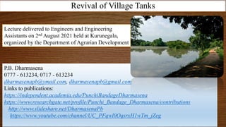
- 1. Revival of Village Tanks P.B. Dharmasena 0777 - 613234, 0717 - 613234 dharmasenapb@ymail.com, dharmasenapb@gmail.com Links to publications: https://independent.academia.edu/PunchiBandageDharmasena https://www.researchgate.net/profile/Punchi_Bandage_Dharmasena/contributions http://www.slideshare.net/DharmasenaPb https://www.youtube.com/channel/UC_PFqwl0OqsrxH1wTm_jZeg Lecture delivered to Engineers and Engineering Assistants on 2nd August 2021 held at Kurunegala, organized by the Department of Agrarian Development
- 2. Covid – 19 Pandemic Situation • Up to 1st August 2021: • Cases: 198,964,808 • Deaths: 4,239,512 • Recovered: 179,588,198 (90%) Country % recovered USA 83.0 UK 76.9 Russia 89.5 India 97.3 Sri Lanka 89.6 Bhutan 94.7 Nepal 94.1 Food habits Environment • Reasons for the death of Covid-19 victims • Low immunity • High blood pressure • Diabetics • Heart diseases • Respiratory diseases First of all we must be healthy
- 3. Human health can be ensured by improving the ecosystem health Risk reduction impact
- 4. Ancient Water Management Master Plan of Sri Lanka Country level Inter-river basin level Inter-reservoir level Sub-watershed level Village level Field level
- 5. Kevesastha (Northern) Upulwangiri (Kala Oya) Rakungiri (Malwathu Oya) Mahagiri (Samanala mountain area) – Kelani, Kalu, Walawe, Mahaweli Chalaka (Mi Oya) Neelagiri (Modaragam Aru) Kawasthalabha (Yan oya) Dhumaka Kaddeera (Deduru Oya, Maha Oya) Indra (Maduru Oya, Mundeni Aru, Gal oya) Agni (Kumbukkan Oya, Menik Ganga, Kirindi Oya Decentralized Governance Leadership
- 6. Water resources shared by River Basin Leaders (600 BC – 1200 AD) • Dambulu Oya - Malwathu Oya diversion canal (860 AD) • Malwathu Oya - Kanadara Oya diversion canal (860 AD) • Yoda Ela - Nachchduwa feeder canal (540 AD) Mahakanadarawa Nachchaduwa Kalawewa-Balaluwewa Dambulu oya Malwathu oya Kanadara oya Kala Oya Inter-river basin level
- 7. Manewa cascade Mahakanumulla cascade • Single bank canal • It runs along contour • Water is collected from upstream • Water is released to both sides • Canal moves along tank upstream • Tank cascade systems are fed • Diyakaliya and wewa to ensure water security Kalawewa-Thisawewa Giant Canal
- 8. Left bank Sedimentation Diyakaliya Natural rock Soil mound Mahailluppallama Amunukole Diyakaliya Source: Dr. Ashoka Karunaratne, 2021
- 9. Upper land and Lower land sluice gates of Yodha Ela Position of Upper land Sluice gates Position of lower land Sluice gates B A Aluth wewa Amunukole wewa Koon wewa Wewa Source: Dr. Ashoka Karunaratne, 2021
- 10. Diyakaliya Wewa 1 Placed above the canal Placed below the canal 2 Canal has been connected to the diyakaliya Constructed the canal running above the wewa 3 Diyakaliya has been connected to a natural rock line or soil ridge Bund of the wewa has been raised to a higher contour 4 Issue of water through a natural process Release of water to wewa is through sluice placed on the left bank of Yodha Ela canal 5 Controlling the Sediment Controlling the sediment and providing water to paddy tract 6 Providing water to upland cultivation Combined with human settlement and cascade systems Source: Dr. Ashoka Karunaratne, 2021
- 11. April – May 2010 “Inconvenient Truth” behind Engineering Designs of Irrigation Projects developed during the Last Century. “……….Those days we thought that the canal was planned to avoid rock barriers as the ancient people did not own the technology to break them ……..” - Eng. Mahinda Panapitiya
- 12. – Kalawewa - Thisawewa Yodha Ela (470 AD) – Nachchaduwa - Nuwarawewa feeder canal (290 AD) – Balaluwewa - Siyambalangamuwa feeder canal (290 AD) – Basawakkulama - Maha Vilachchiya feeder canal (470 AD) Kalawewa-Balaluwewa Thisawewa Siyambalangamuwa Nachchaduwa Nuwarawewa Mahavilachchiya Basawakkulama Malwathu oya Thalawa oya Kala oya Water resources shared by Reservoir Leaders (600 BC – 1200 AD)
- 13. Tank Cascade System (Village) – Collective Leadership (Self governing system) රාල leadership • ගමරාල - Village leader • කපුරාල - Leader for rituals • දනුමැතිරාල - The most knowledgeable person in the village • වෙදරාල - Medical practitioner • නැකැත්රාල - Providing auspicious times • (සිෙුරාල) - Religious knowledge
- 14. Kalawewa - Balaluwewa Minneriya Parakrama Samudraya Maduruoya Udawalawe Kantale All ancient reservoirs are found below 150 masl contour Senanayake Samudraya Huruluwewa Nachchaduwa
- 15. Annual average rainfall: 2,000 mm Land extent: 65,610 km2 Total volume of water: 131.22 bil. m3 Discharge to sea: 66.18 bil. M3 (>50%) No. of river basins: 103 Major reservoirs and dams: 80 Small tanks: 14,421 Small anicuts: 12,773 Source: N. Eriyagama et al 2015 Shortage of water or wastage of water?
- 16. River basins – Water losses to Sea River Basin Total Basin Area (Km2) Length of the river (km) Total Rainfall (million M3) Drainage to Sea (million M3) Percent Drainage to Sea Deduru Oya 2,616 142 4,794 1,608 34.0 % Kala Oya 2,772 148 4,424 587 13.0 % Malwathu Oya 3,246 164 4,592 568 12.0 % Yan Oya 1,520 142 2,269 300 19.0 % Kelani Ganga 2,278 145 8,692 5,474 62.0 % Gin Ganga 922 113 3039 1903 62.0% Kalu Ganga 2,688 129 10,122 7,862 77.0 % Walawe Ganga 2,442 138 9,843 2,165 22.0 % Mahaweli Ganga 10,327 335 26,804 11,016 41.0 % Mee Oya 1,516 109 2,176 338 16.0 %
- 17. River Basin Total Basin Area (km2) River lengths (km) Total Rainfall (million m3) Drainage to Sea (million m3) % Kala Oya 2,772 148 4,424 587 13.0 Major reservoirs: 3 Minor tanks: 1015 Source: Dept. of Agrarian Development
- 18. River Basin Total Basin Area (km2) Total Rainfall (million m3) Drainage to Sea (million m3) % Yan Oya 1,520 2,269 300 19.0 Major tanks 2 Small tanks 746 Source: Dept. of Agrarian Development
- 19. River Basin Total Basin Area (km2) Total Rainfall (million m3) Drainage to Sea (million m3) % Mee Oya 1,516 2,176 338 16.0 Major tanks 1 Small tanks 750 Source: Dept. of Agrarian Development
- 20. Source: Dept. of Agrarian Development River Basin Total Basin Area (Km2) Length of the river (km) Total Rainfall (million M3) Drainage to Sea (million M3) Percent Drainage to Sea Deduru Oya 2,616 142 4,794 1,608 34.0 % Major tanks 4 Small tanks 2408
- 21. Source: Dept. of Agrarian Development River Basin Total Basin Area (Km2) Length of the river (km) Total Rainfall (million M3) Drainage to Sea (million M3) Percent Drainage to Sea Malwathu Oya 3,246 164 4,592 568 12.0 % Major tanks 5 Small tanks 1731
- 22. River Basin Total Basin Area (km2) River length (km) Total Rainfall (million m3) Drainage to Sea (million m3) % Walawe Ganga 2,442 138 9,843 2,165 22.0 Source: Dept. of Agrarian Development Major/ medium reservoirs: 12 Minor tanks: 750
- 23. Source: Dept. of Agrarian Development River Basin Total Basin Area (Km2) Length of the river (km) Total Rainfall (million M3) Drainage to Sea (million M3) Percent Drainage to Sea Kelani Ganga 2,278 145 8,692 5,474 62.0 % Major tanks 0 Small tanks 9
- 24. Source: Dept. of Agrarian Development River Basin Total Basin Area (Km2) Length of the river (km) Total Rainfall (million M3) Drainage to Sea (million M3) Percent Drainage to Sea Gin Ganga 922 113 3039 1903 62.0% Major tanks 0 Small tanks 0
- 25. Source: Dept. of Agrarian Development River Basin Total Basin Area (Km2) Length of the river (km) Total Rainfall (million M3) Drainage to Sea (million M3) Percent Drainage to Sea Kalu Ganga 2,688 129 10,122 7,862 77.0 % Major tanks 0 Small tanks 3
- 26. Nachchaduwa Kanadarawewa Kalawewa and Balaluwewa Huruluwewa Network of tanks and streams in the form of cascades Vilachchiya There was no old term such as cascade or ellanga. It was the whole village. Therefore, the whole system was managed by the village leaders
- 27. Tank clusters or cascades Kendewa cascade Kapiriggama cascade Bandara Rathmale cascade Kallanchiya tank
- 28. Nachchaduwa tank Mahakanumulla cascade Ulagalle cascade Thirappane cascade Tank clusters or cascades
- 29. Horiwila tank Palugaswewa cascade Udakadawala cascade Tank clusters or cascades
- 30. Source: Dept. of Agrarian Development
- 31. Northern Zone North Western Zone South Eastern Zone Tank cascades zones of Sri Lanka
- 32. Searching for a Globally Important Agricultural Heritage System (GIAHS)
- 33. The first GIAHS declared in Sri Lanka by UNFAO on 19th April 2018 is the Cascaded Tank-Village System and it is the 39th in the World. Globally Important Agricultural Heritage System (GIAHS)
- 34. Old definition of the tank cascade system New definition of the tank cascade system • A „cascade‟ is a connected series of tanks organized within a micro- catchment (meso catchment) of the dry zone landscape, storing, conveying and utilizing water from an ephemeral rivulet‟. (Madduma Bandara, 1985) An ecosystem, where water and land resources are organized within the micro- catchments of the dry zone landscape, providing basic needs to human, floral and faunal communities through water, soil, air and vegetation with human intervention on sustainable basis‟ – Dharmasena, 2019
- 35. Productivity Potential of Tank Cascade System • Physical productivity potential: • food, water, air, timber, fuel wood, medicine, raw materials for handicraft, ….. • Economic productivity potential: • agriculture, fishery, livestock, handicraft, ……….. • Ecological productivity potential: • habitats, biodiversity, aesthetic beauty, nutrient cycling, ………….. • Scio-cultural productivity potential: • living environment, local knowledge, tourism, education, human health, rituals, ……………..
- 36. Therefore, I suggest it is essential to probe deeply the awakening of „Sri Lankan Water Culture‟ not only through a physical/ engineering point of view but also on the basis of a spiritual dimension. When we attempt to study the creations made by a human society nurtured in a spiritual environs by using only physical and environmental principles we may understand only a fraction of it.
- 38. Godawala Perahana Gasgommana Iswetiya Tank water – no pollution, no sedimentation: safe drinking water, good storage Tank-Village Ecosystem
- 39. Landa Thisbambe Gangoda Kattakaduwa Kiul-ela Paddy field - no salinity, good fertility: High productivity Tank-Village Ecosystem
- 40. Gasgommana Perahana Rootlet web Rootlet web Rootlet web Terminalia arjuna
- 44. Traditional Vision of Water Management Integrated Water Management Approach (Rainwater, Irrigation water, Groundwater) Saturated soil zone Capillary action Water table fluctuation Poorly drained soil IWRM
- 45. Keta sorowwa – release surface water, self controlled Traditional sluice Traditional Vision of Water Management
- 46. Diya keta pahana to measure tank water level Traditional sluice Traditional Vision of Water Management
- 47. Karahan kote Cuts are made in the log with different width and depth so that discharge is different. This provides water for different extents and different soils during the same sluice opening time Flow distribution structure
- 48. • ‘Bethma’ practice during drought periods – It is a practice that temporarily redistributes plots of land among shareholders (paddy landowners) in part of the command area (territory) of a tank (reservoir) during drought periods • ‘Pangu’ method – Regular maintenance to avoid disasters – The tank had to be maintained properly to avoid breach, leak, and excess seepage. Repair and desiltation of tanks and cleaning of canals during dry periods are shared tasks assigned to each farmer proportionately to land ownership. • ‘Kekulama’ if the low rainfall maha is expected – Farmers advance the cultivation time using early seasonal rains whenever they feel that tanks would not get enough water to cultivate the command area. They have the experience that if September (2nd inter-monsoonal) rains are high, the total seasonal rainfall is not adequate to fill the tank. • ‘Thawulu Govithena’ during extremely dry situation – Tank bed cultivation using little rains constructing a main soil bund between deep phase and shallow phase of the tank bed • ‘Goda wee hena’ due to inadequate tank storage – Paddy and vegetables are grown on imperfectly drained soil with available soil moisture Water sharing and water recycling
- 49. Water sharing and water recycling Water is recycled through • Drainage from paddy fields (welpahuwathura) • Tank seepage into common drainage (kiul ela) • Lateral flow of groundwater supplying water to puranawela
- 50. Four strata of tank water body Dead storage (Madakaluwa) Deep tank bed (Diyagilma) High flood area (Vaangilma) Shallow tank bed (Thawulla) Partial Desilting Concept
- 51. Madakaluwa Diyagilma Thawulla Vaangilma Change in tank geometry Sediment deposited on tank bed Partial Desilting Concept A sedimentation study indicates that the amount of sediment deposited in minor tanks is in the range of 20 - 35 percent, and half of the sediment is found within one third of the tank bed area closer to the bund (Dharmasena, 1992).
- 52. 0 0.2 0.4 0.6 0.8 1 1.2 1.4 1.6 1.8 2 Rainfall (m) Cropping intensity and rainfall - Anuradhapura district (1970-2003) Cropping intensity
- 53. 0 10 20 30 40 50 60 70 80 90 100 0 0.2 0.4 0.6 0.8 1 1.2 Cropping Intensity Probability (%) Probability of Cropping Intensity under minor irrigation in Anuradhapura District (1970-2003)
- 54. The expansion of water spread area and occurrence of a shallow water body • Reduces the water use efficiency due to increased tank water losses. • Disappearance of the tree strip (Gasgommana) and meadow (Perahana) found along the periphery of the early water spread area. This would enhance the water evaporation due to advection effect. • Development of salinity in the upstream area around F.S.L especially if the tank is second or third in the series. • Inundation of upstream rice fields. This has caused conflict between two village communities • Disappearance of some of the fish species, which cannot survive in shallow waters.
- 55. Disappearance of local fish species
- 56. Geometry of water body affects the loss y = 59.471x-1.3351 R2 = 0.786 30.0 40.0 50.0 60.0 70.0 80.0 90.0 100.0 0.7 0.9 1.1 1.3 1.5 Capacity/area (m) Percent water loss A water balance study was carried out for two years in 8 small tanks
- 57. Partial desilting concept was first introduced in 1994 based on water balance studies carried out in 8 tanks by Field Crops Research and Development Institute, Mahailluppallama
- 58. PARTIAL DESILTING CONCEPT Tank bund Water Sediment Dead storage Sediment
- 59. Area (ha) Elevation (m) Designed curve FSL FSL Sill level DESIGN OF PARTIAL DESILTING CONCEPT
- 60. Old tank bed New tank bed Tank bund Interceptor Removed sediment Natural streams Catchment area PARTIAL DESILTING CONCEPT
- 61. This Partial Desilting Concept was first tested in 2004 and then during 2013- 2015 in Kapiriggama tank cascade system Madakaluwa Diyagilma Thawulla Vaangilma
- 62. Benefits of Partial Desilting • Cost can be minimized • Storage capacity can be increased if needed • Return to investment can be justified if all benefits (water, land, environment, productivity potential) are considered • Increased extent for cultivation • More agriculturally productive lands • Increased cropping intensity • Opportunities for cottage industries • Freshwater fishery
- 63. PARTIAL DESILTING METHODOLOGY • Participatory Rural Appraisal is carried out to obtain farmers' views on tank rehabilitation • Tank bed level survey • Tank bed sediment survey • Partial desiltation design • The required live and dead storage after completing the desilting process. • The minimum requirement of sediment layer to avoid excessive percolation. • The volume of soil required to repair the upstream side of the tank bund and „isweti‟. • The design is initially worked out on the area-elevation diagram and transferred with relevant information to the tank bed contour map. • Plans • Design for silt removal • A diagram showing the cross-sectional view of tank bund including the sill level and dimensions of Kattakaduwa. • Cross-sectional view of soil mounds and isweti. • Plan of Kattakaduwa with improvements. • Plan of Gasgommana area with proposed vegetation.
- 64. Aluthgama
- 65. Mahakadiyawa