
Recommandé
Contenu connexe
Tendances
Tendances (20)
Similaire à Eops 2016 05_02
Similaire à Eops 2016 05_02 (17)
Plus de EOPS EOPS
Plus de EOPS EOPS (19)
Dernier
Dernier (20)
Eops 2016 05_02
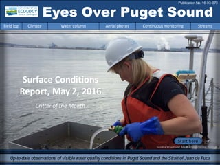
- 1. Critter of the Month Surface Conditions Report, May 2, 2016 Eyes Over Puget Sound Field log Climate Water column Aerial photos Continuous monitoring Streams Publication No. 16-03-073 Up-to-date observations of visiblewater quality conditions in Puget Sound and the Strait of Juan de Fuca Start here Sandra Weakland,MarineMonitoring,Ecology
- 2. Dr. Christopher Krembs (Editor) Personalimpressions p. 3 How’s the Water Quality in Puget Sound? Climateconditions p. 5 Air temperatures andsunlight are above normal. Precipitationis low,but snowmelt-fedrivers are running very high. Watercolumn p. 6 Temperatures are still high in Puget Sound. Recordwarm water fromlast year persists inHoodCanal as of March. Aerialphotography p. 10 Jellyfishare already occurringinhigh numbers in southern inlets. The spring phytoplanktonbloomis in full swing creating abundant organic material that is washingonto beaches. Continuous monitoring p. 29 Chlorophyll concentrations have increasedthroughout Puget Sound and more recently,inthe Strait of Juande Fuca between Admiralty Inlet andVictoria Harbour. Streams p. 31 InMay, the snowpack is dwindling fast as temperatures are up to 7 °F warmer thannormal at higher elevations. LONG-TERMMARINEMONITORINGUNIT Skip Albertson Julia Bos Suzan Pool Editorial assistanceprovided by: Laura Hermanson, Suzan Pool, CarolMaloy Marine conditionsfrom 5-2-2016 at a glance Field log Climate Water column Aerial photos Continuous monitoring Streams Don Watt Mya Keyzers Laura Hermanson
- 3. Critter of the Month Dany Burgess & Angela Eagleston Marine Sediment Monitoring Team Luidia foliolata - The Sand Star This month’s Critter is a familiar face! If you haveever been to an aquariumor explored tide pools, you may have encountered this creaturebefore. Fun Sand Star Facts! • One of the fastestsea stars in the world, moving up to 9 feet per minute due to its unique adhesive systemin its tube feet. • Can quickly shed their arms and regeneratenew ones. • Voracious predators, ingesting sea cucumbers, smallclams, brittle stars, and marine worms. Photo by Jennifer Vanderhoof, courtesy ofKing County Marine Monitoring Program Learn more about sand starandothercritters on Ecology’s EcoConnectbloghere. Personal Field Impression Field log Weather Water column Aerial photos Continuous monitoring Streams Eyes Under Puget Sound 5-2-2016 Field log Climate Water column Aerial photos Continuous monitoring Streams
- 4. Personal Field Impression Field log Weather Water column Aerial photos Continuous monitoring Streams Personal Field Impression 5-2-2016 Field log Climate Water column Aerial photos Continuous monitoring Streams We get asked this question often when interacting with the public. But the question can mean many different things. When you wonder about water quality in Puget Sound, what areyou really interested in? How’s the Water Quality in Puget Sound? Is it safe to go swimming? To check the safetyof saltwater and freshwaterswimming locations, go to the Department of Ecology’s BEACH Program website forclosuresand advisories. You’ll findfurther informationaboutwater quality standards and linksto related information. Is it safe to harvest shellfish? For recreational shellfishharvest information,visitthe Department of Health Shellfish Safetywebsite. The interactive map can helpyou to stay safe and informedabout closuresdue to biotoxinsandpollution. Should I be worried about pollutionand toxins? The Toxic StudiesUnit at the Department of Ecology monitors toxicchemicals in water, sediment,andfishtissue inall waterbodies,aswell as children'sproducts and consumer goods. What is El Niñoand how will it affect me? In the PacificNorthwest, El Niño has caused this spring to be warmer and drier than usual. To understandhow El Niñowill influence yourvacationplans, gardeningschedule,andchances for an outdoor BBQ, check out the El Niño Theme Page from NOAA’s PacificMarine Environmental Laboratory. Photo Creditfromleftto right:mynorthwest.com,PMEL,Encyclopediaof PugetSound,KOMONews. Readhere Readhere Readhere Readhere
- 5. Field log Climate Water column Aerial photos Continuous monitoring Streams Natural Influence leadingto 5-2-2016 Climate and naturalinfluences,includingweather,rivers,and the adjacent ocean,canaffect our marine waters. Graphics are basedonprovisional data andare subject to change. http://www.ecy.wa.gov/programs/eap/mar_wat/weather.html,page 26. Putting the puzzle piecesof influencing factorstogether… lowerhigher expected No data *UpwellingAnomalies(PFEL) ENSO = El Niño SouthernOscillation * Summary for April 2016: Air temperatures remain above normal in the Puget Sound lowlands. Precipitationlevels werebelow normal during April, after five months of abovenormal rain. Sunshine levels weremuch abovenormal (low cloud cover). River flows areslightly above normal, except for the Fraser River (very high) and Chehalis River (low), which is mostly fed by precipitation. Downwelling eased off in April and ENSO and PDO remain in their warmphase(El Niño).
- 6. We usea boatand a chartered float plane to access our monthly monitoring stations. We communicate data and environmental marine conditions using: 1. Marine Water Condition Index (MWCI) 2. Eyes OverPuget Sound (EOPS) 3. Anomaliesand sourcedata Field log Climate Water column Aerial photos Continuous monitoring Streams Ourlong-termmarinemonitoringstationsinWashington Starthere Isl. .
- 7. 0 2000 4000 6000 8000 10000 12000 Dec-13 Jan-14 Feb-14 Mar-14 Apr-14 May-14 Jun-14 Jul-14 Aug-14 Sep-14 Oct-14 Nov-14 Dec-14 Jan-15 Feb-15 Mar-15 Apr-15 May-15 Jun-15 Jul-15 Aug-15 Sep-15 Oct-15 Nov-15 Dec-15 Jan-16 Feb-16 Mar-16 Apr-16 Discharge(m3s-1) Field log Climate Water column Aerial photos Continuous monitoring Streams ArePugetSoundconditionsnormalizing? Year 2016 is continuingrecordbreakingglobal temperatures. NOAAprovides updates onthe pages below. Inour region, the Fraser River has not been flowingas high as last year,though it has picked up. A better snow base lets us hope that summer flows andestuarine circulationwill be closer to normal,contrastinglast year’s drought. Estuarine circulation is important because watertemperatures in Puget Soundare still warmerthan what they should be! The Fraser River is the largestfreshwater sourcefor the Salish Sea, significantly affecting estuarine circulation. If rivers continue to improve water exchange duringsummer, we have anopportunity to bring in cooler oceanwater. Inwinter andspring 2015, the Fraser River and other rivers dischargedprematurely. Very low summer flows followedandinhibited the renewal of water inPuget Sound. Rivers are now normal or running higher, but not like last year. Estuarine circulationis presently as expected. Source: http://wateroffice.ec.gc.ca/index_e.html Higher than normal Lower than normal Expected Credit: Christopher Krembs Readhere
- 8. Region 1 2 3 4 5 6 7 8 9 10 11 12 1 2 3 4 5 6 7 8 9 10 11 12 1 2 3 1 2 3 4 5 6 7 8 9 10 11 12 1 2 3 4 5 6 7 8 9 10 11 12 1 2 3 1 2 3 4 5 6 7 8 9 10 11 12 1 2 3 4 5 6 7 8 9 10 11 12 1 2 3 201620152016 201620142015 2015 Whidbey Basin Hood Canal Central Sound South Sound 20142014 Grays Harbor Willapa Bay North Sound San Juan Physical conditionstracked in historicalcontext Field log Climate Water column Aerial photos Continuous monitoring Streams Explore profiles at all stations Still higher temperature in P. Sound ExpectedOxygenSalinity below normal Temperatures fromMarchremainhighin Puget Soundand recordwarmwater fromlast year persists much longer in HoodCanal. OxygeninPuget Sound is generally expected. Conditions are comparable,but less pronouncedat the Coast.
- 9. a) PacificDecadalOscillationIndex(PDO,temperature) (explanation) b) UpwellingIndex(anomalies)(Upwelling,low oxygen) (explanation) c) NorthPacificGyreOscillationIndex(NPGO, productivity) (explanation) Field log Climate Water column Aerial photos Continuous monitoring Streams Theoceanaffectswaterquality: OceanClimateIndices NPGO(x10) PDO/UpwellingIndex Three-year running average of PDO, Upwelling, and NPGO indices scores . Ocean boundaryconditions are in transition: (a)water is still warm (PDO), (b) upwellingoflow oxygen and high nutrient ocean water are normal (UpwellingIndex anomaly),and (c)surface productivityalong the coast is normalizing(NPGO). -25 -20 -15 -10 -5 0 5 10 15 20 25 -1.5 -1 -0.5 0 0.5 1 1.5 1945 1950 1955 1960 1965 1970 1975 1980 1985 1990 1995 2000 2005 2010 2015
- 10. Summary: Aerial photography5-2-2016 Jellyfish are already occurring in high numbers in southern inlets. The spring phytoplankton bloom is in full swing creating abundantorganic material at the surfacethat is washing onto beaches. Field log Climate Water column Aerial photos Continuous monitoring Streams Start here Mixing and Fronts: Occasionalfronts in Central Sound, Dyes Inlet, and Colvos Passagedelineating water of different coloration. Debris: Abundantorganic debris fromdecaying blooms in Colvos Passage, Dyes Inlet, PortMadison, Sinclair Inlet, and Central Sound. Visible blooms: Spring phytoplankton bloom in full swing in all places and staining water dark green and brown. In someplaces, blooms are colored red-brown. Jellyfish: Numerous jellyfish patches in Budd, Eld, and Henderson Inlets. BloomDebrisFront Suspendedsediment: Very little suspended sediment. Plume Salmon Bay withno oil sheen– that is good. Lake Union, a busy place to land!
- 11. Strait of Juan de Fuca San Juan Islands Padilla Bay Main Basin Hood Canal South Sound Whidbey Basin Field log Climate Water column Aerial photos Continuous monitoring Streams Sunny,broken ceilingnear Bremerton Flight Information: Aerial photography and navigation guide 7 Flight route 9 3 2 8 Tide data (Seattle): Time Height(ft.) High/Low 01:52 AM 11.1 H 08:24 AM 3.88 L 01:56 PM 8.56 H 08:00 PM 2.03 L 6 10 11 14 13 4 5 1 Observation Maps: Central Sound South Sound 15 12
- 12. Jellyfishpatches in Budd Inlet and spring bloom conditions coloring the water green-brown. Location: Budd Inlet (South Sound),4:44 PM. 1 Aerial photography 5-2-2016 Navigate Field log Climate Water column Aerial photos Continuous monitoring Streams boat jellyfish jellyfish jellyfish
- 13. A. B. 2 NavigateAerial photography 5-2-2016 Field log Climate Water column Aerial photos Continuous monitoring Streams A. Organic material washing onto beaches and decaying. B. Very strong spring blooming conditions. Location: West side of Budd Inlet (South Sound),4:44 PM. Bloom boat marker Public submission of picture, by Laura Uhis
- 14. Bloom boat jellyfish jellyfish jellyfish jellyfish jellyfish jellyfish jellyfish jellyfish boat A. B. 3 NavigateAerial photography 5-2-2016 Numerous Jellyfish patches in Eld Inlet occurring unusually early. A. Looking north, B. Looking south. Location: Eld Inlet (South Sound),4:47 PM. Field log Climate Water column Aerial photos Continuous monitoring Streams
- 15. 4 Navigate Field log Climate Water column Aerial photos Continuous monitoring Streams Aerial photography 5-2-2016 Water rich in phytoplankton of different species coloring the water green-brown or red-brown. Location: Totten Inlet (South Sound),4:51 PM. Bloom Debris
- 16. 5 NavigateAerial photography 5-2-2016 Field log Climate Water column Aerial photos Continuous monitoring Streams Large patches of organic debris accumulating at the surface. Location: Steamboat Island,Totten Inlet (South Sound),4:52 PM. Debris Debris Debris Debris Debris
- 17. Intense green bloom in Horsehead Bay. Location: Forest Beach, Carr Inlet (South Sound),5:00 PM. 6 NavigateAerial photography 5-2-2016 Field log Climate Water column Aerial photos Continuous monitoring Streams Bloom
- 18. Brown water different from colors in the adjacent Tacoma Narrows suggesting different phytoplankton species. Location: GigHarbor (Central Sound),5:03 PM. 7 NavigateAerial photography 5-2-2016 Field log Climate Water column Aerial photos Continuous monitoring Streams
- 19. Water rich in phytoplankton and organic material floating at the surface and enteringColvos Passage from South Sound on an ebb tide. Location: Southern entrance ofColvos Passage (Central Sound),5:05 PM. 8 NavigateAerial photography 5-2-2016 Field log Climate Water column Aerial photos Continuous monitoring Streams Debris Bloom
- 20. Large rafts of organic material floating at the surface through Colvos Passage. Location: Colvos Passage (CentralSound),5:08 PM. 9 NavigateAerial photography 5-2-2016 Field log Climate Water column Aerial photos Continuous monitoring Streams Debris
- 21. 10 NavigateAerial photography 5-2-2016 Spring bloom in colors of green (hint of red), organic debris, but no jellyfish, unlike South Sound. Location: Sinclair Inlet (Central Sound),5:14PM. Field log Climate Water column Aerial photos Continuous monitoring Streams Bloom Debris
- 22. Bloom Bloom boat Debris boat A. B. NavigateAerial photography 5-2-2016 A. Large accumulations of organic material. B. Spring bloom in colors of green (hint of red). Location: Sinclair Inlet (Central Sound),5:15PM. Field log Climate Water column Aerial photos Continuous monitoring Streams 11
- 23. NavigateAerial photography 5-2-2016 Large and numerous accumulations of organic material at the surface. Phytoplankton bloom. Location: Dyes Inlet (Central Sound),5:19 PM. Field log Climate Water column Aerial photos Continuous monitoring Streams 12 boat Debris Bloom boat
- 24. NavigateAerial photography 5-2-2016 Large and numerous accumulations of organic material at the surface. Phytoplankton bloom. Location: Port Madison (CentralSound),5:26 PM. Field log Climate Water column Aerial photos Continuous monitoring Streams 13 Debris Debris
- 25. A. NavigateAerial photography 5-2-2016 A. Large and numerous accumulations of organic material. B. Phytoplankton bloom in red-brown and green visible near a tidal front. Location: Port Madison (Central Sound),5:26 PM. Field log Climate Water column Aerial photos Continuous monitoring Streams 14 boat Bloom Bloom Bloom boat ship Debris B.
- 26. NavigateAerial photography 5-2-2016 Large and numerous accumulations of organic material. Phytoplankton bloom around Bainbridge Island. Location: East of Bainbridge Island (Central Sound),5:30 PM. Field log Climate Water column Aerial photos Continuous monitoring Streams 15 Debris Debris Bloom ship
- 27. n.a. Hood Canal Central Sound Numbers on map refer to picture numbers for spatial reference Date: 5-2-2016 Qualitative aerial observer map during transit Navigate Numbers on map refer to picture numbers for spatial reference 11 12 10 Field log Climate Water column Aerial photos Continuous monitoring Streams 15 14 9 8 13 7
- 28. Date: 5-2-2016 Qualitative aerial observer map during transit Numbers on map refer to picture numbers for spatial reference Navigate South Sound Field log Climate Water column Aerial photos Continuous monitoring Streams 12 3 4 5 6 7
- 29. Summary of Victoria Clipper IVferry data: The near-surface water startedmakinga seasonal transition. Temperature has increased over the last few days. Chlorophyll concentrations increasedthroughout Puget Soundand more recently,in the Strait of Juande Fuca betweenAdmiralty Inlet and Victoria Harbour. Turbidity and CDOMremainlow. The Victoria Clipper IV carries sensorsin its sea chest. The sensorsallow us to plot overtime transects of: A. Temperature B. Chlorophyll C. Turbidity D. CDOM Over time,we see the dynamics of these variables in surface water betweenSeattle and Victoria,BC. C. B.A. D. Field log Climate Water column Aerial photos Continuous monitoring Streams Continuousmonitoring 5-2-2016
- 30. Figures show daily sensor data installedonthe ferry which measure near-surface water at 5-sec intervals while the Victoria Clipper IV transits between Seattle andVictoria,BC. A. Sea Surface Temperature: Water is becomingwarmer in Central Basin. B. Chlorophyll: Concentrations were low inthe Strait and clearly increasedin Puget Sound. C. Turbidity: Turbidity was low onentire route. D. Colored Dissolved Organic Matter(CDOM): Humics inthe water are low inCentral Basin and nearly absent in the Strait of Juande Fuca. A. B. C. Victoria Olympic Peninsula Seattle Victoria Olympic Peninsula Seattle Victoria Olympic Peninsula Seattle Victoria Olympic Peninsula Seattle D. Field log Climate Water column Aerial photos Continuous monitoring Streams Continuousmonitoring 5-2-2016
- 31. Warm and dry weather, losing the snow fast Field log Climate Water column Aerial photos Continuous monitoring Streams At first, warmer air temperatures in April did not affect snow water equivalencies. However, continued warmer temperatures into May havereduced the snowpack quickly in Washington. Precipitation has dropped to less than normal. What can we expect for the summer to come? Don Watt, Ecology Over the last month, weatherin the Puget Sound Regionwas verywarm and dry. Mean temperatureswere 3 to 6 °F above normal for the PugetSound basinand 6 to 7 °F above normal along the Cascade Crest and on the higherpeaks inthe Olympics. Alongwith the exceptionallywarmtemperaturesinApril came much lower than normal precipitationformuch of the Puget Sound Basin.
- 32. Warm and dry weather, losing the snow fast Field log Climate Water column Aerial photos Continuous monitoring Streams The combinedeffectof the very warm and dry weather inApril has beena rapid lossof snowpack across much of the region. Snowpack had beennear or above normal across the regionin earlyApril. But by early May, snowpack in the mountainseast of PugetSound had dwindledtobetween56 and 83% of seasonal normal. Snowpack in the Olympicsremainsin the near-normal category. April May
- 33. Accessmooring data: ftp://www.ecy.wa.gov/ea p/Mooring_Raw/Puget_S ound/ Continuous monitoring : Suzan.Pool@ecy.wa.gov Get data from Ecology’sMarine MonitoringPrograms Long–Term MonitoringNetwork Real–Time Sensor Network Accesscore monitoringdata: https://fortress.wa.gov/ec y/eap/marinewq/mwdata set.asp christopher.krembs@ecy.w a.gov Ecology’s long-termmarine monitoring stations Continuous track Field log Climate Water column Aerial photos Continuous monitoring Streams Riverand Stream WaterQuality Monitoring http://www.ecy.wa.gov/programs/eap/fw_riv /rv_main.html Discontinued (fundingcuts)
- 34. You may subscribe or unsubscribe to the Eyes Over Puget Sound email listservby going to: http://listserv.wa.gov/cgi-bin/wa?A0=ECOLOGY-EYES-OVER-PUGET-SOUND Many thanks to our business partners: Clipper Navigation,SwantownMarina,andKenmore Air. We are looking forfeedbackto improve ourproducts. Dr. ChristopherKrembs christopher.krembs@ecy.wa.gov Marine Monitoring Unit EnvironmentalAssessment Program WA Department of Ecology Field log Climate Water column Aerial photos Continuous monitoring Streams