
Recommandé
Contenu connexe
Tendances
Tendances (20)
Similaire à Eops 2017 8_28
Similaire à Eops 2017 8_28 (20)
Plus de EOPS EOPS
Plus de EOPS EOPS (15)
Dernier
Dernier (20)
Eops 2017 8_28
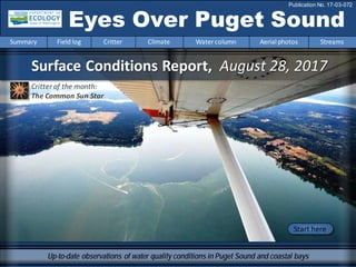
- 1. Surface Conditions Report, August 28, 2017 Eyes Over Puget Sound Publication No. 17-03-072 Up-to-date observations of water quality conditions in Puget Sound and coastal bays Start here Summary Field log Critter Climate Water column Aerial photos Streams Critter of the month: The Common Sun Star
- 2. Personalimpressions p. 3 How do we know if benthic invertebrate communities are changing? Climateinfluences p. 5 Warmair temperatures andabundant sunshine continue,but river flows are droppingin the Fraser River. Upwellinghas picked up slightly. Watercolumn p. 8 Puget Sound is fresher thanit’s ever been the past 17 years. Warmer temperatures persist aroundWest Point,Elliott and Commencement Bays. Aerialphotography p. 11 Large rafts of driftingmacroalgaeinCentral Sound. Diverse blooms in colors ofgreen,orange andred-brown. Jellyfish abundance low. Case Inlet withintense bloom. Streams p. 35 Warmer and drier conditions persisted. Despite a robust snowpack this spring, the supply of freshwater to Puget Soundis variable. LONG-TERMMARINEMONITORINGUNIT Editorial assistanceprovided by: J. Ruffner, V. Partridge, C. Maloy Marine conditionsfrom 8-28-2017 at a glance Dr. Christopher Krembs (Editor) Skip Albertson Julia Bos Tyler Burks Jim Shedd Mya Keyzers Allison Brownlee Summary Field log Critter Climate Water column Aerial photos Streams p.10
- 3. Monitoringbenthic invertebrates(benthos) Measuringbiomass and size class We collect sediment fromour long-term monitoring stations in Puget Sound using a double van Veen sediment grab. We sievethe benthos fromthe sediment and preservethem for lab identification/analysis. Megafauna!Not all our critters are as large as this bloodworm. Benthos are categorized into sizeclasses: small, medium, large, and megafauna. Measurements will be used to forma Puget Sound benthic invertebratebiomass baseline, which can tell us more aboutchange in benthic communities than abundance data alone. Check out our poster! Each identified specimen is weighed (grams) and measured (millimeters). How do we know if benthic invertebrate communities are changing? Nicole Marks – Washington Conservation Corps intern Personal Field ImpressionPersonal Field Impression 8-28-2017 Summary Field log Critter Climate Water column Aerial photos Streams
- 4. Critter of the Month – The Common Sun Star Dany Burgess & Angela Eagleston Marine Sediment Monitoring Team Learn moreabout the IceCream Cone Worms and other critters on Ecology’s EcoConnectblog here. Personal Field ImpressionEyes Under Puget Sound 8-28-2017 Summary Field log Critter Climate Water column Aerial photos Streams Fun Sun Star Facts! • Comes in a variety of colors and patterns, but almost always has 11 arms • Can “smell” its prey using chemical receptors • Can shootits stomach out of its body to digestfood items that won’tfit into its small mouth (pictured below) Crossaster papposus There’s nothing common about this month’s solar eclipse-themed critter! The Common Sun Star may be beautiful, but it is also a dominant predator, playing an important role in Puget Sound benthic communities.
- 5. Climate Influences leading to 8-28-2017 higher No datalowerexpected *UpwellingAnomalies (PFEL) PDO = PacificDecadal Oscillation NPGO = North Pacific GyreOscillation ENSO = El Niño Southern Oscillation Summary Field log Critter Climate Water column Aerial photos Streams Climate and naturalinfluences include weather,river flows,andthe adjacent oceanconditions that affect our marine waters. This graphic provides contextfor interpretingPuget Soundmarine conditions. All data frompublic sources: weather fromUWGrayskies;river flows fromUSGS and Environment Canada; indices fromNOAA,UW (PDO),and E. Di Lorenzo (NPGO). July Summary: Air temperatures havebeen mostly above normalsince May. Precipitationlevels havebeen very low. Sunshine levels havebeen abovenormal for most of the summer. River flows aredropping to below normal in the Fraser and SkagitRivers. Upwelling is slightly above normal. PDO is trending down, but still warm-phase.
- 6. We usea boatand a chartered float plane equipped with a CTD packageto access our monthly monitoring stations. We communicate data and environmental marine conditions using: 1. Marine Water Condition Index (MWCI) 2. Eyes OverPuget Sound (EOPS) 3. Anomaliesand sourcedata Ourlong-termmarinemonitoringstationsinWashington Starthere Isl. . Station network of ambient water quality monitoring stations San Juan Isl. Summary Field log Critter Climate Water column Aerial photos Streams
- 7. HowwellisPugetSoundexchangingitswater? Year 2016 had record-breaking globaltemperatures. The year 2017 is looking much better. Fraser River flows were normalor higher than normal in early June and similar to the year 2014. However, due to weaker than normal upwellingalongthe coast,we expect that the inflowof low-oxygen,nutrient-rich,saltywater into Puget Sound has been lower. The Fraser River is the major driver of estuarine circulation and water exchange with the ocean. Historically,peaks ofcoastal upwellingand the freshet are in sync. Wikipedia: The term freshet is mostcommonly used to describe a spring thaw resulting fromsnow and ice melt in rivers located in the northern latitudes of North America. Summary Field log Critter Climate Water column Aerial photos Streams Higher than normal Lower than normal Expected Fraser River
- 8. Fresher conditionspersist in summer2017 Explore profiles at all stations Expected Temperature Historically Low Salinity As of July 2017, warmer temperaturepersists in Central Sound with 17-year surfacemaxima measured near West Point and in Elliott and Commencement Bays. Low salinity persists. A continued trend of significantly fresher conditions in Puget Sound has been measured since November, 2016. CentralSound and Hood Canal also show higher DO values continuing into July. Region 7 8 9 10 11 12 1 2 3 4 5 6 7 8 9 10 11 12 1 2 3 4 5 6 7 7 8 9 10 11 12 1 2 3 4 5 6 7 8 9 10 11 12 1 2 3 4 5 6 7 7 8 9 10 11 12 1 2 3 4 5 6 7 8 9 10 11 12 1 2 3 4 5 6 7 Whidbey Basin Hood Canal Central Sound South Sound Grays Harbor Willapa Bay North Sound San Juan 2015 20152016 2017 2015 20162016 20172017 Higher DO = higher than expected(>*IQR) = expected(=*IQR) = lowerthan expected(< *IQR) = higher than previousmeasurements = no data = lowerthan previousmeasurements *IQR = Interquartile Range (25th – 75th percentiles); n = 17 Summary Field log Critter Climate Water column Aerial photos Streams
- 9. a) PacificDecadalOscillationIndex(PDO,temperature) (explanation) b) UpwellingIndex(anomalies)(Upwelling,low oxygen) (explanation) c) NorthPacificGyreOscillationIndex(NPGO, productivity) (explanation) Theoceanaffectswaterquality: OceanClimateIndices NPGO(x10) PDO/UpwellingIndex Three-year running average of PDO, Upwelling, and NPGO index scores . Ocean boundaryconditions long-term variability: (a)water is still warm (PDO), (b) upwellingoflow oxygen and high nutrient ocean water are low (UpwellingIndex anomaly),and (c) surface productivity alongthe coast is near normal (NPGO). -25 -20 -15 -10 -5 0 5 10 15 20 25 -1.5 -1 -0.5 0 0.5 1 1.5 1945 1950 1955 1960 1965 1970 1975 1980 1985 1990 1995 2000 2005 2010 2015 Summary Field log Critter Climate Water column Aerial photos Streams
- 10. This isa newfeature,andwearesolicitingfeedback (salb461@ecy.wa.gov). Eventuallywewill featurethemostrecentdata. visibility What was the visibility (ft) in the water for divers? Find depths with high and low visibility • Best visibility was 39 feetaround Mukilteo. Seattle and south had lower viz in July. • Poor visibility occurred in many places to the south of Seattle, but also in Bellingham Bay. • We usetransmissometer readings fromour CTD packageand convertthem into horizontalvisibility. See our recent publication for details: Underwater Visibility Maps – a Tool for Scuba Divers. July Visibility (ft)/depth(ft) good poor The divers' page, visibility 8-28-2017 Summary Field log Critter Climate Water column Aerial photos Streams Read poster #) Best Worst 1) 25 / 98 11 / 8 2) 13 / 20 9 / 61 3) 27 / 98 7 / 3 4) 39 / 98 6 / 15 5) 25 / 80 6 / 7 6) 11 / 94 5 / 3 7) 25 / 67 1 / 2 8) 9 / 26 2 / 3 9) 18 / 98 5 / 7 10) 26 / 72 4 / 43 11) 16 / 72 4 / 8 12) 7 / 5 4 / 21 13) 23 / 21 19 / 64 14) 27 / 82 16 / 8 15) 19 / 77 14 / 7 16) 12 / 21 2 / 11
- 11. Summary: Aerial photography8-28-2017 Start here BloomDebrisFrontPlume Red-brownbloomin DyesInlet(OysterBay) Noctiluca bloomon beach,Portage, VashonIsland Summary Field log Critter Climate Water column Aerial photos Streams Mixing and Fronts: Tidal fronts in PortMadison, EastPassage, Dalco Passage, Case and Carr Inlets. Tidal eddy in Dyes Inlet. Internalwaves in Case Inlet, East Passageand Commencement Bay. Debris: Largerafts of macroalgaein large portions of Central Sound. Organic debris floating at the surfacein Case and Carr Inlets. Visible blooms: Green: Northern portions of Case and Carr Inlets. Orange: Caseand Carr Inlets and Quartermaster Harbor. Some looking like Noctiluca. Red-brown: Dyes and Sinclair Inlets; Totten, Eld, Budd and Henderson Inlets; Carr and Case Inlets; Dalco Passage. Jellyfish: Occasionaljellyfish patches limited to Eld Inlet, rarein Budd Inlet. Suspendedsediment: Glacial flour entering with Puyallup River and extending into EastPassageand Quartermaster Harbor Large rafts of driftingmacroalgaeinCentral Sound. Diverse blooms inCase andCarrInlets incolors of green, orange andred-brown. Many red-brownblooms seeninmost inlets of Southand Central Sound. Jellyfishabundance low,confinedmostly to EldInlet. Orange andgreen blooms couldbe Noctiluca?
- 12. Strait of Juan de Fuca San Juan Islands Padilla Bay Main Basin Hood Canal Whidbey Basin Sunny,but wildfires lower visibility. Flight Information: Aerial photography and navigation guide Flight route 6 1 Observation Maps: Central Sound South Sound 12 7 19 16 17 14 3 9 8 10 13 15 20 4 5 11 18 South Sound Summary Field log Critter Climate Water column Aerial photos Streams Tide data(Seattle): Time Height (ft) High/Low 04:24 AM 1.85 L 11:02 AM 8.77 H 4:30 PM 5.59 L 10:26 PM 9.87 H 2
- 13. Large rafts of macroalgae. Location: A. President Point, B. Point Jefferson,Port Madison (CentralSound),12:37 PM. A. B. 1 Aerial photography 8-28-2017 Navigate Summary Field log Critter Climate Water column Aerial photos Streams boat Ship Ship President Point PointJefferson macroalgae macroalgae macroalgae macroalgae macroalgae macroalgae
- 14. Large rafts of macroalgae. Location: Off Point Monroe,Port Madison (Central Sound),12:41 PM. 2 NavigateAerial photography 8-28-2017 Summary Field log Critter Climate Water column Aerial photos Streams Debris Debris Point Monroe
- 15. 3 NavigateAerial photography 8-28-2017 Large red-brown bloom and large tidal eddy. Location: Erland Point,Dyes Inlet (Central Sound),12:48 PM. Summary Field log Critter Climate Water column Aerial photos Streams Bloom boat Debris Erland Point
- 16. 4 NavigateAerial photography 8-28-2017 Large red-brown bloom and front. Location: Elwood Point,Dyes Inlet (Central Sound),12:49 PM. Elwood Point Summary Field log Critter Climate Water column Aerial photos Streams Bloom boat Debris
- 17. 5 NavigateAerial photography 8-28-2017 Red-brown bloom mixedin with water colored in green-ochre. Location: Sinclair Inlet (Central Sound),12:52 PM. Summary Field log Critter Climate Water column Aerial photos Streams Bloom boat
- 18. Greenbloom. Location: North Bay, Case Inlet (South Sound),12:59 PM. 6 NavigateAerial photography 8-28-2017 Summary Field log Critter Climate Water column Aerial photos Streams Bloom Bloom boat Bloom
- 19. Noctiluca bloom mixedin with green bloom along tidal front. Location: Off Stretch Island, Case Inlet (South Sound), 1:03 PM. 7 NavigateAerial photography 8-28-2017 Summary Field log Critter Climate Water column Aerial photos Streams Bloom boat Debris Bloom Bloom Bloom
- 20. Red-brown bloom, suspended sediment. Location: Burns Point,Totten Inlet (South Sound),1:15 PM. 8 NavigateAerial photography 8-28-2017 Burns Point Summary Field log Critter Climate Water column Aerial photos Streams Bloom boat
- 21. Red-brown bloom and occasional jellyfishpatches. Location: Eld Inlet (South Sound),1:18 PM. 9 NavigateAerial photography 8-28-2017 jellyfish Summary Field log Critter Climate Water column Aerial photos Streams Bloom boat jellyfish jellyfish
- 22. 10 NavigateAerial photography 8-28-2017 Red-brown bloom, weak internal waves. Location: Henderson Inlet (South Sound),1:24 PM. Summary Field log Critter Climate Water column Aerial photos Streams Bloom Bloom raft internal waves
- 23. NavigateAerial photography 8-28-2017 Organic material accumulating at tidal fronts. Location: Balch Passage (South Sound),1:27 PM. 11 Debris Debris Summary Field log Critter Climate Water column Aerial photos Streams boat Debris boat
- 24. NavigateAerial photography 8-28-2017 Organic material accumulating at tidal front next to intense green and orange bloom. Location: Off Samego Point,McNeil Island,Carr Inlet (South Sound),1:32 PM. 12 Debris Debris Summary Field log Critter Climate Water column Aerial photos Streams Bloom boat
- 25. NavigateAerial photography 8-28-2017 Organic material accumulating at tidal front next to intense green and orange bloom. Location: Off Samego Point,McNeil Island,Carr Inlet (South Sound),1:32 PM. 13 Debris Debris Summary Field log Critter Climate Water column Aerial photos Streams Bloom boat
- 26. NavigateAerial photography 8-28-2017 Internal waves forming in near-surface green and orange bloom. Location: Carr Inlet (South Sound),1:33 PM. 14 Summary Field log Critter Climate Water column Aerial photos Streams Bloom internal waves
- 27. NavigateAerial photography 8-28-2017 Orange and green near-surface blooms meetingat front. Location: Fox Island, Carr Inlet (South Sound),1:33 PM. 15 Summary Field log Critter Climate Water column Aerial photos Streams Bloom Bloom boat
- 28. NavigateAerial photography 8-28-2017 Red-brown bloom and organic material accumulating at fronts. Location: Cutts Island, Carr Inlet (South Sound),1:36 PM. 16 Summary Field log Critter Climate Water column Aerial photos Streams Bloom boat Debris Debris Cutts Island
- 29. NavigateAerial photography 8-28-2017 Macroalgae accumulating at tidal front. To the right, red-brown bloom. Location: Off Gig Harbor, Case Inlet (Central Sound), 1:41 PM. 17 Summary Field log Critter Climate Water column Aerial photos Streams Bloom boat Gig Harbor macroalgae
- 30. NavigateAerial photography 8-28-2017 Large rafts of macroalgae accumulating along front. Plume of Puyallup River extendingnorth. Location: Off Maury Island (Central Sound),1:45 PM. 18 Maury Island Summary Field log Critter Climate Water column Aerial photos Streams boat macroalgae macroalgae macroalgae macroalgae Plume internal waves
- 31. NavigateAerial photography 8-28-2017 Rafts of macroalgae accumulating along front. Plume of Puyallup River extendinginto Quartermaster Harbor. Location: Entrance ofQuartermaster Harbor (Central Sound), 1:46 PM. 19 Summary Field log Critter Climate Water column Aerial photos Streams Bloom boat Maury IslandVashon Island macro algae macroalgae Plume
- 32. NavigateAerial photography 8-28-2017 An urban waterway without oil sheens.A good day! Location: Salmon Bay,Seattle (Central Sound),2:00 PM. 20 Summary Field log Critter Climate Water column Aerial photos Streams
- 33. Hood Canal Central Sound Numbers on map refer to picture numbers for spatial reference Date: 8-28-2017 Qualitative aerial observer map Navigate Numbers on map refer to picture numbers for spatial reference Summary Field log Critter Climate Water column Aerial photos Streams 1 2 3 5 4 20 19 18 17 n.a.
- 34. Date: 8-28-2017 Qualitative aerial observer map Numbers on map refer to picture numbers for spatial reference Navigate South Sound 15 Summary Field log Critter Climate Water column Aerial photos Streams 14 8 7 10 12 6 11 9 13 16 17
- 35. Snowpack and stream flows are variable Tyler Burks, Jim Shedd Ecology Warmer and drier conditions persisted in western WA. Despite a robustsnowpack this spring, the supply of freshwater to Puget Sound is somewhatvariable. The Skagit, Snohomish, and Stillaguamish Rivers are below normal due to a lack of precipitation. Rivers of south Puget Sound and fromthe Olympic Mountains are generally flowing normal to below normal. https://wrcc.dri.edu/anom/was_anom.html Summary Field log Critter Climate Water column Aerial photos Streams
- 36. Accesshistoric mooring data: http://www.ecy.wa.gov/pr ograms/eap/mar_wat/dat a.html - : Suzan.Pool@ecy.wa.gov Get data from Ecology’s Marine MonitoringPrograms Long–Term MonitoringNetwork Discontinued mooring network Accesscore monitoringdata: https://fortress.wa.gov/ec y/eap/marinewq/mwdata set.asp christopher.krembs@ecy.w a.gov Ecology’s long-termmarine monitoring stations Continuous track Riverand Stream WaterQuality Monitoring http://www.ecy.wa.gov/programs/eap/fw_riv /rv_main.html Discontinued (fundingcuts) Summary Field log Critter Climate Water column Aerial photos Streams
- 37. You may subscribe or unsubscribe to the Eyes Over Puget Sound email listservby going to: http://listserv.wa.gov/cgi-bin/wa?A0=ECOLOGY-EYES-OVER-PUGET-SOUND Many thanks to our business partners: Clipper Navigation,SwantownMarina,andKenmore Air. Contact: Dr. ChristopherKrembs, ckre461@ecy.wa.gov Marine Monitoring Unit Environmental AssessmentProgram WA Departmentof Ecology Recommended Citation: Washington State Department of Ecology. 2017. EyesOver PugetSound, Surface ConditionsReport, August28, 2017. Ecology PublicationNo. 17-03-072. https://fortress.wa.gov/ecy/publications/documents/1703072.pdf Summary Field log Critter Climate Water column Aerial photos Streams