2. Create Web Maps
Combine your data with ready-to-use, authoritative
maps on hundreds of topics. Use high-quality basemaps
published by Esri, including street, topographic, imagery,
and demographic maps. You also have access to thousands
of map layers shared by users around the world that you
can use with your own maps and data.
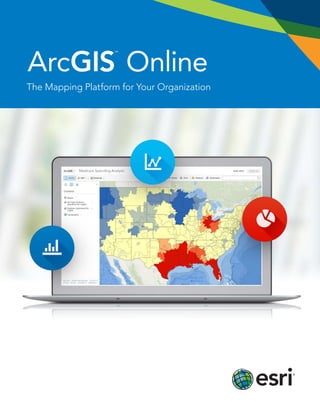
ArcGIS Online is a cloud-based platform
for making and sharing maps, apps,
and other geographic data and content.
Collaborate and Share
Make interacting with your organizational data easier.
Share content related to a common activity through private
groups. Or share relevant content with the public. Embed
your maps in web pages, apps, or blogs or share through
social media.
Knowledge
Workers
Policy Makers
Managers and
Decision Makers
Casual Users
Geospatial
Professionals
Web GIS
Field Work
Force
3. ArcGIS Marketplace
Browse ArcGIS®
Marketplace and discover apps
and data from Esri and authorized Esri partners and
distributors. ArcGIS Marketplace is your one-stop
destination for apps and data that are integrated with
the ArcGISSM
Online platform.
Ready-to-Use Apps
for Your Organization
Make your work force productive right away with
ready-to-use apps for the desktop, browsers, smartphones,
and tablets.
Esri Maps for Office
Make dynamic maps of your spreadsheet data right inside
Microsoft Excel. You also get access to Esri’s demographic
and lifestyle data that you can add to your map to get
more context and details. Esri®
Maps for Office®
is a
downloadable plug-in available in more than 20 languages.
Collector for ArcGIS
Improve the efficiency of your field work force and the
accuracy of your GIS. Use maps and collect data anywhere,
whether you are connected or not. Collector for ArcGIS is
available for iOS and Android devices.
Operations Dashboard for ArcGIS
Monitor real-time data feeds for large-scale events of day-
to-day operations. Create focused, executive dashboards
that combine maps, charts, and graphs. Operations
Dashboard for ArcGIS is available for desktops and tablets.
Web App and Story Map Templates
Let anyone interact with your maps. The ArcGIS Online
apps gallery features a variety of configurable templates
that don’t require coding. You can showcase multiple maps
using story map templates, create time-aware maps, or
build apps focused on a particular workflow.
4. Powerful Analysis Tools
ArcGIS Online gives you access to ready-to-use analysis
tools delivered as a web service that you can use with your
maps and apps.
Data GeoEnrichment
Enrich your maps with Esri’s demographic and lifestyle
data. Get more context for your area of interest by adding
population, household, consumer behavior, and market
potential data. Create infographic pop-up windows or
preformatted reports that display on top of your map or
append the data to your spreadsheets and then map it in
Esri Maps for Office or Esri Maps for SharePoint®
.
Geocoding and Place Search
Convert an address, postal code, or other identifier to
an x,y coordinate or batch geocode a large number of
addresses. The World Geocoding service supports high
location accuracy up to address-level geocoding for over
100 countries. You can visualize the results on a map, insert
the points as stops along a route, or use them as input for
your spatial analysis. You can also store the results for later
use or use the Place Search service to look up a place or
point of interest anywhere in the world and display it
on your map.
Directions and Routing
Calculate routes, including drive times, closest facilities,
and multivehicle routes. With ArcGIS Online global network
analysis services, you can calculate the quickest way
between two points, what facilities are within a certain drive
time, what vehicles can respond to an incident the fastest,
and how you can improve your fleet’s delivery time windows.
Spatial Analysis
Detect patterns in your data to discover new information.
Find hot spots of potential customers, identify locations
for a new business based on certain characteristics, or
summarize your data to see what intersects or connects.
5. Add Mapping to Your
Business Systems
Map your data and analyze it directly in your BI, CRM, EAM,
or ERP system. With ArcGIS Online location analytics plug-
ins for IBM Cognos, SAP, Salesforce.com, or MicroStrategy,
you can create maps of your business data and get more
insights out of your data that you can share with others in
your organization.
Publish Your Open Data
Provide access to your open data to the public. Set up a
website in just a few minutes and add the authoritative data
you want to share. Anyone can search and download data,
filter information, and view the data on an interactive map.
Security
ArcGIS Online gives you control over how you share your
maps, apps, and data. You decide what to share publicly,
share with specific groups, or keep completely private.
Esri’s security strategy is based on an industry-standard,
define-in-depth approach that provides security controls at
every level for every user. Organizations retain ownership of
intellectual property rights for data they publish and control
when and what to delete.
6. Administering Your
ArcGIS Online Organization
As an ArcGIS Online administrator, you have access to tools
and settings that allow you to customize your ArcGIS Online
home page, monitor usage, manage named user accounts,
and set up access privileges. Administrators also manage
security settings and have the ability to delete content and
named user accounts.
Brand Your ArcGIS Online Site
Brand your ArcGIS Online home page by adding your logo
and banner. Populate the gallery with featured maps and
apps that your organization will find useful. You can set a
basemap and extent default that will be the starting point
for making maps in the map viewer. You also have the
option to set the preferred language and region for your
ArcGIS Online users. ArcGIS Online is available in more
than 25 languages, and regional content is available for
more than 60 countries.
7. Roles User Publisher Administrator
Add data * * *
Create web maps * * *
Share content * * *
Participate in groups * * *
Publish hosted services from
feature or map tile data
* *
Manage organization *
Manage users *
To learn more and sign up, visit esri.com/agol.
My Organization used 89 credits
Flexible Subscription Plans
ArcGIS Online is available through an annual subscription plan. Plans
are structured to support organizations of any size. Each subscription
includes a set number of named users and service credits. Service credits
are the currency of ArcGIS Online and are used when you perform certain
functions in ArcGIS Online, for example, spatial analysis or geocoding.
Custom Roles
Custom roles give ArcGIS Online administrators greater control and
flexibility in assigning privileges to members of the organization.
This capability enables administrators to add additional roles that
specifically fit the organization. For example, you might have some
members who need
access to maps and
apps but do not need
to create groups. Or
you might have other
members who need
to publish features
but not tiles.
Sign Up for a Free Trial
Experience how easy it is to make and share maps. Sign up for a
30-day trial that includes five named users, 200 service credits, and
ready-to-use apps.
67.4%
25.8%
4.5%
2.2%
Click or tap slice for more detail