2. Floris van Weelderen, P.Eng, PTOE
Manager, Transportation Planning
MMM Group Limited
vanweelderenf@mmm.ca
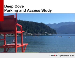
Deep Cove
Parking and Access Study
Presented by:
3. Acknowledgements
District of North Vancouver
• Erica Geddes, P.Eng, PTOE
• Tegan Smith
MMM Group Limited
• Becky Lai, P.Eng
• Shezana Islam, P.Eng
• Mark Merlo, P.Eng, PTOE
• Laurel Richl, P.Eng, PTOE
• Steven Wong, P.Eng
• Jack Crabtree, EIT
Senior Advisors
• Brian W. Wallace, P.Eng – BWW
Consulting
• David C. Hill – Clayton-Hill
Associates
Concord Parking
• Marc Postlethwaite
enrg Research Group
• Liddie Sorensen-Lawrence
4. WHO, WHAT, WHY, WHERE, WHEN
AND HOW?
1. Where is Deep Cove?
2. Why do people come to the Cove?
3. How do they get to Deep Cove?
4. How much parking is available?
5. Where do people park?
6. When is the peak parking demand?
7. What works well?
8. What could be improved?
9. How was the parking data collected?
10.What was the rate of error?
5. Overview
• Context
• Key Definitions
• Data Collection
• LPR
• Data Visualization
• Measles Charts and Heat Maps
• Findings
• TEST YOUR KNOWLEDGE!
6. Where is Deep Cove?
District of
North Vancouver
DEEP COVE
14. Acceptable Walking Distance
• Distance that people are willing to walk between the
place where they parked their vehicle and their
destination
• Affected by:
Quality of the pedestrian environment
Climate
Line of sight
Friction
15. Acceptable Walking Distance
Source: Table 2 - Acceptable Walking Distances, Shared Parking: Sharing Parking
Facilities among Multiple Users (Victoria, BC: Victoria Transport Policy Institute, March
12, 2013)
LONG Major sport or cultural
event
Overflow parking
MEDIUM General retail
Restaurant
Employees
Entertainment center
Religious institution
SHORT Grocery stores
Professional services
Medical clinics
Residents
ADJACENT People with disabilities
Deliveries and loading
Emergency services
Convenience store
LONG
(1,600 ft. /
8 min.)
MEDIUM
(1,200 ft. /
6 min.)
SHORT
(800 ft. /
4 min.)
ADJACENT
(100 ft.)
17. Maximum Capacity
100% of total capacity Absolute maximum number of
parking spaces in a given area
18. Practical Capacity
85% of the
maximum capacity
Generally accepted parking
industry measure
Represents maximum
functional capacity
> 85% capacity? Finding a
vacant parking space
becomes increasingly difficult
Occupancy rate
of between 75%
and 85%
Considered to be an industry
“best practice”
Reasonable opportunity for a
customer or visitor to find
parking
Parking occupancy
exceeds the
practical capacity?
Customers and/or
visitors would:
Park at less
convenient locations
Potentially shop or
visit elsewhere
19. Goldilocks and the Three Bears
TOO HOT >85%
JUST RIGHT 75 – 85%
TOO COLD <50%
20. Duration
• Average length of time that a vehicle remains parked
• Goal: Observed duration similar to the posted or intended time
• Parking time limits in core business areas / along main streets:
• Typically one hour
• May be two hours depending on abutting businesses,
• Intent of parking limits in commercial areas:
• Provide turnover of prime parking spaces
• Optimize number of customers who can make use of a particular
prime parking space
21. Turnover
• Directly related to Duration
• Number of unique vehicles that make use a parking
space over a study period
• Number of potential people served by the space
22. Turnover and Duration
10 hour period
1 car parked
during a
10 hour period
10 cars parked
1 hour each
23. How was Parking Data Collected?
• Two Options
• Traditional License Plate Survey (Pen & Paper)
• License Plate Recognition (LPR) Survey
24. Traditional License Plate Survey
• Data collected manually (Pen & Paper)
• Record the last four letters / digits from
license plates on a block-by-block basis
over an extended period of time
• Data collection / data entry is expensive
• Manpower intensive
• Time-consuming (large data set)
• Subject to field and transcription errors
• Partial nature of the license plate data
precludes using Pen & Paper to
establish trip origin
25. License Plate Recognition (LPR)
Combines digital cameras and
Optical Character Recognition
software to “read” license
plates on vehicles and store
the image/text as electronic
records
Vehicle-mounted applications
incorporate GPS to capture
location data
26. LPR Data Collection: Process
LPR vehicle circulated
through a study area,
gathering data
repeatedly at 1 hour
intervals during specific
times of the week
Observations
recorded in
Excel
spreadsheet
Data couriered
to MMM for
analysis
1 — LPR VEHICLE
2 — PERSON TEAM
2x — 6-HOUR STUDY PERIODS
3 — PARKING LOTS
74 — BLOCK FACES
27. What was the Rate Of Error?
LPR
Common sources of data errors:
1. Field
2. Non-plate data - Inconsistent /
misinterpreted characters
Rate of Error – 5.9%
4,568 Readings
268 Errors
Pen & Paper
Common sources of data errors:
1. Inconsistent / misinterpreted
characters
2. Field and Transcription
Rate of Error – 4.5%
Source: Guidelines for Data
Collection Techniques and Methods
for Roadside Station Origin-
Destination Studies (Washington,
DC: FHWA, 2005)
28. Error Sources in the Field
• Cars parked too close together
• Alberta license plates (some manually captured)
• Personalized license plates (some manually captured)
• Other cars stopping (in parking lots)
• Bike racks on rear of cars (blocking license plates)
• Cars parked on curb (too high for automatic capture)
• Inability to stop for manual capture in
traffic
29. Non-Plate Captures:
That’s Not a License Plate!
Fence: 111I1A1
Road Closed Sign: R0AD2
Ad on Garbage/Recycling Container:
NFERH0WARD1
Lettering on Truck: D117M000S
Taxi Decal/Sticker: FREQUENISK
31. Data Visualization
• Presentation of data in a pictorial or graphical format
• Enables decision makers to see analytics presented
visually
OBJECTIVE:
Grasp difficult concepts or identify new patterns
32. Raw Data
Noon Peak Period Location: Banbury Road @ Raeburn Street
Date:
Notes: Bikes and peds not included in following data
Time NORTH Approach SOUTH Approach WEST Approach EAST Approach Total
Period Volume N S W E N S W E
12:00 0 1 0 2 1 12 0 0 4 7 8 0 35 0 4 10 3 0 2 0 0
12:15 0 0 0 8 0 5 0 0 2 16 1 1 33 0 0 1 1 0 0 0 0
12:30 0 0 0 3 2 8 0 0 1 5 3 0 22 4 1 0 6 0 1 3 0
12:45 0 2 0 2 0 10 0 2 3 8 6 0 33 1 2 0 3 0 1 0 0
13:00 0 1 0 3 0 7 0 1 2 10 6 0 30 3 2 0 14 0 0 2 0
13:15 0 0 1 3 1 9 0 1 7 10 5 0 37 1 0 1 9 0 2 0 1
13:30 0 3 0 0 0 5 0 2 3 6 6 0 25 0 0 0 8 0 0 0 0
13:45 2 3 0 4 1 7 0 0 3 9 3 2 34 0 4 0 2 0 3 0 0
Total 2 10 1 25 5 63 0 6 25 71 38 3 249 9 13 12 46 0 9 5 1
Pk Hr 2 7 1 10 2 28 0 4 15 35 20 2 126 4 6 1 33 0 5 2 1
15x4 8 12 0 12 4 36 0 4 28 40 24 0 #N/A 0 16 0 8 0 12 0 0
Avg Hr 1 5 1 13 3 32 0 3 13 36 19 2 125 5 7 6 23 0 5 3 1
May 17 2014
Pedestrians Bikes
5014221-001
Deep Cove Parking and Access Study - North Vancouver, BC
FvW
15-May-14
Parking Survey - Friday, May 16, 2014
First License Plate
Count Time Stamp Count Time Stamp Count Time Stamp Count Time Stamp Count Time Stamp Count Time Stamp
Zone Area Description 15:00 16:00 17:00 18:00 19:00 20:00
1 A 2200-2300 blocks Panorama Drive - East 20 - 17 - 13 - 17 - 14 - 15 -
2 A 2400 block Panorama Drive - East 1 - 1 - 1 - 2 - 5 - 4 -
3 A 2500 block Panorama Drive - East 2 - 2 - 3 - 3 - 4 - 3 -
4 A 2600 block Panorama Drive - East 6 - 5 - 3 - 4 - 6 - 7 -
5 A 2700 block Panorama Drive - East 7 - 7 - 6 - 7 - 7 - 7 -
6 A 2800 block Panorama Drive - East 0 - 0 - 0 - 0 18:03 0 19:03 0 20:04
7 A 2800 block Panorama Drive - West 3 - 3 - 4 - 3 - 3 - 2 -
8 A 2700 block Panorama Drive - West 13 - 13 - 16 - 15 - 16 - 17 -
9 A 2600 block Panorama Drive - West 7 - 9 - 7 - 10 - 13 - 13 -
10 A 2500 block Panorama Drive - West 3 - 3 - 3 - 2 - 3 - 2 -
11 A 2450 block Panorama Drive - West 0 - 0 - 0 - 0 18:07 0 19:05 0 20:08
12 A 2200-2300 blocks Panorama Drive - West 0 - 0 - 0 - 0 - 0 - 0 -
13 A Panorama Park - Parking Lot 55 - 47 - 40 - 47 18:08 47 19:07 55 20:10
14 B 4300-4350 Gallant Ave - North 5 - 3 - 1 - 4 - 5 - 6 -
15 C 2200 block Caledonia Ave - East 2 - 2 - 3 - 3 - 3 - 3 -
16 C 2300 block Caledonia Ave - East 1 - 1 - 0 - 1 - 1 - 1 -
17 C 2400-2500 blocks Caledonia Ave - East 0 - 0 - 0 - 0 - 0 - 0 -
18 C 2400-2500 blocks Caledonia Ave - West 7 - 7 - 6 - 7 - 9 - 10 -
19 C 2300 block Caledonia Ave - West 2 - 4 - 4 - 4 - 4 - 3 -
20 C 2200 block Caledonia Ave - West 3 - 3 - 3 - 3 18:11 3 19:10 3 20:14
21 C 2000-2100 blocks Badger Road - East 2 - 0 - 0 - 2 - 1 - 1 -
22 C 2200 block Badger Road - East 0 - 1 - 1 - 1 - 1 - 1 -
23 C 2300 block Badger Road - East 0 - 0 - 0 - 0 - 0 - 0 -
24 C 2400 block Badger Road - East 1 - 0 - 1 - 0 - 3 - 3 -
25 C 2500 block Badger Road - East 0 - 0 - 0 - 1 18:13 0 19:12 0 20:16
26 C 2500 block Badger Road - West 1 - 1 - 1 - 2 - 2 - 2 -
27 C 2400 block Badger Road - West 7 - 6 - 5 - 5 - 4 - 4 -
28 C 2350-2400 Badger Road - West 2 - 2 - 1 - 2 - 2 - 2 -
29 C Badger Place 1 - 1 - 0 - 0 - 0 - 1 -
30 C 2200-2350 Badger Road - West 3 - 2 - 2 - 2 - 2 - 2 -
31 C 2000-2100 blocks Badger Road - West 3 - 4 - 3 - 3 18:14 3 19:14 3 20:18
32 C 2000-2100 blocks Deep Cove Road - East 5 - 5 - 5 - 6 - 7 - 7 -
33 B 4300-4350 Gallant Ave - South 5 - 4 - 3 - 4 - 4 - 5 -
34 B 4350-4400 Gallant Ave - South 9 - 9 - 7 - 9 18:15 11 19:15 8 20:20
35 B 2100 block Banbury Road - West 0 - 0 - 0 - 0 - 0 - 0 -
36 D 2000 block Banbury Road - West 6 - 5 - 6 - 4 - 5 - 6 -
37 D 2000 block Banbury Road - East 3 - 3 - 4 - 2 - 4 - 4 -
38 B 2100 block Banbury Road - East 4 - 4 - 3 - 3 18:17 4 19:17 2 20:22
39 B Gallant Ave / Banbury Road Circle 1 - 0 - 0 - 0 - 0 - 0 -
40 B 4350-4400 Gallant Ave - North 10 - 5 - 12 - 13 - 13 - 12 -
41 B 2100 block Panorama Drive - West 0 - 0 - 0 - 0 - 0 - 0 -
42 D 2000 block Burns Ave - West 0 - 0 - 1 - 1 - 1 - 1 -
43 D 2000 block Burns Ave - East 0 - 0 - 1 - 3 18:18 1 19:18 2 -
44 B 4350-4400 Naughton Ave - South 0 - 0 - 0 - 0 - 0 - 0 -
45 D Naughton Ave - Parking Lot 35 - 36 - 35 - 29 18:21 31 19:22 27 20:30
46 D 1900-2000 blocks Rock Cliff Road - West 1 - 1 - 1 - 2 - 1 - 2 -
47 D 4400 block Raeburn St - North 2 - 5 - 4 - 4 - 4 - 4 -
48 D 1900 block Banbury Road - East 1 - 1 - 1 - 1 - 1 - 1 -
49 D 1900 block Banbury Road - West 2 - 1 - 1 - 1 18:23 1 19:23 1 20:32
50 D 4400 block Raeburn St - South 0 - 0 - 0 - 0 - 0 - 0 -
51 D Rock Cliff Road - Parking Lot 20 - 15 - 14 - 8 18:24 7 19:24 6 20:33
52 D 1900-2000 blocks Rock Cliff Road - East 9 - 6 - 8 - 7 - 8 - 8 -
53 D 2100 block Rock Cliff Road - East 20 - 20 - 21 - 19 18:26 13 19:26 16 20:34
54 B 4350-4400 Naughton Ave - North 0 - 2 - 2 - 1 - 1 - 1 -
55 B 2100 block Panorama Drive - East 5 - 4 - 5 - 6 - 5 - 8 -
56 B 4300-4350 Naughton Ave - North 4 - 3 - 4 - 4 - 2 - 1 -
57 D 2000 block Deep Cove Cr - West 0 - 0 - 0 - 0 - 0 - 0 -
58 D 2000 block Deep Cove Cr - East 5 - 5 - 5 - 4 18:28 4 19:28 5 20:38
59 D 2000 block Naughton Ave 7 - 6 - 6 - 8 - 8 - 8 -
60 D 1900 block Caledonia Ave 3 - 4 - 3 - 3 - 4 - 5 -
61 D 1800 block Caledonia Ave 2 - 2 - 2 - 0 - 0 - 0 -
62 D 4200 block Cliffmont Road - South 1 - 1 - 1 - 2 18:30 1 19:30 1 20:41
63 D 1700 block Caledonia Ave - West 0 - 0 - 0 - 0 - 0 - 0 -
64 D 4300 block Cliffmont Road - South 6 - 5 - 7 - 9 - 9 - 9 -
65 D 1800 block Banbury Road - East 1 - 1 - 1 - 2 - 3 - 3 -
66 D 4300 block Raeburn Street - North 2 - 1 - 2 - 2 - 3 - 4 -
67 D 1900-2000 blocks Panorama Drive - East 0 - 0 - 0 - 0 - 0 - 0 -
68 B 4300 block Naughton Ave - South 0 - 0 - 0 - 0 18:33 0 19:33 0 20:44
69 D 1900-2000 blocks Panorama Drive - West 0 - 1 - 1 - 1 - 1 - 0 -
70 D 4300 block Raeburn Street - South 3 - 3 - 4 - 6 - 4 - 5 -
71 D 1800 block Banbury Road - West 6 - 6 - 5 - 4 - 4 - 2 -
72 D 4300 block Cliffmont Road - North 3 - 2 - 3 - 3 - 4 - 4 -
73 D 1800 block Caledonia Ave - East 0 - 0 - 1 - 2 18:35 2 19:36 2 20:48
74 D 1800 block Caledonia Ave - West 2 - 1 - 1 - 2 - 2 - 2 -
75 D 4200 block Cliffmont Road - North 0 - 0 - 0 - 0 - 0 - 0 -
76 D 1800 block Deep Cove Road - East 2 - 2 - 0 - 0 - 0 - 0 -
77 D 1900 block Deep Cove Road - East 4 - 5 - 5 - 5 18:37 7 19:37 7 20:49
Summary
1904 images
5-8% error
Areas
A Panorama
B Deep Cove Village
C Caledonia / Badger
D Cliffmont
Parking Demand
036 WRD 240 PTG 240 PTG 240 PTG 240 PTG DN 9390
Zones
1-13
14, 33-35, 38-41, 44, 54-56, 68
15-32
36, 37, 42, 43, 45-53, 57-67, 69-77
Noon Peak Period Location: Banbury Road @ Raeburn Street
Date:
Notes: Bikes and peds not included in following data
Time NORTH Approach SOUTH Approach WEST Approach EAST Approach Total
Period Volume N S W E N S W E
12:00 0 1 0 2 1 12 0 0 4 7 8 0 35 0 4 10 3 0 2 0 0
12:15 0 0 0 8 0 5 0 0 2 16 1 1 33 0 0 1 1 0 0 0 0
12:30 0 0 0 3 2 8 0 0 1 5 3 0 22 4 1 0 6 0 1 3 0
12:45 0 2 0 2 0 10 0 2 3 8 6 0 33 1 2 0 3 0 1 0 0
13:00 0 1 0 3 0 7 0 1 2 10 6 0 30 3 2 0 14 0 0 2 0
13:15 0 0 1 3 1 9 0 1 7 10 5 0 37 1 0 1 9 0 2 0 1
13:30 0 3 0 0 0 5 0 2 3 6 6 0 25 0 0 0 8 0 0 0 0
13:45 2 3 0 4 1 7 0 0 3 9 3 2 34 0 4 0 2 0 3 0 0
Total 2 10 1 25 5 63 0 6 25 71 38 3 249 9 13 12 46 0 9 5 1
Pk Hr 2 7 1 10 2 28 0 4 15 35 20 2 126 4 6 1 33 0 5 2 1
15x4 8 12 0 12 4 36 0 4 28 40 24 0 #N/A 0 16 0 8 0 12 0 0
Avg Hr 1 5 1 13 3 32 0 3 13 36 19 2 125 5 7 6 23 0 5 3 1
May 17 2014
Pedestrians Bikes
Incident_ID Community Street Name Block Number Cross Street Name Location Description Incident Date Incident Time Incident Year Incident Month Incident Day
8503553 DNV BADGER RD 2111 ; 13-May-11 1330 2011 MAY FRIDAY
8078191 DNV BADGER RD 2190 ;Report 0002: HOME ADDRESS ; 20-Apr-10 1400 2010 APRIL TUESDAY
7388252 DNV BADGER RD 2220 Report 0001: VEH PKD ON RD @ 2220 BADGER RD ; 3-Jan-09 1900 2009 JANUARY SATURDAY
7157781 DNV BADGER RD 2365 ;Report 0002: BADGER RD ; 28-Jun-08 0 2008 JUNE SATURDAY
8021109 DNV BADGER RD 2408 Report 0001: INSD'S RESIDENCE, ACROSS FROM MT SEYMOUR PARK ;;6-May-10 1200 2010 MAY THURSDAY
7623945 DNV BADGER RD 2590 ;Report 0002: AT INSD RES., 2590 BADGER RD, N VCR ;Report 0003: 2150 ;5-Apr-09 1800 2009 APRIL SUNDAY
7610121 DNV BANBURY RD 0 GALLANT AVE Report 0001: THE BOATHOUSE (KAYAK) ; 19-Jun-09 0 2009 JUNE FRIDAY
7918768 DNV BANBURY RD 1955 Report 0001: INSURED'S RESIDENCE ;; 7-Feb-10 1930 2010 FEBRUARY SUNDAY
7273299 DNV BANBURY RD 1990 ;; 13-Oct-08 2100 2008 OCTOBER MONDAY
7369339 DNV BANBURY RD 2007 Report 0001: 2007 BANBURY RD ;; 17-Dec-08 1130 2008 DECEMBER WEDNESDAY
8968980 DNV BANBURY RD 2012 Report 0001: 2012 BANBURY RD, NTH VAN ;Report 0002: 2014 BANBURY RD, NORTH VANCOUVER ;7-Jan-12 1900 2012 JANUARY SATURDAY
8953290 DNV BANBURY RD 2150 Report 0001: P/LOT OF PANORAMA PARK ;Report 0002: SHOPPING PKG LOT ;8-May-12 1500 2012 MAY TUESDAY
8271456 DNV BANBURY RD 2151 ;Report 0002: PRKD IN FRONT OF 2151 BANBURY RD - RESIDENCE ;11-Nov-10 1250 2010 NOVEMBER THURSDAY
8587814 DNV BURNS AVE 2063 ; 29-Jul-11 1130 2011 JULY FRIDAY
8045547 DNV BURNS AVE 2087 Report 0001: PKD AT HOME IN DRIVEWAY ;Report 0002: 9038 162ND STREET ;30-Apr-10 2030 2010 APRIL FRIDAY
7716400 DNV CALEDONIA AVE 0 GALLANT AVE Report 0001: PARKED ON CALEDONIA & ? ;; 13-Sep-09 1230 2009 SEPTEMBER SUNDAY
7861027 DNV CALEDONIA AVE 0 DEEP COVE RD ; 6-Dec-09 1130 2009 DECEMBER SUNDAY
9307397 DNV CALEDONIA AVE 1204 DEEP COVE RD Report 0001: SEYCOVE SCHOOL P/LOT ;Report 0002: SEACOVE HIGH SCHOOL PARKING LOT ;20-Dec-12 1400 2012 DECEMBER THURSDAY
8625270 DNV CALEDONIA AVE 2200 Report 0001: 2200 BLOCK OF CALEDONIA AVE ;; 26-Aug-11 1800 2011 AUGUST FRIDAY
9335755 DNV CALEDONIA AVE 2207 ;; 16-Apr-11 0 2011 APRIL SATURDAY
8145209 DNV CALEDONIA AVE 2290 ;Report 0002: IN FRONT OF INS'S HOME ; 2-Aug-10 1720 2010 AUGUST MONDAY
8881788 DNV CALEDONIA AVE 2291 Report 0001: 2291 CALEDONIA AVE - IN FRONT OF INS' HOME ;Report 0002: 2221 CALEDONIA AVE ;3-Mar-12 1745 2012 MARCH SATURDAY
8713927 DNV CALEDONIA AVE 2300 ;Report 0002: 2360 CALEDONIA AVE, NORTH VANCOUVER ;14-Nov-11 2145 2011 NOVEMBER MONDAY
9007163 DNV CALEDONIA AVE 2307 DOLLARTON HWY Report 0001: PARKED ON STREET AT FRIEND'S ;; 20-Jun-12 1100 2012 JUNE WEDNESDAY
7416643 DNV CALEDONIA AVE 2363 Report 0001: INFRT OF RES ; 4-Jan-09 800 2009 JANUARY SUNDAY
7030738 DNV CALEDONIA AVE 2380 ; 26-Apr-08 1330 2008 APRIL SATURDAY
7216338 DNV CALEDONIA AVE 2500 ;; 19-Sep-08 1140 2008 SEPTEMBER FRIDAY
7895672 DNV CALEDONIA AVE 2515 ;; 28-Jan-10 1400 2010 JANUARY THURSDAY
7507090 DNV DEEP COVE CRES 0 NAUGHTON AVE Report 0001: KATE'S PARK PARKING LOT ;Report 0002: KATE PARK P/LOT ;18-Apr-09 1300 2009 APRIL SATURDAY
8019444 DNV DEEP COVE CRES 2038 Report 0001: PARKING LOT AT 2039 DEEP COVE CRES ;; 2-Jun-10 1410 2010 JUNE WEDNESDAY
7744852 DNV DEEP COVE RD 0 BADGER RD ;Report 0002: DEEP COVE RD AND BADGER ;; 6-Sep-09 400 2009 SEPTEMBER SUNDAY
8065522 DNV DEEP COVE RD 0 CALEDONIA AVE ;; 1-Jun-10 2110 2010 JUNE TUESDAY
8073923 DNV DEEP COVE RD 0 GALLANT AVE Report 0001: DEEP COVE PAR P/LOT ; 19-Jun-10 915 2010 JUNE SATURDAY
8153279 DNV DEEP COVE RD 0 CALEDONIA AVE Report 0001: PARALLEL PARKED - DEEP COVE ; 24-Jul-10 1800 2010 JULY SATURDAY
7831135 DNV DEEP COVE RD 2071 ; 3-Nov-09 630 2009 NOVEMBER TUESDAY
8474595 DNV DEEP COVE RD 2071 Report 0001: 2071 DEEP COVE RD ; 22-Apr-11 1201 2011 APRIL FRIDAY
7802243 DNV DEEP COVE RD 2121 ; 30-Oct-09 0 2009 OCTOBER FRIDAY
7067681 DNV GALLANT AVE 0 BANBURY RD Report 0001: GALLANT & BANBURY ; 8-May-08 1240 2008 MAY THURSDAY
7136305 DNV GALLANT AVE 0 PANORAMA DR ;; 29-Jul-08 1900 2008 JULY TUESDAY
7177025 DNV GALLANT AVE 0 PANORAMA DR ;; 5-Aug-08 1730 2008 AUGUST TUESDAY
7235052 DNV GALLANT AVE 0 PANORAMA DR Report 0001: DEEP COVE CULTURAL CTRE ;; 25-Sep-08 1915 2008 SEPTEMBER THURSDAY
7509205 DNV GALLANT AVE 0 PANORAMA DR ;; 6-Apr-09 1700 2009 APRIL MONDAY
7600483 DNV GALLANT AVE 0 PANORAMA DR ;; 19-Jun-09 2230 2009 JUNE FRIDAY
7808310 DNV GALLANT AVE 0 DEEP COVE RD Report 0001: DEEP COVE YACHT CLUB ;; 29-Nov-09 1400 2009 NOVEMBER SUNDAY
7912527 DNV GALLANT AVE 0 DEEP COVE RD Report 0001: DR. SUTHERLAND'S OFFICE U/G PKG LOT; DEEP COVE ;20-Jan-10 1545 2010 JANUARY WEDNESDAY
7925002 DNV GALLANT AVE 0 PANORAMA DR Report 0001: MEDICAL LAB P/LOT ; 1-Feb-10 1350 2010 FEBRUARY MONDAY
7943288 DNV GALLANT AVE 0 PANORAMA DR ;; 9-Mar-10 1050 2010 MARCH TUESDAY
7963656 DNV GALLANT AVE 0 PANORAMA DR Report 0001: PARKED IN P/L NEAR GALLANT AND PANORAMA DRIVE ;20-Mar-10 900 2010 MARCH SATURDAY
7995455 DNV GALLANT AVE 0 PANORAMA DR Report 0001: PKD ON GALLANT ; 3-Apr-10 1730 2010 APRIL SATURDAY
8094482 DNV GALLANT AVE 0 BANBURY RD ;; 12-Jun-10 954 2010 JUNE SATURDAY
8070017 DNV GALLANT AVE 0 PANORAMA DR ;Report 0002: IN DEEP COVE ; 22-Jun-10 1715 2010 JUNE TUESDAY
8404085 DNV GALLANT AVE 0 PANORAMA DR ;; 21-Mar-11 1000 2011 MARCH MONDAY
8448403 DNV GALLANT AVE 0 PANORAMA DR Report 0001: JAPANESE RESTAURANT ;; 16-Apr-11 1900 2011 APRIL SATURDAY
8562647 DNV GALLANT AVE 0 PANORAMA DR ;Report 0002: GALLANT AVE & PANORAMA DRV, NORTH VANCOUVER, B.C. ;26-Jul-11 1200 2011 JULY TUESDAY
8786353 DNV GALLANT AVE 0 PANORAMA DR ; 25-Nov-11 1130 2011 NOVEMBER FRIDAY
8804275 DNV GALLANT AVE 0 PANORAMA DR Report 0001: PHARMACY ;; 6-Jan-12 1655 2012 JANUARY FRIDAY
9001658 DNV GALLANT AVE 0 DEEP COVE RD Report 0001: DEEP COVE - JUST AHEAD OF HONEYS DONUTS ;;15-Jun-12 1230 2012 JUNE FRIDAY
9099396 DNV GALLANT AVE 0 CALEDONIA AVE Report 0001: CONSTRUCTION SITE PLOT ;; 19-Sep-12 1200 2012 SEPTEMBER WEDNESDAY
34. 0%
20%
40%
60%
80%
100%
15:00 16:00 17:00 18:00 19:00 20:00
ParkingOccupancy
Time of Day
Friday Practical Capacity
Histograms
Visualizes distribution of data over
continuous interval or certain time period
38. Existing Land Use
Four distinct sub areas:
• Panorama
• Caledonia / Badger
• Deep Cove Village
• Rockcliff / Cliffmont
39. Existing Land Use
Four distinct sub areas:
• Panorama
• Caledonia / Badger
• Deep Cove Village
• Rockcliff / Cliffmont
40. Existing Land Use
Notes: Residential = number of single-family, multifamily dwelling units
Commercial = number of retail units, restaurants, offices
Institutional = number of schools, churches, day care, museums
Recreational = number of DNV parks and trails, marinas, theatres
SUBAREA RESIDENTIAL COMMERCIAL INSTITUTIONAL RECREATIONAL
Panorama 139 0 0 3
Caledonia /
Badger
101 0 0 0
Deep Cove
Village
162 25 2 5
Rockcliff /
Cliffmont
173 1 2 2
Total 575 26 4 10
41. Recreational Land Uses
• Panorama and Deep Cove Parks
• Deep Cove Yacht Club / Government Wharf
• Deep Cove Canoe & Kayak Centre
• Deep Cove Rowing Club
• Baden-Powell Trail and Quarry Rock
46. Why do People Visit Deep Cove?
Top 11 Destinations
Deep Cove Canoe and Kayak Centre
Deep Cove Cultural Centre
Deep Cove Park
Deep Cove Rowing Club
Deep Cove Yacht Club
Gallant Avenue shops, restaurants &
galleries
Government Wharf
Panorama Park
Quarry Rock / Baden-Powell Trail
Seycove Marina
Seymour Art Gallery
51. Parking Shortfall: When & Where?
Study Periods
Day of Week
Sub-area
Block
Face &
Parking
Lot
When &
Where
Inventory
Observation
s Interviews
License
Plate
Survey
License Plate
Survey
License Plate Survey
Size of Data
Source
Data Visualization
Tool
Histogram
Heat Map
Measles
Chart
Histogram
52. Typical Activity Patterns
at Deep Cove Attractions
Weekends are typically busier
than weekdays
Nice weather days – particularly in the
summer – result in the Cove approaching
capacity for parking and traffic
53. Parking Occupancy – Study Area
Victoria Day Weekend (May 16 & 17, 2014)
0%
20%
40%
60%
80%
100%
13:00 14:00 15:00 16:00 17:00 18:00 19:00 20:00
ParkingOccupancy
Time of Day
Friday Saturday Practical Capacity
54. Parking Occupancy – Sub-Area
Saturday, 2014 Victoria Day Weekend
0%
20%
40%
60%
80%
100%
120%
13:00 14:00 15:00 16:00 17:00 18:00
ParkingOccupancy
Time of Day
Caledonia / Badger Panorama Deep Cove Village
Cliffmont Practical Capacity
56. Where Do Visitors Come From?
• BC
• Alberta
• Manitoba
• Ontario
• Quebec
• Washington
• Illinois
• Colorado
36%
44%
25% 31%
19%
12%
10%
10%
8% 7%
6%
6%
37% 37%
60% 54%
0%
10%
20%
30%
40%
50%
60%
70%
80%
90%
100%
Friday
Afternoon
Friday
Evening
Saturday
Afternoon
Saturday
Evening
PercentageofTotalParkedVehiccles
2014 Victoria Day Weekend
Non North Shore
Other North Shore
Other DNV
Deep Cove
57. Things that Work Well
• Resident Parking Only (RPO) zone:
Trial - Panorama Drive
Existing - Banbury and Rockcliff
Roads
• Overflow parking:
75 public off-street parking spaces
at Myrtle Park
58. Things that Work Well
• Parking regulations in the Village:
• Average duration: 1.3 – 1.7 hours
• Support surrounding land uses
59. Things that Could be Improved:
Parking Supply
• Shortage of public parking in the
Panorama and Deep Cove Village
subareas
60. Things that Could be Improved:
Driver Wayfinding
• Wayfinding for drivers to / from
overflow lots:
Inbound - confusing and unclear
Outbound - missing
61. Things that Could be Improved:
Pedestrian Wayfinding
• Wayfinding missing for pedestrians
between overflow lots and key
attractions
• Sidewalk network:
• currently incomplete
• key connections missing
63. Next Steps
• Actions identified in the plan
include:
• Maximize use of overflow parking lots
• Review rules and solutions for
Panorama Drive parking
• Investigate use of pay parking
• Optimize regulations and improve street
use in the Village
• Provide parking management
coordination for special events
64. Summary
1. Where is Deep Cove?
2. Why do people come to the Cove?
3. How do they get to Deep Cove?
4. How much parking is available?
5. Where do people park?
6. When is the peak parking demand?
7. What works well?
8. What could be improved?
9. How was the parking data collected?
10. What was the rate of error?
65. More Information
Deep Cove Parking and Access
https://www.dnv.org/property-and-development/deep-cove-parking-and-access
MMM Group Limited
Floris van Weelderen, P.Eng, PTOE
vanweelderenf@mmm.ca