Physical based models of Landslides' triggering
•
2 j'aime•2,255 vues

This contain the talk I gave at Cosenza November 7, 2013. It summarises our view of the state of the topic, and present some work we did recently

Recommandé
Recommandé
Contenu connexe
Tendances
Tendances (20)
Similaire à Physical based models of Landslides' triggering
Similaire à Physical based models of Landslides' triggering (20)
Plus de Riccardo Rigon
Plus de Riccardo Rigon (20)
Dernier
Dernier (20)
Physical based models of Landslides' triggering
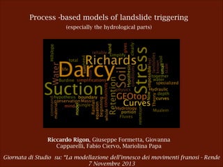
- 1. Process -based models of landslide triggering (especially the hydrological parts) Riccardo Rigon, Giuseppe Formetta, Giovanna Capparelli, Fabio Ciervo, Mariolina Papa Giornata di Studio su: “La modellazione dell’innesco dei movimenti franosi - Rende 7 Novembre 2013
- 2. We feel clearly that we are only now beginning to acquire reliable material for welding together the sum total of all that is known into a whole; but, on the other hand, it has become next to impossible for a single mind fully to command more than a small specialized portion of it. ! E. Schroedinger (What is life ?)
- 3. Introduction What’s the physics of landslides ? Hillslope Hydrology + Hillslope stability !3 Rigon et al.
- 4. Introduction Hillslope Hydrology bricks Darcy hypothesis Mass conservation Soil water retention curves (SWRC) Fluxes Hypothesis Eventually assume a theory that relates SWRC to fluxes !4 Rigon et al.
- 5. Hillslope hydrology Darcy’s hypothesis This is the REV Representative Elementary Volume !5 Rigon et al.
- 6. Hillslope hydrology Richards’ equation core is that what it is true is this Mass conservation (no nuclear reactions) ! but actually true if the continuum (a.k.a. Darcy) hypothesis is valid !6 Rigon et al.
- 7. Hillslope hydrology Assume a parametric form of soil water retention curves Se = [1 + ( C(⇥) := ⇥) )] m ⇤ w () ⇤⇥ But other forms are possible ... Rigon et al. n Se := Parametric van Genuchten (1981) w r ⇥s r !7
- 8. Hillslope hydrology Flux hypothesis Buckingham, 1907, Richards, 1931 Darcy-Buckingham Law ~ ~ Jv = K(✓w )r h Hydraulic conductivity times gradient of the hydraulic head Volumetric flow through the surface of the infinitesimal volume !8 Rigon et al.
- 9. Hillslope hydrology A theory for getting hydraulic conductivity from soil water retention curves K( w) = Ks ⇧ Se ⇤ 1 (1 But other forms are possible also here... Rigon et al. Se ) 1/m ⇥ m ⌅2 !9
- 10. Hillslope hydrology Now you can simplify it http://abouthydrology.blogspot.it/2013/06/ezio-todini-70th-symposium-my-talk.html Rigon et al. !10
- 11. Simplifications with more details An outcome of this project http://abouthydrology.blogspot.it/2013/07/hillslope-hydrology-from-point-of-view.html Rigon et al. !11
- 12. The medium is the message Soil depth Where does water flow ? Soil rocks !12 !12 Rigon et al.
- 13. The medium is the message Soil depth is particularly important for landslides http://abouthydrology.blogspot.it/2012/09/soil-depth-estimation.html Because is usually believed that it is the perched water table that can form at soil discontinuity that causes shallow landslides Perched water table Water table !13 Rigon et al.
- 14. Geomechanics Hillslope stability bricks Stresses (and strains) Effective stresses Soil stresses characteristics curves (SSCC) Material strength (Coulomb Hypotesis) Factor of safety !14 Rigon et al.
- 15. Geomechanics I do not enter into the geotechnical details http://www.camilab.unical.it/summer_school/index.html !15 Rigon et al.
- 16. Geomechanics Commercial a good book save a lot of searching N. Lu, J. Godt,Hillslope Hydrology and Stability, Cambridge University Press, 2012 !16 Rigon et al.
- 17. Advancing Knowledge Geomechanics Promoting Learning ! Suction stress is the effective stress (skeleton stress) with zero total stress. ! However, let me say something Suction stress is the work done by the inter-particle stress or internal stress due to water. Lu and Godt, 2012 dε2 s s dε2 s Dry: no stress (a) Dry: no stress s dε1 dε1 Dry: equivalent suction stress (c) Wet: internal suction stress (b) Wet: internal suction causes , and Dry: equivalent suction stress ! What are the components correspondent of the inter-particle stress σs? ! s = !! strain ! ! ! S u ! u = !! C 6.#Effec(ve#Stress#in#Soil cap pc ( a w ) 11 !17 Rigon et al.
- 19. efine a Learninghydrology that moting stresszone accounts for soil saturation an Geomechanics and vadose cribing strength and deformation at Representati Effective stress at REV is the composition of several V). Area of REV Cross-Section forces acting at micro scale Lu and Godt, 2012 Aa1 Fcap Aw1 ua Aa2 Aw2 A Ac1 Fc Fpc uw Ft Aa3 Aw3 Aa4 Ac2 Ac3 Rigon et al. =- s '=( !19 ua ) + S ( ua u
- 20. Geomechanics and vadose zone hydrology Lu and Godt, 2012 Effective suction stress is then: Suction stress air pressure Effective stress Stress in material !20 Rigon et al.
- 21. Geomechanics and vadose zone hydrology Effective suction stress is then: interparticle stresses capillarity water pressure relative water content !21 Rigon et al.
- 22. Geomechanics and vadose zone hydrology Soil Suction Characteristic Curves SSCC As a result of Lu et al. 2010 work, suction stress can be expressed as a function of the SWRC: Se = [1 + ( ⇥) )] m n Se := Parametric van Genuchten (1981) w r ⇥s r from slide 7 !22 Rigon et al.
- 23. Geomechanics and vadose zone hydrology Therefore The determination of the SWRC is of fundamental importance, and the key to predict both soils suction and stress evolution in hillslopes What about hillslope failure ? !23 Rigon et al.
- 24. Geomechanics and vadose zone hydrology FoS Factor of Safety Both Material Strength and Design Loads, in the hillslope game are function of the stresses Details in Lu and Godt, 2012 and references therein !24 Rigon et al.
- 25. ! To sum up We have a sound and comprehensive theory !25
- 26. GEOtop and its brothers and sisters
- 27. So what ? We have the theory (and the equations)! However we have to implement it in sound numerical code to identify the parameters (and there are quite a few) treat the input and the output data !27 Rigon et al.
- 28. GEOtop as a tool of this project Rigon et al., 2006 , Endrizzi et al., 2013 GEOtop ! • it models: ! - subsurface saturated and unsaturated flows ! - surface runoff ! - turbulent fluxes across the soil-atmosphere interface. Rigon et al. !28
- 29. GEOtop as a tool of this project Rigon et al., 2006 , Endrizzi et al., 2013 GEOtop • 3D physically based finite-difference model ! ! • spatially distributed !29 Rigon et al.
- 30. GEOtop as a tool of this project Model integration with OMS The Object Modeling System is a modular modeling framework that, using an open source software approach, enables all members of the David et al., 2013 scientific community to address collaboratively the many complex issues associated with the design, development, and application of distributed hydrological and environmental models. Features Components interoperability Data interoperability Language interoperability !30 Rigon et al.
- 31. Other tools In reality GEOtop is the most complex of a series of models and one scope is to compare many of them, and eventually use them for different purposes. In red those already implemented for the project. !31 Rigon et al.
- 32. Every is free … as “free of speech" GEOtop: code at: https://code.google.com/p/geotop/ information at: http://abouthydrology.blogspot.it/search/label/GEOtop CISLAM and SHALSTAB: code at: https://code.google.com/p/jgrasstools/ information at: http://abouthydrology.blogspot.it/2012/09/my-past-research-on-shallow-landslide.html !32
- 33. Questions Research but also practical questions Many landslides models with many physical approximations ! • Does exist a minimum physical degree of simplification to model a landslide? ! • Is it possible create a unique modeling framework where different models can be executed and compared? ! ! ! ! ! ! !33 Rigon et al.
- 34. It works! Waiting for the data … an application where we have some Tuostolo Rigon et al. !34
- 35. It works! Some results Measurement station !35 Rigon et al.
- 36. It works! Tuostolo - Campania- Italy Measurement station • Suction [KPa] simulation at 0.35 m depth ! • Simulation period: 01-12-2007 to 01-05-2008 Rigon et al. PBIAS=1.90 NSE=0.83 !36
- 37. Tuostolo - Campania- Italy • Soil moisture simulation at 0.35 m depth ! • Simulation period: 01-12-2007 to 01-05-2008 ! • Time step: hourly PBIAS=2.1 NSE=0.70 !37
- 38. Drake River - CO - USA C3 C1 Input data: • Radiation • Rainfall • Air Temperature • Relative Humidity ! Output: • soil moisture at different depths G. Formetta, Trento 17 June 2011 24 !38
- 39. Drake River - CO - USA Simulation period: 01/09/2008-01/02/20 09 ! Simulation timestep: hourly !39
- 40. Drake River - CO - USA Suction (mm) Simulation period: 01/09/2008-01/02/20 09 ! Simulation timestep: hourly 30 cm depth 50 cm depth !40
- 41. Drake River - CO - USA Suction (mm) Simulation period: 01/09/2008-01/02/20 09 ! Simulation timestep: hourly 30 cm depth 50 cm depth !41
- 42. Drake River - CO - USA Suction (mm) Simulation period: 01/09/2008-01/02/20 09 ! Simulation timestep: hourly 30 cm depth 50 cm depth !42
- 43. Drake River - CO - USA Safety factor !43
- 44. It works! Comments • GEOtop seems able to reproduce decently suction and water contents • Therefore it can be reliably used for trying a forecasting of these quantities • Certainly more analysis and data are required !44 Rigon et al.
- 45. The IWL3 Round Robin
- 46. GEOtop in the lab Thanks to Neaples Group: the IWL3 experiment R. Greco1, L. Comegna1, E. Damiano1, A. Guida1,2, L. Olivares1, and L. Picarelli1 1Dipartimento di Ingegneria Civile Design Edilizia e Ambiente, Seconda Università di Napoli, via Roma 29, 81031 Aversa (CE), Italy 2Centro Euro-Mediterraneo sui Cambiamenti Climatici, via Maiorise, Capua (CE) 81043, Italy !46 Rigon et al.
- 47. t GEOtop in the lab Soil Thickness (cm) Slope Length (cm) Initial porosity n0 Rainfall intensity (mm/h) Initial mean s uction (kPa) Duration of test (min) 10.0 100 0.75 55 17.5 36 10.0 120 0.76 56 41.0 30 The inclination of the slope is 40°. ! The test are carried out with constant and spatially homogeneous rainfall intensity. Several devices (tensiometer, pore pressure transducer, TDR and laser !47 Rigon et al.
- 48. Analysis of the data Suctions and pressures failure first displacement first displacement . -5 cm ! ! factor of safety here is 1.2 -10 cm !48 Rigon et al.
- 49. Analysis of the data Water Content !49 Rigon et al.
- 50. Analysis of the data Water Content talks Hydraulic conductivity was measured in the lab. The value given was around one order of magnitude less than the artificial rainfall So we expect an Hortonian flux: saturation at the top and movement downward. Which we do not have! !50 Rigon et al.
- 51. Analysis of the data So we expect an Hortonian flux: saturation at the top and movement downward. red line is more ore less what we expect just after the beginning of irrigation in a Hortonian interpretation of infiltration Rigon et al. !51
- 52. Questions What about the Darcy scale here ? !52 Rigon et al.
- 53. Analysis of the data Water Content talks Is irrigation really stationary ? What happens after the 28th minute ? Lateral flow triggers ? !53 Rigon et al.
- 54. Let’s go ! Two hydraulic conductivities One hypothesis we did is that, despite the homogeneity of the preparation of the experiment, hydraulic conductivity (at saturation) at the bottom is different from hydraulic conductivity at the top of the mock-up. Due to packing of particles ? Due to some unavoidable imperfection in preparation ? Due to avoidable imperfection of the preparation ? What else ? !54 Rigon et al.
- 55. Which parameters ? Suction talks Both suction and water content data were used to calibrate van Genuchten parameters. Also the hydraulic conductivity is among Se = [1 + ( Se := n ⇥) )] m w r ⇥s r Also hydraulic conductivity at saturation is a calibration parameter K( w) = Ks ⇧ Se ⇤ 1 (1 Se ) 1/m ⇥ m ⌅2 !55 Rigon et al.
- 56. Which parameters ? Calibrated Parameters alfa 0.052 n m 1.805 0.445983 Ksat_layer superficiale (0-5cm) = 0.178 mm/s Ksat_layer di fondo (5-10cm) = 0.117 mm/s !56 Rigon et al.
- 58. Water content Averaging does not get the right result even if water contents are reproduced fairly well until the 21th minute Rigon et al. !58
- 59. Analysis of the set up Discussion The friction angle of the material is 38 degrees. Therefore the stability depends mainly on suction. The FoS has been calculated into 2 different ways, by using the Fos below that includes both the “classical” and “Lu’ Fos: !59 Rigon et al.
- 62. Stresswise Comment The way you calculate the FoS matters. While with the classical approach, FoS remains consistently higher than 1 (close to 2), with Lu approach the FoS comes close to 1. In a sense, also this is not satisfactory, since we would like to have a safety factor well below 1. Do we neglected something ? !62 Rigon et al.
- 63. What we gain Conclusion We are close … but also far away … The project allowed to set up an infrastructure that can be used to investigate real cases, and to better tune experiments On the present infrastructure can be incrementally built “Real Time” physical modelling of these phenomena is feasible !63 Rigon et al.
- 64. Closing G.Ulrici, 2000 ? Thank you for your attention La presentazione può essere scaricata da http://abouthydrology.blogspot.com !64 R. Rigon
- 65. Closing Questions The theory is sound … where it fails ? Do the physics simplify at hillslope scale ? Which measures can we envision to make a verification of the theory ? Can lab measures reproduce field ? How we characterise spatial patterns (needed to check real cases) ? What the relation between mass waste and erosion ? What is the influence of these phenomena on landscape evolution ? How can we validate the overall process ? Rigon et al. !65
- 66. Closing Questions What the role of plants’ roots in stability? !66 Rigon et al.