Support system for spatial vulnerability assessment
•
2 j'aime•759 vues

Spatial vulnerbility to Climate Change in Trentino. The plan for a survey.

Recommandé
Recommandé
Contenu connexe
Tendances
Tendances (20)
Similaire à Support system for spatial vulnerability assessment
Similaire à Support system for spatial vulnerability assessment (20)
Plus de Riccardo Rigon
Plus de Riccardo Rigon (20)
Dernier
Dernier (20)
Support system for spatial vulnerability assessment
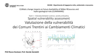
- 1. Task 5 – Interplay between science, society and policy Spatial vulnerability assessment Valutazione della vulnerabilità dei Comuni Trentini ai Cambiamenti Climatici CLIMatic change impacts on future Availability of WAter REsources and hydro-geological risks (CLIMAWARE) DICAM - Dipartimento di Ingegneria civile, ambientale e meccanica -0.1 0.0 0.1 0.2 -0.10.00.10.2 Comp.1 Comp.2 1 1 1 2 3 3 3 2 2 3 3 3 1 3 3 3 3 3 3 1 1 3 3 2 2 3 3 2 1 1 2 1 1 2 1 2 2 22 3 1 3 2 2 2 1 2 2 3 1 2 1 3 3 1 2 2 1 2 2 1 3 32 1 1 2 2 3 3 1 1 2 3 3 1 1 3 2 3 2 2 1 3 2 2 1 1 1 3 2 12 1 1 1 3 1 3 1 1 1 2 3 2 3 1 2 3 2 1 1 11 2 3 3 1 3 3 31 1 111 1 1 1 2 2 2 1 3 1 3 3 2 3 1 2 3 2 3 32 3 2 3 2 2 1 1 3 3 2 1 1 2 22 1 3 1 2 2 2 1 2 2 2 2 2 2 1 3 33 3 3 3 1 1 1 1 1 1 3 1 3 12 2 3 3 3 1 2 1 3 2 1 2 1 2 2 3 2 3 3 1 1 2 2 3 1 1 1 3 11 2 3 -200 -100 0 100 200 300 400 -200-1000100200300400 giorni25 pr_inv_med_c PhD Rocco Scolozzi, Prof. Davide Geneletti
- 2. Spatial vulnerability assessment 1. Cluster analysis for social survey 2. IPCC framework and definitions 3. Examples at EU level 4. Sensitivity analysis for municipalities of Trento Province 5. Adaptation capacity analysis 6. Sector assessment (to be further developed)
- 3. Cluster analysis for social survey • Objective: to support stratification of Trento Province sample • Max differentiation among the clusters (max 3-5 groups) • Feasible with data at municipal level ➔Candidate climate variables: • variables among the most recognizable and distinguishable by the people (without instrumentation) • interesting for their variability in recent periods (1961-1990 vs. 198-2010). Collaboration with Emanuela Bozzini, Dep. of Sociology and Social Research
- 4. Cluster analysis for social survey • Modeling and mapping • Modelling (for elevation) and interpolation of point climate data for periods 1961-1990 and 198-2010 (by Lavinia Laiti & Co.) • Extraction by Land Use and municipality layer • Integration in table data of municipalities
- 5. Cluster analysis for social survey -0.1 0.0 0.1 0.2 -0.10.00.10.2 Comp.1 Comp.2 1 1 1 2 3 3 3 2 2 3 3 3 1 3 3 3 3 3 3 1 1 3 3 2 2 3 3 2 1 1 2 1 1 2 1 2 2 22 3 1 3 2 2 2 1 2 2 3 1 2 1 3 3 1 2 2 1 2 2 1 3 32 1 1 2 2 3 3 1 1 2 3 3 1 1 3 2 3 2 2 1 3 2 2 1 1 1 3 2 12 1 1 1 3 1 3 1 1 1 2 3 2 3 1 2 3 2 1 1 11 2 3 3 1 3 3 3 1 1 111 1 1 1 2 2 2 1 3 1 3 3 2 3 1 2 3 2 3 32 3 2 3 2 2 1 1 3 3 2 1 1 2 22 1 3 1 2 2 2 1 2 2 2 2 2 2 1 3 33 3 3 3 1 1 1 1 1 1 3 1 3 12 2 3 3 3 1 2 1 3 2 1 2 1 2 2 3 2 3 3 1 1 2 2 3 1 1 1 3 11 2 3 -200 -100 0 100 200 300 400 -200-1000100200300400 giorni25 pr_inv_med_c Cluster Days C°>25 (in aree residenziali) average monthly precipitation (Dec-Jan-Feb) Population 2001 Municipalities 1 62,1 154,3 288’824 80 2 36,7 125,0 78’541 72 3 51,1 185,0 109’652 71
- 6. IPCC framework and definitions
- 7. IPCC framework and definitions • Exposure: The nature and degree to which a system is exposed to significant climatic variations. • Sensitivity: The degree to which a system is affected, either adversely or beneficially, by climate related stimuli. • Adaptive capacity: the ability of a natural or human system to adjust to potential damage, to take advantage of opportunities, or to cope with the consequences. • Vulnerability: The degree to which a system is susceptible to, or unable to cope with, adverse effects of climate change. Vulnerability is a function of the character, magnitude, and rate of climate variation to which a system is exposed, its sensitivity, and its adaptive capacity. http://climatechange.lta.org
- 8. Prepare for Vulnerability Planning for vulnerability to climate change generally involves three steps: 1. Determine which resources are vulnerable to changing conditions. By identifying the most vulnerable resources, we are able to prioritize our conservation actions. The vulnerability of a resource is determined by exposure, sensitivity, and the ability to adapt to the impacts of climate change. 2. Determine why those resources are vulnerable. It is not enough to know that a particular resource is vulnerable. We also must know why the resource is vulnerable. This allows us to choose conservation actions that are most likely to reduce the threats posed by climate change. 3. Use this information to guide actions that will reduce vulnerability, and develop strategic adaptation strategies, foster collaboration at different scales
- 9. Example: ESPON Climate ESPON 2013 Programme, partly financed by the European Regional Development Fund Climate Change and Territorial Effects on Regions and Local Economies www.espon.eu ESPON - European Observation Network for Territorial Development and Cohesion
- 11. Examples from ESPON Physical sensitivity • Settlements sensitive to flash floods • Roads and railways sensitive to flash floods • Settlements sensitive to river flooding • Roads and railways sensitive to river flooding • Airports and harbours sensitive to river flooding • Settlements sensitive to coastal flooding • Roads and railways sensitive to coastal flooding • Airports and harbours sensitive to coastal flooding
- 12. Examples from ESPON Environmental sensitivity • Forests sensitive to forest fires • Protected natural areas • Areas prone to soil erosion • Soil organic carbon
- 13. Examples from ESPON Economic sensitivity Agriculture sensitive to water availability Forestry sensitive to water availability Summer tourism sensitive to summer temperatures Winter tourism sensitive to snow cover changes Energy demand sensitive to summer heat Energy demand sensitive to winter frost Energy supply sensitive to changing river water levels
- 14. Examples from ESPON Social sensitivity Population sensitive to summer heat Population sensitive to coastal flooding Population sensitive to river flooding Population sensitive to flash floods
- 15. Examples from ESPON Cultural sensitivity UNESCO Cultural World Heritage Sites sensitive to river flooding UNESCO Cultural World Heritage Sites sensitive to coastal flooding Museums sensitive to river flooding Museums sensitive to sea level rise
- 16. Task 5 – Interplay between science, society and policy
- 17. Climate stimuli Target Indicator Unit of meaure Temperature stress Population Population over 65 year old N° Days>25C° N° Water stress Tourism Tourism services personnel N° Agriculture Personnel N° Population Total precipitation m3 Sensitivity to climate change at municipal level
- 18. Climate stimuli Target Indicator Unità di misura Water stress 1. Capacità di assorbire eventuali occupati nel turismo in crisi per CC Incidenza addetti ai servizi alberghieri e complementari su totale addetti (eccetto agricoltura) % 1. Capacità di assorbire eventuali occupati in agricoltura in crisi per CC Incidenza degli occupati in agricoltura % Temperature stress 1. Capacità di gestire popolazione più esposta Incidenza della popolazione di 65 anni e oltre % Trust (istitutions) 1. Propensione a seguire indicazioni di emergenza Questionario: In caso di ordine di evacuazione della Protezione Civile sarebbe disponibile a lasciare la sua abitazione per un determinato tempo? (risposta: scala 1- 5, es. no - certamente) Social network 1. Capacità di trovare una sistemazione-rifugio Questionario: In caso di emergenza sarebbe in grado di trovare una sistemazione temporanea (per alcuni giorni) per lei e la sua famiglia in 24 ore, ad esempio presso parenti o amici? Risposta: da 1-con estrema difficoltà a 5-senza problemi Adaptive capacity at municipal level
- 19. Task 5 – Interplay between science, society and policy
- 20. Climate stimuli Target Indicator Definition u.m. Esposizione stress idrico Agriculture GAP1 domanda/offerta Differenza tra bisogno totale e disponibilità lorda attuale m3 GAP1b domanda/offerta Differenza tra bisogno totale scenario e disponibilità lorda scenario m3 Tourism GAP2 domanda/offerta Differenza tra bisogno totale e disponibilità lorda attuale m3 GAP2b domanda/offerta Differenza tra bisogno totale scenario e disponibilità lorda scenario m3 Esposizione rischio alluvione Industry ESP1 Aree produttive infrastrutture Aree attuali attualmente a rischio ha ESP1b Aree produttive infrastrutture Aree scenario a rischio scenario (in mancanza, rischio attuale) ha Population ESP2 Aree residenziali Aree attuali attualmente a rischio ha ESP2b Aree residenziali Aree scenario a rischio scenario (in mancanza, rischio attuale) ha Exposure at municipal level