
Recommandé
Recommandé
Contenu connexe
En vedette
En vedette (20)
Similaire à Intelligent Bus Alert System Helps Blind Passengers
Similaire à Intelligent Bus Alert System Helps Blind Passengers (20)
Plus de Iaetsd Iaetsd
Plus de Iaetsd Iaetsd (20)
Intelligent Bus Alert System Helps Blind Passengers
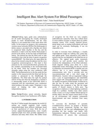
- 1. Intelligent Bus Alert System For Blind Passengers N.Surendra Yadav1 , Tulasi Sanath Kumar2 1 PG Student, Department of Electronics & Communication Engineering, ASCET, Gudur, A.P, India. 2 Asst. Professor, Department of Electronics & Communication Engineering, ASCET, Gudur, A.P, India 1 cupid.suri@gmail.com 2 tulasisanath@gmail.com Abstract:Talking signs, guide cane, echolocations are all useful innavigating the visually challenged people to reach theirdestination, but the main objective is not reached that it fails tojoin them with traffic. In this project we propose a bus systemusing wireless sensor networks (WSNs).The blind people in thebus station is provided with a Zig-Bee unit which is recognized bythe Zig-Bee in the bus and the indication is made in the bus thatthe blind people is present in the station. So the bus stops at theparticular station. The desired bus that the blind want to take isnotified to him with the help of speech recognition systemHM2007. The blind gives the input about the place he has toreach using microphones and the voice recognition systemrecognizes it .The input is then analyzed by the microcontrollerwhich generates the bus numbers corresponding to the locationprovided by the blind. These bus numbers are converted intoaudio output using the voice synthesizer APR 9600. TheZig-Beetransceiver in the bus sends the bus number to the transceiverwith the blind and the bus number is announced to the blindthrough the headphones. The blind takes the right bus parked infront of him and when the destination is reached it is announcedby means of the GPS-634R which is connected with the controllerand voice synthesizer which produces the audio output. Thisproject is also aimed at helping the elder people for independentnavigation. Index Terms:Wireless sensor networks, Speech Recognition System,Voice Synthesizer, GPS, Zigbee. I. INTRODUCTION Out the 6.7 billion people that populate the world,161 million are visually impaired. Each visually impairedindividual faces different challenges based on their specificlevel of vision. With the rise of various support-basedorganizations, more visually impaired people have been giventhe opportunity to education and many other means. But stillthe issues of navigation for the blind are very complex andtroublesome especially when they walked down in street andalso navigate to distant places by public transport system. Fora visually impaired person, doing things such as reading trafficsignals and street signs can be extremely challenging, if not itis impossible to do. In order to overcome these challenges, a visually impairedperson might use walking cane, guide dog, and sighted guide. These alternatives also called as assistive devices can behelpful to the blind but not so effective. The sighted guide canbe immensely effective, as well provide social comfort, but itrestricts the independence of the blind individual. Guide dogsand walking canes allow for a more independent means oftravelling, but they are limited in unfamiliar environments.RFID is feasible and cost effective but it is more suitable forindoor communication only. Also it provides only one waycommunication and a very short range of identification. Asystem with an augmented walking cane, a pair of augmentedglasses and identifiable items tagged with semacode/datamatrix tags is used for outdoor navigation of blind people. If aman has to take the bus, he walks along the pavement and hiswalking cane recognizes a tag. But the image quality of theweb camera is fairly poor. Tag recognition in darkness or inbad lightning conditions might be a problem. Another issue isthat camera needs a visual, so if a tag is hidden behind aperson or another object, then the camera cannot detect it.Tags on all environments will properly contaminate theenvironment and meet resistance from many citizens. To overcome the drawbacks of currently availableassistive devices, we propose a Wireless sensor network systemwith Zig-Bee for blind identification by the bus and embeddedsystem for providing the bus number and [mally GPS fordestination indication. Wireless sensor network (WSNs)consists of sensors that continuously Proceedings of International Conference on Developments in Engineering Research ISBN NO : 378 - 26 - 13840 - 9 www.iaetsd.in INTERNATIONAL ASSOCIATION OF ENGINEERING & TECHNOLOGY FOR SKILL DEVELOPMENT 71
- 2. monitors theenvironmental conditions and send their data to the mainnetwork [51. Zig-Bee is an embedded device for use in a WSNwhich is tiny in size. These nodes have processing andcomputational capability and generally consist of an RFtransceiver, memory, on board sensors/actuators and a powersource [71. Zig-Bee have CC2420 which is a true single-chip 2.4GHz IEEE 802.15.4 compliant RF (Radio Frequency)transceiver designed for low-power and low-voltage wirelessapplications so we can send or receive useful informationthrough using this chip. The number of the bus parked in frontof the blind is send to the Zig-Bee in the blind system. Anotherfunction of Zig-Bee is identification of blind in the bus station.If both the numbers match the buzzer in the bus unit alarmsand indicates the driver that there is blind in the bus station. The software part is Embedded C with MPLAB IDE(Operating System) for programming the controller. MPLABIDE runs as a 32-bit application on MS Windows, is easy touse and includes a host of free software components for fastapplication development and super-charged debugging.MPLAB IDE also serves as a single, unified graphical userinterface for additional Microchip and third party software andhardware development tools. II. DESIGN PRINCIPLES OF ELECTRONIC TRAVELLING AIDS The most important travelling aid for a visually impairedperson is still the white cane. It is after all an excellentexample of a good travelling aid: multifunctional, cheap andreliable. It also tells others that the person is visuallyimpaired. Another irreplaceable travelling aid is a guide dog.Among other things the dog is also a friend and a companion. In studies about visually impaired person navigation it hasbeen noted that even a small amount of extra informationabout the environment makes a remarkable increase inperformance. Also it seems that a good travelling aidshould produce only small amounts of meaningfulinformation and the ETA should not block hearing or othersenses so that the visually impaired can still use theirtraditional methods to acquire information about theenvironment. If the user needs to concentrate heavily on usingthe ETA, he or she has no capacity left for normalenvironment perception. Therefore, instead of trying to develop ETAs to replaceprimary travelling aids, one should develop complementarysystems.Navigation systems have usually worked well in smallscaleimplementations, but a large-scale implementation maybe extremely expensive (especially with beacon basednavigation systems). The amount of visually impaired personsof the population is small (~ 1,6 %) and therefore largeinvestments to special infrastructure are not sensible.As an example, there have often been suggestions aboutequipping buses with radio transmitters to help the visuallyimpaired to know when the bus is coming. The visuallyimpaired would in turn carry a radio receiver.In Prague there is a pilot system in operation. However, forexample in Finland, where we have about 80 000 visuallyimpaired and 10 000 buses, a similar system would cost atleast 10 M€ just for the bus transmitters. Other methods need to be found to ensure that the visuallyimpaired persons have equal possibilities to access sameservices than all the other citizens. 2.1. Visually Impaired Persons and Public Transport Generic travelling difficulties for the visually impairedpersons are localization and environment perception, selecting and maintaining the correct heading, detecting obstaclesabove waist and detecting unexpected roadworks. If we examine problems a visually impaired person meetswhen using public transport, we recognize the following list(the list depends slightly of the transportation): • planning a trip • finding a stop or station • finding an entrance to the station • navigating inside the station • finding the right platform and waiting place • knowing when the right vehicle arrives • finding a vehicle entrance • payment • finding a seat • receiving passenger information during the trip • depart on the right stop • finding the destination. Most of these tasks are trivial for the sighted persons, butvery difficult for the visually impaired. For example therehave been cases when a blind has spent several hours at a busstop, because he couldn't recognize the arrival of the rightvehicle. For true door-to-door navigation for a visually impairedthere are requirements for continuous positioning, continuous(Internet) access to real time Proceedings of International Conference on Developments in Engineering Research ISBN NO : 378 - 26 - 13840 - 9 www.iaetsd.in INTERNATIONAL ASSOCIATION OF ENGINEERING & TECHNOLOGY FOR SKILL DEVELOPMENT 72
- 3. public transport information andavailability of accurate map data together with roadworkinformation. Electronic maps are designed for car navigation and notsuitable for pedestrian route planning purposes. Informationabout pavements and pedestrian crossings is collectedseparately and not included in typical map data. Door-to-doorguidance requires map data pointing entrances to houses andcontinuous guidance would require indoor maps and indoorpositioning. These are generally unavailable today. Nevertheless, in our studies we did not find many specificinformation needs for the visually impaired group alone. Theinformation needed and sought for is in most cases useful forall passengers or already accessible to some user groups. Onlythe means for a visually impaired to access the informationwould be different. Therefore it is very important to offeradditional interface, when new passenger informationservices are designed. III. NOPPA ARCHITECTURE AND PROTOTYPE Our approach is to improve public transport accessibilityby creating access to passenger information with a personalmobile device rather than building physical infrastructure.NOPPA architecture (fig.1) is based on public and/orcommercial information services and databases available via the Internet, a client-server approach with near continuousTCP/IP connection (GPRS for practical reasons) andprogrammable mobile devices with capabilities for speechuser interface (mainly speech synthesis) and satellitepositioning. Fig.1. Architecture of the NOPPA system The terminal devices in NOPPA user tests have by far beenvarious PDAs with Microsoft's Pocket PC / Pocket PC PhoneEdition operating system and there is also an early version formobile phones with Symbian Series 60 operating system. Design goals for NOPPA were: • Easy and fast to use (preferably faster than any traditionalmethod) • Affordable to the user • Access to public transportation and passengerinformation systems • Applicable both indoors and outdoors • Integration of products and services for personalnavigation • Modular, easy to update, easy to add functions • Speech user interface • Easy to customize for various user groups and purposes. The Information Server is an interpreter between the userand Internet information systems. It collects filters andintegrates information from different sources and delivers theresults to the user. The server handles speech recognition (e.g. from 13200street and destination names) and functions requiring eitherheavy calculations or large data transfer from the Internet.The data transfer between the server and the client is kept inminimum. The client terminal (fig.2) holds speechsynthesis, user interface, positioning and most of routeguidance. The user interface is menu-based and selections aredone with hardware buttons and speech input. As the mobile devices gain more memory and fasterprocessors some of the speech recognition work can be donein the user terminal which will further reduce the need fordata transfer between the client and the server. It will alsoenable menu selections with speech user interface when thereis no server connection. Nevertheless, the speech recognitionrequires a very large vocabulary (street names) which also hasto be updated from time to time, so it may be unpractical tocompletely do the processing in the terminal. Proceedings of International Conference on Developments in Engineering Research ISBN NO : 378 - 26 - 13840 - 9 www.iaetsd.in INTERNATIONAL ASSOCIATION OF ENGINEERING & TECHNOLOGY FOR SKILL DEVELOPMENT 73
- 4. NOPPA terminal software with speech synthesis needs tobe installed on the device, completely replacing theunderplaying operating system's user interface. If the operatingsystem supports a screen reader for example, more functions(such as phone calls, SMS and MMS) can be left to originalsoftware. The first prototype system has the followingcharacteristics: • Speech recognition and synthesis • 6 simultaneous users per single server computer (a 2 GHz PC) for speech processing time limits • Access to three route planners (commuter and intercitytraffic both bus and train, also a possibility to calculatecar navigation type of routes) • Guidance and route following during a trip • Personal in-vehicle stops announcements • Roadwork information (connection to a city's database) • Access to some bus, tram and train real time informationsystems (only early development) • Flight departure information at the largest airport in Finland, real time • Several news services, local weather • Watch • Memo • GSM phone and SMS services (basic implementation) • Bluetooth and GPRS connectivity (also WLAN possible) • GPS and GSM positioning, optional pedometer andcompass unit • Indoor navigation features based on Bluetooth, WLANpositioning or compass/pedometer • Own recorded walking routes, basic GPS functions • Search of current address • POI (Point of Interest) and AOI (Area of Inters)databases Fig.2. NOPPA Pocket PC terminal and a Bluetooth GPS receiver The prototype is now at user evaluation phase. Usability,reliability and recovery after an error are known to beimportant issues. For example a continuous GPRS serverconnection is not possible when moving in a train, elevator orbasement. The system must be designed to handle connection failures so that they don't break guidance or prevent usingother functions (phone call, SMS, memo etc).Commercial sensitive GPS receivers are able to operateinside a bus and a tram, but still greatly benefit from antennaplacement near window. Also GPS receivers' slow time tofirst fix (TTFF, typically 30-60 seconds) can be a problemwhen turning a GPS first on or leaving a building after beinga long time inside with no update to receiver satellite data. The speech output in guidance and in describing a routemust be carefully planned to avoid misunderstandings and tohelp create a mental image of the route. The program shouldnot try to give more accurate guidance than it safely can. Forexample when standing near a bus stop, if the program wouldadvice that "the bus stop is 10 meters forwards", the usermight very well end up standing on a driveway. Combinedinaccuracy of GPS positioning and map data is very oftenover 10 meters and the program should not really try to guidethat short a distance (at least not require the user to move),even though there would seem to be a clear differencebetween GPS and target coordinates. The difficulty is to tell the user without misunderstandings,that the calculated target is maybe 20 meters forwards, but theuser has to find the exact Proceedings of International Conference on Developments in Engineering Research ISBN NO : 378 - 26 - 13840 - 9 www.iaetsd.in INTERNATIONAL ASSOCIATION OF ENGINEERING & TECHNOLOGY FOR SKILL DEVELOPMENT 74
- 5. location himself and it may not beeven safe to move the full 20 meters. Often there is someinformation even in the short distances, so the user mightwant to hear the target distance and direction after all, insteadof just hearing "the target is near".In practice, one must take into account that map data canhave outdated information or inaccuracies, positioning can beunavailable or inaccurate, or wireless data transmission is notalways available. Therefore a lot of responsibility is left forthe user and guidance is complementary. IV. RESULTS AND DISCUSSION When the person reaches the bus station, he canfind the buses that pass through a particular location with thehelp of voice recognition system and voice synthesizer. When the bus approaches the bus station, there is anindication in the bus by the beep sound of a buzzer that thereis a blind person available in the bus station.This is achieved with the help of Zig-Bee unit both in the busunit and blind unit. Finally when the bus reaches the stationthe bus number is announced to the blind through headphones. There are currently available systems for the outdoornavigation but they will not assist in travelling to unfamiliarareas. Some systems use PDA which is not so economic andcannot be afforded by all. In most of the systems RFID tagsare used which are required in 1000s of numbers for trackingof route. Also it provides only one way communication. Thesystem we use is a mobile unit, weightless and economicallyfeasible. V. CONCLUSION Primarily, the blind person in the bus station is identifiedwith RF communication. The blind informs the location heneeds through the microphone which is given to the voicerecognition system which produces the output of bus numbersin the voice synthesizer unit which is heard in headset. Thenthis location is transmitted to the transceiver in the bus. If thenames in the transceiver in the bus matches with that of thename send by the blind, then there is an alarm in the bus unitalerting the presence of blind and a voice to the user's headsetthat the particular bus has arrived. With the help of GPStracker connected with audio output the destination chosen bythe blind is intimated when the bus reaches the correctlocation. PDA's can be used for GPS tracking but it is not costeffective. VI. REFERENCES [1] G.Lavanya ME, Preethy. W, Shameem.A, Sushmitha.R, “Passenger BUS Alert System for EasyNavigation of Blind”, 2013 International Conference on Circuits, Power and Computing Technologies. [2] Baudoin,G., Sayah,J, Venard, O. and EI Hassan, B.(2005), 'Simulation using OMNeT++ of the RAMPE systemanInteractive Additive Machine helping blinds in PublicTransports', EUROCON, Belgrade,pp.1-5. [3] Bolivar Torres, Qing Pang, (2010), 'Integration of anRFID reader to a Wireless sensor network and its use to identify an individual carrying RFID tag', InternationalJournal of ad hoc. sensor& ubiquitous computing ,voU,no.4,pp.1-15. [4] Brendan D Perry, Sean Morris and Stephanie Carcieri,(2009), 'RFID Technology to Aid in Navigation andOrganization for the Blind and Partially Sighted', pp. 1-52. [5] HerveGuyennet, KamalBeydoun and Violeta Felea,(2011), 'Wireless sensor network system helping navigation ofthe visually impaired', IEEE international conference onInformation and Communication Technologies: from Theoryto Applications, version 1, pp. 1-5. [6] Hyn Kwan Lee, Ki Hwan Eom , Min Chul Kim and TrungPham Quoc, (2010), 'Wireless Sensor Network Apply for theBlind U-bus System', International Journal of u- and eservice,Science and Technology,VoI.3,No.3,pp.l3-24. [7] Jack Loomis,M. and Roberta Klatzky,L. (2008),'Navigation System for Blind', Massachusetts Institute ofTechnology, Vol 7, No.2, pp.193-203. [8] Jain.P.C ,Vijaygopalan.K.P. (2010), 'RFID and WirelessSensor Networks', Proceedings of ASCNT, CDAC, Noida,India, pp. 1 - 11. [9] Loc Ho ,Melody Moh, Teng-Sheng Moh and ZacharyWalker (2007) , 'A Prototype on RFID and Sensor Networksfor Elder Health Care', Taylor & Francis Group, LLC,pp.314-317. [10] Oyarzun, C.A and Sanchez, J.H. (2008), 'Mobile audioassistance in bus transportation for the blind', Department of Computer Science, University of Chile, pp.279-286. Proceedings of International Conference on Developments in Engineering Research ISBN NO : 378 - 26 - 13840 - 9 www.iaetsd.in INTERNATIONAL ASSOCIATION OF ENGINEERING & TECHNOLOGY FOR SKILL DEVELOPMENT 75
- 6. [11] Ravi Mishra and SornnathKoley, (2012),'Voice OperatedOutdoor Navigation System For Visually Impaired Persons',International Journal of Engineering and Technology,Vol 3,Issue 2,pp.l53- 157. [12] RiazAhamed, S.S (2009), 'The Role of Zig- BeeTechnology In Future Data Communication System', Journalof Theoretical and Applied Information Technology,India, pp.129-134. Proceedings of International Conference on Developments in Engineering Research ISBN NO : 378 - 26 - 13840 - 9 www.iaetsd.in INTERNATIONAL ASSOCIATION OF ENGINEERING & TECHNOLOGY FOR SKILL DEVELOPMENT 76
- 7. 7Proceedings of International Conference on Developments in Engineering Research ISBN NO : 378 - 26 - 13840 - 9 www.iaetsd.in INTERNATIONAL ASSOCIATION OF ENGINEERING & TECHNOLOGY FOR SKILL DEVELOPMENT 77