SlideShare une entreprise Scribd logo
1  sur  8
GIS as strategic management tool
Geographic Information System (GIS) can be used as a strategic
management tool for the infrastructure development cycle from
planning, environment assessment, survey, design, construction,
safety and security, operations, disaster preparedness, maintenance
and public information & dissemination.
It can also be used in facilities management to include infra-related
equipment pools, information technology resources and
regional/district office buildings.
It can also help in financial administration for monitoring
expenditures in the central office, project management offices,
regional offices and district engineering offices.
Planning
GIS technology can provide rich analytic and visual tools to find the
right balance between the need to accommodate demand on public
infrastructure and the responsibility to preserve quality of life and
environmental sustainability of infrastructure projects.
GIS can provide a framework to inform models, such as those used
to forecast travel demand and plan capital improvements, and to
support strategic decision making. In addition, GIS applications for
making environmental evaluations can shed light on the
consequences of various transportation alternatives.
Implementing Offices
– Planning Service (Central Office)
– Planning Division (Regional Offices)
Application Software to be integrated by GIS
- Multi Year Programming System (MYPS)
- Road and Bridge Information Administration (RBIA)
- RBIA Utilities
- Road Traffic Information Administration (RTIA)
- Pavement Management System (PMS)
- Bridge Management System (BMS)
- Traffic Accident Recording and Analysis System (TARAS)
- Confirm
- Confirm Utilities
Survey
As a surveyor, you depend on a variety of software and technology
in your daily workflows. GIS technology integrates with other
systems while providing new functionality and a central database. A
GIS database gives you a better way to easily manage, reuse,
share, and analyze your survey data, saving you time, money, and
resources.
Because GIS software solutions are interoperable with the many
data formats used in the field and office, you can deliver your data
in the format required by your clients while maintaining the data’s
core integrity.
GIS software adds intelligence to spatial data, whether the data is
generated in the field with GPS or remotely with lidar and
photogrammetry. You can enter raw data, measurements, and
field sketches directly into the GIS, enabling you to efficiently
manage your data in a geodatabase with other spatial
information.
You can use GIS technology for collecting, importing, converting,
and storing spatial measurement and computational fabrics. You
can integrate computations, such as COGO and traverse least
squares, and preexisting networks as well as import spatial data
feature classes and relationships.
With GIS software, you can bring data straight from the field
into a geodatabase in a seamless workflow and take GIS data
back into the field via a data collector or laptop computer. GIS
software is customized to best meet your needs by optimizing
functionality needed to complete a job.
Implementing Offices
– Bureau of Design (Central Office)
– Design Division (Regional Office)
– Right of Way Division (Central Office)
– Surveying Division (Regional Office)
Environment Assessment
As scientists and environmental managers, you use GIS to study
the environment, report on environmental phenomena, and model
how the environment is responding to natural and man-made
factors.
With Esri GIS software you can
o Manage multiple types of geographic data.
o Assess relationships such as runoff and groundwater purity.
o Measure change such as wildlife habitat encroachment.
o Model events such as drought impact on forest health.
o Improve workflow processes, from data gathering and
analysis to publication and distribution of findings.
Implementing Office
– Environmental and Social Services Office (ESSO)
Design
The design engineers who are using the computer-aided design
(CAD) tools to accomplish design tasks can take the advantage of
GIS capability to incorporate the GIS-based information in the
design process.
With tools available in Esri core software, the design engineers can
also import CAD documents into the GIS to perform robust cost
estimate calculations and update other spatial information.
GIS support for surface and hydraulic models and soil and
geotechnical analyses gives you a rich set of capabilities for
designing context-sensitive projects.
Implementing Offices
– Bureau of Design (Central Office)
– Design Division (Regional Office)
– Right of Way Division (Central Office)
Application Software to be integrated by GIS
- Infrastructure Right of Way (IROW)
- Autocad versions
- Primavera/MS Project
- STAAD Pro
- Construction Cost Information System (CCIS)
Safety and Security
Governments worldwide emphasize the importance of highway
design and other methods that increase roadway safety. Engineers
are using the power of GIS to perform safety analyses and identify
root causes of dangerous highway segments. GIS makes it possible
to take human factors into consideration as well as design
elements.
At the same time, demand has increased for transportation security
in transportation operations at airports, ports, and transportation
depots. GIS provides an integrating technology for incident
response systems and infrastructure security systems.
Implementing Offices
- Bureau of Research and Standards (Central Office)
- Research and Standards Division (Central Offices)
- Special Buildings
Construction
GIS helps in the effective and efficient project delivery for new
infrastructure projects especially multi-year projects that require
careful monitoring, coordination, and management.
GIS uses location as the cornerstone of data management for
organizing project delivery information. GIS can be used to support
initial planning and environmental studies; organize map, survey,
and design documents; and share information with personnel in the
office or the field.
The open software platform of Esri GIS allows integration with
project management software such as Primavera and MS Project.
Integration makes it possible to provide a comprehensive view of
projects and their current status, which gives project managers
valuable support for achieving effective project delivery.
Implementing Offices
– Bureau of Construction (Central Office)
– Construction Division (Regional Offices)
– Project Management Offices
– Procurement Office
Proposed Application to be developed and integrated with GIS
- Constructors Performance Evaluation System (CPES)
Application Software to be integrated with GIS
- Autocad versions
- Primavera/MS Project
- Construction Cost Information System (CCIS)
- Project Monitoring System (PMOS)
- Project Information (PIPS)
- Civil Works Registry (CWR)
Operations
Operations managers work to achieve the highest efficiencies
possible with existing infrastructure. One approach is to use traffic
management strategies that help traffic engineers respond to
changing conditions in ways that ensure optimal system
performance.
GIS can take a central role in developing effective traffic
management strategies. The capabilities to integrate data feeds and
share dashboard views make GIS ideal for viewing a comprehensive
picture of current traffic conditions. For example, traffic managers
can visually monitor bottlenecks and related information to quickly
respond to vehicle incidents. In addition, these views can be shared
with the public, giving drivers the latest information on road
closures and current travel conditions.
Implementing Offices
- Office of the Secretary
- Office of the Undersecretaries
- Office of the Assistant Secretaries
- Project Management Offices
- Regional Offices
- District Engineering Offices
Application Software to be developed and integrated with GIS
- Regional Operation Information System (ROIS)
- District Engineering Operation Information System (DEOIS)
Application Software to be integrated with GIS
- Executive Information System (EXIS)
Maintenance
Budget constraints create a challenge for managers who make
decisions about infrastructure maintenance. Having a well-planned
and proactive maintenance regime can save significant costs over
the life cycle of transportation infrastructure.
GIS can provide the framework for an effective asset and
maintenance management strategy. For example, mapping and
analysis capabilities of GIS can be combined with pavement and
bridge management models to produce comprehensive maintenance
management solutions. GIS software for field use enables
inspectors and field-based maintenance personnel to record
inspections on site and quickly update agency databases through a
wireless connection, which increases data accuracy and saves time.
– Bureau of Maintenance (Central Office
– Bureau of Equipment (Central Office)
– Regional Equipment Pool (Regional Offices)
– Maintenance Division (Regional Offices)
Proposed Application software to be developed and integrated with
GIS
- Equipment Pool Management System (EPMS)
- Bridge Maintenance Management System (BMMS)
Application Software to be integrated with GIS
- Road Maintenance and Management System (RMMS)
Disaster Preparedness
GIS is an essential technology for all phases of emergency
management: preparation, mitigation, response, and recovery. Find
out how GIS provides a foundation for comprehensive emergency
management [PDF].
To prepare for and mitigate emergencies, GIS can map and model
potential disasters to help visualize critical vulnerabilities and
damage consequences. As rebuilding begins, GIS aids local, state,
and federal agencies with technology that supports collaboration
between multiple agencies.
Field data captured with mobile GIS provides the ability to add
updates from remote locations for more efficient incident
management. It also supplies rapid damage assessment and more
accurate recovery operations.
Implementing Office
– Environmental and Social Services Office (ESSO)
Public Information and Dissemination
For highway operations, Intelligent Transportation Systems (ITS)
utilize the latest technologies to help alleviate traffic congestion and
optimize traffic flow. A wide range of Esri desktop, server, and
mobile GIS software and applications help highway engineers
monitor dynamic traffic conditions for analysis, response, and
communication. GIS can be configured to push real-time traffic
condition updates out to the public via the Internet or to
geographically specific areas via cell phones.
Esri open architecture software supports development of spatial
data models and promotes information management and sharing
among agencies. It supports 511 systems in the United States and,
in Europe and Asia, makes it possible to share data and real-time
information among transportation, public transport, and emergency
response systems. Esri GIS technology is integrated into the most
advanced ITS worldwide.
Implementing Offices
- Public Information Division (Central Office)
- Field Operation (Regional Offices)
- Field Operation (District Offices )
Application Software to be integrated with GIS
- IT Kiosk
- Complaints Acquisition and Action Center (CAAC)
- Complaints Verification and Investigation Center (CVIC)
Facilities and IT Asset Management
Using an IT system based on GIS allows you to manage land,
infrastructure, and building assets in one common
database. Such an information system is useful throughout the life
cycle of a facility, from deciding where to build to space planning.
An enterprise GIS benefits facilities management by streamlining
data collection, dissemination, construction, and maintenance while
promoting better communication, planning, and analysis.
Implementing Offices
- Facilities Maintenance Division (Central Office)
- Facilities Maintenance Division (Regional Offices)
- Monitoring and Information Service (MIS)
- Network Administrator Units (Regional Offices)
Application Software to be developed and integrated with GIS
- Facilities Inventory and Maintenance System (FIMS)
- IT Help Desk Database Utility Import
- IT Asset Preventive Maintenance System (IAPMS)
Application Software to be integrated with GIS
- Property Accountability and Management (PAMS)
- IT Asset Management System (ITAMS)
- IT Help Desk
Financial Administration
Government organizations realize a significant return on GIS
investments. GIS is integral in operations, decision making, and
communication. It has demonstrated real business value, or return
on investment (ROI), over the years. With GIS you can
o Save money and time
o Increase efficiency and accuracy
o Generate revenue
o Automate workflows
o Improve accountability and transparency
Implementing Offices
- Budget Division
- Accounting Division
Proposed application software to be developed and integrated with
GIS
- Import Utility Program for E-budget
- Import Utility Program for E-NGAS
Application software to be integrated with GIS
- E-Budget
- E-NGAS
- Accounts Payable System (APS)
- Cash Advances Monitoring System (CAMS)

Contenu connexe

Tendances

Geographic Information System - Swisstrack GPS Erfahrungen
Geographic Information System - Swisstrack GPS ErfahrungenGeographic Information System - Swisstrack GPS Erfahrungen
Geographic Information System - Swisstrack GPS ErfahrungenSwisstrack GPS Erfahrungen
 
2013 ASPRS Track, Modeling Asset Condition Using LIDAR and GIS Data by Colin ...
2013 ASPRS Track, Modeling Asset Condition Using LIDAR and GIS Data by Colin ...2013 ASPRS Track, Modeling Asset Condition Using LIDAR and GIS Data by Colin ...
2013 ASPRS Track, Modeling Asset Condition Using LIDAR and GIS Data by Colin ...GIS in the Rockies
 
Using Geometry to Integrated Road Information
Using Geometry to Integrated Road InformationUsing Geometry to Integrated Road Information
Using Geometry to Integrated Road InformationSafe Software
 
Application of gis in urban traffic air quality
Application of gis in urban traffic air qualityApplication of gis in urban traffic air quality
Application of gis in urban traffic air qualitySAMITINJAY SHARMA
 
Applications of GIS to Logistics and Transportation
Applications of GIS to Logistics and TransportationApplications of GIS to Logistics and Transportation
Applications of GIS to Logistics and Transportationsorbi
 
GIS for traffic management system
GIS for traffic management systemGIS for traffic management system
GIS for traffic management systemSourabh Jain
 
Full planning support system at your fingertips mvopc p&z_120712
Full planning support system at your fingertips mvopc p&z_120712Full planning support system at your fingertips mvopc p&z_120712
Full planning support system at your fingertips mvopc p&z_120712MVRPC
 
Importance of GPS in Transport
Importance of GPS in TransportImportance of GPS in Transport
Importance of GPS in TransportWebXpress.IN
 
Integrating sanitary televising data with utility gis data within the city of...
Integrating sanitary televising data with utility gis data within the city of...Integrating sanitary televising data with utility gis data within the city of...
Integrating sanitary televising data with utility gis data within the city of...Wisconsin Land Information Association
 
GIS MVRPC
GIS MVRPCGIS MVRPC
GIS MVRPCMVRPC
 
Components of gis
Components of gisComponents of gis
Components of gisPramoda Raj
 
Regionalsurveyresults final 081215
Regionalsurveyresults final 081215Regionalsurveyresults final 081215
Regionalsurveyresults final 081215MVRPC
 
Application of gis and remote sensing in modern transport system
Application of gis and remote sensing in modern transport systemApplication of gis and remote sensing in modern transport system
Application of gis and remote sensing in modern transport systemSabhapathy Civil
 
Ohio gis2012
Ohio gis2012Ohio gis2012
Ohio gis2012MVRPC
 
Application of GIS (Geographical information system)
Application of GIS (Geographical information system)Application of GIS (Geographical information system)
Application of GIS (Geographical information system)Fayaz Ahamed A P
 
Fundamental operations
Fundamental operationsFundamental operations
Fundamental operationssrinivas2036
 
GIS at MVRPC
GIS at MVRPCGIS at MVRPC
GIS at MVRPCMVRPC
 

Tendances (20)

Geographic Information System - Swisstrack GPS Erfahrungen
Geographic Information System - Swisstrack GPS ErfahrungenGeographic Information System - Swisstrack GPS Erfahrungen
Geographic Information System - Swisstrack GPS Erfahrungen
 
Gis in transportation
Gis in transportationGis in transportation
Gis in transportation
 
2013 ASPRS Track, Modeling Asset Condition Using LIDAR and GIS Data by Colin ...
2013 ASPRS Track, Modeling Asset Condition Using LIDAR and GIS Data by Colin ...2013 ASPRS Track, Modeling Asset Condition Using LIDAR and GIS Data by Colin ...
2013 ASPRS Track, Modeling Asset Condition Using LIDAR and GIS Data by Colin ...
 
Using Geometry to Integrated Road Information
Using Geometry to Integrated Road InformationUsing Geometry to Integrated Road Information
Using Geometry to Integrated Road Information
 
Application of gis in urban traffic air quality
Application of gis in urban traffic air qualityApplication of gis in urban traffic air quality
Application of gis in urban traffic air quality
 
Applications of GIS to Logistics and Transportation
Applications of GIS to Logistics and TransportationApplications of GIS to Logistics and Transportation
Applications of GIS to Logistics and Transportation
 
GIS for traffic management system
GIS for traffic management systemGIS for traffic management system
GIS for traffic management system
 
Full planning support system at your fingertips mvopc p&z_120712
Full planning support system at your fingertips mvopc p&z_120712Full planning support system at your fingertips mvopc p&z_120712
Full planning support system at your fingertips mvopc p&z_120712
 
Importance of GPS in Transport
Importance of GPS in TransportImportance of GPS in Transport
Importance of GPS in Transport
 
Integrating sanitary televising data with utility gis data within the city of...
Integrating sanitary televising data with utility gis data within the city of...Integrating sanitary televising data with utility gis data within the city of...
Integrating sanitary televising data with utility gis data within the city of...
 
GIS MVRPC
GIS MVRPCGIS MVRPC
GIS MVRPC
 
Components of gis
Components of gisComponents of gis
Components of gis
 
Regionalsurveyresults final 081215
Regionalsurveyresults final 081215Regionalsurveyresults final 081215
Regionalsurveyresults final 081215
 
Application of gis and remote sensing in modern transport system
Application of gis and remote sensing in modern transport systemApplication of gis and remote sensing in modern transport system
Application of gis and remote sensing in modern transport system
 
Ohio gis2012
Ohio gis2012Ohio gis2012
Ohio gis2012
 
Gis applications
Gis applicationsGis applications
Gis applications
 
Application of GIS (Geographical information system)
Application of GIS (Geographical information system)Application of GIS (Geographical information system)
Application of GIS (Geographical information system)
 
Fundamental operations
Fundamental operationsFundamental operations
Fundamental operations
 
GIS at MVRPC
GIS at MVRPCGIS at MVRPC
GIS at MVRPC
 
Gis
GisGis
Gis
 

Similaire à GIS as strategic management tool

Gis application in civil engineering
Gis application in civil engineeringGis application in civil engineering
Gis application in civil engineeringAmal C Varghese
 
Gisapplicationincivilengineering 140227110022-phpapp02
Gisapplicationincivilengineering 140227110022-phpapp02Gisapplicationincivilengineering 140227110022-phpapp02
Gisapplicationincivilengineering 140227110022-phpapp02Antriksh Vatsyayana
 
GIS Application Used in Urban Planning In India
GIS Application Used in Urban Planning In IndiaGIS Application Used in Urban Planning In India
GIS Application Used in Urban Planning In IndiaIRJET Journal
 
Leveraging ArcGIS Platform & CityEngine for GIS based Master Plans
Leveraging ArcGIS Platform & CityEngine for GIS based Master PlansLeveraging ArcGIS Platform & CityEngine for GIS based Master Plans
Leveraging ArcGIS Platform & CityEngine for GIS based Master PlansEsri India
 
Max Bolen Resume 12202016
Max Bolen Resume 12202016Max Bolen Resume 12202016
Max Bolen Resume 12202016Max Bolen
 
Management information system
Management information systemManagement information system
Management information systemSajid Jadoon
 
A Review of _Urban Water Networks Management Using GIS
A Review of _Urban Water Networks Management Using GISA Review of _Urban Water Networks Management Using GIS
A Review of _Urban Water Networks Management Using GISIRJET Journal
 
What is GIS (PDF).pdf
What is GIS (PDF).pdfWhat is GIS (PDF).pdf
What is GIS (PDF).pdfKartikBhatt43
 
IMPACT OF IT IN CIVIL ENGINEERING
IMPACT OF IT IN CIVIL ENGINEERINGIMPACT OF IT IN CIVIL ENGINEERING
IMPACT OF IT IN CIVIL ENGINEERINGKulbir Singh gill
 
Introduction To Geographical Information System (GIS)
Introduction To Geographical Information System (GIS) Introduction To Geographical Information System (GIS)
Introduction To Geographical Information System (GIS) Ajay Singh Lodhi
 
Introduction to gis and its application
Introduction to gis and its application Introduction to gis and its application
Introduction to gis and its application gandhinagar
 
MODERN trends of GIS
MODERN trends of GISMODERN trends of GIS
MODERN trends of GISVAISHALI JAIN
 

Similaire à GIS as strategic management tool (20)

Gis application in civil engineering
Gis application in civil engineeringGis application in civil engineering
Gis application in civil engineering
 
Gisapplicationincivilengineering 140227110022-phpapp02
Gisapplicationincivilengineering 140227110022-phpapp02Gisapplicationincivilengineering 140227110022-phpapp02
Gisapplicationincivilengineering 140227110022-phpapp02
 
GIS Application Used in Urban Planning In India
GIS Application Used in Urban Planning In IndiaGIS Application Used in Urban Planning In India
GIS Application Used in Urban Planning In India
 
Leveraging ArcGIS Platform & CityEngine for GIS based Master Plans
Leveraging ArcGIS Platform & CityEngine for GIS based Master PlansLeveraging ArcGIS Platform & CityEngine for GIS based Master Plans
Leveraging ArcGIS Platform & CityEngine for GIS based Master Plans
 
( G . i . s )
( G . i . s )( G . i . s )
( G . i . s )
 
Max Bolen Resume 12202016
Max Bolen Resume 12202016Max Bolen Resume 12202016
Max Bolen Resume 12202016
 
David Miller Retired
David Miller RetiredDavid Miller Retired
David Miller Retired
 
Symposium 2008
Symposium 2008Symposium 2008
Symposium 2008
 
Management information system
Management information systemManagement information system
Management information system
 
A Review of _Urban Water Networks Management Using GIS
A Review of _Urban Water Networks Management Using GISA Review of _Urban Water Networks Management Using GIS
A Review of _Urban Water Networks Management Using GIS
 
What is GIS (PDF).pdf
What is GIS (PDF).pdfWhat is GIS (PDF).pdf
What is GIS (PDF).pdf
 
Mrp Intrim
Mrp IntrimMrp Intrim
Mrp Intrim
 
A revolution for a better management
A revolution for a better managementA revolution for a better management
A revolution for a better management
 
IMPACT OF IT IN CIVIL ENGINEERING
IMPACT OF IT IN CIVIL ENGINEERINGIMPACT OF IT IN CIVIL ENGINEERING
IMPACT OF IT IN CIVIL ENGINEERING
 
Introduction To Geographical Information System (GIS)
Introduction To Geographical Information System (GIS) Introduction To Geographical Information System (GIS)
Introduction To Geographical Information System (GIS)
 
G I S.pptx
G I S.pptxG I S.pptx
G I S.pptx
 
Introduction to gis and its application
Introduction to gis and its application Introduction to gis and its application
Introduction to gis and its application
 
3D Modeling by GIS
3D Modeling by GIS3D Modeling by GIS
3D Modeling by GIS
 
Enterprise GIS Planning and Framework
Enterprise GIS Planning and FrameworkEnterprise GIS Planning and Framework
Enterprise GIS Planning and Framework
 
MODERN trends of GIS
MODERN trends of GISMODERN trends of GIS
MODERN trends of GIS
 

GIS as strategic management tool

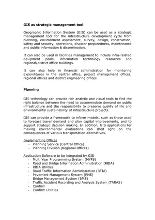
  • 1. GIS as strategic management tool Geographic Information System (GIS) can be used as a strategic management tool for the infrastructure development cycle from planning, environment assessment, survey, design, construction, safety and security, operations, disaster preparedness, maintenance and public information & dissemination. It can also be used in facilities management to include infra-related equipment pools, information technology resources and regional/district office buildings. It can also help in financial administration for monitoring expenditures in the central office, project management offices, regional offices and district engineering offices. Planning GIS technology can provide rich analytic and visual tools to find the right balance between the need to accommodate demand on public infrastructure and the responsibility to preserve quality of life and environmental sustainability of infrastructure projects. GIS can provide a framework to inform models, such as those used to forecast travel demand and plan capital improvements, and to support strategic decision making. In addition, GIS applications for making environmental evaluations can shed light on the consequences of various transportation alternatives. Implementing Offices – Planning Service (Central Office) – Planning Division (Regional Offices) Application Software to be integrated by GIS - Multi Year Programming System (MYPS) - Road and Bridge Information Administration (RBIA) - RBIA Utilities - Road Traffic Information Administration (RTIA) - Pavement Management System (PMS) - Bridge Management System (BMS) - Traffic Accident Recording and Analysis System (TARAS) - Confirm - Confirm Utilities
  • 2. Survey As a surveyor, you depend on a variety of software and technology in your daily workflows. GIS technology integrates with other systems while providing new functionality and a central database. A GIS database gives you a better way to easily manage, reuse, share, and analyze your survey data, saving you time, money, and resources. Because GIS software solutions are interoperable with the many data formats used in the field and office, you can deliver your data in the format required by your clients while maintaining the data’s core integrity. GIS software adds intelligence to spatial data, whether the data is generated in the field with GPS or remotely with lidar and photogrammetry. You can enter raw data, measurements, and field sketches directly into the GIS, enabling you to efficiently manage your data in a geodatabase with other spatial information. You can use GIS technology for collecting, importing, converting, and storing spatial measurement and computational fabrics. You can integrate computations, such as COGO and traverse least squares, and preexisting networks as well as import spatial data feature classes and relationships. With GIS software, you can bring data straight from the field into a geodatabase in a seamless workflow and take GIS data back into the field via a data collector or laptop computer. GIS software is customized to best meet your needs by optimizing functionality needed to complete a job. Implementing Offices – Bureau of Design (Central Office) – Design Division (Regional Office) – Right of Way Division (Central Office) – Surveying Division (Regional Office) Environment Assessment As scientists and environmental managers, you use GIS to study the environment, report on environmental phenomena, and model how the environment is responding to natural and man-made factors.
  • 3. With Esri GIS software you can o Manage multiple types of geographic data. o Assess relationships such as runoff and groundwater purity. o Measure change such as wildlife habitat encroachment. o Model events such as drought impact on forest health. o Improve workflow processes, from data gathering and analysis to publication and distribution of findings. Implementing Office – Environmental and Social Services Office (ESSO) Design The design engineers who are using the computer-aided design (CAD) tools to accomplish design tasks can take the advantage of GIS capability to incorporate the GIS-based information in the design process. With tools available in Esri core software, the design engineers can also import CAD documents into the GIS to perform robust cost estimate calculations and update other spatial information. GIS support for surface and hydraulic models and soil and geotechnical analyses gives you a rich set of capabilities for designing context-sensitive projects. Implementing Offices – Bureau of Design (Central Office) – Design Division (Regional Office) – Right of Way Division (Central Office) Application Software to be integrated by GIS - Infrastructure Right of Way (IROW) - Autocad versions - Primavera/MS Project - STAAD Pro - Construction Cost Information System (CCIS)
  • 4. Safety and Security Governments worldwide emphasize the importance of highway design and other methods that increase roadway safety. Engineers are using the power of GIS to perform safety analyses and identify root causes of dangerous highway segments. GIS makes it possible to take human factors into consideration as well as design elements. At the same time, demand has increased for transportation security in transportation operations at airports, ports, and transportation depots. GIS provides an integrating technology for incident response systems and infrastructure security systems. Implementing Offices - Bureau of Research and Standards (Central Office) - Research and Standards Division (Central Offices) - Special Buildings Construction GIS helps in the effective and efficient project delivery for new infrastructure projects especially multi-year projects that require careful monitoring, coordination, and management. GIS uses location as the cornerstone of data management for organizing project delivery information. GIS can be used to support initial planning and environmental studies; organize map, survey, and design documents; and share information with personnel in the office or the field. The open software platform of Esri GIS allows integration with project management software such as Primavera and MS Project. Integration makes it possible to provide a comprehensive view of projects and their current status, which gives project managers valuable support for achieving effective project delivery. Implementing Offices – Bureau of Construction (Central Office) – Construction Division (Regional Offices) – Project Management Offices – Procurement Office Proposed Application to be developed and integrated with GIS - Constructors Performance Evaluation System (CPES)
  • 5. Application Software to be integrated with GIS - Autocad versions - Primavera/MS Project - Construction Cost Information System (CCIS) - Project Monitoring System (PMOS) - Project Information (PIPS) - Civil Works Registry (CWR) Operations Operations managers work to achieve the highest efficiencies possible with existing infrastructure. One approach is to use traffic management strategies that help traffic engineers respond to changing conditions in ways that ensure optimal system performance. GIS can take a central role in developing effective traffic management strategies. The capabilities to integrate data feeds and share dashboard views make GIS ideal for viewing a comprehensive picture of current traffic conditions. For example, traffic managers can visually monitor bottlenecks and related information to quickly respond to vehicle incidents. In addition, these views can be shared with the public, giving drivers the latest information on road closures and current travel conditions. Implementing Offices - Office of the Secretary - Office of the Undersecretaries - Office of the Assistant Secretaries - Project Management Offices - Regional Offices - District Engineering Offices Application Software to be developed and integrated with GIS - Regional Operation Information System (ROIS) - District Engineering Operation Information System (DEOIS) Application Software to be integrated with GIS - Executive Information System (EXIS) Maintenance Budget constraints create a challenge for managers who make decisions about infrastructure maintenance. Having a well-planned
  • 6. and proactive maintenance regime can save significant costs over the life cycle of transportation infrastructure. GIS can provide the framework for an effective asset and maintenance management strategy. For example, mapping and analysis capabilities of GIS can be combined with pavement and bridge management models to produce comprehensive maintenance management solutions. GIS software for field use enables inspectors and field-based maintenance personnel to record inspections on site and quickly update agency databases through a wireless connection, which increases data accuracy and saves time. – Bureau of Maintenance (Central Office – Bureau of Equipment (Central Office) – Regional Equipment Pool (Regional Offices) – Maintenance Division (Regional Offices) Proposed Application software to be developed and integrated with GIS - Equipment Pool Management System (EPMS) - Bridge Maintenance Management System (BMMS) Application Software to be integrated with GIS - Road Maintenance and Management System (RMMS) Disaster Preparedness GIS is an essential technology for all phases of emergency management: preparation, mitigation, response, and recovery. Find out how GIS provides a foundation for comprehensive emergency management [PDF]. To prepare for and mitigate emergencies, GIS can map and model potential disasters to help visualize critical vulnerabilities and damage consequences. As rebuilding begins, GIS aids local, state, and federal agencies with technology that supports collaboration between multiple agencies. Field data captured with mobile GIS provides the ability to add updates from remote locations for more efficient incident management. It also supplies rapid damage assessment and more accurate recovery operations. Implementing Office – Environmental and Social Services Office (ESSO)
  • 7. Public Information and Dissemination For highway operations, Intelligent Transportation Systems (ITS) utilize the latest technologies to help alleviate traffic congestion and optimize traffic flow. A wide range of Esri desktop, server, and mobile GIS software and applications help highway engineers monitor dynamic traffic conditions for analysis, response, and communication. GIS can be configured to push real-time traffic condition updates out to the public via the Internet or to geographically specific areas via cell phones. Esri open architecture software supports development of spatial data models and promotes information management and sharing among agencies. It supports 511 systems in the United States and, in Europe and Asia, makes it possible to share data and real-time information among transportation, public transport, and emergency response systems. Esri GIS technology is integrated into the most advanced ITS worldwide. Implementing Offices - Public Information Division (Central Office) - Field Operation (Regional Offices) - Field Operation (District Offices ) Application Software to be integrated with GIS - IT Kiosk - Complaints Acquisition and Action Center (CAAC) - Complaints Verification and Investigation Center (CVIC) Facilities and IT Asset Management Using an IT system based on GIS allows you to manage land, infrastructure, and building assets in one common database. Such an information system is useful throughout the life cycle of a facility, from deciding where to build to space planning. An enterprise GIS benefits facilities management by streamlining data collection, dissemination, construction, and maintenance while promoting better communication, planning, and analysis. Implementing Offices - Facilities Maintenance Division (Central Office) - Facilities Maintenance Division (Regional Offices) - Monitoring and Information Service (MIS) - Network Administrator Units (Regional Offices)
  • 8. Application Software to be developed and integrated with GIS - Facilities Inventory and Maintenance System (FIMS) - IT Help Desk Database Utility Import - IT Asset Preventive Maintenance System (IAPMS) Application Software to be integrated with GIS - Property Accountability and Management (PAMS) - IT Asset Management System (ITAMS) - IT Help Desk Financial Administration Government organizations realize a significant return on GIS investments. GIS is integral in operations, decision making, and communication. It has demonstrated real business value, or return on investment (ROI), over the years. With GIS you can o Save money and time o Increase efficiency and accuracy o Generate revenue o Automate workflows o Improve accountability and transparency Implementing Offices - Budget Division - Accounting Division Proposed application software to be developed and integrated with GIS - Import Utility Program for E-budget - Import Utility Program for E-NGAS Application software to be integrated with GIS - E-Budget - E-NGAS - Accounts Payable System (APS) - Cash Advances Monitoring System (CAMS)