
Recommandé
Contenu connexe
Tendances
Tendances (19)
Similaire à Water-Wise Landscaping guide for water management planning - Utah State University
Similaire à Water-Wise Landscaping guide for water management planning - Utah State University (20)
Plus de Kaila694m
Plus de Kaila694m (20)
Dernier
Dernier (20)
Water-Wise Landscaping guide for water management planning - Utah State University
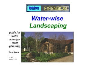
- 1. Water-wise Landscaping guide for water manage- ment planning Terry Keane EC 458 January 1995
- 2. Contents Getting Started .............................. Contents DRAWING A PLOT PLAN .............................. Materials Needed to Prepare a Plot Plan . References .................................................. SITE INVENTORY .......................................... Reference .................................................... SOILS .............................................................. Characteristics ............................................ Mapping Your Soils .................................... Reference .................................................... Contents .................................................... i SITE ANALYSIS .............................................. LIST OF FIGURES ...................................................... iii Reference .................................................... LIST OF TABLES ........................................................ iv LANDSCAPE IDEAS ....................................... Preface ..................................................... v Look ............................................................. Visit .............................................................. Read ............................................................ ACKNOWLEDGMENTS .................................................. VI Relating Ideas to Your Site ........................ Introduction............................................... 1 Planning ......................................... DEFINITION ..................................................................... 1 THREE IMPORTANT PLANNING CONSIDERATIONS ........................................ SOCIAL BENEFITS ......................................................... 2 1. Landscape Use ....................................... 2. Circulation. .............................................. THE CONSERVATION ALTERNATIVE ......................... 2 3. Environmental Aspects. ......................... HOW TO USE THIS BOOK ............................................. 2 FOUR BASIC PLANNING STEPS ................. Getting Started ............................................................ 3 1. Program Development ........................... Planning ....................................................................... 3 2. Conceptual Planning .............................. Designing ..................................................................... 3 3. Synthesis ................................................ Plant Selection ............................................................. 3 4. Design ..................................................... Implementing Your Plan .............................................. 3 Bibliography ................................................................. 3 PROGRAM DEVELOPMENT ......................... Private/Secluded Areas .............................
- 3. Contents e Areas ............................................................... 13 Aesthetics .................................................................. 31 ife Areas ............................................................. 13 Function ..................................................................... 31 rtaining ................................................................ 13 Water Conservation ................................................... 32 r Features .......................................................... 13 ening .................................................................. 13 ENVIRONMENTAL CONSIDERATIONS ...................... 32 tenance .............................................................. 13 Soils ............................................................................ 32 eral Use ............................................................... 14 Aspect ........................................................................ 32 s Viewed by the Public ...................................... 14 Wind ........................................................................... 33 Precipitation and Irrigation ........................................ 34 PTUAL PLANNING ........................................... 14 PLANT LIST ................................................................... 34 ESIS ................................................................... 15 Water Zones .............................................................. 34 Hardiness ................................................................... 34 ng................................................ 17 Size ............................................................................. 35 Color ........................................................................... 35 Evergreen/Deciduous ................................................ 35 N PRINCIPLES ................................................... 17 Perennials/Annuals ................................................... 35 nce ...................................................................... 17 Remarks ..................................................................... 35 hasis ................................................................... 17 Nomenclature ............................................................ 35 y and Variety ....................................................... 18 inuity ................................................................... 19 SELECTING PLANTS .................................................... 35 ONAL DESIGN CONSIDERATIONS ................ 19 r Zoning ............................................................. 19 Plant Selection Guide ............................ 37 or Climate Control ............................................. 19 TALL TREES (40'+) ....................................................... 37 N EXAMPLES ..................................................... 20 rences ................................................................. 20 MEDIUM TREES (25-40') .............................................. 41 N MATERIALS .................................................... 20 LOW TREES (0-25') ...................................................... 42 NING YOUR SPACE .......................................... 28 SHRUBS OVER 6 FEET TALL ..................................... 44 G PLANT MATERIALS ....................................... 28 SHRUBS UNDER 6 FEET TALL .................................. 48 ING WATER ZONES ......................................... 29 ANNUALS & PERENNIALS .......................................... 54 election ....................................... 31 GROUND COVERS ....................................................... 65 N INTENT ............................................................ 31 TURF GRASSES ........................................................... 68
- 4. Contents References ................................................................. 69 Subsurface Drainage and Underground U Additional Plants for Consideration that are not Walls and Walkways .................................. Readily Available ....................................................... 70 Permanent Irrigation Systems ................... Planting Large Trees .................................. Implementing Your Plan ......................... 71 Planting, Seeding, Fertilizing, and Mulchin Overplanting / Thinning .............................. References .................................................. SOIL AMENDMENTS .................................................... 71 MAINTENANCE .............................................. MULCH ........................................................................... 71 Water Zones 0 and 1 Plants ...................... References ................................................................. 72 Spring Mulch Mending ............................... Maintaining Turf .......................................... IRRIGATION ................................................................... 72 Pest Control ................................................ Annual and Perennial Beds ....................... WHEN TO IRRIGATE .................................................... 73 Pruning ........................................................ 1. Check the Soil ....................................................... 73 Fertilizing Trees and Shrubs ...................... 2. Water Zones .......................................................... 73 Irrigation System Maintenance .................. 3. Indicator Plants ..................................................... 74 References .................................................. 4. Feel the Soil ........................................................... 74 5. Evapotranspiration ................................................ 74 Irrigation Rate ............................................................ 76 Conclusion ..................................... Designing Your System ............................................ 76 Appendix A: CHECKING YOUR SYSTEM ......................................... 77 References ................................................................. 77 BIBLIOGRAPHY .............................................. LANDSCAPE INSTALLATION ...................................... 77 OTHER WATER-WISE LANDSCAPING SOU A SUMMARY OF STEPS .............................................. 77 COSTS ............................................................................ 78 Planting Trees, Shrubs and Ground Cover ............. 78 LIST OF FIGURES PHASING CONSTRUCTION ......................................... 78 1. Water-Wise Landscaping with a native plant bord 2. USDA Hardiness Zone Map, Areas 4 and 5. PHASING EXAMPLE ..................................................... 79 3. Natural landscape with wildflowers, grass and sp INSTALLATION PROCEDURES .................................. 80 4. Traditional landscape that is predominantly blue Site Clearing of Debris and Unwanted 5. Comparative landscape water use, in gallons for n Plant Material. ............................................................ 80 mixed uses and Kentucky Bluegrass. Rough Grading .......................................................... 80
- 5. Contents mple residential plot plan. 30. A 5000 square foot planting bed with trees, shrubs and ground ls used for determining the slope of the site, and the resulting cover. e map with lines showing approximate grade changes. 31. Comparative soil intake rates of sand, loam and clay. e inventory of environmental factors, utility lines, buildings 32. This construction phase includes removal of turf to establish trees plants. and shrubs. e inventory compared with a site analysis. 33. Directing roof water to plant basins. Butte Garden & Arboretum, Salt Lake City, Utah. 34. A brick patio with ground cover and shrubs. ater conserving landscape in Salt Lake City, Utah. 35. Bare root planting detail (left) and tree planting detail (right). ncept plan delineating areas for activities. 36. Shrub planting detail. nthesis plan of the concept plan and the site analysis. 37. Tree pruning. er zoning applied to a landscape. angular modules can be used for space efficiency on small LIST OF TABLES 1. Quick symbols for drawing a plot plan. vilinear lines create a more natural appearance. 2. Monthly precipitation, effective precipitation and evapo- e motifs are dynamic. transpiration. fescue turf is shown (water zone 2) with irregular brick walk 3. Landscape coefficients for determining irrigation requirements. s and a brick patio. ooded lot is created using tall pine trees for shade and privacy. oad ties installed in gravel. k section drawings provide views of the landscape. an view of the final design illustrates the use of curvilinear and rectangles with plant materials. w maintenance landscape with mulched plant beds. juniper and big sagebrush on a south facing slope. color from yellowing iris leaves, junipers and red spreading neaster. t material selection for a shaded area. sun planting of yellow violets, penstemon and big sagebrush. dded wood mulch used in a zone 2 planting bed. d mulch controls weeds and conserves water. C over Photo Water-wise Landscaping by Curt Maughan and Melody Fasselin
- 6. Preface v Preface Figure 1 (far right). Water-wise Land use, like a pendulum, has swung from sparse land settle- designed native landscaping with a native plant ments of Native Americans, with a reverence for nature, to plant landscape that border and turf. sprawling developments of western settlers. The settlers’ intent provides diversity, was to “tame” the harsh western elements. The result was the beauty, and habitat introduction of soggy green English landscapes to the West. for indigenous wild- The landscape approach across the country has been to clear life (Figure 1). In the land and “start over,” rather than to make use of existing northern Utah val- indigenous plants. A concept is now emerging that integrates leys with only 14↑ of some reverence for nature and recognition of the aesthetic value annual rainfall, such of the local landscape with fulfillment of contemporary human landsccaping is im- desires. Once a landowner has learned about the local climate, portant for conser- soils, plants, and animals, and has identified intended uses for a vation of water and landscape, alterations can be made to specific areas of land to preservation of the create a useful, water conserving landscape. scenic aesthetic quality of the region. Water-wise landscaping is an approach to landscaping that This book was written primarily for residents of northern Utah focuses on water conservation, designs that address human with an interest in landscaping to conserve water. The basic con- desires, and use of drought tolerant native or introduced plants. cepts of landscape design apply anywhere, but the plants and the Emphasis is placed on planning for the user and for the environ- cultural practices are refined for water conservation in this region ment. There isn’t a more interesting landscape than a well (Figure 2). The region is within plant hardiness zones 4 and 5, referred
- 7. vi Preface to here as areas 4 and 5 to avoid confusion with water zones. These ACKNOWLEDGMENTS hardiness zones/areas were established by the U. S. Department of Several knowledgeable people have contributed to this publica- Agriculture based on minimum annual survival temperatures tion. Their time and assistance is greatly appreciated. for plants. Special thanks to the following people for helpful reviews Plants rated for hardiness area 4 are capable of surviving - and comments: Craig Johnson, Advisor and Editor, USU LAEP 20° to -30°F, and for hardiness area 5: -10° to -20°F. Variations in Department; Larry Wegkamp, USU Extension Community De- microclimate make any classification questionable, but this is a velopment Specialist; Larry Rupp, USU Extension Ornamental useful guide. Horticulture Specialist. Also, many thanks to the following: Other factors that will determine a plant’s hardiness for a John Flannery, USU Information Services region are wind exposure, snow cover, reflected light and heat Durant McArthur, Intermountain Research Station, Provo, Utah from surrounding buildings, maximum temperatures, aspect Steve Smith, Aqua Engineering, Colorado (north, south, east, west), humidity, soil pH (acidity), and rain- Robert Hill, USU Extension Irrigation Specialist fall. Consult the local Extension agent if you are unsure of the Jim Morris, Avid grower of native and alpine plants hardiness number for your area. Dave Okelberry, Utah Native Plant Society Vern Budge, USU LAEP Department Jan Striefel, LandMark Design, Inc., Salt Lake City, Utah Logan Jim Lance, CDOT, Grand Junction, Colorado Ogden Salt Lake Provo Figure 2 (far left). USDA Hardiness Zone Map, Areas 4 and 5.
- 8. Introduction 1 Introduction Figure 3 (far right). Natural Envision a beautiful place near your home where there is native landscape with wildflowers, grass vegetation: grasses, sagebrush, oaks, and junipers or spruce, and spruce. pine, and grasses. With an image in mind, place your house in the picture without disturbing the site. The view from inside your home is a natural garden. Occasionally you see deer and butterflies, and bird songs fill the air. Your water bill is reduced, there is little or no lawn mowing, and less fertilizing and main- tenance. This is what Water-wise landscaping can be (Figure 3). It can be a contemporary landscape, a modification of a tradi- tional style, or a combination of styles - the commonality is low DEFINITION water use. Figure 4 (right). Traditional Water-wise landscaping is landscaping without wasting water. landscape that is predominantly It includes planning a yard for your lifestyle, grouping plants bluegrass. together with similar water requirements, watering just to meet plant needs and using non-water consuming areas, such as decks and patios. By using water wisely up to 50% of landscape irrigation water can be saved. Consider a typical quarter acre lot with a 7000 square foot traditionally landscaped yard planted to Ken- tucky bluegrass and common high water use ornamental trees and shrubs (Figure 4). The irrigation water requirement for these
- 9. 2 Introduction plants for 5 months, at 18 gallons per square foot (high water SOCIAL BENEFITS use), is 126,000 gallons. The cumulative benefit of saving 57,000 gallons of landscape Conversion of the landscape to low water use plants with an water per house per year, equates to a greater saving than the irrigation requirement of only 3 gallons per sq. ft. results in use immediate monetary reward. It would slow the rate of environ- of 21,000 gallons of water in 5 months. For many homeowners it mental degradation by decreasing the demand for water and by would be preferable to plant one third of the yard with high curtailing the immediate need for additional water impound- water use plants at 18 gallons per sq. ft., one third with moderate ments resulting in savings of billions of tax dollars for water water use plants at 10 gallons per sq.ft., one sixth with low water development projects. It would also protect the natural scenery, use plants at 3 gallons per sq.ft., and to install one sixth in a hard fisheries and wildlife habitat. THE CONSERVATION ALTERNATIVE Kentucky Bluegrass Maintaining a lush green landscape in Utah requires consider- Figure 5 (far left). Comparative 126,000 able time, water, fertilizer, and pesticides. Consider the alterna- landscape water use (in gallons/ tives: 1000 ft2/year) for native plants, Mixed Uses 1. Create a native low water use landscape with shrub beds, mixed uses and Kentucky 69,000 small perennial gardens and patios. Bluegrass. 2. Compromise and retain small high water use areas, such as Native Plants turf, and convert the remaining yard to patios, decks, walk- 21,000 ways, and low water use plants. 3. Convert small areas of an existing landscape each year to lower water consuming plants. Costs of converting to a water conserving landscape are higher surface such as a wood deck, or brick patio, and walkway. This than the initial financial saving on water. However these costs scenario would result in the use of 69,000 gallons of water for the equalize in time, and the day is fast approaching when there will season (saving 57,000 gallons). The water saving would be 45% not be enough water or enough affordable water to waste on lush of the total for the conventional landscape (Figure 5). landscapes. Now is the time to plan and install a water-wise Water in Utah is cheap compared to other states. Using a landscape for a new home or to convert a high water use current water rate of $1.00 per 1,000 gallons of water plus $1.00 landscape for an existing home. per additional 1,000 gallons, only $57.00 per season would be saved in the example above. But, as the population and water demands increase, and water supplies decrease, both rates and potential savings will increase.
- 10. Introduction 3 HOW TO USE THIS BOOK are listed by plant type: trees, shrubs, annuals and perennials, This guide will take you through the steps necessary to plan, ground covers, and turf. The tables are arranged in water zones design and establish a water efficient landscape. reflecting weekly or monthly plant water requirements. Getting Started Implementing Your Plan The first section explains how to develop a map of the yard. This Implementing your plan may involve site grading, creating includes locating existing buildings and environmental features positive drainage, preparing and amending soil, planning/in- such as: vegetation, direction of prevailing wind, slopes, direc- stalling an irrigation system, constructing hard surfaces, plant- tion of drainage, soils, sunny/shaded areas, and unique aspects ing, mulching, and maintenance. of the site. The next step is to find ideas by walking in open spaces with native vegetation to observe plant communities; walking Bibliography through neighborhoods; and looking at garden and landscape The references listed within each section to provide additional books and magazines. information are summarized in the bibliography. Planning Planning involves identifying people’s preferences, intended uses and goals for the landscape. These goals are then combined with the environmental features of the property to create a map. This “synthesis map” is refined by applying design principles to create a beautiful, functional landscape. Designing Design principles include balance, emphasis, unity/variety and continuity. Two additional design considerations are presented that are important to the success of your landscape: water zoning (grouping plants by water requirements), and climate control (planting to maximize winter solar gain and summer cooling). Plant Selection Allowing time for careful plant selection will be important to the success of your landscape. Tables of hardy plants for this region
- 11. 4 Introduction
- 12. Getting Started 5 Getting Started DRAWING A PLOT PLAN plan, read this entire section before starting. Property dimension A plot plan is a map of a house and yard showing the existing lines should be available from your city engineering department. buildings, property lines and utilities. If a plot plan of the property exists, you have a head start. If you need to make a plot Materials Needed to Prepare a Plot Plan • 100′ measuring tape • masking or drafting tape • clipboard • ruler or engineer’s scale • pencil and eraser • 8-1/2↑ x 11↑ graph tracing paper with 4 or 10 squares per inch, giving you a scale of 1↑= 40′ or 1↑= 10′ • right angle triangle • T-square • french curve • circle template Note: foot = ′ and inches = ↑ Begin by taking a quick walk around the yard and notice the location of the house, other structures, trees, property lines, etc. Figure 6 (right). Sample Gather a clipboard and pencil, 8-1/2↑ x 11↑ graph paper, a 100′ residential plot plan. measuring tape and a helper.
- 13. 6 Getting Started This is done by using a carpenter’s level, a hand level, a surveyor’s Table 1 (far left). Quick symbols. Tree Shrub level and rod, or by hiring a surveyor (Figure 7). If you have steep erosive slopes of 50% or more (50′ elevation change in 100′), you Property Line may save money by hiring a landscape architect to assist you with a plan to stabilize the slopes. Roof Overhang Make a clean bold copy of your plot plan that can be easily read through tracing paper, orient the lot so north is at the top of the page. You will need this for the next steps. Fence References Utility Lines Western Home Landscaping, All About Landscaping, and Residential Landscaping I. Figure 7 (left and left below). Windows & Door Levels used for determining the Structure (heavy lines) slope of the site, and the resulting slope map with lines showing approximate grade changes. Measure the length and width of the property between the Surveyor’s level Carpenter’s level Hand level property corners (Fig. 6, A-A′). Measure from the property lines to the house corners sight- ing along the sides of the house (Fig. 6, B-B′). Next, locate, measure and draw other structures, utility lines, driveways, garbage storage areas, existing gardens, exist- ing trees, easements and setbacks. Approximate the location of adjacent houses or anything that would influence your views or solar access. Consult the city or county planning department about land- scaping ordinances. There are setback limitations and height restrictions that apply to landscaping. If the lot has more than a gentle slope, you will need to determine the grade or change in elevation across the property.
- 14. Getting Started 7 Figure 8 (far right). A site SITE INVENTORY inventory of environmental Inventorying your site is easy and important to the success of the factors, utility lines, buildings, final plan. The objective is to note site assets and constraints for and plants. planning (Figure 8). Trace your plot plan on an 8 1/2↑ x 11↑ sheet of tracing paper. On the copy, draw the following: • existing vegetation • arrows showing the direction of prevailing winds • a symbol indicating noise sources • steep slopes • drainage direction • location of different soils, refer to “Soils” below • areas of good/poor views • sunny areas and areas of dense shade • wetlands, rock outcrops or other unique aspects of the site Reference or write to Soil Testing Lab, Utah State University, Logan, UT Landscaping. 84322-4820. The soil test kit comes with instructions. It is impor- tant to take soil samples in areas where you may plant and where SOILS there are soil texture changes as discussed below. Mark the It is important to learn about soils before planning a landscape or sample site with a numbered stake and note it on your site selecting plants. Soils in northern Utah areas 4 and 5, vary from inventory map. The results of the soil test will indicate the pH porous excessively drained sandy soil to heavy poorly drained and high and low levels of soil nutrients for plant growth. Specify silty clay loams. The soil acidity varies too, but is usually about your intended use, such as Kentucky bluegrass turf or water pH 7.5-8 (ranging from pH 6 to pH 10). This is alkaline on the pH conserving grasses and native plants with no irrigation. The lab scale of 1 to 14, where 1 is acidic, 7 is neutral and 14 is alkaline. will adjust nutrient recommendations accordingly. With this Fortunately, some plants thrive in these alkaline soils while information, you can amend your soil by adding the correct others must live in acidic soils. amount of nutrients. A soil test will provide specific information about your soil which will help you select plants that are tolerant of your soil. Soil testing is easy to do. Simply call for a soil test kit at 797-2217,
- 15. 8 Getting Started Characteristics a loamy soil. If the soil is very sticky and you are able to make a Soil texture and structure effect soil drainage and plant survival. smooth ball that ribbons when you squeeze it, it is likely clay. Coarse textured soils with little structure, such as sands, drain It is common to have sandy loams, clay loams, or loamy and dry out rapidly. Fine soils with developed structure such as clays, but it is most important for irrigation and drainage to clays drain more slowly, thus holding water longer. classify soil into one of three categories: sand, loam or clay. Once Alkali, or sodium salts, destroy soil structure. If you have a you have an idea about what texture the soils are, draw lines on clay soil with alkali, your plant selection will be limited because your site inventory map to delineate the soils and label them few plants can tolerate the lack of air space, waterlogged soil and sand, loam, or clay. You can confirm your soil classifications by high sodium salts. It is advisable to find plants that tolerate these requesting texture determinations when the soil test samples are conditions, rather than try to amend such a difficult soil. sent to the lab. Be sure that samples are numbered and shown on Some soils have an impervious hardpan or fragipan layer your inventory map. within good soil. If the layer is thin, it can be broken up to allow roots to extend below. When the layer cannot be broken, or if you Reference have shallow soil (less than 3′) over rock, either build raised Water-wise Gardening. planting beds or grow shallow rooted plants such as perennials, annuals or ground covers. SITE ANALYSIS Now put a sheet of tracing paper over the site inventory map. Mapping Your Soils Analyze the site and conceptualize solutions to the limitations The USDA Soil Conservation Service has mapped the soils in this shown on your map (Figure 9). region. Published soil surveys are available from local offices Indicate screens to hide poor views and show buffers to cold and usually at the local library. The mapping is done at a large winds. Consider and note soil limitations and hazards from scale so you will find good general information about the soils in steep slopes. the vicinity, but you will need to “map” your own soils in more Next, evaluate the neighborhood landscape. Is there an detail. element worth repeating such as a street tree planting that With a shovel and a bottle of water, walk to different sections unifies the appearance of the neighborhood? Note and plan to of the yard and make a soil test in each section. This is done by emphasize assets of your site such as well drained soils or good digging out a handful of soil within 12↑ of the surface and adding views. Analyze and indicate on the map, the climate control a few drops of water to it. Roll the soil into a ball if possible and potential for shading the south and west sides of the house squeeze it between your index finger and your thumb. If it crumbles, feels very coarse, and your hands are rather clean, it is during summer to save energy and for comfort. likely a sandy soil. If your hands are muddy, the soil feels sticky but still coarse, and the soil makes a crumbly ball; it is probably
- 16. Getting Started 9 Figure 9a (right). A site inventory Visit for comparison with site analysis. There are many sites worth visiting including the Utah Botanical Gardens in Ogden and Kaysville, and the Red Butte Gardens and Arboretum in Salt Lake City (Figure 10). They have a diversity of native and introduced plants. Red Butte Gardens also offers classes in residential landscaping. Although it is out of the region, the Denver Botanic Gardens, Denver, Colorado, has beautiful low water use gardens. Reference Nature’s Design. Figure 9b (far right) Site analysis. LANDSCAPE IDEAS Landscape ideas come from experiences; landscapes we see and enjoy; books about art, landscape and environment; neighbors yards that we like or dislike; walks in the foothills and moun- tains; and other sources. Look Before planning your yard, look at what others have done. Walk or ride a bike in different neighborhoods looking for new ideas. Many homeowners in the Salt Lake area are converting small areas to more water conserving plants (Figure 11). Use their successful ideas in planning. Walk the foothills and notice which plants are growing together. Think of their use in your land- scape.
- 17. 10 Getting Started There are several landscape architecture, horticulture and Figure 10 (far left). Red Butte gardening magazines with pictures helpful for visualizing Garden and Arboretum, Salt Lake what you want to achieve. City, Utah. Relating Ideas to Your Site Create a landscape that fulfills the needs of your family, and responds to the assets and constraints of the site. Ideas gath- ered from looking, visiting and reading should be adapted to these needs with sensitivity to your site, to the land and to the growing conditions. Watching your landscape for a year and just maintaining what exists is educational. It allows time to learn about the property, recognize microclimates critical to plant growth, note seasonal changes, identify existing plants, and observe wildlife use of the site. Read Sunset Magazine has published Water-wise Gardening, a helpful book with good water- wise information, although, the plant sec- tion is directed to California. The Small Gar- den by John Brookes has good ideas on in- corporating hard surfaces such as brick or stone into the landscape. Backyard Design by Breskend provides ideas on the use of decks and fencing as well as garden designs. The Utah Native Plant Society prints a newsletter called “Sego Lily” with good in- formation about native plants. Society mem- bers are using water zoning in areas and they are friendly and willing to exchange Figure 11 (left). A water plant information. conserving landscape in Salt Lake City, Utah.
- 18. Planning 11 Planning The planning objective is to evaluate your needs for the land- 2. Circulation scape and site and develop goals that can be accomplished Circulation routes facilitate use of the landscape. Wide paths or through design and installation. Synthesizing environmental large connecting spaces enable use by many people simulta- considerations with your program of activities and goals will neously. Narrow winding paths with uneven stone surfaces lead you to a design concept, a theme, for your design. Without discourage active use, and help seclude areas. Paths or walk- planning, landscapes often become a hodgepodge of plants and ways and other connecting spaces should be shown in the disorganized spaces that are neither used nor enjoyed. conceptual phase and the final design. THREE IMPORTANT PLANNING CONSIDERATIONS 3. Environmental Aspects Planning to make the best use of site assets and limitations is 1. Landscape Use important. Assets may include views, rock outcroppings, well Consideration must be given to the arrangement of landscape drained soils, areas with sunlight or shade, or existing vegeta- activity areas and the compatibility of adjacent uses. For ex- tion. Microclimate (a unique climate in a small area) is easily ample, it may be preferable to locate an outdoor eating area near overlooked, but it is important for comfort and plant survival. the kitchen door for convenience. A secluded patio may be Utilizing summer shade and breezes, and the warmth of the planned near an exterior bedroom door but it would not be winter sun, with protection from cold wind will enhance your advisable to locate it adjacent to a volleyball court. If street noise enjoyment of the landscape. and unpleasant views must be contended with, use of aesthetic Site limitations may exclude some landscape uses but facili- barriers should be considered to diminish annoyances. tate others. Limitations could include: a high water table, an odd shaped lot, poor drainage, high wind exposure, steep slopes,
- 19. 12 Planning highway frontage, or flooding. For example, a narrow lot may 4. Design preclude use for volleyball but it may facilitate development of Design is a process of using your imagination to create and refine a secluded patio or a wildlife area. Addressing limitations early forms and spaces to achieve aesthetic and activity goals. Inherent in the planning process is important. in this is the organization of your thoughts about use of space for specific purposes. Design emphasizes the aesthetic quality of the FOUR BASIC PLANNING STEPS landscape yet accommodates your program goals in an environ- There are four basic steps in the planning process: program mentally sensitive way. Because of the importance and complex- development, conceptual planning, synthesis, and design. ity of the design process, it is treated as a separate section following this one. 1. Program Development Program development is a process for determining who will use PROGRAM DEVELOPMENT the landscape and for what purposes. The outcome will be a list Program development is used to identify your priorities for the of goals and desirable activities to accomplish in the landscape. landscape and to establish goals for accomplishment. These The integrated use of the interior spaces in the home and the goals may include a shaded yard with large trees, low ground exterior spaces of the landscape becomes an important consider- covers, and a large stone patio for reading and entertaining. Your ation in this stage of planning. Thought should also be given to goals might include an active area for badminton or a natural who will install and maintain the landscape, and at what cost. area for wildlife. The following are planning ideas to consider for your yard. 2. Conceptual Planning Add to the list, try to bring up concepts you or your family This is a process of delineating spaces in the landscape for haven’t considered before. program activities and goals. The resulting plan drawing will Think of your landscape as an extension of your home. include a hierarchy of spaces from large dominant spaces to Envision one of your rooms extending outside, creating an smaller spaces sized for intended uses. exterior space. Think of the beauty created by the connection of the interior/exterior expanse as well as the functional possibili- 3. Synthesis ties of the connection. Apply this thinking to different rooms of In this step a synthesis drawing is developed by combining the the house and to the activity areas specified for outdoor use. drawings you have made to this point: site inventory, site analy- Then develop and prioritize a list of landscape elements for your sis, and conceptual plan. The synthesis drawing illustrates how family and create goals. the conceptual plan fits with the limitations and assets of the site. Adjustments can then be made to the conceptual plan before developing a final design.
- 20. Planning 13 Private/Secluded Areas • Do you entertain outdoors creating the need for: sitting Continuation of private areas from the home to the yard may be areas, storage for chairs, barbecue pit/cooker, paths to con- useful to you, or you may desire an outdoor hideaway that is nect areas, or privacy/public space? separate and secluded from the house. Consider these options • Do you want an east facing outdoor breakfast nook, or an and the aesthetic implications of their location in your yard. evening shaded deck? • Do you enjoy sitting /reading/sunbathing in the yard? • Would you enjoy having lunch in a sunny/shaded area of • Do you need quiet and active areas that can be used simul- the yard? taneously? • Is night lighting important in your landscape? • How about a hot tub under the stars? Water Features Active Areas These are usually used as a focus element in the landscape. They Locate active areas adjacent to other compatible use areas or may also be installed for functional uses. resolve the issue of how to separate the spaces successfully. • Are water features important such as: fountains, swimming pools, birdbaths, a hose and wash basin for garden veg- • Are active use areas important such as: etables, or a lily pond? basketball, badminton, horseshoes, swings, softball, frisbee Consider locations for outdoor faucets. • Should a children’s play area be visible to a certain room in the house? Gardening If gardening is a priority, consider the aesthetic incorporation of Wildlife Areas a garden into the landscape, as opposed to isolating and screen- These are often perimeter areas that can be planned to attract wildlife to your property. Adjacent land uses should be chosen ing it. Consider use of the garden and its maintenance. and planned carefully so that wildlife are not frightened away, • Do you want a vegetable garden and an area for tool storage? and to avoid feeding damage from wildlife. • Do you want a cutting or formal flower garden? • Is attracting birds and other wildlife an objective? Consider: • Is a native plants garden of interest? birdbaths, feeders, viewing areas, food/native plants, and • Would you enjoy creating an alpine garden and being in- protecting the remainder of the landscape from browsing. volved with an international alpine garden club? • Will there be a compost pile? Entertaining Consider the convenience of locating outdoor entertaining areas Maintenance near a kitchen or dining room, plan the size of the area based on Determine the amount of time you are willing to devote to the size of the anticipated user group. Think about enclosed areas landscape maintenance. Consider storage of necessary tools and with trellises and overhead structure versus open areas. landscape equipment.
- 21. 14 Planning • Is low maintenance a priority? Consider using vegetative • Will you have a dog run or a fenced yard? ground covers, hard surfaces, native plants, low water use • Consider storage for garbage cans, recycling boxes, or fire- plants, and mulch. place wood. • Do you enjoy high maintenance tasks such as frequent • Will additions be made to the house resulting in the need for mowing, fertilizing, watering, pruning, and weeding? temporary landscaping? • Is snow removal necessary? If so where can snow be piled • Do deliveries made to the house need to be accommodated without damaging plants? (mail, milk, parcels)? • Do you want more sun/shade in the yard/house? General Use Everyday uses of the landscape are important considerations. Areas Viewed by the Public Try to facilitate these uses in an aesthetic manner. You must often make a decision about whether to conform to the • Is a workshop or shed needed? neighborhood landscape or to carefully and tastefully create • Is a garage or carport needed? your own style. Your intended use of this area will be a determin- • Do you use a clothesline? ing factor. • For parking, do you need a turn around, wide driveway, • What type of views do you hope to create from inside the parking space; or do you want to minimize paved surface? house and at the entry to your house? • What impression do you want to create in the public space? • If you have a narrow curbside planting strip, can a low maintenance, low water use ground cover be used? • Is there a streetscape theme worth repeating such as rows of trees? • Will you use the public space? After you have developed a list of intended uses for your landscape, set goals to design and install them. These goals will be your checklist for the conceptual plan and your final design. CONCEPTUAL PLANNING Conceptual planning identifies compatible and incompatible Figure 12 (far left). A concept locations of activity areas, pathways or connections to spaces, plan delineating areas for activities.
- 22. Planning 15 Figure 13 (right). A synthesis plan within the shadow of the north side of the of the concept plan and site house. Adjust the concept plan until it analysis. works well with your site analysis. This will be the basis for your landscape de- sign. It is important to begin considering the aesthetics of the spaces being created. The entry, for example, is a key visual point for you and the public. The path to the front door should be safe and wel- coming. While bluegrass has tradition- ally been used for front yards, more ap- propriate landscaping employs interest- ing combinations of low water use trees, shrubs, flowers and ground covers. This is more in keeping with the character of the west. Active areas may require the use of turf for durability. This may be high, mod- and inside/outside connections for various uses. A concept plan erate or low water use turf, depending on the preferred look and shows your intended activities located in the landscape where the planned amount of water use. you think they will be most appropriate. Vegetable and flower cutting gardens are typically high On a clean plot plan of the yard and house, draw areas for the water use areas incompatible with active use or wildlife areas. uses you identified in the program development process (Figure They work well adjacent to sites for passive recreation and 12). Use loose free lines, erase and juggle locations until the uses entertaining, or as borders along walkways or around patios. fit the way you want them. You now have a concept plan. Water features are often used as a focal point in entertain- ment areas, and they are a welcome addition to a secluded area SYNTHESIS for relaxation. Now trace the concept plan and the site analysis on one sheet of General use areas need to be durable, attractive, and most paper (Figure 13). Check for incompatible uses such as a garden people prefer that they be low maintenance. A low water use planned where a healthy tree exists or a sunlit patio planned planting of flowering shrubs and ground cover can improve the
- 23. 16 Planning appearance of a storage shed. Tall plants can help screen garages, and natural wood fencing can be used to hide garbage contain- ers. The small details in a landscape often give a finished quality look. Phased landscaping is discussed in the installation section. If you are renovating an existing landscape or beginning with bare soil, the landscape can be developed in stages, or all at once, depending on your needs, budget and energy. Useful references for planning include: Step by Step Land- scaping, Western Home Landscaping, Water-wise Gardening, How to Plan Your Own Landscape, Site Planning, and Landscaping.
- 24. Designing 17 Designing The objective of landscape design is to aesthetically define space Symmetrical balance uses identical distribution of items on each to satisfy your program requirements in an environmentally side of an area. It is more formal than asymmetrical balance. It responsible manner. The design should be tailored to fit your can be achieved with a symmetrical distribution of trees, walk- property. ways or spaces on each side of a yard. It can also be created by symmetrical use of color, tree or pavement texture, and tree or structure shapes or volumes. DESIGN PRINCIPLES Asymmetrical balance is achieved by creating the same Several guiding principles used in designing landscapes are: feeling of weight, or mass, on each side of a yard, but with balance, emphasis, unity/variety, and continuity. A brief de- random distribution of the elements mentioned above. The scription of the use of these principles follows. For more informa- spaces created or implied are irregular and interesting. Asym- tion see the references on page 20. metrical balance is more conducive to diverse environmental characteristics such as undulating topography, natural plant Balance materials, and changing soil conditions. There are two types of balance; symmetrical and asymmetrical. Seasonal color balance is fun to use in design. It is a process of determining when colors appear on plants in flower blooms or leaves, what the colors will be, and where to position them to achieve color balance throughout the year. Emphasis A focus created in the landscape is called emphasis. It draws Symmetrical tree planting Asymmetrical tree planting attention and evokes curiosity, making the landscape interest-
- 25. 18 Designing angles on the ground plane can also be used to draw attention from the house. Vertical tree trunks and overhead tree canopies with low horizontal shrubs define areas and can enclose and emphasize spaces. Rows of trees can also provide strong emphasis as shown Large tree, small shrubs One red shrub with green shrubs in the two sketches adapted from Outdoor Design. ing. It can be a planting theme, a fountain, a large space, or a Unity and variety structure. Contrasting colors, sizes and textures are used to A design is held together by unity and variety. Unity is accom- create emphasis. A row of small shrubs planted on two sides of plished through repetition, such as group plantings of like plant a large tree will help to emphasize the large tree. One red shrub planted among many green shrubs will become the focus, but it is possible that the mass planting of shrubs is the landscape emphasis. An absence of plants within a space defined by plants can also draw attention, possibly with the intent of using a sculpture or a rock as a focus. The plant and landscape materials used must be in scale with the site to be effective. Many new tree Grouped planting with Scattered planting with varieties available from nurseries are smaller and more aestheti- repetition of plant materials too much variety cally suitable to most residential sites. A house is often the focal point or emphasis in a landscape. materials versus a scattered planting of associated plants. The If attractive house lines can be repeated to unite the house with item repeated may be color, leaf texture, plants of a certain size the landscape, you will find the design stronger and more or shape, spaces of a certain size, an arrangement of plants, pleasing. Some architecture is improved by screening with land- paving materials, fencing, or details of the architecture. Forms of scape plants such as tall trees and wide shrubs. Strong curves or planting areas and hard surfaces such as patios are dominant unifying elements in a landscape. Color is an important unifying element. Think of a mass planting of yellow gaillardia flowers in front of dark green shrubs in the backyard. As you look around the yard, visualize those colors along the sides of the yard too, and maybe in the front yard. You may repeat other colors as well such as red or shades of red or green; the repetition creates unity through Enclosure Emphasis continuity.
- 26. Designing 19 Variety assures that all landscape elements will not be the in this booklet for discussion and classification of plant materi- same. Use of a diversity of materials such as trees shrubs or als. There will be exceptions to the recommended watering paving surfaces adds interest. Variety of color use also adds frequencies as site and soil conditions vary, but the zones can be interest, but use of too many colors can create a cluttered, busy, used as a guide. look. The zones range from 0 to 4 as follows: no irrigation (zone 0), monthly irrigation (zone 1), irrigation every two weeks (zone 2), Continuity weekly irrigation (zone 3), and irrigation twice per week (zone Continuity is the “thread” that is woven throughout the land- 4). scape. It includes repetition of plants, colors, textures, shapes, Plants such as Kentucky bluegrass thrive on lots of water but it also emphasizes their use throughout. By repeating the use (30↑) per year plus rainfall (14↑), requiring irrigation twice per of the same texture in the landscape, you can create a sense of week (zone 4). Native plants in the valleys, such as sagebrush continuity. Consider a bed of junipers as a border in one corner and rabbitbrush, survive with only 14↑ of rainfall per year and of the yard, by planting additional small clusters of junipers in little or no irrigation (zone 0-1). It wastes water to irrigate plants other areas, your eye will pick up the continuity or the familiarity that grow well without water, and many plants will die from too in the landscape and it will feel comfortable. If you plant only much watering. junipers around the yard, the effect will be boring, there will not Your decision about which water zone(s) to use in your be enough variety for interest. landscape will be based on your environmental ethic concerning the amount of water to use for a landscape, how much you are ADDITIONAL DESIGN CONSIDERATIONS willing to spend for landscape water, your design vision as it There are two additional design components of conservation relates to the surrounding natural environment, and what you want to achieve aesthetically in your landscape. Compare the design that are important to understand before you develop high (4) and moderate (2) water zones with the water conserving your final design: water zoning to conserve water, and designing landscape design. for interior climate control for comfort and to save energy on A landscape with a predominance of lower water zones, 0 to heating and cooling. 1, will require less water than a landscape that is all water zone 4. Figure 14 illustrates the idea of water zoning by showing a Water Zoning typical Kentucky bluegrass landscape and a new water conserv- Water zoning is a design process that divides the landscape into ing landscape with a diversity of water zones. areas that will receive a suggested frequency of irrigation. Plants A water conserving landscape often has more diversity of with similar water requirements are then matched with the plants than a traditional landscape. There is also more diversity appropriate water zone. This makes it possible to more accu- in water zones in this design that adds up to a substantial saving rately meet plant water needs. Five water zones have been used of water compared to a zone 4 landscape.
- 27. 20 Designing Interior Climate Control Primer on Landscape Architectural Design with Plant Materials for A quick look at your site inventory map will show directions of more specific information. cold winds, hot southern and western exposures, and areas with dense shade. Heat from southern and western exposures and DESIGN EXAMPLES cold winds from the north and northwest are the most costly Sample landscapes are presented in Figures 15 through 19, to environmental elements to contend with in terms of home en- provide ideas for water-wise designs. ergy use. You can protect the house from cold to some extent, by As you look at the examples, think about the design prin- using foundation plantings as insulators, or by using trees and ciples discussed previously. Try to imagine yourself in the land- shrubs as windbreaks. Trees can reduce wind velocity on the scapes, think of the overhead tree canopy and the feeling of leeward side, for a distance of 10 to 15 times their height. enclosure. Notice large and small spaces and their connection. However, snow will often drift within the area from the trees to Look for unity expressed in the shape of planting beds and hard 10 times their height, on the leeward side. If you want to protect surfaces. Determine if there is continuity within the yards and a north/northwest oriented entry or garage from north winds, how it is achieved. Consider balance: with more formal sym- use a dense staggered planting with several rows of evergreens metrical balance in some designs and natural asymmetrical and shrubs. The objective is to prevent wind and snow from balance in others. Look for repeated use of a shape that ties the blowing through to create drifts. If the lot is large enough, plant design together. Identify elements that may be applicable to your the windbreak a distance of 10-15 times the mature tree height yard. from the house to avoid wind and snow drifts. Winter sunlight and heat are valuable in this cold climate, so REFERENCES plantings should be carefully selected and located to allow Nature’s Design, The Small Garden Book, Water-wise Gardening, sunlight to warm the house. While evergreens are good insula- Landscape Planning for Energy Conservation, Southwestern Land- tors, they also block light and heat, so they are often planted on scaping That Saves Energy and Water, Primer on Landscape Architec- the north side of buildings. Deciduous trees (trees that shed their tural Design with Plant Materials, and Guide to Residential Landscape leaves in the fall) are advantageous on the south, east and west Development volumes 1-3. sides of homes as they allow light and heat to reach the house during winter and provide shade during the summer. DESIGN MATERIALS Energy required for cooling can be significantly reduced by Landscape materials include hard surfaces such as concrete, shading with trees, shrubs and overhead trellises. Because the brick, wood and stone, and soft surfaces such as sand, pea gravel angle of the sun is very high during summer, plants must be close and wood mulch. Landscape materials are selected for their to whatever they are to shade during midday. During the evening durability, aesthetic qualities, cost, ease of installation, porosity the sun drops to due west casting long shadows. Shading from for drainage, and maintenance qualities. They are a particularly the evening sun requires low dense screens. Refer to the charts in
- 28. Designing 21 Figure 14a Before. This is a standard landscape with Kentucky bluegrass, junipers around the perimeter and a few trees. Compare the high (4) and moderate (2) water zones with the water conserving landscape design below. Figure 14b After. A water conserving landscape often has more diversity of plants than a traditional landscape. There is also more diversity in water zones in this design that adds up to a substantial saving of water compared to a zone 4 landscape.
- 29. 22 Designing Figure 15. Rectangular modules can be used for space efficiency on small lots. The perimeter of this Pergola design could be low water zones 0 or 1. The grass and garden will require the most water. The entry Trees, shrubs, should be a separate water zone. and ground cover Grass Garden Deck House Patio ISOMETRIC VIEW Driveway Entry Ground cover PLAN VIEW
- 30. Designing 23 Figure 16. Curvilinear lines create a more natural appearance. Trees and shrubs are used to separate Deciduous tree with shrubs below spaces, creating a large turf area and a private brick patio. Ground Turf cover and drought tolerant trees and shrubs are used for the front Evergreen yard and along the perimeter of Brick patio the property. Deck Brick walkway ISOMETRIC VIEW House Wood decking Driveway PLAN VIEW
- 31. 24 Designing Figure 17. Angle motifs are dynamic. The entire landscape is zone 1 with the exception of the Patio vegetable garden at the entry. Zone 0 can also be used in many areas of Shrub border this design. Ground cover Pergola House Evergreen Turf or ground cover Fence & gate ISOMETRIC VIEW Vegetable garden PLAN VIEW Mixed wildflowers and low grasses
- 32. Designing 25 Figure 18. Tall Fescue turf is shown here, water zone 2, with irregular brick walkways and a brick patio. Clusters of tall columnar trees and vines are used Flowering trees and ground cover along the west side of the house for shade. A large shade tree is shown Driveway on the south side. A small garden is included with a low shrub Brick entry border. The front yard has ground cover and flowering trees. Patio ISOMETRIC VIEW House Garden PLAN VIEW Tall Fescue turf
- 33. 26 Designing Figure 19. A wooded lot is created using tall pine trees for shade and Shrub border privacy. Shrubs and ground cover Garden are used below. Lower shrubs are used around the garden to avoid Fence shading that area. A private entry Turf is created with shrubs and trees. Wood chip walkway Patio ISOMETRIC VIEW House Flag stone PLAN VIEW Pine trees Ground cover
- 34. Designing 27 important ground treatment in water conserving designs be- Wood chips and shredded pole peelings are good surface cause they don’t require water; many also help to retain moisture materials for walkways and patios. They should be replenished in the ground. every few years as they decompose, but they are light, relatively Surface materials provide an additional opportunity to visu- inexpensive, and easy to work with. They are a great surface ally tie the landscape together. Repeated use of one or two material for planted areas because they keep moisture in the materials will help provide unity in the design and in the yard. ground and prevent weed growth. If mulch is replenished each Installation of hard surface materials in a porous base such year for several years, weeds are seldom a problem. Woven as sand, gravel or mulch will benefit surrounding plants by landscape fabric installed below these materials will also pre- allowing water to move through to the root zone. Figure 20 vent weed growth and still allow water to infiltrate. shows wood railroad ties installed in gravel with healthy plants along the edges. This creates a functional and aesthetically pleasing walkway. It is also common to use unit pavers such as brick, asphalt, or stone set in sand and/or gravel. Pavers can also be set on soil and surrounded with 3↑ of decomposed surface mulch. Weeds will be a problem for a year or two, but the mulch eventually wins. Concrete, as a surface or a base, is du- rable and requires little maintenance. It can be tinted or painted to reflect a color in your house or the landscape, and it can be stamped to provide texture and pattern. Additional gravel can be added to concrete and ex- posed in the finishing operation to give a durable natural look of exposed aggregate. There is also a perviously exposed aggre- gate material available which would be ben- eficial to your plants, but it is expensive. Figure 20 (right). Railroad ties installed in gravel.