SlideShare une entreprise Scribd logo
1  sur  24
LIDAR COLORIZATION AND
SURFACE GENERATION
LiDAR VECTORSRASTERS
Soloh Karani
solohkarani@gmail.com
ARCGIS DATA INTEROPERABILITY
GIS, LiDAR and CAD @solohkarani solohkarani solohkarani
W E L C O M E !
Thank you for joining us today!
Tuesday, March 1, 2016
A G E N D A
3
4:02
PM
Who are we?
.
INTRODUCTION
4:04
PM
Why are we here?
ABOUT THE MEETING
4:06
PM
The actual LiDAR process
WORKFLOW PRESENTATION
4:20
PM
Give us your piece of mind
.
NEW IDEAS FROM THE
TEAM
4:25
PM
How have you felt?
FEED BACK
4:30
PM
We are open to queries
CONTACT US
4
G E N E R A L L I D A R
P R A C T I C E S
A simplified practice
L e v e l 1
L e v e l 2
L e v e l 3
FLYING
PREPROCESSING
PROCESSING AND OUTPUT
Air Ops
Air Ops and GSP
GSP and Production
5
L i D A R
ASPRS LAS
.las
BENTLEY POD
.pod
ASCII/XYZ
.xyz
TERRASOLID SCAN
.scn
ORACLE, E57, RDB, ZFS
…...
COMMON FORMATS
6
1
DELEANATE AOI
Project areal coverage
EXAMINE THE IMAGE
Ensure the image is stored in a format
that is supported by FME Readers
CLASSIFY LiDAR
Ground is the most important Class for
production of DTM
T H E
W O R K F L O W
The overall steps for Lidar colorization and
surface generation in ArcGIS
2
7
2
CHECK PARAMETERS
Set all the necessary parameters.
SET THE OUTPUT
Ensure your output datasets are in the
right formats
3
INPUT DATA
Feed you model with data (vector AOI,
Point Clouds and Raster imagery)
8
3
CHECK OUTPUT
Examine the quality of the output
REDO(ALTER PARAMETERS
AND COMPARE OUTPUT)
Reset your parameters and rerun the
model
MAKE USE OF IT!
Share the model
4
9
C U P O F C O F F E E / T E A R U L E
Should a single process take more than the time it takes you to consume a cup of tea or coffee, don’t hesitate, kill
the process and revisit your parameters
Spatial ETL is Memory Sensitive
10
The Project Area of Interest
The point cloud data in ASPRS
LAS format(1.0, 1.1, 1……)
The Orthophoto(RGB source)
DATA INPUT
11
Port
Transformer (similar to
G.P Tool)
Parameters
TRANSFORMERS
Connectors
12
Colorized LAS points
DTM in 3D PDF Format
Textured DTM in 3D PDF format
DATA OUTPUT
I NTRODUCTI ON
ABOUT US
The Geoprocessing Tool
LAS INPUT
VECTOR INPUT
IMAGE INPUT
LAS OUTPUT
DTM PDF OUTPUT
15
AERIAL IMAGE
16
POINT CLOUDS
BY ELEVATION
17
POINT CLOUDS
BY RGB
18
POINT CLOUDS
BY RGB
19
DSM
20
DTM
21
CONTOURS ON
THE DTM
22
MANAGEABLE AOI
Delineate a workable project area(time and resources)
THE SECRET
The recipe behind a quality GIS-LIDAR workflow
MANAGEABLE INPUT(TILE)
Input must proportional to resource input (machine specs)
OUTPUT FORMAT
Chose a universal format
QUALITY OUPUT
A satisfied client
NEW IDEA?
SHARE IT WITH
US!
T H A N K Y O U !
A N Y Q U E S T I O N S ?
solohkarani@gmail.com

Contenu connexe

Similaire à Lidar Visualization workflow

What's New in ArcGIS 10.1 Data Interoperability Extension
What's New in ArcGIS 10.1 Data Interoperability ExtensionWhat's New in ArcGIS 10.1 Data Interoperability Extension
What's New in ArcGIS 10.1 Data Interoperability ExtensionSafe Software
 
Building the Autodesk Design Graph-(Yotto Koga, Autodesk)
Building the Autodesk Design Graph-(Yotto Koga, Autodesk)Building the Autodesk Design Graph-(Yotto Koga, Autodesk)
Building the Autodesk Design Graph-(Yotto Koga, Autodesk)Spark Summit
 
Metadata and the Power of Pattern-Finding
Metadata and the Power of Pattern-FindingMetadata and the Power of Pattern-Finding
Metadata and the Power of Pattern-FindingDATAVERSITY
 
Optimization of Incremental Queries CloudMDE2015
Optimization of Incremental Queries CloudMDE2015Optimization of Incremental Queries CloudMDE2015
Optimization of Incremental Queries CloudMDE2015József Makai
 
Data Science & AI Syllabus - DS & AI.pdf
Data Science & AI Syllabus - DS & AI.pdfData Science & AI Syllabus - DS & AI.pdf
Data Science & AI Syllabus - DS & AI.pdfAayushdigichrome
 
Python & machine learning Syllabus - DS & AI.pdf
Python & machine learning Syllabus - DS & AI.pdfPython & machine learning Syllabus - DS & AI.pdf
Python & machine learning Syllabus - DS & AI.pdfAayushdigichrome
 
Data Science & Artificial intelligence Syllabus - DS & AI.pdf
Data Science & Artificial intelligence Syllabus - DS & AI.pdfData Science & Artificial intelligence Syllabus - DS & AI.pdf
Data Science & Artificial intelligence Syllabus - DS & AI.pdfDIGICROMESUPPORTTEAM
 
Training in Analytics, R and Social Media Analytics
Training in Analytics, R and Social Media AnalyticsTraining in Analytics, R and Social Media Analytics
Training in Analytics, R and Social Media AnalyticsAjay Ohri
 
Coral & Transport UDFs: Building Blocks of a Postmodern Data Warehouse​
Coral & Transport UDFs: Building Blocks of a Postmodern Data Warehouse​Coral & Transport UDFs: Building Blocks of a Postmodern Data Warehouse​
Coral & Transport UDFs: Building Blocks of a Postmodern Data Warehouse​Walaa Eldin Moustafa
 
Arc: An IR for Batch and Stream Programming
Arc: An IR for Batch and Stream ProgrammingArc: An IR for Batch and Stream Programming
Arc: An IR for Batch and Stream ProgrammingLars Kroll
 
Lecture 2- Practical AD and DA Conveters (Online Learning).pptx
Lecture 2- Practical AD and DA Conveters (Online Learning).pptxLecture 2- Practical AD and DA Conveters (Online Learning).pptx
Lecture 2- Practical AD and DA Conveters (Online Learning).pptxHamzaJaved306957
 
[FOSS4G Seoul 2015] New Geoprocessing Toolbox in uDig Desktop GIS
[FOSS4G Seoul 2015] New Geoprocessing Toolbox in uDig Desktop GIS[FOSS4G Seoul 2015] New Geoprocessing Toolbox in uDig Desktop GIS
[FOSS4G Seoul 2015] New Geoprocessing Toolbox in uDig Desktop GISMinPa Lee
 
Sample project-Quality Circle
Sample project-Quality CircleSample project-Quality Circle
Sample project-Quality CircleMohamed Yusuff
 
Rdf conjunctive query selectivity estimation
Rdf conjunctive query selectivity estimationRdf conjunctive query selectivity estimation
Rdf conjunctive query selectivity estimationINRIA-OAK
 
AI Deeplearning Programming
AI Deeplearning ProgrammingAI Deeplearning Programming
AI Deeplearning ProgrammingPaulSombat
 
OPTIMIZING THE TICK STACK
OPTIMIZING THE TICK STACKOPTIMIZING THE TICK STACK
OPTIMIZING THE TICK STACKInfluxData
 

Similaire à Lidar Visualization workflow (20)

What's New in ArcGIS 10.1 Data Interoperability Extension
What's New in ArcGIS 10.1 Data Interoperability ExtensionWhat's New in ArcGIS 10.1 Data Interoperability Extension
What's New in ArcGIS 10.1 Data Interoperability Extension
 
Building the Autodesk Design Graph-(Yotto Koga, Autodesk)
Building the Autodesk Design Graph-(Yotto Koga, Autodesk)Building the Autodesk Design Graph-(Yotto Koga, Autodesk)
Building the Autodesk Design Graph-(Yotto Koga, Autodesk)
 
Metadata and the Power of Pattern-Finding
Metadata and the Power of Pattern-FindingMetadata and the Power of Pattern-Finding
Metadata and the Power of Pattern-Finding
 
Optimization of Incremental Queries CloudMDE2015
Optimization of Incremental Queries CloudMDE2015Optimization of Incremental Queries CloudMDE2015
Optimization of Incremental Queries CloudMDE2015
 
Data Science & AI Syllabus - DS & AI.pdf
Data Science & AI Syllabus - DS & AI.pdfData Science & AI Syllabus - DS & AI.pdf
Data Science & AI Syllabus - DS & AI.pdf
 
Python & machine learning Syllabus - DS & AI.pdf
Python & machine learning Syllabus - DS & AI.pdfPython & machine learning Syllabus - DS & AI.pdf
Python & machine learning Syllabus - DS & AI.pdf
 
Data Science & Artificial intelligence Syllabus - DS & AI.pdf
Data Science & Artificial intelligence Syllabus - DS & AI.pdfData Science & Artificial intelligence Syllabus - DS & AI.pdf
Data Science & Artificial intelligence Syllabus - DS & AI.pdf
 
Training in Analytics, R and Social Media Analytics
Training in Analytics, R and Social Media AnalyticsTraining in Analytics, R and Social Media Analytics
Training in Analytics, R and Social Media Analytics
 
Coral & Transport UDFs: Building Blocks of a Postmodern Data Warehouse​
Coral & Transport UDFs: Building Blocks of a Postmodern Data Warehouse​Coral & Transport UDFs: Building Blocks of a Postmodern Data Warehouse​
Coral & Transport UDFs: Building Blocks of a Postmodern Data Warehouse​
 
Arc: An IR for Batch and Stream Programming
Arc: An IR for Batch and Stream ProgrammingArc: An IR for Batch and Stream Programming
Arc: An IR for Batch and Stream Programming
 
Lecture 2- Practical AD and DA Conveters (Online Learning).pptx
Lecture 2- Practical AD and DA Conveters (Online Learning).pptxLecture 2- Practical AD and DA Conveters (Online Learning).pptx
Lecture 2- Practical AD and DA Conveters (Online Learning).pptx
 
Tfm slides
Tfm slidesTfm slides
Tfm slides
 
[FOSS4G Seoul 2015] New Geoprocessing Toolbox in uDig Desktop GIS
[FOSS4G Seoul 2015] New Geoprocessing Toolbox in uDig Desktop GIS[FOSS4G Seoul 2015] New Geoprocessing Toolbox in uDig Desktop GIS
[FOSS4G Seoul 2015] New Geoprocessing Toolbox in uDig Desktop GIS
 
Sample project-Quality Circle
Sample project-Quality CircleSample project-Quality Circle
Sample project-Quality Circle
 
Rdf conjunctive query selectivity estimation
Rdf conjunctive query selectivity estimationRdf conjunctive query selectivity estimation
Rdf conjunctive query selectivity estimation
 
Surround me.
Surround me.Surround me.
Surround me.
 
AI Deeplearning Programming
AI Deeplearning ProgrammingAI Deeplearning Programming
AI Deeplearning Programming
 
R programming
R programmingR programming
R programming
 
OPTIMIZING THE TICK STACK
OPTIMIZING THE TICK STACKOPTIMIZING THE TICK STACK
OPTIMIZING THE TICK STACK
 
An Introduction To Map-Reduce
An Introduction To Map-ReduceAn Introduction To Map-Reduce
An Introduction To Map-Reduce
 

Lidar Visualization workflow

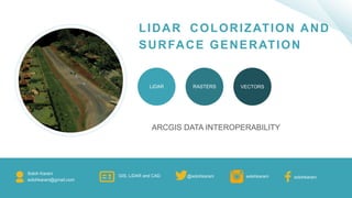
  • 1. LIDAR COLORIZATION AND SURFACE GENERATION LiDAR VECTORSRASTERS Soloh Karani solohkarani@gmail.com ARCGIS DATA INTEROPERABILITY GIS, LiDAR and CAD @solohkarani solohkarani solohkarani
  • 2. W E L C O M E ! Thank you for joining us today! Tuesday, March 1, 2016
  • 3. A G E N D A 3 4:02 PM Who are we? . INTRODUCTION 4:04 PM Why are we here? ABOUT THE MEETING 4:06 PM The actual LiDAR process WORKFLOW PRESENTATION 4:20 PM Give us your piece of mind . NEW IDEAS FROM THE TEAM 4:25 PM How have you felt? FEED BACK 4:30 PM We are open to queries CONTACT US
  • 4. 4 G E N E R A L L I D A R P R A C T I C E S A simplified practice L e v e l 1 L e v e l 2 L e v e l 3 FLYING PREPROCESSING PROCESSING AND OUTPUT Air Ops Air Ops and GSP GSP and Production
  • 5. 5 L i D A R ASPRS LAS .las BENTLEY POD .pod ASCII/XYZ .xyz TERRASOLID SCAN .scn ORACLE, E57, RDB, ZFS …... COMMON FORMATS
  • 6. 6 1 DELEANATE AOI Project areal coverage EXAMINE THE IMAGE Ensure the image is stored in a format that is supported by FME Readers CLASSIFY LiDAR Ground is the most important Class for production of DTM T H E W O R K F L O W The overall steps for Lidar colorization and surface generation in ArcGIS 2
  • 7. 7 2 CHECK PARAMETERS Set all the necessary parameters. SET THE OUTPUT Ensure your output datasets are in the right formats 3 INPUT DATA Feed you model with data (vector AOI, Point Clouds and Raster imagery)
  • 8. 8 3 CHECK OUTPUT Examine the quality of the output REDO(ALTER PARAMETERS AND COMPARE OUTPUT) Reset your parameters and rerun the model MAKE USE OF IT! Share the model 4
  • 9. 9 C U P O F C O F F E E / T E A R U L E Should a single process take more than the time it takes you to consume a cup of tea or coffee, don’t hesitate, kill the process and revisit your parameters Spatial ETL is Memory Sensitive
  • 10. 10 The Project Area of Interest The point cloud data in ASPRS LAS format(1.0, 1.1, 1……) The Orthophoto(RGB source) DATA INPUT
  • 11. 11 Port Transformer (similar to G.P Tool) Parameters TRANSFORMERS Connectors
  • 12. 12 Colorized LAS points DTM in 3D PDF Format Textured DTM in 3D PDF format DATA OUTPUT
  • 14. ABOUT US The Geoprocessing Tool LAS INPUT VECTOR INPUT IMAGE INPUT LAS OUTPUT DTM PDF OUTPUT
  • 22. 22 MANAGEABLE AOI Delineate a workable project area(time and resources) THE SECRET The recipe behind a quality GIS-LIDAR workflow MANAGEABLE INPUT(TILE) Input must proportional to resource input (machine specs) OUTPUT FORMAT Chose a universal format QUALITY OUPUT A satisfied client
  • 23. NEW IDEA? SHARE IT WITH US!
  • 24. T H A N K Y O U ! A N Y Q U E S T I O N S ? solohkarani@gmail.com