SlideShare une entreprise Scribd logo
1  sur  32
Weather
How to read the signs
By Kella Randolph M. Ed.
Photo https://wikitravel.org/upload/en/thumb/1/12/Tornado.jpg/300px-
Tornado.jpg
Weather refers to day-to-
day temperature and
precipitation activity.
• Climate is for the averaging of
atmospheric conditions over longer
periods of time.
Contents
Terms for weather
maps
How weather data
is collected
How weather
forecasting is done
Some types of
weather and their
weather map
symbols
Some terms for
weather maps
Air mass
Air pressure
Cold front
High-pressure system
Knot
Low-pressure system
Precipitation
Warm front
Air mass
• – a large body of air that is
similar in temperature,
humidity, and air pressure
throughout.
• Air masses can measure
hundreds or even thousands
of miles across.
• Image courtesy of
http://ww2010.atmos.uiuc.edu
/(Gh)/guides/maps/upa/jet.rx
ml
https://goo.gl/images/1TuUSD
Air pressure • – the force of air on a
surface.
• Air pressure is equal to the
weight of a vertical column of
air divided by the area of the
base of the column.
• Air pressure is measured in
millibars (mb).
• At sea level, air pressure
averages 1,013 millibars
• Image courtesy of NOAA
https://goo.gl/images/Yh6Mgy
Cold front
• Front– the boundary between an
advancing mass of relatively cold air
and a mass of warmer air.
• The denser cold air moves below
the warm air and pushes it up.
• Cold fronts often are associated
with gusty winds, intense rain, and
thunderstorms.
• On a weather map, a cold front
is indicated by a row of triangles.
• Image courtesy of the Cooperative Institute of
Atmospheric Studies https://goo.gl/images/yodiAx
High-pressure system
• High pressure system – a region in which
the atmospheric pressure is higher than in
the surrounding areas.
• High-pressure systems are associated with
relatively dry air and sunny weather.
• High-pressure systems are also known as
anticyclones.
• Image: https://goo.gl/images/q33jb5
Knot
knot– a unit of speed equal to
1.151 miles per hour.
The barbs on the “feathers”
point to the direction the wind
is coming from.
Image:
https://goo.gl/images/4mYdWY
How fast is
the wind
moving?
IMAGE:
HTTPS://GOO.GL/IMAGES/G
LI2XH
Low-pressure system
• a region in which the
atmospheric pressure is lower
than in the surrounding areas.
• Low-pressure systems are
associated with relatively
moist air and cloudy
conditions.
• Low-pressure systems are
also known as cyclones.
• Low pressure symbol is in
red
• https://goo.gl/images/JqsfRo
Precipitation
• Precipitation is water that
falls to Earth’s surface.
• Types of precipitation
include rain, sleet, snow, hail,
and mist.
• Image:
https://goo.gl/images/aEjEi7
• https://goo.gl/images/xt
Dfgf
Warm front • Warm front– the boundary
between an advancing mass of
relatively warm air and a mass
of colder air.
• The warm air moves above
the cold air, rising up gradually.
• Warm fronts are often
associated with overcast skies
and gentle showers.
• On a weather map, a warm
front is indicated by a row of
semicircles.
• https://goo.gl/images/6BnUJT
https://images.app.goo.gl/cgB8N4UsRcBDd7rQ9
https://images.app.goo.gl/HRfGvoNfG9ENREVY8
https://images.app.goo.gl/G9j4YTPMHb1GhS6c8
Jet Stream
current of rapidly moving air
• The jet stream is a current of fast-moving
air found in the upper levels of the
atmosphere. This rapid current is typically
thousands of kilometers long, a few hundred
kilometers wide, and only a few kilometers
thick. Jet streams are usually found
somewhere between 10-15 km (6-9 miles)
above the earth's surface. The position of
this upper-level jet stream denotes the
location of the strongest SURFACE
temperature contrast (as in the diagram to
the right).
• Map courtesy of the University of Illinois:
http://ww2010.atmos.uiuc.edu/(Gh)/guides/maps/upa/jet.rxml
Jet streams • During the winter months, Arctic and
tropical air masses create a stronger surface
temperature contrast resulting in a strong
jet stream. However, during the summer
months, when the surface temperature
variation is less dramatic, the winds of the
jet are weaker.
• Below is an ETA Model forecast panel for
300 mb winds and geopotential heights
(white contours). The color filled regions
indicate wind speed in knots and is color
coded according to the legend at the bottom
of the image. The shades of blue indicate
winds less than 60 knots, while winds
greater than 120 knots are given in shades
of red.
• Image:
https://images.app.goo.gl/syvkQ5bRdUJhrtZ
h9
How weather data is collected
• Radars have an important role in the field of meteorology.
These devices send out and receive signals providing valuable
information about the location and intensity of precipitation.
Advanced Doppler radar technology goes beyond simple
detection to providing high resolution reflectivity and
estimated velocity data, which is vital to short term
forecasting and severe weather prediction. Satellites
• Graphic by: Steven E. Hall:
http://ww2010.atmos.uiuc.edu/(Gh)/guides/rs/home.rxml https://images.app.goo.gl/empXefZmYgSKtybZ8
https://images.app.goo.gl/q6hQzN944JvLtdEY8
How weather
forecasting is
done
https://www.star.nesdis.noaa.gov/GOES/GOES
16_CONUS.php
Photo by NASA / Public domain
GOES and POES satellites
• The Geostationary Operational Environmental Satellite (GOES)/ Polar Operational
Environmental Satellite (POES) program is a key element in National Weather Service
(NWS) operations.
• The GOES/POES mission is composed of two geostationary satellites and two polar
orbiting satellites. These satellites operate in pairs. The geostationary satellites, GOES-
East covering the East Coast and GOES-West covering the West Coast, provide real-time
weather data for use in short-term weather forecasting (warnings of severe weather) and
space environment monitoring, as well as research and development. The polar orbiting
satellites primarily provide long-range weather forecasting, ensuring that non-visible
data, for any region of the Earth, are no more than six hours old
• NASA: https://science.nasa.gov/earth-science/programs/goes-poes
Weather satellites can see Earth from space.
Geostationary Operational
Environmental Satellite (GOES)/
Polar Operational Environmental
Satellites (POES
https://www.ospo.noaa.gov/Operations/POES/ind
ex.html
https://upload.wikimedia.org/wikipedia/commons/thumb/7/74/GOES-8_thru_GOES-
12_Spac0256.jpg/600px-GOES-8_thru_GOES-12_Spac0256.jpg
Photo of earth made by the GOES-East Image Viewer
Full Disk View - GeoColor : 7 Mar 2018 - 1700 GMT
https://www.star.nesdis.noaa.gov/GOES/
https://images.app.goo.gl/ro2K4zDDmBMBVw5x9
https://images.app.goo.gl/bvfwxUSGrCnxMGg8A
GOES
The Geostationary
Operational
Environmental
Satellite system (GOES),
operated by the United States'
National Oceanic and
Atmospheric Administration's
National
Environmental Satellite, Data,
and Information Service
division, supports weather
forecasting, severe storm
tracking, and meteorology
research.
• Geostationary Operational Environmental Satellite -
Wikipedia
• https://en.wikipedia.org/wiki/Geostationary_Operat
ional_Environmental_Satellite
NOAA retires polar-orbiting satellite
Satellite exceeded anticipated lifespan by eight
years
April 10, 2013
• It was one of NOAA's longest
operating spacecraft, which have a
typical lifespan of three years. The
shutdown will result in no data gap, as
NOAA-17 was being used as a back-up
satellite and was removed from service
after several key systems on board
became inoperable.
• NOAA and its partners at the
National Aeronautics and Space
Administration (NASA) are continuing
to build the next generation of polar-
orbiting satellites, the Joint Polar
Satellite System (JPSS), which is
scheduled to launch the JPSS-1 satellite
in 2017.
• http://www.noaanews.noaa.gov/sto
ries2013/20130410_noaa17retire.html
POES Satellite
http://images.slideplayer.com/12/3
384033/slides/slide_4.jpg
Sea Surface Temperature
Anne O’Carroll (European Organisation
for the Exploitation of Meteorological
Satellites, EUMETSAT)
Kenneth S. Casey (National Oceanic
and Atmospheric Administration,
NOAA)
http://ceos.org/ourwork/virtual-
constellations/sst/
NASA's Earth science program
uses satellite imaging
• This is a composite image of
the North African Continent. A
dust storm can be seen
blowing off the coast of
Morocco in the northwest
corner.
• Image: MODIS band combination 1,4,3.
https://science.nasa.gov/earth-science
Some types of weather and
their weather map symbols
Courtesy of Weather.gov
https://goo.gl/images/gA5TB
N
How to Read the
Symbols and Colors
on Weather Maps
• Published January 29, 2016, Written by Tiffany Means,
• https://goo.gl/images/jWSmLt
The Beaufort Scale is the standard
measurement for describing wind
speed and associated wave height
with sea conditions on a scale of 1-12
with 1 being calm, flat conditions and
12 being hurricane force winds
greater than 118 km/hour with huge
waves in excess of 14 meters.
Saved from Swimswithseals.com
https://www.pinterest.com/pin/752241943
979266243/
Works cited
• Teachers and Educators: Permission is hereby granted to individual teachers to print out,
copy and distribute the pages herein to their students for educational purposes: University of
Illinois
http://ww2010.atmos.uiuc.edu/(Gh)/wwhlpr/terms.rxml?hret=/guides/maps/upa/jet.rxml
• https://goo.gl/images/gA5TBN
• http://ceos.org/ourwork/virtual-constellations/sst/

Contenu connexe

Tendances

Tools for weather forecasting
Tools for weather forecastingTools for weather forecasting
Tools for weather forecastingammulachu
 
Simulating Weather: Numerical Weather Prediction as Computational Simulation
Simulating Weather: Numerical Weather Prediction as Computational SimulationSimulating Weather: Numerical Weather Prediction as Computational Simulation
Simulating Weather: Numerical Weather Prediction as Computational SimulationTing-Shuo Yo
 
Virginia Space Update January 13, 2015 Wallops Island Regional Alliance
Virginia Space Update January 13, 2015 Wallops Island Regional AllianceVirginia Space Update January 13, 2015 Wallops Island Regional Alliance
Virginia Space Update January 13, 2015 Wallops Island Regional AllianceWallopsIslandRegionalAlliance
 
Weather forecasting
Weather forecastingWeather forecasting
Weather forecastingESSBY
 
TIME INTEGRATION OF EVAPOTRANSPIRATION USING A TWO SOURCE SURFACE ENERGY BALA...
TIME INTEGRATION OF EVAPOTRANSPIRATION USING A TWO SOURCE SURFACE ENERGY BALA...TIME INTEGRATION OF EVAPOTRANSPIRATION USING A TWO SOURCE SURFACE ENERGY BALA...
TIME INTEGRATION OF EVAPOTRANSPIRATION USING A TWO SOURCE SURFACE ENERGY BALA...Ramesh Dhungel
 
5 - K Prasad - Weather forecasting in modern age-Sep-16
5 - K Prasad - Weather forecasting in  modern age-Sep-165 - K Prasad - Weather forecasting in  modern age-Sep-16
5 - K Prasad - Weather forecasting in modern age-Sep-16indiawrm
 
Time integration of evapotranspiration using a two source surface energy bala...
Time integration of evapotranspiration using a two source surface energy bala...Time integration of evapotranspiration using a two source surface energy bala...
Time integration of evapotranspiration using a two source surface energy bala...Ramesh Dhungel
 
2013 ASPRS Track, Developing an ArcGIS Toolbox for Estimating EvapoTranspirat...
2013 ASPRS Track, Developing an ArcGIS Toolbox for Estimating EvapoTranspirat...2013 ASPRS Track, Developing an ArcGIS Toolbox for Estimating EvapoTranspirat...
2013 ASPRS Track, Developing an ArcGIS Toolbox for Estimating EvapoTranspirat...GIS in the Rockies
 
Unit 5 2014 South Napa earthquake presentation
Unit 5 2014 South Napa earthquake presentationUnit 5 2014 South Napa earthquake presentation
Unit 5 2014 South Napa earthquake presentationSERC at Carleton College
 
Cliff Mass: Big Data and Weather Prediction - Seattle Interactive 2015
Cliff Mass: Big Data and Weather Prediction - Seattle Interactive 2015Cliff Mass: Big Data and Weather Prediction - Seattle Interactive 2015
Cliff Mass: Big Data and Weather Prediction - Seattle Interactive 2015Seattle Interactive Conference
 
Weather: my report in earth science
Weather: my report in earth scienceWeather: my report in earth science
Weather: my report in earth scienceGlenda Mora
 
Spatial-temporal Characterization of Hurricane Path using GNSS-derived Precip...
Spatial-temporal Characterization of Hurricane Path using GNSS-derived Precip...Spatial-temporal Characterization of Hurricane Path using GNSS-derived Precip...
Spatial-temporal Characterization of Hurricane Path using GNSS-derived Precip...CSCJournals
 

Tendances (20)

Tools for weather forecasting
Tools for weather forecastingTools for weather forecasting
Tools for weather forecasting
 
Dryden2011Poster
Dryden2011PosterDryden2011Poster
Dryden2011Poster
 
Simulating Weather: Numerical Weather Prediction as Computational Simulation
Simulating Weather: Numerical Weather Prediction as Computational SimulationSimulating Weather: Numerical Weather Prediction as Computational Simulation
Simulating Weather: Numerical Weather Prediction as Computational Simulation
 
Virginia Space Update January 13, 2015 Wallops Island Regional Alliance
Virginia Space Update January 13, 2015 Wallops Island Regional AllianceVirginia Space Update January 13, 2015 Wallops Island Regional Alliance
Virginia Space Update January 13, 2015 Wallops Island Regional Alliance
 
Weather forecasting
Weather forecastingWeather forecasting
Weather forecasting
 
Weather forecasting
Weather forecastingWeather forecasting
Weather forecasting
 
weather forecasting
weather forecasting weather forecasting
weather forecasting
 
Event 31
Event 31Event 31
Event 31
 
TIME INTEGRATION OF EVAPOTRANSPIRATION USING A TWO SOURCE SURFACE ENERGY BALA...
TIME INTEGRATION OF EVAPOTRANSPIRATION USING A TWO SOURCE SURFACE ENERGY BALA...TIME INTEGRATION OF EVAPOTRANSPIRATION USING A TWO SOURCE SURFACE ENERGY BALA...
TIME INTEGRATION OF EVAPOTRANSPIRATION USING A TWO SOURCE SURFACE ENERGY BALA...
 
FLARE_Brief
FLARE_BriefFLARE_Brief
FLARE_Brief
 
5 - K Prasad - Weather forecasting in modern age-Sep-16
5 - K Prasad - Weather forecasting in  modern age-Sep-165 - K Prasad - Weather forecasting in  modern age-Sep-16
5 - K Prasad - Weather forecasting in modern age-Sep-16
 
Time integration of evapotranspiration using a two source surface energy bala...
Time integration of evapotranspiration using a two source surface energy bala...Time integration of evapotranspiration using a two source surface energy bala...
Time integration of evapotranspiration using a two source surface energy bala...
 
MUSE
MUSEMUSE
MUSE
 
2013 ASPRS Track, Developing an ArcGIS Toolbox for Estimating EvapoTranspirat...
2013 ASPRS Track, Developing an ArcGIS Toolbox for Estimating EvapoTranspirat...2013 ASPRS Track, Developing an ArcGIS Toolbox for Estimating EvapoTranspirat...
2013 ASPRS Track, Developing an ArcGIS Toolbox for Estimating EvapoTranspirat...
 
Unit 5 2014 South Napa earthquake presentation
Unit 5 2014 South Napa earthquake presentationUnit 5 2014 South Napa earthquake presentation
Unit 5 2014 South Napa earthquake presentation
 
Cliff Mass: Big Data and Weather Prediction - Seattle Interactive 2015
Cliff Mass: Big Data and Weather Prediction - Seattle Interactive 2015Cliff Mass: Big Data and Weather Prediction - Seattle Interactive 2015
Cliff Mass: Big Data and Weather Prediction - Seattle Interactive 2015
 
Weather: my report in earth science
Weather: my report in earth scienceWeather: my report in earth science
Weather: my report in earth science
 
Spatial-temporal Characterization of Hurricane Path using GNSS-derived Precip...
Spatial-temporal Characterization of Hurricane Path using GNSS-derived Precip...Spatial-temporal Characterization of Hurricane Path using GNSS-derived Precip...
Spatial-temporal Characterization of Hurricane Path using GNSS-derived Precip...
 
NS2 3.5 Weather Forecasting
NS2 3.5 Weather ForecastingNS2 3.5 Weather Forecasting
NS2 3.5 Weather Forecasting
 
WEATHER FORECASTING
WEATHER FORECASTINGWEATHER FORECASTING
WEATHER FORECASTING
 

Similaire à Weather satellites and how to read the signs

Davies 2011 chaser con forecast school slideshare
Davies 2011 chaser con forecast school slideshareDavies 2011 chaser con forecast school slideshare
Davies 2011 chaser con forecast school slidesharejd0955
 
Making the invisible visible
Making the invisible visibleMaking the invisible visible
Making the invisible visibleWania Pereira
 
Atmospheric Dispersion in Nuclear Power Plant Siting
Atmospheric Dispersion in Nuclear Power Plant SitingAtmospheric Dispersion in Nuclear Power Plant Siting
Atmospheric Dispersion in Nuclear Power Plant SitingHussain Majid
 
CAAC_Downbursts_Fog_KP
CAAC_Downbursts_Fog_KPCAAC_Downbursts_Fog_KP
CAAC_Downbursts_Fog_KPKen Pryor
 
Near real time ash cloud
Near real time ash cloudNear real time ash cloud
Near real time ash cloudAndrew Zolnai
 
Global precip measuring mission article
Global precip measuring mission articleGlobal precip measuring mission article
Global precip measuring mission articlejcv57
 
Lab eight midlatitude cyclones
Lab eight midlatitude cyclonesLab eight midlatitude cyclones
Lab eight midlatitude cyclonesLisa Schmidt
 
Forecasting (1).ppt
Forecasting (1).pptForecasting (1).ppt
Forecasting (1).pptfffff44
 
Hydrology_Lecture note on chapter two about precipitation occurrence
Hydrology_Lecture note on chapter two about precipitation occurrenceHydrology_Lecture note on chapter two about precipitation occurrence
Hydrology_Lecture note on chapter two about precipitation occurrenceGetachew563258
 
Physics Wind , Storms and Cyclone's ppt
Physics Wind , Storms and Cyclone's pptPhysics Wind , Storms and Cyclone's ppt
Physics Wind , Storms and Cyclone's pptAditya Gupta
 
Satellite Observations Of Rainfall And Water Vapor
Satellite Observations Of Rainfall And Water VaporSatellite Observations Of Rainfall And Water Vapor
Satellite Observations Of Rainfall And Water Vaporkehowell
 
Space Weather: Forecasting, Tracking, and the Effects of Earth Directed Solar...
Space Weather: Forecasting, Tracking, and the Effects of Earth Directed Solar...Space Weather: Forecasting, Tracking, and the Effects of Earth Directed Solar...
Space Weather: Forecasting, Tracking, and the Effects of Earth Directed Solar...Emily Schomp
 
Weather fronts
Weather frontsWeather fronts
Weather frontsJoanne
 
Christopher Yang Poster_NHedit
Christopher Yang Poster_NHeditChristopher Yang Poster_NHedit
Christopher Yang Poster_NHeditChristopher Yang
 
weather_forecasting_Archana_ppt.pptx
weather_forecasting_Archana_ppt.pptxweather_forecasting_Archana_ppt.pptx
weather_forecasting_Archana_ppt.pptxarchana reddy
 
Stratospheric satellitesjun01
Stratospheric satellitesjun01Stratospheric satellitesjun01
Stratospheric satellitesjun01Clifford Stone
 

Similaire à Weather satellites and how to read the signs (20)

Davies 2011 chaser con forecast school slideshare
Davies 2011 chaser con forecast school slideshareDavies 2011 chaser con forecast school slideshare
Davies 2011 chaser con forecast school slideshare
 
Making the invisible visible
Making the invisible visibleMaking the invisible visible
Making the invisible visible
 
Weather and Climate
Weather and Climate Weather and Climate
Weather and Climate
 
Atmospheric Dispersion in Nuclear Power Plant Siting
Atmospheric Dispersion in Nuclear Power Plant SitingAtmospheric Dispersion in Nuclear Power Plant Siting
Atmospheric Dispersion in Nuclear Power Plant Siting
 
CAAC_Downbursts_Fog_KP
CAAC_Downbursts_Fog_KPCAAC_Downbursts_Fog_KP
CAAC_Downbursts_Fog_KP
 
Near real time ash cloud
Near real time ash cloudNear real time ash cloud
Near real time ash cloud
 
Global precip measuring mission article
Global precip measuring mission articleGlobal precip measuring mission article
Global precip measuring mission article
 
Lab eight midlatitude cyclones
Lab eight midlatitude cyclonesLab eight midlatitude cyclones
Lab eight midlatitude cyclones
 
Forecasting (1).ppt
Forecasting (1).pptForecasting (1).ppt
Forecasting (1).ppt
 
Hydrology_Lecture note on chapter two about precipitation occurrence
Hydrology_Lecture note on chapter two about precipitation occurrenceHydrology_Lecture note on chapter two about precipitation occurrence
Hydrology_Lecture note on chapter two about precipitation occurrence
 
Ll3519561960
Ll3519561960Ll3519561960
Ll3519561960
 
Physics Wind , Storms and Cyclone's ppt
Physics Wind , Storms and Cyclone's pptPhysics Wind , Storms and Cyclone's ppt
Physics Wind , Storms and Cyclone's ppt
 
Introduction to Engineering Hydrology
Introduction to Engineering HydrologyIntroduction to Engineering Hydrology
Introduction to Engineering Hydrology
 
Satellite Observations Of Rainfall And Water Vapor
Satellite Observations Of Rainfall And Water VaporSatellite Observations Of Rainfall And Water Vapor
Satellite Observations Of Rainfall And Water Vapor
 
Space Weather: Forecasting, Tracking, and the Effects of Earth Directed Solar...
Space Weather: Forecasting, Tracking, and the Effects of Earth Directed Solar...Space Weather: Forecasting, Tracking, and the Effects of Earth Directed Solar...
Space Weather: Forecasting, Tracking, and the Effects of Earth Directed Solar...
 
Weather fronts
Weather frontsWeather fronts
Weather fronts
 
Christopher Yang Poster_NHedit
Christopher Yang Poster_NHeditChristopher Yang Poster_NHedit
Christopher Yang Poster_NHedit
 
Flash flood
Flash floodFlash flood
Flash flood
 
weather_forecasting_Archana_ppt.pptx
weather_forecasting_Archana_ppt.pptxweather_forecasting_Archana_ppt.pptx
weather_forecasting_Archana_ppt.pptx
 
Stratospheric satellitesjun01
Stratospheric satellitesjun01Stratospheric satellitesjun01
Stratospheric satellitesjun01
 

Plus de Kella Randolph

Earth and environmental science part 2 of 4
Earth and environmental science part 2 of 4 Earth and environmental science part 2 of 4
Earth and environmental science part 2 of 4 Kella Randolph
 
Earth and environmental science part 4 of 4
Earth and environmental science part 4 of 4Earth and environmental science part 4 of 4
Earth and environmental science part 4 of 4Kella Randolph
 
Earth and environmental science review part 3 of 4
Earth and environmental science review part 3 of 4Earth and environmental science review part 3 of 4
Earth and environmental science review part 3 of 4Kella Randolph
 
Earth and environmental science part 2 of 4 1 (1)
Earth and environmental science part 2 of 4 1 (1)Earth and environmental science part 2 of 4 1 (1)
Earth and environmental science part 2 of 4 1 (1)Kella Randolph
 
Earth and environmental science review part 3 of 4
Earth and environmental science review part 3 of 4Earth and environmental science review part 3 of 4
Earth and environmental science review part 3 of 4Kella Randolph
 
Review for earth and environmental science final
Review for earth and environmental science final Review for earth and environmental science final
Review for earth and environmental science final Kella Randolph
 
Earth and environmental science review day one (1)
Earth and environmental science review day one (1)Earth and environmental science review day one (1)
Earth and environmental science review day one (1)Kella Randolph
 
The berlin conference of 1884
The berlin conference of 1884The berlin conference of 1884
The berlin conference of 1884Kella Randolph
 
Planetary motion study guide
Planetary motion study guidePlanetary motion study guide
Planetary motion study guideKella Randolph
 
Review earth and environmental science
Review earth and environmental scienceReview earth and environmental science
Review earth and environmental scienceKella Randolph
 
Earth and moon impact theory
Earth and moon impact theoryEarth and moon impact theory
Earth and moon impact theoryKella Randolph
 
Barrier islands and estuaries
Barrier islands and estuariesBarrier islands and estuaries
Barrier islands and estuariesKella Randolph
 
Review of seven of earth's biomes
Review of seven of earth's biomesReview of seven of earth's biomes
Review of seven of earth's biomesKella Randolph
 
Koppen classification and land area characteristics [autosaved]
Koppen classification and land area characteristics [autosaved]Koppen classification and land area characteristics [autosaved]
Koppen classification and land area characteristics [autosaved]Kella Randolph
 
Vocabulary the greenhouse effect
Vocabulary the greenhouse effectVocabulary the greenhouse effect
Vocabulary the greenhouse effectKella Randolph
 
Turbidity and water pollution
Turbidity and  water pollutionTurbidity and  water pollution
Turbidity and water pollutionKella Randolph
 
Review human impact on the earth
Review human impact on the earthReview human impact on the earth
Review human impact on the earthKella Randolph
 
Hydrology presentation
Hydrology presentationHydrology presentation
Hydrology presentationKella Randolph
 
The structure of the earth
The structure of the earthThe structure of the earth
The structure of the earthKella Randolph
 

Plus de Kella Randolph (20)

Earth and environmental science part 2 of 4
Earth and environmental science part 2 of 4 Earth and environmental science part 2 of 4
Earth and environmental science part 2 of 4
 
Earth and environmental science part 4 of 4
Earth and environmental science part 4 of 4Earth and environmental science part 4 of 4
Earth and environmental science part 4 of 4
 
Earth and environmental science review part 3 of 4
Earth and environmental science review part 3 of 4Earth and environmental science review part 3 of 4
Earth and environmental science review part 3 of 4
 
Earth and environmental science part 2 of 4 1 (1)
Earth and environmental science part 2 of 4 1 (1)Earth and environmental science part 2 of 4 1 (1)
Earth and environmental science part 2 of 4 1 (1)
 
Earth and environmental science review part 3 of 4
Earth and environmental science review part 3 of 4Earth and environmental science review part 3 of 4
Earth and environmental science review part 3 of 4
 
Review for earth and environmental science final
Review for earth and environmental science final Review for earth and environmental science final
Review for earth and environmental science final
 
Earth and environmental science review day one (1)
Earth and environmental science review day one (1)Earth and environmental science review day one (1)
Earth and environmental science review day one (1)
 
The berlin conference of 1884
The berlin conference of 1884The berlin conference of 1884
The berlin conference of 1884
 
Planetary motion study guide
Planetary motion study guidePlanetary motion study guide
Planetary motion study guide
 
Review earth and environmental science
Review earth and environmental scienceReview earth and environmental science
Review earth and environmental science
 
Earth and moon impact theory
Earth and moon impact theoryEarth and moon impact theory
Earth and moon impact theory
 
Barrier islands and estuaries
Barrier islands and estuariesBarrier islands and estuaries
Barrier islands and estuaries
 
Review of seven of earth's biomes
Review of seven of earth's biomesReview of seven of earth's biomes
Review of seven of earth's biomes
 
Koppen classification and land area characteristics [autosaved]
Koppen classification and land area characteristics [autosaved]Koppen classification and land area characteristics [autosaved]
Koppen classification and land area characteristics [autosaved]
 
Vocabulary the greenhouse effect
Vocabulary the greenhouse effectVocabulary the greenhouse effect
Vocabulary the greenhouse effect
 
Turbidity and water pollution
Turbidity and  water pollutionTurbidity and  water pollution
Turbidity and water pollution
 
Review human impact on the earth
Review human impact on the earthReview human impact on the earth
Review human impact on the earth
 
Hydrology presentation
Hydrology presentationHydrology presentation
Hydrology presentation
 
Common fossil fuels
Common fossil fuels Common fossil fuels
Common fossil fuels
 
The structure of the earth
The structure of the earthThe structure of the earth
The structure of the earth
 

Dernier

THEORIES OF ORGANIZATION-PUBLIC ADMINISTRATION
THEORIES OF ORGANIZATION-PUBLIC ADMINISTRATIONTHEORIES OF ORGANIZATION-PUBLIC ADMINISTRATION
THEORIES OF ORGANIZATION-PUBLIC ADMINISTRATIONHumphrey A Beña
 
4.16.24 21st Century Movements for Black Lives.pptx
4.16.24 21st Century Movements for Black Lives.pptx4.16.24 21st Century Movements for Black Lives.pptx
4.16.24 21st Century Movements for Black Lives.pptxmary850239
 
Visit to a blind student's school🧑‍🦯🧑‍🦯(community medicine)
Visit to a blind student's school🧑‍🦯🧑‍🦯(community medicine)Visit to a blind student's school🧑‍🦯🧑‍🦯(community medicine)
Visit to a blind student's school🧑‍🦯🧑‍🦯(community medicine)lakshayb543
 
Culture Uniformity or Diversity IN SOCIOLOGY.pptx
Culture Uniformity or Diversity IN SOCIOLOGY.pptxCulture Uniformity or Diversity IN SOCIOLOGY.pptx
Culture Uniformity or Diversity IN SOCIOLOGY.pptxPoojaSen20
 
Earth Day Presentation wow hello nice great
Earth Day Presentation wow hello nice greatEarth Day Presentation wow hello nice great
Earth Day Presentation wow hello nice greatYousafMalik24
 
How to do quick user assign in kanban in Odoo 17 ERP
How to do quick user assign in kanban in Odoo 17 ERPHow to do quick user assign in kanban in Odoo 17 ERP
How to do quick user assign in kanban in Odoo 17 ERPCeline George
 
GRADE 4 - SUMMATIVE TEST QUARTER 4 ALL SUBJECTS
GRADE 4 - SUMMATIVE TEST QUARTER 4 ALL SUBJECTSGRADE 4 - SUMMATIVE TEST QUARTER 4 ALL SUBJECTS
GRADE 4 - SUMMATIVE TEST QUARTER 4 ALL SUBJECTSJoshuaGantuangco2
 
Virtual-Orientation-on-the-Administration-of-NATG12-NATG6-and-ELLNA.pdf
Virtual-Orientation-on-the-Administration-of-NATG12-NATG6-and-ELLNA.pdfVirtual-Orientation-on-the-Administration-of-NATG12-NATG6-and-ELLNA.pdf
Virtual-Orientation-on-the-Administration-of-NATG12-NATG6-and-ELLNA.pdfErwinPantujan2
 
What is Model Inheritance in Odoo 17 ERP
What is Model Inheritance in Odoo 17 ERPWhat is Model Inheritance in Odoo 17 ERP
What is Model Inheritance in Odoo 17 ERPCeline George
 
Proudly South Africa powerpoint Thorisha.pptx
Proudly South Africa powerpoint Thorisha.pptxProudly South Africa powerpoint Thorisha.pptx
Proudly South Africa powerpoint Thorisha.pptxthorishapillay1
 
Concurrency Control in Database Management system
Concurrency Control in Database Management systemConcurrency Control in Database Management system
Concurrency Control in Database Management systemChristalin Nelson
 
Procuring digital preservation CAN be quick and painless with our new dynamic...
Procuring digital preservation CAN be quick and painless with our new dynamic...Procuring digital preservation CAN be quick and painless with our new dynamic...
Procuring digital preservation CAN be quick and painless with our new dynamic...Jisc
 
FILIPINO PSYCHology sikolohiyang pilipino
FILIPINO PSYCHology sikolohiyang pilipinoFILIPINO PSYCHology sikolohiyang pilipino
FILIPINO PSYCHology sikolohiyang pilipinojohnmickonozaleda
 
ECONOMIC CONTEXT - PAPER 1 Q3: NEWSPAPERS.pptx
ECONOMIC CONTEXT - PAPER 1 Q3: NEWSPAPERS.pptxECONOMIC CONTEXT - PAPER 1 Q3: NEWSPAPERS.pptx
ECONOMIC CONTEXT - PAPER 1 Q3: NEWSPAPERS.pptxiammrhaywood
 
INTRODUCTION TO CATHOLIC CHRISTOLOGY.pptx
INTRODUCTION TO CATHOLIC CHRISTOLOGY.pptxINTRODUCTION TO CATHOLIC CHRISTOLOGY.pptx
INTRODUCTION TO CATHOLIC CHRISTOLOGY.pptxHumphrey A Beña
 
Incoming and Outgoing Shipments in 3 STEPS Using Odoo 17
Incoming and Outgoing Shipments in 3 STEPS Using Odoo 17Incoming and Outgoing Shipments in 3 STEPS Using Odoo 17
Incoming and Outgoing Shipments in 3 STEPS Using Odoo 17Celine George
 

Dernier (20)

THEORIES OF ORGANIZATION-PUBLIC ADMINISTRATION
THEORIES OF ORGANIZATION-PUBLIC ADMINISTRATIONTHEORIES OF ORGANIZATION-PUBLIC ADMINISTRATION
THEORIES OF ORGANIZATION-PUBLIC ADMINISTRATION
 
4.16.24 21st Century Movements for Black Lives.pptx
4.16.24 21st Century Movements for Black Lives.pptx4.16.24 21st Century Movements for Black Lives.pptx
4.16.24 21st Century Movements for Black Lives.pptx
 
YOUVE_GOT_EMAIL_PRELIMS_EL_DORADO_2024.pptx
YOUVE_GOT_EMAIL_PRELIMS_EL_DORADO_2024.pptxYOUVE_GOT_EMAIL_PRELIMS_EL_DORADO_2024.pptx
YOUVE_GOT_EMAIL_PRELIMS_EL_DORADO_2024.pptx
 
Visit to a blind student's school🧑‍🦯🧑‍🦯(community medicine)
Visit to a blind student's school🧑‍🦯🧑‍🦯(community medicine)Visit to a blind student's school🧑‍🦯🧑‍🦯(community medicine)
Visit to a blind student's school🧑‍🦯🧑‍🦯(community medicine)
 
Model Call Girl in Tilak Nagar Delhi reach out to us at 🔝9953056974🔝
Model Call Girl in Tilak Nagar Delhi reach out to us at 🔝9953056974🔝Model Call Girl in Tilak Nagar Delhi reach out to us at 🔝9953056974🔝
Model Call Girl in Tilak Nagar Delhi reach out to us at 🔝9953056974🔝
 
Raw materials used in Herbal Cosmetics.pptx
Raw materials used in Herbal Cosmetics.pptxRaw materials used in Herbal Cosmetics.pptx
Raw materials used in Herbal Cosmetics.pptx
 
Culture Uniformity or Diversity IN SOCIOLOGY.pptx
Culture Uniformity or Diversity IN SOCIOLOGY.pptxCulture Uniformity or Diversity IN SOCIOLOGY.pptx
Culture Uniformity or Diversity IN SOCIOLOGY.pptx
 
Earth Day Presentation wow hello nice great
Earth Day Presentation wow hello nice greatEarth Day Presentation wow hello nice great
Earth Day Presentation wow hello nice great
 
How to do quick user assign in kanban in Odoo 17 ERP
How to do quick user assign in kanban in Odoo 17 ERPHow to do quick user assign in kanban in Odoo 17 ERP
How to do quick user assign in kanban in Odoo 17 ERP
 
GRADE 4 - SUMMATIVE TEST QUARTER 4 ALL SUBJECTS
GRADE 4 - SUMMATIVE TEST QUARTER 4 ALL SUBJECTSGRADE 4 - SUMMATIVE TEST QUARTER 4 ALL SUBJECTS
GRADE 4 - SUMMATIVE TEST QUARTER 4 ALL SUBJECTS
 
Virtual-Orientation-on-the-Administration-of-NATG12-NATG6-and-ELLNA.pdf
Virtual-Orientation-on-the-Administration-of-NATG12-NATG6-and-ELLNA.pdfVirtual-Orientation-on-the-Administration-of-NATG12-NATG6-and-ELLNA.pdf
Virtual-Orientation-on-the-Administration-of-NATG12-NATG6-and-ELLNA.pdf
 
What is Model Inheritance in Odoo 17 ERP
What is Model Inheritance in Odoo 17 ERPWhat is Model Inheritance in Odoo 17 ERP
What is Model Inheritance in Odoo 17 ERP
 
Proudly South Africa powerpoint Thorisha.pptx
Proudly South Africa powerpoint Thorisha.pptxProudly South Africa powerpoint Thorisha.pptx
Proudly South Africa powerpoint Thorisha.pptx
 
Concurrency Control in Database Management system
Concurrency Control in Database Management systemConcurrency Control in Database Management system
Concurrency Control in Database Management system
 
Procuring digital preservation CAN be quick and painless with our new dynamic...
Procuring digital preservation CAN be quick and painless with our new dynamic...Procuring digital preservation CAN be quick and painless with our new dynamic...
Procuring digital preservation CAN be quick and painless with our new dynamic...
 
FILIPINO PSYCHology sikolohiyang pilipino
FILIPINO PSYCHology sikolohiyang pilipinoFILIPINO PSYCHology sikolohiyang pilipino
FILIPINO PSYCHology sikolohiyang pilipino
 
YOUVE GOT EMAIL_FINALS_EL_DORADO_2024.pptx
YOUVE GOT EMAIL_FINALS_EL_DORADO_2024.pptxYOUVE GOT EMAIL_FINALS_EL_DORADO_2024.pptx
YOUVE GOT EMAIL_FINALS_EL_DORADO_2024.pptx
 
ECONOMIC CONTEXT - PAPER 1 Q3: NEWSPAPERS.pptx
ECONOMIC CONTEXT - PAPER 1 Q3: NEWSPAPERS.pptxECONOMIC CONTEXT - PAPER 1 Q3: NEWSPAPERS.pptx
ECONOMIC CONTEXT - PAPER 1 Q3: NEWSPAPERS.pptx
 
INTRODUCTION TO CATHOLIC CHRISTOLOGY.pptx
INTRODUCTION TO CATHOLIC CHRISTOLOGY.pptxINTRODUCTION TO CATHOLIC CHRISTOLOGY.pptx
INTRODUCTION TO CATHOLIC CHRISTOLOGY.pptx
 
Incoming and Outgoing Shipments in 3 STEPS Using Odoo 17
Incoming and Outgoing Shipments in 3 STEPS Using Odoo 17Incoming and Outgoing Shipments in 3 STEPS Using Odoo 17
Incoming and Outgoing Shipments in 3 STEPS Using Odoo 17
 

Weather satellites and how to read the signs

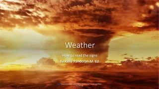
  • 1. Weather How to read the signs By Kella Randolph M. Ed. Photo https://wikitravel.org/upload/en/thumb/1/12/Tornado.jpg/300px- Tornado.jpg
  • 2. Weather refers to day-to- day temperature and precipitation activity. • Climate is for the averaging of atmospheric conditions over longer periods of time.
  • 3. Contents Terms for weather maps How weather data is collected How weather forecasting is done Some types of weather and their weather map symbols
  • 4. Some terms for weather maps Air mass Air pressure Cold front High-pressure system Knot Low-pressure system Precipitation Warm front
  • 5. Air mass • – a large body of air that is similar in temperature, humidity, and air pressure throughout. • Air masses can measure hundreds or even thousands of miles across. • Image courtesy of http://ww2010.atmos.uiuc.edu /(Gh)/guides/maps/upa/jet.rx ml https://goo.gl/images/1TuUSD
  • 6. Air pressure • – the force of air on a surface. • Air pressure is equal to the weight of a vertical column of air divided by the area of the base of the column. • Air pressure is measured in millibars (mb). • At sea level, air pressure averages 1,013 millibars • Image courtesy of NOAA https://goo.gl/images/Yh6Mgy
  • 7. Cold front • Front– the boundary between an advancing mass of relatively cold air and a mass of warmer air. • The denser cold air moves below the warm air and pushes it up. • Cold fronts often are associated with gusty winds, intense rain, and thunderstorms. • On a weather map, a cold front is indicated by a row of triangles. • Image courtesy of the Cooperative Institute of Atmospheric Studies https://goo.gl/images/yodiAx
  • 8. High-pressure system • High pressure system – a region in which the atmospheric pressure is higher than in the surrounding areas. • High-pressure systems are associated with relatively dry air and sunny weather. • High-pressure systems are also known as anticyclones. • Image: https://goo.gl/images/q33jb5
  • 9. Knot knot– a unit of speed equal to 1.151 miles per hour. The barbs on the “feathers” point to the direction the wind is coming from. Image: https://goo.gl/images/4mYdWY
  • 10. How fast is the wind moving? IMAGE: HTTPS://GOO.GL/IMAGES/G LI2XH
  • 11. Low-pressure system • a region in which the atmospheric pressure is lower than in the surrounding areas. • Low-pressure systems are associated with relatively moist air and cloudy conditions. • Low-pressure systems are also known as cyclones. • Low pressure symbol is in red • https://goo.gl/images/JqsfRo
  • 12. Precipitation • Precipitation is water that falls to Earth’s surface. • Types of precipitation include rain, sleet, snow, hail, and mist. • Image: https://goo.gl/images/aEjEi7
  • 14. Warm front • Warm front– the boundary between an advancing mass of relatively warm air and a mass of colder air. • The warm air moves above the cold air, rising up gradually. • Warm fronts are often associated with overcast skies and gentle showers. • On a weather map, a warm front is indicated by a row of semicircles. • https://goo.gl/images/6BnUJT
  • 17. Jet Stream current of rapidly moving air • The jet stream is a current of fast-moving air found in the upper levels of the atmosphere. This rapid current is typically thousands of kilometers long, a few hundred kilometers wide, and only a few kilometers thick. Jet streams are usually found somewhere between 10-15 km (6-9 miles) above the earth's surface. The position of this upper-level jet stream denotes the location of the strongest SURFACE temperature contrast (as in the diagram to the right). • Map courtesy of the University of Illinois: http://ww2010.atmos.uiuc.edu/(Gh)/guides/maps/upa/jet.rxml
  • 18. Jet streams • During the winter months, Arctic and tropical air masses create a stronger surface temperature contrast resulting in a strong jet stream. However, during the summer months, when the surface temperature variation is less dramatic, the winds of the jet are weaker. • Below is an ETA Model forecast panel for 300 mb winds and geopotential heights (white contours). The color filled regions indicate wind speed in knots and is color coded according to the legend at the bottom of the image. The shades of blue indicate winds less than 60 knots, while winds greater than 120 knots are given in shades of red. • Image: https://images.app.goo.gl/syvkQ5bRdUJhrtZ h9
  • 19. How weather data is collected • Radars have an important role in the field of meteorology. These devices send out and receive signals providing valuable information about the location and intensity of precipitation. Advanced Doppler radar technology goes beyond simple detection to providing high resolution reflectivity and estimated velocity data, which is vital to short term forecasting and severe weather prediction. Satellites • Graphic by: Steven E. Hall: http://ww2010.atmos.uiuc.edu/(Gh)/guides/rs/home.rxml https://images.app.goo.gl/empXefZmYgSKtybZ8 https://images.app.goo.gl/q6hQzN944JvLtdEY8
  • 21. GOES and POES satellites • The Geostationary Operational Environmental Satellite (GOES)/ Polar Operational Environmental Satellite (POES) program is a key element in National Weather Service (NWS) operations. • The GOES/POES mission is composed of two geostationary satellites and two polar orbiting satellites. These satellites operate in pairs. The geostationary satellites, GOES- East covering the East Coast and GOES-West covering the West Coast, provide real-time weather data for use in short-term weather forecasting (warnings of severe weather) and space environment monitoring, as well as research and development. The polar orbiting satellites primarily provide long-range weather forecasting, ensuring that non-visible data, for any region of the Earth, are no more than six hours old • NASA: https://science.nasa.gov/earth-science/programs/goes-poes
  • 22. Weather satellites can see Earth from space. Geostationary Operational Environmental Satellite (GOES)/ Polar Operational Environmental Satellites (POES https://www.ospo.noaa.gov/Operations/POES/ind ex.html https://upload.wikimedia.org/wikipedia/commons/thumb/7/74/GOES-8_thru_GOES- 12_Spac0256.jpg/600px-GOES-8_thru_GOES-12_Spac0256.jpg
  • 23. Photo of earth made by the GOES-East Image Viewer Full Disk View - GeoColor : 7 Mar 2018 - 1700 GMT https://www.star.nesdis.noaa.gov/GOES/ https://images.app.goo.gl/ro2K4zDDmBMBVw5x9 https://images.app.goo.gl/bvfwxUSGrCnxMGg8A
  • 24. GOES The Geostationary Operational Environmental Satellite system (GOES), operated by the United States' National Oceanic and Atmospheric Administration's National Environmental Satellite, Data, and Information Service division, supports weather forecasting, severe storm tracking, and meteorology research. • Geostationary Operational Environmental Satellite - Wikipedia • https://en.wikipedia.org/wiki/Geostationary_Operat ional_Environmental_Satellite
  • 25. NOAA retires polar-orbiting satellite Satellite exceeded anticipated lifespan by eight years April 10, 2013 • It was one of NOAA's longest operating spacecraft, which have a typical lifespan of three years. The shutdown will result in no data gap, as NOAA-17 was being used as a back-up satellite and was removed from service after several key systems on board became inoperable. • NOAA and its partners at the National Aeronautics and Space Administration (NASA) are continuing to build the next generation of polar- orbiting satellites, the Joint Polar Satellite System (JPSS), which is scheduled to launch the JPSS-1 satellite in 2017. • http://www.noaanews.noaa.gov/sto ries2013/20130410_noaa17retire.html
  • 27. Sea Surface Temperature Anne O’Carroll (European Organisation for the Exploitation of Meteorological Satellites, EUMETSAT) Kenneth S. Casey (National Oceanic and Atmospheric Administration, NOAA) http://ceos.org/ourwork/virtual- constellations/sst/
  • 28. NASA's Earth science program uses satellite imaging • This is a composite image of the North African Continent. A dust storm can be seen blowing off the coast of Morocco in the northwest corner. • Image: MODIS band combination 1,4,3. https://science.nasa.gov/earth-science
  • 29. Some types of weather and their weather map symbols Courtesy of Weather.gov https://goo.gl/images/gA5TB N
  • 30. How to Read the Symbols and Colors on Weather Maps • Published January 29, 2016, Written by Tiffany Means, • https://goo.gl/images/jWSmLt
  • 31. The Beaufort Scale is the standard measurement for describing wind speed and associated wave height with sea conditions on a scale of 1-12 with 1 being calm, flat conditions and 12 being hurricane force winds greater than 118 km/hour with huge waves in excess of 14 meters. Saved from Swimswithseals.com https://www.pinterest.com/pin/752241943 979266243/
  • 32. Works cited • Teachers and Educators: Permission is hereby granted to individual teachers to print out, copy and distribute the pages herein to their students for educational purposes: University of Illinois http://ww2010.atmos.uiuc.edu/(Gh)/wwhlpr/terms.rxml?hret=/guides/maps/upa/jet.rxml • https://goo.gl/images/gA5TBN • http://ceos.org/ourwork/virtual-constellations/sst/

Notes de l'éditeur

  1. Copy this url and paste it into a search bar. It will take you to a LIVE GOES images program. You can see weather information in real time! https://www.star.nesdis.noaa.gov/GOES/