Jennie Moonan mas 2017
•
0 j'aime•421 vues

Presentation at Massachusetts Sustainable Communities and Campuses Conference on March 17, 2017

Recommandé
Recommandé
Contenu connexe
Tendances
Tendances (20)
En vedette
En vedette (20)
Similaire à Jennie Moonan mas 2017
Similaire à Jennie Moonan mas 2017 (20)
Plus de GWT
Plus de GWT (20)
Dernier
Dernier (20)
Jennie Moonan mas 2017
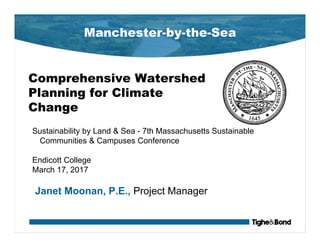
- 1. Manchester-by-the-Sea Comprehensive Watershed Planning for Climate Change Sustainability by Land & Sea - 7th Massachusetts Sustainable Communities & Campuses Conference Endicott College March 17, 2017 Janet Moonan, P.E., Project Manager
- 3. Sawmill Brook Watershed Concerns
- 8. Sawmill Brook Watershed Concerns Inland Flooding • Poor Soils • Impervious Surface • Channelized Drainage Coastal Flooding • High Tide • Wave Action • Storm Surge Water Quality Issues • Bacteria • Low pH • Sedimentation
- 9. Flooding Impacts Community Assets People Built Environment Economy Natural Environment
- 10. Town Hall & Police WWTP Fire Station
- 11. Climate Change Adaptation- Opportunities for Wastewater Town Hall & Police WWTP Fire Station
- 12. Future Flooding from Coastal Influences http://www.geosciconsultants.com/projects/2015/5/27/coastal-risk-mapping-in-salem-sound
- 13. Big Picture View ... Strategic Thinking ■ Town Staff wanted to understand future impacts of climate change on the town, recognized comprehensive approach needed. ■ Funding strategy included applying for CZM Grants and FEMA Grants ■ Coordinated work between grants. ■ Included not only flood mitigation but habitat improvement and water quality improvements ■ To reduce risk and vulnerability of flooding on community assets, considered Green Stormwater Infrastructure
- 14. Green Stormwater Infrastructure… A lot of options to consider… Roof Drain Disconnects & Rain Harvesting Bioretention / Rain Gardens Infiltration Practices Constructed Wetlands Street Planters Porous Pavement Pretreatment & Filters Green Roofs Stream Bank Storage
- 15. An “Easy” Seven-Step Process to Assess Green Infrastructure 1. A desktop (GIS-based) screening and ranking; 2. Review of results and complete site visits; 3. Identify other site conditions that would impact implementation; 4. Conceptual sizing of GSI practices (volume treated, pollutant reduction, etc.); 5. A hydrologic and hydraulic model evaluation; 6. Calculation of pollutant load reduction; and 7. Development of costs … assess cost vs. benefit.
- 21. Desktop Assessment: Primary + Secondary Screening
- 22. Additional Considerations Permitting and Environment – Wetlands – Drinking water impacts – Habitat impacts – Historical area – Contamination – Sea Level Rise – Etc Qualitative Input – Community support – Cultivation of educational opportunities – Operation & Maintenance – Aesthetic and habitat improvement – Coordination with other town project – Etc
- 23. Field Work to Assess Green Infrastructure Assessment of: ■ Existing structures (23 culverts and tide gate) ■ Potential structural solutions (17 sites for Green Infrastructure/ Flood Mitigation)
- 24. What we found… Large parking areas at High School Parking at Elementary School Parking at Turf Field
- 25. What we found… Small flood storage areas Large flood storage areas
- 26. Defined extent of BMP corridors in Phase 2 Downtown Improvement areas What we found…
- 27. Let the modeling show… ■ Incorporated stormwater GSI into watershed-wide HEC-RAS model ■ Looked at current and future (2025, 2050, 2100) Scenarios ■ Even for larger projects (i.e. golf course flood storage, elementary school parking lot,) limited potential to reduce watershed-wide surface water elevations under all scenarios
- 28. Porous Asphalt Parking Area at Coach Field
- 31. Manchester is moving forward in these ways… ■ Updating Town Master Plan to identify climate change risks, vulnerability to community assets and mitigation solutions ■ Formalizing actions in an approved FEMA Hazard Mitigation Plan, including GSI in downtown and to address roadway flooding ■ Keeping the public informed and engaged through public workshops, web site update and news articles
- 32. Questions? Gabrielle Belfit, Senior Environmental Scientist, Project Manager – Phone: 508-564-7285 – Email: GCBelfit@TigheBond.com Janet Moonan, P.E., Project Engineer – Phone: 781-708-9826 – Email: JSMoonan@tighebond.com Mary Reilly, Grants Administrator – Phone: 978-525-6427 – Email: reillym@manchester.ma.us Documents can be found the Manchester town website at: www.manchester.ma.us/354/Sawmill-Brook-Watershed-Project and www.manchester.ma.us/355/FEMA-PDM-Grant-Projects