1. Abstract
It was urgently felt that there should be some easy tools for the Field Surveyors in order to help
GIS Unit, IDMS Project in regards to data entry. Actually the time duration and easiness along with
data consistency were the main ingredients which led the author (Major Md. Zamil Hossain Munshi,
In-charge, GIS Unit) to develop this tool.
Acknowledgement
Author acknowledges the contribution of Mr. S.M. Saifullah, TA(F), No: 4 Party in providing source
code used in his Geo_Trans software of Geodetic Detachment. Author also acknowledges Mr.
Ganesh Chandra Roy, In-charge, Geodetic Detachment and Mr. Jahangir Alam,Computer,
Geodetic Detachment in providing sample data of different GPSes in use.
TOOL
This tool has been developed using Visual Basic programming language in Microsoft Excel and
saved the workbook as Macro-Enabled Worksheet namely “GPS Data Conversion for GIS Unit”
with a single sheet (i.e. Sheet1) in it.
Opening the Excel Workbook:
The file resides in “ZTool-GPS Data Conversion Software” Folder with other necessary files. To
open the file, the user needs to select it and:
Double click the file OR
Right click>Open from popup menu.
This will open the workbook with user’s information dialog box for future reference.
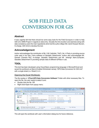
SOB FIELD DATA
CONVERSION FOR GIS
2. Pressing “OK” will show “Sheet Name” dialog box in order to insert the six digit sheet name
with part name e.g. 78P05A_North by the user:
Pressing “OK” will be replacing “Sheet1” with 78P05A_NORTH:
If wrong name or blank space is left; it will remind the operator to name sheet with six digit
(e.g. 78P05A).
However, if user forgets or ignores the naming of the sheet; he has to name it afterwards by
selecting Sheet1>Right Click>Rename. It must be remembered that in coarse of time, this particular
naming convention will help the tool to generate an excel workbook with same map sheet name
(78P05A.xls) having number of worksheets along with part name (e.g. 78P05A_NORTH,
78P05A_SOUTH etc.) as explained in Make Data for GIS of “Monitor Task” section .
3. Configuring the Tool:
Initially an error will be shown describing the non-availability of toolbar/macro. To configure the
tool as different menu, following methods to be adhered:
Right Click>Customize the Ribbon… OR
File>Options>Excel Options opens> Customize Ribbon
Choose commands from>Macros
Select “Main Tabs” from Customize the Ribbon options.
Press Import/Export>Import customization file will open “File Open” dialog box.
Browse to “ZTool-GPS Data Conversion Software” Folder and select “GPS Data Conversion
for GIS Unit.exportedUI” .This will show the following dialog box.
4. Press Yes.
A new and separate tab as “SOB FIELD DATA (Custom)” in the main Menu will be created
along with other menus as seen here.
Select “GPS Data Conversion (Custom)” group name and expand it by clicking [+].
This will open subgroup items like Explorist 400/500, Garmin eTrex Legend/HCX/10.
o Select subgroup (e.g. Explorist 400/500)>Right Click>Rename OR Select
subgroup>Press Rename… button at the bottom.
o Copy the name [Note: This is done to use the same name for each subgroup items as
mentioned later]
o Cancel the “Rename” dialogbox.
o Press “Remove” will remove Explorist 400/500 from the “GPS Data Conversion
(Custom)” group name.
o Select “Explorist_Click” from Macros and press “Add”. This will again add the
Explorist_Click in the subgroup name with default symbol image as seen here.
Tab Name
Group Name
Subgroup Name
5. o Right Click on subgroup (here Explorist_Click )>Rename
o Replace “Explorist_Click “ by pasting “Explorist 400/500” in the Display name box or
rewrite the same.
o Choose the image and press “OK”
Continue for each group and its associated subgroup using macros. The final look from initial
setup will be:
Dismiss the dialog box “Excel Options” by pressing “OK”. A new tab with following images will
be created as seen below:
6. SOB FIELD DATA Tab
Tab Description:
It comprises following groups/sections:
GPS Data Conversion.
Code Generation.
Quality Checks.
Monitor Task.
Help.
Data Description:
To use the buttons of those groups, the operator has to copy the GPS downloaded data from the
respective excel file which has been generated directly from GPS while downloading the data or
while using download software of respective GPS. The data then should be pasted in “A1” cell of
“GPS Data Conversion for GIS Unit” excel file. The sample data from both Explorist 400/500 and
Garmin eTrex Legend/HCX/10 could be seen here in Figure:1 and Figure:2 respectively:
Figure: 1 Downloaded Data from Epxlorist 400/500
Figure: 2 Downloaded Data from Garmin eTrex Legend/HCX/10
GPS Data Conversion:
Operator has to press either of the buttons of this group in order to convert Latitude and Longitude
data of WGS84 system to Northing and Easting of BUTM2010 system:
Explorist 400/500: Press this button while using data of Explorist GPS.
Garmin eTrex Legend/HCX/10: Press this button while using data of Garmin GPS.
Output: GIS Field Attribute Collection Form (Figure:3) will be created and all the latitudes and
longitudes in degree minute decimal of Explorist 400/500 or degree minute second decimal of
eTrex Legend/HCX/10 of WGS84 will be converted to Easting and Northing in meter of
BUTM2010 instantly. There will be four elements namely Record Code, Serial No, Easting and
Northing filled with GPS data. On the other hand operator has to fill F_Name and Remarks (if
any) column of Field Attribute Form.
Figure: 3 GIS Field Attribute Collection Form with Converted Data
7. Action Needed: Surveyors/Camp Officer to arrange the filling of F_Name and Remarks from
prepared hardcopy.
Code Generation:
After filling up F_Name and Remarks, pressing “Feature Code” will generate F_Type and F_Code
instantly as seen in the Figure:4 below:
Figure: 4 Filled Up GIS Field Attribute Collection Form with Necessary Data
Quality Checks:
This section deals with necessary quality checks on the filled up form of Figure: 5. The checks are
shown below:
Inconsistent Plotting: This will identify the data falling outside the neat line of a particular
map sheet of 1:25000 scale. The point which will fall out of the neat line, its “Easting” or/and
“Northing” will be colored to red basing on the data. Surveyor should check its GPS data
properly. This may be due to bad reading taken during field survey or GPS might have
malfunctioned during data taking or even surveyor makes error during manual data entry. This
tool has got approximate accuracy up to ±2 cm on the ground.
This tool must not be pressed till F_Code and Type has been generated.
Figure: 5 Result of Inconsistent Plotting Check
Blank Data: Pressing this will identify the data which lacks in “F_Name” i.e. no feature name
has been collected. Collecting specific information is one of the main reasons for field survey.
Hence feature name must not be forgotten to collect. . It should be remembered that F_Type
i.e. feature type has connection with “F_Name”. Feature name (e.g. Biral Jhuri Government
Primary School) and feature type (e.g. Primary School) are not same. While the former is more
specific in nature, the later shows the generic type of feature. To make it more clear, there may
be 10 to 20 primary schools in a particular sheet but more than one primary school with same
name are rarely observed. However where "F_Name" is not available,"Feature_Type" should
be written instead, because this field MUST NOT be left vacant.
Figure: 6 Result of Blank Data Check
Missing Data: Pressing this will identify the data which lacks in “Record Code”. Fill "Record
Code" column of the form with the given1 to239 entries in the "GIS FIELD ATTRIBUTE TABLE-
1:25,000". Firstly, the Surveyor needs to look for "FeatureType" in the Attribute Table and write
down its associated "Record Code" in this form. ANY MISTAKE WILL LEAD TO CHANGE OF
8. FEATURE CLASS. "Serial No" must not be prefixed by any text (e.g.Write1instead of F-01 or
S-1 etc.).
Figure: 7 Result of Missing Data Check
Wrong F_Code: Pressing this will identify the data where F_Type does not match with
F_Name . It often happens when Surveyor forgets to write exact F_Code. These will be in
different fill color to show emphasis of use of F_Code.
Figure: 8 Result of Wrong F_Code Check
Show All Data: Pressing will show all the data those were already filtered by the above checks.
This should be done after correcting all the data and to have a final visual check on the full
data.
Monitor Task:
It helps operator to monitor his/her task smoothly.
Show Task Tracker: Pressing will open a new sheet with various personal data entry
information. Opening other sheet will deactivate or hide it.
Figure: 9 Show Task Tracker
Make Data for GIS: Pressing this will pick relevant information as recorded and paste it in the
different file with same Map Sheet name.
Figure: 10 Make Data for GIS
9. This file resides on the Drive where this “GPS Data Conversion for GIS Unit” excel file resides in
a folder namely “FieldData-For GIS”.
Figure: 11 Location of GPS Data for GIS Unit
Help:
Record Code: Pressing for the first time will show the “Record Code” reference with respect to
“F_Code” and “F_Type” for operator to correct their entered data. Pressing second time will
hide the reference.
Figure: 12 Show F_Code Help
Read Me: Pressing this will open the “Readme-GPS Data Conversion for GIS Unit” file.
GENERAL ADVICES
Camp Officer/Surveyor/Operator/User should study this prior to use the tool carefully.
Configure the tool properly before using it.
Major Md. Zamil Hossain Munshi
Deputy Director (Survey)
Officer In-charge
No: 1 Cartography Office & GIS Unit
05 November 2013
SPECIAL NOTE
This software may not run without configuration of each tool residing in the tab “SOB FIELD DATA”
even after coping and pasting this file to any Computers. Please configure your computer with the
help of configuration process as explained in Configuring the Tool or by above signed developer
prior to use it properly.