Call Girls Service Pune ₹7.5k Pick Up & Drop With Cash Payment 8005736733 Cal...
Land subsidence in Matale, Sri Lanka
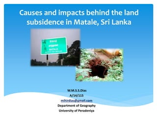
1. Causes and impacts behind the land
subsidence in Matale, Sri Lanka
W.M.S.S.Dias
A/14/115
mihirdias@gmail.com
Department of Geography
University of Peradeniya
2. “Land subsidence is a gradual setting or sudden sinking of
the Earth’s surface owning to subsurface movement of
earth materials.”
- USGS (United States Geologic Survey)
Introduction
Source: USGS(United States Geologic Survey)
3. Study Area :
Methodology
Objectives
•To identify the physical and human factors cause to land
subsidence in the area
•To identify the major impacts of land subsidence in the area
Secondary Data
• Geomorphology maps
• Slope maps
• Surface drainage maps
• Geology maps
• Landuse maps
• Research articles
• Documentaries
• Magazines
• Internet
• News papers
• Satellite maps
4. Physical and Natural Causes Subsidence
Geomorphology
Surface drainage
Geology
Rain fall
Landuse
Results and Discussion
5. Geology
• High vulnerability - Marble and calc-silicate areas
• Moderate vulnerability - Banded gneiss areas
• Low vulnerability - Charnockite and Hbl- Bt gneiss areas
6. Geomorphology
• High vulnerability- Brittle structured (joints) areas
• Moderate vulnerability - Brittle structured (lineaments) areas
• Low vulnerability - Ductile structured (antiforms and synforms)areas
7. Elevation
• Low vulnerability - high elevation (above 400m)
• Moderate vulnerability - above 360m to 400m
• High vulnerability - bellow 360m
8. Drainage system
• High vulnerability - areas along the main streams
• Moderate vulnerability - areas less distance from the main stream
• Low vulnerability - areas far from the main stream
9. Landuse pattern
• High vulnerability – Built area and constructed areas (urban areas)
•Moderate vulnerability – Home gardens and less constructed areas (rural areas)
•Low vulnerability – Less or zero human influenced areas (mountains and forests)
11. “NBRO identifies 19 locations prone to land subsidence in Matale”
Hiru News: December 27, 2012
“Matale Threatened With Land Subsidence”
Ceylontoday: December 28, 2012
“Mitigation program for landslide-prone areas:NBRO warns residents”
Sunday observer: February 17, 2013
“Norwegian Ambassador to visit Geotechnical Project in Matale”
DAILY FT: September 26, 2017
"The NBRO has identified a number of subsidence prone locations in the
Thotagamuwa junction andPalapathwala,Matale. Two subsidences were
reported in the area in December 2012, accompanied by heavy rains and
found there were nearly 15 to 20 cavities underground"
Image 10
“Residents in various areas in Matale such as Rattota and Ukuwela Division who are at
risk will be resettled in safer locations.” - NBRO
Recent incidents
12. People have to inform the NBRO about cracks appearing on the walls of
houses and changes occurring in the ground.
People who construct houses and other structures should conduct a
thorough study on the condition of the underground.
Subsidence awareness programs targeting executive range officers and
people in the grassroots level.
Residents in subsidence prone areas need to relocate to safe areaswith
the guidance of the NBRO.
Necessary arrangements have been made to give early warnings to
people living in areas vulnerable to subsidence.
The “NBRO subsidence maps” have to give to local authorities such as
Pradeshiya Sabhas and Divisional Secretariats.
The people who live in areas vulnerable to landslides or subsidence have
been instructed to be vigilant and refrain from building houses or other
structures in such area.
Recommendation
13. The reaction of water in the marble bands underground
is the technical reason for land subsidence in Matale.
Every authorities, responsibility persons, government
and public have to consider their attention towards the
land subsidence as hazard in Matale area to prevent and
minimize the vulnerability because it is not included in
Sri Lanka Disaster Management Act, No.13 of 2005 as a
hazard.
Conclusion
14. Bandara, P. (1991). AN ENVIRONMENTAL PROFILE. University of Peradeniya,
Department of Geography. the Central Environmental Authority,Maligawatte
New Town .Colombo 10 , Sri Lanka.
DS Munasinghe, E. W. (2015). Vulnerability Assessment Methods for Land
Subsidence Prone Areas – A Case Study: Matale Municipal Council Area. NBRO.
Jayamali, M. (2015). APPLICATIONS OF GEO SPATIAL AND STATISTICAL
METHODS FOR PREDICTION OF GROUND SUBSIDENCE A CASE STUDY FROM
MATALE.
M.J.P.T.M. Jayasekara, H.K. Kadupitiya, U.W.A. Vitharana. (2018). Mapping of Soil
Erosion Hazard Zones of Sri Lanka. Tropical Agricultural Research, 29.
R.M.S Bandara, Pathmakumara Jayasingha. (2018). Landslide Disaster Risk
Reduction Strategies and Present Achievements in Sri Lanka. Geosciences
Research, 3.
Rohana Chandrajith, HAH Jayasena, Robert van Geldern, Johannes AC Barth.
(2015). Assessment of land subsidence mechanisms triggered by dolomitic
marble dissolution from hydrogeochemistry and stable isotopes of spring
waters.
UP Nawagamuwa, MIDH Wijewickrama, K Sugathapala, WA Karunawardena,
RMS. (2017). Matale ground subsidence and overlooked construction basics.
Bibliography