SlideShare une entreprise Scribd logo
1  sur  59
Télécharger pour lire hors ligne
Autonomous Exploration for 
Gathering Increased Science
                        AEGIS

                       Tara Estlin
Benjamin Bornstein, Daniel Gaines, David R. Thompson, Rebecca Castano, 
Robert C. Anderson,  Michael Burl, Charles de Granville and Michele Judd


                                2011 NASA Software of the Year
Consider the following problem…
• You are a robotic explorer                                           
  on another planet 
• You only talk to Earth                                                           
  once a day
• You are in a hostile                                      
  environment
• You have limited power and computing abilities
• You are constantly on the move exploring different 
  terrains
• As you move, you need to quickly determine if you 
  see objects that are interesting to scientists
• If you do, you want to acquire data on these 
  objects, before the rover moves past                                       2
This is why we developed AEGIS
  AEGIS:
• Is a new paradigm for in‐situ                    
  science using onboard autonomy
• Provides intelligent targeting and 
  data acquisition by
   – analyzing images of the rover scene
   – identifying high‐priority science targets 
     (e.g., rocks), and
   – taking high quality data of these targets 
     completely autonomously with no 
     ground interaction required
                                                      3
AEGIS Video


              4
How is AEGIS being used?
   AEGIS:
• Is in regular operational use onboard                                   
  the Mars Exploration Rover (MER) Mission                               
  Opportunity rover for the past  two years
• Excels in automated targeting with narrow field‐of‐
  view (FOV) remote sensing instruments, such as:
     – MER Panoramic Cameras (in current use)
     – MER Mini‐Thermal Emission Spectrometer 
     – Mars Science Laboratory (MSL) Rover                                              
       ChemCam Spectrometer

                                                   Mini-TES Mosaic
 – Before AEGIS, had to manually select                                   
   targets, based on ground analysis
                                                                                           5
AEGIS Process for MER
                                                       Process fully automated!
                                                                         Advanced image
                                   Navcam acquisition                    processing technique
                                                                         enables reliable, rapid
                                                                         identification of candidate
                                                                         targets.
                                    Target detection


Algorithms quantify key               Target feature                                Scientists can
intuitive target                        extraction                                  prioritize
properties such as                                                                  important
brightness, size, and                                                               properties
shape.                                                                              for each run
                                   Target prioritization


                                     Target pointing
                                     determination
 Robust approach to                                              Top score
                                                                for large size
 pointing selection
 maximizes data of target.
                                    Pancam pointing

                                                                         High-quality, 13 color
                                                                         filter, quarter-frame
                                   Pancam acquisition
                                                                         Panoramic camera
                                                                         image
Benefit of AEGIS for Rover Drive

                                       Autonomously‐targeted remote sensing
                                       taken end of drive by AEGIS

                                            X


                                                    X
                                       Autonomously‐targeted remote 
                                       sensing taken mid‐drive by AEGIS


   Manually‐targeted remote sensing 
   as specified by science team
   (taken before drive)


             Targeted data                       Targeted data
           selected manually                      with AEGIS
                                                                              7
AEGIS identifies rock targets
Scientist target profile: large rocks of high reflectance.
Markers show top ten prioritized targets.


                                                      8
AEGIS identifies rock targets
Area covered by MER Panoramic Camera.


                                        9
AEGIS identifies rock targets
Area covered by MER Panoramic Camera.


                                        10
AEGIS delivers 13F Pancam image


     after autonomously targeting
          the top priority rock     11
MER before AEGIS


   Sol 1                 Sol 2         Sol 3
     Perform 
   MANUALLY 
TARGETED remote                                       Pancam Sol 2
sensing of current        Perform        Perform 
   rover area           untargeted     untargeted  
Drive rover 100m          remote         remote 
to new stopping          sensing of     sensing of 
      point              local area     local area
 Acquire wide‐
angle images of 
new terrain area
                                                      Pancam Sol 3

                      Multi-Sol Plan                            12
MER after AEGIS


   Sol 1                 Sol 2          Sol 3
     Perform 
   MANUALLY 
TARGETED remote                                        AEGIS Pancam 1
sensing of current        Perform         Perform 
   rover area           autonomously    autonomously
                           targeted        targeted
Drive rover 100m          remote          remote 
to new stopping          sensing of      sensing of 
      point              local area      local area
 Acquire wide‐
angle images of 
new terrain area
                                                       AEGIS Pancam 2

                      Multi-Sol Plan                             13
SIGNIFICANCE
 Scientists trust AEGIS to make intelligent 
 decisions about collecting new science.
Significance: Aerospace
• Fully operational and used                                       Opportunity Today


  regularly on MER mission
   – Saves valuable time every targeted                                                 
     data collection
   – Has been used more than any other                                               
     new technology on the Opportunity rover
• Currently infusing into Mars Science 
  Laboratory (MSL) Mission
• Attracting strong interest for 
   – 2018 Mars rover and other future in‐situ                            
     missions (e.g., Titan, Venus, Europa)
   – Military applications (e.g., UAVs)
                                                                                 15
Significance: Science/Technology
• Enables the collection of science data that would 
  otherwise not be possible
    – During or right after drives
    – Different times of day and temps
• Saves significant time and cost                                for  
  targeted data collection
    – Gets data into the hands of scientists twice as fast                 
      (or more) than standard operations
• Enables scientists to easily use and                                   
  interact with autonomy software 
    – Parameters chosen after significant                                     
      consultation with scientists
• 25+ science and technology publications
• Application to large number of problems in 
  industry and academia (e.g., underwater robotics)                              16
Significance: Humanitarian
• Directly contributing to humanity goal of 
  finding life on other planets
   – Mars program theme of “Follow the water…”


• Significant outreach vehicle; over 35 media 
  articles since release in 2010
   – “Mars Rover Getting Smarter As It Gets Older”
   – “NASA upgrades Mars rover brain”

                                                     17
Significance: Humanitarian
      Inspiring the next generation in STEM:
Science, Technology, Engineering and Mathematics


                       Over 46 Amateur Astronomy Clubs,
   Australia        Schools and Teacher Organizations around
   United Kingdom      the world featured our “rock hound”
                           software in their newsletters
                                                           18
DEVELOPMENT
 AEGIS is flight proven and fully operational
Development Status
 • TRL Level 9: Flight Proven
      – Software fully operational 
      – In regular use on MER Opportunity rover

 • MER and MSL Scientists have already asked for 
   extensions, which are in progress:
      –   Enabling multiple targeted observations
      –   Triggering on single filter color images
      –   Identifying novel targets
      –   Identifying representative targets
      –   “Soil only” detector

“AEGIS is a true success story for the Mars Technology Program”
                                     Dr. Samad Hayati
                                     Manager of Mars Technology Program
                                                                    20
ASSESSMENT
    of USE
AEGIS technology is being applied in a wide range 
of applications.
NASA Use – MER
       AEGIS is considered every multi‐sol plan.


           Sol 2138    Sol 2172         Sol 2313   Sol 2221    Sol 2247


           Sol 2278                                            Sol 2290


           Sol 2304                                            Sol 2312

“AEGIS is a significant enhancement for the mission and the scientific 
community. MER is the first mission to implement the capability that AEGIS 
provides – and it has really paid off.”
                                  Dr. John Callas
                                                                            22
                                  Mars Exploration Rover Mission Project Manager
NASA Use – MSL Rover
• The MSL Rover ChemCam Team has requested 
  AEGIS (PI: Roger Wiens)
• AEGIS is ideal for ChemCam’s narrow field‐of‐view
  Laser‐Induced Breakdown Spectrometer (LIBS)
   – Samples rocks from a distance of 1 to 7 meters 
   – Able to rapidly identify rock elemental composition
• AEGIS enables multiple autonomously targeted
  ChemCam measurements throughout the day
• MSL flight software integration in progress


                                                           23
NASA Use – MSL

Video clip from Dr. Roger Wiens
Principal Investigator
MSL Rover Mission Chemcam Instrument


                                       24
NASA Use – MSL


                 25
NASA Use – Mars 2018 Rover
• 2018 Rover Mission will have                                               
  limited time to core and store                                              
  up to 30 rock samples 
    – Will need to drive up to                                                       
      20 kilometers
    – Will need to consider targets                                                           
      from distinct areas

• Strong interest from Mars 2018 Mission Program 
  Office (Charles Whetsel, Chris Salvo) in using 
  AEGIS to collect data on potential targets
    – Get data to science team faster
    – More targets could be considered 

                                                                                    26
Future Use – Other Missions
• AEGIS system can enable a wide spectrum of 
  missions: 
   – Collect valuable science more often
   – Enhance onboard autonomy capabilities
• Strong application to in‐situ missions to Titan, 
  Europa, Venus, Mars, the Moon, and small 
  bodies
• Science autonomy listed as critical capability 
  in Titan Prebiotic Explorer Mission Study
   – Helps address challenges such as extremely limited 
     communication, high platform mobility, etc.

“Onboard science algorithms will analyze the image
data to detect trigger conditions such as science
events, interesting features, changes relative to
previous observations, …”
                            TiPEx mission study team       27
Industry, Government, Research Use
                           Autonomous 
                           Underwater 
                          Vehicles (AUVs)

                                                     Unmanned 
       Lunar 
                                                       Aerial 
     Exploration
                                                      Vehicles


Unmanned  
Sea Surface 
                    AEGIS
                   AEGIS is transferable to
                                                           Multi‐core 
                                                            Processor 
 Vehicles             a wide range of                     Benchmarking
  (USSVs)
                    application domains


                                            Search and 
                Commercial 
                                              Rescue 
               Spectroscopy
                                             Robotics
                                                                         28
Industry, Government, Research Use
                               Autonomous 
                               Underwater 
                              Vehicles (AUVs)
          Unmanned Aerial Vehicles (UAVs)
                                                         Unmanned 
• Developing Lunar 
              automated                                    Aerial 
            Exploration
  cueing capability for UAV                               Vehicles
  surveillance platforms.
• Lower-resolution wide area
  imagery used to trigger

  on selected areas.
       Sea Surface 
                       AEGIS
  higher-resolution follow-up
       Unmanned  
                                                   Multi‐core 
                                                   Processor 
• Proof-of-concept completed for ships using satellite imagery
        Vehicles 
                                                 Benchmarking
         (USSVs)
• Evaluating for use identifying ground vehicles on imagery from
  AFRL "Angel Fire" aerial asset

                                                Search and 
                   Commercial 
                                                  Rescue 
                  Spectroscopy
                                                 Robotics
                                                                     29
Industry, Government, Research Use
                       Autonomous 
                       Underwater 
                      Vehicles (AUVs)

                                     Unmanned 
     Lunar 
                                        Aerial 
   Exploration
  “Moon Express is developing a lunar lander and
                                       Vehicles
   mobility system for exploration of platinum
   group metals on the surface of the moon as
   well as compete for the Google Lunar X-Prize.


Unmanned  
                AEGIS
     AEGIS could be a great asset to
     this quest by autonomously
     recognizing rocks from iron-rich
Sea Surface 
                                                       Multi‐core 
                                                        Processor 
 Vehicles 
     asteroids that might contain                     Benchmarking
  (USSVs)
     platinum.”


   -- Moon Express, Inc.
                                        Search and 
            Commercial 
                                          Rescue 
           Spectroscopy
                                         Robotics
                                                                     30
Industry, Government, Research Use
                          Autonomous 
                          Underwater 
         Robotic Underwater Vehicles
                         Vehicles (AUVs)

  • WHOI Nereus vehicle
      Lunar 
                                                    Unmanned 
                                                      Aerial 
     Exploration
       – Performs deep ocean scientific
                                                     Vehicles
         survey and sampling
       – Used to locate hydrothermal
         systems, volcanic processes, etc.


Unmanned  
                   AEGIS
  • CMU/Pittsburgh Aquarium Reefbot
        – Automatically detect,
          classify, and count fish
Sea Surface 
                                                          Multi‐core 
                                                           Processor 
 Vehicles in their natural habitat
                                                         Benchmarking
  (USSVs)
  • AEGIS could save days/weeks
    of exploration time through
    autonomous data collection
                                           Search and 
              Commercial 
                                             Rescue 
             Spectroscopy
                                            Robotics
                                                                        31
Industry, Government, Research Use
                          Autonomous 
                          Underwater 
         Robotic Underwater Vehicles
                         Vehicles (AUVs)

  • WHOI Nereus vehicle important advances in automatic
      Lunar 
             “AEGIS makes                 Unmanned 
                                             Aerial 
      – Performs deep ocean.. It has direct relevance to work
    Explorationdata analysis. scientific
                                           Vehicles
               at CMU in underwater vehicles for detecting
        survey and sampling
      – Usedand cataloging fish in deep water reefs.”
                to locate hydrothermal
         systems, volcanic processes, etc.
                                 D. Wettergreen

Unmanned  
                   AEGIS
  • CMU/Pittsburgh Aquarium Reefbot
        – Automatically detect,
                                 CMU Robotics Institute

          classify, and count fish
Sea Surface 
                                                          Multi‐core 
                                                           Processor 
 Vehicles in their natural habitat
                                                         Benchmarking
  (USSVs)
  • AEGIS could save days/weeks
    of exploration time through
    autonomous data collection
                                           Search and 
              Commercial 
                                             Rescue 
             Spectroscopy
                                            Robotics
                                                                        32
IMPACT
“AEGIS usage on the MER Opportunity Rover 
showcases how it could be extremely beneficial for 
the Mars 2018 Mission.”

              Charles Whetsel, 
              Manager, Advanced Concepts
              2018 Mars Program Office
MER Impact: Increased Science
• Before AEGIS, all targeted data required:
   – Manual evaluation of images
   – One to several communication cycles 
   – The rover to remain stationary and sometimes backtrack

                                   By the time the “Block Island”
                                   meteorite was noticed in an image,
                                   the Opportunity rover was already
                                   200 meters past. The rover had to
                                   turn around and backtrack (costing
                                   25 additional sols).


• After AEGIS, targeted data can be collected:
   –   Without ground analysis of context images
   –   Without communication cycles
   –   Any time during a rover drive 
   –   Any time of day                                          34
MER Impact: Increased Science

Video clip from Professor Steve Squyres
Principal Investigator
Mars Exploration Rover Mission


                                          35
MER Impact: Increased Science


                          36
MSL 2011 Rover Impact 
MSL Impact: Increased Science

• 2008 study on ChemCam                                            
                                                                9m
  target selection using 65                                         
  MER Panoramic camera                                               
  images 

• Top 5 targets evaluated
    – If random sampling, 10% chance of being rock
    – If chosen by AEGIS, 92% chance of being rock


                                                               37
2018 Rover Impact
Mars 2018 Rover Impact: Increased Science
• Previous study on AEGIS application to 2018 Mission
• AEGIS can be used to collect additional targeted 
  science data
   – Increased close‐contact measurements by 50%
   – Increased remote‐sensing measurements by 500%
   – Provides scientists more targets to choose from           
     for coring

2018 Rover Impact: Cost Benefit
• Study showed number of sols required to investigate 
  and core a target could be decreased from 7 to 4 sols

                                                                  38
CREATIVITY
AEGIS is a pioneering flight software system 
that provides scientists with sophisticated 
control over targeted data collection
Creativity: Innovation
• AEGIS provides new paradigm for                                               
                                                  Original Optimized

  surface data acquisition                            62


                                                                   Memory Usage (megabytes)
    – Scientist provides description of target
    – System can collect data whenever target                                                     
      detected 

• Flight challenges                                                                                           3.75


    – Image processing performed on RAD6000 
      (orders of magnitude slower than standard                                                Memory reduced 16x
      desktop machine)                                                                            62 MB to 3.75 MB
    – AEGIS limited to < 4 MB of memory
    – Large performance optimizations made!


                                                                   Runtime (seconds)
• Inventive approach to flight 
  software change
    – Full flight software upload not possible
                                                                                                   Benchmark Images
    – AEGIS uploaded as standalone module
    – Loaded into memory whenever want to use                                                 Performance improved 7X
      (< 30 secs)
                                                                                                                      40
Creativity: Usability
• Parameters defined through collaboration with scientists
    – Describe attributes of candidate targets
    – Express diverse and evolving science goals 
• System did not require extensions to                                           
                                               Albedo, shape, and size
  MER command dictionary or telemetry
• Training materials 
    – Web interface for creating commands
    – User’s guide for software usage and                                                    
      sequencing
    – Standard terrain profiles available
    – Result message (EVR) interpreter

“One of the key aspects that has made the AEGIS team successful is their long 
track record of working with the scientists.”
                                       Dr. Jack Stocky
                                       New Millennium Program Manager     41
Creativity: Quality Factors


• Reliable target detection
   – Find rock targets in diverse terrain
   – Is resilient to dust‐covered or shadowed rocks
   – Works under strict computation constraints
• Risk control through resource limits and time 
  deadlines
• Validation and Verification
   – Extensive MER testing procedure and code reviews
   – Nightly build, static analysis, unit and regression tests

                                                                 42
SUMMARY
“This autonomous science breakthrough is really 
changing expectations for future science mission 
operations.”

                     Raymond E. Arvidson
                     Deputy Principal Investigator
                     Mars Exploration Rover
Summary
• Significance:  Far Reaching
   – Aerospace: Routinely used on MER
   – Science/Technology:
       • Enables science that could not be previously collected
       • Applications in military, commercial and research fields
   – Humanitarian:
       • Contributing to goal of finding life on other planets
       • Inspiring next generation in STEM areas

• Development:  Flight Proven
• Assessment of use:  
   – Planned for Infusion into New Missions and Applications
• Creativity:  Pioneering/Deeply Innovative
   – Innovation: New paradigm for in‐situ data acquisition
   – Usability: System parameters designed through direct 
     collaboration with scientists
   – Quality: Reliable target detection under strict computation 
                                                                  44
     constraints
For more information and surface results, visit 
 the AEGIS website: http://aegis.jpl.nasa.gov/
                                             45
For more information…


Questions?
Tara.Estlin@jpl.nasa.gov

         We’d like to acknowledge our sponsors:
   New Millennium Program, Mars Technology Program,
   JPL Research and Technology Development Program,
            and the IND Technology Program

                and thank you to the:
          The Mars Exploration Rover Mission
EXTRA
AEGIS Target Detection


                                  Contours


                        Flood fill +
                        Morphology ops


                Edge detection 
Contours can be further filtered


                                    Operator 
                                    Filtering 
                                    Rules


               Rover Body Masking
                                             49
Target Feature Extraction

Reflectance
   –    Mean
   –    Variance
   –    Skew
   –    Kurtosis


Size                       Light          Dark
  – Inscribed circle
  – Pixel area


Shape
  –    Eccentricity
  –    Ellipse fit error
  –    Roundness
  –    Ruggedness
  –    Angularity
                            Rounded   Angular
Target Prioritization / Top Target Selection
                                              Images from MER field trial
• Scientists can 
                                 Near the
  prioritize different           top of the
  feature values and             list of
  combinations of two            “round”
   – e.g., prefer large, high    rocks
     albedo rocks
   – Can also support MER 
     cobble campaign, outcrop 
     finder, soil finder, etc.

• Priority specification is                                        Near the
  part of command                                                  bottom of
                                                                   the list of
  sequencing                                                       “round”
                                                                   rocks
• Can be easily changed 
  as rover enters 
  different terrain areas
AEGIS Code Details
• AEGIS is 7968 SLOC (C)
• Limited to less than 4 MB of memory
• Requires only 232 KB of disk space
• Regular static analysis using Coverity
  PreventTM
• Formal code reviews
    – Internal AEGIS Team
    – Other JPL AI/machine-learning developers not
      members of AEGIS Team
    – MER Team


                        52
Meteorite Detector


              Devin Island
Meteorite Detector


            Marquette Island
AEGIS Target Detections
• Target detections are consistent with AEGIS selection 
  profiles 
   – 90% of top targets meet the selection profile 
   – Confirmed by evaluation of context Navcam imagery
   – All results reviewed with MER Science Team
• The MER Science Team is very happy with AEGIS and 
  continues to request it regularly


                                                     55
OASIS Framework 
• OASIS: Onboard Autonomous Science
  Investigation System
• Objective: Maximize science returned on surface mission
   – Identify and respond to science opportunities
   – Data prioritization for downlink
   – Maximize utilization of onboard resources
• Approach
   – Data segmentation and feature
     extraction for multiple instruments
   – Science Data Analysis
       • Prioritize targets and/or data
       • Summarize data
   – Automated Planning and Scheduling
       • Adjust rover activities to collect new
         data
       • Ensure operation within rover
         resource and operation constraints
AEGIS in the OASIS Framework 
• AEGIS is a flight software system derived from the
  larger OASIS framework
• Developed by same team of people
• AEGIS includes a subset of OASIS capabilities
  selected for MER
    Relevant - Instruments available on MER
    Desired - Requested by scientists
    Feasible - Fit within memory and time limits
AEGIS Results from B Sol 2138
AEGIS Result from B Sol 2221 

Contenu connexe

Tendances

Can Humans Survive 1000 Days in Space?
Can Humans Survive 1000 Days in Space? Can Humans Survive 1000 Days in Space?
Can Humans Survive 1000 Days in Space? mtnadmin
 
"Using Vision to Enable Autonomous Land, Sea and Air Vehicles," a Keynote Pre...
"Using Vision to Enable Autonomous Land, Sea and Air Vehicles," a Keynote Pre..."Using Vision to Enable Autonomous Land, Sea and Air Vehicles," a Keynote Pre...
"Using Vision to Enable Autonomous Land, Sea and Air Vehicles," a Keynote Pre...Edge AI and Vision Alliance
 
Suborbital Opportunities for Students
Suborbital Opportunities for StudentsSuborbital Opportunities for Students
Suborbital Opportunities for StudentsKimberly Ennico Smith
 
International Space Station as the Gateway for Humankind's Future in Space an...
International Space Station as the Gateway for Humankind's Future in Space an...International Space Station as the Gateway for Humankind's Future in Space an...
International Space Station as the Gateway for Humankind's Future in Space an...ISSRDC
 
UAV Mangroves Rev 0 colour
UAV Mangroves Rev 0 colourUAV Mangroves Rev 0 colour
UAV Mangroves Rev 0 colourPeter Mellor
 
Markets in Motion: Developing Markets in Low Earth Orbit
Markets in Motion: Developing Markets in Low Earth OrbitMarkets in Motion: Developing Markets in Low Earth Orbit
Markets in Motion: Developing Markets in Low Earth OrbitISSRDC
 
Canberra Nanosatellitre Keynote-jw hines
Canberra Nanosatellitre Keynote-jw hinesCanberra Nanosatellitre Keynote-jw hines
Canberra Nanosatellitre Keynote-jw hinesJohn Hines
 
Romanella
RomanellaRomanella
RomanellaNASAPMC
 
Visions ofthefuturemay02
Visions ofthefuturemay02Visions ofthefuturemay02
Visions ofthefuturemay02Clifford Stone
 
Gis120 lec1 slide_share_practice
Gis120 lec1 slide_share_practiceGis120 lec1 slide_share_practice
Gis120 lec1 slide_share_practiceMichelle Kinzel
 
STEM on the ISS: How the ISS National Lab is Influencing Students and Teacher...
STEM on the ISS: How the ISS National Lab is Influencing Students and Teacher...STEM on the ISS: How the ISS National Lab is Influencing Students and Teacher...
STEM on the ISS: How the ISS National Lab is Influencing Students and Teacher...mtnadmin
 
World View - Alan Stern
World View - Alan SternWorld View - Alan Stern
World View - Alan SternNewSpace 2014
 

Tendances (19)

Can Humans Survive 1000 Days in Space?
Can Humans Survive 1000 Days in Space? Can Humans Survive 1000 Days in Space?
Can Humans Survive 1000 Days in Space?
 
"Using Vision to Enable Autonomous Land, Sea and Air Vehicles," a Keynote Pre...
"Using Vision to Enable Autonomous Land, Sea and Air Vehicles," a Keynote Pre..."Using Vision to Enable Autonomous Land, Sea and Air Vehicles," a Keynote Pre...
"Using Vision to Enable Autonomous Land, Sea and Air Vehicles," a Keynote Pre...
 
Suborbital Opportunities for Students
Suborbital Opportunities for StudentsSuborbital Opportunities for Students
Suborbital Opportunities for Students
 
International Space Station as the Gateway for Humankind's Future in Space an...
International Space Station as the Gateway for Humankind's Future in Space an...International Space Station as the Gateway for Humankind's Future in Space an...
International Space Station as the Gateway for Humankind's Future in Space an...
 
Welcome oct02
Welcome oct02Welcome oct02
Welcome oct02
 
UAV Mangroves Rev 0 colour
UAV Mangroves Rev 0 colourUAV Mangroves Rev 0 colour
UAV Mangroves Rev 0 colour
 
Markets in Motion: Developing Markets in Low Earth Orbit
Markets in Motion: Developing Markets in Low Earth OrbitMarkets in Motion: Developing Markets in Low Earth Orbit
Markets in Motion: Developing Markets in Low Earth Orbit
 
Iirs rstechnologypdf
Iirs rstechnologypdfIirs rstechnologypdf
Iirs rstechnologypdf
 
Canberra Nanosatellitre Keynote-jw hines
Canberra Nanosatellitre Keynote-jw hinesCanberra Nanosatellitre Keynote-jw hines
Canberra Nanosatellitre Keynote-jw hines
 
Report
ReportReport
Report
 
Romanella
RomanellaRomanella
Romanella
 
Visions ofthefuturemay02
Visions ofthefuturemay02Visions ofthefuturemay02
Visions ofthefuturemay02
 
Customer Success Story
Customer Success StoryCustomer Success Story
Customer Success Story
 
Gis120 lec1 slide_share_practice
Gis120 lec1 slide_share_practiceGis120 lec1 slide_share_practice
Gis120 lec1 slide_share_practice
 
Presentation vytas sunspiral
Presentation vytas sunspiralPresentation vytas sunspiral
Presentation vytas sunspiral
 
STEM on the ISS: How the ISS National Lab is Influencing Students and Teacher...
STEM on the ISS: How the ISS National Lab is Influencing Students and Teacher...STEM on the ISS: How the ISS National Lab is Influencing Students and Teacher...
STEM on the ISS: How the ISS National Lab is Influencing Students and Teacher...
 
Future directions
Future directionsFuture directions
Future directions
 
MODIS
MODISMODIS
MODIS
 
World View - Alan Stern
World View - Alan SternWorld View - Alan Stern
World View - Alan Stern
 

En vedette

David.fuller
David.fullerDavid.fuller
David.fullerNASAPMC
 
Stefanini.trinh
Stefanini.trinhStefanini.trinh
Stefanini.trinhNASAPMC
 
Alan.brache
Alan.bracheAlan.brache
Alan.bracheNASAPMC
 
Norm smith
Norm smithNorm smith
Norm smithNASAPMC
 
Inter pech bounds
Inter pech boundsInter pech bounds
Inter pech boundsNASAPMC
 
Ortiz.james
Ortiz.jamesOrtiz.james
Ortiz.jamesNASAPMC
 
Majerowicz
MajerowiczMajerowicz
MajerowiczNASAPMC
 
Backup darren elliott
Backup darren elliottBackup darren elliott
Backup darren elliottNASAPMC
 
Smith.marshall.bryant
Smith.marshall.bryantSmith.marshall.bryant
Smith.marshall.bryantNASAPMC
 
Hughitt brian
Hughitt brianHughitt brian
Hughitt brianNASAPMC
 
Dumbacher2012 pmchallenge
Dumbacher2012 pmchallengeDumbacher2012 pmchallenge
Dumbacher2012 pmchallengeNASAPMC
 
Berry.kevin
Berry.kevinBerry.kevin
Berry.kevinNASAPMC
 
R simpson elee
R simpson eleeR simpson elee
R simpson eleeNASAPMC
 
Marco.sampietro
Marco.sampietroMarco.sampietro
Marco.sampietroNASAPMC
 
Haudan.jim
Haudan.jimHaudan.jim
Haudan.jimNASAPMC
 
Steven noneman
Steven nonemanSteven noneman
Steven nonemanNASAPMC
 
Bill.okeefe
Bill.okeefeBill.okeefe
Bill.okeefeNASAPMC
 
Olson,john$isecg overview olson pmc v go
Olson,john$isecg overview olson pmc v goOlson,john$isecg overview olson pmc v go
Olson,john$isecg overview olson pmc v goNASAPMC
 

En vedette (20)

David.fuller
David.fullerDavid.fuller
David.fuller
 
Stefanini.trinh
Stefanini.trinhStefanini.trinh
Stefanini.trinh
 
Alan.brache
Alan.bracheAlan.brache
Alan.brache
 
Norm smith
Norm smithNorm smith
Norm smith
 
Inter pech bounds
Inter pech boundsInter pech bounds
Inter pech bounds
 
Ortiz.james
Ortiz.jamesOrtiz.james
Ortiz.james
 
Majerowicz
MajerowiczMajerowicz
Majerowicz
 
Backup darren elliott
Backup darren elliottBackup darren elliott
Backup darren elliott
 
Smith.marshall.bryant
Smith.marshall.bryantSmith.marshall.bryant
Smith.marshall.bryant
 
Hughitt brian
Hughitt brianHughitt brian
Hughitt brian
 
Dumbacher2012 pmchallenge
Dumbacher2012 pmchallengeDumbacher2012 pmchallenge
Dumbacher2012 pmchallenge
 
Berry.kevin
Berry.kevinBerry.kevin
Berry.kevin
 
Amer v2
Amer v2Amer v2
Amer v2
 
R simpson elee
R simpson eleeR simpson elee
R simpson elee
 
Marco.sampietro
Marco.sampietroMarco.sampietro
Marco.sampietro
 
Krishen
KrishenKrishen
Krishen
 
Haudan.jim
Haudan.jimHaudan.jim
Haudan.jim
 
Steven noneman
Steven nonemanSteven noneman
Steven noneman
 
Bill.okeefe
Bill.okeefeBill.okeefe
Bill.okeefe
 
Olson,john$isecg overview olson pmc v go
Olson,john$isecg overview olson pmc v goOlson,john$isecg overview olson pmc v go
Olson,john$isecg overview olson pmc v go
 

Similaire à Estlin aegissoyajpl 2012

Delta Handheld Xrf Mining In 12
Delta Handheld Xrf Mining In 12Delta Handheld Xrf Mining In 12
Delta Handheld Xrf Mining In 12najp51n
 
Self Automated Rovers
Self Automated RoversSelf Automated Rovers
Self Automated RoversRutikBhoyar
 
Intelligent satellites
Intelligent satellitesIntelligent satellites
Intelligent satellitesClifford Stone
 
Remote Sensing Data Acquisition,Scanning/Imaging systems
Remote Sensing Data Acquisition,Scanning/Imaging systemsRemote Sensing Data Acquisition,Scanning/Imaging systems
Remote Sensing Data Acquisition,Scanning/Imaging systemsdaniyal rustam
 
Adoption of Software By A User Community: The Montage Image Mosaic Engine Exa...
Adoption of Software By A User Community: The Montage Image Mosaic Engine Exa...Adoption of Software By A User Community: The Montage Image Mosaic Engine Exa...
Adoption of Software By A User Community: The Montage Image Mosaic Engine Exa...SoftwarePractice
 
ASCEND 2023 presentation
ASCEND 2023 presentationASCEND 2023 presentation
ASCEND 2023 presentationMiguel Arias
 
RECAP Horizon 2020 Project - 1st RECAP Webinar
RECAP Horizon 2020 Project - 1st RECAP WebinarRECAP Horizon 2020 Project - 1st RECAP Webinar
RECAP Horizon 2020 Project - 1st RECAP WebinarRECAP_H2020_Project
 
Remote sensing-presentaion
Remote sensing-presentaionRemote sensing-presentaion
Remote sensing-presentaionMouna Guru
 
Citron : Context Information Acquisition Framework on Personal Devices
Citron : Context Information Acquisition Framework on Personal DevicesCitron : Context Information Acquisition Framework on Personal Devices
Citron : Context Information Acquisition Framework on Personal DevicesTetsuo Yamabe
 
Nanonics - Raman MultiProbe
Nanonics - Raman MultiProbeNanonics - Raman MultiProbe
Nanonics - Raman MultiProbeNanonics
 
CyMap Sept 12
CyMap Sept 12CyMap Sept 12
CyMap Sept 12marblar
 
Data analytics space final
Data analytics  space finalData analytics  space final
Data analytics space finalM S Prasad
 
Mm6 Vs Juno Wp En June 2009
Mm6 Vs Juno Wp En June 2009Mm6 Vs Juno Wp En June 2009
Mm6 Vs Juno Wp En June 2009guesta2a0eba
 
Remote sensing and its applications, DIP, GIS, GPS
Remote sensing and its applications, DIP, GIS, GPSRemote sensing and its applications, DIP, GIS, GPS
Remote sensing and its applications, DIP, GIS, GPSUniversity of Jammu
 

Similaire à Estlin aegissoyajpl 2012 (20)

Delta Handheld Xrf Mining In 12
Delta Handheld Xrf Mining In 12Delta Handheld Xrf Mining In 12
Delta Handheld Xrf Mining In 12
 
Self Automated Rovers
Self Automated RoversSelf Automated Rovers
Self Automated Rovers
 
Intelligent satellites
Intelligent satellitesIntelligent satellites
Intelligent satellites
 
Mino
MinoMino
Mino
 
Remote Sensing Data Acquisition,Scanning/Imaging systems
Remote Sensing Data Acquisition,Scanning/Imaging systemsRemote Sensing Data Acquisition,Scanning/Imaging systems
Remote Sensing Data Acquisition,Scanning/Imaging systems
 
Raskar Computational Camera Fall 2009 Lecture 01
Raskar Computational Camera Fall 2009 Lecture 01Raskar Computational Camera Fall 2009 Lecture 01
Raskar Computational Camera Fall 2009 Lecture 01
 
Adoption of Software By A User Community: The Montage Image Mosaic Engine Exa...
Adoption of Software By A User Community: The Montage Image Mosaic Engine Exa...Adoption of Software By A User Community: The Montage Image Mosaic Engine Exa...
Adoption of Software By A User Community: The Montage Image Mosaic Engine Exa...
 
ASCEND 2023 presentation
ASCEND 2023 presentationASCEND 2023 presentation
ASCEND 2023 presentation
 
RECAP Horizon 2020 Project - 1st RECAP Webinar
RECAP Horizon 2020 Project - 1st RECAP WebinarRECAP Horizon 2020 Project - 1st RECAP Webinar
RECAP Horizon 2020 Project - 1st RECAP Webinar
 
Remote sensing-presentaion
Remote sensing-presentaionRemote sensing-presentaion
Remote sensing-presentaion
 
Citron : Context Information Acquisition Framework on Personal Devices
Citron : Context Information Acquisition Framework on Personal DevicesCitron : Context Information Acquisition Framework on Personal Devices
Citron : Context Information Acquisition Framework on Personal Devices
 
Nanonics - Raman MultiProbe
Nanonics - Raman MultiProbeNanonics - Raman MultiProbe
Nanonics - Raman MultiProbe
 
CyMap Sept 12
CyMap Sept 12CyMap Sept 12
CyMap Sept 12
 
20210226 esa-science-coffee-v2.0
20210226 esa-science-coffee-v2.020210226 esa-science-coffee-v2.0
20210226 esa-science-coffee-v2.0
 
Data analytics space final
Data analytics  space finalData analytics  space final
Data analytics space final
 
Mm6 Vs Juno Wp En June 2009
Mm6 Vs Juno Wp En June 2009Mm6 Vs Juno Wp En June 2009
Mm6 Vs Juno Wp En June 2009
 
Open GeoSocial API
Open GeoSocial APIOpen GeoSocial API
Open GeoSocial API
 
Remote sensing and its applications, DIP, GIS, GPS
Remote sensing and its applications, DIP, GIS, GPSRemote sensing and its applications, DIP, GIS, GPS
Remote sensing and its applications, DIP, GIS, GPS
 
Remote sensing
Remote sensingRemote sensing
Remote sensing
 
Senslab - open hardware - fossa2010
Senslab - open hardware - fossa2010Senslab - open hardware - fossa2010
Senslab - open hardware - fossa2010
 

Plus de NASAPMC

Bejmuk bo
Bejmuk boBejmuk bo
Bejmuk boNASAPMC
 
Baniszewski john
Baniszewski johnBaniszewski john
Baniszewski johnNASAPMC
 
Yew manson
Yew mansonYew manson
Yew mansonNASAPMC
 
Wood frank
Wood frankWood frank
Wood frankNASAPMC
 
Wood frank
Wood frankWood frank
Wood frankNASAPMC
 
Wessen randi (cd)
Wessen randi (cd)Wessen randi (cd)
Wessen randi (cd)NASAPMC
 
Vellinga joe
Vellinga joeVellinga joe
Vellinga joeNASAPMC
 
Trahan stuart
Trahan stuartTrahan stuart
Trahan stuartNASAPMC
 
Stock gahm
Stock gahmStock gahm
Stock gahmNASAPMC
 
Snow lee
Snow leeSnow lee
Snow leeNASAPMC
 
Smalley sandra
Smalley sandraSmalley sandra
Smalley sandraNASAPMC
 
Seftas krage
Seftas krageSeftas krage
Seftas krageNASAPMC
 
Sampietro marco
Sampietro marcoSampietro marco
Sampietro marcoNASAPMC
 
Rudolphi mike
Rudolphi mikeRudolphi mike
Rudolphi mikeNASAPMC
 
Roberts karlene
Roberts karleneRoberts karlene
Roberts karleneNASAPMC
 
Rackley mike
Rackley mikeRackley mike
Rackley mikeNASAPMC
 
Paradis william
Paradis williamParadis william
Paradis williamNASAPMC
 
Osterkamp jeff
Osterkamp jeffOsterkamp jeff
Osterkamp jeffNASAPMC
 
O'keefe william
O'keefe williamO'keefe william
O'keefe williamNASAPMC
 
Muller ralf
Muller ralfMuller ralf
Muller ralfNASAPMC
 

Plus de NASAPMC (20)

Bejmuk bo
Bejmuk boBejmuk bo
Bejmuk bo
 
Baniszewski john
Baniszewski johnBaniszewski john
Baniszewski john
 
Yew manson
Yew mansonYew manson
Yew manson
 
Wood frank
Wood frankWood frank
Wood frank
 
Wood frank
Wood frankWood frank
Wood frank
 
Wessen randi (cd)
Wessen randi (cd)Wessen randi (cd)
Wessen randi (cd)
 
Vellinga joe
Vellinga joeVellinga joe
Vellinga joe
 
Trahan stuart
Trahan stuartTrahan stuart
Trahan stuart
 
Stock gahm
Stock gahmStock gahm
Stock gahm
 
Snow lee
Snow leeSnow lee
Snow lee
 
Smalley sandra
Smalley sandraSmalley sandra
Smalley sandra
 
Seftas krage
Seftas krageSeftas krage
Seftas krage
 
Sampietro marco
Sampietro marcoSampietro marco
Sampietro marco
 
Rudolphi mike
Rudolphi mikeRudolphi mike
Rudolphi mike
 
Roberts karlene
Roberts karleneRoberts karlene
Roberts karlene
 
Rackley mike
Rackley mikeRackley mike
Rackley mike
 
Paradis william
Paradis williamParadis william
Paradis william
 
Osterkamp jeff
Osterkamp jeffOsterkamp jeff
Osterkamp jeff
 
O'keefe william
O'keefe williamO'keefe william
O'keefe william
 
Muller ralf
Muller ralfMuller ralf
Muller ralf
 

Dernier

Artificial Intelligence: Facts and Myths
Artificial Intelligence: Facts and MythsArtificial Intelligence: Facts and Myths
Artificial Intelligence: Facts and MythsJoaquim Jorge
 
Scaling API-first – The story of a global engineering organization
Scaling API-first – The story of a global engineering organizationScaling API-first – The story of a global engineering organization
Scaling API-first – The story of a global engineering organizationRadu Cotescu
 
How to convert PDF to text with Nanonets
How to convert PDF to text with NanonetsHow to convert PDF to text with Nanonets
How to convert PDF to text with Nanonetsnaman860154
 
Advantages of Hiring UIUX Design Service Providers for Your Business
Advantages of Hiring UIUX Design Service Providers for Your BusinessAdvantages of Hiring UIUX Design Service Providers for Your Business
Advantages of Hiring UIUX Design Service Providers for Your BusinessPixlogix Infotech
 
A Call to Action for Generative AI in 2024
A Call to Action for Generative AI in 2024A Call to Action for Generative AI in 2024
A Call to Action for Generative AI in 2024Results
 
Data Cloud, More than a CDP by Matt Robison
Data Cloud, More than a CDP by Matt RobisonData Cloud, More than a CDP by Matt Robison
Data Cloud, More than a CDP by Matt RobisonAnna Loughnan Colquhoun
 
04-2024-HHUG-Sales-and-Marketing-Alignment.pptx
04-2024-HHUG-Sales-and-Marketing-Alignment.pptx04-2024-HHUG-Sales-and-Marketing-Alignment.pptx
04-2024-HHUG-Sales-and-Marketing-Alignment.pptxHampshireHUG
 
Factors to Consider When Choosing Accounts Payable Services Providers.pptx
Factors to Consider When Choosing Accounts Payable Services Providers.pptxFactors to Consider When Choosing Accounts Payable Services Providers.pptx
Factors to Consider When Choosing Accounts Payable Services Providers.pptxKatpro Technologies
 
Automating Google Workspace (GWS) & more with Apps Script
Automating Google Workspace (GWS) & more with Apps ScriptAutomating Google Workspace (GWS) & more with Apps Script
Automating Google Workspace (GWS) & more with Apps Scriptwesley chun
 
Mastering MySQL Database Architecture: Deep Dive into MySQL Shell and MySQL R...
Mastering MySQL Database Architecture: Deep Dive into MySQL Shell and MySQL R...Mastering MySQL Database Architecture: Deep Dive into MySQL Shell and MySQL R...
Mastering MySQL Database Architecture: Deep Dive into MySQL Shell and MySQL R...Miguel Araújo
 
GenCyber Cyber Security Day Presentation
GenCyber Cyber Security Day PresentationGenCyber Cyber Security Day Presentation
GenCyber Cyber Security Day PresentationMichael W. Hawkins
 
From Event to Action: Accelerate Your Decision Making with Real-Time Automation
From Event to Action: Accelerate Your Decision Making with Real-Time AutomationFrom Event to Action: Accelerate Your Decision Making with Real-Time Automation
From Event to Action: Accelerate Your Decision Making with Real-Time AutomationSafe Software
 
Presentation on how to chat with PDF using ChatGPT code interpreter
Presentation on how to chat with PDF using ChatGPT code interpreterPresentation on how to chat with PDF using ChatGPT code interpreter
Presentation on how to chat with PDF using ChatGPT code interpreternaman860154
 
08448380779 Call Girls In Diplomatic Enclave Women Seeking Men
08448380779 Call Girls In Diplomatic Enclave Women Seeking Men08448380779 Call Girls In Diplomatic Enclave Women Seeking Men
08448380779 Call Girls In Diplomatic Enclave Women Seeking MenDelhi Call girls
 
08448380779 Call Girls In Civil Lines Women Seeking Men
08448380779 Call Girls In Civil Lines Women Seeking Men08448380779 Call Girls In Civil Lines Women Seeking Men
08448380779 Call Girls In Civil Lines Women Seeking MenDelhi Call girls
 
[2024]Digital Global Overview Report 2024 Meltwater.pdf
[2024]Digital Global Overview Report 2024 Meltwater.pdf[2024]Digital Global Overview Report 2024 Meltwater.pdf
[2024]Digital Global Overview Report 2024 Meltwater.pdfhans926745
 
Slack Application Development 101 Slides
Slack Application Development 101 SlidesSlack Application Development 101 Slides
Slack Application Development 101 Slidespraypatel2
 
Strategies for Unlocking Knowledge Management in Microsoft 365 in the Copilot...
Strategies for Unlocking Knowledge Management in Microsoft 365 in the Copilot...Strategies for Unlocking Knowledge Management in Microsoft 365 in the Copilot...
Strategies for Unlocking Knowledge Management in Microsoft 365 in the Copilot...Drew Madelung
 
TrustArc Webinar - Stay Ahead of US State Data Privacy Law Developments
TrustArc Webinar - Stay Ahead of US State Data Privacy Law DevelopmentsTrustArc Webinar - Stay Ahead of US State Data Privacy Law Developments
TrustArc Webinar - Stay Ahead of US State Data Privacy Law DevelopmentsTrustArc
 
A Domino Admins Adventures (Engage 2024)
A Domino Admins Adventures (Engage 2024)A Domino Admins Adventures (Engage 2024)
A Domino Admins Adventures (Engage 2024)Gabriella Davis
 

Dernier (20)

Artificial Intelligence: Facts and Myths
Artificial Intelligence: Facts and MythsArtificial Intelligence: Facts and Myths
Artificial Intelligence: Facts and Myths
 
Scaling API-first – The story of a global engineering organization
Scaling API-first – The story of a global engineering organizationScaling API-first – The story of a global engineering organization
Scaling API-first – The story of a global engineering organization
 
How to convert PDF to text with Nanonets
How to convert PDF to text with NanonetsHow to convert PDF to text with Nanonets
How to convert PDF to text with Nanonets
 
Advantages of Hiring UIUX Design Service Providers for Your Business
Advantages of Hiring UIUX Design Service Providers for Your BusinessAdvantages of Hiring UIUX Design Service Providers for Your Business
Advantages of Hiring UIUX Design Service Providers for Your Business
 
A Call to Action for Generative AI in 2024
A Call to Action for Generative AI in 2024A Call to Action for Generative AI in 2024
A Call to Action for Generative AI in 2024
 
Data Cloud, More than a CDP by Matt Robison
Data Cloud, More than a CDP by Matt RobisonData Cloud, More than a CDP by Matt Robison
Data Cloud, More than a CDP by Matt Robison
 
04-2024-HHUG-Sales-and-Marketing-Alignment.pptx
04-2024-HHUG-Sales-and-Marketing-Alignment.pptx04-2024-HHUG-Sales-and-Marketing-Alignment.pptx
04-2024-HHUG-Sales-and-Marketing-Alignment.pptx
 
Factors to Consider When Choosing Accounts Payable Services Providers.pptx
Factors to Consider When Choosing Accounts Payable Services Providers.pptxFactors to Consider When Choosing Accounts Payable Services Providers.pptx
Factors to Consider When Choosing Accounts Payable Services Providers.pptx
 
Automating Google Workspace (GWS) & more with Apps Script
Automating Google Workspace (GWS) & more with Apps ScriptAutomating Google Workspace (GWS) & more with Apps Script
Automating Google Workspace (GWS) & more with Apps Script
 
Mastering MySQL Database Architecture: Deep Dive into MySQL Shell and MySQL R...
Mastering MySQL Database Architecture: Deep Dive into MySQL Shell and MySQL R...Mastering MySQL Database Architecture: Deep Dive into MySQL Shell and MySQL R...
Mastering MySQL Database Architecture: Deep Dive into MySQL Shell and MySQL R...
 
GenCyber Cyber Security Day Presentation
GenCyber Cyber Security Day PresentationGenCyber Cyber Security Day Presentation
GenCyber Cyber Security Day Presentation
 
From Event to Action: Accelerate Your Decision Making with Real-Time Automation
From Event to Action: Accelerate Your Decision Making with Real-Time AutomationFrom Event to Action: Accelerate Your Decision Making with Real-Time Automation
From Event to Action: Accelerate Your Decision Making with Real-Time Automation
 
Presentation on how to chat with PDF using ChatGPT code interpreter
Presentation on how to chat with PDF using ChatGPT code interpreterPresentation on how to chat with PDF using ChatGPT code interpreter
Presentation on how to chat with PDF using ChatGPT code interpreter
 
08448380779 Call Girls In Diplomatic Enclave Women Seeking Men
08448380779 Call Girls In Diplomatic Enclave Women Seeking Men08448380779 Call Girls In Diplomatic Enclave Women Seeking Men
08448380779 Call Girls In Diplomatic Enclave Women Seeking Men
 
08448380779 Call Girls In Civil Lines Women Seeking Men
08448380779 Call Girls In Civil Lines Women Seeking Men08448380779 Call Girls In Civil Lines Women Seeking Men
08448380779 Call Girls In Civil Lines Women Seeking Men
 
[2024]Digital Global Overview Report 2024 Meltwater.pdf
[2024]Digital Global Overview Report 2024 Meltwater.pdf[2024]Digital Global Overview Report 2024 Meltwater.pdf
[2024]Digital Global Overview Report 2024 Meltwater.pdf
 
Slack Application Development 101 Slides
Slack Application Development 101 SlidesSlack Application Development 101 Slides
Slack Application Development 101 Slides
 
Strategies for Unlocking Knowledge Management in Microsoft 365 in the Copilot...
Strategies for Unlocking Knowledge Management in Microsoft 365 in the Copilot...Strategies for Unlocking Knowledge Management in Microsoft 365 in the Copilot...
Strategies for Unlocking Knowledge Management in Microsoft 365 in the Copilot...
 
TrustArc Webinar - Stay Ahead of US State Data Privacy Law Developments
TrustArc Webinar - Stay Ahead of US State Data Privacy Law DevelopmentsTrustArc Webinar - Stay Ahead of US State Data Privacy Law Developments
TrustArc Webinar - Stay Ahead of US State Data Privacy Law Developments
 
A Domino Admins Adventures (Engage 2024)
A Domino Admins Adventures (Engage 2024)A Domino Admins Adventures (Engage 2024)
A Domino Admins Adventures (Engage 2024)
 

Estlin aegissoyajpl 2012

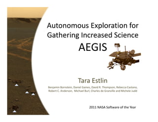
  • 1. Autonomous Exploration for  Gathering Increased Science AEGIS Tara Estlin Benjamin Bornstein, Daniel Gaines, David R. Thompson, Rebecca Castano,  Robert C. Anderson,  Michael Burl, Charles de Granville and Michele Judd 2011 NASA Software of the Year
  • 2. Consider the following problem… • You are a robotic explorer                                            on another planet  • You only talk to Earth                                                            once a day • You are in a hostile                                       environment • You have limited power and computing abilities • You are constantly on the move exploring different  terrains • As you move, you need to quickly determine if you  see objects that are interesting to scientists • If you do, you want to acquire data on these  objects, before the rover moves past 2
  • 3. This is why we developed AEGIS AEGIS: • Is a new paradigm for in‐situ                     science using onboard autonomy • Provides intelligent targeting and  data acquisition by – analyzing images of the rover scene – identifying high‐priority science targets  (e.g., rocks), and – taking high quality data of these targets  completely autonomously with no  ground interaction required 3
  • 5. How is AEGIS being used? AEGIS: • Is in regular operational use onboard                                    the Mars Exploration Rover (MER) Mission                                Opportunity rover for the past  two years • Excels in automated targeting with narrow field‐of‐ view (FOV) remote sensing instruments, such as: – MER Panoramic Cameras (in current use) – MER Mini‐Thermal Emission Spectrometer  – Mars Science Laboratory (MSL) Rover                                               ChemCam Spectrometer Mini-TES Mosaic – Before AEGIS, had to manually select                                    targets, based on ground analysis 5
  • 6. AEGIS Process for MER Process fully automated! Advanced image Navcam acquisition processing technique enables reliable, rapid identification of candidate targets. Target detection Algorithms quantify key Target feature Scientists can intuitive target extraction prioritize properties such as important brightness, size, and properties shape. for each run Target prioritization Target pointing determination Robust approach to Top score for large size pointing selection maximizes data of target. Pancam pointing High-quality, 13 color filter, quarter-frame Pancam acquisition Panoramic camera image
  • 7. Benefit of AEGIS for Rover Drive Autonomously‐targeted remote sensing taken end of drive by AEGIS X X Autonomously‐targeted remote  sensing taken mid‐drive by AEGIS Manually‐targeted remote sensing  as specified by science team (taken before drive) Targeted data Targeted data selected manually with AEGIS 7
  • 8. AEGIS identifies rock targets Scientist target profile: large rocks of high reflectance. Markers show top ten prioritized targets. 8
  • 11. AEGIS delivers 13F Pancam image after autonomously targeting the top priority rock 11
  • 12. MER before AEGIS Sol 1 Sol 2 Sol 3 Perform  MANUALLY  TARGETED remote  Pancam Sol 2 sensing of current  Perform  Perform  rover area untargeted   untargeted   Drive rover 100m  remote  remote  to new stopping  sensing of  sensing of  point local area local area Acquire wide‐ angle images of  new terrain area Pancam Sol 3 Multi-Sol Plan 12
  • 13. MER after AEGIS Sol 1 Sol 2 Sol 3 Perform  MANUALLY  TARGETED remote  AEGIS Pancam 1 sensing of current  Perform  Perform  rover area autonomously  autonomously targeted targeted Drive rover 100m  remote  remote  to new stopping  sensing of  sensing of  point local area local area Acquire wide‐ angle images of  new terrain area AEGIS Pancam 2 Multi-Sol Plan 13
  • 15. Significance: Aerospace • Fully operational and used                                 Opportunity Today regularly on MER mission – Saves valuable time every targeted                                                  data collection – Has been used more than any other                                                new technology on the Opportunity rover • Currently infusing into Mars Science  Laboratory (MSL) Mission • Attracting strong interest for  – 2018 Mars rover and other future in‐situ                             missions (e.g., Titan, Venus, Europa) – Military applications (e.g., UAVs) 15
  • 16. Significance: Science/Technology • Enables the collection of science data that would  otherwise not be possible – During or right after drives – Different times of day and temps • Saves significant time and cost                                for   targeted data collection – Gets data into the hands of scientists twice as fast                  (or more) than standard operations • Enables scientists to easily use and                                    interact with autonomy software  – Parameters chosen after significant                                      consultation with scientists • 25+ science and technology publications • Application to large number of problems in  industry and academia (e.g., underwater robotics) 16
  • 17. Significance: Humanitarian • Directly contributing to humanity goal of  finding life on other planets – Mars program theme of “Follow the water…” • Significant outreach vehicle; over 35 media  articles since release in 2010 – “Mars Rover Getting Smarter As It Gets Older” – “NASA upgrades Mars rover brain” 17
  • 18. Significance: Humanitarian Inspiring the next generation in STEM: Science, Technology, Engineering and Mathematics Over 46 Amateur Astronomy Clubs, Australia Schools and Teacher Organizations around United Kingdom the world featured our “rock hound” software in their newsletters 18
  • 20. Development Status • TRL Level 9: Flight Proven – Software fully operational  – In regular use on MER Opportunity rover • MER and MSL Scientists have already asked for  extensions, which are in progress: – Enabling multiple targeted observations – Triggering on single filter color images – Identifying novel targets – Identifying representative targets – “Soil only” detector “AEGIS is a true success story for the Mars Technology Program” Dr. Samad Hayati Manager of Mars Technology Program 20
  • 21. ASSESSMENT of USE AEGIS technology is being applied in a wide range  of applications.
  • 22. NASA Use – MER AEGIS is considered every multi‐sol plan. Sol 2138 Sol 2172 Sol 2313 Sol 2221 Sol 2247 Sol 2278 Sol 2290 Sol 2304 Sol 2312 “AEGIS is a significant enhancement for the mission and the scientific  community. MER is the first mission to implement the capability that AEGIS  provides – and it has really paid off.” Dr. John Callas 22 Mars Exploration Rover Mission Project Manager
  • 23. NASA Use – MSL Rover • The MSL Rover ChemCam Team has requested  AEGIS (PI: Roger Wiens) • AEGIS is ideal for ChemCam’s narrow field‐of‐view Laser‐Induced Breakdown Spectrometer (LIBS) – Samples rocks from a distance of 1 to 7 meters  – Able to rapidly identify rock elemental composition • AEGIS enables multiple autonomously targeted ChemCam measurements throughout the day • MSL flight software integration in progress 23
  • 26. NASA Use – Mars 2018 Rover • 2018 Rover Mission will have                                                limited time to core and store                                               up to 30 rock samples  – Will need to drive up to                                                        20 kilometers – Will need to consider targets                                                            from distinct areas • Strong interest from Mars 2018 Mission Program  Office (Charles Whetsel, Chris Salvo) in using  AEGIS to collect data on potential targets – Get data to science team faster – More targets could be considered  26
  • 27. Future Use – Other Missions • AEGIS system can enable a wide spectrum of  missions:  – Collect valuable science more often – Enhance onboard autonomy capabilities • Strong application to in‐situ missions to Titan,  Europa, Venus, Mars, the Moon, and small  bodies • Science autonomy listed as critical capability  in Titan Prebiotic Explorer Mission Study – Helps address challenges such as extremely limited  communication, high platform mobility, etc. “Onboard science algorithms will analyze the image data to detect trigger conditions such as science events, interesting features, changes relative to previous observations, …” TiPEx mission study team 27
  • 28. Industry, Government, Research Use Autonomous  Underwater  Vehicles (AUVs) Unmanned  Lunar  Aerial  Exploration Vehicles Unmanned   Sea Surface  AEGIS AEGIS is transferable to Multi‐core  Processor  Vehicles  a wide range of Benchmarking (USSVs) application domains Search and  Commercial  Rescue  Spectroscopy Robotics 28
  • 29. Industry, Government, Research Use Autonomous  Underwater  Vehicles (AUVs) Unmanned Aerial Vehicles (UAVs) Unmanned  • Developing Lunar  automated Aerial  Exploration cueing capability for UAV Vehicles surveillance platforms. • Lower-resolution wide area imagery used to trigger on selected areas. Sea Surface  AEGIS higher-resolution follow-up Unmanned   Multi‐core  Processor  • Proof-of-concept completed for ships using satellite imagery Vehicles  Benchmarking (USSVs) • Evaluating for use identifying ground vehicles on imagery from AFRL "Angel Fire" aerial asset Search and  Commercial  Rescue  Spectroscopy Robotics 29
  • 30. Industry, Government, Research Use Autonomous  Underwater  Vehicles (AUVs) Unmanned  Lunar  Aerial  Exploration “Moon Express is developing a lunar lander and Vehicles mobility system for exploration of platinum group metals on the surface of the moon as well as compete for the Google Lunar X-Prize. Unmanned   AEGIS AEGIS could be a great asset to this quest by autonomously recognizing rocks from iron-rich Sea Surface  Multi‐core  Processor  Vehicles  asteroids that might contain Benchmarking (USSVs) platinum.” -- Moon Express, Inc. Search and  Commercial  Rescue  Spectroscopy Robotics 30
  • 31. Industry, Government, Research Use Autonomous  Underwater  Robotic Underwater Vehicles Vehicles (AUVs) • WHOI Nereus vehicle Lunar  Unmanned  Aerial  Exploration – Performs deep ocean scientific Vehicles survey and sampling – Used to locate hydrothermal systems, volcanic processes, etc. Unmanned   AEGIS • CMU/Pittsburgh Aquarium Reefbot – Automatically detect, classify, and count fish Sea Surface  Multi‐core  Processor  Vehicles in their natural habitat Benchmarking (USSVs) • AEGIS could save days/weeks of exploration time through autonomous data collection Search and  Commercial  Rescue  Spectroscopy Robotics 31
  • 32. Industry, Government, Research Use Autonomous  Underwater  Robotic Underwater Vehicles Vehicles (AUVs) • WHOI Nereus vehicle important advances in automatic Lunar  “AEGIS makes Unmanned  Aerial  – Performs deep ocean.. It has direct relevance to work Explorationdata analysis. scientific Vehicles at CMU in underwater vehicles for detecting survey and sampling – Usedand cataloging fish in deep water reefs.” to locate hydrothermal systems, volcanic processes, etc. D. Wettergreen Unmanned   AEGIS • CMU/Pittsburgh Aquarium Reefbot – Automatically detect, CMU Robotics Institute classify, and count fish Sea Surface  Multi‐core  Processor  Vehicles in their natural habitat Benchmarking (USSVs) • AEGIS could save days/weeks of exploration time through autonomous data collection Search and  Commercial  Rescue  Spectroscopy Robotics 32
  • 34. MER Impact: Increased Science • Before AEGIS, all targeted data required: – Manual evaluation of images – One to several communication cycles  – The rover to remain stationary and sometimes backtrack By the time the “Block Island” meteorite was noticed in an image, the Opportunity rover was already 200 meters past. The rover had to turn around and backtrack (costing 25 additional sols). • After AEGIS, targeted data can be collected: – Without ground analysis of context images – Without communication cycles – Any time during a rover drive  – Any time of day 34
  • 37. MSL 2011 Rover Impact  MSL Impact: Increased Science • 2008 study on ChemCam                                             9m target selection using 65                                          MER Panoramic camera                                                images  • Top 5 targets evaluated – If random sampling, 10% chance of being rock – If chosen by AEGIS, 92% chance of being rock 37
  • 38. 2018 Rover Impact Mars 2018 Rover Impact: Increased Science • Previous study on AEGIS application to 2018 Mission • AEGIS can be used to collect additional targeted  science data – Increased close‐contact measurements by 50% – Increased remote‐sensing measurements by 500% – Provides scientists more targets to choose from            for coring 2018 Rover Impact: Cost Benefit • Study showed number of sols required to investigate  and core a target could be decreased from 7 to 4 sols 38
  • 40. Creativity: Innovation • AEGIS provides new paradigm for                                                Original Optimized surface data acquisition 62 Memory Usage (megabytes) – Scientist provides description of target – System can collect data whenever target                                                      detected  • Flight challenges 3.75 – Image processing performed on RAD6000  (orders of magnitude slower than standard  Memory reduced 16x desktop machine) 62 MB to 3.75 MB – AEGIS limited to < 4 MB of memory – Large performance optimizations made! Runtime (seconds) • Inventive approach to flight  software change – Full flight software upload not possible Benchmark Images – AEGIS uploaded as standalone module – Loaded into memory whenever want to use  Performance improved 7X (< 30 secs) 40
  • 41. Creativity: Usability • Parameters defined through collaboration with scientists – Describe attributes of candidate targets – Express diverse and evolving science goals  • System did not require extensions to                                            Albedo, shape, and size MER command dictionary or telemetry • Training materials  – Web interface for creating commands – User’s guide for software usage and                                                     sequencing – Standard terrain profiles available – Result message (EVR) interpreter “One of the key aspects that has made the AEGIS team successful is their long  track record of working with the scientists.” Dr. Jack Stocky New Millennium Program Manager 41
  • 42. Creativity: Quality Factors • Reliable target detection – Find rock targets in diverse terrain – Is resilient to dust‐covered or shadowed rocks – Works under strict computation constraints • Risk control through resource limits and time  deadlines • Validation and Verification – Extensive MER testing procedure and code reviews – Nightly build, static analysis, unit and regression tests 42
  • 44. Summary • Significance:  Far Reaching – Aerospace: Routinely used on MER – Science/Technology: • Enables science that could not be previously collected • Applications in military, commercial and research fields – Humanitarian: • Contributing to goal of finding life on other planets • Inspiring next generation in STEM areas • Development:  Flight Proven • Assessment of use:   – Planned for Infusion into New Missions and Applications • Creativity:  Pioneering/Deeply Innovative – Innovation: New paradigm for in‐situ data acquisition – Usability: System parameters designed through direct  collaboration with scientists – Quality: Reliable target detection under strict computation  44 constraints
  • 46. For more information… Questions? Tara.Estlin@jpl.nasa.gov We’d like to acknowledge our sponsors: New Millennium Program, Mars Technology Program, JPL Research and Technology Development Program, and the IND Technology Program and thank you to the: The Mars Exploration Rover Mission
  • 47. EXTRA
  • 48. AEGIS Target Detection Contours Flood fill + Morphology ops Edge detection 
  • 49. Contours can be further filtered Operator  Filtering  Rules Rover Body Masking 49
  • 50. Target Feature Extraction Reflectance – Mean – Variance – Skew – Kurtosis Size Light Dark – Inscribed circle – Pixel area Shape – Eccentricity – Ellipse fit error – Roundness – Ruggedness – Angularity Rounded Angular
  • 51. Target Prioritization / Top Target Selection Images from MER field trial • Scientists can  Near the prioritize different  top of the feature values and  list of combinations of two “round” – e.g., prefer large, high rocks albedo rocks – Can also support MER  cobble campaign, outcrop  finder, soil finder, etc. • Priority specification is  Near the part of command  bottom of the list of sequencing “round” rocks • Can be easily changed  as rover enters  different terrain areas
  • 52. AEGIS Code Details • AEGIS is 7968 SLOC (C) • Limited to less than 4 MB of memory • Requires only 232 KB of disk space • Regular static analysis using Coverity PreventTM • Formal code reviews – Internal AEGIS Team – Other JPL AI/machine-learning developers not members of AEGIS Team – MER Team 52
  • 53. Meteorite Detector Devin Island
  • 54. Meteorite Detector Marquette Island
  • 55. AEGIS Target Detections • Target detections are consistent with AEGIS selection  profiles  – 90% of top targets meet the selection profile  – Confirmed by evaluation of context Navcam imagery – All results reviewed with MER Science Team • The MER Science Team is very happy with AEGIS and  continues to request it regularly 55
  • 56. OASIS Framework  • OASIS: Onboard Autonomous Science Investigation System • Objective: Maximize science returned on surface mission – Identify and respond to science opportunities – Data prioritization for downlink – Maximize utilization of onboard resources • Approach – Data segmentation and feature extraction for multiple instruments – Science Data Analysis • Prioritize targets and/or data • Summarize data – Automated Planning and Scheduling • Adjust rover activities to collect new data • Ensure operation within rover resource and operation constraints
  • 57. AEGIS in the OASIS Framework  • AEGIS is a flight software system derived from the larger OASIS framework • Developed by same team of people • AEGIS includes a subset of OASIS capabilities selected for MER Relevant - Instruments available on MER Desired - Requested by scientists Feasible - Fit within memory and time limits