NDGeospatialSummit2019 - Estimation of Total Above Ground Biomass from High-Resolution UAS Imagery
•
0 j'aime•191 vues

Presented during the 2019 North Dakota Geospatial Summit in Bismarck, ND, October 22-23.

Recommandé
Recommandé
Contenu connexe
Tendances
Tendances (8)
Similaire à NDGeospatialSummit2019 - Estimation of Total Above Ground Biomass from High-Resolution UAS Imagery
Similaire à NDGeospatialSummit2019 - Estimation of Total Above Ground Biomass from High-Resolution UAS Imagery (20)
Plus de North Dakota GIS Hub
Plus de North Dakota GIS Hub (20)
Dernier
Dernier (20)
NDGeospatialSummit2019 - Estimation of Total Above Ground Biomass from High-Resolution UAS Imagery
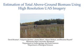
- 1. Estimation of Total Above-Ground Biomass Using High Resolution UAS Imagery David Kramar1, Valquiria Quirino1, Asami Minei1, Alison Wallace, and Breanna Huynh2 Minnesota State University Moorhead 1Department of Anthropology and Earth Sciences 2Department of Biological Sciences
- 2. Objectives • Collect and Classify High-Resolution Imagery from Two Sites using an Off-The-Shelf UAS • Compare multiple Non-NIR Vegetation Indices to Determine which Produces the Best Results • Determine Which Index Best Estimates Above Ground Biomass Source: https://www.mnstate.edu/sciencecenter/
- 3. The Regional Science Center • The Minnesota State University Moorhead Regional Science Center (RSC) is located 16 miles east of Moorhead, adjacent to Buffalo River State Park (BRSP)1.* • There are 25 rare plants and animal species within the complex BRSP, RSC, and Bluestem Prairie2.** Source: https://www.mnstate.edu/sciencecenter/
- 4. The Regional Science Center • Currently several projects are underway in the Regional Science Center o One is a prairie restoration project funded under the Minnesota Environment and Natural Resources Trust Fund (ENRTF). o A second project supporting the Nutrient Network (NutNet)* – which is a coordinated research network that is quantifying the impacts of human activities on ecological systems (see http://www.nutnet.org/home for additional information about NutNet) - is also underway. o There is a rich archeology history here. • It provides programs for over 7000 Pre-K-12 students every year. • It is an excellent “Living Laboratory”. Thus, there is an INTEREST IN MONITORING VEGETATION CHANGES in this area.
- 6. Nutrient Network Overview • At Nutrient Network ecologists and scientists are collecting data in a standardized experimental design, across a broad range of site types. • Designed to quantify community and ecosystem responses across a range of vegetative ecosystems. • Comprised of more than 40 grassland sites worldwide. • Grassroots effort. • We have two sites that we are currently monitoring.
- 7. Plot Design of the Northern Study Area
- 8. Software, UAS Platform, and Tools • Software: (GIS/Remote Sensing) o ArcGIS, QGIS, ORFEO TB • Software: (Statistics) o R (RATTLE Package) o R (random forest, party, tree, etc) o Statistica • Software: (UAS/Processing) o Pix4D Desktop o Pix4D Capture o Drone Harmony • UAS Platform: • Phantom 4 Advanced • Example of Tools (GIS) • Spatial Analyst Extension • Segment Mean Shift • Nibble • Region • Etc
- 9. Vegetation Indices (Minei 2019) • We focused on two sites. • Imagery was collected every 2 weeks from mid-May until the end of September. • We wanted to determine which index did the best job identifying healthy versus unhealthy vegetation, and which index would best predict total above-ground biomass. • All vegetation indexes were generated and interpreted by student Asami Minei. The sheer volume of data she has analyzed is overwhelming. • Modified VVI • 𝑉𝑉𝐼 = 𝐿𝑜𝑔 10 1 − 𝑅−𝑅𝑜 𝑅+𝑅𝑜 + 10 1 − 𝐺−𝐺𝑜 𝐺+𝐺𝑜 + 10 1 − 𝐵−𝐵𝑜 𝐵+𝐵𝑜 + 10 • Modified Global Environmental Monitoring Index • 𝐺𝐸𝑀𝐼 = 𝑒𝑡𝑎 1 − 0.25 ∗ 𝑒𝑡𝑎 − 𝑝𝑅𝑒𝑑−0.125 1−𝑝𝑅𝑒𝑑 • where 𝑒𝑡𝑎 = 2∗ 𝑝𝐺𝑟𝑒𝑒𝑛2−𝑝𝑅𝑒𝑑2 +1.5 ∗𝑝𝐺𝑟𝑒𝑒𝑛+0.5 ∗𝑝𝑅𝑒𝑑 𝑝𝐺𝑟𝑒𝑒𝑛+𝑝𝑅𝑒𝑑+0.5 • Green Leaf Index • GLI = 2 ∗ρ𝐺𝑟𝑒𝑒𝑛−𝑝𝑅𝑒𝑑 −ρ𝐵𝑙𝑢𝑒 2 ∗ρ𝐺𝑟𝑒𝑒𝑛+𝑝𝑅𝑒𝑑+ρ𝐵𝑙𝑢𝑒 • VariGreen • 𝑉𝐴𝑅𝐼 = 𝑝𝐺𝑟𝑒𝑒𝑛−𝑝𝑅𝑒𝑑 𝑝𝐺𝑟𝑒𝑒𝑛+𝑝𝑅𝑒𝑑−𝑝𝐵𝑙𝑢𝑒 • Green-Red Vegetation Index • 𝐺𝑅𝑉𝐼 = ρ𝐺𝑟𝑒𝑒𝑛 −𝑝𝑅𝑒𝑑 ρ𝐺𝑟𝑒𝑒𝑛+ρ𝑅𝑒𝑑 • We also calculated a soil-adjusted index (modified version of SAVI) which appeared to perform well. Due to time limitations, we do not present that here.
- 11. Minei, A. 2019
- 12. Vegetation Indices VVI – Greater Detail GLI – More Washed Out Minei, A. 2019
- 13. Minei, A. 2019
- 15. Minei, A. 2019
- 16. Minei, A. 2019
- 17. Biomass Estimates • Biomass was collected in 10 cm wide x 100 cm long strips from two locations in each plot. • This resulted in 60 sub-plots. During the first collection, the sub-plots were combined (DOH!), which reduced the total sample size to 30. Moving forward these will be kept separate. • We extracted the min, max, mean, and standard deviation of the different vegetation indices as they related to the biomass sub-plots. • Models were developed using polynomial regression, random forests/CART, and neural networks. • Today I will present results from Decision Trees (CART), Random Forests, and Neural Networks.
- 19. Biomass Estimates 1. Collected 2. Sorted 3. Identified 4. Weighed
- 20. Biomass Estimates • Initial Models were Developed in R using both command line and Rattle. • Methods were implemented into an R-Package that will be distributed via the R CRAN in the future (later talk at conference). • Models were implemented spatially in both ArcGIS and R (due to R- package development). • Results were cross-validated. This year we have training AND validation biomass plots that allow us to assess the models in areas outside of the Nutrient Network proper. • While we present the estimates as “High, Medium, Low”, actual estimates were in grams, and then converted to grams per meter squared.
- 23. Biomass-Decision Tree (VVI) Generally predicted total biomass well based off the modified VVI.
- 24. Biomass-Decision Tree (VVI) Generally predicted grass biomass well based off the modified VVI.
- 25. Biomass-Decision Tree (VVI) Prediction of forbes biomass was not as robust as grass and total biomass.
- 26. Biomass-Decision Tree (GLI) GLI performed better than GEMI, but not as well as the VVI.
- 27. Biomass-Decision Tree (GLI) GLI performed better than GEMI, but not as well as the VVI. Total Biomass
- 28. Biomass-Decision Tree (GLI) Similar to forbes estimates for the VVI, estimates from the GLI were also lower
- 29. Biomass-Decision Tree (VariGreen) VariGreen also performed better than GEMI, But not as well as the VVI and not as well as the GLI. As such – No Map For You! Come Back 1 Month!
- 30. Biomass-Decision Tree (GEMI) GEMI did not perform well in terms of biomass estimates. As a result, the map is a HOT MESS and not presented!
- 32. Biomass-Random Forests(VVI) Random Forests provided a better solution to Biomass estimates than a traditional regression tree.
- 33. Biomass-Random Forests(VVI) Random Forests provided a better solution to Biomass estimates of total grass than a traditional regression tree.
- 34. Biomass-Random Forests(VVI) Random Forests provided a better solution to Biomass estimates of total forbes than a traditional regression tree.
- 35. Biomass-Random Forests(GLI) GLI did not Perform as well as the VVI, however, the results are still acceptable. GEMI and Varigreen did not perform well, and are not presented here. Total Biomass.
- 37. Biomass - Neural Networks
- 38. Biomass - Neural Networks (VVI) Neural Networks provided a good solution to Biomass estimates using the VVI. Whereas the relationship was not as strong as the Random Forests, the fit was adequate.
- 39. Biomass - Neural Networks (GLI) Neural Networks also provided a good solution to Biomass estimates using the GLI. Whereas the relationship was not as strong as the Random Forests, the fit was adequate, and performs on par with the VVI. Varigreen and GEMI performed poorly with the resulting pseudo R2 values ~ R = 0.23
- 40. Conclusions • The Modified VVI worked well, as did the GLI. Overall, the VVI was a better predictor of total above ground biomass, however GLI also performed at an acceptable rate. • I am really on the fence with object oriented versus traditional ISO classification. I have had great luck with object-oriented classification using imagery such as NAIP, or even resolution down to about 6”. In some respects object oriented worked better, in other cases it did not. I am not aware of this being done at sub ¼” pixel resolution. • Random Forests, CART, and Neural Networks work well in predicting total above ground biomass based on this study. • The project was a lot of fun!
- 41. Moving Forward • Biomass collection from each sub-plot will not be collapsed into a single sample. Samples for 2019 were processed a couple weeks ago, models are in progress – promising! • There is a continued interest in determining if we can estimate biomass for certain plant types (equisitem, forbes, big bluestem, etc). To that end, biomass has been separated based on type. Currently grass estimates are robust. • While we have been able to get reasonable results in classifying down to species (not presented here), additional work is warranted. • Focus efforts more heavily on issues pertaining to non-native grass encroachment. • We recently acquired a Sentera NDVI sensor mounted on a DJI Mavic. We are anxious to see how this performs in comparison. Questions?