Presentation by Christian Quest on Openstreetmap made at the OECD Conference on Innovating the Public Sector: From Ideas to Impact (12-13 November 2014)
•
0 j'aime•3,016 vues

This presentation by Christian Quest was made at the OECD conference on Innovating the Public Sector: From Ideas to Impact (12-13 November 2014). For more information visit the OECD Observatory of Public Sector Innovation: https://www.oecd.org/governance/observatory-public-sector-innovation/events/.

Recommandé
Recommandé
Contenu connexe
Tendances
Tendances (20)
En vedette
En vedette (12)
Similaire à Presentation by Christian Quest on Openstreetmap made at the OECD Conference on Innovating the Public Sector: From Ideas to Impact (12-13 November 2014)
Similaire à Presentation by Christian Quest on Openstreetmap made at the OECD Conference on Innovating the Public Sector: From Ideas to Impact (12-13 November 2014) (20)
Plus de OECD Governance
Plus de OECD Governance (20)
Dernier
Dernier (20)
Presentation by Christian Quest on Openstreetmap made at the OECD Conference on Innovating the Public Sector: From Ideas to Impact (12-13 November 2014)
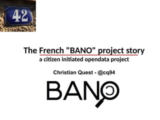
- 1. The French "BANO" project story a citizen initiated opendata project Christian Quest - @cq94
- 3. Address data : why ? A basic « key » dataset Used by many actors High economic impact → Some studies indicate a 0.5 % impact on GDP ! ← 3
- 4. Address data : for who ? 4 Post Office / Delivery
- 5. Address data : for who ? Emergency & Rescue
- 6. Address data : for who ? Start / end point for route calculation...
- 7. Address data : for who ? Geocoding : brings non geospatial data into the geospatial world….
- 8. Available open data in France A few open datasets in major cities... Lyon, Toulouse, Montpellier, Rennes, Strasbourg, Mulhouse… → only 7.5 % of France coverage OpenStreetMap addresses ? → Less than 10 % of France coverage → No global national open dataset available ←
- 9. Available « closed » data in France Many different datasets ● Post Office (La Poste has 4 datasets!) ● National Geographic Institute (IGN) ● Electricity/Gaz company (ErDF, GrDF) ● Phone operators… (Orange, etc) ● Private companies… → Minimal collaboration… None of good quality ! ←
- 10. OpenStreetMap France starts its « BANO »project... January 2014 : first scripts tests to collect data April 2014 : BANO project explained during OSM France annual conference in Paris May 2014 : First datasets published made of ● OpenStreetMap address data ● opendata from major cities ● Addresses extracted automatically from cadastre data (1.3M pdf files downloaded and processed in 10 days !)
- 11. BANO coverage... OpenStreetMap opendata cadastre + OSM cadastre only Hosted by : OpenStreetMap France
- 12. BANO data... Nearly 20M locations (90 % population covered) → 15.2M addresses points, 3.8M named places, 1M street / municipalities locations Data updated and published nightly by OpenStreetMap-France → CSV files, Shapefile, RDF (turtle) for the semantic web (W3C/ISA/INSPIRE ontology) Data under ODbL 1.0 licence Also available on data.gouv.fr french national opendata portal...
- 13. BANO future... + + = National (Open) Address Database
- 14. National Address Database (to be announced)
- 15. BANO future... Support from Etalab (data.gouv.fr) to go further... ● First step towards a real key national (open) dataset ● Definition of unique nationwide address identifiers ● Work closer with government agencies (IGN, DGFiP, etc) ● Web interface to simplify error reporting and fixing BANO benefit for OSM ● Shows where streets and streetnames are missing ● More than 100.000 streetnames added since May (rate doubled thank to BANO)
- 16. Questions ? @projetBANO / bano@openstreetmap.fr @cq94 / cquest@openstreetmap.fr christian.quest@data.gouv.fr