CARTER ROAD WATERFRONT DEVELOPMENT
•Télécharger en tant que PPTX, PDF•
6 j'aime•4,090 vues

Landscape designing case study

Recommandé
Recommandé
Contenu connexe
Tendances
Tendances (20)
Similaire à CARTER ROAD WATERFRONT DEVELOPMENT
Similaire à CARTER ROAD WATERFRONT DEVELOPMENT (20)
Plus de Omkar Nandavadekar
Dernier
Dernier (20)
CARTER ROAD WATERFRONT DEVELOPMENT
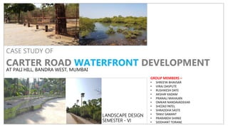
- 1. CASE STUDY OF CARTER ROAD WATERFRONT DEVELOPMENT AT PALI HILL, BANDRA WEST, MUMBAI LANDSCAPE DESIGN SEMESTER - VI GROUP MEMBERS – • SHREEYA BHAVSAR • VIRAJ DASPUTE • RUSHIKESH DATE • AKSHAY KADAM • PRANALI MAHAJAN • OMKAR NANDAVADEKAR • SHEZAD PATEL • SHRADDHA SASTE • TANVI SAWANT • PRARABDH SHIRKE • SIDDHANT TORANE
- 2. CONTENT • Abstract • Aim of case study • Methodology • Scope and limitations • Background and history • Purpose of project INTRODUCTION SITE STUDY • Location and access to site • Site surrounding • Development plan cross check • Similar nearby spaces and land use • Topographic study • Site plan • Climate study • Vegetation mapping • Activity mapping on site • User classification and analysis ANALYSIS • Sensor mapping • Services analysis • Identification of problems • Overall Analysis • Conclusion
- 3. ABSTRACT • Urban waterfronts are interface between city and water bodies of sea, river and lake. • The host city maintains visual image as well functional characteristics of it. One such mega city waterfront is located at the carter road at Mumbai, India with elements of visual and functional interpretation as one walks through it. • This is a unique formal urban waterfront constructed, maintained and operationalized largely by the public participation without the direct support of local and the provincial governments. • It was constructed in the year 2002 initially, but become fully operational and opened for the public use after the restoration in 2008 under the public space reclamation project. • The responsibility to manage is shared between and amongst the two community based organization - Bandra west residents association (BWRA) and Kurla-Bandra-Santa Cruz foundation. • Public access to waterfront is universal however; accessibility is limited to non-commercial use of this urban space. • This study tries to understand sustainable principles of urban waterfronts based on its design, functionality, and management components. • Further the principles of urban waterfronts have been divided into physical and social factors. • Chronological evolution of carter road waterfront has been studied to understand sustainable factors mentioned above. Stakeholder’s consultations have been carried out to assess the design, functions and management aspects of the waterfront. • The main stakeholders in this case are local residence, a local member of parliament, a group of design professionals and a commercial agency. • User’s survey has been conducted to know the activities that are being carried out on the waterfront on a regular basis largely manifested by the surrounding land uses. • The carter road waterfronts provides access to all the age groups, while it designates spaces for recreational and health facilities. • It also provides spaces for social events as and when needed. • It appears that the waterfront is attracting people from all section of the society both local and tourist alike, however there exists a few conflicts of local fishing community and daily users of the promenade.
- 4. SCOPE & LIMITATIONS Scope : As the site is surrounded by residential area many people can visit on regular basis for morning walks etc. As people visit the site regularly, social events like blood donations camps, fitness events etc can get a good response. Limitations : Due to the coastal area which there might be problems in rainy season. The slight change in suitable climatic conditions can affect the comfort of users METHODOLOGY 1. This content consist of the case study done by a group of people who visited the place and studied details of the allotted area. 2. It is based on governance aspects in which public participation in maintenance and overall management was the supreme priority. 3. This case study is relied on some primary data collection, public interaction, activity mapping at the surrounding neighbourhoods and some group discussions. AIM & OBJECTIVE Aim : the major aim of this study is to understand sustainable principles of carter road waterfront as far as its design, functionality and management are concerned. The followings are the main objectives of the study : 1. To study chronological evolution of carter road waterfront based on sustainability principles; 2. To understand the physical sustainability in terms of design of the promenade; 3. To understand the social sustainability in terms of functionality and management.
- 5. PURPOSE OF THE PROJECT • Looking back into the history of Carter Road, it dates back to era of British Rule in India. During that period several fishing communities from Bandra resided at this place originally. The communal place where the fishing communities resided was locally known as “Kolliwadas”. The area where the promenade is constructed was used by these fishing communities to carry out various fishing activities. • As the years passed the same area of promenade started to convert into construction waste dumping ground. The accumulated waste and certain fishing activities had hampered the environmental conditions and the natural mangroves plantation patches were damaged. So to stop further environmental degradation and also to increase the aesthetic appeal of the area of the place the citizens of Bandra West locality also known as Bandra West Residents Association (BWRA) came together. • As the first initiative, they had appealed the local government of Brihanmumbai Municipal Corporation (BMC) to take care of deteriorating environmental resources in the neighborhood. But the plan drafted by the local authority for the promenade was not acceptable by the local resident association as the design of the promenade mentioned in the plan did not favor preservation of mangroves and eliminated the fishing village. • So to stop the local government authority to do so, the local citizens filled a case in Mumbai High Court against the local authorities and won the case (Times of India, Mumbai 16 March 2012). Promenade was constructed in the year 2002 and made open for public without any help of BMC and or the State Government of Maharashtra. The promenade was designed in such way that the remaining mangroves were preserved and the fishing village was shifted to the north of the promenade. Initial years public response in using the promenade were very poor and maintenance become an issue. • It was redesigned with features such as amphitheaters, chess playing tables, dog parks, and children play area in the year 2008. The design was such that it promoted more of recreational and health related activities. The design also permitted the fishermen to use some part of the promenade to keep their boats and other required equipment. • The land use has also changed over period of time. It is said to be sustainable development if communities that require direct access to water are given first preference while allocating land. Mixed land use is very important feature for sustainable development and has been prioritized in this case.
- 6. LOCATION – CARTER ROAD, BANDRA WEST, MUMBAI, MAHARASHTRA. INDIA MAHARASHTRA MUMBAI BANDRA (WEST) WATERFRONT AT CARTER ROAD LANDMARKS RIZVI COLLEGE OF ARTS,COMMERCE AND SCIENCE OTTERS CLUB JOGGERS PARK CAFÉ COFFEE DAY BY TRAIN : 3.4 KM (13MIN.) AIRPORT : 9.8 KM (23MIN) CHHATRAPATI SHIVAJI INTERNATIONAL AIRPORT BUS STAND : (BEST) 0.5KM
- 7. SITE SURROUNDING DOG PARK RIZVI COLLEGE CHILDRENS PARK CAFÉ COFFEE DAY RESIDENTIAL BUILDINGS RIZVI COMPLEX BUS STOP JOGGERS PARK WESTERN RAILWAY GUEST HOUSE
- 8. CASE STUDY OF CARTER ROAD WATERFRONT, BANDRA. SIMILAR NEARBY SPACES AND LAND USEDEVELOPMENT PLAN CROSS CHECK TO THE SOUTH LIES THE BANDSTAND AREA EASTERN SIDE OF THE SIDE IS COVERED WITH RESIDENTIAL PLOTS AND BUILDINGS ALONG WITH GOVERNMENT COLONIES ARABIANSEATOTHEWEST NORTHERN SIDE OF SITE CONSISTS OF RESIDENTIALAREA AND VILLAGE OF KHAR DANDA SITE SURROUNDING LAND USE SITE EXTENT MCGM DEVELOPMENT PLAN 2034 SIMILAR NEARBY SPACES SITE UNDER CONSIDERATION FOR STUDY AREA TO SOUTH KNOWN AS BANDSTAND, BANDRA END, BANDRA FORT PRECINCT ARABIAN SEA FALLS UNDER WARD – H IN GREEN ZONE
- 9. CASE STUDY OF CARTER ROAD WATERFRONT, BANDRA. SITE PLAN A R A B I A N S E A PROMENADE MANGROVES CARTER ROAD TOWARDS KHAR DANDA BOULDER ROCKS TOWARDS BANDRA STATION SITE DETAILS Site length – 1.2 kilometers. Abutting road width – 18 meter wide.
- 10. CASE STUDY OF CARTER ROAD WATERFRONT, BANDRA. CLIMATE STUDY Site falls under Mumbai Suburban Region. Mumbai's climate can be best described as moderately hot with high level of humidity. Its coastal nature and tropical location ensures temperatures won't fluctuate much throughout the year. Average rainfall precipitation is 242.2 cm (95.35 inches The mean maximum average temperatures is about 32 °C (90 °F) in summer and 30 °C (86 °F) in winter, while the average minimums are 25 °C (77 °F) in summer and 18 °C (64 °F) in winter. Mumbai experiences three distinct seasons: 1. Winter (Nov to Feb or mid March) 2. Summer (Feb/March to mid June and Sept to Nov) 3. Monsoon: (June to August, at times until October) Typical geography of Mumbai. Surrounded by sea and creeks on three sides and hills in the northern side allows the vapors from sea due to evaporation remaining in Mumbai's surrounding rather than drifting away. This results in higher humidity in air TOPOGRAPHY HUMIDITY
- 11. CASE STUDY OF CARTER ROAD WATERFRONT, BANDRA. VEGETATION ON SITE FOXTAIL PALM
- 12. CASE STUDY OF CARTER ROAD WATERFRONT, BANDRA. ACTIVITY MAPPING ON SITE CHILDRENS PLAY PARK Public play for kids and nearby residential children. Kids play during day and evening time period FISHING BAY Local fishermen carrying out their job SEA VIEW POINT Enjoying the sea by standing and seating along with provided seats JOGGING TRACK Running parallel to the sea covering the whole site Used for morning walks and fitness aspects DOG PARK For the beloved dogs of their owners used throughout the day for sake of joy for dogs SITE PLAN General data of activities carried out by different types of space users according to the segregated spaces in site AMPHITHEATRE For small festivals and cultural shows UNION PARK INTERACTIVE SPACE Festival and gathering space with seating.
- 13. CASE STUDY OF CARTER ROAD WATERFRONT, BANDRA. USER CLASSIFICATION The space was also used for drying clothes in morning by ‘Dhobi’. According to age group…… KIDS TEENAGERS ADULTS SENIOR CITIZENS Jogging, yoga exercise, leisure, fishing, and walking with the pets etc. Observed were mainly recreational and health sports such as walking Relaxing under the shade and enjoying the calm nature Play parks in central portion of site were used by them
- 14. CASE STUDY OF CARTER ROAD WATERFRONT, BANDRA. USER ANALYSIS EARLY MORNING ACTIVITY GENERATORS DAY TIME ACTIVITY GENERATORS LATE EVENING ACTIVITY GENERATORS SITE PLAN
- 15. CASE STUDY OF CARTER ROAD WATERFRONT, BANDRA. SENSOR MAPPING AND SERVICES 1.2 M WIDE STORM WATER DRAINAGE CAST IRON PIPE @ 7 M C/C CAST IRON PIPE @ 5 M C/C NALA NALA (FOUL SMELL) VIEW POINT CHILDRENS PARK DOG PARK AMPHITHEATER ROAD (NOISE)