SlideShare une entreprise Scribd logo
1  sur  13
Bay Area Protected Areas Database
           January 17, 2013
Bay Area Protected Areas Database (BPAD)


 How many acres of potential rangeland are
 unprotected in the Bay Area?

 How many acres of publicly accessible land in
 Santa Clara County?

 What percentage of protected lands are
 owned by Federal Agencies in the region?

 What percentage of kids under 15 don’t live
 within walking distance of a park?
Bay Area Protected Areas Database (BPAD)


   1.4 million
 How many acres of potential rangeland are
 unprotected in the Bay Area?


   ~139,000
 How many acres of publicly accessible land in
 Santa Clara County?


   ~215,000
 What percentage of protected lands are
 owned by Federal Agencies in the region?


     62
 What percentage of kids under 15 don’t live
 within walking distance of a park?
Bay Area Protected Areas Database (BPAD)


A critical dataset that enables the
region to:

- Illustrate our collective successes
-Measure progress toward our
regional goals
- Provide a baseline for many ongoing
planning and research efforts
Bay Area Protected Areas Database (BPAD)


      Quick History:
1960’s ABAG

1970s Greenbelt (Larry Orman)

1990’s GIS!! At Risk Map, GIN
and BAOSC

2000s Expansion to all of California
Bay Area Protected Areas Database (BPAD)

Critical Dataset for Planning, Research,
Measuring Progress, Outdoor Sites
Bay Area Protected Areas Database (BPAD)

Critical Dataset for Planning, Research,
Measuring Progress, Outdoor Sites
Bay Area Protected Areas Database (BPAD)

Critical Dataset for Planning, Research,
Measuring Progress, Outdoor Sites
Bay Area Protected Areas Database (BPAD)

Critical Dataset for Planning, Research,
Measuring Progress, Outdoor Sites
Bay Area Protected Areas Database (BPAD)


    Member benefit - Download the database!

http://openspacecouncil.org/link/bpad
        1. Regional Map
        2. Table with statistics on ownership type, access, agency type, county
        3. GIS data with complete metadata

365+ downloads since summer of 2009

200 different organizations – Land Trusts, Environmental Consultants,
Researchers, College Students/Professors, Public Agencies, and many more
Bay Area Protected Areas Database (BPAD)


2012 Release – Together we are making progress!

http://openspacecouncil.org/link/bpad
1.3 million acres – Most of any major metropolitan area in the world!

Area 1.7 x the size of Yosemite, right in our Backyard

Nearly 1 million acres of publicly accessible parks, trails and open spaces!

Acquisition Dates included for 80% of the acreage.
Bay Area Protected Areas Database (BPAD)


                 Thank You!

GreenInfo Network

Bay Area Program of the State Coastal Conservancy

Jon Christensen and Maria Santos for support with Acquisition Dates

And all of you for your dedication and hard work!

Contenu connexe

En vedette

Captura digital
Captura digitalCaptura digital
Captura digitalAdriana
 
биоген презентација
биоген презентацијабиоген презентација
биоген презентацијаAssociation BIOGEN
 
Certificação em TIC, uma forma de valorização dos docentes.
Certificação em TIC, uma forma de valorização dos docentes.Certificação em TIC, uma forma de valorização dos docentes.
Certificação em TIC, uma forma de valorização dos docentes.Fernanda Ledesma
 
Mudras fuego aire eter tierra agua
Mudras fuego aire eter tierra aguaMudras fuego aire eter tierra agua
Mudras fuego aire eter tierra aguaNone
 
Metodologi penelitian pgmi 2103 bagian 1
Metodologi penelitian pgmi 2103 bagian 1 Metodologi penelitian pgmi 2103 bagian 1
Metodologi penelitian pgmi 2103 bagian 1 sadirun
 
Intervención pedagdesarrollosexprees
Intervención pedagdesarrollosexpreesIntervención pedagdesarrollosexprees
Intervención pedagdesarrollosexpreescaspeac
 
A State-based Model for Runtime Resource Reservation for Component-based Appl...
A State-based Model for Runtime Resource Reservation for Component-based Appl...A State-based Model for Runtime Resource Reservation for Component-based Appl...
A State-based Model for Runtime Resource Reservation for Component-based Appl...IDES Editor
 
MIS assignment web version
MIS assignment web versionMIS assignment web version
MIS assignment web versionSergey Kogai
 
Jr wirsan vs jr riyoo.2
Jr wirsan vs jr riyoo.2Jr wirsan vs jr riyoo.2
Jr wirsan vs jr riyoo.2Putra Meunafa
 
OSC沖縄2014_JPUG資料
OSC沖縄2014_JPUG資料OSC沖縄2014_JPUG資料
OSC沖縄2014_JPUG資料kasaharatt
 

En vedette (15)

Apam 1
Apam 1Apam 1
Apam 1
 
Lol
LolLol
Lol
 
Captura digital
Captura digitalCaptura digital
Captura digital
 
биоген презентација
биоген презентацијабиоген презентација
биоген презентација
 
Bab 9 – pengurusan bilik darjah
Bab 9 – pengurusan bilik darjahBab 9 – pengurusan bilik darjah
Bab 9 – pengurusan bilik darjah
 
Certificação em TIC, uma forma de valorização dos docentes.
Certificação em TIC, uma forma de valorização dos docentes.Certificação em TIC, uma forma de valorização dos docentes.
Certificação em TIC, uma forma de valorização dos docentes.
 
Mudras fuego aire eter tierra agua
Mudras fuego aire eter tierra aguaMudras fuego aire eter tierra agua
Mudras fuego aire eter tierra agua
 
Metodologi penelitian pgmi 2103 bagian 1
Metodologi penelitian pgmi 2103 bagian 1 Metodologi penelitian pgmi 2103 bagian 1
Metodologi penelitian pgmi 2103 bagian 1
 
Intervención pedagdesarrollosexprees
Intervención pedagdesarrollosexpreesIntervención pedagdesarrollosexprees
Intervención pedagdesarrollosexprees
 
A State-based Model for Runtime Resource Reservation for Component-based Appl...
A State-based Model for Runtime Resource Reservation for Component-based Appl...A State-based Model for Runtime Resource Reservation for Component-based Appl...
A State-based Model for Runtime Resource Reservation for Component-based Appl...
 
MIS assignment web version
MIS assignment web versionMIS assignment web version
MIS assignment web version
 
Ppoint pai t.1
Ppoint pai t.1Ppoint pai t.1
Ppoint pai t.1
 
Doc1
Doc1Doc1
Doc1
 
Jr wirsan vs jr riyoo.2
Jr wirsan vs jr riyoo.2Jr wirsan vs jr riyoo.2
Jr wirsan vs jr riyoo.2
 
OSC沖縄2014_JPUG資料
OSC沖縄2014_JPUG資料OSC沖縄2014_JPUG資料
OSC沖縄2014_JPUG資料
 

Similaire à Announcing 2012 Bay Area Protected Lands Map

C:\Documents And Settings\Sachink\Desktop\Shilpa Study\Gis Projects Test
C:\Documents And Settings\Sachink\Desktop\Shilpa Study\Gis Projects TestC:\Documents And Settings\Sachink\Desktop\Shilpa Study\Gis Projects Test
C:\Documents And Settings\Sachink\Desktop\Shilpa Study\Gis Projects Testshilpagupta1984
 
wildlifereport2013
wildlifereport2013wildlifereport2013
wildlifereport2013Mac Kobza
 
GIS 165 Tarzana Nature & Education Center Project Proposal FINAL (1)
GIS 165 Tarzana Nature & Education Center Project Proposal FINAL (1)GIS 165 Tarzana Nature & Education Center Project Proposal FINAL (1)
GIS 165 Tarzana Nature & Education Center Project Proposal FINAL (1)Paige Terry
 
Protecting Groundwater Resources - OH Clean Water Conference
Protecting Groundwater Resources - OH Clean Water ConferenceProtecting Groundwater Resources - OH Clean Water Conference
Protecting Groundwater Resources - OH Clean Water ConferenceOhio Environmental Council
 
Natural England Update
Natural England UpdateNatural England Update
Natural England UpdateGreenSpace
 
Defra: Data Round Table
Defra: Data Round TableDefra: Data Round Table
Defra: Data Round TableAlex Coley
 
GFW Partner Meeting 2017 - Parallel Discussions 3: Monitoring Beyond Forests
GFW Partner Meeting 2017 - Parallel Discussions 3: Monitoring Beyond ForestsGFW Partner Meeting 2017 - Parallel Discussions 3: Monitoring Beyond Forests
GFW Partner Meeting 2017 - Parallel Discussions 3: Monitoring Beyond ForestsWorld Resources Institute (WRI)
 
Transportation and Environmental Collaboration Initiative
Transportation and Environmental Collaboration InitiativeTransportation and Environmental Collaboration Initiative
Transportation and Environmental Collaboration Initiative219GreenConnect
 
Gfw presentation for wb master class 27march15
Gfw presentation for wb master class 27march15Gfw presentation for wb master class 27march15
Gfw presentation for wb master class 27march15Nancy Harris
 
2016 conservation track: identifying key wetlands areas in the rio grande na...
2016 conservation track:  identifying key wetlands areas in the rio grande na...2016 conservation track:  identifying key wetlands areas in the rio grande na...
2016 conservation track: identifying key wetlands areas in the rio grande na...GIS in the Rockies
 
Water and Environmental Hub - CWRA - June 30 2011
Water and Environmental Hub - CWRA - June 30 2011Water and Environmental Hub - CWRA - June 30 2011
Water and Environmental Hub - CWRA - June 30 2011Alex Joseph
 
2013 GISCO Track, Utilizing GIS to Locate Environmental and Recreation Stream...
2013 GISCO Track, Utilizing GIS to Locate Environmental and Recreation Stream...2013 GISCO Track, Utilizing GIS to Locate Environmental and Recreation Stream...
2013 GISCO Track, Utilizing GIS to Locate Environmental and Recreation Stream...GIS in the Rockies
 

Similaire à Announcing 2012 Bay Area Protected Lands Map (20)

GIS-Based Approach to Shoreline Access Mapping
GIS-Based Approach to Shoreline Access MappingGIS-Based Approach to Shoreline Access Mapping
GIS-Based Approach to Shoreline Access Mapping
 
C:\Documents And Settings\Sachink\Desktop\Shilpa Study\Gis Projects Test
C:\Documents And Settings\Sachink\Desktop\Shilpa Study\Gis Projects TestC:\Documents And Settings\Sachink\Desktop\Shilpa Study\Gis Projects Test
C:\Documents And Settings\Sachink\Desktop\Shilpa Study\Gis Projects Test
 
wildlifereport2013
wildlifereport2013wildlifereport2013
wildlifereport2013
 
A Water Quality Valuation Approach To Strategic Planning
A Water Quality Valuation Approach To Strategic PlanningA Water Quality Valuation Approach To Strategic Planning
A Water Quality Valuation Approach To Strategic Planning
 
GIS 165 Tarzana Nature & Education Center Project Proposal FINAL (1)
GIS 165 Tarzana Nature & Education Center Project Proposal FINAL (1)GIS 165 Tarzana Nature & Education Center Project Proposal FINAL (1)
GIS 165 Tarzana Nature & Education Center Project Proposal FINAL (1)
 
Protecting Groundwater Resources - OH Clean Water Conference
Protecting Groundwater Resources - OH Clean Water ConferenceProtecting Groundwater Resources - OH Clean Water Conference
Protecting Groundwater Resources - OH Clean Water Conference
 
Natural England Update
Natural England UpdateNatural England Update
Natural England Update
 
Defra: Data Round Table
Defra: Data Round TableDefra: Data Round Table
Defra: Data Round Table
 
Gis projects test
Gis projects testGis projects test
Gis projects test
 
GFW Partner Meeting 2017 - Parallel Discussions 3: Monitoring Beyond Forests
GFW Partner Meeting 2017 - Parallel Discussions 3: Monitoring Beyond ForestsGFW Partner Meeting 2017 - Parallel Discussions 3: Monitoring Beyond Forests
GFW Partner Meeting 2017 - Parallel Discussions 3: Monitoring Beyond Forests
 
NASA Keynote Presentation - Monday Conservation Forum
NASA Keynote Presentation - Monday Conservation ForumNASA Keynote Presentation - Monday Conservation Forum
NASA Keynote Presentation - Monday Conservation Forum
 
Transportation and Environmental Collaboration Initiative
Transportation and Environmental Collaboration InitiativeTransportation and Environmental Collaboration Initiative
Transportation and Environmental Collaboration Initiative
 
Hawaii and US Pacific Basin Orthoimagery Update
Hawaii and US Pacific Basin Orthoimagery UpdateHawaii and US Pacific Basin Orthoimagery Update
Hawaii and US Pacific Basin Orthoimagery Update
 
DGuenaga_Report
DGuenaga_ReportDGuenaga_Report
DGuenaga_Report
 
Gfw presentation for wb master class 27march15
Gfw presentation for wb master class 27march15Gfw presentation for wb master class 27march15
Gfw presentation for wb master class 27march15
 
2016 conservation track: identifying key wetlands areas in the rio grande na...
2016 conservation track:  identifying key wetlands areas in the rio grande na...2016 conservation track:  identifying key wetlands areas in the rio grande na...
2016 conservation track: identifying key wetlands areas in the rio grande na...
 
Lauriault access donneesnumeriques_legal@it__04042011
Lauriault access donneesnumeriques_legal@it__04042011Lauriault access donneesnumeriques_legal@it__04042011
Lauriault access donneesnumeriques_legal@it__04042011
 
NASA - NACD Panel 20220718 (1).pptx
NASA - NACD Panel 20220718 (1).pptxNASA - NACD Panel 20220718 (1).pptx
NASA - NACD Panel 20220718 (1).pptx
 
Water and Environmental Hub - CWRA - June 30 2011
Water and Environmental Hub - CWRA - June 30 2011Water and Environmental Hub - CWRA - June 30 2011
Water and Environmental Hub - CWRA - June 30 2011
 
2013 GISCO Track, Utilizing GIS to Locate Environmental and Recreation Stream...
2013 GISCO Track, Utilizing GIS to Locate Environmental and Recreation Stream...2013 GISCO Track, Utilizing GIS to Locate Environmental and Recreation Stream...
2013 GISCO Track, Utilizing GIS to Locate Environmental and Recreation Stream...
 

Announcing 2012 Bay Area Protected Lands Map

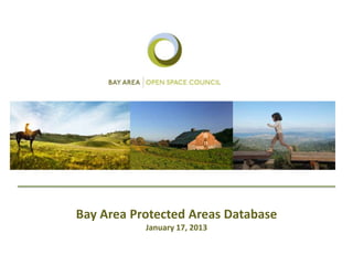
  • 1. Bay Area Protected Areas Database January 17, 2013
  • 2. Bay Area Protected Areas Database (BPAD) How many acres of potential rangeland are unprotected in the Bay Area? How many acres of publicly accessible land in Santa Clara County? What percentage of protected lands are owned by Federal Agencies in the region? What percentage of kids under 15 don’t live within walking distance of a park?
  • 3. Bay Area Protected Areas Database (BPAD) 1.4 million How many acres of potential rangeland are unprotected in the Bay Area? ~139,000 How many acres of publicly accessible land in Santa Clara County? ~215,000 What percentage of protected lands are owned by Federal Agencies in the region? 62 What percentage of kids under 15 don’t live within walking distance of a park?
  • 4. Bay Area Protected Areas Database (BPAD) A critical dataset that enables the region to: - Illustrate our collective successes -Measure progress toward our regional goals - Provide a baseline for many ongoing planning and research efforts
  • 5.
  • 6. Bay Area Protected Areas Database (BPAD) Quick History: 1960’s ABAG 1970s Greenbelt (Larry Orman) 1990’s GIS!! At Risk Map, GIN and BAOSC 2000s Expansion to all of California
  • 7. Bay Area Protected Areas Database (BPAD) Critical Dataset for Planning, Research, Measuring Progress, Outdoor Sites
  • 8. Bay Area Protected Areas Database (BPAD) Critical Dataset for Planning, Research, Measuring Progress, Outdoor Sites
  • 9. Bay Area Protected Areas Database (BPAD) Critical Dataset for Planning, Research, Measuring Progress, Outdoor Sites
  • 10. Bay Area Protected Areas Database (BPAD) Critical Dataset for Planning, Research, Measuring Progress, Outdoor Sites
  • 11. Bay Area Protected Areas Database (BPAD) Member benefit - Download the database! http://openspacecouncil.org/link/bpad 1. Regional Map 2. Table with statistics on ownership type, access, agency type, county 3. GIS data with complete metadata 365+ downloads since summer of 2009 200 different organizations – Land Trusts, Environmental Consultants, Researchers, College Students/Professors, Public Agencies, and many more
  • 12. Bay Area Protected Areas Database (BPAD) 2012 Release – Together we are making progress! http://openspacecouncil.org/link/bpad 1.3 million acres – Most of any major metropolitan area in the world! Area 1.7 x the size of Yosemite, right in our Backyard Nearly 1 million acres of publicly accessible parks, trails and open spaces! Acquisition Dates included for 80% of the acreage.
  • 13. Bay Area Protected Areas Database (BPAD) Thank You! GreenInfo Network Bay Area Program of the State Coastal Conservancy Jon Christensen and Maria Santos for support with Acquisition Dates And all of you for your dedication and hard work!