SlideShare une entreprise Scribd logo
1  sur  25
Osbert Grey
Riverbank Stabilization Assessment
White Marl Business Complex
Rio Cobre River, White Marl, St Catherine, Jamaica
April 2012
For
FACTORIES CORPORATION OF JAMAICA LTD.
1 
 
Osbert Grey 589‐7517 
 
Riverbank Stabilization Assessment
Table of Contents 
EXECUTIVE SUMMARY .......................................................................................................................... 3 
Essential Elements of the Project .................................................................................................................. 3 
1.0. PROJECT BACKGROUND ................................................................................................................. 4 
1.1. Bank Erosion .................................................................................................................................. 4 
1.2. Statement of the Problem ............................................................................................................... 4 
Bank Instability: A Snapshot ..................................................................................................................... 4 
1.3. Purpose of the Project .................................................................................................................... 4 
1.4. Research Questions ........................................................................................................................ 4 
1.5. Limitations of the Study ................................................................................................................. 4 
1.6. Delimitations of the Study ............................................................................................................. 5 
1.7. Significance of the Study ............................................................................................................... 5 
1.8. Definition of Significant Terms ..................................................................................................... 5 
2.0. RIVERBANK STABILIZATION – LITERATURE REVIEW ............................................................ 6 
2.1. Geomorphic Considerations and General Approach ...................................................................... 6 
2.2. Riverbank Erosion ......................................................................................................................... 6 
2.3. Erosion Causes and Pressures ........................................................................................................ 7 
2.4. STABILIZATION TECHNIQUES ....................................................................................................... 7 
2.4.1. Description of Potential Stabilization Techniques ...................................................................... 7 
2.4.2. Rock Riprap ................................................................................................................................ 7 
2.4.3. Articulated Concrete Block Revetment ...................................................................................... 8 
2.4.4. Gabion Gravity Retaining Walls ................................................................................................. 8 
3.0. METHODOLOGY ................................................................................................................................ 8 
4.0. RESULTS .............................................................................................................................................. 9 
4.1. Assessment of Aerial Photography and Bathymetric ..................................................................... 9 
4.2. Reach Environs .............................................................................................................................. 9 
4.3. Erosion and Bank Properties .......................................................................................................... 9 
5.0. STRATEGIES FOR THE MANAGEMENT OF BANK EROSION .................................................... 9 
5.1. LAND STEWARDSHIP................................................................................................................ 9 
5.1.1. Factories Corporation of Jamaica Role: ...................................................................................... 9 
2 
 
Osbert Grey 589‐7517 
 
6.0. FUTURE MANAGEMENT OF THAT SEGMENT OF THE RIO COBRE RIVER ........................ 10 
6.1. Riparian Vegetation ..................................................................................................................... 10 
7.0. THREATS............................................................................................................................................ 10 
8.0. CONCLUSION .................................................................................................................................... 10 
REFERENCES ........................................................................................................................................... 11 
Appendices .................................................................................................................................................. 12 
Picture 1 .............................................................................................................................................. 13 
Picture 2 .............................................................................................................................................. 14 
Picture 3 .............................................................................................................................................. 15 
Picture 4 .............................................................................................................................................. 16 
Picture 5 .............................................................................................................................................. 17 
Picture 6 .............................................................................................................................................. 18 
Picture 7 .............................................................................................................................................. 19 
Aerial 1 ............................................................................................................................................... 20 
Aerial 2 ............................................................................................................................................... 21 
Aerial 3 ............................................................................................................................................... 22 
Aerial 4 ............................................................................................................................................... 23 
         Section thru Gabion ..........................................................................................................................24. 


3 
 
Osbert Grey 589‐7517 
 
EXECUTIVE SUMMARY
GreeBilt Engineering was commissioned by The Factories Corporation of Jamaica Ltd (FCOJ) to
undertake an assessment of riverbank stabilization within the lower reaches of the Rio Cobre
River. A riverbank stabilization assessment was thus undertaken to undergird the need to
immediately implement Engineering Works to stabilize the riverbank to the rear of Units # 11 &
12 in the White Marl Complex in St Catherine. The Riverbank stabilization is an important plank
for the preservation of the structural integrity of the factory buildings namely Unit # 11, bearing
in mind that the foundation is exposed as a result of the failure of a soak away pit.
This riverbank stabilization assessment was undertaken on a study area extending the entire
length of the rear of Units # 11 & 12. Characteristics considered in this assessment included;
channel geometry, adjacent land uses, depth and composition of fringing vegetation, and bank
properties. The aim of this study is to inform the decision making process as to the extent of
riverbank erosion on the Rio Cobre directly behind Units # 11 & 12; to identify possible local
causes of this erosion, determine any potential impacts from the existing development, identify
possible strategies for the management of erosion and ultimately proffer a design solution to
stabilize the riverbank at that location that would not only have the requisite utilitarian benefits,
but is also environmentally friendly and cost effective.
Essential Elements of the Project
The following items describe the biotechnical stabilization method proposed by GreeBilt
Engineers:
1. Excavate slopes back to a shallower angle; 3H: 1V where possible, otherwise 2H: 1V given a
buffer strip width of 12 to 18 feet. Gabions will be stepped in a ratio of 1H: 1V and height of 15’.
2. Install twelve levels of stone‐filled gabions at the toe of the slope. The bottom two shall be
sunk into the river bed to provide protection against undercutting. All gabions are to be installed
at an angle (6 deg) to provide against sliding, with typical gabions being 0.5 x 1x 2M.
3. Plant native shrubs into bank on top of the upper gabion to provide additional toe and bank
stabilization. This measure, along with the lower gabion being sunk into the river bed will help
cover the gabions to add a more natural look to the river while sufficiently stabilizing it.
4. Plant a mixture of native grasses, shrubs and trees including wild cane, within a 12 to 18‐foot
buffer strip along biotechnical stabilization areas. This will contribute to bank stabilization, help
cover and prevent access to the gabions, and help create a more natural riparian corridor.
Hard stabilization at the lower reaches of the banks is necessary for long‐term success.
Velocities of the Rio Cobre exceed those allowed as maximum for “soft” measures such as coir
logs or lone vegetative stabilization. These high velocities can be attributed to steep topographies
(river bed exceeds 10%‐15% gradient in some locations) and a significant amount of urban
development upstream.
This report includes:
• a background to riverbank erosion, erosion mechanisms and erosion causes;
• a site description;
• an assessment of baseline data from a riverbank erosion field investigation;
• discussion of results which are relevant for the FCOJ proposed bank restoration.
• literature review on existing riverbank erosion, and management strategies to address
identified pressures.
4 
 
Osbert Grey 589‐7517 
 
1.0. PROJECT BACKGROUND
1.1. Bank Erosion
Erosion is a natural process that, in free-flowing rivers, reaches a state of equilibrium: the
amount of sediment lost from one area equals the amount of soil deposited in another area. This
natural cycle of erosion and sedimentation is beneficial to the aquatic ecosystem. Human use of
the river and land within its watershed that increases the rate of erosion and sedimentation can
result damage to roads, buildings and other structures. The causes of bank erosion are complex
and interrelated and include: river flow velocities, water level fluctuations, bed and bank
material, pressure imbalances at the bank face, absence of bank vegetation, obstacles in the
stream, wet-dry cycles, and debris.
1.2. Statement of the Problem
Bank Instability: A Snapshot
In a discussion with the MD Mr. Horace Sutherland, the FC Mr. Everton Hanson, Property
Manager Mr. Lionel Brown, and Board Director Mr. Derrick Webb, at the FCOJ, it was the
consensus that the riverbank directly behind Units 3 11 & 13 at the White Marl Complex
showed signs of imminent failure. It was further revealed that a part of the foundation to Unit #
11 was actually exposed and would need some kind of emergency intervention prior to the June
rains. Consonantly, the MD instructed that Officer Brown make a site visit with the author of this
report to make an assessment and come up with findings and an engineering design solution.
1.3. Purpose of the Project
The primary goal of this project is to provide slope stability directly behind Units # 11 & 12 at
the White Marl Park, with a collateral benefit of a more attractive, naturalized stream banks.
The stabilization will consist of three components: (a) Installation of rock‐filled gabions at the
toe of the bank slopes to protect against erosion during high flow events;
(b) Re-grading the bank slopes to grades of between 3H: 1V and 2H: 1V; and (c) planting the
slopes and gabions with native trees, shrubs including bundles or wild cane.
1.4. Research Questions
What is River Bank Erosion?
Is there evidence of riverbank erosion in the study area?
Is there bank instability in the subject area?
What is the solution mix to cauterize the problem and reinstate the integrity of the bank to retain
the foundations to Units # 11 & 12.
1.5. Limitations of the Study
This study is an assessment of existing riverbank stabilization directly behind Units #11 &12 of
the White Marl Complex, within the lower reaches of the Rio Cobre River to address sections of
foundation failure particularly at Unit # 11. The area behind only two units was investigated due
to time constraints. However, the findings would to a lesser extent, be applicable to the other
units, as the subject two was at high risk for possible structural failure if the slope instability is
left unabated.
5 
 
Osbert Grey 589‐7517 
 
1.6. Delimitations of the Study
The study did not take into account a comprehensive Hydrological Study which would include
areas such as the hereinafter topics:
Catchment Basin morphology
Shape Soils
Hydrological methods Erosion and sediment transportation
Relief Rainfall
Drainage pattern Evaporation
1.7. Significance of the Study
The results of this study will provide some insights and information and a possible design
solution to an existing erosion/slope instability problem now impacting sections of the White
Marl Complex in St. Catherine. It will hopefully also raise awareness and put on the front burner,
the issue of not only the need for periodic corrective action, but more so the imperative to see
preventive intervention as part of an entrenched modus vivendi among all the stake holders of the
White Marl Complex.
1.8. Definition of Significant Terms
Riparian refers to that area adjacent to a river that is physically linked to the moisture regime of
the streamside environment (Dixon et al. 2006). Riparian buffers provide essential functions for
river and stream ecosystems, including cover and shade, a source of fine or coarse woody
material, nutrients, and organic and inorganic debris that maintain stream ecosystem function.
The riparian buffer ideally extends from the river’s ordinary high water line to the outer edge of
the floodplain.
Bathymetric Surveys are measurements f underwater depth of the river. In other words,
bathymetry is the underwater equivalent to hypsometry or topography
• Sedimentation is the act or process of depositing sediments which have been transported
for some time and distance.
• Soil is the thin and loosely packed layer of earth materials composed of decaying organic
matter and weathered minerals which provides nutrients, physical support, and adequate
amounts of air and water for plant growth.
Forces which drive erosion include:
• physical forces (also known as mechanical forces) such as wind, flowing water, flooding,
gravity, temperature shifts (expansion and contraction), evaporation due to the sun, and
glacial ice melts
• chemical forces such as acid rain acting upon exposed rock and forest fires which
remove plants anchoring the soil
• biological forces such as beavers who dam rivers and flood land areas and people whose
human practices expose soil
• biochemical forces such as acids deposited by plant roots or fallen leaves or by animal
waste such as urine. Both can lower the pH of the soil making it difficult for protective
plant growth to occur.
6 
 
Osbert Grey 589‐7517 
 
TYPES OF EROSION
• Sub aerial erosion describes erosion that occurs when land is exposed to the atmosphere.
Chemical or mechanical processes alter exposed rock (weathering) which is then
transported in a variety of ways. The leading causes of sub aerial erosion include gravity,
running water, wind, and near shore ocean waves.
• Gravity erosion (also known as mass wasting) occurs where slopes and other
irregularities in land surface allow gravity to weather away and transport rock debris
downward.
• Running water (fluvial) erosion is when the force of moving water dislodges rocks and
other solid particles which are carried along by the water. These particles scrape and
scour the soil, loosening it and carrying it away. This scouring caused by the bouncing
and rolling of solid particles is called siltation.
• Wind (Eolian) erosion is most destructive in areas where there is little to no ground
cover and small rocks, sand, and silt are blown across the land.
• Subaqueous erosion is when currents move along the bottom of bodies of standing water
and the currents move solid fragments of rock/soil which, in turn, scrape the soil layer
and cause soil loss in the area.
2.0. RIVERBANK STABILIZATION – LITERATURE REVIEW
2.1. Geomorphic Considerations and General Approach
Rivers are natural open systems that adjust their morphology to transmit the flow and sediment
load delivered from their watershed. Over the shorter time periods, natural and man-made
changes in a river’s flow and sediment transport regime can induce erosion or deposition and
associated changes in the river channel form, as the river adjusts to increased or decreased
sediment loads or flows. Bank stabilization design, is accomplished by comparing the observed
morphological features of a river to those of known stable systems in order to account for the
natural tendency of a particular river system or segment to adjust to a more stable channel form.
2.2. Riverbank Erosion
Riverbank erosion processes can be simplified into three basic categories:
• Scour where sediments are gradually removed from the riverbank by water and wind;
• Collapse, sometimes referred to as mass-failure or slump, where larger sections of the
bank fail and collapse in the river; and
• Sub-aerial erosion mechanisms, which include processes external to the water body, such
as cattle trampling, rain splash or wind throw of river-side trees.
These erosion mechanisms often act in combination on riverbanks, with the relative importance
of each largely dependent on which section of the catchment the riverbank is situated in.
Rates of erosion can increase beyond normal baseline levels as a result of natural occurrences
such as floods. Additionally, human activities, including clearing of vegetation, and grazing of
stock can further exacerbate the process.
Riparian vegetation has been reported to assist in bank stability in a number of ways.
• Roots knit soil and sediment particles together into a matrix that resists erosion.
• Plant stems increase hydraulic roughness on channel banks and floodplains, slowing flow
velocity and reducing scour.
7 
 
Osbert Grey 589‐7517 
 
• Large trees act as anchor points and buttress banks to resist failure.
• Inputs of large woody debris may roughen and stabilize the channel (in addition to
providing improved fish and insect habitat).
• Riparian vegetation moderates the rate of lateral channel migration.
In short riverbank erosion is a not a local issue, but a regional issue requiring long-term
catchment focused management programmes to reduce pressures including: loss of riparian
vegetation, quality storm water runoff, and stock grazing.
2.3. Erosion Causes and Pressures
The main cause of erosion within the defined study area was identified as historical, current land
uses and human interference. Historical land use and human interference appeared to
significantly impact on the type and width of the riparian buffer which has been shown to affect
bank stability and was inversely related to the number of breaks in the riparian corridor.
Based on results of the riverbank assessment, the existing key pressures to the natural erosion
processes within the study area include the following in no order of importance:
• riparian zone degradation caused by vegetation removal, (altered land uses);
• unmanaged surface runoff;
• full bank water flows;
• river front development including disturbance of virgin earth for the installation of waste
water discharge systems: and
• a failed sewer soak away;
2.4. STABILIZATION TECHNIQUES
2.4.1. Description of Potential Stabilization Techniques
‘Soft’ engineering, or bioengineering, uses appropriate vegetation to retain riverbanks; it is less
expensive and provides multiple benefits. Appropriately vegetated riverbanks intercept sediment
in overland flows dramatically improving water quality in waterways.
In areas that are subject to greater instability (like the subject site), such as where shear stress
and channel velocities are particularly severe, bioengineering techniques are unlikely to
succeed (at least by themselves), and thus traditional hardening methods (e.g., use of concrete,
riprap, and gabion baskets) in combination with bioengineering, are necessary to prevent
bank soil erosion.
2.4.2. Rock Riprap
Stone has long been used to provide immediate and permanent riverbank protection. One use of
stone is riprap which consists of large angular rocks placed on the bank is to reduce bank shear
stress and erosion. Riprap is one of the most effective measures at the toe of a slope or unstable
bank for preventing erosion. A primary advantage of riprap over vegetation is its immediate
effectiveness with little or no establishment period. Above bank full elevation, other applicable
bank treatments would be used, such as coir matting and joint plantings (where appropriate), to
re-vegetate the banks with herbaceous and shrub vegetation.
8 
 
Osbert Grey 589‐7517 
 
2.4.3. Articulated Concrete Block Revetment
An articulated concrete block (ACB) revetment system is a matrix of interconnected concrete
block units installed to provide an erosion resistant revetment. An ACB revetment system
consists of concrete block units that are typically connected by geometric interlock, cables,
ropes, geotextiles, or geogrids to form a mattress. This concrete mattress overlays a geotextile
fabric and allows for subsoil retention.
2.4.4. Gabion Gravity Retaining Walls
In civil engineering a gabion wall is a retaining wall made of rectangular containers (baskets)
fabricated of thick galvanized wire, which are filled with stone and stacked on one another,
usually in tiers that step back with the slope rather than vertically. The most common civil
engineering use of gabions is to stabilize slopes against erosion. Gabion baskets have some
advantages over loose riprap because of their modularity and ability to be stacked in various
shapes; they are also resistant to being washed away by moving water. Gabions also have
advantages over more rigid structures because they can conform to ground movement, dissipate
energy from flowing water, and drain freely. Their strength (PVC-coated galvanized gabions
have been estimated to survive for 60 years) and effectiveness may increase with time in some
cases, as silt and vegetation fill the interstitial voids and reinforce the structure.
Gabions are cost effective & environmentally friendly alternative to concrete system;
The Gabion structure blends easily and harmoniously with natural surroundings;
Simple & speedy installation using natural or quarried stones obtained locally;
Ability to deform without cracking allowing the structure to withstand any unpredictable
movement or settlement without loss or stability;
Higher resistance to natural forces due to better tensile strength;
Majority of manpower need not to be skilled & speed at which the work is carried out is
unparalleled in civil engineering, besides making it cost effective;
Easy of repair to any damaged cages, with minimal expense.
3.0. METHODOLOGY
3.1. Site Evaluation and Classification
The methodology used to classify segments of river bank assumes that specific characteristics of
a river bank can be inventoried and collectively assessed to determine the bank's susceptibility to
erosive forces. These characteristics include:
• Bank Material - The soil/sediment type and characteristics control a significant portion
of the forces resisting erosion. The subject bank is dominated by non-cohesive sediment
particles (sand and gravel), the weight of the individual sediment particles provide the
resistive force.
• Bank Geometry - The subject bank has a slope of about 60 deg in some places, and a
height of about 30’-0’’.and hence is less resistant to erosion than flatter, shorter banks
with the presence of buffer zone that dissipates the erosive energy of the moving water.
• Vegetation - In the subject site, the vegetative cove is sparse and juvenile in nature.
• Erosion/Stability Characteristics - Factors indicative of susceptibility to erosion on the
subject site include overhanging upper banks, trees with exposed roots, traces of
continual sliding of bank material, mass wasting, and undercutting of lower banks
9 
 
Osbert Grey 589‐7517 
 
4.0. RESULTS
4.1. Assessment of Aerial Photography and Bathymetric
Photography courtesy of Google Earth were viewed and showed quite conclusively that the
subject site is at the outer convex boundary of the meandering Rio Cobre River. There were no
in-house bathymetric maps available to be assessed. Nonetheless, fisher folks were observed in
the water up to waist height in front of the subject site, and up to breast height a short distance
down stream from the subject site. Silt deposition was also observed on the inner curve of the
river a short distance upstream from the subject site.
4.2. Reach Environs
Erosion within the study area was generally characterised by scour and collapse (mass failure)
and in some isolated cases, sub-aerial erosion. Mass failure and sub-aerial erosion predominantly
occurred with the upper reaches of the study area. Scour affected the entire length of the study
area, but had a more pronounced impact in the lower reaches of the study area. Wind and flow
action in this area increased the potential for erosion.
Nu
4.3. Erosion and Bank Properties
Erosion was clearly evident on the concave bank which is the subject of this study. The scale of
erosion varied significantly along the bank over a short distance. The general description of
vegetation suggests that the dominant plants within the riparian vegetation were juvenile shrubs
of little conservation significance. However it was evident that, that type of vegetation will not
stop the erosion. Bank failure underneath Unit # 11 was as a result of a failed soak away pit . A
decrease in erosion severity was observed as correlating with a wider and denser riparian buffer
up stream.
5.0. STRATEGIES FOR THE MANAGEMENT OF BANK EROSION
Retaining and restoring riparian vegetation and managing storm water runoff, the overall health
of the bank can be measurably improved. It was clear in this assessment that riparian buffers play
an important role in bank stability and storm water runoff. A strategy must be implemented for
the management and improvement of the riverbank to minimize and/or eliminate bank erosion.
5.1. LAND STEWARDSHIP
5.1.1. Factories Corporation of Jamaica Role:
It is relevant to note that while it has been generally accepted that increased urbanisation leads to
a decrease in the overall health of a waterway, there are examples of rivers which have been
managed effectively and are achieving improved ecosystem health (Noosa Shire Council 2007,
Gold Coast City Council 2007). Development within the Rio Cobre River catchment, by
comparison, is mainly rural in nature, and as such, its overall health can be improved.
Management strategies should have a strong focus on sustainable riverside development, riparian
restoration and control of storm water runoff.
10 
 
Osbert Grey 589‐7517 
 
6.0. FUTURE MANAGEMENT OF THAT SEGMENT OF THE RIO COBRE RIVER
6.1. Riparian Vegetation
Management strategies for riverbank erosion are most commonly site specific and are generally
focused on improving riparian vegetation. This assessment identifies the quality and extent of
riparian vegetation to be very closely related to the level of erosion observed, and thus a future
strategy which focuses on the reinstatement of riparian vegetation corridors on a catchment wide
scale can be expected to bring a significant improvement to the quality of the riparian ecosystem.
• introduction of commercial entities operator’s Code of Practice within the White Marl
Complex;
• planting reeds and returning large woody debris to parts of the bank that are
undercut;
• installing wash control structures around planted areas;
• preventing overflow from parking at ramps onto the river;
• an intensive information and education campaign in the context of substantial
environmental remediation programmes; and/or
• soft engineering bank stabilisation works such as tow rock or re-vegetated finger groynes
etc.).
7.0. THREATS
Based on results of the riverbank assessment, the existing key threats to natural erosion processes
within the study area are:
• riparian zone degradation caused by vegetation removal (altered land uses);
• storm water surface runoff;
• sewer system insertion in the buffer zone, without due regard to the design, construction
and location
• water flows when river in spate;
• repairing the land after a flood event
• mitigating potential anthropogenic impacts through good environmental, social and
economic planning
8.0. CONCLUSION
The severity and mechanisms for erosion were found to vary along the length of the study area,
which stretches along the entire length of Units # 11 & 12 in the White Marl Complex. Results
suggest the riverbank in the study area is generally severely eroded, particularly where riparian
vegetation is lacking. In general, steep bank slopes combined with a decrease in stability
associated with reduced vegetation cover are significant attributes influencing erosion in the
lower and upper reaches of the study area.
In conclusion, the combination of initiatives not only as stop gap measures, but as a paradigm
shift in terms of the modus operandi of FCOJ going forward, would measurably improve bank
stability and will result in a significant net improvement to the structural integrity of the built
environment and improve the bio-diversity of the area generally
11 
 
Osbert Grey 589‐7517 
 
REFERENCES
• Abernethy, B. and Rutherfurd, I. D. (1999). Guidelines for stabilizing streambanks with
riparian vegetation. Cooperative Research Centre for Catchment Hydrology Department.
• DNRW (2001). State of the Rivers methodology. Queensland Department of Natural
Resources and Water, Brisbane
• Phillips, N., Bennett, J. and Moulton, D. (2002) Principles and Tools for Protecting
Australian Rivers. Land and Water Resources and Queensland Government.
Retrieved from: http://downloads.lwa2.com/downloads/publications_pdf/PR010161.pdf
• RIVERBANK EROSION ASSESSMENT
Northeast Business Park Pty Ltd Version 1 22 October 2007
I:7800-40WPCardno ReportsBank ErosionRiverbank Erosion Assessment
• Rutherford, I., Abernethy, B. and Prosser, I. (eds) (1999) Chapter 6. Stream Erosion. In
Lovett, S. and Price, P. (eds) (1999). Riparian Land Management Technical Guidelines,
Volume One: Principles of Sound Management, LWRRDC, Canberra.
12 
 
Osbert Grey 589‐7517 
 
Appendices
13 
 
Osbert Grey 589‐7517 
 
Picture 1
14 
 
Osbert Grey 589‐7517 
 
 
Picture 2
15 
 
Osbert Grey 589‐7517 
 
Picture 3
 
16 
 
Osbert Grey 589‐7517 
 
Picture 4
 
17 
 
Osbert Grey 589‐7517 
 
Picture 5
 
18 
 
Osbert Grey 589‐7517 
 
Picture 6
19 
 
Osbert Grey 589‐7517 
 
 
Picture 7
20 
 
Osbert Grey 589‐7517 
 
Aerial 1
21 
 
Osbert Grey 589‐7517 
 
Aerial 2
 
 
22 
 
Osbert Grey 589‐7517 
 
Aerial 3
23 
 
Osbert Grey 589‐7517 
 
Aerial 4
 
24 
 
Osbert Grey 589‐7517 
 
 
SECTION  THRU GABION 

Contenu connexe

Tendances (17)

Exploring Tight Gas Reservoir Using Intelligent Well Technology
Exploring Tight Gas Reservoir Using Intelligent Well TechnologyExploring Tight Gas Reservoir Using Intelligent Well Technology
Exploring Tight Gas Reservoir Using Intelligent Well Technology
 
SJRA and the Catahoula
SJRA and the CatahoulaSJRA and the Catahoula
SJRA and the Catahoula
 
IPTC-13174-ms
IPTC-13174-msIPTC-13174-ms
IPTC-13174-ms
 
Spe 165174-ms
Spe 165174-msSpe 165174-ms
Spe 165174-ms
 
Integrating Geomechanics With Operational Practices Improves Extended-Reach D...
Integrating Geomechanics With Operational Practices Improves Extended-Reach D...Integrating Geomechanics With Operational Practices Improves Extended-Reach D...
Integrating Geomechanics With Operational Practices Improves Extended-Reach D...
 
Nykilde geoweb channel protection design package
Nykilde geoweb channel protection design packageNykilde geoweb channel protection design package
Nykilde geoweb channel protection design package
 
Case Study Of A Successful Sesc Plan
Case Study Of A Successful Sesc PlanCase Study Of A Successful Sesc Plan
Case Study Of A Successful Sesc Plan
 
E triton cs_yates_8.06
E triton cs_yates_8.06E triton cs_yates_8.06
E triton cs_yates_8.06
 
Energy Brochure
Energy BrochureEnergy Brochure
Energy Brochure
 
WISE Products and Services
WISE Products and ServicesWISE Products and Services
WISE Products and Services
 
Expl 2-jb-57-e
Expl 2-jb-57-eExpl 2-jb-57-e
Expl 2-jb-57-e
 
VMS November Presentation
VMS November PresentationVMS November Presentation
VMS November Presentation
 
Project Dewatering Ltd 2016
Project Dewatering Ltd 2016Project Dewatering Ltd 2016
Project Dewatering Ltd 2016
 
Deepwater
DeepwaterDeepwater
Deepwater
 
Development of Tight Gas Fields
Development of Tight Gas FieldsDevelopment of Tight Gas Fields
Development of Tight Gas Fields
 
Planning for Watershed Restoration by Neil Stichert
Planning for Watershed Restoration by Neil StichertPlanning for Watershed Restoration by Neil Stichert
Planning for Watershed Restoration by Neil Stichert
 
SSCS Track Record
SSCS Track RecordSSCS Track Record
SSCS Track Record
 

Similaire à Rio Cobre Riverbank Assessment in White Marl,St. Catherine, Jamaica W.I.

Xeriscape Design Concepts for Large Lots Solutions to the Challenges of Lands...
Xeriscape Design Concepts for Large Lots Solutions to the Challenges of Lands...Xeriscape Design Concepts for Large Lots Solutions to the Challenges of Lands...
Xeriscape Design Concepts for Large Lots Solutions to the Challenges of Lands...Eric851q
 
IRJET- De-Silting Artifice for Dams
IRJET-  	  De-Silting Artifice for DamsIRJET-  	  De-Silting Artifice for Dams
IRJET- De-Silting Artifice for DamsIRJET Journal
 
FEIS H-Revised Stormwater Management Plan
FEIS H-Revised Stormwater Management Plan FEIS H-Revised Stormwater Management Plan
FEIS H-Revised Stormwater Management Plan WSP_SELLS
 
SLIPP All-Committee Meeting: Shoreline Update 12-April-2012
SLIPP All-Committee Meeting: Shoreline Update 12-April-2012SLIPP All-Committee Meeting: Shoreline Update 12-April-2012
SLIPP All-Committee Meeting: Shoreline Update 12-April-2012Erin Vieira
 
Oyster castle addition at bennett's point
Oyster castle addition at bennett's pointOyster castle addition at bennett's point
Oyster castle addition at bennett's pointMadisonSocha
 
Study-and-Design-Weir-Irrigation-Project.pptx
Study-and-Design-Weir-Irrigation-Project.pptxStudy-and-Design-Weir-Irrigation-Project.pptx
Study-and-Design-Weir-Irrigation-Project.pptxSulemanTalegegn
 
Swat internship report
Swat internship reportSwat internship report
Swat internship reportuali53840
 
BioFilters for Pollution Removal from Storm Water
BioFilters for Pollution Removal from Storm WaterBioFilters for Pollution Removal from Storm Water
BioFilters for Pollution Removal from Storm WaterSotirakou964
 
Personal Dock Bbuilding 101
Personal Dock Bbuilding 101Personal Dock Bbuilding 101
Personal Dock Bbuilding 101Clean1Waterfront
 
Sustainable drainage systems (autosaved)(tg)
Sustainable drainage systems (autosaved)(tg)Sustainable drainage systems (autosaved)(tg)
Sustainable drainage systems (autosaved)(tg)CKMCforstudents
 
Okanagan Waterwise: A Soft Path for Water Sustainability Case Study, Town of ...
Okanagan Waterwise: A Soft Path for Water Sustainability Case Study, Town of ...Okanagan Waterwise: A Soft Path for Water Sustainability Case Study, Town of ...
Okanagan Waterwise: A Soft Path for Water Sustainability Case Study, Town of ...Fiona9864
 
Port lavaca desalination study
Port lavaca desalination studyPort lavaca desalination study
Port lavaca desalination studyJeffrey Pickett
 
Breach Brief Feb 2018, NWRR Symposium
Breach Brief Feb 2018, NWRR SymposiumBreach Brief Feb 2018, NWRR Symposium
Breach Brief Feb 2018, NWRR SymposiumJimWaddell4
 
Consent 303 Gee Creek Flood Study 2018
Consent 303 Gee Creek Flood Study 2018Consent 303 Gee Creek Flood Study 2018
Consent 303 Gee Creek Flood Study 2018VictoriaColangelo
 
Planning of reservoir
Planning of reservoirPlanning of reservoir
Planning of reservoirnumber113
 
Fundamentals Of Reservoir.pdf
Fundamentals Of Reservoir.pdfFundamentals Of Reservoir.pdf
Fundamentals Of Reservoir.pdfYashGyanchandani5
 

Similaire à Rio Cobre Riverbank Assessment in White Marl,St. Catherine, Jamaica W.I. (20)

Xeriscape Design Concepts for Large Lots Solutions to the Challenges of Lands...
Xeriscape Design Concepts for Large Lots Solutions to the Challenges of Lands...Xeriscape Design Concepts for Large Lots Solutions to the Challenges of Lands...
Xeriscape Design Concepts for Large Lots Solutions to the Challenges of Lands...
 
IRJET- De-Silting Artifice for Dams
IRJET-  	  De-Silting Artifice for DamsIRJET-  	  De-Silting Artifice for Dams
IRJET- De-Silting Artifice for Dams
 
Sedimentation.ppt
Sedimentation.pptSedimentation.ppt
Sedimentation.ppt
 
FEIS H-Revised Stormwater Management Plan
FEIS H-Revised Stormwater Management Plan FEIS H-Revised Stormwater Management Plan
FEIS H-Revised Stormwater Management Plan
 
LID adoption
LID adoptionLID adoption
LID adoption
 
SLIPP All-Committee Meeting: Shoreline Update 12-April-2012
SLIPP All-Committee Meeting: Shoreline Update 12-April-2012SLIPP All-Committee Meeting: Shoreline Update 12-April-2012
SLIPP All-Committee Meeting: Shoreline Update 12-April-2012
 
Oyster castle addition at bennett's point
Oyster castle addition at bennett's pointOyster castle addition at bennett's point
Oyster castle addition at bennett's point
 
Usingstartatthesource
 Usingstartatthesource Usingstartatthesource
Usingstartatthesource
 
Study-and-Design-Weir-Irrigation-Project.pptx
Study-and-Design-Weir-Irrigation-Project.pptxStudy-and-Design-Weir-Irrigation-Project.pptx
Study-and-Design-Weir-Irrigation-Project.pptx
 
Swat internship report
Swat internship reportSwat internship report
Swat internship report
 
BioFilters for Pollution Removal from Storm Water
BioFilters for Pollution Removal from Storm WaterBioFilters for Pollution Removal from Storm Water
BioFilters for Pollution Removal from Storm Water
 
Final report cive 540 1
Final report cive 540 1Final report cive 540 1
Final report cive 540 1
 
Personal Dock Bbuilding 101
Personal Dock Bbuilding 101Personal Dock Bbuilding 101
Personal Dock Bbuilding 101
 
Sustainable drainage systems (autosaved)(tg)
Sustainable drainage systems (autosaved)(tg)Sustainable drainage systems (autosaved)(tg)
Sustainable drainage systems (autosaved)(tg)
 
Okanagan Waterwise: A Soft Path for Water Sustainability Case Study, Town of ...
Okanagan Waterwise: A Soft Path for Water Sustainability Case Study, Town of ...Okanagan Waterwise: A Soft Path for Water Sustainability Case Study, Town of ...
Okanagan Waterwise: A Soft Path for Water Sustainability Case Study, Town of ...
 
Port lavaca desalination study
Port lavaca desalination studyPort lavaca desalination study
Port lavaca desalination study
 
Breach Brief Feb 2018, NWRR Symposium
Breach Brief Feb 2018, NWRR SymposiumBreach Brief Feb 2018, NWRR Symposium
Breach Brief Feb 2018, NWRR Symposium
 
Consent 303 Gee Creek Flood Study 2018
Consent 303 Gee Creek Flood Study 2018Consent 303 Gee Creek Flood Study 2018
Consent 303 Gee Creek Flood Study 2018
 
Planning of reservoir
Planning of reservoirPlanning of reservoir
Planning of reservoir
 
Fundamentals Of Reservoir.pdf
Fundamentals Of Reservoir.pdfFundamentals Of Reservoir.pdf
Fundamentals Of Reservoir.pdf
 

Dernier

Gurgaon ✡️9711147426✨Call In girls Gurgaon Sector 51 escort service
Gurgaon ✡️9711147426✨Call In girls Gurgaon Sector 51 escort serviceGurgaon ✡️9711147426✨Call In girls Gurgaon Sector 51 escort service
Gurgaon ✡️9711147426✨Call In girls Gurgaon Sector 51 escort servicejennyeacort
 
Electronically Controlled suspensions system .pdf
Electronically Controlled suspensions system .pdfElectronically Controlled suspensions system .pdf
Electronically Controlled suspensions system .pdfme23b1001
 
Study on Air-Water & Water-Water Heat Exchange in a Finned Tube Exchanger
Study on Air-Water & Water-Water Heat Exchange in a Finned Tube ExchangerStudy on Air-Water & Water-Water Heat Exchange in a Finned Tube Exchanger
Study on Air-Water & Water-Water Heat Exchange in a Finned Tube ExchangerAnamika Sarkar
 
CCS355 Neural Networks & Deep Learning Unit 1 PDF notes with Question bank .pdf
CCS355 Neural Networks & Deep Learning Unit 1 PDF notes with Question bank .pdfCCS355 Neural Networks & Deep Learning Unit 1 PDF notes with Question bank .pdf
CCS355 Neural Networks & Deep Learning Unit 1 PDF notes with Question bank .pdfAsst.prof M.Gokilavani
 
Concrete Mix Design - IS 10262-2019 - .pptx
Concrete Mix Design - IS 10262-2019 - .pptxConcrete Mix Design - IS 10262-2019 - .pptx
Concrete Mix Design - IS 10262-2019 - .pptxKartikeyaDwivedi3
 
Risk Assessment For Installation of Drainage Pipes.pdf
Risk Assessment For Installation of Drainage Pipes.pdfRisk Assessment For Installation of Drainage Pipes.pdf
Risk Assessment For Installation of Drainage Pipes.pdfROCENODodongVILLACER
 
Introduction-To-Agricultural-Surveillance-Rover.pptx
Introduction-To-Agricultural-Surveillance-Rover.pptxIntroduction-To-Agricultural-Surveillance-Rover.pptx
Introduction-To-Agricultural-Surveillance-Rover.pptxk795866
 
welding defects observed during the welding
welding defects observed during the weldingwelding defects observed during the welding
welding defects observed during the weldingMuhammadUzairLiaqat
 
TechTAC® CFD Report Summary: A Comparison of Two Types of Tubing Anchor Catchers
TechTAC® CFD Report Summary: A Comparison of Two Types of Tubing Anchor CatchersTechTAC® CFD Report Summary: A Comparison of Two Types of Tubing Anchor Catchers
TechTAC® CFD Report Summary: A Comparison of Two Types of Tubing Anchor Catcherssdickerson1
 
Application of Residue Theorem to evaluate real integrations.pptx
Application of Residue Theorem to evaluate real integrations.pptxApplication of Residue Theorem to evaluate real integrations.pptx
Application of Residue Theorem to evaluate real integrations.pptx959SahilShah
 
Earthing details of Electrical Substation
Earthing details of Electrical SubstationEarthing details of Electrical Substation
Earthing details of Electrical Substationstephanwindworld
 
Call Girls Narol 7397865700 Independent Call Girls
Call Girls Narol 7397865700 Independent Call GirlsCall Girls Narol 7397865700 Independent Call Girls
Call Girls Narol 7397865700 Independent Call Girlsssuser7cb4ff
 
Call Girls Delhi {Jodhpur} 9711199012 high profile service
Call Girls Delhi {Jodhpur} 9711199012 high profile serviceCall Girls Delhi {Jodhpur} 9711199012 high profile service
Call Girls Delhi {Jodhpur} 9711199012 high profile servicerehmti665
 
Introduction to Machine Learning Unit-3 for II MECH
Introduction to Machine Learning Unit-3 for II MECHIntroduction to Machine Learning Unit-3 for II MECH
Introduction to Machine Learning Unit-3 for II MECHC Sai Kiran
 
US Department of Education FAFSA Week of Action
US Department of Education FAFSA Week of ActionUS Department of Education FAFSA Week of Action
US Department of Education FAFSA Week of ActionMebane Rash
 
IVE Industry Focused Event - Defence Sector 2024
IVE Industry Focused Event - Defence Sector 2024IVE Industry Focused Event - Defence Sector 2024
IVE Industry Focused Event - Defence Sector 2024Mark Billinghurst
 
Correctly Loading Incremental Data at Scale
Correctly Loading Incremental Data at ScaleCorrectly Loading Incremental Data at Scale
Correctly Loading Incremental Data at ScaleAlluxio, Inc.
 
UNIT III ANALOG ELECTRONICS (BASIC ELECTRONICS)
UNIT III ANALOG ELECTRONICS (BASIC ELECTRONICS)UNIT III ANALOG ELECTRONICS (BASIC ELECTRONICS)
UNIT III ANALOG ELECTRONICS (BASIC ELECTRONICS)Dr SOUNDIRARAJ N
 

Dernier (20)

Gurgaon ✡️9711147426✨Call In girls Gurgaon Sector 51 escort service
Gurgaon ✡️9711147426✨Call In girls Gurgaon Sector 51 escort serviceGurgaon ✡️9711147426✨Call In girls Gurgaon Sector 51 escort service
Gurgaon ✡️9711147426✨Call In girls Gurgaon Sector 51 escort service
 
Electronically Controlled suspensions system .pdf
Electronically Controlled suspensions system .pdfElectronically Controlled suspensions system .pdf
Electronically Controlled suspensions system .pdf
 
Study on Air-Water & Water-Water Heat Exchange in a Finned Tube Exchanger
Study on Air-Water & Water-Water Heat Exchange in a Finned Tube ExchangerStudy on Air-Water & Water-Water Heat Exchange in a Finned Tube Exchanger
Study on Air-Water & Water-Water Heat Exchange in a Finned Tube Exchanger
 
CCS355 Neural Networks & Deep Learning Unit 1 PDF notes with Question bank .pdf
CCS355 Neural Networks & Deep Learning Unit 1 PDF notes with Question bank .pdfCCS355 Neural Networks & Deep Learning Unit 1 PDF notes with Question bank .pdf
CCS355 Neural Networks & Deep Learning Unit 1 PDF notes with Question bank .pdf
 
Concrete Mix Design - IS 10262-2019 - .pptx
Concrete Mix Design - IS 10262-2019 - .pptxConcrete Mix Design - IS 10262-2019 - .pptx
Concrete Mix Design - IS 10262-2019 - .pptx
 
Design and analysis of solar grass cutter.pdf
Design and analysis of solar grass cutter.pdfDesign and analysis of solar grass cutter.pdf
Design and analysis of solar grass cutter.pdf
 
Risk Assessment For Installation of Drainage Pipes.pdf
Risk Assessment For Installation of Drainage Pipes.pdfRisk Assessment For Installation of Drainage Pipes.pdf
Risk Assessment For Installation of Drainage Pipes.pdf
 
Introduction-To-Agricultural-Surveillance-Rover.pptx
Introduction-To-Agricultural-Surveillance-Rover.pptxIntroduction-To-Agricultural-Surveillance-Rover.pptx
Introduction-To-Agricultural-Surveillance-Rover.pptx
 
welding defects observed during the welding
welding defects observed during the weldingwelding defects observed during the welding
welding defects observed during the welding
 
TechTAC® CFD Report Summary: A Comparison of Two Types of Tubing Anchor Catchers
TechTAC® CFD Report Summary: A Comparison of Two Types of Tubing Anchor CatchersTechTAC® CFD Report Summary: A Comparison of Two Types of Tubing Anchor Catchers
TechTAC® CFD Report Summary: A Comparison of Two Types of Tubing Anchor Catchers
 
Application of Residue Theorem to evaluate real integrations.pptx
Application of Residue Theorem to evaluate real integrations.pptxApplication of Residue Theorem to evaluate real integrations.pptx
Application of Residue Theorem to evaluate real integrations.pptx
 
young call girls in Green Park🔝 9953056974 🔝 escort Service
young call girls in Green Park🔝 9953056974 🔝 escort Serviceyoung call girls in Green Park🔝 9953056974 🔝 escort Service
young call girls in Green Park🔝 9953056974 🔝 escort Service
 
Earthing details of Electrical Substation
Earthing details of Electrical SubstationEarthing details of Electrical Substation
Earthing details of Electrical Substation
 
Call Girls Narol 7397865700 Independent Call Girls
Call Girls Narol 7397865700 Independent Call GirlsCall Girls Narol 7397865700 Independent Call Girls
Call Girls Narol 7397865700 Independent Call Girls
 
Call Girls Delhi {Jodhpur} 9711199012 high profile service
Call Girls Delhi {Jodhpur} 9711199012 high profile serviceCall Girls Delhi {Jodhpur} 9711199012 high profile service
Call Girls Delhi {Jodhpur} 9711199012 high profile service
 
Introduction to Machine Learning Unit-3 for II MECH
Introduction to Machine Learning Unit-3 for II MECHIntroduction to Machine Learning Unit-3 for II MECH
Introduction to Machine Learning Unit-3 for II MECH
 
US Department of Education FAFSA Week of Action
US Department of Education FAFSA Week of ActionUS Department of Education FAFSA Week of Action
US Department of Education FAFSA Week of Action
 
IVE Industry Focused Event - Defence Sector 2024
IVE Industry Focused Event - Defence Sector 2024IVE Industry Focused Event - Defence Sector 2024
IVE Industry Focused Event - Defence Sector 2024
 
Correctly Loading Incremental Data at Scale
Correctly Loading Incremental Data at ScaleCorrectly Loading Incremental Data at Scale
Correctly Loading Incremental Data at Scale
 
UNIT III ANALOG ELECTRONICS (BASIC ELECTRONICS)
UNIT III ANALOG ELECTRONICS (BASIC ELECTRONICS)UNIT III ANALOG ELECTRONICS (BASIC ELECTRONICS)
UNIT III ANALOG ELECTRONICS (BASIC ELECTRONICS)
 

Rio Cobre Riverbank Assessment in White Marl,St. Catherine, Jamaica W.I.

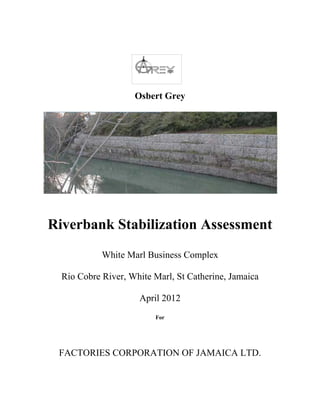
  • 1. Osbert Grey Riverbank Stabilization Assessment White Marl Business Complex Rio Cobre River, White Marl, St Catherine, Jamaica April 2012 For FACTORIES CORPORATION OF JAMAICA LTD.
  • 2. 1    Osbert Grey 589‐7517    Riverbank Stabilization Assessment Table of Contents  EXECUTIVE SUMMARY .......................................................................................................................... 3  Essential Elements of the Project .................................................................................................................. 3  1.0. PROJECT BACKGROUND ................................................................................................................. 4  1.1. Bank Erosion .................................................................................................................................. 4  1.2. Statement of the Problem ............................................................................................................... 4  Bank Instability: A Snapshot ..................................................................................................................... 4  1.3. Purpose of the Project .................................................................................................................... 4  1.4. Research Questions ........................................................................................................................ 4  1.5. Limitations of the Study ................................................................................................................. 4  1.6. Delimitations of the Study ............................................................................................................. 5  1.7. Significance of the Study ............................................................................................................... 5  1.8. Definition of Significant Terms ..................................................................................................... 5  2.0. RIVERBANK STABILIZATION – LITERATURE REVIEW ............................................................ 6  2.1. Geomorphic Considerations and General Approach ...................................................................... 6  2.2. Riverbank Erosion ......................................................................................................................... 6  2.3. Erosion Causes and Pressures ........................................................................................................ 7  2.4. STABILIZATION TECHNIQUES ....................................................................................................... 7  2.4.1. Description of Potential Stabilization Techniques ...................................................................... 7  2.4.2. Rock Riprap ................................................................................................................................ 7  2.4.3. Articulated Concrete Block Revetment ...................................................................................... 8  2.4.4. Gabion Gravity Retaining Walls ................................................................................................. 8  3.0. METHODOLOGY ................................................................................................................................ 8  4.0. RESULTS .............................................................................................................................................. 9  4.1. Assessment of Aerial Photography and Bathymetric ..................................................................... 9  4.2. Reach Environs .............................................................................................................................. 9  4.3. Erosion and Bank Properties .......................................................................................................... 9  5.0. STRATEGIES FOR THE MANAGEMENT OF BANK EROSION .................................................... 9  5.1. LAND STEWARDSHIP................................................................................................................ 9  5.1.1. Factories Corporation of Jamaica Role: ...................................................................................... 9 
  • 3. 2    Osbert Grey 589‐7517    6.0. FUTURE MANAGEMENT OF THAT SEGMENT OF THE RIO COBRE RIVER ........................ 10  6.1. Riparian Vegetation ..................................................................................................................... 10  7.0. THREATS............................................................................................................................................ 10  8.0. CONCLUSION .................................................................................................................................... 10  REFERENCES ........................................................................................................................................... 11  Appendices .................................................................................................................................................. 12  Picture 1 .............................................................................................................................................. 13  Picture 2 .............................................................................................................................................. 14  Picture 3 .............................................................................................................................................. 15  Picture 4 .............................................................................................................................................. 16  Picture 5 .............................................................................................................................................. 17  Picture 6 .............................................................................................................................................. 18  Picture 7 .............................................................................................................................................. 19  Aerial 1 ............................................................................................................................................... 20  Aerial 2 ............................................................................................................................................... 21  Aerial 3 ............................................................................................................................................... 22  Aerial 4 ............................................................................................................................................... 23           Section thru Gabion ..........................................................................................................................24.               
  • 4. 3    Osbert Grey 589‐7517    EXECUTIVE SUMMARY GreeBilt Engineering was commissioned by The Factories Corporation of Jamaica Ltd (FCOJ) to undertake an assessment of riverbank stabilization within the lower reaches of the Rio Cobre River. A riverbank stabilization assessment was thus undertaken to undergird the need to immediately implement Engineering Works to stabilize the riverbank to the rear of Units # 11 & 12 in the White Marl Complex in St Catherine. The Riverbank stabilization is an important plank for the preservation of the structural integrity of the factory buildings namely Unit # 11, bearing in mind that the foundation is exposed as a result of the failure of a soak away pit. This riverbank stabilization assessment was undertaken on a study area extending the entire length of the rear of Units # 11 & 12. Characteristics considered in this assessment included; channel geometry, adjacent land uses, depth and composition of fringing vegetation, and bank properties. The aim of this study is to inform the decision making process as to the extent of riverbank erosion on the Rio Cobre directly behind Units # 11 & 12; to identify possible local causes of this erosion, determine any potential impacts from the existing development, identify possible strategies for the management of erosion and ultimately proffer a design solution to stabilize the riverbank at that location that would not only have the requisite utilitarian benefits, but is also environmentally friendly and cost effective. Essential Elements of the Project The following items describe the biotechnical stabilization method proposed by GreeBilt Engineers: 1. Excavate slopes back to a shallower angle; 3H: 1V where possible, otherwise 2H: 1V given a buffer strip width of 12 to 18 feet. Gabions will be stepped in a ratio of 1H: 1V and height of 15’. 2. Install twelve levels of stone‐filled gabions at the toe of the slope. The bottom two shall be sunk into the river bed to provide protection against undercutting. All gabions are to be installed at an angle (6 deg) to provide against sliding, with typical gabions being 0.5 x 1x 2M. 3. Plant native shrubs into bank on top of the upper gabion to provide additional toe and bank stabilization. This measure, along with the lower gabion being sunk into the river bed will help cover the gabions to add a more natural look to the river while sufficiently stabilizing it. 4. Plant a mixture of native grasses, shrubs and trees including wild cane, within a 12 to 18‐foot buffer strip along biotechnical stabilization areas. This will contribute to bank stabilization, help cover and prevent access to the gabions, and help create a more natural riparian corridor. Hard stabilization at the lower reaches of the banks is necessary for long‐term success. Velocities of the Rio Cobre exceed those allowed as maximum for “soft” measures such as coir logs or lone vegetative stabilization. These high velocities can be attributed to steep topographies (river bed exceeds 10%‐15% gradient in some locations) and a significant amount of urban development upstream. This report includes: • a background to riverbank erosion, erosion mechanisms and erosion causes; • a site description; • an assessment of baseline data from a riverbank erosion field investigation; • discussion of results which are relevant for the FCOJ proposed bank restoration. • literature review on existing riverbank erosion, and management strategies to address identified pressures.
  • 5. 4    Osbert Grey 589‐7517    1.0. PROJECT BACKGROUND 1.1. Bank Erosion Erosion is a natural process that, in free-flowing rivers, reaches a state of equilibrium: the amount of sediment lost from one area equals the amount of soil deposited in another area. This natural cycle of erosion and sedimentation is beneficial to the aquatic ecosystem. Human use of the river and land within its watershed that increases the rate of erosion and sedimentation can result damage to roads, buildings and other structures. The causes of bank erosion are complex and interrelated and include: river flow velocities, water level fluctuations, bed and bank material, pressure imbalances at the bank face, absence of bank vegetation, obstacles in the stream, wet-dry cycles, and debris. 1.2. Statement of the Problem Bank Instability: A Snapshot In a discussion with the MD Mr. Horace Sutherland, the FC Mr. Everton Hanson, Property Manager Mr. Lionel Brown, and Board Director Mr. Derrick Webb, at the FCOJ, it was the consensus that the riverbank directly behind Units 3 11 & 13 at the White Marl Complex showed signs of imminent failure. It was further revealed that a part of the foundation to Unit # 11 was actually exposed and would need some kind of emergency intervention prior to the June rains. Consonantly, the MD instructed that Officer Brown make a site visit with the author of this report to make an assessment and come up with findings and an engineering design solution. 1.3. Purpose of the Project The primary goal of this project is to provide slope stability directly behind Units # 11 & 12 at the White Marl Park, with a collateral benefit of a more attractive, naturalized stream banks. The stabilization will consist of three components: (a) Installation of rock‐filled gabions at the toe of the bank slopes to protect against erosion during high flow events; (b) Re-grading the bank slopes to grades of between 3H: 1V and 2H: 1V; and (c) planting the slopes and gabions with native trees, shrubs including bundles or wild cane. 1.4. Research Questions What is River Bank Erosion? Is there evidence of riverbank erosion in the study area? Is there bank instability in the subject area? What is the solution mix to cauterize the problem and reinstate the integrity of the bank to retain the foundations to Units # 11 & 12. 1.5. Limitations of the Study This study is an assessment of existing riverbank stabilization directly behind Units #11 &12 of the White Marl Complex, within the lower reaches of the Rio Cobre River to address sections of foundation failure particularly at Unit # 11. The area behind only two units was investigated due to time constraints. However, the findings would to a lesser extent, be applicable to the other units, as the subject two was at high risk for possible structural failure if the slope instability is left unabated.
  • 6. 5    Osbert Grey 589‐7517    1.6. Delimitations of the Study The study did not take into account a comprehensive Hydrological Study which would include areas such as the hereinafter topics: Catchment Basin morphology Shape Soils Hydrological methods Erosion and sediment transportation Relief Rainfall Drainage pattern Evaporation 1.7. Significance of the Study The results of this study will provide some insights and information and a possible design solution to an existing erosion/slope instability problem now impacting sections of the White Marl Complex in St. Catherine. It will hopefully also raise awareness and put on the front burner, the issue of not only the need for periodic corrective action, but more so the imperative to see preventive intervention as part of an entrenched modus vivendi among all the stake holders of the White Marl Complex. 1.8. Definition of Significant Terms Riparian refers to that area adjacent to a river that is physically linked to the moisture regime of the streamside environment (Dixon et al. 2006). Riparian buffers provide essential functions for river and stream ecosystems, including cover and shade, a source of fine or coarse woody material, nutrients, and organic and inorganic debris that maintain stream ecosystem function. The riparian buffer ideally extends from the river’s ordinary high water line to the outer edge of the floodplain. Bathymetric Surveys are measurements f underwater depth of the river. In other words, bathymetry is the underwater equivalent to hypsometry or topography • Sedimentation is the act or process of depositing sediments which have been transported for some time and distance. • Soil is the thin and loosely packed layer of earth materials composed of decaying organic matter and weathered minerals which provides nutrients, physical support, and adequate amounts of air and water for plant growth. Forces which drive erosion include: • physical forces (also known as mechanical forces) such as wind, flowing water, flooding, gravity, temperature shifts (expansion and contraction), evaporation due to the sun, and glacial ice melts • chemical forces such as acid rain acting upon exposed rock and forest fires which remove plants anchoring the soil • biological forces such as beavers who dam rivers and flood land areas and people whose human practices expose soil • biochemical forces such as acids deposited by plant roots or fallen leaves or by animal waste such as urine. Both can lower the pH of the soil making it difficult for protective plant growth to occur.
  • 7. 6    Osbert Grey 589‐7517    TYPES OF EROSION • Sub aerial erosion describes erosion that occurs when land is exposed to the atmosphere. Chemical or mechanical processes alter exposed rock (weathering) which is then transported in a variety of ways. The leading causes of sub aerial erosion include gravity, running water, wind, and near shore ocean waves. • Gravity erosion (also known as mass wasting) occurs where slopes and other irregularities in land surface allow gravity to weather away and transport rock debris downward. • Running water (fluvial) erosion is when the force of moving water dislodges rocks and other solid particles which are carried along by the water. These particles scrape and scour the soil, loosening it and carrying it away. This scouring caused by the bouncing and rolling of solid particles is called siltation. • Wind (Eolian) erosion is most destructive in areas where there is little to no ground cover and small rocks, sand, and silt are blown across the land. • Subaqueous erosion is when currents move along the bottom of bodies of standing water and the currents move solid fragments of rock/soil which, in turn, scrape the soil layer and cause soil loss in the area. 2.0. RIVERBANK STABILIZATION – LITERATURE REVIEW 2.1. Geomorphic Considerations and General Approach Rivers are natural open systems that adjust their morphology to transmit the flow and sediment load delivered from their watershed. Over the shorter time periods, natural and man-made changes in a river’s flow and sediment transport regime can induce erosion or deposition and associated changes in the river channel form, as the river adjusts to increased or decreased sediment loads or flows. Bank stabilization design, is accomplished by comparing the observed morphological features of a river to those of known stable systems in order to account for the natural tendency of a particular river system or segment to adjust to a more stable channel form. 2.2. Riverbank Erosion Riverbank erosion processes can be simplified into three basic categories: • Scour where sediments are gradually removed from the riverbank by water and wind; • Collapse, sometimes referred to as mass-failure or slump, where larger sections of the bank fail and collapse in the river; and • Sub-aerial erosion mechanisms, which include processes external to the water body, such as cattle trampling, rain splash or wind throw of river-side trees. These erosion mechanisms often act in combination on riverbanks, with the relative importance of each largely dependent on which section of the catchment the riverbank is situated in. Rates of erosion can increase beyond normal baseline levels as a result of natural occurrences such as floods. Additionally, human activities, including clearing of vegetation, and grazing of stock can further exacerbate the process. Riparian vegetation has been reported to assist in bank stability in a number of ways. • Roots knit soil and sediment particles together into a matrix that resists erosion. • Plant stems increase hydraulic roughness on channel banks and floodplains, slowing flow velocity and reducing scour.
  • 8. 7    Osbert Grey 589‐7517    • Large trees act as anchor points and buttress banks to resist failure. • Inputs of large woody debris may roughen and stabilize the channel (in addition to providing improved fish and insect habitat). • Riparian vegetation moderates the rate of lateral channel migration. In short riverbank erosion is a not a local issue, but a regional issue requiring long-term catchment focused management programmes to reduce pressures including: loss of riparian vegetation, quality storm water runoff, and stock grazing. 2.3. Erosion Causes and Pressures The main cause of erosion within the defined study area was identified as historical, current land uses and human interference. Historical land use and human interference appeared to significantly impact on the type and width of the riparian buffer which has been shown to affect bank stability and was inversely related to the number of breaks in the riparian corridor. Based on results of the riverbank assessment, the existing key pressures to the natural erosion processes within the study area include the following in no order of importance: • riparian zone degradation caused by vegetation removal, (altered land uses); • unmanaged surface runoff; • full bank water flows; • river front development including disturbance of virgin earth for the installation of waste water discharge systems: and • a failed sewer soak away; 2.4. STABILIZATION TECHNIQUES 2.4.1. Description of Potential Stabilization Techniques ‘Soft’ engineering, or bioengineering, uses appropriate vegetation to retain riverbanks; it is less expensive and provides multiple benefits. Appropriately vegetated riverbanks intercept sediment in overland flows dramatically improving water quality in waterways. In areas that are subject to greater instability (like the subject site), such as where shear stress and channel velocities are particularly severe, bioengineering techniques are unlikely to succeed (at least by themselves), and thus traditional hardening methods (e.g., use of concrete, riprap, and gabion baskets) in combination with bioengineering, are necessary to prevent bank soil erosion. 2.4.2. Rock Riprap Stone has long been used to provide immediate and permanent riverbank protection. One use of stone is riprap which consists of large angular rocks placed on the bank is to reduce bank shear stress and erosion. Riprap is one of the most effective measures at the toe of a slope or unstable bank for preventing erosion. A primary advantage of riprap over vegetation is its immediate effectiveness with little or no establishment period. Above bank full elevation, other applicable bank treatments would be used, such as coir matting and joint plantings (where appropriate), to re-vegetate the banks with herbaceous and shrub vegetation.
  • 9. 8    Osbert Grey 589‐7517    2.4.3. Articulated Concrete Block Revetment An articulated concrete block (ACB) revetment system is a matrix of interconnected concrete block units installed to provide an erosion resistant revetment. An ACB revetment system consists of concrete block units that are typically connected by geometric interlock, cables, ropes, geotextiles, or geogrids to form a mattress. This concrete mattress overlays a geotextile fabric and allows for subsoil retention. 2.4.4. Gabion Gravity Retaining Walls In civil engineering a gabion wall is a retaining wall made of rectangular containers (baskets) fabricated of thick galvanized wire, which are filled with stone and stacked on one another, usually in tiers that step back with the slope rather than vertically. The most common civil engineering use of gabions is to stabilize slopes against erosion. Gabion baskets have some advantages over loose riprap because of their modularity and ability to be stacked in various shapes; they are also resistant to being washed away by moving water. Gabions also have advantages over more rigid structures because they can conform to ground movement, dissipate energy from flowing water, and drain freely. Their strength (PVC-coated galvanized gabions have been estimated to survive for 60 years) and effectiveness may increase with time in some cases, as silt and vegetation fill the interstitial voids and reinforce the structure. Gabions are cost effective & environmentally friendly alternative to concrete system; The Gabion structure blends easily and harmoniously with natural surroundings; Simple & speedy installation using natural or quarried stones obtained locally; Ability to deform without cracking allowing the structure to withstand any unpredictable movement or settlement without loss or stability; Higher resistance to natural forces due to better tensile strength; Majority of manpower need not to be skilled & speed at which the work is carried out is unparalleled in civil engineering, besides making it cost effective; Easy of repair to any damaged cages, with minimal expense. 3.0. METHODOLOGY 3.1. Site Evaluation and Classification The methodology used to classify segments of river bank assumes that specific characteristics of a river bank can be inventoried and collectively assessed to determine the bank's susceptibility to erosive forces. These characteristics include: • Bank Material - The soil/sediment type and characteristics control a significant portion of the forces resisting erosion. The subject bank is dominated by non-cohesive sediment particles (sand and gravel), the weight of the individual sediment particles provide the resistive force. • Bank Geometry - The subject bank has a slope of about 60 deg in some places, and a height of about 30’-0’’.and hence is less resistant to erosion than flatter, shorter banks with the presence of buffer zone that dissipates the erosive energy of the moving water. • Vegetation - In the subject site, the vegetative cove is sparse and juvenile in nature. • Erosion/Stability Characteristics - Factors indicative of susceptibility to erosion on the subject site include overhanging upper banks, trees with exposed roots, traces of continual sliding of bank material, mass wasting, and undercutting of lower banks
  • 10. 9    Osbert Grey 589‐7517    4.0. RESULTS 4.1. Assessment of Aerial Photography and Bathymetric Photography courtesy of Google Earth were viewed and showed quite conclusively that the subject site is at the outer convex boundary of the meandering Rio Cobre River. There were no in-house bathymetric maps available to be assessed. Nonetheless, fisher folks were observed in the water up to waist height in front of the subject site, and up to breast height a short distance down stream from the subject site. Silt deposition was also observed on the inner curve of the river a short distance upstream from the subject site. 4.2. Reach Environs Erosion within the study area was generally characterised by scour and collapse (mass failure) and in some isolated cases, sub-aerial erosion. Mass failure and sub-aerial erosion predominantly occurred with the upper reaches of the study area. Scour affected the entire length of the study area, but had a more pronounced impact in the lower reaches of the study area. Wind and flow action in this area increased the potential for erosion. Nu 4.3. Erosion and Bank Properties Erosion was clearly evident on the concave bank which is the subject of this study. The scale of erosion varied significantly along the bank over a short distance. The general description of vegetation suggests that the dominant plants within the riparian vegetation were juvenile shrubs of little conservation significance. However it was evident that, that type of vegetation will not stop the erosion. Bank failure underneath Unit # 11 was as a result of a failed soak away pit . A decrease in erosion severity was observed as correlating with a wider and denser riparian buffer up stream. 5.0. STRATEGIES FOR THE MANAGEMENT OF BANK EROSION Retaining and restoring riparian vegetation and managing storm water runoff, the overall health of the bank can be measurably improved. It was clear in this assessment that riparian buffers play an important role in bank stability and storm water runoff. A strategy must be implemented for the management and improvement of the riverbank to minimize and/or eliminate bank erosion. 5.1. LAND STEWARDSHIP 5.1.1. Factories Corporation of Jamaica Role: It is relevant to note that while it has been generally accepted that increased urbanisation leads to a decrease in the overall health of a waterway, there are examples of rivers which have been managed effectively and are achieving improved ecosystem health (Noosa Shire Council 2007, Gold Coast City Council 2007). Development within the Rio Cobre River catchment, by comparison, is mainly rural in nature, and as such, its overall health can be improved. Management strategies should have a strong focus on sustainable riverside development, riparian restoration and control of storm water runoff.
  • 11. 10    Osbert Grey 589‐7517    6.0. FUTURE MANAGEMENT OF THAT SEGMENT OF THE RIO COBRE RIVER 6.1. Riparian Vegetation Management strategies for riverbank erosion are most commonly site specific and are generally focused on improving riparian vegetation. This assessment identifies the quality and extent of riparian vegetation to be very closely related to the level of erosion observed, and thus a future strategy which focuses on the reinstatement of riparian vegetation corridors on a catchment wide scale can be expected to bring a significant improvement to the quality of the riparian ecosystem. • introduction of commercial entities operator’s Code of Practice within the White Marl Complex; • planting reeds and returning large woody debris to parts of the bank that are undercut; • installing wash control structures around planted areas; • preventing overflow from parking at ramps onto the river; • an intensive information and education campaign in the context of substantial environmental remediation programmes; and/or • soft engineering bank stabilisation works such as tow rock or re-vegetated finger groynes etc.). 7.0. THREATS Based on results of the riverbank assessment, the existing key threats to natural erosion processes within the study area are: • riparian zone degradation caused by vegetation removal (altered land uses); • storm water surface runoff; • sewer system insertion in the buffer zone, without due regard to the design, construction and location • water flows when river in spate; • repairing the land after a flood event • mitigating potential anthropogenic impacts through good environmental, social and economic planning 8.0. CONCLUSION The severity and mechanisms for erosion were found to vary along the length of the study area, which stretches along the entire length of Units # 11 & 12 in the White Marl Complex. Results suggest the riverbank in the study area is generally severely eroded, particularly where riparian vegetation is lacking. In general, steep bank slopes combined with a decrease in stability associated with reduced vegetation cover are significant attributes influencing erosion in the lower and upper reaches of the study area. In conclusion, the combination of initiatives not only as stop gap measures, but as a paradigm shift in terms of the modus operandi of FCOJ going forward, would measurably improve bank stability and will result in a significant net improvement to the structural integrity of the built environment and improve the bio-diversity of the area generally
  • 12. 11    Osbert Grey 589‐7517    REFERENCES • Abernethy, B. and Rutherfurd, I. D. (1999). Guidelines for stabilizing streambanks with riparian vegetation. Cooperative Research Centre for Catchment Hydrology Department. • DNRW (2001). State of the Rivers methodology. Queensland Department of Natural Resources and Water, Brisbane • Phillips, N., Bennett, J. and Moulton, D. (2002) Principles and Tools for Protecting Australian Rivers. Land and Water Resources and Queensland Government. Retrieved from: http://downloads.lwa2.com/downloads/publications_pdf/PR010161.pdf • RIVERBANK EROSION ASSESSMENT Northeast Business Park Pty Ltd Version 1 22 October 2007 I:7800-40WPCardno ReportsBank ErosionRiverbank Erosion Assessment • Rutherford, I., Abernethy, B. and Prosser, I. (eds) (1999) Chapter 6. Stream Erosion. In Lovett, S. and Price, P. (eds) (1999). Riparian Land Management Technical Guidelines, Volume One: Principles of Sound Management, LWRRDC, Canberra.