SlideShare une entreprise Scribd logo
1  sur  63
INSTRUMENT
LANDING
SYSTEM (ILS)
Amideebin Azizan
Present to

MR. MuzaffarMustapha
Air Traffic Controller of KLIA
Department of Civil Aviation
Malaysia
SECTION 1
Outlines of ILS
•
•
•
•
•
•
•
•

Introduction to ILS
What is ILS?
The Uses of ILS
ILS Components
How Localizer Works
How Glide Path Works
ILS Categories
Marker Beacons
What Is ILS?
• ILS is stand for Instrument Landing System.
• It has been existence for over 60 years.
• But today, it is still the most accurate approach and landing
aid that is used by the airliners.
• Why need ILS?
History of ILS

The first scheduled passenger airliner to land
using ILS was in 1938.
The Uses of ILS
• To guide the pilot during the approach and landing.
• It is very helpful when visibility is limited and the
pilot cannot see the airport and runway.
• To provide an aircraft with a precision final
approach.
• To help the aircraft to a runway touchdown point.
• To provide an aircraft guidance to the runway both
in the horizontal and vertical planes.
• To increase safety and situational awareness.
Flight Profile
Poor Visibility Landings
• Scheduled service would be impossible without a
way to land in poor weather.
Poor Visibility Landings
Runway Approach
Non-Instrument Runway (NI)

Precision Runway (P)

Aiming
point
Touchdown
zone

Threshold

Non-Precision Runway (NP)

10
Types of Runway Approach
1.Non-Instrument Runway (NI)
•
A runway intended for the operation of aircraft using visual
approach procedure
2. Instrument Runway
•
A runway intended for the operation of aircraft using instrument
approach procedures
a) Non-Precision Runway (NP)
•
An instrument runway served by visual aids and a non-visual aid
providing at least lateral guidance adequate for a straight-in
approach

b)

Precision Runway (P)
•

Allow operations with a decision height and visibility
corresponding to Category

1, or II, or III
ILS category

Height above touch down (HAT)/decision
height (DH)

Runway visual range

CAT I

HAT not less than 200 feet

Not less than 1800 feet

CAT II

HAT not less than 100 feet

Not less than 1200 feet

CAT III A

No decision height

Not less than 700 feet

CAT III B

No decision height

Not less than 150 feet

CAT III C

No decision height

No RVR minimum
CAT 1
• The visibility of the runway is at the minimum 1800 feet
(548,64 M)
• The plane has to be equipped apart from the devices for flying
in IFR (Instrument Flight Rules) conditions also with the ILS
system and a marker beacon receiver.
CAT 2
• The visibility of the runway is at the minimum 1200 feet
(365,76 M)
• The plane has to be equipped with a radio altimeter or an
inner marker receiver, an autopilot link, a raindrops remover
and also a system for the automatic draught control of the
engine can be required. The crew consists of two pilots.
CAT 3 -A
• A minimal decision height lower than 100 feet (30,48 M)
• The visibility of the runway is at the minimum 700 feet
(213,36 M)
• The aircraft has to be equipped with an autopilot with a
passive malfunction monitor or a HUD (Head-up di)
CAT 3-B
• A minimal decision height lower than 50 feet (15,24 M)
• The visibility of the runway is at the minimum 150 feet (45,72
M)
• A device for alteration of a rolling speed to travel speed.
CAT 3-C
• Zero visibility
• A precision instrument approach and landing with no decision
height and no runway visual range limitations. A Category III C
system is capable of using an aircraft's autopilot to land the
aircraft and can also provide guidance along the runway
surface.
Precision Runway (P)
Categories
• Runway Threshold: Beginning of runway for landing.
• Touchdown zone: The first point for the aircraft shoul touch
the runway during landing.
• Aiming point: serves as a visual aiming point for a landing
aircraft.
ILS Components
•
•

ILS consists of Ground Installations and Airborne
Equipments
There are 3 equipments for Ground Installations, which
are:
1.
2.
3.

•

Ground Localizer (LLZ) Antenna – To provide horizontal
navigation
Ground Glide path (GP) Antenna – To provide vertical
navigation
Marker Beacons – To enable the pilot cross check the aircraft’s
height.

There are 2 equipments for Airborne Equipments, which
are:
1.
2.

LLZ and GP antennas located on the aircraft nose.
ILS indicator inside the cockpit
ILS Components

ILS Indicator inside the cockpit

Ground Localizer
Antenna

Ground Glide Path Antenna
ILS Indicator
Signal Integrity Flag
Indicates if instrument
is unreliable

Localizer
Glidepath
Deviation from
Deviation from
optimal glide path runway centre line

“Dots”
Each “dot” on the
instrument represents 2°
of deviation
How ILS works?
• Ground localizer antenna transmit VHF signal in
direction opposite of runway to horizontally guide
aircraft to the runway centre line.
• Ground Glide Path antenna transmit UHF signal in
vertical direction to vertically guide aircraft to the
touchdown point.
• Localizer and Glide Path antenna located at
aircraft nose receives both signals and sends it to
ILS indicator in the cockpit.
Cont.
• These signals activate the vertical and
horizontal needles inside the ILS indicator
to tell the pilot either go left/right or go
up/down.
• By keeping both needles centered, the
pilot can guide his aircraft down to end of
landing runway aligned with the runway
center line and aiming the touch down.
ILS Components
Marker Beacons: the
height aircraft

Glide Path:
vertical guidance

Localizer:
horizontal guidance

24
Question Banks
• What is Localizer and how does it works?
• What is Glide Slope and how does it works?
• An Airport with an ILS is often rated as Cat 1 or Cat II or Cat III.
Explain the definition of these.
• Explain Outer Marker, Middle Marker and Inner Marker of ILS
system.
Localizer

• Localizer is the horizontal antenna array located at the
opposite end of the runway.
• Localizer operates in VHF band between 108 to 111.975 MHz
How Localizer Works
• Localizer transmit two signals which overlap at the
centre.
• The left side has a 90 Hz modulation and the right has a
150 Hz modulation.
• The overlap area provides the on-track signal.
• For example, if an aircraft approaching the runway
centre line from the right, it will receive more of the
150 Hz modulation than 90Hz modulation.
• Difference in Depth of Modulation will energizes the
vertical needle of ILS indicator.
• Thus, aircraft will be given the direction to GO LEFT.
How Localizer Works
Left

Right
Localizer

Needle indicates direction
of runway.
Centered Needle = Correct
Alignment
Glide Path Antenna Array
• Glide Path is the vertical antenna located on one side of the
runway about 300 m to the end of runway.
• Glide Path operates in UHF band between 329.15 and 335 MHz
How Glide Path Works
• Glide path produces two signals in the vertical plane.
• The upper has a 90 Hz modulation and the bottom has a
150 Hz modulation.
• For example, if an aircraft approaching the runway too
high, it will receive more of the 90 Hz modulation than
150Hz modulation.
• Difference in Depth of Modulation will energizes the
horizontal needle of ILS indicator.
• Thus, aircraft will be given the direction to GO DOWN.
How Glide Path Works
Glide Path

Needle indicates
above/below glide path.
Centered Needle = Correct
Glide path
Marker Beacons
• Marker beacons operating at a carrier frequency of 75 MHz
are provided.
• When the transmission from a marker beacon is received it
activates an indicator on the pilot's instrument panel.
• The correct height the aircraft should be at when the signal is
received in an aircraft.
Marker Beacons
Outer marker
• The outer marker should be located about 7.2 km from the
threshold.
• The modulation is repeated Morse-style dashes of a 400 Hz
tone.
• The cockpit indicator is a blue lamp that flashes accordingly
with the received audio code.
• The purpose of this beacon is to provide height, distance and
equipment functioning checks to aircraft on intermediate
and final approach.
Marker Beacons
Middle marker

• The middle marker should be located so as to indicate,
in low visibility conditions.
• Ideally at a distance of 1050m from the threshold.
• The cockpit indicator is an amber lamp that flashes in
accordingly with the received audio code.
Marker Beacons
Inner marker
• The inner marker, shall be located so as to indicate in low
visibility conditions.
• This is typically the position of an aircraft on the ILS as it
reaches Category II minima.
• The cockpit indicator is a white lamp that flashes in
accordingly with the received audio code.
Advantages of ILS
• The most accurate approach and landing aid that is used by
the airliners.
Disadvantages of ILS
• Interference due to large reflecting objects, other vehicles or
moving objects.
• This interference can reduce the strength of the directional
signals.
ILS Protected Area
• ILS Critical Area- Aircraft and Vehicles are excluded during all
ILS operations.
• ILS Sensitive Area
SECTION 2
Outlines of ATC
•
•
•
•

What is ATC?
How does the ATC function?
The problem with ATC
The solution
•

Air Traffic Controller
What is ATC system?
• ATCS or ATC is a government run organization that is part of
FAA and DCA
• The ATC control all the air traffic on the Malaysia (DCA)
• Controller can gives the aircraft attitude, speed and direction
at any time to the pilot
• The controller also gives directions and weather forecast to
the pilot. If this command were to missed or interpreted
differently , the result could be catastrophic.
How does ATC function
• When the aircraft take-off, the departure control which is in the terminal
radar control facilities TRACON give the aircraft direction while the aircraft
remain the TRACON airspace.
• It then switches over the middle
zone, where the air route traffic
control center ARTCC take over from the
TRACON
• In the ARTCC zone two controllers monitor
the aircraft, called the radio associate
controllers
• The associate and radar controller work together in
charge of their own zone. The radar controller controls
all air to ground communication to maintain aircraft
separation within the zone and coordinates activities
with others sector and/or center
The Problem of ATC
• The technology used with the
ATC is outdated
*The radar that are used date
back to WW2
*The radio sets that are used
date all the ways back to the
1960s

• There is an excessive amount
of AT congestion
*Too many aircraft flying means
that the airways are not safe,
and airborne collisions are more
likely to happen

• Weather
*Thunderstorm cause major delays
if not correctly redirected
*poor Visibility
The Solution
• First, replace all of the old
technology with the new
technology
*GPS systems installed in planes
and controlled
*satellites used to give weather and
create flight maps and routes
• Weather issues can be solved by
implementing the technology of
satellite

*Air routes can be changed via GPS
if a storm is predicted

• Airways Congestion

*New technology can be
implemented to solve this problem.
-Aircraft will get ’ turn by
turn’ directions to get to
destinations and to avoid other
aircraft
*Replace all the old jets, with
newer, more fuel efficiency jets.
-newer jets can fly through
the air at faster rates and do not
struggle as much as older jets.
SECTION 3
Future Development
ILS VS MLS
What is MLS?
• MLS (Microwave Landing System) is an advanced
precision approach and landing system.
• MLS was developed to improve the uses of ILS
system, however only few Airports have MLS
installations.
• MLS operates in the Super High Frequency (SHF)
between 5.031 to 5.090GHz.
Advantages of MLS
• MLS provide large coverage signals even in very poor
visibility.
• As MLS signals have large coverage, this will increase
runway utilization.
• MLS also has more channels which can avoid the signal
interferences.
MLS Coverage
MLS vs ILS
• Aircraft flying into Heathrow Airport in fog or poor
visibility.
• On a clear day, about 44 planes an hour land at
Heathrow.
• However, if the visibility drops and aircraft have to use
the ILS system to land, only 24 aircraft could land per
hour.
• This is because the radio transmitter at the end of the
runway needs good line of sight to the approaching
aircraft, but because it is at the far end of the
runway, planes have to land and taxi clear before a full
signal is restored.
• However, MLS allows an extra six aircraft an hour to
land, meaning that while fog will still cause disruption, its
effects will be less prominent.
MLS Ground Installations

An MLS azimuth (horizontal) guidance
station
MLS Ground Installations

An MLS elevation (vertical) guidance station
ATC NEXT GEN 2018
NEXt Gen 2018
• A government run
project to upgrade the
technology of the ATC
• Upgrades include a GPS
and satellite system in
every airplane
• Next Gen 2018 has two
major fundamental
problems

• The project has no marketbased infrastructure to
support all the ATC receiving.
-Without this, the project
would be just like expanding a tollfree highway. Sooner or later, the
highway will be just as crowded as
it was before.
• Next Gen 2018 also might have a
problem implementing the right
technology.
• The whole process of upgrading
the ATC will happen again.
SECTION 4
ILS related to the ATC
• ILS is the equipment that guide the pilot landing to the
touchdown point and also known as the ATC technology
• This equipment is the helpful to the ATC because the ATC no
need to
*Guide the pilot by their self.
• The ATC just control the aircraft at the TRACON area and guide
to the marker beacon area for aircraft connecting by antenna
to the ILS for make a landing.

• This equipment was supporting the ATC and it’s a useful to the
aircraft and also the ATC got the benefit from that.
Resources
•
•
•
•
•
•

Lecture Note- Mr Muzaffar and Major Maya
Wikipedia website
FAA website
NASA website
DCA website
New Technology of ILS –PDF file
Conclusion
• For airport all over the world, cost-efficiency, environmental
protection and passenger comfort are at the top of the agenda.
However, due to the complexity of everyday airport operations and
new aircraft fleet to achieving these goals is uncertainties and this
is where equipment like ILS and ATC working principles/procedure
helping to minimize error and problem although increasing
efficiency in flight scheduling procedure , safety, time accuracy and
airport profitability
Result: Improved

overall situational awareness and
flight operation quality
SPECIAL THANKS TO
MALAYSIA AIRPORT
HOLDINGS BERHAD
Mr Muzaffar Mustaffa
Major Maya
KPMC

Q&A

Contenu connexe

Tendances

Nav Topic 8 automatic direction finder
Nav Topic 8 automatic direction finderNav Topic 8 automatic direction finder
Nav Topic 8 automatic direction finder
Izah Asmadi
 
Aircraft navigation system
Aircraft navigation systemAircraft navigation system
Aircraft navigation system
Krishikesh Singh
 
Traffic alert and Collision Avoidance System
Traffic alert and Collision Avoidance System Traffic alert and Collision Avoidance System
Traffic alert and Collision Avoidance System
greeshma6225
 
Lecture+3 air+traffic+control+(atc)+tower
Lecture+3 air+traffic+control+(atc)+towerLecture+3 air+traffic+control+(atc)+tower
Lecture+3 air+traffic+control+(atc)+tower
titu11
 
Aircraft instrumentsystems
Aircraft instrumentsystemsAircraft instrumentsystems
Aircraft instrumentsystems
Mahnil
 

Tendances (20)

Air traffic control & air navigation
Air traffic control & air navigationAir traffic control & air navigation
Air traffic control & air navigation
 
Nav Topic 8 automatic direction finder
Nav Topic 8 automatic direction finderNav Topic 8 automatic direction finder
Nav Topic 8 automatic direction finder
 
Atc unit 3
Atc unit 3Atc unit 3
Atc unit 3
 
Flight data recorder
Flight data recorderFlight data recorder
Flight data recorder
 
Fundamentals of Air Traffic Control
Fundamentals of Air Traffic ControlFundamentals of Air Traffic Control
Fundamentals of Air Traffic Control
 
Air Traffic Control and You
Air Traffic Control and YouAir Traffic Control and You
Air Traffic Control and You
 
Aircraft navigation system
Aircraft navigation systemAircraft navigation system
Aircraft navigation system
 
Traffic alert and Collision Avoidance System
Traffic alert and Collision Avoidance System Traffic alert and Collision Avoidance System
Traffic alert and Collision Avoidance System
 
RADIO NAVIGATION.pptx
RADIO NAVIGATION.pptxRADIO NAVIGATION.pptx
RADIO NAVIGATION.pptx
 
Atc unit 2
Atc unit 2Atc unit 2
Atc unit 2
 
Traffic Alert and collision avoidance system (TCAS)
Traffic Alert and collision avoidance system (TCAS)Traffic Alert and collision avoidance system (TCAS)
Traffic Alert and collision avoidance system (TCAS)
 
Distance measuring equipment
Distance measuring equipmentDistance measuring equipment
Distance measuring equipment
 
Cns for air traffic management
Cns for air traffic managementCns for air traffic management
Cns for air traffic management
 
Instrument landing system (ils) ppt
Instrument landing system (ils) pptInstrument landing system (ils) ppt
Instrument landing system (ils) ppt
 
Lecture+3 air+traffic+control+(atc)+tower
Lecture+3 air+traffic+control+(atc)+towerLecture+3 air+traffic+control+(atc)+tower
Lecture+3 air+traffic+control+(atc)+tower
 
FDR and CVR of Aircrafts
FDR and CVR of AircraftsFDR and CVR of Aircrafts
FDR and CVR of Aircrafts
 
Aircraft instrumentsystems
Aircraft instrumentsystemsAircraft instrumentsystems
Aircraft instrumentsystems
 
Aviation Technology in Tomorrow
Aviation Technology in TomorrowAviation Technology in Tomorrow
Aviation Technology in Tomorrow
 
Communication Navigation & Surveillance
 Communication Navigation & Surveillance Communication Navigation & Surveillance
Communication Navigation & Surveillance
 
Air navigation PILOTS
Air navigation PILOTSAir navigation PILOTS
Air navigation PILOTS
 

En vedette

Instrument landing system (ils)
Instrument landing system (ils)Instrument landing system (ils)
Instrument landing system (ils)
Divya Chopra
 
Nav Topic 10 instrument landing systems
Nav Topic 10 instrument landing systemsNav Topic 10 instrument landing systems
Nav Topic 10 instrument landing systems
Izah Asmadi
 
Vor navigation and_tracking
Vor navigation and_trackingVor navigation and_tracking
Vor navigation and_tracking
drbagwell
 

En vedette (20)

Instrument Landing System (ILS)
Instrument Landing System (ILS)Instrument Landing System (ILS)
Instrument Landing System (ILS)
 
Instrument landing system (ils)
Instrument landing system (ils)Instrument landing system (ils)
Instrument landing system (ils)
 
Instrument Landing System
Instrument Landing SystemInstrument Landing System
Instrument Landing System
 
Distance Measurement equipment (DME)
Distance Measurement equipment (DME)Distance Measurement equipment (DME)
Distance Measurement equipment (DME)
 
Doppler VHF Omni Directional Range (DVOR)
Doppler VHF Omni Directional Range (DVOR)Doppler VHF Omni Directional Range (DVOR)
Doppler VHF Omni Directional Range (DVOR)
 
Nav Topic 10 instrument landing systems
Nav Topic 10 instrument landing systemsNav Topic 10 instrument landing systems
Nav Topic 10 instrument landing systems
 
Vor navigation and_tracking
Vor navigation and_trackingVor navigation and_tracking
Vor navigation and_tracking
 
ILS paperwork air traffic control
ILS paperwork air traffic controlILS paperwork air traffic control
ILS paperwork air traffic control
 
ILS
ILSILS
ILS
 
Transcript about Tenerife disaster
Transcript about Tenerife disasterTranscript about Tenerife disaster
Transcript about Tenerife disaster
 
Loran c Enav
Loran c EnavLoran c Enav
Loran c Enav
 
Airport operation control centre (aocc)
Airport operation control centre (aocc)Airport operation control centre (aocc)
Airport operation control centre (aocc)
 
Aircraft Communication Topic 7 elt, cvr and fdr
Aircraft Communication  Topic 7 elt, cvr and fdrAircraft Communication  Topic 7 elt, cvr and fdr
Aircraft Communication Topic 7 elt, cvr and fdr
 
Aircraft Communication Topic 4 vhf communication system
Aircraft Communication  Topic 4 vhf communication systemAircraft Communication  Topic 4 vhf communication system
Aircraft Communication Topic 4 vhf communication system
 
Aircraft Communication Topic 8 automatic direction finder
Aircraft Communication  Topic 8 automatic direction finderAircraft Communication  Topic 8 automatic direction finder
Aircraft Communication Topic 8 automatic direction finder
 
Aircraft Communication Topic 10 instrument landing systems
Aircraft Communication Topic 10 instrument landing systemsAircraft Communication Topic 10 instrument landing systems
Aircraft Communication Topic 10 instrument landing systems
 
Air Traffic Control
Air Traffic ControlAir Traffic Control
Air Traffic Control
 
Aircraft communication system
Aircraft communication systemAircraft communication system
Aircraft communication system
 
2 -dme
2  -dme2  -dme
2 -dme
 
Aircraft control systems
Aircraft control systemsAircraft control systems
Aircraft control systems
 

Similaire à Ils and air traffic

Avionicawgtwrgwrgdsbffefaes Project.pptx
Avionicawgtwrgwrgdsbffefaes Project.pptxAvionicawgtwrgwrgdsbffefaes Project.pptx
Avionicawgtwrgwrgdsbffefaes Project.pptx
KartikSidana1
 
Instrument landing system.docx
Instrument landing system.docxInstrument landing system.docx
Instrument landing system.docx
CyprianObota
 
5.1 Electronic Instrument Systems
5.1 Electronic Instrument Systems5.1 Electronic Instrument Systems
5.1 Electronic Instrument Systems
lpapadop
 
FINALS PPT COMM NAVIGATION SYSTEMS..pptx
FINALS PPT COMM NAVIGATION SYSTEMS..pptxFINALS PPT COMM NAVIGATION SYSTEMS..pptx
FINALS PPT COMM NAVIGATION SYSTEMS..pptx
SamAmin16
 
AMStestingonly
AMStestingonlyAMStestingonly
AMStestingonly
Andrew Tan
 

Similaire à Ils and air traffic (20)

8875634.ppt
8875634.ppt8875634.ppt
8875634.ppt
 
Radio and Radar: Radar Continued - systems
Radio and Radar: Radar Continued - systemsRadio and Radar: Radar Continued - systems
Radio and Radar: Radar Continued - systems
 
Avionicawgtwrgwrgdsbffefaes Project.pptx
Avionicawgtwrgwrgdsbffefaes Project.pptxAvionicawgtwrgwrgdsbffefaes Project.pptx
Avionicawgtwrgwrgdsbffefaes Project.pptx
 
Instrument landing system.docx
Instrument landing system.docxInstrument landing system.docx
Instrument landing system.docx
 
318099023-Internship-at-AAI-Baroda.pdf
318099023-Internship-at-AAI-Baroda.pdf318099023-Internship-at-AAI-Baroda.pdf
318099023-Internship-at-AAI-Baroda.pdf
 
Air Traffic Control.pptx
Air Traffic Control.pptxAir Traffic Control.pptx
Air Traffic Control.pptx
 
Navigation aids
Navigation aidsNavigation aids
Navigation aids
 
Instrument Landing System (ILS)
Instrument Landing System (ILS)Instrument Landing System (ILS)
Instrument Landing System (ILS)
 
Air craft surveillance & instrumental landing system
Air craft surveillance & instrumental landing systemAir craft surveillance & instrumental landing system
Air craft surveillance & instrumental landing system
 
5.1 Electronic Instrument Systems
5.1 Electronic Instrument Systems5.1 Electronic Instrument Systems
5.1 Electronic Instrument Systems
 
5251631.ppt
5251631.ppt5251631.ppt
5251631.ppt
 
cnsreportpresentation-200726152923.pdf
cnsreportpresentation-200726152923.pdfcnsreportpresentation-200726152923.pdf
cnsreportpresentation-200726152923.pdf
 
CNS AAI Internship Presentation
CNS AAI Internship PresentationCNS AAI Internship Presentation
CNS AAI Internship Presentation
 
Air traffic management
Air traffic managementAir traffic management
Air traffic management
 
PPt on AAI
PPt on AAIPPt on AAI
PPt on AAI
 
FINALS PPT COMM NAV.pptx
FINALS PPT COMM NAV.pptxFINALS PPT COMM NAV.pptx
FINALS PPT COMM NAV.pptx
 
FINALS PPT COMM NAVIGATION SYSTEMS..pptx
FINALS PPT COMM NAVIGATION SYSTEMS..pptxFINALS PPT COMM NAVIGATION SYSTEMS..pptx
FINALS PPT COMM NAVIGATION SYSTEMS..pptx
 
All About Instrument Landing Systems Antennas
All About Instrument Landing Systems AntennasAll About Instrument Landing Systems Antennas
All About Instrument Landing Systems Antennas
 
Air Traffic Control
Air Traffic ControlAir Traffic Control
Air Traffic Control
 
AMStestingonly
AMStestingonlyAMStestingonly
AMStestingonly
 

Plus de Amidee Azizan Stringfellow

Plus de Amidee Azizan Stringfellow (20)

Lebanese twa flight 847 Hijacking fact
Lebanese twa flight 847 Hijacking factLebanese twa flight 847 Hijacking fact
Lebanese twa flight 847 Hijacking fact
 
Turkish airlines flight 1754
Turkish airlines flight 1754Turkish airlines flight 1754
Turkish airlines flight 1754
 
Thai airways
Thai airwaysThai airways
Thai airways
 
Future outlook of passenger air transport in open 2
Future outlook of  passenger air transport in open 2Future outlook of  passenger air transport in open 2
Future outlook of passenger air transport in open 2
 
Challenges airport planning
Challenges airport planningChallenges airport planning
Challenges airport planning
 
Atmospheric science turbulence 2
Atmospheric science  turbulence 2Atmospheric science  turbulence 2
Atmospheric science turbulence 2
 
Air Transport
Air TransportAir Transport
Air Transport
 
Turbulence
TurbulenceTurbulence
Turbulence
 
Traffic controller
Traffic controllerTraffic controller
Traffic controller
 
Radio aids & navigation
Radio aids & navigationRadio aids & navigation
Radio aids & navigation
 
Navigation aids
Navigation aidsNavigation aids
Navigation aids
 
Aviation history
Aviation historyAviation history
Aviation history
 
Airport Management 11
Airport Management  11Airport Management  11
Airport Management 11
 
Airport operation
Airport operationAirport operation
Airport operation
 
Flight Instrument .
Flight Instrument .Flight Instrument .
Flight Instrument .
 
Aviation safety n security
Aviation safety n securityAviation safety n security
Aviation safety n security
 
Airport Emergency
Airport EmergencyAirport Emergency
Airport Emergency
 
airline deregulation
airline deregulationairline deregulation
airline deregulation
 
Aviation Newsletter
Aviation NewsletterAviation Newsletter
Aviation Newsletter
 
The first man to 'fly' ..wright brothers
The first man to 'fly'      ..wright brothersThe first man to 'fly'      ..wright brothers
The first man to 'fly' ..wright brothers
 

Dernier

IAC 2024 - IA Fast Track to Search Focused AI Solutions
IAC 2024 - IA Fast Track to Search Focused AI SolutionsIAC 2024 - IA Fast Track to Search Focused AI Solutions
IAC 2024 - IA Fast Track to Search Focused AI Solutions
Enterprise Knowledge
 
CNv6 Instructor Chapter 6 Quality of Service
CNv6 Instructor Chapter 6 Quality of ServiceCNv6 Instructor Chapter 6 Quality of Service
CNv6 Instructor Chapter 6 Quality of Service
giselly40
 

Dernier (20)

ProductAnonymous-April2024-WinProductDiscovery-MelissaKlemke
ProductAnonymous-April2024-WinProductDiscovery-MelissaKlemkeProductAnonymous-April2024-WinProductDiscovery-MelissaKlemke
ProductAnonymous-April2024-WinProductDiscovery-MelissaKlemke
 
How to Troubleshoot Apps for the Modern Connected Worker
How to Troubleshoot Apps for the Modern Connected WorkerHow to Troubleshoot Apps for the Modern Connected Worker
How to Troubleshoot Apps for the Modern Connected Worker
 
Understanding Discord NSFW Servers A Guide for Responsible Users.pdf
Understanding Discord NSFW Servers A Guide for Responsible Users.pdfUnderstanding Discord NSFW Servers A Guide for Responsible Users.pdf
Understanding Discord NSFW Servers A Guide for Responsible Users.pdf
 
Exploring the Future Potential of AI-Enabled Smartphone Processors
Exploring the Future Potential of AI-Enabled Smartphone ProcessorsExploring the Future Potential of AI-Enabled Smartphone Processors
Exploring the Future Potential of AI-Enabled Smartphone Processors
 
GenAI Risks & Security Meetup 01052024.pdf
GenAI Risks & Security Meetup 01052024.pdfGenAI Risks & Security Meetup 01052024.pdf
GenAI Risks & Security Meetup 01052024.pdf
 
Boost Fertility New Invention Ups Success Rates.pdf
Boost Fertility New Invention Ups Success Rates.pdfBoost Fertility New Invention Ups Success Rates.pdf
Boost Fertility New Invention Ups Success Rates.pdf
 
IAC 2024 - IA Fast Track to Search Focused AI Solutions
IAC 2024 - IA Fast Track to Search Focused AI SolutionsIAC 2024 - IA Fast Track to Search Focused AI Solutions
IAC 2024 - IA Fast Track to Search Focused AI Solutions
 
Handwritten Text Recognition for manuscripts and early printed texts
Handwritten Text Recognition for manuscripts and early printed textsHandwritten Text Recognition for manuscripts and early printed texts
Handwritten Text Recognition for manuscripts and early printed texts
 
Presentation on how to chat with PDF using ChatGPT code interpreter
Presentation on how to chat with PDF using ChatGPT code interpreterPresentation on how to chat with PDF using ChatGPT code interpreter
Presentation on how to chat with PDF using ChatGPT code interpreter
 
Strategies for Landing an Oracle DBA Job as a Fresher
Strategies for Landing an Oracle DBA Job as a FresherStrategies for Landing an Oracle DBA Job as a Fresher
Strategies for Landing an Oracle DBA Job as a Fresher
 
Partners Life - Insurer Innovation Award 2024
Partners Life - Insurer Innovation Award 2024Partners Life - Insurer Innovation Award 2024
Partners Life - Insurer Innovation Award 2024
 
How to Troubleshoot Apps for the Modern Connected Worker
How to Troubleshoot Apps for the Modern Connected WorkerHow to Troubleshoot Apps for the Modern Connected Worker
How to Troubleshoot Apps for the Modern Connected Worker
 
presentation ICT roal in 21st century education
presentation ICT roal in 21st century educationpresentation ICT roal in 21st century education
presentation ICT roal in 21st century education
 
Boost PC performance: How more available memory can improve productivity
Boost PC performance: How more available memory can improve productivityBoost PC performance: How more available memory can improve productivity
Boost PC performance: How more available memory can improve productivity
 
CNv6 Instructor Chapter 6 Quality of Service
CNv6 Instructor Chapter 6 Quality of ServiceCNv6 Instructor Chapter 6 Quality of Service
CNv6 Instructor Chapter 6 Quality of Service
 
Mastering MySQL Database Architecture: Deep Dive into MySQL Shell and MySQL R...
Mastering MySQL Database Architecture: Deep Dive into MySQL Shell and MySQL R...Mastering MySQL Database Architecture: Deep Dive into MySQL Shell and MySQL R...
Mastering MySQL Database Architecture: Deep Dive into MySQL Shell and MySQL R...
 
04-2024-HHUG-Sales-and-Marketing-Alignment.pptx
04-2024-HHUG-Sales-and-Marketing-Alignment.pptx04-2024-HHUG-Sales-and-Marketing-Alignment.pptx
04-2024-HHUG-Sales-and-Marketing-Alignment.pptx
 
08448380779 Call Girls In Greater Kailash - I Women Seeking Men
08448380779 Call Girls In Greater Kailash - I Women Seeking Men08448380779 Call Girls In Greater Kailash - I Women Seeking Men
08448380779 Call Girls In Greater Kailash - I Women Seeking Men
 
The 7 Things I Know About Cyber Security After 25 Years | April 2024
The 7 Things I Know About Cyber Security After 25 Years | April 2024The 7 Things I Know About Cyber Security After 25 Years | April 2024
The 7 Things I Know About Cyber Security After 25 Years | April 2024
 
How to convert PDF to text with Nanonets
How to convert PDF to text with NanonetsHow to convert PDF to text with Nanonets
How to convert PDF to text with Nanonets
 

Ils and air traffic

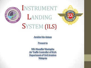
  • 1. INSTRUMENT LANDING SYSTEM (ILS) Amideebin Azizan Present to MR. MuzaffarMustapha Air Traffic Controller of KLIA Department of Civil Aviation Malaysia
  • 3. Outlines of ILS • • • • • • • • Introduction to ILS What is ILS? The Uses of ILS ILS Components How Localizer Works How Glide Path Works ILS Categories Marker Beacons
  • 4. What Is ILS? • ILS is stand for Instrument Landing System. • It has been existence for over 60 years. • But today, it is still the most accurate approach and landing aid that is used by the airliners. • Why need ILS?
  • 5. History of ILS The first scheduled passenger airliner to land using ILS was in 1938.
  • 6. The Uses of ILS • To guide the pilot during the approach and landing. • It is very helpful when visibility is limited and the pilot cannot see the airport and runway. • To provide an aircraft with a precision final approach. • To help the aircraft to a runway touchdown point. • To provide an aircraft guidance to the runway both in the horizontal and vertical planes. • To increase safety and situational awareness.
  • 8. Poor Visibility Landings • Scheduled service would be impossible without a way to land in poor weather.
  • 10. Runway Approach Non-Instrument Runway (NI) Precision Runway (P) Aiming point Touchdown zone Threshold Non-Precision Runway (NP) 10
  • 11. Types of Runway Approach 1.Non-Instrument Runway (NI) • A runway intended for the operation of aircraft using visual approach procedure 2. Instrument Runway • A runway intended for the operation of aircraft using instrument approach procedures a) Non-Precision Runway (NP) • An instrument runway served by visual aids and a non-visual aid providing at least lateral guidance adequate for a straight-in approach b) Precision Runway (P) • Allow operations with a decision height and visibility corresponding to Category 1, or II, or III
  • 12. ILS category Height above touch down (HAT)/decision height (DH) Runway visual range CAT I HAT not less than 200 feet Not less than 1800 feet CAT II HAT not less than 100 feet Not less than 1200 feet CAT III A No decision height Not less than 700 feet CAT III B No decision height Not less than 150 feet CAT III C No decision height No RVR minimum
  • 13. CAT 1 • The visibility of the runway is at the minimum 1800 feet (548,64 M) • The plane has to be equipped apart from the devices for flying in IFR (Instrument Flight Rules) conditions also with the ILS system and a marker beacon receiver.
  • 14. CAT 2 • The visibility of the runway is at the minimum 1200 feet (365,76 M) • The plane has to be equipped with a radio altimeter or an inner marker receiver, an autopilot link, a raindrops remover and also a system for the automatic draught control of the engine can be required. The crew consists of two pilots.
  • 15. CAT 3 -A • A minimal decision height lower than 100 feet (30,48 M) • The visibility of the runway is at the minimum 700 feet (213,36 M) • The aircraft has to be equipped with an autopilot with a passive malfunction monitor or a HUD (Head-up di)
  • 16. CAT 3-B • A minimal decision height lower than 50 feet (15,24 M) • The visibility of the runway is at the minimum 150 feet (45,72 M) • A device for alteration of a rolling speed to travel speed.
  • 17. CAT 3-C • Zero visibility • A precision instrument approach and landing with no decision height and no runway visual range limitations. A Category III C system is capable of using an aircraft's autopilot to land the aircraft and can also provide guidance along the runway surface.
  • 18. Precision Runway (P) Categories • Runway Threshold: Beginning of runway for landing. • Touchdown zone: The first point for the aircraft shoul touch the runway during landing. • Aiming point: serves as a visual aiming point for a landing aircraft.
  • 19. ILS Components • • ILS consists of Ground Installations and Airborne Equipments There are 3 equipments for Ground Installations, which are: 1. 2. 3. • Ground Localizer (LLZ) Antenna – To provide horizontal navigation Ground Glide path (GP) Antenna – To provide vertical navigation Marker Beacons – To enable the pilot cross check the aircraft’s height. There are 2 equipments for Airborne Equipments, which are: 1. 2. LLZ and GP antennas located on the aircraft nose. ILS indicator inside the cockpit
  • 20. ILS Components ILS Indicator inside the cockpit Ground Localizer Antenna Ground Glide Path Antenna
  • 21. ILS Indicator Signal Integrity Flag Indicates if instrument is unreliable Localizer Glidepath Deviation from Deviation from optimal glide path runway centre line “Dots” Each “dot” on the instrument represents 2° of deviation
  • 22. How ILS works? • Ground localizer antenna transmit VHF signal in direction opposite of runway to horizontally guide aircraft to the runway centre line. • Ground Glide Path antenna transmit UHF signal in vertical direction to vertically guide aircraft to the touchdown point. • Localizer and Glide Path antenna located at aircraft nose receives both signals and sends it to ILS indicator in the cockpit.
  • 23. Cont. • These signals activate the vertical and horizontal needles inside the ILS indicator to tell the pilot either go left/right or go up/down. • By keeping both needles centered, the pilot can guide his aircraft down to end of landing runway aligned with the runway center line and aiming the touch down.
  • 24. ILS Components Marker Beacons: the height aircraft Glide Path: vertical guidance Localizer: horizontal guidance 24
  • 25. Question Banks • What is Localizer and how does it works? • What is Glide Slope and how does it works? • An Airport with an ILS is often rated as Cat 1 or Cat II or Cat III. Explain the definition of these. • Explain Outer Marker, Middle Marker and Inner Marker of ILS system.
  • 26. Localizer • Localizer is the horizontal antenna array located at the opposite end of the runway. • Localizer operates in VHF band between 108 to 111.975 MHz
  • 27. How Localizer Works • Localizer transmit two signals which overlap at the centre. • The left side has a 90 Hz modulation and the right has a 150 Hz modulation. • The overlap area provides the on-track signal. • For example, if an aircraft approaching the runway centre line from the right, it will receive more of the 150 Hz modulation than 90Hz modulation. • Difference in Depth of Modulation will energizes the vertical needle of ILS indicator. • Thus, aircraft will be given the direction to GO LEFT.
  • 29. Localizer Needle indicates direction of runway. Centered Needle = Correct Alignment
  • 30. Glide Path Antenna Array • Glide Path is the vertical antenna located on one side of the runway about 300 m to the end of runway. • Glide Path operates in UHF band between 329.15 and 335 MHz
  • 31. How Glide Path Works • Glide path produces two signals in the vertical plane. • The upper has a 90 Hz modulation and the bottom has a 150 Hz modulation. • For example, if an aircraft approaching the runway too high, it will receive more of the 90 Hz modulation than 150Hz modulation. • Difference in Depth of Modulation will energizes the horizontal needle of ILS indicator. • Thus, aircraft will be given the direction to GO DOWN.
  • 32. How Glide Path Works
  • 33. Glide Path Needle indicates above/below glide path. Centered Needle = Correct Glide path
  • 34. Marker Beacons • Marker beacons operating at a carrier frequency of 75 MHz are provided. • When the transmission from a marker beacon is received it activates an indicator on the pilot's instrument panel. • The correct height the aircraft should be at when the signal is received in an aircraft.
  • 35. Marker Beacons Outer marker • The outer marker should be located about 7.2 km from the threshold. • The modulation is repeated Morse-style dashes of a 400 Hz tone. • The cockpit indicator is a blue lamp that flashes accordingly with the received audio code. • The purpose of this beacon is to provide height, distance and equipment functioning checks to aircraft on intermediate and final approach.
  • 36. Marker Beacons Middle marker • The middle marker should be located so as to indicate, in low visibility conditions. • Ideally at a distance of 1050m from the threshold. • The cockpit indicator is an amber lamp that flashes in accordingly with the received audio code.
  • 37. Marker Beacons Inner marker • The inner marker, shall be located so as to indicate in low visibility conditions. • This is typically the position of an aircraft on the ILS as it reaches Category II minima. • The cockpit indicator is a white lamp that flashes in accordingly with the received audio code.
  • 38. Advantages of ILS • The most accurate approach and landing aid that is used by the airliners.
  • 39. Disadvantages of ILS • Interference due to large reflecting objects, other vehicles or moving objects. • This interference can reduce the strength of the directional signals.
  • 40. ILS Protected Area • ILS Critical Area- Aircraft and Vehicles are excluded during all ILS operations. • ILS Sensitive Area
  • 42. Outlines of ATC • • • • What is ATC? How does the ATC function? The problem with ATC The solution
  • 44. What is ATC system? • ATCS or ATC is a government run organization that is part of FAA and DCA • The ATC control all the air traffic on the Malaysia (DCA) • Controller can gives the aircraft attitude, speed and direction at any time to the pilot • The controller also gives directions and weather forecast to the pilot. If this command were to missed or interpreted differently , the result could be catastrophic.
  • 45. How does ATC function • When the aircraft take-off, the departure control which is in the terminal radar control facilities TRACON give the aircraft direction while the aircraft remain the TRACON airspace. • It then switches over the middle zone, where the air route traffic control center ARTCC take over from the TRACON • In the ARTCC zone two controllers monitor the aircraft, called the radio associate controllers
  • 46. • The associate and radar controller work together in charge of their own zone. The radar controller controls all air to ground communication to maintain aircraft separation within the zone and coordinates activities with others sector and/or center
  • 47. The Problem of ATC • The technology used with the ATC is outdated *The radar that are used date back to WW2 *The radio sets that are used date all the ways back to the 1960s • There is an excessive amount of AT congestion *Too many aircraft flying means that the airways are not safe, and airborne collisions are more likely to happen • Weather *Thunderstorm cause major delays if not correctly redirected *poor Visibility
  • 48. The Solution • First, replace all of the old technology with the new technology *GPS systems installed in planes and controlled *satellites used to give weather and create flight maps and routes • Weather issues can be solved by implementing the technology of satellite *Air routes can be changed via GPS if a storm is predicted • Airways Congestion *New technology can be implemented to solve this problem. -Aircraft will get ’ turn by turn’ directions to get to destinations and to avoid other aircraft *Replace all the old jets, with newer, more fuel efficiency jets. -newer jets can fly through the air at faster rates and do not struggle as much as older jets.
  • 52. What is MLS? • MLS (Microwave Landing System) is an advanced precision approach and landing system. • MLS was developed to improve the uses of ILS system, however only few Airports have MLS installations. • MLS operates in the Super High Frequency (SHF) between 5.031 to 5.090GHz.
  • 53. Advantages of MLS • MLS provide large coverage signals even in very poor visibility. • As MLS signals have large coverage, this will increase runway utilization. • MLS also has more channels which can avoid the signal interferences. MLS Coverage
  • 54. MLS vs ILS • Aircraft flying into Heathrow Airport in fog or poor visibility. • On a clear day, about 44 planes an hour land at Heathrow. • However, if the visibility drops and aircraft have to use the ILS system to land, only 24 aircraft could land per hour. • This is because the radio transmitter at the end of the runway needs good line of sight to the approaching aircraft, but because it is at the far end of the runway, planes have to land and taxi clear before a full signal is restored. • However, MLS allows an extra six aircraft an hour to land, meaning that while fog will still cause disruption, its effects will be less prominent.
  • 55. MLS Ground Installations An MLS azimuth (horizontal) guidance station
  • 56. MLS Ground Installations An MLS elevation (vertical) guidance station
  • 57. ATC NEXT GEN 2018
  • 58. NEXt Gen 2018 • A government run project to upgrade the technology of the ATC • Upgrades include a GPS and satellite system in every airplane • Next Gen 2018 has two major fundamental problems • The project has no marketbased infrastructure to support all the ATC receiving. -Without this, the project would be just like expanding a tollfree highway. Sooner or later, the highway will be just as crowded as it was before. • Next Gen 2018 also might have a problem implementing the right technology. • The whole process of upgrading the ATC will happen again.
  • 60. ILS related to the ATC • ILS is the equipment that guide the pilot landing to the touchdown point and also known as the ATC technology • This equipment is the helpful to the ATC because the ATC no need to *Guide the pilot by their self. • The ATC just control the aircraft at the TRACON area and guide to the marker beacon area for aircraft connecting by antenna to the ILS for make a landing. • This equipment was supporting the ATC and it’s a useful to the aircraft and also the ATC got the benefit from that.
  • 61. Resources • • • • • • Lecture Note- Mr Muzaffar and Major Maya Wikipedia website FAA website NASA website DCA website New Technology of ILS –PDF file
  • 62. Conclusion • For airport all over the world, cost-efficiency, environmental protection and passenger comfort are at the top of the agenda. However, due to the complexity of everyday airport operations and new aircraft fleet to achieving these goals is uncertainties and this is where equipment like ILS and ATC working principles/procedure helping to minimize error and problem although increasing efficiency in flight scheduling procedure , safety, time accuracy and airport profitability Result: Improved overall situational awareness and flight operation quality
  • 63. SPECIAL THANKS TO MALAYSIA AIRPORT HOLDINGS BERHAD Mr Muzaffar Mustaffa Major Maya KPMC Q&A

Notes de l'éditeur

  1. ILS (instrument landing system)Primarily consists of three instruments:Marker beacons are used to measure how far aircraft until landingGlideslope or GlidePath for vertical guidanceLocalizer for lateral guidance All of these systems transmitt signals at different frequencies that are translated by electronics to determine the position of the aircraft