SlideShare une entreprise Scribd logo
1  sur  2
ã2017 California Institute of Technology. Government sponsorship acknowledged.
NISAR: The NASA-ISRO SAR Mission
Ocean Winds, Waves, and Ice Monitoring
The first civilian synthetic aperture radar (SAR), launched
on Seasat in 1978, was designed by NASA to measure the
ocean surface. In the intervening years, SAR systems have
become important for the measurement of ocean surface
winds, waves and other phenomena. The applications are
particularly valuable in that the measurements can be
made at a higher spatial resolution (sub-kilometer) than
other spaceborne instruments, in all weather, day-or-
night, and even in the polar winter when light conditions
preclude visible imaging.
Marine Hazards
NISAR will provide information used to monitor ocean wind, waves and
sea-ice extent that can aid weather forecasting and warn of marine
hazards. Its coverage of coastal oceans benefits sea transportation and
coastal communities.
Cargo Shipping
World trade and prosperity are dependent upon the safe water transport
of products. Over 100 million cargo containers aboard cargo ships
traverse the oceans each year. Safe marine operations are dependent on
wind and wave forecasts and monitoring sea-ice extent in the polar
regions.
Hazards don’t just threaten traffic in the open waters of the ocean. As
sea-ice retreats, more shipping traffic will save fuel by using polar routes.
Spaceborne radar measurements can provide the necessary information
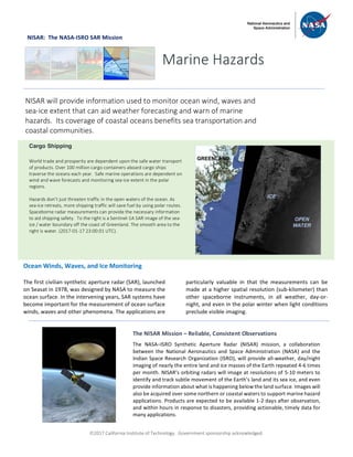
to aid shipping safety. To the right is a Sentinel-1A SAR image of the sea-
ice / water boundary off the coast of Greenland. The smooth area to the
right is water. (2017-01-17 23:00:01 UTC).
The NISAR Mission – Reliable, Consistent Observations
The NASA–ISRO Synthetic Aperture Radar (NISAR) mission, a collaboration
between the National Aeronautics and Space Administration (NASA) and the
Indian Space Research Organization (ISRO), will provide all-weather, day/night
imaging of nearly the entire land and ice masses of the Earth repeated 4-6 times
per month. NISAR’s orbiting radars will image at resolutions of 5-10 meters to
identify and track subtle movement of the Earth’s land and its sea ice, and even
provide information about what is happening below the land surface. Images will
also be acquired over some northern or coastal waters to support marine hazard
applications. Products are expected to be available 1-2 days after observation,
and within hours in response to disasters, providing actionable, timely data for
many applications.
ã2017 California Institute of Technology. Government sponsorship acknowledged.
Continued from front page
The basics of ocean imaging are readily understood. SAR
systems can create images of the ocean surface at incident
angles between 20 to 50 degrees. At these angles, a
smooth ocean surface will reflect much of the radar
energy away from the radar so that the water appears
very dark. However, when waves and ripples are present,
more energy is reflected backwards. The backscattered
energy, and consequently image brightness, increases
with the ocean surface roughness. Thus, physical
processes that affect ocean surface roughness, such as
winds blowing over the ocean, can be measured by SARs.
It is known from both theoretical studies and
empirical measurements that the image brightness
increases with wind speed. This relationship has made it
possible to measure ocean surface wind speeds at 500 m
resolution. The National Oceanic and Atmospheric
Administration (NOAA) can use NISAR data to provide
wind speed measurements in coastal areas as the images
become available. These images will help form high-
resolution wind speed climatologies that can aid in
assessing the placement of offshore wind power turbines.
Ocean surface waves are also visible in SAR images.
Wave crests are slightly rougher than wave troughs,
making the undulations of surface waves visible. NISAR
will provide images of the ocean surface at 50-m
resolution so that the ocean surface waves, which are
generally 100-300 m from peak to peak, will be visible.
These too will help in understanding high-resolution wave
climatologies, particularly in coastal areas.
SAR imagery over the Arctic is also useful in
determining sea-ice extent. SAR images over ice show the
details of ice floes. NISAR will also be particularly useful in
discriminating between new ice and generally thicker
multi-year ice. NOAA regularly provides composites of a
day’s worth of ESA’s Sentinel-1 SAR imagery to the U.S.
National Ice Center, where analysts use the SAR imagery
to identify sea-ice hazards to navigation. NOAA can also
use NISAR data to help understand the dynamics of ice
formation and motion.
National Aeronautics and Space Administration For more information, visit http://nisar.jpl.nasa.gov/applications
Jet Propulsion Laboratory / California Institute of Technology / Pasadena, California / www.jpl.nasa.gov
Both empirical measurements and
electromagnetic theory bear out the relationship
between radar image brightness and wind speed
over the ocean. The brightness increases with
wind speed and is higher when the wind is blowing
towards or away from the radar imaging direction,
and lower for wind directions perpendicular to the
imaging direction This relationship makes it
possible to measure ocean surface wind speeds at
500-m resolution. In this way, the transition
between open ocean wind conditions and those
near the coast can be resolved.
The NISAR mission will provide the U.S.’s first
Earth observing spaceborne synthetic aperture
radar since the Shuttle Radar Topography Mission
(SRTM). The mission is designed to operate for at
least three years, providing images of land and
coastal oceans that agencies, such as NOAA, can
translate into information products to support
safe ocean transit and marine hazard response.
The radar cross section, or brightness, of a synthetic aperture radar (SAR) image can be
related to wind speed. Above is an image of wind speed over the Alaskan
Peninsula derived from Sentinel-1B SAR data. The various wind speeds are represented
as different colors. NISAR will be able to provide similar wind speed measurements in
coastal areas. NOAA regularly generates wind speed products using available SAR data,
and NISAR will augment the available information, particularly along U.S. coasts.
Radar Measurements
of Winds & Waves

Contenu connexe

Similaire à NISAR NASA-ISRO Synthetic Aperture Radar (NISAR) Marine Hazards

NISAR NASA-ISRO Synthetic Aperture Radar (NISAR) Sinkholes and Cavern Collapse
NISAR NASA-ISRO Synthetic Aperture Radar (NISAR) Sinkholes and Cavern CollapseNISAR NASA-ISRO Synthetic Aperture Radar (NISAR) Sinkholes and Cavern Collapse
NISAR NASA-ISRO Synthetic Aperture Radar (NISAR) Sinkholes and Cavern CollapseDr. Pankaj Dhussa
 
NISAR NASA-ISRO Synthetic Aperture Radar (NISAR) Hazards in Texas
NISAR NASA-ISRO Synthetic Aperture Radar (NISAR) Hazards in TexasNISAR NASA-ISRO Synthetic Aperture Radar (NISAR) Hazards in Texas
NISAR NASA-ISRO Synthetic Aperture Radar (NISAR) Hazards in TexasDr. Pankaj Dhussa
 
NISAR NASA-ISRO Synthetic Aperture Radar (NISAR) Hazards in Florida
NISAR NASA-ISRO Synthetic Aperture Radar (NISAR) Hazards in FloridaNISAR NASA-ISRO Synthetic Aperture Radar (NISAR) Hazards in Florida
NISAR NASA-ISRO Synthetic Aperture Radar (NISAR) Hazards in FloridaDr. Pankaj Dhussa
 
NISAR NASA-ISRO Synthetic Aperture Radar (NISAR) Coastal Land Loss
NISAR NASA-ISRO Synthetic Aperture Radar (NISAR) Coastal Land LossNISAR NASA-ISRO Synthetic Aperture Radar (NISAR) Coastal Land Loss
NISAR NASA-ISRO Synthetic Aperture Radar (NISAR) Coastal Land LossDr. Pankaj Dhussa
 
NISAR NASA-ISRO Synthetic Aperture Radar (NISAR) Sea Ice
NISAR NASA-ISRO Synthetic Aperture Radar (NISAR) Sea IceNISAR NASA-ISRO Synthetic Aperture Radar (NISAR) Sea Ice
NISAR NASA-ISRO Synthetic Aperture Radar (NISAR) Sea IceDr. Pankaj Dhussa
 
NISAR Oil, Gas, and Water Underground Reservoirs
NISAR Oil, Gas, and Water Underground ReservoirsNISAR Oil, Gas, and Water Underground Reservoirs
NISAR Oil, Gas, and Water Underground ReservoirsDr. Pankaj Dhussa
 
NISAR NASA-ISRO Synthetic Aperture Radar (NISAR) Damage Mapping
NISAR NASA-ISRO Synthetic Aperture Radar (NISAR) Damage MappingNISAR NASA-ISRO Synthetic Aperture Radar (NISAR) Damage Mapping
NISAR NASA-ISRO Synthetic Aperture Radar (NISAR) Damage MappingDr. Pankaj Dhussa
 
PosterDryden2011txt
PosterDryden2011txtPosterDryden2011txt
PosterDryden2011txtMichelle Wen
 
NISAR ( NASA-ISRO Synthetic Aperture Radar (NISAR) ) Water
NISAR ( NASA-ISRO Synthetic Aperture Radar (NISAR) ) WaterNISAR ( NASA-ISRO Synthetic Aperture Radar (NISAR) ) Water
NISAR ( NASA-ISRO Synthetic Aperture Radar (NISAR) ) WaterDr. Pankaj Dhussa
 
TU2.T10.2.ppt
TU2.T10.2.pptTU2.T10.2.ppt
TU2.T10.2.pptgrssieee
 
Presentation on Aerosols, cloud properties
Presentation on Aerosols, cloud properties Presentation on Aerosols, cloud properties
Presentation on Aerosols, cloud properties Esayas Meresa
 
Flood risk mapping using GIS and remote sensing and SAR
Flood risk mapping using GIS and remote sensing and SARFlood risk mapping using GIS and remote sensing and SAR
Flood risk mapping using GIS and remote sensing and SARRohan Tuteja
 
NISAR NASA-ISRO Synthetic Aperture Radar (NISAR) Cryosphere
NISAR NASA-ISRO Synthetic Aperture Radar (NISAR) CryosphereNISAR NASA-ISRO Synthetic Aperture Radar (NISAR) Cryosphere
NISAR NASA-ISRO Synthetic Aperture Radar (NISAR) CryosphereDr. Pankaj Dhussa
 
Describe and explain satellite remote sensing mission for monitoring.pdf
Describe and explain satellite remote sensing mission for monitoring.pdfDescribe and explain satellite remote sensing mission for monitoring.pdf
Describe and explain satellite remote sensing mission for monitoring.pdfalshaikhkhanzariarts
 
NISAR NASA-ISRO Synthetic Aperture Radar (NISAR) Changes in Permafrost
NISAR NASA-ISRO Synthetic Aperture Radar (NISAR) Changes in PermafrostNISAR NASA-ISRO Synthetic Aperture Radar (NISAR) Changes in Permafrost
NISAR NASA-ISRO Synthetic Aperture Radar (NISAR) Changes in PermafrostDr. Pankaj Dhussa
 

Similaire à NISAR NASA-ISRO Synthetic Aperture Radar (NISAR) Marine Hazards (20)

NISAR NASA-ISRO Synthetic Aperture Radar (NISAR) Sinkholes and Cavern Collapse
NISAR NASA-ISRO Synthetic Aperture Radar (NISAR) Sinkholes and Cavern CollapseNISAR NASA-ISRO Synthetic Aperture Radar (NISAR) Sinkholes and Cavern Collapse
NISAR NASA-ISRO Synthetic Aperture Radar (NISAR) Sinkholes and Cavern Collapse
 
Microwave remote sensing
Microwave remote sensingMicrowave remote sensing
Microwave remote sensing
 
NISAR NASA-ISRO Synthetic Aperture Radar (NISAR) Hazards in Texas
NISAR NASA-ISRO Synthetic Aperture Radar (NISAR) Hazards in TexasNISAR NASA-ISRO Synthetic Aperture Radar (NISAR) Hazards in Texas
NISAR NASA-ISRO Synthetic Aperture Radar (NISAR) Hazards in Texas
 
NISAR NASA-ISRO Synthetic Aperture Radar (NISAR) Hazards in Florida
NISAR NASA-ISRO Synthetic Aperture Radar (NISAR) Hazards in FloridaNISAR NASA-ISRO Synthetic Aperture Radar (NISAR) Hazards in Florida
NISAR NASA-ISRO Synthetic Aperture Radar (NISAR) Hazards in Florida
 
NISAR NASA-ISRO Synthetic Aperture Radar (NISAR) Coastal Land Loss
NISAR NASA-ISRO Synthetic Aperture Radar (NISAR) Coastal Land LossNISAR NASA-ISRO Synthetic Aperture Radar (NISAR) Coastal Land Loss
NISAR NASA-ISRO Synthetic Aperture Radar (NISAR) Coastal Land Loss
 
bout NISAR.pptx
bout NISAR.pptxbout NISAR.pptx
bout NISAR.pptx
 
NASA EarthDay 2023
NASA EarthDay 2023NASA EarthDay 2023
NASA EarthDay 2023
 
Discover the world around you.
Discover the world around you.Discover the world around you.
Discover the world around you.
 
NISAR NASA-ISRO Synthetic Aperture Radar (NISAR) Sea Ice
NISAR NASA-ISRO Synthetic Aperture Radar (NISAR) Sea IceNISAR NASA-ISRO Synthetic Aperture Radar (NISAR) Sea Ice
NISAR NASA-ISRO Synthetic Aperture Radar (NISAR) Sea Ice
 
NISAR Oil, Gas, and Water Underground Reservoirs
NISAR Oil, Gas, and Water Underground ReservoirsNISAR Oil, Gas, and Water Underground Reservoirs
NISAR Oil, Gas, and Water Underground Reservoirs
 
NISAR NASA-ISRO Synthetic Aperture Radar (NISAR) Damage Mapping
NISAR NASA-ISRO Synthetic Aperture Radar (NISAR) Damage MappingNISAR NASA-ISRO Synthetic Aperture Radar (NISAR) Damage Mapping
NISAR NASA-ISRO Synthetic Aperture Radar (NISAR) Damage Mapping
 
PosterDryden2011txt
PosterDryden2011txtPosterDryden2011txt
PosterDryden2011txt
 
NISAR ( NASA-ISRO Synthetic Aperture Radar (NISAR) ) Water
NISAR ( NASA-ISRO Synthetic Aperture Radar (NISAR) ) WaterNISAR ( NASA-ISRO Synthetic Aperture Radar (NISAR) ) Water
NISAR ( NASA-ISRO Synthetic Aperture Radar (NISAR) ) Water
 
TU2.T10.2.ppt
TU2.T10.2.pptTU2.T10.2.ppt
TU2.T10.2.ppt
 
Presentation on Aerosols, cloud properties
Presentation on Aerosols, cloud properties Presentation on Aerosols, cloud properties
Presentation on Aerosols, cloud properties
 
Flood risk mapping using GIS and remote sensing and SAR
Flood risk mapping using GIS and remote sensing and SARFlood risk mapping using GIS and remote sensing and SAR
Flood risk mapping using GIS and remote sensing and SAR
 
NISAR NASA-ISRO Synthetic Aperture Radar (NISAR) Cryosphere
NISAR NASA-ISRO Synthetic Aperture Radar (NISAR) CryosphereNISAR NASA-ISRO Synthetic Aperture Radar (NISAR) Cryosphere
NISAR NASA-ISRO Synthetic Aperture Radar (NISAR) Cryosphere
 
Remote sensing
Remote sensing Remote sensing
Remote sensing
 
Describe and explain satellite remote sensing mission for monitoring.pdf
Describe and explain satellite remote sensing mission for monitoring.pdfDescribe and explain satellite remote sensing mission for monitoring.pdf
Describe and explain satellite remote sensing mission for monitoring.pdf
 
NISAR NASA-ISRO Synthetic Aperture Radar (NISAR) Changes in Permafrost
NISAR NASA-ISRO Synthetic Aperture Radar (NISAR) Changes in PermafrostNISAR NASA-ISRO Synthetic Aperture Radar (NISAR) Changes in Permafrost
NISAR NASA-ISRO Synthetic Aperture Radar (NISAR) Changes in Permafrost
 

Plus de Dr. Pankaj Dhussa

NASA Public Perception: Community Response to X-59 Quesst Mission: Phase 3
NASA Public Perception: Community Response to X-59 Quesst Mission: Phase 3NASA Public Perception: Community Response to X-59 Quesst Mission: Phase 3
NASA Public Perception: Community Response to X-59 Quesst Mission: Phase 3Dr. Pankaj Dhussa
 
NASA Overcoming the 50-Year Ban History of the Ban on Commercial Supersonic F...
NASA Overcoming the 50-Year Ban History of the Ban on Commercial Supersonic F...NASA Overcoming the 50-Year Ban History of the Ban on Commercial Supersonic F...
NASA Overcoming the 50-Year Ban History of the Ban on Commercial Supersonic F...Dr. Pankaj Dhussa
 
NASA Flight Demonstration and Capabilities Quesst Phase 3 Flight Operations
NASA Flight Demonstration and Capabilities Quesst Phase 3 Flight OperationsNASA Flight Demonstration and Capabilities Quesst Phase 3 Flight Operations
NASA Flight Demonstration and Capabilities Quesst Phase 3 Flight OperationsDr. Pankaj Dhussa
 
NASA Carbon Fiber Composites (CFC) Recycling Technology Enabled by the TuFF T...
NASA Carbon Fiber Composites (CFC) Recycling Technology Enabled by the TuFF T...NASA Carbon Fiber Composites (CFC) Recycling Technology Enabled by the TuFF T...
NASA Carbon Fiber Composites (CFC) Recycling Technology Enabled by the TuFF T...Dr. Pankaj Dhussa
 
NASA Urban Air Mobility Fatigue Prediction Aaron Crawford – NASA ULI Innovati...
NASA Urban Air Mobility Fatigue Prediction Aaron Crawford – NASA ULI Innovati...NASA Urban Air Mobility Fatigue Prediction Aaron Crawford – NASA ULI Innovati...
NASA Urban Air Mobility Fatigue Prediction Aaron Crawford – NASA ULI Innovati...Dr. Pankaj Dhussa
 
NASA Automated Repair Approaches for AAM
NASA Automated Repair Approaches for AAMNASA Automated Repair Approaches for AAM
NASA Automated Repair Approaches for AAMDr. Pankaj Dhussa
 
NASA Multiscale Analysis Tool (NASMAT) Robust, Integrated, Physics-based, Non...
NASA Multiscale Analysis Tool (NASMAT) Robust, Integrated, Physics-based, Non...NASA Multiscale Analysis Tool (NASMAT) Robust, Integrated, Physics-based, Non...
NASA Multiscale Analysis Tool (NASMAT) Robust, Integrated, Physics-based, Non...Dr. Pankaj Dhussa
 
NASA Materials Informatics Enables Rapid Materials Discovery
NASA Materials Informatics Enables Rapid Materials DiscoveryNASA Materials Informatics Enables Rapid Materials Discovery
NASA Materials Informatics Enables Rapid Materials DiscoveryDr. Pankaj Dhussa
 
NASA CFD Vision 2030: The Power of Exascale Computing
NASA CFD Vision 2030: The Power of Exascale ComputingNASA CFD Vision 2030: The Power of Exascale Computing
NASA CFD Vision 2030: The Power of Exascale ComputingDr. Pankaj Dhussa
 
NASA High Lift Common Research Model (CRM-HL) Ecosystem
NASA High Lift Common Research Model (CRM-HL) EcosystemNASA High Lift Common Research Model (CRM-HL) Ecosystem
NASA High Lift Common Research Model (CRM-HL) EcosystemDr. Pankaj Dhussa
 
NASA Aviary Open-source software tool for optimizing next-generation aircraft...
NASA Aviary Open-source software tool for optimizing next-generation aircraft...NASA Aviary Open-source software tool for optimizing next-generation aircraft...
NASA Aviary Open-source software tool for optimizing next-generation aircraft...Dr. Pankaj Dhussa
 
NASA Aircraft Certification by Analysis (CbA) 20-year Vision for Virtual Flig...
NASA Aircraft Certification by Analysis (CbA) 20-year Vision for Virtual Flig...NASA Aircraft Certification by Analysis (CbA) 20-year Vision for Virtual Flig...
NASA Aircraft Certification by Analysis (CbA) 20-year Vision for Virtual Flig...Dr. Pankaj Dhussa
 
NASA Self-Aligned Focusing Schlieren (SAFS) Flow Visualization Technique
NASA Self-Aligned Focusing Schlieren (SAFS) Flow Visualization TechniqueNASA Self-Aligned Focusing Schlieren (SAFS) Flow Visualization Technique
NASA Self-Aligned Focusing Schlieren (SAFS) Flow Visualization TechniqueDr. Pankaj Dhussa
 
NASA DECO CAS Research into a New Operating Mode for Digitally Enabled Cooper...
NASA DECO CAS Research into a New Operating Mode for Digitally Enabled Cooper...NASA DECO CAS Research into a New Operating Mode for Digitally Enabled Cooper...
NASA DECO CAS Research into a New Operating Mode for Digitally Enabled Cooper...Dr. Pankaj Dhussa
 
NASA Advanced Exploration of Reliable Operation at low Altitudes: meteorology...
NASA Advanced Exploration of Reliable Operation at low Altitudes: meteorology...NASA Advanced Exploration of Reliable Operation at low Altitudes: meteorology...
NASA Advanced Exploration of Reliable Operation at low Altitudes: meteorology...Dr. Pankaj Dhussa
 
NASA Self-Adaptation of Loosely Coupled Systems across a System of Small Uncr...
NASA Self-Adaptation of Loosely Coupled Systems across a System of Small Uncr...NASA Self-Adaptation of Loosely Coupled Systems across a System of Small Uncr...
NASA Self-Adaptation of Loosely Coupled Systems across a System of Small Uncr...Dr. Pankaj Dhussa
 
NASA Safety Case Approach for Automated Flight Authorization System
NASA Safety Case Approach for Automated Flight Authorization SystemNASA Safety Case Approach for Automated Flight Authorization System
NASA Safety Case Approach for Automated Flight Authorization SystemDr. Pankaj Dhussa
 
NASA RealWindDroneSim (RWDS) Enhancing Simulation Fidelity of small Uncrewed ...
NASA RealWindDroneSim (RWDS) Enhancing Simulation Fidelity of small Uncrewed ...NASA RealWindDroneSim (RWDS) Enhancing Simulation Fidelity of small Uncrewed ...
NASA RealWindDroneSim (RWDS) Enhancing Simulation Fidelity of small Uncrewed ...Dr. Pankaj Dhussa
 
NASA ARMD Test Data Portal (ATDP) Agile Development Method Introduction of an...
NASA ARMD Test Data Portal (ATDP) Agile Development Method Introduction of an...NASA ARMD Test Data Portal (ATDP) Agile Development Method Introduction of an...
NASA ARMD Test Data Portal (ATDP) Agile Development Method Introduction of an...Dr. Pankaj Dhussa
 
NASA ARMD Test Data Portal (ATDP) he ARMD Test Data Portal (ATDP) is a secure...
NASA ARMD Test Data Portal (ATDP) he ARMD Test Data Portal (ATDP) is a secure...NASA ARMD Test Data Portal (ATDP) he ARMD Test Data Portal (ATDP) is a secure...
NASA ARMD Test Data Portal (ATDP) he ARMD Test Data Portal (ATDP) is a secure...Dr. Pankaj Dhussa
 

Plus de Dr. Pankaj Dhussa (20)

NASA Public Perception: Community Response to X-59 Quesst Mission: Phase 3
NASA Public Perception: Community Response to X-59 Quesst Mission: Phase 3NASA Public Perception: Community Response to X-59 Quesst Mission: Phase 3
NASA Public Perception: Community Response to X-59 Quesst Mission: Phase 3
 
NASA Overcoming the 50-Year Ban History of the Ban on Commercial Supersonic F...
NASA Overcoming the 50-Year Ban History of the Ban on Commercial Supersonic F...NASA Overcoming the 50-Year Ban History of the Ban on Commercial Supersonic F...
NASA Overcoming the 50-Year Ban History of the Ban on Commercial Supersonic F...
 
NASA Flight Demonstration and Capabilities Quesst Phase 3 Flight Operations
NASA Flight Demonstration and Capabilities Quesst Phase 3 Flight OperationsNASA Flight Demonstration and Capabilities Quesst Phase 3 Flight Operations
NASA Flight Demonstration and Capabilities Quesst Phase 3 Flight Operations
 
NASA Carbon Fiber Composites (CFC) Recycling Technology Enabled by the TuFF T...
NASA Carbon Fiber Composites (CFC) Recycling Technology Enabled by the TuFF T...NASA Carbon Fiber Composites (CFC) Recycling Technology Enabled by the TuFF T...
NASA Carbon Fiber Composites (CFC) Recycling Technology Enabled by the TuFF T...
 
NASA Urban Air Mobility Fatigue Prediction Aaron Crawford – NASA ULI Innovati...
NASA Urban Air Mobility Fatigue Prediction Aaron Crawford – NASA ULI Innovati...NASA Urban Air Mobility Fatigue Prediction Aaron Crawford – NASA ULI Innovati...
NASA Urban Air Mobility Fatigue Prediction Aaron Crawford – NASA ULI Innovati...
 
NASA Automated Repair Approaches for AAM
NASA Automated Repair Approaches for AAMNASA Automated Repair Approaches for AAM
NASA Automated Repair Approaches for AAM
 
NASA Multiscale Analysis Tool (NASMAT) Robust, Integrated, Physics-based, Non...
NASA Multiscale Analysis Tool (NASMAT) Robust, Integrated, Physics-based, Non...NASA Multiscale Analysis Tool (NASMAT) Robust, Integrated, Physics-based, Non...
NASA Multiscale Analysis Tool (NASMAT) Robust, Integrated, Physics-based, Non...
 
NASA Materials Informatics Enables Rapid Materials Discovery
NASA Materials Informatics Enables Rapid Materials DiscoveryNASA Materials Informatics Enables Rapid Materials Discovery
NASA Materials Informatics Enables Rapid Materials Discovery
 
NASA CFD Vision 2030: The Power of Exascale Computing
NASA CFD Vision 2030: The Power of Exascale ComputingNASA CFD Vision 2030: The Power of Exascale Computing
NASA CFD Vision 2030: The Power of Exascale Computing
 
NASA High Lift Common Research Model (CRM-HL) Ecosystem
NASA High Lift Common Research Model (CRM-HL) EcosystemNASA High Lift Common Research Model (CRM-HL) Ecosystem
NASA High Lift Common Research Model (CRM-HL) Ecosystem
 
NASA Aviary Open-source software tool for optimizing next-generation aircraft...
NASA Aviary Open-source software tool for optimizing next-generation aircraft...NASA Aviary Open-source software tool for optimizing next-generation aircraft...
NASA Aviary Open-source software tool for optimizing next-generation aircraft...
 
NASA Aircraft Certification by Analysis (CbA) 20-year Vision for Virtual Flig...
NASA Aircraft Certification by Analysis (CbA) 20-year Vision for Virtual Flig...NASA Aircraft Certification by Analysis (CbA) 20-year Vision for Virtual Flig...
NASA Aircraft Certification by Analysis (CbA) 20-year Vision for Virtual Flig...
 
NASA Self-Aligned Focusing Schlieren (SAFS) Flow Visualization Technique
NASA Self-Aligned Focusing Schlieren (SAFS) Flow Visualization TechniqueNASA Self-Aligned Focusing Schlieren (SAFS) Flow Visualization Technique
NASA Self-Aligned Focusing Schlieren (SAFS) Flow Visualization Technique
 
NASA DECO CAS Research into a New Operating Mode for Digitally Enabled Cooper...
NASA DECO CAS Research into a New Operating Mode for Digitally Enabled Cooper...NASA DECO CAS Research into a New Operating Mode for Digitally Enabled Cooper...
NASA DECO CAS Research into a New Operating Mode for Digitally Enabled Cooper...
 
NASA Advanced Exploration of Reliable Operation at low Altitudes: meteorology...
NASA Advanced Exploration of Reliable Operation at low Altitudes: meteorology...NASA Advanced Exploration of Reliable Operation at low Altitudes: meteorology...
NASA Advanced Exploration of Reliable Operation at low Altitudes: meteorology...
 
NASA Self-Adaptation of Loosely Coupled Systems across a System of Small Uncr...
NASA Self-Adaptation of Loosely Coupled Systems across a System of Small Uncr...NASA Self-Adaptation of Loosely Coupled Systems across a System of Small Uncr...
NASA Self-Adaptation of Loosely Coupled Systems across a System of Small Uncr...
 
NASA Safety Case Approach for Automated Flight Authorization System
NASA Safety Case Approach for Automated Flight Authorization SystemNASA Safety Case Approach for Automated Flight Authorization System
NASA Safety Case Approach for Automated Flight Authorization System
 
NASA RealWindDroneSim (RWDS) Enhancing Simulation Fidelity of small Uncrewed ...
NASA RealWindDroneSim (RWDS) Enhancing Simulation Fidelity of small Uncrewed ...NASA RealWindDroneSim (RWDS) Enhancing Simulation Fidelity of small Uncrewed ...
NASA RealWindDroneSim (RWDS) Enhancing Simulation Fidelity of small Uncrewed ...
 
NASA ARMD Test Data Portal (ATDP) Agile Development Method Introduction of an...
NASA ARMD Test Data Portal (ATDP) Agile Development Method Introduction of an...NASA ARMD Test Data Portal (ATDP) Agile Development Method Introduction of an...
NASA ARMD Test Data Portal (ATDP) Agile Development Method Introduction of an...
 
NASA ARMD Test Data Portal (ATDP) he ARMD Test Data Portal (ATDP) is a secure...
NASA ARMD Test Data Portal (ATDP) he ARMD Test Data Portal (ATDP) is a secure...NASA ARMD Test Data Portal (ATDP) he ARMD Test Data Portal (ATDP) is a secure...
NASA ARMD Test Data Portal (ATDP) he ARMD Test Data Portal (ATDP) is a secure...
 

Dernier

Streamlining Python Development: A Guide to a Modern Project Setup
Streamlining Python Development: A Guide to a Modern Project SetupStreamlining Python Development: A Guide to a Modern Project Setup
Streamlining Python Development: A Guide to a Modern Project SetupFlorian Wilhelm
 
Training state-of-the-art general text embedding
Training state-of-the-art general text embeddingTraining state-of-the-art general text embedding
Training state-of-the-art general text embeddingZilliz
 
Are Multi-Cloud and Serverless Good or Bad?
Are Multi-Cloud and Serverless Good or Bad?Are Multi-Cloud and Serverless Good or Bad?
Are Multi-Cloud and Serverless Good or Bad?Mattias Andersson
 
Powerpoint exploring the locations used in television show Time Clash
Powerpoint exploring the locations used in television show Time ClashPowerpoint exploring the locations used in television show Time Clash
Powerpoint exploring the locations used in television show Time Clashcharlottematthew16
 
The Future of Software Development - Devin AI Innovative Approach.pdf
The Future of Software Development - Devin AI Innovative Approach.pdfThe Future of Software Development - Devin AI Innovative Approach.pdf
The Future of Software Development - Devin AI Innovative Approach.pdfSeasiaInfotech2
 
DevoxxFR 2024 Reproducible Builds with Apache Maven
DevoxxFR 2024 Reproducible Builds with Apache MavenDevoxxFR 2024 Reproducible Builds with Apache Maven
DevoxxFR 2024 Reproducible Builds with Apache MavenHervé Boutemy
 
DevEX - reference for building teams, processes, and platforms
DevEX - reference for building teams, processes, and platformsDevEX - reference for building teams, processes, and platforms
DevEX - reference for building teams, processes, and platformsSergiu Bodiu
 
"Debugging python applications inside k8s environment", Andrii Soldatenko
"Debugging python applications inside k8s environment", Andrii Soldatenko"Debugging python applications inside k8s environment", Andrii Soldatenko
"Debugging python applications inside k8s environment", Andrii SoldatenkoFwdays
 
Unraveling Multimodality with Large Language Models.pdf
Unraveling Multimodality with Large Language Models.pdfUnraveling Multimodality with Large Language Models.pdf
Unraveling Multimodality with Large Language Models.pdfAlex Barbosa Coqueiro
 
Artificial intelligence in cctv survelliance.pptx
Artificial intelligence in cctv survelliance.pptxArtificial intelligence in cctv survelliance.pptx
Artificial intelligence in cctv survelliance.pptxhariprasad279825
 
Kotlin Multiplatform & Compose Multiplatform - Starter kit for pragmatics
Kotlin Multiplatform & Compose Multiplatform - Starter kit for pragmaticsKotlin Multiplatform & Compose Multiplatform - Starter kit for pragmatics
Kotlin Multiplatform & Compose Multiplatform - Starter kit for pragmaticscarlostorres15106
 
Scanning the Internet for External Cloud Exposures via SSL Certs
Scanning the Internet for External Cloud Exposures via SSL CertsScanning the Internet for External Cloud Exposures via SSL Certs
Scanning the Internet for External Cloud Exposures via SSL CertsRizwan Syed
 
"ML in Production",Oleksandr Bagan
"ML in Production",Oleksandr Bagan"ML in Production",Oleksandr Bagan
"ML in Production",Oleksandr BaganFwdays
 
"Federated learning: out of reach no matter how close",Oleksandr Lapshyn
"Federated learning: out of reach no matter how close",Oleksandr Lapshyn"Federated learning: out of reach no matter how close",Oleksandr Lapshyn
"Federated learning: out of reach no matter how close",Oleksandr LapshynFwdays
 
Integration and Automation in Practice: CI/CD in Mule Integration and Automat...
Integration and Automation in Practice: CI/CD in Mule Integration and Automat...Integration and Automation in Practice: CI/CD in Mule Integration and Automat...
Integration and Automation in Practice: CI/CD in Mule Integration and Automat...Patryk Bandurski
 
Commit 2024 - Secret Management made easy
Commit 2024 - Secret Management made easyCommit 2024 - Secret Management made easy
Commit 2024 - Secret Management made easyAlfredo García Lavilla
 
Story boards and shot lists for my a level piece
Story boards and shot lists for my a level pieceStory boards and shot lists for my a level piece
Story boards and shot lists for my a level piececharlottematthew16
 
CloudStudio User manual (basic edition):
CloudStudio User manual (basic edition):CloudStudio User manual (basic edition):
CloudStudio User manual (basic edition):comworks
 
My Hashitalk Indonesia April 2024 Presentation
My Hashitalk Indonesia April 2024 PresentationMy Hashitalk Indonesia April 2024 Presentation
My Hashitalk Indonesia April 2024 PresentationRidwan Fadjar
 

Dernier (20)

Streamlining Python Development: A Guide to a Modern Project Setup
Streamlining Python Development: A Guide to a Modern Project SetupStreamlining Python Development: A Guide to a Modern Project Setup
Streamlining Python Development: A Guide to a Modern Project Setup
 
Training state-of-the-art general text embedding
Training state-of-the-art general text embeddingTraining state-of-the-art general text embedding
Training state-of-the-art general text embedding
 
E-Vehicle_Hacking_by_Parul Sharma_null_owasp.pptx
E-Vehicle_Hacking_by_Parul Sharma_null_owasp.pptxE-Vehicle_Hacking_by_Parul Sharma_null_owasp.pptx
E-Vehicle_Hacking_by_Parul Sharma_null_owasp.pptx
 
Are Multi-Cloud and Serverless Good or Bad?
Are Multi-Cloud and Serverless Good or Bad?Are Multi-Cloud and Serverless Good or Bad?
Are Multi-Cloud and Serverless Good or Bad?
 
Powerpoint exploring the locations used in television show Time Clash
Powerpoint exploring the locations used in television show Time ClashPowerpoint exploring the locations used in television show Time Clash
Powerpoint exploring the locations used in television show Time Clash
 
The Future of Software Development - Devin AI Innovative Approach.pdf
The Future of Software Development - Devin AI Innovative Approach.pdfThe Future of Software Development - Devin AI Innovative Approach.pdf
The Future of Software Development - Devin AI Innovative Approach.pdf
 
DevoxxFR 2024 Reproducible Builds with Apache Maven
DevoxxFR 2024 Reproducible Builds with Apache MavenDevoxxFR 2024 Reproducible Builds with Apache Maven
DevoxxFR 2024 Reproducible Builds with Apache Maven
 
DevEX - reference for building teams, processes, and platforms
DevEX - reference for building teams, processes, and platformsDevEX - reference for building teams, processes, and platforms
DevEX - reference for building teams, processes, and platforms
 
"Debugging python applications inside k8s environment", Andrii Soldatenko
"Debugging python applications inside k8s environment", Andrii Soldatenko"Debugging python applications inside k8s environment", Andrii Soldatenko
"Debugging python applications inside k8s environment", Andrii Soldatenko
 
Unraveling Multimodality with Large Language Models.pdf
Unraveling Multimodality with Large Language Models.pdfUnraveling Multimodality with Large Language Models.pdf
Unraveling Multimodality with Large Language Models.pdf
 
Artificial intelligence in cctv survelliance.pptx
Artificial intelligence in cctv survelliance.pptxArtificial intelligence in cctv survelliance.pptx
Artificial intelligence in cctv survelliance.pptx
 
Kotlin Multiplatform & Compose Multiplatform - Starter kit for pragmatics
Kotlin Multiplatform & Compose Multiplatform - Starter kit for pragmaticsKotlin Multiplatform & Compose Multiplatform - Starter kit for pragmatics
Kotlin Multiplatform & Compose Multiplatform - Starter kit for pragmatics
 
Scanning the Internet for External Cloud Exposures via SSL Certs
Scanning the Internet for External Cloud Exposures via SSL CertsScanning the Internet for External Cloud Exposures via SSL Certs
Scanning the Internet for External Cloud Exposures via SSL Certs
 
"ML in Production",Oleksandr Bagan
"ML in Production",Oleksandr Bagan"ML in Production",Oleksandr Bagan
"ML in Production",Oleksandr Bagan
 
"Federated learning: out of reach no matter how close",Oleksandr Lapshyn
"Federated learning: out of reach no matter how close",Oleksandr Lapshyn"Federated learning: out of reach no matter how close",Oleksandr Lapshyn
"Federated learning: out of reach no matter how close",Oleksandr Lapshyn
 
Integration and Automation in Practice: CI/CD in Mule Integration and Automat...
Integration and Automation in Practice: CI/CD in Mule Integration and Automat...Integration and Automation in Practice: CI/CD in Mule Integration and Automat...
Integration and Automation in Practice: CI/CD in Mule Integration and Automat...
 
Commit 2024 - Secret Management made easy
Commit 2024 - Secret Management made easyCommit 2024 - Secret Management made easy
Commit 2024 - Secret Management made easy
 
Story boards and shot lists for my a level piece
Story boards and shot lists for my a level pieceStory boards and shot lists for my a level piece
Story boards and shot lists for my a level piece
 
CloudStudio User manual (basic edition):
CloudStudio User manual (basic edition):CloudStudio User manual (basic edition):
CloudStudio User manual (basic edition):
 
My Hashitalk Indonesia April 2024 Presentation
My Hashitalk Indonesia April 2024 PresentationMy Hashitalk Indonesia April 2024 Presentation
My Hashitalk Indonesia April 2024 Presentation
 

NISAR NASA-ISRO Synthetic Aperture Radar (NISAR) Marine Hazards

  • 1. ã2017 California Institute of Technology. Government sponsorship acknowledged. NISAR: The NASA-ISRO SAR Mission Ocean Winds, Waves, and Ice Monitoring The first civilian synthetic aperture radar (SAR), launched on Seasat in 1978, was designed by NASA to measure the ocean surface. In the intervening years, SAR systems have become important for the measurement of ocean surface winds, waves and other phenomena. The applications are particularly valuable in that the measurements can be made at a higher spatial resolution (sub-kilometer) than other spaceborne instruments, in all weather, day-or- night, and even in the polar winter when light conditions preclude visible imaging. Marine Hazards NISAR will provide information used to monitor ocean wind, waves and sea-ice extent that can aid weather forecasting and warn of marine hazards. Its coverage of coastal oceans benefits sea transportation and coastal communities. Cargo Shipping World trade and prosperity are dependent upon the safe water transport of products. Over 100 million cargo containers aboard cargo ships traverse the oceans each year. Safe marine operations are dependent on wind and wave forecasts and monitoring sea-ice extent in the polar regions. Hazards don’t just threaten traffic in the open waters of the ocean. As sea-ice retreats, more shipping traffic will save fuel by using polar routes. Spaceborne radar measurements can provide the necessary information to aid shipping safety. To the right is a Sentinel-1A SAR image of the sea- ice / water boundary off the coast of Greenland. The smooth area to the right is water. (2017-01-17 23:00:01 UTC). The NISAR Mission – Reliable, Consistent Observations The NASA–ISRO Synthetic Aperture Radar (NISAR) mission, a collaboration between the National Aeronautics and Space Administration (NASA) and the Indian Space Research Organization (ISRO), will provide all-weather, day/night imaging of nearly the entire land and ice masses of the Earth repeated 4-6 times per month. NISAR’s orbiting radars will image at resolutions of 5-10 meters to identify and track subtle movement of the Earth’s land and its sea ice, and even provide information about what is happening below the land surface. Images will also be acquired over some northern or coastal waters to support marine hazard applications. Products are expected to be available 1-2 days after observation, and within hours in response to disasters, providing actionable, timely data for many applications.
  • 2. ã2017 California Institute of Technology. Government sponsorship acknowledged. Continued from front page The basics of ocean imaging are readily understood. SAR systems can create images of the ocean surface at incident angles between 20 to 50 degrees. At these angles, a smooth ocean surface will reflect much of the radar energy away from the radar so that the water appears very dark. However, when waves and ripples are present, more energy is reflected backwards. The backscattered energy, and consequently image brightness, increases with the ocean surface roughness. Thus, physical processes that affect ocean surface roughness, such as winds blowing over the ocean, can be measured by SARs. It is known from both theoretical studies and empirical measurements that the image brightness increases with wind speed. This relationship has made it possible to measure ocean surface wind speeds at 500 m resolution. The National Oceanic and Atmospheric Administration (NOAA) can use NISAR data to provide wind speed measurements in coastal areas as the images become available. These images will help form high- resolution wind speed climatologies that can aid in assessing the placement of offshore wind power turbines. Ocean surface waves are also visible in SAR images. Wave crests are slightly rougher than wave troughs, making the undulations of surface waves visible. NISAR will provide images of the ocean surface at 50-m resolution so that the ocean surface waves, which are generally 100-300 m from peak to peak, will be visible. These too will help in understanding high-resolution wave climatologies, particularly in coastal areas. SAR imagery over the Arctic is also useful in determining sea-ice extent. SAR images over ice show the details of ice floes. NISAR will also be particularly useful in discriminating between new ice and generally thicker multi-year ice. NOAA regularly provides composites of a day’s worth of ESA’s Sentinel-1 SAR imagery to the U.S. National Ice Center, where analysts use the SAR imagery to identify sea-ice hazards to navigation. NOAA can also use NISAR data to help understand the dynamics of ice formation and motion. National Aeronautics and Space Administration For more information, visit http://nisar.jpl.nasa.gov/applications Jet Propulsion Laboratory / California Institute of Technology / Pasadena, California / www.jpl.nasa.gov Both empirical measurements and electromagnetic theory bear out the relationship between radar image brightness and wind speed over the ocean. The brightness increases with wind speed and is higher when the wind is blowing towards or away from the radar imaging direction, and lower for wind directions perpendicular to the imaging direction This relationship makes it possible to measure ocean surface wind speeds at 500-m resolution. In this way, the transition between open ocean wind conditions and those near the coast can be resolved. The NISAR mission will provide the U.S.’s first Earth observing spaceborne synthetic aperture radar since the Shuttle Radar Topography Mission (SRTM). The mission is designed to operate for at least three years, providing images of land and coastal oceans that agencies, such as NOAA, can translate into information products to support safe ocean transit and marine hazard response. The radar cross section, or brightness, of a synthetic aperture radar (SAR) image can be related to wind speed. Above is an image of wind speed over the Alaskan Peninsula derived from Sentinel-1B SAR data. The various wind speeds are represented as different colors. NISAR will be able to provide similar wind speed measurements in coastal areas. NOAA regularly generates wind speed products using available SAR data, and NISAR will augment the available information, particularly along U.S. coasts. Radar Measurements of Winds & Waves