
Recommandé
Recommandé
Contenu connexe
Tendances
Tendances (20)
Similaire à Class lectures on Hydrology by Rabindra Ranjan Saha Lecture 3
Similaire à Class lectures on Hydrology by Rabindra Ranjan Saha Lecture 3 (20)
Plus de World University of Bangladesh
Plus de World University of Bangladesh (17)
Dernier
Dernier (20)
Class lectures on Hydrology by Rabindra Ranjan Saha Lecture 3
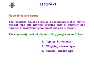
- 1. 1 Lecture -3 Recording rain gauge The recording gauges produce a continuous plot of rainfall against time and provide valuable data of intensity and duration of rainfall for hydrological analysis of storms. The commonly used rainfall recording gauges are as follows: 1. Typing - bucket type 2. Weighing – bucket type 3. Natural – Siphon type
- 2. 2 Lecture -3 Types of Recording Rain Gauge Twotypes 1.Telemetering Rain gauges This is electronic units to transmit the data on rainfall to a base station both at regular intervals and on interrogation. The typing- bucket type rain gauge is ideally suited for this purpose. Telemetering gauges are most suitable to record rainfall data from mountainous and generally inaccessible places. 2.Radar Rain gauges The metrological radar is a powerful instrument for measuring the real extent, location and movement of rain storms. The amounts of rainfall over large areas can be determined through the radar with a good degree of accuracy. The radar is a remote-sensing super gauge covering an aerial extent of as much as 100,000 km2 .
- 3. 3 Lecture -3 Rain gauge networks According to the World Metrological Organization (WMO) the criteria for establishment of rain gauge stations : 1. In flat regions of temperate, Mediterranean and tropical zones : ideal – 1 station for 600- 900 km2 acceptable – 1 station for 900 – 3000 km2 2. in mountainous regions of temperate, Mediterranean and tropical zones: ideal – 1 station for 100 – 200 km2 acceptable - 1 station for 250 – 1000 km2 and 3. In arid and polar zones : 1 station for 1500 – 10,000 km2 depending on the feasibility.
- 4. 4 Lecture -3 Adequacy of Rain gauge Stations The percentage of error in the estimation of mean rainfall is obtained by statistical analysis. Optimal number of stations may be determined as N = (Cv / Є )2 ......................... Eq – 1 Where, N = Optimal number of stations Є = allowable degree of error in the estimate of the mean rainfall and Cv = coefficient of variation of the rainfall values at the existing m stations (in percent).
- 5. 5 If there are m stations in the catchment each recording rainfall values P1, P2, P3, ..., upto Pm in a known time, the coefficient of variation Cv is calculated as : Cv = (100 * σm-1 )/ Pavg Where, m σm-1 = √ [{∑ ( Pi– Pavg ) 2 }/{(m-1)}] =Standard deviation ...Eq-2 i=1 Pi = precipitation magnitude in the ith station m = Number of stations Lecture -3(contd.)
- 6. 6 Lecture -3(contd.) m Mean precipitation, Pavg = (1/m) ∑ Pi ....... Eq-3 i = 1 It is usual to take Є = 10 % in calculating N from the Eq- 2. If the value of Є is small, the number of rain gauge stations will be more .
- 7. 7 Lecture -3(contd.) Example 2- 1 A catchment has a six rain gauge stations. In a year the annual rainfall recorded by the gauges are shown in Data Table-1 . For a 10% error in the estimation of the mean rainfall, calculate the optimum number of stations in the catchment. Station A B C D E F Rainfall (cm) 82.60 102.90 180.30 110.30 98.80 136.70 Data Table-1
- 8. 8 Solution : Given m (number of stations) = 6 error, Є = 10% Annual rainfall data in Table-1 To be calculated the optimum number of stations in the catchment. We know optimal number of stations, N as N = (Cv / Є )2 and...................... Eq- 4 and Cv = (100 * σm-1 )/ Pavg Lecture -3(contd.)
- 9. 9 As we know from Eq-3 mean precipitation m Pavg = (1/m) ∑ Pi i = 1 m ∑ Pi = 82.6 + 102.90 + 180.30 + 110.30 + 98.80 + 136.70 = 711.60cm i = 1 Putting this value in above equation , Pavg = 711.60/ 6 = 118.60 cm Lecture -3(contd.)
- 10. 10 Putting the value of m, Pi and P in Eq -2 , we find A, (Pi–Pavg) 2 = (82.6 – 118.6)2 =1296 B, (Pi – Pavg) 2 = (102.9 – 118.6) 2 =246.49 C, (Pi – Pavg) 2 = (180.3– 118.6) 2 = 3806.89 D, (Pi – Pavg) 2 = (110.3 – 118.6) 2 = 68.89 E , (Pi – Pavg ) 2 = (98.8 – 118.6) 2 = 392.00 F, (Pi – Pavg) 2 = (136.7– 118.6) 2 = 327.6 Hence, ∑(Pi–Pavg) 2 =(1296.0 + 246.49 + 3808.89 + 68.89 + 392.00 + 327.6 = 6137.88 Lecture -3(contd.)
- 11. 11 Lecture -3(contd.) Now for σm-1 m σm-1= √ [{∑ ( Pi– Pavg ) 2 }/{(m-1)}] =Standard deviation i=1 Putting the respective values in the equation above σm-1 = 6137.88 / (6-1) = 35.04 Again for Cv Cv = (100 x 35.04 ) / (118.60) = 29.54 Putting all the values of Cv , σm-1 and Pavg in the Eq-1 for calculation of optimum number of stations, N = (Cv / Є )2 = (29.54 / 10 )2 = 8.70, Say, 9 nos.
- 12. 12 Lecture -3(contd.) Preparation of Data : Estimation of missing Data Methods of estimation of missing data. Two types (2) Ratios of normal annual precipitations (1) Arithmetic mean/Average Method Assume the annual precipitation values, P1, P2, P3, .......Pm at neighboring M stations 1,2,3,4.......... M respectively. It is required to find the missing annual precipitation Px at a station X not included in the above M stations. The normal annual precipitations N1, N2, N3 ....... ......... Ni ..... at each of the above (M+1) stations including station X are known. Then Arithmetic mean/Average Px = [1/M ] [ P1+P2+P3+...........+Pm]............... Eq -5 (1) Arithmetic mean
- 13. 13 Lecture -3(contd.) If the normal annual precipitations at various stations are within about 10% of the normal annual precipitation at station X, than arithmetic average method is followed to estimate Px . (2) Ratios of normal annual precipitations If the normal annual precipitations at various stations are more than about 10% of the normal annual precipitation at station X then the Px is estimated by weighing the precipitation at the various stations by the ratios of normal annual precipitations. This method is known as the normal ratio method, which will give Px as Px = (Nx / M )(P1 / N1 + P2 / N2 + P3 / N3 + ........+ Pm / Nm ) .... Eq -6
- 14. 14 Lecture -3(contd.) Example 2-2 The normal annual rainfall at stations A, B, C and D in a basin are 80.97, 67.59, 76.28 and 92.01 cm respectively. In the year 1975, the station D was inoperative and the station A, B and C recorded annual precipitation of 91.11, 72.23 and 79.89 cm respectively. Estimate the rainfall at station D in that year. Solution : Given, Normal annual rainfall at stations:- A = 80.97 cm B = 67.59 cm C = 76.28 cm D= 92.01 cm
- 15. 15 Annual precipitations:- P1 = 91.11 cm P2 = 72.23 cm P3 = 79.89 cm To be estimated annual rainfall at station D Checking of methods- The variation among the stations : 76.28-67.59 = 8.69 cm Which is , (8.69 /76.28) x 100 = 11.39 % < 10 % Lecture -3(contd.)
- 16. 16 Lecture -3(contd.) Hence, Ratios of normal annual precipitations method to be used Putting respective values in Eq-6 PD = (ND / M )(P1 / N1 + P2 / N2 + P3 / N3 + ........+ Pm / Nm ) PD = (92.01 / 3 )(91.11 / 80.97 + 72.23 / 67.59 + 79.89/ 76.28) PD = 99.41 cm
- 17. 17 Lecture -3(contd.) Presentation of rainfall data The rainfall data may present in three ways. 1. Mass Curve of Rainfall The mass curve is a plot of the accumulated precipitation against time, plotted in chronological order. Records of float type and weighing bucket type gauges are of these form. For extracting the information on the duration and magnitude of a storm, Mass curves rainfall is very much useful. Again the intensity of the storm can also be calculated by slope of the curve Figure-2-3. 3.Point Rainfall 2.Hyetograph1. Mass Curve of Rainfall
- 18. 18 Lecture -3(contd.) 0 1 2 3 4 AccumulatedPrecipitation(cm) 02468101214 1st storm = 10 cm 2nd storm = 4 cm Time (days) Figure 2-3 -Mass curve of rainfall
- 19. 19 0 8 16 24 30 36 42 48 56 62 00.10.20.30.4 Rainfallintensity(cm/hr) Hyetograph of the first storm in Total depth = 10 cm Duration = 56 hrs. Figure2-4: Hyetograph of a storm (2) Hyetograph A plot representated by the intensity of rainfall against the time interval is called hyetograph. The hyetograph is derived from the mass curve and is usually represented as a bar chart as shown in figure 2-4. It is particularly important in the development of design storms to predict extreme floods. The area under hyetograph represents the total precipitation received in the period. In larger catchments the time interval is 6hrs. Lecture -3(contd.)
- 20. 20 Lecture -3(contd.) (3) Point Rainfall Point rainfall is also known as station rainfall refers to the rainfall data of a station. Depending on the need, data listed as • daily • weekly • monthly • seasonal • annual values for various periods. Graphically these data are represented as plots of magnitude vs chronological time in the form of a bar diagram.
- 21. 21 Lecture -3(contd.) Mean Precipitation over an area. To convert the point rainfall values at various stations into average value over a catchment- there are three methods : (1) Arithmetical mean method (2) Thiessen –polygon method (3) Isohyetal method
- 22. 22 Lecture -3(contd.) (1) Arithmetical mean/average method Assume P1, P2, P3 ......Pn are the precipitation values of the stations N for the given period. Then the average value of the mean precipitation p over the catchment will be arithmetical mean of the precipitation as follows : Pavg = (P1 + P2 + P3 + ....... + Pi... + Pn )/N N Pavg = 1/N ( ∑ Pi ) i = 1 where. i = 1,2, 3 ....... N
- 23. 23 Lecture -3(contd.) 2) Thiessen - mean method The rainfall recorded at each station is given a weightage on the basis of an area closest to the station. Procedure for determining the weighting area Consider a catchment area has three rain gauge stations. And three stations outside the catchment but the positions in its neighborhood. The catchment area is drawn to scale and the positions of the six stations marked on it. Station 1 to 6 are joined to form a network of triangles. Perpendicular bisectors for each of the sides of the triangle are drawn. These bisectors form a polygon around each station. The boundary of the catchment, if it cuts the bisectors is taken as the outer limit of the polygon. Thus the station 1, the bounding polygon is abcd. For station 2, kade is taken as the bounding polygon. These bounding polygons are called Thiessen
- 24. 24 Lecture -3(contd.) The boundary of the catchment, if it cuts the bisectors is taken as the outer limit of the polygon. Thus the station 1, the bounding polygon is abcd. For station 2, kade is taken as the bounding polygon. These bounding polygons are called Thiessen polygons. Figure: Thiessen Polygon
- 25. 25 Lecture -3(contd.) The areas of those six Thiessen Polygons are determined either with a planimeter or by using an overlay grid. Calculations of mean precipitation If P1, P2, P3 ......P6 are the rainfall magnitudes recorded by the stations 1,2, 3, ............. 6 respectively and A1, A2, A3 ......A6 are the respective areas of the Thiessen Polygons. The total area = A1 +A2+ A3 +...... +A6 = A The weightage area for each stations = A1 /A A2 /A ... A6 / A
- 26. 26 Lecture -3(contd.) then the average rainfall Pavg over the catchment is given by Pavg ={ (A1 /A)P1 + (A2/A) P2) + (A3/A)P3 )+..... + (A6/A)P6)} In general for M stations, M Pavg = ∑Pi Ai / A i where, i = 1,2,3.....M The ratio Ai / A is called the weightage factor for each station.