July 30-1030-Nancy Somerville
•Télécharger en tant que PPTX, PDF•
1 j'aime•57 vues

2019 SWCS International Annual Conference July 28-31, 2019 Pittsburgh, Pennsylvania

Recommandé
Recommandé
Contenu connexe
Tendances
Tendances (20)
Similaire à July 30-1030-Nancy Somerville
Similaire à July 30-1030-Nancy Somerville (20)
Plus de Soil and Water Conservation Society
Plus de Soil and Water Conservation Society (20)
Dernier
Dernier (20)
July 30-1030-Nancy Somerville
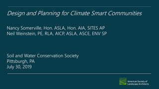
- 1. Design and Planning for Climate Smart Communities Nancy Somerville, Hon. ASLA, Hon. AIA, SITES AP Neil Weinstein, PE, RLA, AICP, ASLA, ASCE, ENV SP Soil and Water Conservation Society Pittsburgh, PA July 30, 2019
- 2. ASLA Blue Ribbon Panel on Climate Change and Resilience Diane Jones Allen, ASLA University of Texas at Arlington Armando Carbonell, FAICP Lincoln Institute of Land Policy Mark Dawson, FASLA Sasaki Associates Inc. Tim Duggan, ASLA Phronesis Ying-yu Hung, ASLA SWA, Los Angeles Studio Dr. Dwane Jones University of the District of Columbia Adam Ortiz Prince George’s County, Maryland Dr. Jalonne L. White-Newsome The Kresge Foundation Vaughn B. Rinner, FASLA ASLA 2017 President Nancy C. Somerville, Hon. ASLA ASLA Executive Vice President and CEO
- 3. • Core principles • Key design and planning approaches for creating healthy, climate-smart, and resilient communities • Public policy recommendations to support those approaches Photo: ASLA Smart Policies for a Changing Climate
- 4. Policies should: Use incentives whenever feasible Promote holistic planning and provide multiple benefits Address environmental justice and racial and social equity Reflect meaningful community engagement Be regularly evaluated, including for unintended consequences Address regional as well as local and site-specific goals/issues
- 5. Natural Systems Community Development Vulnerable Communities Transportation Agriculture
- 6. Natural Systems Maximum use of green infrastructure Porous pavement technologies Protection and expansion of open space and natural systems Increased tree canopy Wetlands, etc., as buffers Preservation of wildlands Biohabitat- and pollinator-supporting vegetation
- 7. Natural Systems Prohibition on building on floodplains Water conservation and water reuse Protection of critical water sources Greenways and wildlife corridors to support plant and animal migration
- 8. Community Development Transit-oriented development with multimodal green and complete streets Reuse/redevelopment of brownfields and grayfields Clean energy and energy efficient solutions Walkable open space within a quarter mile of all residential development
- 9. Vulnerable Communities Equitable access to transportation, housing, jobs, recreation, and open space Environmental justice analyses as part of all planning Mixed-income housing and mixed-used development Relocation, retreat, and/or evacuation plans Limitations or prohibitions on building in fire- prone areas
- 10. Transportation Transit-oriented development with green and complete streets Equitable access to transportation options Green infrastructure and protection of natural environment and habitat in transportation projects “Road diets” to improve safety and promote active transportation Charging stations and accommodations for new/emerging transportation modes
- 11. Agriculture Farmland preservation and protection of prime soils Pro-active planning to address food deserts Promotion of urban and suburban agriculture Promotion of conservation farming practices for healthy soils and carbon sequestration
- 12. Landscape Architects emerging role in the challenge to address climate adaptation • HISTORICAL CONTEXT • SPHERES OF INFLUENCE • OPPORTUNITIES FOR PARTNERSHIPS AND LEADERSHIP
- 13. What will our urban riparian areas look like? 1938, 1965, 2018, FUTURE! Austin Bladensburg
- 14. “Typical” urbanized riparian area “
- 15. Climate Adaptation is not just about properties that are located in the 100 Year floodplain and volume issues. Localized flooding, water quality and supply, impacts on infrastructure, air quality, equity, and mobility are often overlooked in the discussion.
- 16. What is the effect of more intense and frequent rainfall? “Cloudbursts”
- 17. Other Extremes (heat, cold, drought, humidity)
- 18. How Do Our Plant Communities Respond? Increase in the number of high temperature days and higher temperatures at night Where is my Cone Flower?
- 19. Maybe we need some different approaches and answers to these challenges!
- 20. About 25 years ago we began down this road. Low Impact Development (LID)/Green Stormwater Infrastructure (GSI): Natural processes to restore or maintain hydrologic and ecological function or targeted watershed goals. 20 • Low Impact Development (LID): Site Scale • Green Stormwater Infrastructure (GSI): Watershed and Large-Scale Implementation
- 21. Nutrients, Carbon, Energy, Materials Recycling….. 21
- 22. Some tools! Green Stormwater Infrastructure/Low Impact Development has unique and integrated configurations 22
- 23. Storage and Processing 23 Permeable Pavement Bioretention Surface, Media, Gravel, Vaults….
- 24. Landscape Architects will have a critical role in protecting and restoring watersheds through Green Infrastructure planning and design • Earlier definitions of Green Infrastructure focused on integrated open space • 2007 MOA with EPA Office of Water on Combined Sewer Overflow (CSO) and then National Pollutant Discharge Elimination System (NPDES) Separate Storm Sewer System (MS4) Permits • Green Stormwater Infrastructure (GSI)
- 25. What is the value to our communities for using these tools?
- 26. Traditional Design & Infrastructure Stream?
- 29. Range of options to achieve volume and rate control
- 30. Green Infrastructure at Multiple Scales: Neighborhoods Local/Neighborhood Scale • Greater emphasis on restoration activities such as planting trees and installing bioswales, restoring wetlands, maintaining open spaces, and incorporating existing landscape features into site design plans • Focus Stormwater Management and Co-benefits
- 31. Co-Benefits of Green Infrastructure: Leveraging of programs and funds Town of Edmonston, Maryland Green And Complete Street
- 33. Bloomingdale Grey/ Green Solution possible real time controls
- 34. Traditionally controls meant for sediment and pollutants (nutrients and toxics). Starting to focus on ecosystem services and co-benefits. Urban Stream and River Valleys
- 35. Use and access to stream valleys and corridors
- 36. Forms and functions of restoration and protection practices
- 37. Design Choices
- 38. Implementation Policy and Tools • Master Plans • Design Guides • Codes and Ordinances • Standards and Specifications • Revitalization and Economic Development Plans NRPA Great Urban Parks Guide 2018 1964
- 39. Prince George’s County, Maryland • In 2000 the County was concerned with increasing amount of development & impact to natural resources • Concern regarding loss of forests, especially around riparian areas • Established a Green Infrastructure Network: • Regulated Areas • Evaluation Areas • Gap Areas … to help direct growth away from these areas • Now used in the development review process to ensure areas are protected and, where possible/necessary, restored
- 40. Regional Scale Can lower average summer temperature by up to 1 ° Fahrenheit Allows you to ask questions: What portions of the county are in greatest need of more forest/tree cover to increase protection from summertime heat? Prince George’s County Green Infrastructure Study Prevents 4.3 billion gallons of polluted rain from entering the storm drain per year – A $12.8 billion dollar savings Offsets greenhouse gas emission of 161,000 passenger vehicles a year… ...and stores more CO2 than that emitted by 5 power plants.
- 41. Microclimate Modifications/ Temperature • Overall temperature reductions provided by the tree and forest cover in Prince George’s County, MD, is 0.29°C. Depending on where you are in the county, this can be greater or lower
- 42. Green Infrastructure From Watersheds To Regional Scale • Interconnected network of waterways, wetlands, woodlands, wildlife habitats, and other natural areas that maintain ecological processes • Preserve, create, or restore vegetated areas and corridors such as greenways, parks, conservation easements, and riparian buffers. • Focus Overall ecosystem
- 43. How we manage vegetation and plant materials and ecosystem strategies for Linear Transportation Projects will be critical
- 44. It’s just a bunch of plants and some soil……
- 45. Heading Management of existing traditional infrastructure assets and potentially competing priorities and resources
- 46. Take away: • Really, Really, Really need interdisciplinary teams to solve this • Need some predictability/certainty on ecosystem responses • Need an adaptable approach that is scalable • The leap from policy to implementation requires pilot projects and persistence • Messaging is critical
- 47. Key Public Policies to Support Natural Systems Provide dedicated funding for green infrastructure Require new development to retain and infiltrate precipitation on site Incentivize use of appropriate plant species Adopt a green space plan Adopt a national urban and suburban tree planting strategy Incentivize development that retains appropriate vegetation
- 48. Key Public Policies to Support Natural Systems Adopt a national water protection and management strategy Prioritize protection of critical water sources Incentivize or require water conservation and reuse technologies Protect wildlands Incentivize planning for plant and animal migration Incentivize best practices in soil management
- 49. Key Policies to Support Community Development Prioritize and incentivize brownfield and grayfield rehabilitation Develop municipal and regional climate resilience plans Support community land banking to convert vacant/abandoned property Create community investment trusts to fund green infrastructure Require walkable open space within ¼ mile of residential development
- 50. Key Policies to Support Transportation Require transit-oriented development with multimodal, green, and complete streets principles Include affordable housing in TOD Address transit deserts Provide incentives for biking and carpooling
- 51. Key Policies to Support Vulnerable Communities Restrict building in floodplains Update FEMA maps and include claims- data analysis Reinstitute Federal Flood Risk Management Standards Require environmental justice analyses Promote mixed-income housing and mixed-use development
- 52. Key Policies to Support Agriculture Incentivize urban and suburban agriculture Protect current farmland and prime farmland soils Identify and address food deserts Promote healthy food education Incentivize conservation farming practices
- 53. Based on ecosystem services Grounded in research Site context Pre-design assessment Site design – water Site design -- soil and vegetation Site design -- materials Site design – human health Construction Operations and maintenance Education and performance monitoring
- 54. Resources Smart Policies for a Changing Climate report: www.asla.org/climate www.asla.org/sustainablelandscapes www.sustainablesites.org