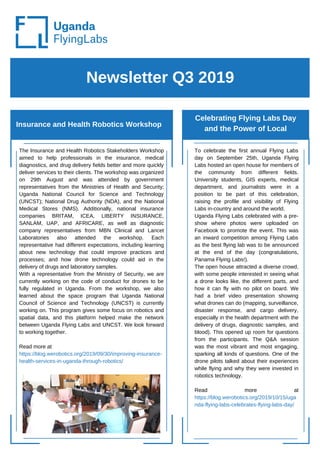
1. Newsletter Q3 2019
Insurance and Health Robotics Workshop
Celebrating Flying Labs Day
and the Power of Local
The Insurance and Health Robotics Stakeholders Workshop
aimed to help professionals in the insurance, medical
diagnostics, and drug delivery fields better and more quickly
deliver services to their clients. The workshop was organized
on 29th August and was attended by government
representatives from the Ministries of Health and Security;
Uganda National Council for Science and Technology
(UNCST); National Drug Authority (NDA), and the National
Medical Stores (NMS). Additionally, national insurance
companies BRITAM, ICEA, LIBERTY INSURANCE,
SANLAM, UAP, and AFRICARE, as well as diagnostic
company representatives from MBN Clinical and Lancet
Laboratories also attended the workshop. Each
representative had different expectations, including learning
about new technology that could improve practices and
processes; and how drone technology could aid in the
delivery of drugs and laboratory samples.
With a representative from the Ministry of Security, we are
currently working on the code of conduct for drones to be
fully regulated in Uganda. From the workshop, we also
learned about the space program that Uganda National
Council of Science and Technology (UNCST) is currently
working on. This program gives some focus on robotics and
spatial data, and this platform helped make the network
between Uganda Flying Labs and UNCST. We look forward
to working together.
Read more at
https://blog.werobotics.org/2019/09/30/improving-insurance-
health-services-in-uganda-through-robotics/
To celebrate the first annual Flying Labs
day on September 25th, Uganda Flying
Labs hosted an open house for members of
the community from different fields.
University students, GIS experts, medical
department, and journalists were in a
position to be part of this celebration,
raising the profile and visibility of Flying
Labs in-country and around the world.
Uganda Flying Labs celebrated with a pre-
show where photos were uploaded on
Facebook to promote the event. This was
an inward competition among Flying Labs
as the best flying lab was to be announced
at the end of the day (congratulations,
Panama Flying Labs!).
The open house attracted a diverse crowd,
with some people interested in seeing what
a drone looks like, the different parts, and
how it can fly with no pilot on board. We
had a brief video presentation showing
what drones can do (mapping, surveillance,
disaster response, and cargo delivery,
especially in the health department with the
delivery of drugs, diagnostic samples, and
blood). This opened up room for questions
from the participants. The Q&A session
was the most vibrant and most engaging,
sparking all kinds of questions. One of the
drone pilots talked about their experiences
while flying and why they were invested in
robotics technology.
Read more at
https://blog.werobotics.org/2019/10/15/uga
nda-flying-labs-celebrates-flying-labs-day/
2. Newsletter April, 2019
Upcoming projects
The intermediate drone training was
held for two days from 27th to 28th
September 2019. This was hands on
with the flying and analysis using
Pix4D and QGIS.
27th September was the day of the
field where the main aim was to do
mission planning and capture as a
much imagery as possible. The day
started with mission planning at the
Hive Colab. The participants who
ranged from Surveys to Electrical
Engineers to GIS experts and
programmers were put in groups of
three with each group having
someone from each field. Having
different expertise in different areas
was beneficial as knowledge and
ideas were shared as a team.
Day two took place at Uganda Flying
Labs Premises at Hive colab. The
overlap of images was very good with
most of the areas having the green
colour which showed more than five
images overlap. Hence showing that
the mission plan was well executed.
From the analysis, we were able to get
the orthomosaic and Digital Surface
Model (DSM).
Photo Gallery
Follow us and Contact us
Uganda Flying Labs
Hive Colab, Level 4, Plot 90
Kanjokya, Kamwokya
Kampala, Uganda
uganda@flyinglabs.org
https://flyinglabs.org/uganda/
https://twitter.com/UgFlyingLabs
https://www.facebook.com/ugandaflyinglabs/
https://www.instagram.com/ugandaflyinglabs/
Participants getting ready for a flying session during the
Intermediate drone training
Intermediate drone training
Drone pilot shares his experience during the open house
event for Flying Labs Day
3. Newsletter 1 Q2 2019
Project: Mapping Refugee Settlements for Risk
Analysis
Third Drone Monthly
Training
Mapping Refugee Settlements for Risk Analysis in Arua
District, Imvempi Refugee Settlement: Customized Training
of the Officers from the Office of the Prime Minister and
Kampala Capital City Authority from the 26th to the 28th of
March, 2019.
The development of UAVs for humanitarian assistance is a
relatively new field, however it is developing quickly and
expanding into multiple areas of use. This has been enhanced
by drone training as the greatest way to learn how to fly better
and an absolute necessity if you want to use drones. In the
recent years, commercial and professional use of unmanned
aerial vehicles (UAVs), unmanned aerial systems (UASs) and
drones (multi rotor and fixed wing) has gained momentum to
compliment satellite imagery and other GIS tools.
It was against this background that this project was conducted in
Arua in the west of the River Nile Region of Uganda. The
participants were trained on how to fly drones and carry out
mapping for Risk Analysis. Four DJI Phantom 4 Pro drones were
deployed with five instructors. The major partners in this project
were Humanitarian OpenStreetMap (HOTOSM) Uganda and
UNDP. From this project, 20 officers from OPM and KCCA learnt
how to fly a drone, they captured aerial images using drones in
Imvempi Refugee Settlement, processed the imagery using
OpenDroneMap software to produce an orthomosaic and carried
out risk analysis from the orthomosaic created.
The feedback from this team was so exciting. The evaluation of
the team was carried out and this pledged another project for
Uganda Flying Labs with these partners. It was widely accepted
in the training that there is a strong need for more and better
adaptive and diagnostic practice in flying drones for the
participants to deploy drones effectively for their humanitarian
response. In conclusion, the training as a whole was a success
in a way that all participant’s expectations were met and the
different organizations pledged to develop action plans and have
it shared across.
Key Achievement
Uganda Flying Labs conducted its
third monthly drone training on 3rd of
March, 2019. The training had about
9 participants which comprised of
surveyors, remote sensing
specialists, GIS Officers and
Videographers.
The main partner was Map Uganda.
The training was a blast, it focused
on the “Use of UAVs for social good
and research applications with main
focus on the use cases of
Agriculture, Health, humanitarian
response, nature conservation, and
development”.
The participant's expectations were
met with a few challenges that
helped us to shape our Flying Labs
policy for other projects ahead.
Uganda Flying Labs with its efforts,
made sure that even after the
training, the questions from these
participants were still attended to.
The team is therefore warming up for
the intermediate training that will
happen in June.
Participants assembling the drone
4. Newsletter April, 2019
Other activities
Demonstration: Uganda Flying Labs
perform a drone demonstration at the
ICT4D global Conference.
It was on 31st of April, 2019 when
Uganda Flying Labs conducted a drone
flying demonstrations to participants at
the ICT4D global conference that took
place at the Common Wealth Speke
Resort Hotel Munyonyo in Kampala.
The conference was organised by CRS
and Ministry of ICT.
The main goal of this demo was to
introduce participants to the drone
technology and its potential use case
across the various sectors in the
country. The participants were from
across the world and from different
professions. Uganda Flying Labs
deployed two drones with two pilots.
It was a great excitement to the
attendees, the majority of which claimed
never to have seen drones before. They
asked questions and had an opportunity
to fly drones. The participants were
convinced and many pledged to go back
and do something with drones.
Photo Gallery
Follow us and Contact us
Inspection of Telecom Towers, funded by IGlobe
Group in Uganda.
Mapping of Farms for the Rain Tree Organization.
Next monthly Drone Training on the 26th of May.
Training with Juba University in June.
Training with the staffs of Infectious Disease
Institute on dates to be communicated.
Upcoming training and projects
uganda@flyinglabs.org
https://flyinglabs.org/uganda/
https://twitter.com/UgFlyingLabs
https://www.facebook.com/ugandaflyinglabs/
https://www.instagram.com/ugandaflyinglabs/
Training of the Officers from the Office of the Prime Minister
and Kampala Capital City Authority:
Day 1 Participants in the Theory Session
Training of the Officers from the Office of the Prime Minister
and Kampala Capital City Authority
Pilot shows the participants the
PX4D interface
5. Newsletter 2 Q2 2019
Mapping landing spots to aid in the delivery of
medicine and vaccines
Training Security Officers
on using Drones
Mapping landing spots on Kalangala Island using drone
technology to aid in the delivery of medicine and
vaccines over the Island from the 8th to 11th of April, 2019.
Medicine and vaccines are the most difficult to transport as
they must be stored at precise temperatures. Kalangala
island is particularly one of the most difficult locations in
Uganda that are hard to reach. This has also made medicine
and vaccines delivery by the development partners very
hard due to it being an island and having a limited number of
roads across its islands which if not most are not accessible
and the cost of fuel which makes boats so costly to use.
Uganda Flying Labs conducted this mapping exercise with
its partners from Infectious Disease Institute, Johnson and
Johnson and John Hopkins.
The project was meant to benefit the residents of Kalangala
Island. Four islands of Buyovu, Kabale, Serimayi were
mapped using drones. The mapping exercise was
completed on time and the partners are to officially start the
project next year in January with Uganda Flying Labs
handling the technical part of using drones for deliveries.
Key Achievement
Uganda Flying Labs managed to have the government
sectors and departments involved in the drone industry,
conducted a number of training and excelled in a number
of Projects that has marketed out Uganda Flying Labs
" Uganda Flying Labs trains
security officers on using
drones for Humanitarian and
Disaster Response, Distribution
and Event Monitoring, Crisis
Management and State
Surveillance and Intelligent
Information Gathering "
Drones originally derives its
genesis from the Military. But due
to its many applications, it was
incorporated into the civilian use.
Uganda Flying Labs was pleased
to train the security officers on how
to fly drones for managing crisis,
carrying out state surveilliance and
disaster response. The officers
were from different units of the
security.
The main partner was Internal
Security Organisation (ISO). It took
place on the 13th of April, 2019 at
Skyz Hotel. The major outcome
was that the security officers were
able to learn how to fly and the
basic regulations behind flying
drones.
This ignited the to request for
another training with the rest of the
other officers on the 1st of June,
2019.
6. Newsletter April, 2019
Upcoming projects Photo Gallery
Follow us and Contact us
Uganda Flying Labs
Hive Colab, Level 4, Plot 90
Kanjokya, Kamwokya
Kampala, Uganda
Day 2: Customized Training of the Officers from the Office of the Prime
Minister and Kampala Capital City Authority
Kampala image analysis session
uganda@flyinglabs.org
https://flyinglabs.org/uganda/
https://twitter.com/UgFlyingLabs
https://www.facebook.com/ugandaflyinglabs/
https://www.instagram.com/ugandaflyinglabs/
7. Newsletter Q1 2019
Training of Office of Prime Minister staff on use of
drones and imagery analysis
Other activities
Training of Office of Prime Minister staff on use of drones
and imagery analysis:
Our Flying Labs organized a drone training for the staff of the
Office of Prime Minister on 26th and 27th March.
The drone training happened within the frame work of the Arua
Refugees Camp UAV surveillance project with the support from
UNDP, Uganda. They sponsored 18 OPM officers (Office of the
Prime Ministers in the department of disaster response and
preparedness) and 2 Senior GIS officers from KCCA (Kampala
Capital City Authority).
The project was bidded to HOT Uganda (Humanitarian
OpenStreetMap) and HOT sub contracted Uganda Flying Labs
to help them with the drone trainings.The team traveled on the
24th to make survey of the area and do pre-testing. The training
had 4 pilots from Uganda Flying Labs and they used 4 DJI
phantom 4 drones.
The Uganda Flying Labs team will again train the participants
on the 4th and 5th of April with analysis of the images that the
participants captured from the field with the drones. The
analysis will be done using OpenDroneMaps.
Key Achievement
Successful two introductory drone trainings with active
participation from diverse sectors.
Efficient publicity and promotion of Uganda Flying Labs
services through social media.
1.We had an introductory training
on 3rd March, 2019, with 8
participants who are from different
walks of life.
The first session was focussed on
theory and mission planning before
beginning with hands on drone flying.
There was such an excitement that
they are anticipating second level of
training.
The the key takeaways:
Understanding flight safety
Code of conduct
Mission planning
Drone operations
Involving communities in drone
flying
DJI rotary drone and wing drone
techniques
2.We hope to engage soon with IDI
on a project for medical cargo in the
next month. We shall have a
preliminary flight where data will be
collected to analyze the Island’s
topography, the distances between
the central points and the patients
and the scale of occupation .
3.On the other hand, we also
participated at the Datafest Kampala
and made a presentation titled: "Mind
the Gap, how we can bridge the
gap with Geodata". We discussed
drones and their relevance to speed
data retrieval. An organization called
Nandi was interested in
crowdsourcing using UAV imagery.
8. Newsletter April, 2019
Upcoming projects Photo Gallery
Follow us and Contact us
Uganda Flying Labs
Hive Colab, Level 4, Plot 90
Kanjokya, Kamwokya
Kampala, Uganda
uganda@flyinglabs.org
https://flyinglabs.org/uganda/
https://twitter.com/UgFlyingLabs
https://www.facebook.com/ugandaflyinglabs/
https://www.instagram.com/ugandaflyinglabs/
Participants in the morning session during the introductory training in Feb, 2019.
Participants pose for a picture after successful training and hands-on
experience with drones.