Geotab general share vm2 opt
•
2 j'aime•769 vues

GPS Fleet Management As the world’s largest provider of GPS fleet management technology, we understand that the decisions you make are only as good as the information you receive. Watch our video to learn more about how our GPS tracking solutions help fleet owners reduce fuel costs, improve MPG, and transform the way you manage your business.

Recommandé
Contenu connexe
Tendances
Tendances (20)
Similaire à Geotab general share vm2 opt
Similaire à Geotab general share vm2 opt (20)
Plus de VM Fleet(PTY)Ltd
Dernier
Dernier (20)
Geotab general share vm2 opt
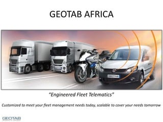
- 1. GEOTAB AFRICA “Engineered Fleet Telematics” Customized to meet your fleet management needs today, scalable to cover your needs tomorrow
- 2. Geotab Africa – What We Do We do Fleet Telematics • Our products and software allow our customers the ability for monitoring and registering the location, movements, status and behaviour of a vehicle or fleet of vehicles. • This is achieved through a combination of a GPS receiver and an electronic GSM device installed in each vehicle, which then communicates with user and web-based software. • Besides these standard services we also act as the telematics hub for 3rd party devices connected to monitor different functions on the vehicle. • Through the OBD II port we monitor and register engine and other vehicle indicators. • Amongst many other functionality enabled through our devices…
- 3. Geotab Africa – Why Fleet Telematics Why Fleet Telematics. • Build a better business. • Stay ahead of competition. • Increased productivity. • Reduction in emissions • Visibility of the critical but normally invisible factors of a fleet. • Improved driver and public on road safety • Assist to minimize Operational Expenses (OPEX) • More effective asset utilization. • Better Return on Investments (ROI’s) • Better management of Service Level Agreements (SLA’s) using factual data. • Attract better drivers. • Ability to locate vehicle/s at any given time. • Intelligent reporting. • Identification of strengths and weaknesses in fleet, with targeted corrective actions possible. • Better risk management • And…
- 4. Geotab Africa – Why Geotab Why Geotab. • Customization possibilities that are scalable for the future. • High quality hardware and software with industry leading non-failure rates and accuracy of GPS data. • Patented technology ensures matching actual travel and routes by assets in field. • End-to-End fleet management system. • One of the most advanced fleet management software systems. • Highly flexible reporting aimed at any size enterprise. • Geotab listed as a TOP 3 telematics provider in Ptolemus Insurance Telematics Global Supplier Ranking Study. • Engineers just build better products
- 5. Geotab Africa – How To Choose Telematics Provider Choice of Provider • Focus on your end goal. Mission “to connect all businesses in Africa to the benefits of vehicle telematics” GEOTAB
- 6. Geotab Africa – Servicing Variety of Fleets
- 8. Geotab - Global Presence • ISO 9001 Certified • For the past 3 consecutive years, Geotab has been recognized as one of the fastest growing technology firms within Canada, currently placed at number 18. • Geotab was also named in Connected World’s prestigious 2013 and 2014 CW100 list and sits among the top 100 machine-to-machine(M2M) companies. • With on-going innovation aimed at improving and perfecting the end-to-end fleet management solution, Geotab is continuously adding new patents to its current portfolio.
- 9. Geotab Africa – Trading Footprint Developing Markets Current Markets
- 10. Our Positioning in Market
- 11. Geotab Africa – Positioning in Market End-to-End Fleet Management Platform Advanced Fleet Telematics The Geotab value proposition is focused on the advanced telematics market Generalised Fleet and Consumer Offering “Consumerized” Tracking/Stolen Vehicle Recovery Non-Connected
- 12. Geotab Africa – Expanded Fleet Telematics Pillars The Geotab system usage spans beyond fleet management only, and if used effectively will become a valuable tool for each area of the business. We believe that the positive impact will benefit the operational aspects of target business as well as the Income Statement and Balance Sheet Risk Management Human Resources Finance Sales & Marketing Customer Care Technical Risk and Audits Compliance Productivity Geotab provides world class live vehicle tracking and telematics for mid to enterprise class fleets Green/Environment Service Safety Legal and Regulatory Manage a Better Business and Stay Ahead of the Competition
- 14. Geotab Africa – Basic System Overview GO6™ is installed into OBD II Port of vehicle, no splicing of harness required and warranty has no impact Uploading of data is done via the GSM or Iridium network Customer Interface is Web based, utilizing the Geotab Checkmate Fleet Management Portal Data from telematics unit is hosted on web based server with industry best practice security in South Africa
- 16. Geotab Africa – Our Core Enablers The world’s first expandable telematics platform, allowing add on of 3rd party applications such as temperature monitoring, and integrating the data into the Geotab Checkmate reporting and monitoring software. The unit is a plug-and-play design that connects directly to vehicles OBD port, thus also allowing the monitoring of engine data. Advanced positioning and monitoring algorithms result in one of the highest accuracy levels within the industry with 99.9% accuracy against vehicle actual distances and routes travelled. Manufacturing quality controls ensures one of the lowest failure rates in the industry at less than 1%. Checkmate hosted reporting and analysis software is the industry’s leading fleet monitoring tool, allowing you to create and generate customised reporting and exceptions that suits your business. Geotab SDK allows creation of customised applications by external developers to further enhance the value that can be extracted by the Geotab telematics solution. Software Security MyGeotab is a web-based software, using SaaS technology - storing data in one of the largest data centers in the world. The servers are updated daily, sit behind a firewall, and use industry best practices. You can export your data at any time and run the vehicle tracking software in your local environment. Your data is always kept safe and secure, and is only accessible under strict password control that's authorized by Geotab support.
- 17. Geotab Africa – The GO6 Telematics Device • GO6™ is a sophisticated plug-and-play telematics device. • Caters for exact trip and driver behaviour monitoring as well as detailed accident reconstruction. • State of the art telematics device that does not require splicing into, or cutting of the vehicle's wiring loom. • CANbus engine data • Accident data memory • SuperSense GPS engine • 3-Axis Accelerometer for measurement of harsh driving • X-Act - patented journey data logging processor - over 99% accurate
- 18. Geotab Africa – GO6 Specifications • Housing: Flame Retarded ABS • Operating Voltage: 8V to 36V • Current Consumption: Operating Mode: 50 - 500 mA (engine running).Sleep Mode: 3 mA. • Compliance: RoHS; Lead Free • Size: 75 mm (L) x 50 mm (W) x 23 mm (H) • Weight: 70 g (0.15 lb) • Operating Temp: Operating Temp. -40° C to 80°C • Intelligent Ignition Detect: Non-engine based ignition detect based on voltage and movement allowing for 2-wire installation. Perfect for older vehicles with no engine information and covert installation for asset recovery. • Voltage Recording: Curve based voltage logging to detect weak batteries, failing alternators, and failing starters. • Antenna: Internal Antennas on GPS and Cellular Recording Parameters • Patented, curve-based GPS/voltage/accelerometer/ engine data logging algorithm for fewer, more accurate data points. GPS Receiver: • NEO-6Q • Voltage: 2.7 V to 3.6 V • 50-channel u-Blox 6 engine with over 2 million effective correlators. • Under 1 second Time-To-First Fix for hot and aided starts. • SuperSense® Indoor GPS for improved acquisition/reacquisition and tracking sensitivity. In-Cab Buzzers: • Driver Feedback: Harsh braking, harsh acceleration, harsh corners, over-revving, excessive idling and speeding, and engine based seatbelt violations (when available). • Test Mode: Diagnostic beeps for system of GPS and wireless connection. Accelerometer: • 3-axis accelerometer for low-voltage digital output linear MEMS, housed in an LGA package. • Full scale (±2g and ±8g), capable of measuring accelerations with an output data rate of 100 Hz or 400 Hz. Engine Management - Diagnostics supported on: • CAN: ISO 15765 • Diesel Engines: SAE J1939 & J1708 • Legacy OBD: SAE J1850 PWM/VPW, ISO 9141-2, and ISO 14230 KWP2000. • Adapter packs available for GM J2411 protocol vehicles and heavy duty vehicles. Memory • Main Data Memory: Records 7,500 km of city driving (40,000 logs). • Accident Memory: Buffer records over 100 minutes of second-by-second data (6,000 logs). Last 72 records (1.2 minutes) are sent instantly on accelerometer triggered accident-level events. I/O Expandability Support (IOX™) • Garmin • Iridium • Auxiliary – Analogue and Digital • Hours of Service (HOS) • Serial Port for 3rd party device integration
- 19. Geotab Africa – GO6 IOX Telematics Technology Geotab has introduced IOX Technology so as to help Fleet Managers and business owners expand the capability of their fleet management solution, without needing to increase business costs or the size of fleet tracking device. These capabilities include the ability to: • Communicate with external serial devices • Read digital ON-OFF signals • Read analog signals, 0 to 30V Geotab GO6 IOX port allows for other IOX expanders to be connected to it, creating a chain of IOX’s that further extend the capabilities of the GO6 device. The advantage of using IOX Technology rests in the ability for business managers to pick and choose only the capabilities that are required, pertaining to their businesses unique needs. In doing so, this helps: Reduce costs. End users only need to pay for pay for what they need and add on. • Reduce in-vehicle hardware space. There is no need to place another device right next to the Geotab GO device, which ensures that drivers are not restricted by space • Allow for Future expandability. As new IOX harnesses are introduced by Geotab, which help satisfy customer demand for new technologies, future expandability is ensured. • Easy installation. When new capabilities are added, the devices only need to be connected to the GO6 or to the last IOX expander in the chain, eliminating the need for removing the existing device and its connections in order to add more devices and functionalities.
- 20. Geotab Checkmate Telematics Software
- 22. Geotab Africa – Driver Safety In-Vehicle Coaching In-Vehicle Driver Coaching • Making it easy for your drivers to immediately improve their on- road driving behaviour, the in- vehicle audible alerts notify drivers of unsafe or potentially risky driving events. • Once the driver has corrected his or her driving behaviour, such a reduction in speed, the interactive in-vehicle alerts will stop beeping. • Helping your firm develop a fleet-wide safety program that works, you can easily receive this information in real-time email.
- 23. Geotab Africa – Driver Safety Seatbelt Usage Ensuring Seatbelt Usage • Along with a world of other advanced safety feature options, Geotab’s platform makes it possible for you to ensure your drivers are wearing their seatbelts. • An automatic driver and passenger seatbelt detection feature reminds drivers to put their seatbelt on. • This unique Geotab feature not only reduces the potential for driver injuries, but also ensures compliance with the law and your firms safety initiatives
- 24. Geotab Africa – Driver Safety Fatigue Alerts Driver Fatigue Alerts • Based on parameters set on Geotab system fatigue alerts could be activated in-cab or at controllers at base. • Exceptions can trigger variety of safety measures, such as immobilization at next key-off, limp mode etc.
- 25. Geotab Africa – Checkmate Zone Creation Zone Creation • Ability to create zones according to business requirements. • Zone examples: • Allowed zone • No-go zones • Operating areas • Regional Offices • Customer locations…etc
- 26. Geotab Africa – Checkmate Route Progress Updates Route Progress Updates • Create zones of progress points/checkpoints on your asset/s route/s, and keep track of progress on route.
- 27. Geotab Africa – Checkmate SANRAL Tollgates Reconciliation Tollgate Zones • Create tollgate zones that allow you to compare monthly SANRAL billing with that of your Geotab system, thereby eliminating “false” and/or incorrect charges..
- 28. Geotab Africa – Checkmate Jammer Alerts Jammer Alerts • Jamming/Scrambling Alerts on GPS can be set on system with pre-set actions to take should such events be registered
- 29. Geotab Africa – Checkmate Vehicle Classification Vehicle Classification • Ability to create different vehicle classifications, as an example bikes, cars, trucks, each with its own dynamics in relation to driving “green” bands. • Classification of vehicles could also be company specific, such as Perishable, Non-Perishable, Taxi, Security, Sales Representative etc…
- 30. Geotab Africa – Checkmate Real-Time Track and Live View Real-Time GPS Vehicle Tracking • Watch your vehicles move on a map in real-time. • See all of the associated trip details by hovering mouse over the trip points – including speed levels, broken rules, and much more. • Geotab’s rich breadcrumb trail tracking is a patented technology that gives you the most advanced insights into your driver’s on-road performance.
- 31. Geotab Africa – Checkmate Route Planning and Deviation Route Planning and Deviations • New routes can be designed and implemented with exception reports when vehicles deviate from the defined routes for that vehicle
- 32. Geotab Africa – Checkmate Trip Reviews Trips and Activity Reporting • Geotab stores your trips history information, letting you re- create any of your trips at any time, and for any date specified. • The reports provide in-depth views for various events, such as time spent at the office vs. driving vs. at customer locations, helping you identify accurate work time allocations. • Service level agreements on store visit times, frequency and duration spent at store is an example of customer usage. • Sales force management is another example of using the activity reporting tool.
- 33. Geotab Africa – Checkmate Comprehensive Exception Algorithms Comprehensive Exception Rules • As an innovative engineering- based organization, Geotab is constantly raising the bar when it comes to driver productivity tracking. • You can set various preferences within the software such as late arrival, early leaving, idling, unauthorized home stops, too much office time, long lunch, and even long stops during work hours.
- 34. Geotab Africa – Checkmate Garmin Dispatch Dispatch with Garmin GPS • As a Garmin partner, Geotab has effectively transformed the GPS devices into powerful messaging and dispatching tools. • You can send route information to the Garmin device which will automatically navigate drivers to the correct destination. • Making it even easier to identify your drivers, you can also set driver statuses to ‘on the job’ when they arrive on site, and have the vehicle colours change on the map based on their status.
- 35. Geotab Africa – Checkmate Route Optimization Better Route Optimization • Effectively dispatch drivers with Geotab's route optimization tool. • You can reduce fuel consumption, mileage, CO2 emissions, and increase your firm's operational efficiency. • Make accurate and fast deliveries while maintaining high customer service satisfaction levels.
- 36. Geotab Africa – Checkmate Risk and Safety Driver Ratings Risk & Safety and Driver Ratings • Designed with next-generation safety technology, you can gain incredible insight into your driver’s on-road behaviour with Geotab’s informative safety management reports. • Risk and safety scores are assigned to individual drivers and are based on various key indicators - speeding, seatbelt usage, harsh braking, sharp corner turns, over acceleration, and after-hours vehicle use. • Realize the potential to enhance your driver's safety with real- time risk and safety reporting.
- 37. Geotab Africa – Checkmate Safety Trend Reporting Safety Trending Reports • All of Geotab’s reports can be fully customized to show daily, weekly, or monthly trend information. • The safety trending reports help you visually see all of the changes occurring within your fleet based on vehicle groups or specific drivers. • The unique reporting environment accurately illustrates driving trends, helping managers develop achievable driver safety performance benchmarks.
- 38. Geotab Africa – Checkmate Posted and Actual Speeds Posted Road Speed vs. Actual Speed • Compare your drivers speed with the posted road speed for local city driving, highway driving, or within specific zones – such as school zones. • Global company speed limits can also be set. • In addition to knowing driver behaviour, you can now observe changes in driving styles depending on the environment the driver is in, such as customer or work zone environments.
- 39. Geotab Africa – Checkmate Instant Accident Notification Instant Accident Notifications • From immediate notifications to detailed second-by-second reports, Geotab’s patented recording algorithm helps you take timely action steps in the event of an accident. • Through in-depth data reporting you can immediately see what occurred within the last 30 seconds leading up to the accident. (Accident Recreation) • If your vehicle has been hit while parked, Geotab’s unique recording technology can help you prove no-fault to your insurance provider.
- 40. Geotab Africa – Checkmate Track Fuel Consumption Track Fuel Consumption • Geotab’s fuel efficiency reports give side-by-side fuel consumption data for all your fleet vehicles. To help you improve your fleet’s fuel economy. • Geotab’s GPS fleet management solutions keep track of driving behaviour’s that directly lead to increased fuel costs. • You can also compare drivers or vehicles with one another to target improvement areas. .
- 41. Geotab Africa – Checkmate Reduce Fuel Costs Reduce Fuel Costs • Thousands of vehicles equipped with Geotab technology have realized significant cost savings benefits. • Geotab offers the most extensive metrics available to help you effectively reduce poor fuel consumption. • Be proactive in keeping your fuel costs down by managing driver behaviour’s, such as excessive speeding or idling • View this information in real- time within Geotab's web- hosted reporting environment.
- 42. Geotab Africa – Checkmate Detect Engine Issues Detect Engine Issues • Stop engine issues before they turn into costly repairs or vehicle down-time by managing your engine fault code information. • These vehicle codes explain what the engine issue is and where to locate it, helping you save on vehicle inspection time and costs. • Prioritize your vehicles for repair based on their active diagnostic faults and other in-depth engine- derived information. • By focusing on predictive engine health, you will realize savings by being pro-active and working with service technicians to pinpoint the core problem areas.
- 43. Geotab Africa – Checkmate VIN Detection VIN Detection • The Geotab GO device automatically detects vehicle identification numbers (VIN). • This enables fleets to easily determine which vehicles they are looking up, and also to cross- reference with their own internal records should the need ever arise. • From an operational point of view, the data collected by the Geotab GO device is not directly coupled with the VIN. • This means that companies, such as vehicle rental organizations, who transfer their GO device(s) between different vehicles, can easily manage fleets of vehicles that are periodically used. • Further to this, Geotab’s intelligent device VIN detection is being used in new and interesting ways with smart decoding to understand both the make and model of vehicles, along with corresponding vehicle specific engine data.
- 44. Geotab Africa – Checkmate SARS Logbook SARS Logbook • The Geotab SARS Logbook service provides highly accurate route reports that can be used for SARS Tax purposes, unlike cheaper or more inferior offerings on the market the accuracy of Geotab is critical and proven in the field.
- 46. Geotab Africa –Suzie Cable Status Alerts Suzie Cable Status • Be alerted if Suzie Cables are not connected on any of your moving vehicles, increased safety and compliance.
- 47. Geotab Africa – Fuel Protector Fuel Protector • Patented technology that registers and records any opening and or closing of Fuel Cap, location and duration.
- 48. Geotab Africa – Fuel Monitoring Probes Fuel Monitoring Probes • Patented and highly accurate fuel monitoring probes directly in fuel tank of vehicle, anti- sloshing technology.
- 49. Geotab Africa – Driver Assist Button Driver Assist Button • Roads can be hazardous and breakdowns can occur anywhere, this is where in-cab Driver Assist Button can alert HQ of driver being stuck next to road. • Alert is created through Checkmate as an exception and responsible personnel alerted. • Example of other uses are customized solution designed to record timestamps as recorded by driver for arrival and departure times.
- 50. Geotab Africa – Driver ID NFC Driver ID • Geotab has incorporated the latest in RFID technologies - Near Field Communications (NFC) - to deliver Driver Identification for drivers that switch between vehicles. • Driver ID allows Management to have a full view into their drivers regardless of what vehicles they are driving - generating reports, rules, and exceptions by driver OR vehicle. • Driver ID can be combined with vehicle immobilization, meaning a valid Driver ID key must be touched to the reader before the vehicle will start.
- 51. Geotab Africa – Mobile Eye Mobile Eye • Using sophisticated vision algorithms, Mobileye collision avoidance technology is able to ‘interpret’ a scene in real-time and provide drivers with an immediate evaluation based on its analysis. • Automakers are now adopting this technology into their rapidly expanding safety feature applications known as Advanced Driver Assistance Systems (ADAS). • The system incorporates a high resolution vision sensor that keeps an ever-watchful “eye” on the road. • This system “sees” and analyzes potential dangerous scenarios, in real time, and alerts drivers to impending dangers, giving them more time to react. • What better protection from an accident is there than preventing one in the first place?
- 52. Geotab Africa – Axle Sensors Axle Sensors • Designed to register loads and offloading weights Geotab integrated with these devices for a number of solutions, such as: • Registering loading and offloading times and destinations of these events. • Overloading indicators. • Uneven load indicators
- 53. Geotab Africa – Dash Tamper Sensor Dash Tamper Sensors • Customised solution built to pre- warn when tampering takes place with dashboard to get to either telematics device and/or stolen vehicle tracking device/s
- 54. Geotab Africa – Exact Rig and Bay Solution Exact Rig Bay Solution • Customized solution built to register and record trailers enter and exit times from loading bays at customer vendor premises. • Solution includes arrival and departure times from customer/vendor premises. • Designed to monitor and manage SLA’s with customer/vendor based on factual data.
- 55. Geotab Africa – Industrial Machinery Industrial Machinery • Geotab integrates into a variety of Industrial vehicles ranging from Cranes to dry feed feeder arms. • Examples of usage includes registering and recording hours of operating hours and feeder arm position engaged or disengaged.
- 56. Geotab Africa – Motorcycles Motorcycles • The Geotab range of products are equally suitable on motorcycle fleets
- 57. Geotab Africa – Cold Chain Monitoring Cold Chain Monitoring • Monitoring, Registering and Recording of cold chain data. • Alerts of exceptions beyond accepted parameters as set by customer.
- 58. Geotab Africa – Fuel Card Systems Fuel Cards and Systems • Geotab integrates with a number of fleet card vendors to allow for reporting on different fleet spends and analysis
- 59. Geotab Africa – Software and Data Vendors Software and Data Integration • Geotab integrates with a number of software and billing vendors across a variety of industries
- 60. Geotab Africa – GARMIN GARMIN • Geotab has taken off-the-shelf compatible Garmin models and turned them into useful messaging tools that support notifications, broadcast alerts, dispatches, canned messages and (of course) navigation. • Messages can be sent to a single vehicle, a specific group of vehicles, or all drivers and vehicles. • Once sent, the GPS Text Messages screen will show the time when the message was read by the Driver – and the time when the Reply was sent.
- 61. Geotab Africa – Iridium IRIDIUM • With IOX technology Geotab’s GO6 device works with the Iridium Satellite modem, providing a backup means of communication. • In the event that the device can no longer communication via GSM or CDMA, likely due to low cellular coverage in the area, the device will send positional updates via the Iridium network. • In turn this provides your organization with reliable and cost effective fleet management solutions.
- 63. Geotab Africa – Courier Control Courier Control • Orbweb utilizes the Geotab SDK to obtain the live coordinates of each vehicle within the client’s fleet, in order to do the following: • Acquire real-time position information to identify the closest available vehicle nearest to a collection point. • Select and Task couriers from a geographical map.
- 64. Geotab Africa – Diesel Guard Diesel Guard • The Diesel Guard range of products has been developed over a number of years within the context of the African Market. This market has provided ITS with the perfect platform to develop a product to meet the stringent requirements that are required to ensure that the end result is a range of products that are tough, maintenance free and easy to install and at the same time providing a 100% solution to the prevention of costly diesel theft.
- 65. Geotab Africa – Masterdrive Masterdrive Proposition • Defensive driver training for commercial and public transport drivers aimed at reduction of accidents, improved fuel consumption and boosting of driver morale. • Skidpan driver training for preparing drivers adequately to drive in wet conditions. • Heavy vehicle roll over prevention training, especially for fuel and dangerous goods drivers. • Collision avoidance training, based on best practices. • Eco driving training, resulting in significant benefits to environment through reduced C02 emissions, and the benefit of reduced fuel consumption. • Vehicle technology training, such as ABS and ESP. • First aid and firefighting training specifically for drivers on the road. • Psychometric risk profiling of drivers. • In-cab driver assessments. • BIZ Protect app for mobile phones that locks phone interface whilst vehicle is in motion. • Hijack prevention training.
- 66. Geotab Africa – Mobitrans Mobitrans • In order to serve the transporting industry with a means to combat the universal problem of unladed return journeys in a safe fraudulent free environment, the Mobi-Trans application was developed. In addition to the main focus point of the application namely connecting operators to clients, the system also has a vast array of information available.
- 67. Geotab Africa – Graffiti Vehicle Branding Graffiti • High quality and durable branding solutions for all types of vehicles.
- 69. Geotab Africa – Some of Geotab International Integrations Intellistick • The IntelliStick Condition Tracker delivers real-time, reliable and vital condition based maintenance information regarding oil condition as well as detecting water or coolant intrusion for fleet operators and transportation professionals where they want it, when they want it, and how they want it. • This innovative technology is currently used on both on- and off-road diesel or gasoline trucks and heavy equipment in every class. • The IntelliStick saves your engine, your time, and your money.
- 70. Geotab Africa – Some of Geotab International Integrations Cirrus Link • Using Geotab's 5.6 SDK Cirrus Link means a unique data delivery solution that can gather information from Geotab's Checkmate system, and delivery it to third party or internal systems within the Enterprise in real time with little or no development by the Customer. • The Chariot Data Broker is based on world-class business messaging middleware, which is specifically designed to share business data across multiple data consumers in real time. • Signals from your fleet generate tracking analytics. • Warehouse sensors forecast shipping needs in real time. In the 21st century, global industry moves at the speed of constant information.
- 71. Geotab Africa – Some of Geotab International Integrations Vulcan Telematics • They provide on-board weighing systems for trucks with spring, air or mixed suspensions. • Tyre pressure monitoring.
- 72. Geotab Africa – Some of Geotab International Integrations Honeywell • Integrating with Geotab’s fleet management solution, Honeywell has developed collision avoidance and traffic control systems, wing ice and wind shear sensors, autopilots, and landing systems. • Their control systems keep homes and offices at the right temperature, and their space- age fibers make body armor bullet-resistant. • As leading makers of safer substitutes for CFCs, Honeywell helps protect the earth's ozone layer.
- 73. Geotab Africa – Some of Geotab International Integrations Garnet • Garnet is the source for state of the art solutions in liquid management. • Their patented SeeLeveL i s designed for liquid level gauging in truck tanks not only provides accurate level information but is also the first totally automated spill prevention system for applications using on-board pumps for loading product. • Garnet’s self-powered, digital SeeLeveL II system for mobile and stationary tanks, which is based on the same technology, and provides extremely high levels of accuracy.
- 74. Geotab Other
- 75. Geotab Africa – Live Outsourced Fleet Monitoring Live Outsourced Fleet Monitoring • No need to employ staff to monitor your fleet, or for your operations manager to try and do one hundred things at the same time. • Dedicated agents monitor your fleet in live environment and for any exceptions, based on rule and response set and defined by your company policies.
- 76. Geotab Africa – Risk Assessment Model Risk Assessment and Recommendations • Get a complete risk assessment and set of recommendations for your fleet, through the risk review model of Geotab. • This service also helpful to determine exact ROI that Geotab can deliver for your business.
- 77. Geotab Africa – Risk Management Insurance Discounts Insurance Discounts • Did you know that Geotab’s fleet management system can help you lower your insurance rates? • Insurance premiums can increase as a result of accidents, speeding tickets, and other unexpected incidents. • Start saving even more when you increase the overall safety of your drivers with Geotab’s GPS fleet management solutions. Geotab listed as a TOP 3 telematics provider in Ptolemus Insurance Telematics Global Supplier Ranking Study Current insurance offerings through Alexander Forbes and AIG South Africa – Commercial Fleets
- 78. Geotab Africa – VESA Approved We are VESA Approved for Stolen Vehicle Recovery Offerings
- 79. Geotab Africa – SDK and API SDK and API • A key part of Geotab offering is the ability to integrate with all areas of your business. • Developers and software companies can use the API and SDK to automatically move data between Geotab and other systems used in your organization, such as accounting or single view management dashboards. • SDK could also be utilized to customize your own reports from the Checkmate data.
- 80. Geotab Africa – Multiple Mapping Support Multiple Mapping Support • Select your default map and when zones are created the information is instantly applied across all maps without compromising the user experience • Own map engine developed for fleet managers in areas where maps are not available
- 81. Geotab Africa – Mobile Support Mobile Support • Geotab has launched Geodrive, an Android App for use with HOS and DVIR. • Geotab web interfaces are accessible and formatted for use on mobile devices. • More applications are in the pipeline for development, some country specific
- 82. Geotab Africa – Languages Multiple Language Support • English, French, Spanish. • Product Guides included
- 83. Geotab Africa – Advanced Analytics and Reporting Service Advanced Analytics • Geotab offers a host of advanced analytics services via our Bureau Service, tailored for small to large business. • For businesses wishing to use our standard data center reports that we send daily, weekly or monthly, these standard reports are included in the Bureau fees.
- 84. Geotab Africa – Software Upgrades Software Upgrades Software Upgrades • In order to maintain the advanced edge of Geotab service software upgrades are done from time-to-time and is included in customer fees. The upgrades are done over-air making the process quick and convenient for our customers.
- 85. Geotab Africa – Training Training • Beyond the inclusive training we provide to all our customers as part of the basic service offering Geotab also offers additional training and refresher courses. • Geotab also assist with training customer internal training programs as part of customer driver training and strongly believes that each customer should have a “Driver Academy”
- 87. Geotab Africa – Dash Cameras Garmin Range Garmin Dash Camera Garmin ‘20 • HD GPS standalone driving recorder with 2.3-inch LCD display • Snapshot feature allows you to take still images, even remove from vehicle to capture collision damage • Integrated microphone records the sounds inside vehicle. • Incident Detection sensor automatically saves footage of collisions and incidents. • Records both audio and video, with GPS for detailed time and location data pinpointing exactly where and when events occurred. • Record in 1080p, 720p or WVGA. • Wide-angle lens that captures the entire road. • Dash Cam starts recording at ignition on position. • The camera features automatic incident detection (G-Sensor) with customizable sensitivity settings.
- 88. Special Features • 3G/4G Cellular Connectivity Module • GPS Speed & Mapping GeoFencing • 3-Axis Accelerometer • Wi-Fi Network Module & Antenna • Live Viewing from Vehicle Camera to Your PC • Live Vehicle Tracking & Border Violation Alert • Live Crash CMS Alert • Remote Video via PC, PDA & Cell Phone • Up to 2 Tb storage • Real-time SMS & E-mail CMS functions • Integration of Pan-Tilt-Zoom Controllers • 16 Input Sensors via Expansion Module • Live Intercom with Driver • Administrator SMS & E-mail Alerts • Remote Control of PTZ Cameras • One click on GPS map and view all the selected on-board cameras. Geotab Africa – Vehicle Camera Systems - MVS Range LIVE VIEW TECHNOLOGY, get all sides of the story! Passive and live view DVR systems Interior and Exterior cameras
- 89. Case Studies
- 90. Geotab Africa – Case Studies Creative Xteriors
- 91. Geotab Africa – Case Studies Red Hawk Security
- 92. Geotab Africa – Customer Testimonial (Theft Incident) “When we last met, some weeks ago, I explained that we believed we were experiencing staff theft in our warehouse and were investigating this. As the investigation progressed we realized that the theft was indeed happening and much larger than we originally expected. We initiated a full scale investigation. The Geotab fleet units we had fitted into trucks and the reports we were able draw from the database, became the cornerstone of our investigation as this provided credible, undisputed evidence, and showed us were to look further in our own operation systems for supporting evidence. The end result was that we stopped the theft, we understand exactly what went wrong in our operation and we have now taken measures to ensure we don’t experience this type of problem again. Without the Geotab system we would not have known where to start and we could not have done a fair analysis of the theft operation. My only regret from this exercise is that we did not fit a Geotab unit to our other trucks sooner (we operated the trucks for nearly three months before we installed the fleet units). Thank you, to you and your team for your support in this matter, and for providing us with the Geotab fleet monitoring system”
- 94. Geotab Africa – Sustainability and the Environment Environmental Impact The absolute biggest contribution that Geotab makes is by enabling customers to save fuel, reduce waste and the reduction of their overall level of CO2 emissions. We are pleased to be playing an active role in improving the carbon footprints of each of our customers and we are continuing to improve our involvement in working towards a green economy and maintaining our commitment to sustainability.
- 95. E-Mail shaunh@vmfleet.co.za Cell: 072 359 6488 Thank You Web Presence www.geotab.co.za www.geotab.com http://www.geotab.com/blog/ https://www.facebook.com/MyGeotab http://www.youtube.com/user/MyGeotab