
Recommandé
Recommandé
Contenu connexe
Dernier
Dernier (20)
En vedette
En vedette (20)
10.1-india-relief-features-part_1_by-srijaya-manem-1-60__1__2023-06-01_09-43-27.pdf
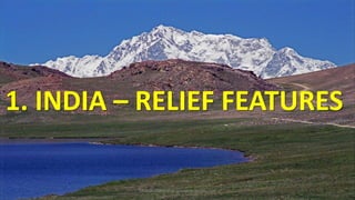
- 1. 1. INDIA – RELIEF FEATURES SRIJAYA MANEM @ gurudeva.weebly.com
- 2. Raised relief map SRIJAYA MANEM @ gurudeva.weebly.com
- 3. India lies in Northern and Eastern Hemispheres. SRIJAYA MANEM @ gurudeva.weebly.com
- 4. SRIJAYA MANEM @ gurudeva.weebly.com
- 5. SRIJAYA MANEM @ gurudeva.weebly.com
- 6. India’s mainland lies between 8°4' N and 37°6' N latitudes and 68°7' E and 97°25' E longitudes. SRIJAYA MANEM @ gurudeva.weebly.com
- 7. SRIJAYA MANEM @ gurudeva.weebly.com
- 8. Standard meridian of India SRIJAYA MANEM @ gurudeva.weebly.com
- 9. The standard meridian of India is 82°30' E which passes near Allahabad. The difference between IST and GMT is 5 ½ hours. SRIJAYA MANEM @ gurudeva.weebly.com
- 10. 82° 30' E Allahabad SRIJAYA MANEM @ gurudeva.weebly.com
- 11. GMT IST 5.30 hrs. SRIJAYA MANEM @ gurudeva.weebly.com
- 12. Geological background SRIJAYA MANEM @ gurudeva.weebly.com
- 13. India was a part of Gondwana land originated due to geological formations and several other processes like weathering, erosion and deposition. SRIJAYA MANEM @ gurudeva.weebly.com
- 14. INDIA SRIJAYA MANEM @ gurudeva.weebly.com
- 15. Indian plate moved towards North-East and collided Eurasian plate. As a result Himalayas evolved. SRIJAYA MANEM @ gurudeva.weebly.com
- 16. SRIJAYA MANEM @ gurudeva.weebly.com
- 17. Large basin SRIJAYA MANEM @ gurudeva.weebly.com
- 18. The large basin filled with sediments deposited by Himalayan rivers and peninsular rivers . This created northern plains of India. SRIJAYA MANEM @ gurudeva.weebly.com
- 19. Major Relief divisions SRIJAYA MANEM @ gurudeva.weebly.com
- 20. 1.The Himalayas 2.The Indo-Gangetic Plain 3.The Peninsular Plateau 4.The Coastal Plains 5.The Desert 6.The Islands SRIJAYA MANEM @ gurudeva.weebly.com
- 21. 1. THE HIMALAYAS SRIJAYA MANEM @ gurudeva.weebly.com
- 22. Distance from Jammu and Kashmir to Arunachal Pradesh is 2400 kms. 500 kms width in western regions and 200 kms in eastern regions. SRIJAYA MANEM @ gurudeva.weebly.com
- 23. SRIJAYA MANEM @ gurudeva.weebly.com
- 24. East 200 KMS West 500 KMS SRIJAYA MANEM @ gurudeva.weebly.com
- 25. There are three ranges in Himalayas. 1.Himadri or Greater Himalayas. 2.Himachal or Lesser Himalayas. 3.Shivaliks. SRIJAYA MANEM @ gurudeva.weebly.com
- 26. SRIJAYA MANEM @ gurudeva.weebly.com
- 27. 1. HIMADRI (Greater Himalayas) It is the northern most range. Consists highest peaks. Average elevation 6100 mts. Glaciers found here. SRIJAYA MANEM @ gurudeva.weebly.com
- 28. HIMADRI SRIJAYA MANEM @ gurudeva.weebly.com
- 29. Some highest peaks in Himadri SRIJAYA MANEM @ gurudeva.weebly.com
- 30. Everest 8848 mts. SRIJAYA MANEM @ gurudeva.weebly.com
- 31. K2 or Godwin Austen 8611 mts SRIJAYA MANEM @ gurudeva.weebly.com
- 32. Kanchenjunga 8586 mts. SRIJAYA MANEM @ gurudeva.weebly.com
- 33. Nanga parbat 8126 mts SRIJAYA MANEM @ gurudeva.weebly.com
- 34. Annapurna 7937 mts SRIJAYA MANEM @ gurudeva.weebly.com
- 35. Nanda Devi 7816 mts. SRIJAYA MANEM @ gurudeva.weebly.com
- 36. Everest Makalu Kanchenjunga Manaslu Annapurna Sikkim SRIJAYA MANEM @ gurudeva.weebly.com
- 37. K2 Nanga parbat Nanda devi SRIJAYA MANEM @ gurudeva.weebly.com
- 38. Glacier SRIJAYA MANEM @ gurudeva.weebly.com
- 39. glacier SRIJAYA MANEM @ gurudeva.weebly.com
- 40. 2.HIMACHAL (Lesser Himalayas) Situated to the south of Himadri. Rugged relief. Height ranges from 3,700 to 4,500 mts. Pirpanjal and Mahabharat are important ranges. SRIJAYA MANEM @ gurudeva.weebly.com
- 41. Pirpanjal SRIJAYA MANEM @ gurudeva.weebly.com
- 42. Mahabharat range SRIJAYA MANEM @ gurudeva.weebly.com
- 43. SRIJAYA MANEM @ gurudeva.weebly.com
- 44. Famous valleys in lesser Himalayas KASHMIR KULU KANGRA SRIJAYA MANEM @ gurudeva.weebly.com
- 45. Kashmir valley SRIJAYA MANEM @ gurudeva.weebly.com
- 46. Kulu valley SRIJAYA MANEM @ gurudeva.weebly.com
- 47. KULU SRIJAYA MANEM @ gurudeva.weebly.com
- 48. Kangra valley SRIJAYA MANEM @ gurudeva.weebly.com
- 49. Some hill stations in Lesser Himalayas Simla Mussorie Nainital Raniket SRIJAYA MANEM @ gurudeva.weebly.com
- 50. SIMLA SRIJAYA MANEM @ gurudeva.weebly.com
- 51. SIMLA SRIJAYA MANEM @ gurudeva.weebly.com
- 52. MUSSORIE SRIJAYA MANEM @ gurudeva.weebly.com
- 53. NAINITAL SRIJAYA MANEM @ gurudeva.weebly.com
- 54. RANIKET SRIJAYA MANEM @ gurudeva.weebly.com
- 55. Evergreen forests in Himalayas SRIJAYA MANEM @ gurudeva.weebly.com
- 56. Narrow steep valleys in sikkim SRIJAYA MANEM @ gurudeva.weebly.com
- 57. MAWKDOK DYMPEP VALLEY IN MEGHALAYA SRIJAYA MANEM @ gurudeva.weebly.com
- 58. SRIJAYA MANEM @ gurudeva.weebly.com
- 59. SRIJAYA MANEM @ gurudeva.weebly.com
- 60. 3.Shivalik Width 10 – 15 kms. Altitude varying between 900 and 1100 mts. These are called as Jammu hills in Jammu region, Mishmi hills in Arunachal Pradesh, Cachar in Assom. SRIJAYA MANEM @ gurudeva.weebly.com