SlideShare une entreprise Scribd logo
1  sur  18
2


 AHN2 0.5 meter gefilterd en dekkend voor alle keringen
 Elke keringen bevat als attributen de definitie van het normprofiel
 Keringen hebben de “juiste” richting (links is boezem)
3


  T/100 als T/2000 (verschillende kruinhoogtes)


                                  BK


                       H T/2000
                                        H T/100
AHN2


                                                   Hoogte
              Hoogte
4


 instelling: elke 25 meter
5


 instelling: lengte dwarsprofiel is 100m
6


                          XYZ van AHN2 omzetten naar afstand (D) en hoogte (Z)
Hoogte (Z) uit AHN2


                      Afstand (D) is negatief aan Boezemzijde                     Afstand (D) is positief aan Achterlandzijde
                                                                Afstand (D) = 0


                                                                                       Hoogte (Z) is met een factor 5 overdreven
7


                       XYZ van normprofiel omzetten naar afstand (D) en hoogte (Z)
Hoogte (Z) uit AHN2


                                                 Afstand (D) = 0


                                                                   Hoogte (Z) is met een factor 5 overdreven
8


 In onderstaand voorbeeld past het normprofiel niet voor
T/100 en ook niet voor T/2000


                                                 Teensloot


                                            Hoogte (Z) is met een factor 5 overdreven
9


 In dit geval wordt gekeken of talud boezem, kruin of talud
achterland beperkend is. In dit geval de talud achterland

                              Kruin


                                               Registreer % dat buiten AHN2 valt


                                             Hoogte (Z) is met een factor 5 overdreven
10


 Toon percentage boven AHN2 voor T/100 en T/2000


                                         Hoogte (Z) is met een factor 5 overdreven
11


 Toon alle AHN2 DZ lijnen voor 1 kering


                                             uitschieters


                                           Hoogte (Z) is met een factor 5 overdreven
12


 Verschil tussen normprofiel en AHN2 (elke 0.5m op dwarsprofiel)


                                            Hoogte (Z) is met een factor 5 overdreven
13


 Controle piping


               intredepunt


                             uittredepunt


                                                              Eind hoogte
           Boezemzijde                      Achterlandzijde
14


 Past de kruin wel als deze verschoven wordt?
  … is kruin op juiste locatie gedefinieerd?
                                                 Schuiven


                  Kruin past niet                           Kruin past wel
15


 Ligging kering niet correct?
16



17
http://twitter.com/#!/XanderBakker


                                                     http://nl.linkedin.com/in/xanderbakker
          Xander Bakker
          Senior GIS Advisor
                                                     Xander [DOT] Bakker [AT] Grontmij [DOT] NL


                                                     http://software.grontmij.nl


Grontmij Netherlands BV :: GIS & ICT – GIS Team :: http://www.Grontmij.com :: +31 30 220 79 11

Contenu connexe

Plus de Xander Bakker

Some thoughts on DevSummit 2012 including comments and links (PDF)
Some thoughts on DevSummit 2012 including comments and links (PDF)Some thoughts on DevSummit 2012 including comments and links (PDF)
Some thoughts on DevSummit 2012 including comments and links (PDF)Xander Bakker
 
Evaluating the Height of Regional Dikes of HH Rijnland with LiDAR using ArcGI...
Evaluating the Height of Regional Dikes of HH Rijnland with LiDAR using ArcGI...Evaluating the Height of Regional Dikes of HH Rijnland with LiDAR using ArcGI...
Evaluating the Height of Regional Dikes of HH Rijnland with LiDAR using ArcGI...Xander Bakker
 
Characterizing regional dikes with LiDAR using ArcGIS 10 by Grontmij
Characterizing regional dikes with LiDAR using ArcGIS 10 by GrontmijCharacterizing regional dikes with LiDAR using ArcGIS 10 by Grontmij
Characterizing regional dikes with LiDAR using ArcGIS 10 by GrontmijXander Bakker
 
ArcGIS Mobile 10 Gas Leak Detection Application by Grontmij and Esri NL
ArcGIS Mobile 10 Gas Leak Detection Application by Grontmij and Esri NLArcGIS Mobile 10 Gas Leak Detection Application by Grontmij and Esri NL
ArcGIS Mobile 10 Gas Leak Detection Application by Grontmij and Esri NLXander Bakker
 
Esri DevSummit 2011 - Grontmij presentation
Esri DevSummit 2011 - Grontmij presentationEsri DevSummit 2011 - Grontmij presentation
Esri DevSummit 2011 - Grontmij presentationXander Bakker
 
ArcGIS Mobile 10 - Grontmij
ArcGIS Mobile 10 - GrontmijArcGIS Mobile 10 - Grontmij
ArcGIS Mobile 10 - GrontmijXander Bakker
 
Detecting Buildings in AHN2 LiDAR data with ArcGIS - Grontmij
Detecting Buildings in AHN2 LiDAR data with ArcGIS - GrontmijDetecting Buildings in AHN2 LiDAR data with ArcGIS - Grontmij
Detecting Buildings in AHN2 LiDAR data with ArcGIS - GrontmijXander Bakker
 

Plus de Xander Bakker (7)

Some thoughts on DevSummit 2012 including comments and links (PDF)
Some thoughts on DevSummit 2012 including comments and links (PDF)Some thoughts on DevSummit 2012 including comments and links (PDF)
Some thoughts on DevSummit 2012 including comments and links (PDF)
 
Evaluating the Height of Regional Dikes of HH Rijnland with LiDAR using ArcGI...
Evaluating the Height of Regional Dikes of HH Rijnland with LiDAR using ArcGI...Evaluating the Height of Regional Dikes of HH Rijnland with LiDAR using ArcGI...
Evaluating the Height of Regional Dikes of HH Rijnland with LiDAR using ArcGI...
 
Characterizing regional dikes with LiDAR using ArcGIS 10 by Grontmij
Characterizing regional dikes with LiDAR using ArcGIS 10 by GrontmijCharacterizing regional dikes with LiDAR using ArcGIS 10 by Grontmij
Characterizing regional dikes with LiDAR using ArcGIS 10 by Grontmij
 
ArcGIS Mobile 10 Gas Leak Detection Application by Grontmij and Esri NL
ArcGIS Mobile 10 Gas Leak Detection Application by Grontmij and Esri NLArcGIS Mobile 10 Gas Leak Detection Application by Grontmij and Esri NL
ArcGIS Mobile 10 Gas Leak Detection Application by Grontmij and Esri NL
 
Esri DevSummit 2011 - Grontmij presentation
Esri DevSummit 2011 - Grontmij presentationEsri DevSummit 2011 - Grontmij presentation
Esri DevSummit 2011 - Grontmij presentation
 
ArcGIS Mobile 10 - Grontmij
ArcGIS Mobile 10 - GrontmijArcGIS Mobile 10 - Grontmij
ArcGIS Mobile 10 - Grontmij
 
Detecting Buildings in AHN2 LiDAR data with ArcGIS - Grontmij
Detecting Buildings in AHN2 LiDAR data with ArcGIS - GrontmijDetecting Buildings in AHN2 LiDAR data with ArcGIS - Grontmij
Detecting Buildings in AHN2 LiDAR data with ArcGIS - Grontmij
 

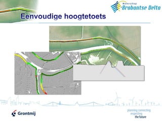
Eenvoudige Toets Brabantse Delta met AHN2 - Grontmij

  • 1.
  • 2. 2  AHN2 0.5 meter gefilterd en dekkend voor alle keringen  Elke keringen bevat als attributen de definitie van het normprofiel  Keringen hebben de “juiste” richting (links is boezem)
  • 3. 3  T/100 als T/2000 (verschillende kruinhoogtes) BK H T/2000 H T/100 AHN2 Hoogte Hoogte
  • 5. 5  instelling: lengte dwarsprofiel is 100m
  • 6. 6  XYZ van AHN2 omzetten naar afstand (D) en hoogte (Z) Hoogte (Z) uit AHN2 Afstand (D) is negatief aan Boezemzijde Afstand (D) is positief aan Achterlandzijde Afstand (D) = 0 Hoogte (Z) is met een factor 5 overdreven
  • 7. 7  XYZ van normprofiel omzetten naar afstand (D) en hoogte (Z) Hoogte (Z) uit AHN2 Afstand (D) = 0 Hoogte (Z) is met een factor 5 overdreven
  • 8. 8  In onderstaand voorbeeld past het normprofiel niet voor T/100 en ook niet voor T/2000 Teensloot Hoogte (Z) is met een factor 5 overdreven
  • 9. 9  In dit geval wordt gekeken of talud boezem, kruin of talud achterland beperkend is. In dit geval de talud achterland Kruin Registreer % dat buiten AHN2 valt Hoogte (Z) is met een factor 5 overdreven
  • 10. 10  Toon percentage boven AHN2 voor T/100 en T/2000 Hoogte (Z) is met een factor 5 overdreven
  • 11. 11  Toon alle AHN2 DZ lijnen voor 1 kering uitschieters Hoogte (Z) is met een factor 5 overdreven
  • 12. 12  Verschil tussen normprofiel en AHN2 (elke 0.5m op dwarsprofiel) Hoogte (Z) is met een factor 5 overdreven
  • 13. 13  Controle piping intredepunt uittredepunt Eind hoogte Boezemzijde Achterlandzijde
  • 14. 14  Past de kruin wel als deze verschoven wordt? … is kruin op juiste locatie gedefinieerd? Schuiven Kruin past niet Kruin past wel
  • 15. 15  Ligging kering niet correct?
  • 17. 17
  • 18. http://twitter.com/#!/XanderBakker http://nl.linkedin.com/in/xanderbakker Xander Bakker Senior GIS Advisor Xander [DOT] Bakker [AT] Grontmij [DOT] NL http://software.grontmij.nl Grontmij Netherlands BV :: GIS & ICT – GIS Team :: http://www.Grontmij.com :: +31 30 220 79 11