
Recommandé
Recommandé
Contenu connexe
Tendances
Tendances (20)
Similaire à Creating Successful Wetlands
Similaire à Creating Successful Wetlands (20)
Dernier
Dernier (20)
Creating Successful Wetlands
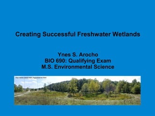
- 1. Creating Successful Freshwater Wetlands Ynes S. Arocho BIO 690: Qualifying Exam M.S. Environmental Science http://www.westcreek.org/preserve.html
- 2. Overview Wetland Loss Ecosystem Services Wetland Policy Wetland Mitigation Mitigation Banks Wetland Function Wetland Plant Development Wetland Soil Development Salvaged Soils Reference Wetlands Restoration Costs Urban Wetlands West Creek Reservation Conclusions
- 3. Wetland Loss 56% of US wetlands (Dahl, 1991) 90% of Ohio wetlands (Dahl, 1991) Over half the world’s wetlands are lost or severely degraded (Yallop and O’Connell, 2000) Source:http://www.nwrc.usgs.gov/wdb/pub/others/wetstatus.pdf
- 4. Wetland Policy Section 404 of the Clean Water Act Compensatory mitigation “No Net Loss” Regulation has three levels: Avoidance Minimization Compensation http://onlinelibrary.wiley.com/doi/10.1111/j.1474-919X.2004.00333.x/full
- 5. Wetland Mitigation Four options Establish a new site Restore a previously exiting site Enhance function of an existing site Preserve an existing site Mitigation ratio Type and size of wetland destroyed determines type and size of created wetland required. Required ≠ Actual
- 6. National Research Council Study, 2001 Purpose: evaluate wetland mitigation practice. Plant species composition = 10 or more yrs to stabilize Soil development = 3- 30 yrs to stabilize Plant assemblages do not replace function Recommendation: Both plant community structure and wetland function should be considered during mitigation. Resulting wetland should be self- sustaining − Wetland hydrology
- 7. Mitigated Wetlands in Ohio Kettlewell,2005 101 mitigation sites 425.3 acres impacted 697.8 acres required 496.8 acres actual (71.2% of required) Mitigation ratio 1.17:1 1.17 acre created / 1 acre destroyed http://www.ohiodnr.com/Home/wild_resourcessubhomepage/Researcha ndSurveys/WildlifePopulationStatusLandingPage/WoodDuck/tabid/1933 4/Default.aspx
- 8. Compliance Performance Standards Vary among permits Vary among similar wetland types Some too stringent or too modest Difficult to determine success or failure Examples: minimum # native plants, survival of # woody species http://andreawilliamsministries.com/what-does-success-really-mean- anyways/success-and-failure-road-sign-with-dramatic-clouds-and-sky/
- 9. Mitigated Wetlands in Illinois Matthews and Endress, 2008 76 mitigation sites 113.6 hectares proposed 31.7 hectares deficit Applied performance standards 8 failed all goals 45 met some goals 23 met all goals Matthews and Endress, 2008
- 10. Mitigation Banks Large wetland area Sell mitigation credits (hectares of wetlands) to parties required to mitigate. 2005 estimates: 363 active banks 75 sold out banks 169 proposed banks 78% are for-profit http://www.dot.state.oh.us/DIVISIONS/TRANSSYSDEV/ENVI RONMENT/ECOLOGICAL_RESOURCES_PERMITS/MITIGA TIONINVENTORY/Pages/default.aspx ODOT Mitigation Inventory
- 11. Wetland Function Federal standards measure vegetation for 5 yrs. Do not measure: Biotic integrity Nutrient cycling Trophic dynamics Hydrology Soils Fauna Microbial characteristics Recommendation: Mitsch and Wilson, 1996 and Zedler, 2004 Require longer monitoring periods Plant characteristics alone are not adequate measurements of wetland function
- 12. Wetland Plant Development Mitsch et al. 2005 Planted vs. unplanted Vegetation cover vs. plant diversity Pulsing experiment: Planted wetland: plant cover from 73% to 62%. Unplanted wetland: plant cover from 74% to 38%. Mitsch et al., 2005
- 13. Wetland Soil Development Mitsch et al. 2005 Prior to creation: no hydric wetland soils 2 yrs later: 78% of samples (0-8 cm) 24% of samples (9-16 cm) 10 yrs later: 94% of samples in both layers. Supports NRC, 2001 Mitsch et al., 2005
- 14. Salvaged Soils McKinstry and Anderson, 2005 Soil from donor wetland used to create new wetland Increased plant composition compared to control group Combination of salvaged soils and plantings? http://www.pacificexc.com/projects/main.php?g2_itemId=468
- 15. Reference Wetlands Campbell et al., 2002 Compared soils and plants Soil chroma, defines soils; low = wetland; high = upland Higher in created sites Plant species richness lower in created sites. Higher percent of upland plant species in created sites. Stolt et. al., 2000 Compared wetland topography Created sites: 40-60% less elevation change across area Created sites: very little microrelief Provides habitat variety thus increasing biodiversity
- 16. Restoration Costs Gutrich and Hitzhusen, 2004 Ecological-economic computer simulation model Functional indicators: plant species richness, hydric soils and native plants Prediction: 7-44 yrs to reach functional equivalency Prediction: $5190-$309,108 lag cost above private cost Recommendations: 1) Require a bond equal to estimated benefits provided by wetland – high restoration cost with low lag cost vs. low restoration cost with high lag cost 2) Delay issuance of drainage permit until functional equivalence is achieved in replacement – no lag costs 3) Use wetland banks – functional equivalency already established
- 17. Urban Wetlands Obstacles: hydrology, habitat, infrastructure, pests and people Goal: rehabilitation not restoration to their original condition Difficult to evaluate success: criteria must reflect ecology of wetland with reality of urban context. Source:http://www.biohabitats.com/ndg_newsite/newsletter/2010spring/article.urbecrest.php
- 18. Urban Wetland Assessment Correct use of reference wetland Undisturbed site Degraded sites Success: restored site more similar to undisturbed reference site without similar response in the degraded control site. Grayson, et al., 1999 http://office.microsoft.com/en-us/images/results.aspx? qu=grades#mt:0
- 19. Maximize Benefits of Restorations 1) Involve the public 2) Community-based initiatives 3) Facilitator (stakeholder representative) 4) Environmental education 5) Small-scale demos 6) Evaluate progress (questionnaires) Casagrande, 1997 Source: http://office.microsoft.com/en-us/images/ Source: http://office.microsoft.com/en-us/images/
- 20. West Creek Reservation West Creek Preservation Committee (citizen goup) Part of Cleveland Metroparks System Parma, Seven Hills, Brooklyn Heights and Independence Highly urbanized area Tributary to Cuyahoga River http://www.westcreek.org/preserve.html
- 21. West Creek Wetlands Old municipal landfill Created and planted in 2002 Wetland design (step- down wetlands) Plant surveys – increased range Usage: recreational, educational and habitat for animals. Source: www.maps.google.com Photo by: Ynes Arocho
- 22. Aug 2002 http://www.westcreek.org/preserve.html Aug 2004http://www.westcreek.org/preserve.html May 2002Photo by: Ynes Arocho
- 23. Conclusions Progress so far: Replace function Salvage soils Plantings Hydrology Mitigation banks Ecosystem services Ideas for the future: Reevaluate policy Standardize permit requirements Encourage use of mitigations banks Further research on function Further explore valuing services