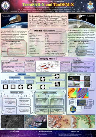
TerraSAR-X and TanDEM-X
•
0 j'aime•123 vues

Two European Satellites (TerraSAR-X and TanDEM-X), independent of the atmospheric conditions and capture the images in day or night.

Recommandé
Contenu connexe
Tendances
Tendances (20)
Similaire à TerraSAR-X and TanDEM-X
Similaire à TerraSAR-X and TanDEM-X (20)
Dernier
Dernier (20)
TerraSAR-X and TanDEM-X
- 1. Imaging Modes Abran Idrees (SS17-15), Ayesha Tariq (SS17-24), Sufyan Ullah (SS17-25) BS (4 Years) Space Science (Session: 2017-21, 4th Semester), Remote Sensing – II (SSC 135) Group Assignment - Poster Presentation TerraSAR-X and TanDEM-X TerraSAR-X TanDEM-XThe TerraSAR-X and TanDEM-X missions are realised in the frame of a Public Private Partnership (PPP) between the German Ministry of Education and Science (BMBF) represented through the German Aerospace Centre (DLR) and Airbus Defence and Space. DLR is also responsible for instrument calibration, operation and scientific use of data. The TanDEM-X (TerraSAR-X add on for Digital Elevation Measurement) is commercial German (SAR) Earth observation satellite for generating a global (DEM) with an extremely high accuracy corresponding to HRTI (High Resolution Terrain Information) - Level 3 specifications. The TerraSAR-X (Terrain Synthetic Aperture Radar) is commercial German (SAR) Earth observation satellite operating in X-Band radar Senser with a range of different operation, allowing it to acquire image with different swath width, resolutions and polarisation. Orbit Sun-Synchronous repeat orbit Altitude at the equator 514 km Orbit period 95 min Inclination angle 97.44° Revisit period 11 days Equatorial Crossing Time 18:00 hrs ascending pass (±0.25h) 06:00 hrs descending pass (±0.25h) Antenna Type Active Phases Array Antenna Band X-band Frequency 9.65 GHz Wavelength 3.1 cm Bandwidth 150 MHz / 300 MHz Mission life time At least 5 years (Lifetime extended due to the excellent health status) Orbital Parameters (Both satellites) Mission Properties Mission Properties Launch date 15 June 2007, 02:14 UTC Rocket Dnepr Resolution Up to 1m Launch date 21 June 2010, 02:14:00 UTC Rocket Dnepr-1 Pixel spacing 0.4, 1 and 3 arcseconds References Available Images https://earth.esa.int/web/eoportal/satellite-missions/t/terrasar-x https://www.dlr.de/dlr/en/desktopdefault.aspx/tabid-10378/566_read-426/#/gallery/345 https://directory.eoportal.org/web/eoportal/satellite-missions/t/tandem-x#sensors https://www.geoimage.com.au/satellite/TerraSar https://terrasar-x-archive.terrasar.com/# www.geo-airbusds.com Contact No. 88039 Friedrichshafen, Germany (Mailing) T: +49 7545 8 4344 Claude-Dornier-Strasse, 88090 Immenstaad, Germany (Courier) F: +49 7545 8 2768 E: intelligence-customer-service-germany@airbus.com TSX, Flood Mapping in the England (Towns of Gloucester & Cheltenham) TDX, The Shunak meteorite impact crater structure in Kazakhstan TDX, Mountain Range, Sutherland, South Africa Submitted To Sir Shahid Parvez, Assistant Professor, Department of Space Science, University of the Punjab, Lahore 1.Bistatic Mode Both satellite look into a common footprints 2. Pursuit Monostatic Mode Both satellite operated independently with time difference 3. Alternating bistatic Mode Transmitted form any one satellite and recoded on both simultaneously Observational Modes Independent of weather conditions Unique agility (Rapid switches between imaging modes and polarizations) Spotlight mode provides to assess man made objects more precisely Objectives 1. ScanSAR 1.1 ScanSAR (SC) Scene Dimension 100Km × 150Km Azimuth Resolution 18.5 m Ground Range Resolution 1.2 m(at 150 MHZ ) 2. StripMap 3. SpotLight 1.2 Wide ScanSAR (WS) Scene Dimension 270Km × 200Km Azimuth Resolution 40 m Ground Range Resolution 1.7 - 3.3 m Scene Dimension (Single pol) (Dual Pol) 30Km × 50Km 15km × 50km Azimuth Resolution 3.3 m 6.6 m Ground Range Resolution 1.2 m 1.2 m 3.1 Staring SpotLight (ST) Scene Dimension 4Km × 3.7Km Azimuth Resolution 0.24 m Ground Range Resolution 0.6 m 3.2 High Res SpotLight 300 Hz (HS300) Scene Dimension 10Km × 5Km Azimuth Resolution 1.1 m Ground Range Resolution 0.6 m 3.3 High Res SpotLight (HS) Scene Dimension (Single pol) (Dual Pol) 10Km × 5Km 10km × 5km Azimuth Resolution 1.1 m 2.2 m Ground Range Resolution 1.2 m 1.2 m Image Products EI (Enhanced Image)L1B (Basic Image) GEC (Geocoded Ellipsoid Corrected ) MGD (Multi- Look Ground) SSC(Single Look Slant) EEC (Enhanced Ellipsoid Corrected) RaN (Radiometrically corrected image) ORI (Orthorectified image) ADM (Ascending/Descending Merge) MC (Mosaic) Polarization Modes Co & Cross 1.Polarization Channel HH,VV StripMap, SpotLight, SannSAR 2 Polarization Channel HH/VV, HH/HV, VV/HV StripMap 4 Polarization Channels HH, VV, VH, VH StripMap Experimental Product 2 Polarization Channels HH/VV, HH/HV, VV/VH StripMap, SpotLight Single DualQuad TanDEM-X DEM Processing Chain TSX TDX Monostatic Bistatic Instrument Calibration Raw DEM Database Height Reference Database DEM Mosaicking and Calibration Interferogram Global DEM TanDEM-X’s Products 3.1 Finer Spacing DEM (FDEM) FDEM Pixel Spacing (0.2 arcsec) (~6 m) DEM Pixel Spacing DEM (0.4 arcsec) (~12 m) DEM (1 arcsec) (~30 m) DEM (3 arcsec) (~90 m) Coverage Global 1. TanDEM-X DEM 2. TanDEM-X Intermediate DEM IDEM Pixel Spacing IDEM (0.4 arcsec) (~12 m) IDEM (1 arcsec) (~30 m) IDEM (3 arcsec) (~90 m) Coverage Regional 3.2 High Resolution DEM (HDEM) HDEM Pixel Spacing (0.2 arcsec) (~6 m) 3. DEMs on Special Request (Coverage is Local For both products) TSX, The port of Sendai, Japan (Color Composite)