SlideShare une entreprise Scribd logo
1  sur  15
Télécharger pour lire hors ligne
Anita Graser
Scientist, Mobility Department – AIT Austrian Institute of Technology
Integrating Open Spaces into OpenStreetMap
Routing Graphs for Realistic Crossing
Behaviour in Pedestrian Navigation
Plaza Mayor – cc-by Kris Arnold on Flicker
Outline
1. Problem description
2. Approaches
3. Results
4. Further improvements
5. Conclusions
3
Open Spaces & Pedestrian Navigation
The Issue
“Turn left onto Josefsplatz”
after 140 meters: “Turn left”
Open Spaces & Pedestrian Navigation
The Issue
Open Spaces & Pedestrian Navigation
Approaches
5 different approaches
 Medial axis
 Straight skeleton
 Regular grid
 Visibility graph
 (Least-cost path over cost surface)
Open Spaces & Pedestrian Navigation
Least-cost path over a cost surface
Impassable / high cost
(e.g. buildings)
Passable / medium cost
(e.g. roads)
Preferred / low cost
(e.g. sidewalks)
Open Spaces & Pedestrian Navigation
Medial axis & straight skeleton
medial axis straight skeleton
points that have more than one closest
neighbour on the polygon boundary
like a roof which covers the polygon
with constant slope on each side
Open Spaces & Pedestrian Navigation
Regular grid & visibility graph
Regular grid Visibility graph
Open Spaces & Pedestrian Navigation
Routing results
100m 102m
116m 91m
144m
Open Spaces & Pedestrian Navigation
Routing graph integration
Open Spaces & Pedestrian Navigation
Implementation results
31
nodes
Open Spaces & Pedestrian Navigation
Implementation results
234
nodes
Open Spaces & Pedestrian Navigation
Improvements
282 edges 19 edges
Open Spaces & Pedestrian Navigation
Conclusion
 visibility graphs
 realistic crossing behaviour on direct routes, without unnecessary detours
 respects potential obstacles such as buildings
 should be integrated directly into OSM graph-generation tools
 improve routing results
 more appropriate navigation instructions  project PERRON
Contact
Anita Graser
anita.graser@ait.ac.at
@underdarkGIS

Contenu connexe

Tendances

openrouteservice.org at sotm08
openrouteservice.org at sotm08openrouteservice.org at sotm08
openrouteservice.org at sotm08
schmitz42
 
Theresa Aubrechtová @FTF2013
Theresa Aubrechtová @FTF2013Theresa Aubrechtová @FTF2013
Theresa Aubrechtová @FTF2013
FTF2013
 
Airborne vehicle detection in dense urban areas using ho g features and dispa...
Airborne vehicle detection in dense urban areas using ho g features and dispa...Airborne vehicle detection in dense urban areas using ho g features and dispa...
Airborne vehicle detection in dense urban areas using ho g features and dispa...
Ecway Technologies
 

Tendances (20)

openrouteservice.org at sotm08
openrouteservice.org at sotm08openrouteservice.org at sotm08
openrouteservice.org at sotm08
 
Putting Nottingham on the Map
Putting Nottingham on the MapPutting Nottingham on the Map
Putting Nottingham on the Map
 
Osm josm os_mmaps
Osm josm os_mmapsOsm josm os_mmaps
Osm josm os_mmaps
 
Regional evaluation workflow
Regional evaluation workflow Regional evaluation workflow
Regional evaluation workflow
 
Georeferencing
GeoreferencingGeoreferencing
Georeferencing
 
ZGIS Selected Topics Lecture GIS and mobility research planning
ZGIS Selected Topics Lecture GIS and mobility research planningZGIS Selected Topics Lecture GIS and mobility research planning
ZGIS Selected Topics Lecture GIS and mobility research planning
 
Rail station passenger congestion: Thinking outside the station
Rail station passenger congestion: Thinking outside the stationRail station passenger congestion: Thinking outside the station
Rail station passenger congestion: Thinking outside the station
 
09 Parking Studies (Traffic Engineering هندسة المرور & Prof. Saad AlGadhi)
09 Parking Studies (Traffic Engineering هندسة المرور & Prof. Saad AlGadhi)09 Parking Studies (Traffic Engineering هندسة المرور & Prof. Saad AlGadhi)
09 Parking Studies (Traffic Engineering هندسة المرور & Prof. Saad AlGadhi)
 
GI-Forum 2014: Assessing bicycle safety in road networks
GI-Forum 2014: Assessing bicycle safety in road networksGI-Forum 2014: Assessing bicycle safety in road networks
GI-Forum 2014: Assessing bicycle safety in road networks
 
Multidimensional Monitoring of Cycling Mobility
Multidimensional Monitoring of Cycling MobilityMultidimensional Monitoring of Cycling Mobility
Multidimensional Monitoring of Cycling Mobility
 
Design of Road Project Using MX Software
Design of Road Project Using MX Software Design of Road Project Using MX Software
Design of Road Project Using MX Software
 
A system of cars, trains, planes, ships and people
A system of cars, trains, planes, ships and peopleA system of cars, trains, planes, ships and people
A system of cars, trains, planes, ships and people
 
Emires short
Emires shortEmires short
Emires short
 
Theresa Aubrechtová @FTF2013
Theresa Aubrechtová @FTF2013Theresa Aubrechtová @FTF2013
Theresa Aubrechtová @FTF2013
 
Digitalcartography
DigitalcartographyDigitalcartography
Digitalcartography
 
Spatial analysis and modelling of bicycle accidents and safety threats
Spatial analysis and modelling of bicycle accidents and safety threatsSpatial analysis and modelling of bicycle accidents and safety threats
Spatial analysis and modelling of bicycle accidents and safety threats
 
08 Agency Of Mapping
08 Agency Of Mapping08 Agency Of Mapping
08 Agency Of Mapping
 
Airborne vehicle detection in dense urban areas using ho g features and dispa...
Airborne vehicle detection in dense urban areas using ho g features and dispa...Airborne vehicle detection in dense urban areas using ho g features and dispa...
Airborne vehicle detection in dense urban areas using ho g features and dispa...
 
Transport Demand Information
Transport Demand InformationTransport Demand Information
Transport Demand Information
 
Skew lines
Skew linesSkew lines
Skew lines
 

Plus de Anita Graser

Plus de Anita Graser (20)

Trajectory Visualization in Notebook Environments @ GI_Salzburg 2022
Trajectory Visualization in Notebook Environments @ GI_Salzburg 2022Trajectory Visualization in Notebook Environments @ GI_Salzburg 2022
Trajectory Visualization in Notebook Environments @ GI_Salzburg 2022
 
Movement Data in GIS - Geobeer Lightning Talk, 2021-03-08
Movement Data in GIS - Geobeer Lightning Talk, 2021-03-08Movement Data in GIS - Geobeer Lightning Talk, 2021-03-08
Movement Data in GIS - Geobeer Lightning Talk, 2021-03-08
 
Exploratory Analysis of Massive Movement Data (RGS-IBG GIScience Research Gro...
Exploratory Analysis of Massive Movement Data (RGS-IBG GIScience Research Gro...Exploratory Analysis of Massive Movement Data (RGS-IBG GIScience Research Gro...
Exploratory Analysis of Massive Movement Data (RGS-IBG GIScience Research Gro...
 
From Simple Features to Moving Features and Beyond? at OGC Member Meeting, Se...
From Simple Features to Moving Features and Beyond? at OGC Member Meeting, Se...From Simple Features to Moving Features and Beyond? at OGC Member Meeting, Se...
From Simple Features to Moving Features and Beyond? at OGC Member Meeting, Se...
 
Data-driven Trajectory Prediction in Maritime LBS
Data-driven Trajectory Prediction in Maritime LBSData-driven Trajectory Prediction in Maritime LBS
Data-driven Trajectory Prediction in Maritime LBS
 
Big Spatial(!) Data Processing mit GeoMesa. AGIT 2019, Salzburg, Austria.
Big Spatial(!) Data Processing mit GeoMesa. AGIT 2019, Salzburg, Austria.Big Spatial(!) Data Processing mit GeoMesa. AGIT 2019, Salzburg, Austria.
Big Spatial(!) Data Processing mit GeoMesa. AGIT 2019, Salzburg, Austria.
 
MovingPandas at PyDays Vienna 2019
MovingPandas at PyDays Vienna 2019MovingPandas at PyDays Vienna 2019
MovingPandas at PyDays Vienna 2019
 
QGIS das Opensource GIS at Linuxwochen Wien 2019
QGIS das Opensource GIS at Linuxwochen Wien 2019QGIS das Opensource GIS at Linuxwochen Wien 2019
QGIS das Opensource GIS at Linuxwochen Wien 2019
 
GIScience for Dynamic Transportation Systems, GIScience Colloquium, Universit...
GIScience for Dynamic Transportation Systems, GIScience Colloquium, Universit...GIScience for Dynamic Transportation Systems, GIScience Colloquium, Universit...
GIScience for Dynamic Transportation Systems, GIScience Colloquium, Universit...
 
QGIS Neuigkeiten @ AGIT2017
QGIS Neuigkeiten @ AGIT2017QGIS Neuigkeiten @ AGIT2017
QGIS Neuigkeiten @ AGIT2017
 
QGIS Processing at Linuxwochen Wien / PyDays 2017
QGIS Processing at Linuxwochen Wien / PyDays 2017QGIS Processing at Linuxwochen Wien / PyDays 2017
QGIS Processing at Linuxwochen Wien / PyDays 2017
 
Neuigkeiten vom QGIS-Projekt - AGIT 2016
Neuigkeiten vom QGIS-Projekt - AGIT 2016Neuigkeiten vom QGIS-Projekt - AGIT 2016
Neuigkeiten vom QGIS-Projekt - AGIT 2016
 
Spatial Data Analysis & Visualization with QGIS - Vienna Data Science Meetup
Spatial Data Analysis & Visualization with QGIS - Vienna Data Science MeetupSpatial Data Analysis & Visualization with QGIS - Vienna Data Science Meetup
Spatial Data Analysis & Visualization with QGIS - Vienna Data Science Meetup
 
Better Urban Travel Time Estimates Using Street Network Centrality #Eurocarto15
Better Urban Travel Time Estimates Using Street Network Centrality #Eurocarto15Better Urban Travel Time Estimates Using Street Network Centrality #Eurocarto15
Better Urban Travel Time Estimates Using Street Network Centrality #Eurocarto15
 
Time Manager Vortrag vom QGIS-DE Anwendertreffen 2015
Time Manager Vortrag vom QGIS-DE Anwendertreffen 2015Time Manager Vortrag vom QGIS-DE Anwendertreffen 2015
Time Manager Vortrag vom QGIS-DE Anwendertreffen 2015
 
Time Manager Workshop vom QGIS-DE Anwendertreffen 2015
Time Manager Workshop vom QGIS-DE Anwendertreffen 2015Time Manager Workshop vom QGIS-DE Anwendertreffen 2015
Time Manager Workshop vom QGIS-DE Anwendertreffen 2015
 
Improving Navigation: Automated Name Extraction for Separately Mapped Pedestr...
Improving Navigation: Automated Name Extraction for Separately Mapped Pedestr...Improving Navigation: Automated Name Extraction for Separately Mapped Pedestr...
Improving Navigation: Automated Name Extraction for Separately Mapped Pedestr...
 
Routing mit OSM - #AGIT2015
Routing mit OSM - #AGIT2015Routing mit OSM - #AGIT2015
Routing mit OSM - #AGIT2015
 
QGIS jenseits von zwei Dimensionen - KAGIS-Fachtagung 2015
QGIS jenseits von zwei Dimensionen - KAGIS-Fachtagung 2015QGIS jenseits von zwei Dimensionen - KAGIS-Fachtagung 2015
QGIS jenseits von zwei Dimensionen - KAGIS-Fachtagung 2015
 
Time Manager Workshop at #QGIS2015 Conference in Nodebo
Time Manager Workshop at #QGIS2015 Conference in NodeboTime Manager Workshop at #QGIS2015 Conference in Nodebo
Time Manager Workshop at #QGIS2015 Conference in Nodebo
 

Dernier

Modular Monolith - a Practical Alternative to Microservices @ Devoxx UK 2024
Modular Monolith - a Practical Alternative to Microservices @ Devoxx UK 2024Modular Monolith - a Practical Alternative to Microservices @ Devoxx UK 2024
Modular Monolith - a Practical Alternative to Microservices @ Devoxx UK 2024
Victor Rentea
 
Architecting Cloud Native Applications
Architecting Cloud Native ApplicationsArchitecting Cloud Native Applications
Architecting Cloud Native Applications
WSO2
 

Dernier (20)

ICT role in 21st century education and its challenges
ICT role in 21st century education and its challengesICT role in 21st century education and its challenges
ICT role in 21st century education and its challenges
 
AI in Action: Real World Use Cases by Anitaraj
AI in Action: Real World Use Cases by AnitarajAI in Action: Real World Use Cases by Anitaraj
AI in Action: Real World Use Cases by Anitaraj
 
Apidays New York 2024 - APIs in 2030: The Risk of Technological Sleepwalk by ...
Apidays New York 2024 - APIs in 2030: The Risk of Technological Sleepwalk by ...Apidays New York 2024 - APIs in 2030: The Risk of Technological Sleepwalk by ...
Apidays New York 2024 - APIs in 2030: The Risk of Technological Sleepwalk by ...
 
Mcleodganj Call Girls 🥰 8617370543 Service Offer VIP Hot Model
Mcleodganj Call Girls 🥰 8617370543 Service Offer VIP Hot ModelMcleodganj Call Girls 🥰 8617370543 Service Offer VIP Hot Model
Mcleodganj Call Girls 🥰 8617370543 Service Offer VIP Hot Model
 
EMPOWERMENT TECHNOLOGY GRADE 11 QUARTER 2 REVIEWER
EMPOWERMENT TECHNOLOGY GRADE 11 QUARTER 2 REVIEWEREMPOWERMENT TECHNOLOGY GRADE 11 QUARTER 2 REVIEWER
EMPOWERMENT TECHNOLOGY GRADE 11 QUARTER 2 REVIEWER
 
Vector Search -An Introduction in Oracle Database 23ai.pptx
Vector Search -An Introduction in Oracle Database 23ai.pptxVector Search -An Introduction in Oracle Database 23ai.pptx
Vector Search -An Introduction in Oracle Database 23ai.pptx
 
presentation ICT roal in 21st century education
presentation ICT roal in 21st century educationpresentation ICT roal in 21st century education
presentation ICT roal in 21st century education
 
How to Troubleshoot Apps for the Modern Connected Worker
How to Troubleshoot Apps for the Modern Connected WorkerHow to Troubleshoot Apps for the Modern Connected Worker
How to Troubleshoot Apps for the Modern Connected Worker
 
Six Myths about Ontologies: The Basics of Formal Ontology
Six Myths about Ontologies: The Basics of Formal OntologySix Myths about Ontologies: The Basics of Formal Ontology
Six Myths about Ontologies: The Basics of Formal Ontology
 
Connector Corner: Accelerate revenue generation using UiPath API-centric busi...
Connector Corner: Accelerate revenue generation using UiPath API-centric busi...Connector Corner: Accelerate revenue generation using UiPath API-centric busi...
Connector Corner: Accelerate revenue generation using UiPath API-centric busi...
 
Introduction to Multilingual Retrieval Augmented Generation (RAG)
Introduction to Multilingual Retrieval Augmented Generation (RAG)Introduction to Multilingual Retrieval Augmented Generation (RAG)
Introduction to Multilingual Retrieval Augmented Generation (RAG)
 
Modular Monolith - a Practical Alternative to Microservices @ Devoxx UK 2024
Modular Monolith - a Practical Alternative to Microservices @ Devoxx UK 2024Modular Monolith - a Practical Alternative to Microservices @ Devoxx UK 2024
Modular Monolith - a Practical Alternative to Microservices @ Devoxx UK 2024
 
Apidays New York 2024 - Scaling API-first by Ian Reasor and Radu Cotescu, Adobe
Apidays New York 2024 - Scaling API-first by Ian Reasor and Radu Cotescu, AdobeApidays New York 2024 - Scaling API-first by Ian Reasor and Radu Cotescu, Adobe
Apidays New York 2024 - Scaling API-first by Ian Reasor and Radu Cotescu, Adobe
 
Apidays New York 2024 - The Good, the Bad and the Governed by David O'Neill, ...
Apidays New York 2024 - The Good, the Bad and the Governed by David O'Neill, ...Apidays New York 2024 - The Good, the Bad and the Governed by David O'Neill, ...
Apidays New York 2024 - The Good, the Bad and the Governed by David O'Neill, ...
 
MINDCTI Revenue Release Quarter One 2024
MINDCTI Revenue Release Quarter One 2024MINDCTI Revenue Release Quarter One 2024
MINDCTI Revenue Release Quarter One 2024
 
"I see eyes in my soup": How Delivery Hero implemented the safety system for ...
"I see eyes in my soup": How Delivery Hero implemented the safety system for ..."I see eyes in my soup": How Delivery Hero implemented the safety system for ...
"I see eyes in my soup": How Delivery Hero implemented the safety system for ...
 
Introduction to use of FHIR Documents in ABDM
Introduction to use of FHIR Documents in ABDMIntroduction to use of FHIR Documents in ABDM
Introduction to use of FHIR Documents in ABDM
 
Architecting Cloud Native Applications
Architecting Cloud Native ApplicationsArchitecting Cloud Native Applications
Architecting Cloud Native Applications
 
Apidays New York 2024 - Accelerating FinTech Innovation by Vasa Krishnan, Fin...
Apidays New York 2024 - Accelerating FinTech Innovation by Vasa Krishnan, Fin...Apidays New York 2024 - Accelerating FinTech Innovation by Vasa Krishnan, Fin...
Apidays New York 2024 - Accelerating FinTech Innovation by Vasa Krishnan, Fin...
 
Artificial Intelligence Chap.5 : Uncertainty
Artificial Intelligence Chap.5 : UncertaintyArtificial Intelligence Chap.5 : Uncertainty
Artificial Intelligence Chap.5 : Uncertainty
 

Integrating Open Spaces into OSM Routing Graphs for Realistic Crossing Behaviour in Pedestrian Navigation

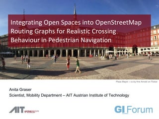
  • 1. Anita Graser Scientist, Mobility Department – AIT Austrian Institute of Technology Integrating Open Spaces into OpenStreetMap Routing Graphs for Realistic Crossing Behaviour in Pedestrian Navigation Plaza Mayor – cc-by Kris Arnold on Flicker
  • 2. Outline 1. Problem description 2. Approaches 3. Results 4. Further improvements 5. Conclusions 3
  • 3. Open Spaces & Pedestrian Navigation The Issue “Turn left onto Josefsplatz” after 140 meters: “Turn left”
  • 4. Open Spaces & Pedestrian Navigation The Issue
  • 5. Open Spaces & Pedestrian Navigation Approaches 5 different approaches  Medial axis  Straight skeleton  Regular grid  Visibility graph  (Least-cost path over cost surface)
  • 6. Open Spaces & Pedestrian Navigation Least-cost path over a cost surface Impassable / high cost (e.g. buildings) Passable / medium cost (e.g. roads) Preferred / low cost (e.g. sidewalks)
  • 7. Open Spaces & Pedestrian Navigation Medial axis & straight skeleton medial axis straight skeleton points that have more than one closest neighbour on the polygon boundary like a roof which covers the polygon with constant slope on each side
  • 8. Open Spaces & Pedestrian Navigation Regular grid & visibility graph Regular grid Visibility graph
  • 9. Open Spaces & Pedestrian Navigation Routing results 100m 102m 116m 91m 144m
  • 10. Open Spaces & Pedestrian Navigation Routing graph integration
  • 11. Open Spaces & Pedestrian Navigation Implementation results 31 nodes
  • 12. Open Spaces & Pedestrian Navigation Implementation results 234 nodes
  • 13. Open Spaces & Pedestrian Navigation Improvements 282 edges 19 edges
  • 14. Open Spaces & Pedestrian Navigation Conclusion  visibility graphs  realistic crossing behaviour on direct routes, without unnecessary detours  respects potential obstacles such as buildings  should be integrated directly into OSM graph-generation tools  improve routing results  more appropriate navigation instructions  project PERRON