[EN] Maps and Digital Tools For Activists [RO] Hărți și instrumente digitale pentru activiști
•Télécharger en tant que PPTX, PDF•
0 j'aime•877 vues

Hărți și instrumente digitale pentru activiști Prezentare Fanfest 2015 @Caminul Cultural - Rosia Montana

Recommandé
Contenu connexe
Tendances
Tendances (20)
En vedette
En vedette (20)
Similaire à [EN] Maps and Digital Tools For Activists [RO] Hărți și instrumente digitale pentru activiști
Similaire à [EN] Maps and Digital Tools For Activists [RO] Hărți și instrumente digitale pentru activiști (20)
Plus de Badita Florin
Plus de Badita Florin (7)
Dernier
Dernier (20)
[EN] Maps and Digital Tools For Activists [RO] Hărți și instrumente digitale pentru activiști
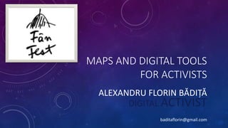
- 1. MAPS AND DIGITAL TOOLS FOR ACTIVISTS ALEXANDRU FLORIN BĂDIȚĂ DIGITAL ACTIVIST baditaflorin@gmail.com
- 2. WHEN A MAP IS USEFUL? ALEXANDRU FLORIN BĂDIȚĂ Maptivism: Maps for activism, transparency and engagement baditaflorin@gmail.com
- 3. OVERVIEW • ABOUT ME @ Map Relevance • Maptivism @ Maps for activism, transparency and engagement • MAPILLARY @ Open Google Street View • OPENSTREETMAP @ Open Source Geodatabase • QGIS @ Make a map • UMAP @ Simple map making
- 4. ABOUT ME • Consultant for the World Bank • Started the OpenStreetMap Romanian FB Community Page http://www.facebook.com/osmromania • Made online and printed maps for : Fanfest, Temps d image, TIFF • Collaborations with Casa Jurnalistului, Rise Project • Elections maps • Data Science / Statistics / WebScraping • Over 2000 request send on the 544/2001 freedom of information law • In the future – Send over 200.000 request on the freedom of information law to all public institutions in Romania
- 5. ABOUT ME : CONSULTANT FOR THE WORLD BANK
- 6. ABOUT ME : CONSULTANT FOR THE WORLD BANK
- 7. ABOUT ME : CONSULTANT FOR THE WORLD BANK
- 8. ABOUT ME : CONSULTANT FOR THE WORLD BANK
- 9. ABOUT ME : OPENSTREETMAP ROMANIA
- 10. ABOUT ME : OPENSTREETMAP ROMANIA
- 11. ABOUT ME : ONLINE AND PRINTED MAPS – TEMPS D`IMAGE
- 12. ABOUT ME : ONLINE AND PRINTED MAPS – TIFF
- 13. ABOUT ME : ONLINE AND PRINTED MAPS – CASA JURNALISTULUI HTTP://UMAP.OPENSTREETMAP.FR/EN/MAP/CASA-JURNALISTULUI_35927#12/44.4310/26.1032
- 14. ABOUT ME : ONLINE AND PRINTED MAPS – FANFEST
- 15. ABOUT ME : 2 NOVEMBER 2014 ELECTIONS
- 18. 544/2001 LAW
- 19. 544/2001 LAW
- 20. 544/2001 LAW
- 21. 544/2001 LAW
- 22. 544/2001 LAW
- 23. 544/2001 LAW
- 24. MAPTIVISM MAPS FOR ACTIVISM, TRANSPARENCY AND ENGAGEMENT • It is estimated as much as 80% of data contains geo-referenced information. • So, a lot of information can be displayed through maps. • Digital maps allow easy ways to present large amounts of data and reduce complexity. • Activists have found creative ways to use maps, but also development organizations have to deal with a lot of spatial information. • Using geo-referenced through maps can improve transparency, and yet not so many organizations use it.
- 25. MAPTIVISM THE POTENTIAL OF MAPPING • Recognition: • Ohh, that’s the place we are talking about! • A feeling of connection: Ohh, actually it´s just around the corner! • Connecting the dots on complex issues: • Engagement: • This has to change! I want to help out
- 26. MAPTIVISM MAPS FOR ACTIVISM, TRANSPARENCY AND ENGAGEMENT http://hotnews.maps.arcgis.com/home/webmap/viewer.html?webmap=310496aed53c42c28086c554e522224d&extent=18.1764,42.7161,32.1071,48.6486
- 27. MAPTIVISM: LIVE TACTICAL MAPPING FOR PROTEST SWARMING
- 28. MAPTIVISM: LIVE TACTICAL MAPPING FOR PROTEST SWARMING
- 29. MAPTIVISM: BOB BURTMAN HIGHLIGHTS INTRIGUING MAPPING WORK IN HIS ARTICLE BY THE CEDAR GROVE INSTITUTE FOR SUSTAINABLE COMMUNITIES. THROUGH SURVEYS AND PUBLIC AVAILABLE DATA, THEY WERE ABLE TO PRODUCE THE MAP BELOW, WHICH SHOWS THE PARTIAL DISTRIBUTION OF WATER IN CITY OF ZANESVILLE.
- 30. MAPILLARY 30,924,104 photos 774,577,813 meters in 8 august 2015 http://www.liverpoolecho.co.uk/news/liverpool-news/lime-street-google-street-view-9837085
- 31. MAPILLARY • Geodocument your trips • Use the geo referenced pictures to add important details to your map • Then and Now ability*** • Send real time Georefferenced information to journalists • Creative Commons licence • *** Make a photo of the same location, before and after a chemical spill / mining activity, fire, etc and show the two views side by side. • *** Track a place over time • Using the filter functions on Mapillary, you can track a place over time. Compare recent pictures to older. 30,924,104 photos 774,577,813 meters in 8 august 2015
- 32. MAPILLARY AS A REVOLUTIONARY TOOL FOR ACTIVISTS AND JOURNALISTS • Ability to have near real time geo-tagged images • Useful for real time / war / protests / civil uprising / undercover work / journalism narrative documentation. • Empowers both the normal user, as also the journalists on the ground, enhance the after work ability of having a better understanding of the environment , can compare and remember memories having a 2d reference points
- 33. MAPILLARY AS A REVOLUTIONARY TOOL FOR ACTIVISTS AND JOURNALISTS •Where you would use it ?
- 35. QGIS INASAFE
- 36. OPENSTREETMAP • History • Use Cases • Wiki - http://wiki.openstreetmap.org/wiki/Map_Features • Drinking water Example : • Overpass-turbo http://overpass-turbo.eu/
- 37. OPENSTREETMAP • Started in 2004 • Over 2.000.000 volunteers • Over 4000 academics papers written about OpenStreetMap m
- 38. 85 MILLION PEOPLE FROM ALL AROUND THE WORLD ARE DEPENDED ON THE WHEELCHAIR Over 500.000 locations have a rating, helping millions of people with disabilities to plan a trip ahead
- 41. LETS GET THE DATA
- 42. OPENSTREETMAP • Started in 2004
- 43. OPENSTREETMAP • Load data into QGIS • Load data into Umap