SlideShare une entreprise Scribd logo
1  sur  8
Регіональний компонент державного кадастру
тваринного світу як автономний інструмент
накопичення даних знахідок видів
Інститут зоології ім. І.І. Шмальгаузена НАН України
Відділ моніторингу та охорони тваринного світу
g.kolomytsev@gmail.com, www.Biomon.org
Григорій Коломицев
Records density map
Результати моделювання розповсюдження
лося (Alces alces) в східній Європі
Анімація потенційних змін розповсюдження
чебачка амурського (Pseudorasbora parva) в Східній
Європі
Державний кадастр
тваринного світу
систематизована сукупність відомостей про географічне поширення
видів (груп видів) тварин, їх чисельність і стан, характеристики
середовища їх перебування і сучасного господарського використання, а
також інших даних необхідних для забезпечення охорони і
раціонального використання тваринного світу.
(КМ України, Постанова КМ "Про порядок ведення державного кадастру тваринного світу" від 15.11.1994 N 772)
Kolomytsev G. The regional component of the national cadastr

Contenu connexe

Tendances

плазуни
плазуниплазуни
плазуниnatalibio
 
Парійчук Л. П. Чорноморський біосферний заповідник
Парійчук Л. П. Чорноморський біосферний заповідникПарійчук Л. П. Чорноморський біосферний заповідник
Парійчук Л. П. Чорноморський біосферний заповідникKusinka
 
походження і еволюція сільськогосподарських тварин
походження і еволюція сільськогосподарських тваринпоходження і еволюція сільськогосподарських тварин
походження і еволюція сільськогосподарських тваринЕвгений Баркарь
 
лекц. №15 інтер'єр сільськогосподарських тварин
лекц. №15 інтер'єр сільськогосподарських тваринлекц. №15 інтер'єр сільськогосподарських тварин
лекц. №15 інтер'єр сільськогосподарських тваринЕвгений Баркарь
 
Екскурсія в світ комах
Екскурсія в світ комахЕкскурсія в світ комах
Екскурсія в світ комахlabinskiir-33
 
Лісостеп. Парійчук Л.П.
Лісостеп. Парійчук Л.П.Лісостеп. Парійчук Л.П.
Лісостеп. Парійчук Л.П.Kusinka
 

Tendances (9)

вчення про породу
вчення про породувчення про породу
вчення про породу
 
плазуни
плазуниплазуни
плазуни
 
гетерозис
гетерозисгетерозис
гетерозис
 
Zapovidnyky
ZapovidnykyZapovidnyky
Zapovidnyky
 
Парійчук Л. П. Чорноморський біосферний заповідник
Парійчук Л. П. Чорноморський біосферний заповідникПарійчук Л. П. Чорноморський біосферний заповідник
Парійчук Л. П. Чорноморський біосферний заповідник
 
походження і еволюція сільськогосподарських тварин
походження і еволюція сільськогосподарських тваринпоходження і еволюція сільськогосподарських тварин
походження і еволюція сільськогосподарських тварин
 
лекц. №15 інтер'єр сільськогосподарських тварин
лекц. №15 інтер'єр сільськогосподарських тваринлекц. №15 інтер'єр сільськогосподарських тварин
лекц. №15 інтер'єр сільськогосподарських тварин
 
Екскурсія в світ комах
Екскурсія в світ комахЕкскурсія в світ комах
Екскурсія в світ комах
 
Лісостеп. Парійчук Л.П.
Лісостеп. Парійчук Л.П.Лісостеп. Парійчук Л.П.
Лісостеп. Парійчук Л.П.
 

En vedette

Bodnya O.V. - GIS technology in the development of zoningбодня зонирование рлп
Bodnya O.V. - GIS technology in the development of zoningбодня зонирование рлпBodnya O.V. - GIS technology in the development of zoningбодня зонирование рлп
Bodnya O.V. - GIS technology in the development of zoningбодня зонирование рлпAnton Biatov
 
Prilutsky О. Storage and management of natural information with database
Prilutsky О. Storage and management of natural information with databasePrilutsky О. Storage and management of natural information with database
Prilutsky О. Storage and management of natural information with databaseAnton Biatov
 
Download Savchenko A. DEM of the national park "Gomilshansky lessy"
  Download	Savchenko A. DEM of the national park "Gomilshansky lessy"  Download	Savchenko A. DEM of the national park "Gomilshansky lessy"
Download Savchenko A. DEM of the national park "Gomilshansky lessy"Anton Biatov
 
Kleshnin A. PostGIS-open solution for spatial data-database
Kleshnin A. PostGIS-open solution for spatial data-databaseKleshnin A. PostGIS-open solution for spatial data-database
Kleshnin A. PostGIS-open solution for spatial data-databaseAnton Biatov
 
Bodnja-gis-mapping-of-the-landscape-of-the-national-park-dvurechansky
Bodnja-gis-mapping-of-the-landscape-of-the-national-park-dvurechanskyBodnja-gis-mapping-of-the-landscape-of-the-national-park-dvurechansky
Bodnja-gis-mapping-of-the-landscape-of-the-national-park-dvurechanskyAnton Biatov
 
Ukraiski P. Decoding the burned areas and monitoringтравяные палы
Ukraiski P. Decoding the burned areas and monitoringтравяные палыUkraiski P. Decoding the burned areas and monitoringтравяные палы
Ukraiski P. Decoding the burned areas and monitoringтравяные палыAnton Biatov
 
Ukraiski P. WEB-GIS nature reserve "Belogorie"
Ukraiski P. WEB-GIS nature reserve "Belogorie"Ukraiski P. WEB-GIS nature reserve "Belogorie"
Ukraiski P. WEB-GIS nature reserve "Belogorie"Anton Biatov
 
YarotskiyYarotskiy V. - Field-Map for the study of natural objects
YarotskiyYarotskiy V. - Field-Map for the study of natural objects YarotskiyYarotskiy V. - Field-Map for the study of natural objects
YarotskiyYarotskiy V. - Field-Map for the study of natural objects Anton Biatov
 
OSM for Conservation
OSM for ConservationOSM for Conservation
OSM for Conservationgisproject
 
ArcGIS for Mobile
ArcGIS for MobileArcGIS for Mobile
ArcGIS for Mobilegisproject
 
Sizo r. Not a single landsat. to meet the sentinel
Sizo r.   Not a single landsat. to meet the sentinelSizo r.   Not a single landsat. to meet the sentinel
Sizo r. Not a single landsat. to meet the sentinelAnton Biatov
 
Kletenkyn v. practical application of gis in dvurechansky national park
Kletenkyn v.   practical application of gis in dvurechansky national parkKletenkyn v.   practical application of gis in dvurechansky national park
Kletenkyn v. practical application of gis in dvurechansky national parkAnton Biatov
 
Khlyestkova a., bodnia o. exploration of not sanction recreation on the nat...
Khlyestkova a., bodnia o.   exploration of not sanction recreation on the nat...Khlyestkova a., bodnia o.   exploration of not sanction recreation on the nat...
Khlyestkova a., bodnia o. exploration of not sanction recreation on the nat...Anton Biatov
 
Kozyr m. use big data in the exploration zoning protected areas, gomylshans...
Kozyr m.   use big data in the exploration zoning protected areas, gomylshans...Kozyr m.   use big data in the exploration zoning protected areas, gomylshans...
Kozyr m. use big data in the exploration zoning protected areas, gomylshans...Anton Biatov
 
Sizo r. Society for conservation gis
Sizo r.   Society for conservation gisSizo r.   Society for conservation gis
Sizo r. Society for conservation gisAnton Biatov
 
Brusentsova n. gis-analysis spatial distribution poinly objects in the ecol...
Brusentsova n.   gis-analysis spatial distribution poinly objects in the ecol...Brusentsova n.   gis-analysis spatial distribution poinly objects in the ecol...
Brusentsova n. gis-analysis spatial distribution poinly objects in the ecol...Anton Biatov
 
Baryshnikov o. georeference maps of protected areas in arc gis and digitizi...
Baryshnikov o.   georeference maps of protected areas in arc gis and digitizi...Baryshnikov o.   georeference maps of protected areas in arc gis and digitizi...
Baryshnikov o. georeference maps of protected areas in arc gis and digitizi...Anton Biatov
 
Bezrodnova o.v. turboveg possibilities for data storage and processing of e...
Bezrodnova o.v.   turboveg possibilities for data storage and processing of e...Bezrodnova o.v.   turboveg possibilities for data storage and processing of e...
Bezrodnova o.v. turboveg possibilities for data storage and processing of e...Anton Biatov
 
Pylypiuk a. Experience cavern mapping in podilski tovtry national park and ...
Pylypiuk a.   Experience cavern mapping in podilski tovtry national park and ...Pylypiuk a.   Experience cavern mapping in podilski tovtry national park and ...
Pylypiuk a. Experience cavern mapping in podilski tovtry national park and ...Anton Biatov
 

En vedette (20)

Bodnya O.V. - GIS technology in the development of zoningбодня зонирование рлп
Bodnya O.V. - GIS technology in the development of zoningбодня зонирование рлпBodnya O.V. - GIS technology in the development of zoningбодня зонирование рлп
Bodnya O.V. - GIS technology in the development of zoningбодня зонирование рлп
 
Prilutsky О. Storage and management of natural information with database
Prilutsky О. Storage and management of natural information with databasePrilutsky О. Storage and management of natural information with database
Prilutsky О. Storage and management of natural information with database
 
Download Savchenko A. DEM of the national park "Gomilshansky lessy"
  Download	Savchenko A. DEM of the national park "Gomilshansky lessy"  Download	Savchenko A. DEM of the national park "Gomilshansky lessy"
Download Savchenko A. DEM of the national park "Gomilshansky lessy"
 
Kleshnin A. PostGIS-open solution for spatial data-database
Kleshnin A. PostGIS-open solution for spatial data-databaseKleshnin A. PostGIS-open solution for spatial data-database
Kleshnin A. PostGIS-open solution for spatial data-database
 
Bodnja-gis-mapping-of-the-landscape-of-the-national-park-dvurechansky
Bodnja-gis-mapping-of-the-landscape-of-the-national-park-dvurechanskyBodnja-gis-mapping-of-the-landscape-of-the-national-park-dvurechansky
Bodnja-gis-mapping-of-the-landscape-of-the-national-park-dvurechansky
 
Ukraiski P. Decoding the burned areas and monitoringтравяные палы
Ukraiski P. Decoding the burned areas and monitoringтравяные палыUkraiski P. Decoding the burned areas and monitoringтравяные палы
Ukraiski P. Decoding the burned areas and monitoringтравяные палы
 
Ukraiski P. WEB-GIS nature reserve "Belogorie"
Ukraiski P. WEB-GIS nature reserve "Belogorie"Ukraiski P. WEB-GIS nature reserve "Belogorie"
Ukraiski P. WEB-GIS nature reserve "Belogorie"
 
YarotskiyYarotskiy V. - Field-Map for the study of natural objects
YarotskiyYarotskiy V. - Field-Map for the study of natural objects YarotskiyYarotskiy V. - Field-Map for the study of natural objects
YarotskiyYarotskiy V. - Field-Map for the study of natural objects
 
QGIS Plugins
QGIS PluginsQGIS Plugins
QGIS Plugins
 
OSM for Conservation
OSM for ConservationOSM for Conservation
OSM for Conservation
 
ArcGIS for Mobile
ArcGIS for MobileArcGIS for Mobile
ArcGIS for Mobile
 
Sizo r. Not a single landsat. to meet the sentinel
Sizo r.   Not a single landsat. to meet the sentinelSizo r.   Not a single landsat. to meet the sentinel
Sizo r. Not a single landsat. to meet the sentinel
 
Kletenkyn v. practical application of gis in dvurechansky national park
Kletenkyn v.   practical application of gis in dvurechansky national parkKletenkyn v.   practical application of gis in dvurechansky national park
Kletenkyn v. practical application of gis in dvurechansky national park
 
Khlyestkova a., bodnia o. exploration of not sanction recreation on the nat...
Khlyestkova a., bodnia o.   exploration of not sanction recreation on the nat...Khlyestkova a., bodnia o.   exploration of not sanction recreation on the nat...
Khlyestkova a., bodnia o. exploration of not sanction recreation on the nat...
 
Kozyr m. use big data in the exploration zoning protected areas, gomylshans...
Kozyr m.   use big data in the exploration zoning protected areas, gomylshans...Kozyr m.   use big data in the exploration zoning protected areas, gomylshans...
Kozyr m. use big data in the exploration zoning protected areas, gomylshans...
 
Sizo r. Society for conservation gis
Sizo r.   Society for conservation gisSizo r.   Society for conservation gis
Sizo r. Society for conservation gis
 
Brusentsova n. gis-analysis spatial distribution poinly objects in the ecol...
Brusentsova n.   gis-analysis spatial distribution poinly objects in the ecol...Brusentsova n.   gis-analysis spatial distribution poinly objects in the ecol...
Brusentsova n. gis-analysis spatial distribution poinly objects in the ecol...
 
Baryshnikov o. georeference maps of protected areas in arc gis and digitizi...
Baryshnikov o.   georeference maps of protected areas in arc gis and digitizi...Baryshnikov o.   georeference maps of protected areas in arc gis and digitizi...
Baryshnikov o. georeference maps of protected areas in arc gis and digitizi...
 
Bezrodnova o.v. turboveg possibilities for data storage and processing of e...
Bezrodnova o.v.   turboveg possibilities for data storage and processing of e...Bezrodnova o.v.   turboveg possibilities for data storage and processing of e...
Bezrodnova o.v. turboveg possibilities for data storage and processing of e...
 
Pylypiuk a. Experience cavern mapping in podilski tovtry national park and ...
Pylypiuk a.   Experience cavern mapping in podilski tovtry national park and ...Pylypiuk a.   Experience cavern mapping in podilski tovtry national park and ...
Pylypiuk a. Experience cavern mapping in podilski tovtry national park and ...
 

Plus de Anton Biatov

Anton Biatov - How to effectively collect data for biologists
Anton Biatov - How to effectively collect data for biologistsAnton Biatov - How to effectively collect data for biologists
Anton Biatov - How to effectively collect data for biologistsAnton Biatov
 
Anton Biatov - GIS for fieldworker Biologists.
Anton Biatov - GIS for fieldworker Biologists. Anton Biatov - GIS for fieldworker Biologists.
Anton Biatov - GIS for fieldworker Biologists. Anton Biatov
 
University ITMO - the first non-classical university of Russia in the field o...
University ITMO - the first non-classical university of Russia in the field o...University ITMO - the first non-classical university of Russia in the field o...
University ITMO - the first non-classical university of Russia in the field o...Anton Biatov
 
Anton Biatov - Report about ArcGIS using by ESRI conservation program in GIS...
Anton Biatov - Report about ArcGIS using  by ESRI conservation program in GIS...Anton Biatov - Report about ArcGIS using  by ESRI conservation program in GIS...
Anton Biatov - Report about ArcGIS using by ESRI conservation program in GIS...Anton Biatov
 
Anton Biatov - Geocoding museum collection as basic tool for studying animal ...
Anton Biatov - Geocoding museum collection as basic tool for studying animal ...Anton Biatov - Geocoding museum collection as basic tool for studying animal ...
Anton Biatov - Geocoding museum collection as basic tool for studying animal ...Anton Biatov
 
Yuriy Strus An attempt to study the biotope distribution of black stork by ...
Yuriy Strus   An attempt to study the biotope distribution of black stork by ...Yuriy Strus   An attempt to study the biotope distribution of black stork by ...
Yuriy Strus An attempt to study the biotope distribution of black stork by ...Anton Biatov
 
Yuriy Protsenko Annual experience of using the GIS of the Pyriatynsky natio...
Yuriy Protsenko   Annual experience of using the GIS of the Pyriatynsky natio...Yuriy Protsenko   Annual experience of using the GIS of the Pyriatynsky natio...
Yuriy Protsenko Annual experience of using the GIS of the Pyriatynsky natio...Anton Biatov
 
Yevhen Skubak Use of GIS to map northern predators of mammals into the Svya...
Yevhen Skubak   Use of GIS to map northern predators of mammals into the Svya...Yevhen Skubak   Use of GIS to map northern predators of mammals into the Svya...
Yevhen Skubak Use of GIS to map northern predators of mammals into the Svya...Anton Biatov
 
Volodymyr Pasternak Application of GIS-technologies for research of forest ...
Volodymyr Pasternak   Application of GIS-technologies for research of forest ...Volodymyr Pasternak   Application of GIS-technologies for research of forest ...
Volodymyr Pasternak Application of GIS-technologies for research of forest ...Anton Biatov
 
Vladimir Kletenkin Practical use of GIS in the Dvurechansky national park i...
Vladimir Kletenkin   Practical use of GIS in the Dvurechansky national park i...Vladimir Kletenkin   Practical use of GIS in the Dvurechansky national park i...
Vladimir Kletenkin Practical use of GIS in the Dvurechansky national park i...Anton Biatov
 
Vasyl Korets The experience of using the geographic information system qgis...
Vasyl Korets   The experience of using the geographic information system qgis...Vasyl Korets   The experience of using the geographic information system qgis...
Vasyl Korets The experience of using the geographic information system qgis...Anton Biatov
 
Svetlana Vinokurova Visualization of time, web map of the dynamics of the r...
Svetlana Vinokurova   Visualization of time, web map of the dynamics of the r...Svetlana Vinokurova   Visualization of time, web map of the dynamics of the r...
Svetlana Vinokurova Visualization of time, web map of the dynamics of the r...Anton Biatov
 
Svetlana Vinokurova Assessment of the condition of reed associations in the...
Svetlana Vinokurova   Assessment of the condition of reed associations in the...Svetlana Vinokurova   Assessment of the condition of reed associations in the...
Svetlana Vinokurova Assessment of the condition of reed associations in the...Anton Biatov
 
Sergei Gorodilov Geocoding. What, why and how
Sergei Gorodilov   Geocoding. What, why and howSergei Gorodilov   Geocoding. What, why and how
Sergei Gorodilov Geocoding. What, why and howAnton Biatov
 
Roman Sizo Society for conservation gis - ua
Roman Sizo   Society for conservation gis - uaRoman Sizo   Society for conservation gis - ua
Roman Sizo Society for conservation gis - uaAnton Biatov
 
Roman Sizo open software and data - history, license types, beer
Roman Sizo   open software and data - history, license types, beerRoman Sizo   open software and data - history, license types, beer
Roman Sizo open software and data - history, license types, beerAnton Biatov
 
Oleg Prilutsky Experience in organizing distributed data collection for mus...
Oleg Prilutsky   Experience in organizing distributed data collection for mus...Oleg Prilutsky   Experience in organizing distributed data collection for mus...
Oleg Prilutsky Experience in organizing distributed data collection for mus...Anton Biatov
 
Natalia Kasyanova Development of gis-project of Dvorichansky national park ...
Natalia Kasyanova   Development of gis-project of Dvorichansky national park ...Natalia Kasyanova   Development of gis-project of Dvorichansky national park ...
Natalia Kasyanova Development of gis-project of Dvorichansky national park ...Anton Biatov
 
Natalia Brusentsova Cerviformes seu artiodactyla monitoring organization in...
Natalia Brusentsova   Cerviformes seu artiodactyla monitoring organization in...Natalia Brusentsova   Cerviformes seu artiodactyla monitoring organization in...
Natalia Brusentsova Cerviformes seu artiodactyla monitoring organization in...Anton Biatov
 
Natalia Atamas Using a meteorological sounding balloon with a video camera ...
Natalia Atamas   Using a meteorological sounding balloon with a video camera ...Natalia Atamas   Using a meteorological sounding balloon with a video camera ...
Natalia Atamas Using a meteorological sounding balloon with a video camera ...Anton Biatov
 

Plus de Anton Biatov (20)

Anton Biatov - How to effectively collect data for biologists
Anton Biatov - How to effectively collect data for biologistsAnton Biatov - How to effectively collect data for biologists
Anton Biatov - How to effectively collect data for biologists
 
Anton Biatov - GIS for fieldworker Biologists.
Anton Biatov - GIS for fieldworker Biologists. Anton Biatov - GIS for fieldworker Biologists.
Anton Biatov - GIS for fieldworker Biologists.
 
University ITMO - the first non-classical university of Russia in the field o...
University ITMO - the first non-classical university of Russia in the field o...University ITMO - the first non-classical university of Russia in the field o...
University ITMO - the first non-classical university of Russia in the field o...
 
Anton Biatov - Report about ArcGIS using by ESRI conservation program in GIS...
Anton Biatov - Report about ArcGIS using  by ESRI conservation program in GIS...Anton Biatov - Report about ArcGIS using  by ESRI conservation program in GIS...
Anton Biatov - Report about ArcGIS using by ESRI conservation program in GIS...
 
Anton Biatov - Geocoding museum collection as basic tool for studying animal ...
Anton Biatov - Geocoding museum collection as basic tool for studying animal ...Anton Biatov - Geocoding museum collection as basic tool for studying animal ...
Anton Biatov - Geocoding museum collection as basic tool for studying animal ...
 
Yuriy Strus An attempt to study the biotope distribution of black stork by ...
Yuriy Strus   An attempt to study the biotope distribution of black stork by ...Yuriy Strus   An attempt to study the biotope distribution of black stork by ...
Yuriy Strus An attempt to study the biotope distribution of black stork by ...
 
Yuriy Protsenko Annual experience of using the GIS of the Pyriatynsky natio...
Yuriy Protsenko   Annual experience of using the GIS of the Pyriatynsky natio...Yuriy Protsenko   Annual experience of using the GIS of the Pyriatynsky natio...
Yuriy Protsenko Annual experience of using the GIS of the Pyriatynsky natio...
 
Yevhen Skubak Use of GIS to map northern predators of mammals into the Svya...
Yevhen Skubak   Use of GIS to map northern predators of mammals into the Svya...Yevhen Skubak   Use of GIS to map northern predators of mammals into the Svya...
Yevhen Skubak Use of GIS to map northern predators of mammals into the Svya...
 
Volodymyr Pasternak Application of GIS-technologies for research of forest ...
Volodymyr Pasternak   Application of GIS-technologies for research of forest ...Volodymyr Pasternak   Application of GIS-technologies for research of forest ...
Volodymyr Pasternak Application of GIS-technologies for research of forest ...
 
Vladimir Kletenkin Practical use of GIS in the Dvurechansky national park i...
Vladimir Kletenkin   Practical use of GIS in the Dvurechansky national park i...Vladimir Kletenkin   Practical use of GIS in the Dvurechansky national park i...
Vladimir Kletenkin Practical use of GIS in the Dvurechansky national park i...
 
Vasyl Korets The experience of using the geographic information system qgis...
Vasyl Korets   The experience of using the geographic information system qgis...Vasyl Korets   The experience of using the geographic information system qgis...
Vasyl Korets The experience of using the geographic information system qgis...
 
Svetlana Vinokurova Visualization of time, web map of the dynamics of the r...
Svetlana Vinokurova   Visualization of time, web map of the dynamics of the r...Svetlana Vinokurova   Visualization of time, web map of the dynamics of the r...
Svetlana Vinokurova Visualization of time, web map of the dynamics of the r...
 
Svetlana Vinokurova Assessment of the condition of reed associations in the...
Svetlana Vinokurova   Assessment of the condition of reed associations in the...Svetlana Vinokurova   Assessment of the condition of reed associations in the...
Svetlana Vinokurova Assessment of the condition of reed associations in the...
 
Sergei Gorodilov Geocoding. What, why and how
Sergei Gorodilov   Geocoding. What, why and howSergei Gorodilov   Geocoding. What, why and how
Sergei Gorodilov Geocoding. What, why and how
 
Roman Sizo Society for conservation gis - ua
Roman Sizo   Society for conservation gis - uaRoman Sizo   Society for conservation gis - ua
Roman Sizo Society for conservation gis - ua
 
Roman Sizo open software and data - history, license types, beer
Roman Sizo   open software and data - history, license types, beerRoman Sizo   open software and data - history, license types, beer
Roman Sizo open software and data - history, license types, beer
 
Oleg Prilutsky Experience in organizing distributed data collection for mus...
Oleg Prilutsky   Experience in organizing distributed data collection for mus...Oleg Prilutsky   Experience in organizing distributed data collection for mus...
Oleg Prilutsky Experience in organizing distributed data collection for mus...
 
Natalia Kasyanova Development of gis-project of Dvorichansky national park ...
Natalia Kasyanova   Development of gis-project of Dvorichansky national park ...Natalia Kasyanova   Development of gis-project of Dvorichansky national park ...
Natalia Kasyanova Development of gis-project of Dvorichansky national park ...
 
Natalia Brusentsova Cerviformes seu artiodactyla monitoring organization in...
Natalia Brusentsova   Cerviformes seu artiodactyla monitoring organization in...Natalia Brusentsova   Cerviformes seu artiodactyla monitoring organization in...
Natalia Brusentsova Cerviformes seu artiodactyla monitoring organization in...
 
Natalia Atamas Using a meteorological sounding balloon with a video camera ...
Natalia Atamas   Using a meteorological sounding balloon with a video camera ...Natalia Atamas   Using a meteorological sounding balloon with a video camera ...
Natalia Atamas Using a meteorological sounding balloon with a video camera ...
 

Kolomytsev G. The regional component of the national cadastr

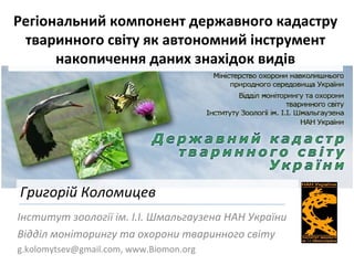
  • 1. Регіональний компонент державного кадастру тваринного світу як автономний інструмент накопичення даних знахідок видів Інститут зоології ім. І.І. Шмальгаузена НАН України Відділ моніторингу та охорони тваринного світу g.kolomytsev@gmail.com, www.Biomon.org Григорій Коломицев
  • 3.
  • 4. Результати моделювання розповсюдження лося (Alces alces) в східній Європі Анімація потенційних змін розповсюдження чебачка амурського (Pseudorasbora parva) в Східній Європі
  • 5. Державний кадастр тваринного світу систематизована сукупність відомостей про географічне поширення видів (груп видів) тварин, їх чисельність і стан, характеристики середовища їх перебування і сучасного господарського використання, а також інших даних необхідних для забезпечення охорони і раціонального використання тваринного світу. (КМ України, Постанова КМ "Про порядок ведення державного кадастру тваринного світу" від 15.11.1994 N 772)