ArcGIS Maps and Microsoft Integration: Power BI
•Télécharger en tant que PPTX, PDF•
0 j'aime•130 vues

2020 Esri Federal GIS Conference Presentation Presenters, Shannon Lindsay and Phil Satlof Enhance the Microsoft business applications you already use with The Science of Where. Learn how ArcGIS integrates directly with Microsoft Power BI. This means that ArcGIS data and capabilities are now available to a new set of users and allow self-service mapping and analytics within any organization.

Recommandé
Recommandé
Contenu connexe
Tendances
Tendances (19)
Similaire à ArcGIS Maps and Microsoft Integration: Power BI
Similaire à ArcGIS Maps and Microsoft Integration: Power BI (20)
Plus de Blue Raster
Plus de Blue Raster (20)
Dernier
Dernier (20)
ArcGIS Maps and Microsoft Integration: Power BI
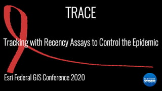
- 1. TRACE Esri Federal GIS Conference 2020 Tracking with Recency Assays to Control the Epidemic
- 2. WELCOME Phil Satlof Program Manager Specialty in health-related GIS Shannon Lindsay Power BI Developer Specialty in health analytics using Microsoft Power BI
- 3. BLUE RASTER < Experts in mapping solutions and data analysis > • Specialists in GIS, web application development, and business intelligence • Small business formed in 2002 • Esri Partner 17+ Years • Headquarters in Arlington, VA with clients worldwide
- 4. The TRACE Initiative • PEPFAR funded through CDC • Implemented by UCSF and Columbia University • Supporting implementation of rapid testing for recent HIV infections • Using real-time data to identify hot spots of current HIV transmission Institute for Global Health Sciences Detect Characterize Monitor Intervene
- 5. Fewer than 200,000 new HIV infections annually 28 million HIV infections averted with ART Aware of their HIV status On HIV treatment Virally Suppressed Data Source: UNAIDS 2017 Graphic Adapted from: www.avert.org
- 6. Building Capacity in Eswatini
- 7. Power BI • Data is shaped and transformed in Power BI Desktop and published to the Power BI service, where users consume data side-by-side with Esri ArcGIS Online analytics Desktop Application Web Service
- 8. Power BI
- 9. Using Real-Time Data Standardized data dashboard enabling countries to identify and describe clusters of recent HIV infections Used to tailor efforts to halt ongoing transmission
- 10. Using Real-Time Data DEMO LIVE DASHBOARD!
- 11. THANK YOU & QUESTIONS Phil Satlof & Shannon Lindsay psatlof@blueraster.com | slindsay@blueraster.com www.blueraster.com | www.trace-recency.org trace-recency.org/example-dashboard
Notes de l'éditeur
- Change background image
- Introduction of Key Personnel
- Esri & Blue Raster
- Esri & Blue Raster
- Esri & Blue Raster
- Esri & Blue Raster
- Esri & Blue Raster
- Esri & Blue Raster
- Intro & Thank You’s