
Recommandé
Contenu connexe
Tendances
Tendances (18)
Similaire à Upload undersea landscapes
Similaire à Upload undersea landscapes (20)
Plus de capjjj
Plus de capjjj (20)
Dernier
Dernier (20)
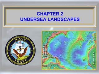
Upload undersea landscapes
- 2. Weight Until the 20th century, most knowledge of the ocean floor came from heaving a lead weight overboard with a hemp rope and looking at the muds, weeds, oozes, and sediments retrieved.
- 3. Depth Soundings Sigsbee Sounding Machine 1875 This became the basic model for the next 50 years
- 4. World War I efforts to combat German successes with submarines led to: Echo Sounder Hydrophone (sends signal-listens for echo) (listens passively)
- 5. Echo Sounder A device for measuring depth of water by sending sound waves down from the surface and recording the time until the echo returns from the bottom
- 6. Searching for submarines in the North Atlantic led to the realization of the diverse ocean floor geography. Intense effort to chart the ocean floor commenced and continues today.
- 7. Relief (of the Earth) The differences in elevation and slope between the higher and lower parts of the land surface of a given area
- 8. Topography Graphic representation on a map of the surface features of a place or region, indicating their relative positions and elevations
- 9. Contour Lines ~ Lines provide elevations ~ Spacing indicates relative slopes
- 10. Earth’s Two Main Levels of Relief Continents Deep Ocean Floor
- 11. DEEP OCEAN FLOOR Also known as: ~ Deep sea ~ Deep ocean basin ~ Abyss
- 12. Abyssal Plain Island Guyot Seamount Canyon Depth Soundings ~ Described in terms of its individual features Fracture Ridges Ridge Trench
- 13. Earth 71% covered by water but only two-thirds is deep oceanic basin Average depth ~ 12,000± feet (2.5 miles) Some trenches ~ 37,000+ feet (7 miles)
- 14. Echo sounders measure the time it takes a sound pulse to travel to the ocean floor and return. The deeper the floor, the longer the return. (Note: two ocean ridges & one rift valley)
- 15. Sound travel averages 4,800 ft/sec in water. If an echo return takes 2 seconds, it traveled 9,600 feet. Since it is a round trip, the depth is 4,800 feet.
- 16. You transmitted a sound in water and the echo returned in 5 seconds. a. How far did the sound travel? b. How deep is the ocean floor?
- 17. You transmitted a sound in water and the echo returned in 5 seconds. a. How far did the sound travel? The sound traveled 24,000 feet (4,800 x 5) b. How deep is the ocean floor? The ocean floor is at 12,000 feet (to floor and back) (24,000 ÷ 2)
- 18. Ocean Floor - Three Distinct Areas
- 19. Continental Shelf The relatively shallow (up to 200 meters), submerged border of a continent that slopes gradually and extends to a point of steeper descent to the ocean floor
- 20. Shelf Land Most maritime nations have agreed that the continental shelf is a part of the land out to a depth of 200 meters (656 feet).
- 21. North Carolina about 75 miles Shelf Land Continental shelves drop off at 7 to 10 feet per mile and average about 42 miles in width.
- 23. Japan Peru Shel f Lan d Some areas of the world have virtually no continental shelf as the oceanic plate subducts below a continental plate.
- 24. Ganges River Basin Indus River Basin Oman Tapi River Basin Shelves may not always have a gradual slope. Sediment such as rocks, sand, mud, silt, clay, and gravel may cover shelves. Coarse sand is the most common.
- 25. The sunlit continental shelves provide food, fuel, and minerals.
- 26. Most food, oil, and mineral explorations are on continental shelves, the area most liable for human conflicts.
- 27. Continental Slope Floor Shelf Land Regardless of the distance from land, at some point the shelf suddenly drops (slopes) to the ocean floor.
- 28. Continental Slope The steep descent of the seabed from the continental shelf to the abyssal zone
- 29. Continental slopes descend 100 to 500 feet per mile, flattening out near the floor. This is where the Earth’s continental crust (granitic material) meets the oceanic crust (basaltic material + sediment).
- 30. Granitic Rock: ~hard, speckled whitish or gray color ~rough appearance ~magma cooled slowly under the Earth’s surface (intrusive) ~most common rock exposed on surface Basaltic Rock: ~hard, dark color ~smooth to glassy appearance ~lava cooled rapidly above the Earth’s surface (extrusive) ~most common rock on Earth’s crust, covering the oceanic crust’s floor
- 31. If continental slope meets oceanic crust at subduction zone: Basalt + sediment e lop S Granite Granite is lighter relative to Basalt and rises to mountainous heights, often with volcanic activity created by the intense pressures.
- 32. Deep Ocean Floor • A bleak and uncomfortable world for humans • No light • No plant life • Extreme pressure • Cold • Sediments - mud, clay, sand, gravel
- 33. ~ Andes Mountains ~ Peru-Chile Trench 8-mile descent in less than 100 miles PERU CHILE
- 34. Continental slope features are similar to continental surface features but on a larger scale. Some of the features are: Submarine canyons, cliffs, valleys, terraces, plateaus, and drop-offs of several thousand of feet.
- 35. Submarine Canyon A deep underwater valley with steep sides
- 36. Terrace A nearly level strip of land with a more or less abrupt descent along the margin of the sea, a lake, or a river
- 37. Continental Slopes Submarine canyons are often carved out by past glaciers, tidal currents, other underwater currents, and landslides.
- 38. Continental Slopes Rapidly moving underwater currents called turbidity currents, carry debris and sediments that scour the canyon walls much like river or wind erosion does on continental surfaces.
- 39. Larger than Arizona’s Grand Canyon, New York’s Submarine Hudson Canyon extends from depths of 300 feet to some 7,000 feet, 150 miles off shore. Hudson River Long Island Hudson Canyon New Jersey Continental Slope Abyss
- 40. The Hudson River deposits an enormous plain of mud called a submarine fan.
- 41. Submarine Fan Mud, silt, and other sediment deposited when rivers empty into the ocean Sometimes extending hundreds of miles out to sea
- 42. Mississippi River Indus Ganges The world’s great rivers extend similar fans hundreds of miles out to sea.
- 43. Indus River Delta Ganges River Delta Mississippi River Delta Submarine fans extending hundreds of miles may also deposit enough sediment to create deltas above the surface.
- 44. The deep ocean floor begins at the bottom of the continental slope and extends seaward as the true bottom.
- 45. Continental Rise Where turbidity currents deposit enough sediment at the base of the continental slope to change angle of the slope.
- 46. Pacific Ocean Atlantic Ocean Indian Ocean The deep ocean floor covers one-third of the Atlantic and Indian Oceans, and three-quarters of the Pacific Ocean.
- 47. Pacific Ocean East of Japan Atlantic Ocean East of United States Most of the Pacific deep ocean basin consists of rolling hills, while plains are widespread in the Atlantic.
- 48. Atlantic Ocean East of Canada Turbidity currents flow through connecting canyons and channels carrying land sediment. Heavier sediments create the rise, lighter sediments settle on the plains.
- 49. Every deep ocean has impressive mountain ranges called ridges. The Mid-Atlantic Ridge soars more than 6,000 feet.
- 50. Mid-Ocean Ridge Many underwater earthquakes occur in a rift running down the ridge's centerline.
- 51. Major plate margins abut the Mid-Ocean Ridge
- 52. Almost all of the small Pacific Islands are tops of former volcanic mountains and true oceanic islands. They did not break away from continents.
- 53. The surface remnant of a volcanic peak that eroded or sank is known as an atoll. An old crater’s center filled with water is a lagoon.
- 54. In some cases, coral islands subside and disappear beneath the sea surface, leaving a peaked seamount. t amoun Se Found in all oceans but most common in the Pacific.
- 55. Seamount An underwater mountain rising from the ocean floor and having a flat topped or peaked summit below the surface of the sea
- 56. In other cases, volcanic activity that does not reach the sea surface can also leave an underwater mountain called a seamount.
- 57. Accurate seamount location and charting is critical for navigation. In January 2005, SSN San Francisco (SSN 711) collided with just such a seamount.
- 58. Seamounts with flattened tops are guyots. Guyots are found only in the Pacific.
- 59. Guyot A flat topped seamount Guyots show evidence of having been above the surface, worn by ocean waves, and gradually subsiding under their own weight as the sea rose.
- 60. The Hawaiian Islands are part of a chain created by volcanic eruption as the Pacific Plate moves northwest.
- 61. Loihi Seamount Southeast of the big island, Hawaii, the newest seamount is actively building to be the next island.
- 62. Kilauea Mauna Loa Two of the world’s most active volcanoes are on the big island of Hawaii.
- 63. High enough to have snow when dormant, Mauna Loa’s lava flow is 13,677 feet above the Pacific Ocean but more than 31,000 feet from the ocean floor.
- 64. South Pacific Caroline Islands Gilbert Islands Samoan Islands Society Islands Similar Volcanic Island Chains
- 65. Sediments Ocean floor sediments consist of three general types: • Oozes • Clays • Land-derived muds
- 66. Oozes Composed of marine shells, and skeletons of minute animals, oozes are found in warm, shallower waters of the equatorial areas and the Atlantic.
- 67. Clays Volcanic, meteorite, and airborne dusts make up the dark brown or reddish clay of the deep, cold, parts of the ocean basin as in the North Pacific.
- 68. Muds Land-derived materials delivered by river flow create the muds that empty into the oceans and spread over the abyssal plains.
- 69. Sediment does not always remain stationary. Underwater landslides and water flow may scour sediment in some areas and deposit great thickness in others.
- 70. Fine sediment buildup on the deep seabed is very slow: 1 inch every 2,500 years.
- 71. Volcanic eruptions spread sediments for miles. The ash and dust may circle the globe for years before falling to the Earth's surface.
- 72. Icebergs, river and shore ice entrap Detritus, loose material (stone fragments, silt, etc.) that is worn away from Rocks that falls to the ocean floor when they melt.
- 73. Mineral crystals often solidify or encrust around tiny objects on the sea bottom, forming nodules, or lumps of metal.
- 74. The most valuable nodule is one that contains manganese, used chiefly as an alloying agent in steel to give it toughness
- 75. Manganese A grayish white, usually hard and brittle, metallic element that resembles iron but is not magnetic A valuable oxidizing agent Used chiefly as an alloying agent in steel to give it toughness
- 77. Most manganese is found at depths over 12,000 feet making retrieval difficult.
- 78. Most seafloor sediment samples are obtained by using a coring tube.
- 79. Studying cores with tiny animal shells in the ooze and sediment provides a history of that part of the ocean. Fossils give clues about geological age and temperatures of the sea.
- 80. Deep water drilling showed: ~ North Atlantic began to form 200 million years ago, South Atlantic 150 million years ago. ~ Earth’s surface is made up of moving plates.
- 81. Q.1. Who invented the hydrophone? A.1. A team of U.S. Navy scientists
- 82. Q.2. What is the purpose of a relief map of the Earth’s surface? A.2. To show elevations of the Earth’s surface by using colors or numbers
- 83. Q.3. The average width of the continental shelves is about how many miles from the shore line? A.3. 42 miles
- 84. Q.4. What is the average depth of the ocean? A.4. 2.5 miles deep
- 85. Q.5. In what part of the ocean would you find sea vegetation? A.5. The continental shelf
- 86. Q.6. What are ocean ridges? A.6. Ocean ridges are enormous mountain ranges running along the center of the ocean floor.
- 87. Q.7. The enormous cracks that are found in the ocean are referred to as what? A.7. Rifts
- 88. Q.8. What is the drop rate of the continental slope? A.8. 100 to 500 feet per mile
- 89. Q.9. What type of materials makeup the ocean floor? A.9. Oozes, clay, and land-derived muds
- 90. Q.10. What are the three (3) areas the ocean floor is divided into? A.10. The continental shelf, continental slope, and deep ocean basin
- 91. Q.11. What is the deep ocean floor sometimes referred to? A.11. The abyss
- 92. Q.12. What is a submarine fan? A.12. The delta of a large river in which an enormous plain of mud can be deposited hundreds of miles out to sea
- 93. Q.13. How were most of the Pacific islands formed? A.13. Through volcanic eruption
- 94. Q.14. What is a guyot, and how is it formed? A.14. A flat-topped undersea mountain believed to have formed from repeated volcanic eruptions