SlideShare une entreprise Scribd logo
1  sur  14
Télécharger pour lire hors ligne
Yale Summer Session 2013
Study of the City
Final Project
Pudong, Shanghai- Its Past, Present and Future
Yunfan Chandler Song
Study of the City Final Project: Pudong, Shanghai- Its Past, Present and Future 1
Introduction
China, after Deng Xiaoping’s “Open Door Policy” during the 1980’s, has quickly become one of the world’s
fastest growing nations. Shanghai as the most populous city in Mainland China and a world-renowned financial
center embodies this swift growth of Chinese economy and technology. Over the last 30 years, central government of
China as well as Shanghai local government have enforced effort on urban development, aiming to build Shanghai as
a global city model. Pudonghas been the major beneficiary of this tide of developments and urban reforms. In this
research paper, we are going to explore the historical background of Pudong, its current development as well as
bright future it stands for. The main focus will be put on Lujiazui, the CBD in Pudong and its influence not only in
Shanghai but also other major Chinese cities.
Historical Background of Shanghai and Pudong
In 1292, the county of Shanghai was founded in the current day Shanghai Old Town along the Shore of
Huangpu River. In 1551, the town under the protection of fortification walls developed into a minor commercial
distribution center. However, the Haijin Policy1 limited Shanghai’s transform into an influential commercial port
even though the city sat on such a geographical advantage. After the Opium War and the Nanjing Treaty, the
emperor of Qing Dynasty agreed to grant the British legal permission to rent and govern autonomously a piece of
land north of the Old Town. Following the British were the Americans and the French. In 1862, the French
concession dropped out of the arrangement and the British along with the American united to form the Shanghai
International Settlement.During the one hundred year between 1843 and 1943, three administrative authorities
existed in the metropolitan area of Shanghai: The Shanghai Municipal Council headed by the British, The Consul
Général headed by the French and the Chinese local government. These authorities all focused on improving
infrastructure such as roads and electricity, helping to build a basis for Shanghai to become the future metropolis.
The application of “western” urbanization philosophy soon had desirable effects on Puxi, the West Bank. However,
Pudong, the East Bank was still a large rural countryside. There used to be attempts to expand Shanghai urban area
beyond Puxi. However, due to the Anti-Japan War (1937-1945) and the Civil War between Chinese Communist Party
and Chinese Republic Party (1946-1949), these attempts were put into abeyance.
1The Haijin literally means “sea ban” and was a policy on maritime activities imposed during Ming Dynasty and Qing
Dynasty.
Study of the City Final Project: Pudong, Shanghai- Its Past, Present and Future 2
Issues of Pudong during Mao Era and Deng Era
Chinese Urban developments had gone through a tough time under Mao’s radical policy trying to reduce the
inequality between the urban and the rural. Especially during the Cultural Revolution, urban productions were
distributed to remote areas, thus defeating the purpose of urban developments particularly in cities like Shanghai. In
the General Regulatory Plan of 1949, some original rural areas including Pudong were to be developed with regards
to the theory of organic dispersion. In contrast, most likely because of the high cost of connection across the
Huangpu River, the urbanization process in Pudong remained isolated and moved at a very slow pace.
After the Cultural Revolution, the central government led by Deng launched the “Open Door Policy” to reconnect
Chinese coastal cities with the world. In the General Regulatory Plan of 1986, some development projects were
planned for the Pudong riverfront due to the emergent demands for housing with higher living standards for the
increasingly augmented metropolitan population. However, because Pudong could only be accessed by ferryboats
across the river, its urbanization was still confronted by a lot of difficulties. Also, Deng’s policy focused mainly
onSouthern cities like Guangzhou and Shenzhen in rivalry with Hong Kong and Macau. Thus, Pudong’s boost did not
happen until late 1980’s. There used to be an old saying among Shanghai residents: “one would prefer a bed in Puxi
to a house to Pudong”. This indicates how undeveloped Pudong was in time and how unwillingly the populations
tend to move to Pudong.
Pudong’s Opportunity
Shanghai is the largest city by population in the People's Republic of China and the largest city proper by
population in the world. It is one of the four province-level municipalities of the PRC along with Beijing, Tianjin and
Chongqing and has a total population of over 23 million as of 2010. It is a major financial center and the busiest
container port in the world.
Pudong, literally means “East Bank”,is a state-level new area of Shanghai, China, situated along the east side
of the Huangpu River, across from the historic city center of Shanghai in Puxi. Formerly a little-developed
agricultural area that was linked only by ferries, Pudong has grown rapidly since the 1990s and emerged as China's
financial and commercial hub. Pudong is distinguished from Puxi ("West Bank"), the older part of Shanghai. It has an
area of 1210.4 km² and according to the 2010 Census, a population of 5,044,430 inhabitants, 1.9 million more than
in 2000.
Study of the City Final Project: Pudong, Shanghai- Its Past, Present and Future 3
A large factor of today’s Pudong’s success is its ideal geographical location at the Yangtze River Delta2. The
central government after the launch of the “Open Door Policy” soon recognized the potentials Pudong would stand
for. Pudong, for a long period of time, has been identified vaguely as the land east of Huangpu River. By 1990, the
administrative boundaries had been identified clearly and the establishment of the Pudong New District was
approved on an area of 350 square kilometers. Not long after, the area expanded to 522 square kilometers, following
by a government decision of merging Nanhui District to Pudong New District, strengthening further the role of
Pudong in Shanghai as well as the Yangtze River Delta. Figure 1 shows the trend of Pudong’s expansion indicated by
the red lines (the longer red line indicates the boundary of Shanghai metropolitan area).
Figure 1 Pudong's expansion: maps of Pudong in comparison to Shanghai metropolitan area in 1990, 1996 and 2006
respectively
In fact, in 1918, Dr. Sun Yat-sen, the leader in the Chinese democratic revolution and the first president of
the Republic of China, initiated the earliest thought to develop Pudong. Dr. Sun proposed in his writing of the
Strategies of founding the Republic to “build a new city center in Pudong, and to create a new bund by constructing a
canal in Pudong”. He envisioned Pudong being New York City in a distant future. Ultimately, the proposal was
abandoned due to political as well as economic crisis. Nevertheless, Dr. Sun’s ideology at least influenced the core
philosophy of Pudong development.
Almost seven decades later, Chinese economy experienced a groundbreaking revolution, from a relatively
conservative government distributed economy to a market-oriented one. Chinese central government initiated
several campaign throughout China, calling “technology for victory” and “urbanization”, unintentionally attracting
more and more people to the cities like Shanghai.
2The Yangtze River Delta, also called the Golden Triangle, generally comprises the triangular-shaped territory of one
Direct-Controlled Municipality and two provinces, Shanghai, Jiangsu and Zhejiang, making it largest concentration of
adjacent metropolitan areas in the world. 160 million people (13% of the national population) account for more than
27% of China’s industrial output. (Source: Wikipedia)
Study of the City Final Project: Pudong, Shanghai- Its Past, Present and Future 4
Policies and Leaderships regarding Pudong Development Project
In 1984, the Shanghai Municipal Government along with the State Council Research Group for Reviving
Shanghai proposed A Report Outline on the Economic Development Strategy of Shanghai. This report was composed
of three plans, one of which was concerning the expansion of Pudong to further eastward. SUPDI, Shanghai Urban
Planning and Design Institute was assigned by the Municipal Government and soon started to work with experts in
different fields such as economics and sociology to explore new ideas for dealing with appropriate urbanizations
under a fast growing market.
According to Yawei Chen, after replacing the old urban planning system with the new system, which
eliminated the allocation system and introduced market mechanism, planners need to find sources to power the
urban growth3. Admittedly, the researchers carefully studied American sociologies such as the Chicago School and
the Los Angeles School, thus putting emphasis on the concept of Central Business District (CBD). Pudong was seen as
an ideal location for this type of urban development. The river served as an important boundary to control the
influence of the CBD even if it failed so that it would not spread to Puxi, the historic CBD.
Seeing the success of Shenzhen emerging from a small village into a metropolis just in decades, Shanghai Municipal
Government was rather confident about the Pudong Development Project. However, Shanghai aside from being a
metropolis, also had political importance and was a revenue generator. Thus, experimenting such a project in
Pudong could not allow failure, or it would harm both the politics and the economics. Under the leadership of Mayor
Zhu Rongji, who later became the Chinese Premier, the Pudong Development Research Consultant Group (PDRCG)
was formed to prepare for the final project plans.
Political riots during late 1980’s did not affect the development negatively, as President Jiang Zemin and
Premier Li Peng influenced by Deng Xiaoping decided to fully open up Shanghai to the western world in showing
Chinese vision into the future. Their actions tightly followed the essence of the “Open Door Policy” and affirmed
their goals on Pudong development as “Developing Pudong, Reviving Shanghai, Serving China, Facing the World”.
Starting from Lujiazui
Lujiazui is a peninsula formed by Huangpu River extending from Pudong into Puxi. This condense area was
3Source: Chen, Y.W., Shanghai Pudong, Urban Development in an Era of Global-local Interaction. Delft: Delft University
Press. 2007
Study of the City Final Project: Pudong, Shanghai- Its Past, Present and Future 5
where the government decided to build the Lujiazui Central Business District on. Planners aimed to link Shanghai
with the rest of the world by building an internationally influential CBD in rivalry of other Asian mature CBD in Hong
Kong, Taipei and Singapore.
After the general ideas and the big picture had been laid out by 1980’s, the Preparatory Committee of
Pudong New District held a competition in searching for the best urban design. Competitors included Richard
Rogers from the UK, Dominique Perrault from France, Toyo Ito from Japan, Massimiliano Fuksas from Italy and the
local Shanghai Urban Planning and Design Institute (SUPDI)4. While hoping to attract global attentions by
competitions, the planners were also looking for a perfect fit of western model onto this special case of a Chinese
growing metropolis. Ideally, structures designed by renowned architects would next be integrated into the market-
oriented principles.
Figure 2 Location of Lujiazui in Pudong, indicated by the red lines (Source: Stamen.com)
Richard Roger’s model applied a concept with a perfect circular figure located in the center of the Lujiazui
and from the circle’s center six radial roads extended centrifugally connecting the new center with the rest
ofPudong. The building blocks followed the shape of the circulation form and theheight of towers ascends from
outside to the core. Roger’s proposal adopted theclassic principles for creating an ideal town plan in the West.
Similar to manyexamples in Europe, this circular pattern with its radial development proved to bethe most effective
way of coping with the city’s expansion and can createconvenient connections to the surrounding spaces. This model
was somewhat similar to the Concentric Ring Model developed by the Chicago School of Sociology. Figure 3 details
Roger’s design.
4Source: Chen, Y.W., Shanghai Pudong, Urban Development in an Era of Global-local Interaction. Delft: Delft University
Press. 2007
Study of the City Final Project: Pudong, Shanghai
Figure 35 Roger's Scheme is based on a circular configuration around a central park, with a general structure of varying
heights that optimized access to daylight while creating open perspective angles to the river and the city. From the park
six main road axes radiate out, the major part of the network giving priority to the circulation of pedestrians and cyclists
in the district, and public transport to access the city center
Other designs also attracted attention due their uniqueness in applying western ideas int
According to Toyo Ito’s ideas, The skeleton of the city is defined by the infrastructure of the subway at the lowest
underground level, and the road system above. A park formation was developed in which city trolley buses, bicycles
and pedestrians moving on the ground can interact freely. Commercial, business, sports, residential, and other
structures are arranged horizontally in 'bar code' formation. Lines of traffic are driven through the creek network
destroying this parallel order6.Dominique Perrault’s Scheme sought architectural aesthetics, emphasizing a free
expression of structure in order for a spectacular perspective from the Bund.
However, while the competition was being held, some of the structures such as the “Oriental Pearl” te
were already under construction. All of the international designs failed to recognize the
were meant to serve as benchmarks for future plans.
Finally, the local institute SUPDI became the winner for its holistic
advantages from other international designs but well integrated existing buildings into the new system. The idea of
having a central public park was dropped at first and was replaced by an extended avenue, “Centur
passed the site and connected Puxi to Pudong through a tunnel under the river.
around this “axis”. The zoning plan came along with the design also reserved specific areas in Lujiazui that were for
different functions such as retail stores, finance, housing and trade (shown in Figure 4).
5Source: Rogers Stirk Harbor + Partners
6 Source: Toyo Ito (Architectural Monographs No
Pudong, Shanghai- Its Past, Present and Future
Roger's Scheme is based on a circular configuration around a central park, with a general structure of varying
heights that optimized access to daylight while creating open perspective angles to the river and the city. From the park
iate out, the major part of the network giving priority to the circulation of pedestrians and cyclists
in the district, and public transport to access the city center
Other designs also attracted attention due their uniqueness in applying western ideas int
The skeleton of the city is defined by the infrastructure of the subway at the lowest
underground level, and the road system above. A park formation was developed in which city trolley buses, bicycles
estrians moving on the ground can interact freely. Commercial, business, sports, residential, and other
structures are arranged horizontally in 'bar code' formation. Lines of traffic are driven through the creek network
nique Perrault’s Scheme sought architectural aesthetics, emphasizing a free
in order for a spectacular perspective from the Bund.
However, while the competition was being held, some of the structures such as the “Oriental Pearl” te
were already under construction. All of the international designs failed to recognize the existing architectures that
for future plans.
Finally, the local institute SUPDI became the winner for its holistic design. Their design absorbed all types of
advantages from other international designs but well integrated existing buildings into the new system. The idea of
having a central public park was dropped at first and was replaced by an extended avenue, “Centur
passed the site and connected Puxi to Pudong through a tunnel under the river. Future developments were closely
The zoning plan came along with the design also reserved specific areas in Lujiazui that were for
functions such as retail stores, finance, housing and trade (shown in Figure 4).
Toyo Ito (Architectural Monographs No 41)
6
Roger's Scheme is based on a circular configuration around a central park, with a general structure of varying
heights that optimized access to daylight while creating open perspective angles to the river and the city. From the park
iate out, the major part of the network giving priority to the circulation of pedestrians and cyclists
Other designs also attracted attention due their uniqueness in applying western ideas into an Asian city.
The skeleton of the city is defined by the infrastructure of the subway at the lowest
underground level, and the road system above. A park formation was developed in which city trolley buses, bicycles
estrians moving on the ground can interact freely. Commercial, business, sports, residential, and other
structures are arranged horizontally in 'bar code' formation. Lines of traffic are driven through the creek network
nique Perrault’s Scheme sought architectural aesthetics, emphasizing a free
However, while the competition was being held, some of the structures such as the “Oriental Pearl” television tower
existing architectures that
Their design absorbed all types of
advantages from other international designs but well integrated existing buildings into the new system. The idea of
having a central public park was dropped at first and was replaced by an extended avenue, “Century Avenue”, that
Future developments were closely
The zoning plan came along with the design also reserved specific areas in Lujiazui that were for
Study of the City Final Project: Pudong, Shanghai- Its Past, Present and Future 7
Figure 4 Lujiazui Zoning Plan
Figure 5 View of Lujiazui from the Bund in 1900, 1990 and 2013respectively
The Main purpose of developing Lujiazui was creating a “global” CBD in the context of a global city. Sassen
defines global cities as strategic sites for the management of the global economy and the production of the most
advanced services and financial operations. The word “globalization” had been extremely emphasized during the
constructions and planning. By incorporating top companies and banks such as Citigroup and HSBC, Lujiazui
targeted to interconnect the world by the most advanced and updated information. A core value in Lujiazui project
was to build a self-sufficient city with the inclusion of over 80 financial institutions, more than 40 of which were
under international and overseas investment.
Skyscraper race
The panoramic view of Lujiazui from the Bund has been the “face” of the fast growing Chinese economy and
technology. Within 10 years, all types of skyscrapers boomed from flat land.After the completion of the “Oriental
Pearl” in 1994, Jinmao building immediately started in 1995, aiming at a height of 420 meters. When completely,
Jinmao received widespread praise not only for its new material and technique, but also the fact that Jinmao
Study of the City Final Project: Pudong, Shanghai- Its Past, Present and Future 8
conveyed the image of a pagoda and played a major role in provoking the landmark architecture in China both
morphologically and mentally. Soon, constructions of a group of skyscrapers of over 200 meters initiated. In 1998,
two most architecturally interesting buildings, the Bank of China Tower and the Bocom Tower started to rise. The
Bocom Tower then became the office building for China Bank of Communication headquartered in Shanghai. By
2002, not only had the Citi Group Tower and the Aurora Tower been completed, but also series of high-rise
residential towers in south Lujiazui. In 2004, after 7 years of debate, the construction of the Shanghai World
Financial Center was finally approved. The building was completed by 2008 and became a model of Chinese
skyscraper being multi-functional. When finished, the SWFC was the second highest building in the world, at a
height of 492 meters.Luxury hotel chains such as Hyatt and many other retail stores were introduced to these
skyscrapers. By 2014, an even more ambitious skyscraper, the Shanghai Tower, will be topped out at 632 meters,
making it the second tallest building by then, just behind the Burj Khalifa in Dubai. Shanghai now has the second
most skyscrapers in the world after Hong Kong. Skyscrapers have occupied most of the usable land by 2013.
Compared to a decade ago when a few skyscrapers were still standing among shipyards and slums, Pudong in 2013
has experienced a massive change. Many experts credited this series of constructions with the “China Speed”. The
notion of creating a vertical city (Chicago School) rather than a horizontal one (Los Angeles School) works in Pudong
well. This tide of building super-tall structures also influenced other cities around China including Guangzhou,
Shenzhen and Nanjing. The architectural style in Pudong, especially that in Lujiazui, stimulated the new “Chinese”
style combined post-modernism with pragmatism. One notable change in Pudong’s skyscrapers constructions is
that, gradually, architects and managing companies of buildings started to realize the importance of environmental
sustainability and aim to reduce consumption of energy and water. Nowadays, only “green” structure would be
approved in Lujiazui. The CBD again becomes the leadership not only in Shanghai but also China in striving for
environmentally friendly urban development.
Study of the City Final Project: Pudong, Shanghai- Its Past, Present and Future 9
Figure 6 The night view of Lujiazui CBD from East Century Avenue in 2013 (the Shanghai Tower on the left is under
construction)
Criticism
Though Lujiazui was and still is one of the most successful projects in China, criticisms still came after
compliments. It is accused of being deprived of humanism and individuality under the shadows of monotonous
architectural functions. The lacks of pedestrian pavements and cyclist paths have urged Lujiazui to be a motor-
vehicle-dominated zone. This problem was not fully solved until a circular pedestrian bridge and underground
systems were established in 2007 (shown in Figure 7). Also, not sufficient additional streets accompany Century
Avenue, thus causing traffic jam often. As population grows, streets are overloaded with cars and buses and the
tunnel from Puxi no longer is sufficient. Overall, the transportation inside the CBD zone as well as from Puxi
remained a problem.
Figure 7 the circular pedestrian bridge over the crossroad and the exit of the tunnel
Study of the City Final Project: Pudong, Shanghai- Its Past, Present and Future 10
Beyond Lujiazui
At the 14th Chinese Communist Party Congress in 1992, the central government formulated a strategy to
“seize the opportunity to develop and open up Shanghai Pudong, to build Shanghai as the dragon head and become
an international economic, financial, and trading center, so as to drive the growth of the Yangtze River Delta and, in
turn, accelerate the whole economy of the east China coast”7.
As the “dragon head” of Yangtze River, Shanghai should capture opportunities from Chinese enormous expanding
industry and economy and in return influence the future of China. However, questions and concerns remained
between people that Pudong would become purely “concrete mass” or an organic development that not only
included architecture but also integrated people. Italian architect Vittorio Gregotti suggested that Lujiazui should be
re-organized into smaller grids in order to connect buildings intimately with people and catch public interests. The
developments in Pudong later were very mindful about these types of concerns. The circular pedestrian bridge
shown in Figure 6 is also an example of integrating people into landscape. Not only does the pedestrian bridge
provide convenience in crossing the street, it also becomes a famous tourist attraction for people to enjoy Lujiazui
architectures.
Beside Lujiazui, a few other projects started to rise around the same time. They included two bridges
crossing Huangpu River, one bridge crossing Hangzhou Harbor, a free trade zone in Waigaoqiao, a new international
airport as well as other communication system such as the subway and the maglev trains.
Developing transportation was meant to closely connect the two sides of the river by having subway passing
through tunnels or over bridges. Subway system really provides people who work in the city and live the suburban
with convenience. Time and again the subway system expands to reach almost every corner of the metropolitan area.
Figure 8 shows a subway map of Shanghai, taking into account of the maglev train.
7Source: Zhai Hailin, Pudong- A missed opportunity for Metropolitan China
Study of the City Final Project: Pudong, Shanghai- Its Past, Present and Future 11
Figure 8 Shanghai Metro Map (Huangpu River indicated by a cyan-colored line)
With improvement of transportation formed the three main axes in the big planning picture:
Huangpu River axis, which connects the urban area along the river, and the riverside open spaces;
Lujiazui CBD- Central Park- International Airport axis, which extends the traditional axis in the west of
Shanghai into the hinterland of Pudong;
Seaside axis, which connects the harbors in Waigaoqiao, International Airport, Lingang New City etc.
Above expansion boosted series of constructions of large residential communities for working class. Between
the CBD, residential communities, factories and harbors were vast areas of transition zones, which were later used
to develop Zhangjiang High Technology Park and other advanced light industries such as Bose.
Figure 9 Pudong International Airport and Waigaoqiao Free Trade Zone on the map of Shanghai
Looking to the future
Indeed, Pudong is a successful project, not only on the scale of Shanghai but also that of Mainland China. The
idea of a plot land containing a CBD, ports, trade zones, an airport, high technology industry and sophisticated
transportation system inspired the future development in other major Chinese city. Among these, the CBD has been
the most influential, connecting Shanghai closely with the world by incorporating foreign companies and banks.
Study of the City Final Project: Pudong, Shanghai- Its Past, Present and Future 12
Pudong is a fairly new project and has only gotten better during these years. Though faced with different types of
difficulties, the planner successfully absorbed western ideas and intelligently combined with Shanghai’s special
situation. The other three direct-controlled municipal cities, Beijing, Tianjin and Chongqing all initiated their new
district developments aiming to imitate Pudong for its huge success. Other large cities, especially the one with
riverfronts such as Guangzhou, Wuhan and Nanjing tried to learn from how Pudong is directly interlocked with the
other side of the river.
Conclusion
Provided with the historical background and the earlier difficulties it faced, we are able to understand how
policies and leaderships actually played roles in the Pudong Development Project. The introduction to some of the
western ideas was indeed crucial to Pudong’s design as well as its ability to attract business in the future. But again,
today’s Pudong does benefit from Lujiazui, a concentrated, multi-functional and efficient CBD. It is Lujiazui’s success
that determined the direction of Pudong Development and laid foundation to other facilities such as Waigaoqiao
Free Trade Zone, Zhangjiang High Tech Park and Pudong International Airport.
Study of the City Final Project: Pudong, Shanghai- Its Past, Present and Future 13
Bibliography
Chen, Yawei. Shanghai Pudong: Urban Development in an Era of Global-Local Interaction. N.p.: Delft University Press,
2007.
"Lujiazui." In Wikipedia.
Parra, Giovanny. Shanghai Pudong. Photograph. http://500px.com/photo/9414001.
"Pudong." In Wikipedia.
Shanghai Metro Map. Photograph. Exploremetro. http://www.exploremetro.com/static/pdf/en/shanghai.pdf.
Shanghai Tower. Photograph. Archo2o. http://www.arch2o.com/shanghai-tower-marshall-strabala/#prettyPhoto/1/.
Wei, Fang. Luijiazui Skyline. Photograph. http://www.flickr.com/photos/fangwei/8266468721/.
Zhai, Hailin. "Observation of Urban Pudong." Shanghai Pudong- a Missed Opportunity for Metropolitan China, 2012.

Contenu connexe

Tendances (20)

Jaipur City Planning - Urban Design
Jaipur City Planning - Urban DesignJaipur City Planning - Urban Design
Jaipur City Planning - Urban Design
 
Alternative for wall construction
Alternative for wall   constructionAlternative for wall   construction
Alternative for wall construction
 
Shanghai tower
Shanghai towerShanghai tower
Shanghai tower
 
Shanghai tower
Shanghai towerShanghai tower
Shanghai tower
 
TAIPEI 101, CASE STUDY
TAIPEI 101, CASE STUDY TAIPEI 101, CASE STUDY
TAIPEI 101, CASE STUDY
 
Highrise buildings....
Highrise buildings....Highrise buildings....
Highrise buildings....
 
Bamboo as a building material
Bamboo as a building materialBamboo as a building material
Bamboo as a building material
 
Architect Ashok B Lall
Architect Ashok B LallArchitect Ashok B Lall
Architect Ashok B Lall
 
Pune city
Pune cityPune city
Pune city
 
Green building delhi case study
Green building delhi case studyGreen building delhi case study
Green building delhi case study
 
POST-TENSIONING SYSTEM
POST-TENSIONING SYSTEMPOST-TENSIONING SYSTEM
POST-TENSIONING SYSTEM
 
Retaining wall
Retaining wallRetaining wall
Retaining wall
 
Shanghai tower
Shanghai towerShanghai tower
Shanghai tower
 
high rise case study
high rise case studyhigh rise case study
high rise case study
 
Earthquake resistant building construction
Earthquake resistant building constructionEarthquake resistant building construction
Earthquake resistant building construction
 
low cost housing delhi
low cost housing delhilow cost housing delhi
low cost housing delhi
 
Water Feature Types
Water Feature TypesWater Feature Types
Water Feature Types
 
composite structure.pptx
composite structure.pptxcomposite structure.pptx
composite structure.pptx
 
Walkability Audit Bhikaji Cama Place - Nov 2012
Walkability Audit  Bhikaji Cama Place - Nov 2012Walkability Audit  Bhikaji Cama Place - Nov 2012
Walkability Audit Bhikaji Cama Place - Nov 2012
 
Building by laws
Building  by lawsBuilding  by laws
Building by laws
 

En vedette

Shanghai preparations for the world fair 2010
Shanghai preparations for the world fair 2010Shanghai preparations for the world fair 2010
Shanghai preparations for the world fair 2010Stonecroft
 
Listed Port Markets in China
Listed Port Markets in ChinaListed Port Markets in China
Listed Port Markets in ChinaInduStreams
 
Shanghai Port Market
Shanghai Port MarketShanghai Port Market
Shanghai Port MarketInduStreams
 
Shanghai: Naissance d'une métropole en trois temps
Shanghai: Naissance d'une métropole en trois tempsShanghai: Naissance d'une métropole en trois temps
Shanghai: Naissance d'une métropole en trois tempsankeqiang
 
Yangshan Shanghai Port
Yangshan   Shanghai PortYangshan   Shanghai Port
Yangshan Shanghai Portshvax
 
China container port industry report, 2010
China container port industry report, 2010China container port industry report, 2010
China container port industry report, 2010ResearchInChina
 
Shanghai 2010: 20 Things to Know | 10 Foods to Try
Shanghai 2010:  20 Things to Know | 10 Foods to TryShanghai 2010:  20 Things to Know | 10 Foods to Try
Shanghai 2010: 20 Things to Know | 10 Foods to Trymmmiata
 
Shanghai power point
Shanghai power pointShanghai power point
Shanghai power pointnacelIPSP
 
Shanghai, the biggest city in China
Shanghai, the biggest city in ChinaShanghai, the biggest city in China
Shanghai, the biggest city in ChinaRen
 

En vedette (14)

Shanghai preparations for the world fair 2010
Shanghai preparations for the world fair 2010Shanghai preparations for the world fair 2010
Shanghai preparations for the world fair 2010
 
Listed Port Markets in China
Listed Port Markets in ChinaListed Port Markets in China
Listed Port Markets in China
 
Shanghai Port Market
Shanghai Port MarketShanghai Port Market
Shanghai Port Market
 
nukeinv
nukeinvnukeinv
nukeinv
 
Shanghai
ShanghaiShanghai
Shanghai
 
Shanghai: Naissance d'une métropole en trois temps
Shanghai: Naissance d'une métropole en trois tempsShanghai: Naissance d'une métropole en trois temps
Shanghai: Naissance d'une métropole en trois temps
 
Yangshan Shanghai Port
Yangshan   Shanghai PortYangshan   Shanghai Port
Yangshan Shanghai Port
 
China container port industry report, 2010
China container port industry report, 2010China container port industry report, 2010
China container port industry report, 2010
 
Shanghai New Port!
Shanghai New Port!Shanghai New Port!
Shanghai New Port!
 
Shanghai 2010: 20 Things to Know | 10 Foods to Try
Shanghai 2010:  20 Things to Know | 10 Foods to TryShanghai 2010:  20 Things to Know | 10 Foods to Try
Shanghai 2010: 20 Things to Know | 10 Foods to Try
 
Shanghai
ShanghaiShanghai
Shanghai
 
Shanghai power point
Shanghai power pointShanghai power point
Shanghai power point
 
Shanghai
ShanghaiShanghai
Shanghai
 
Shanghai, the biggest city in China
Shanghai, the biggest city in ChinaShanghai, the biggest city in China
Shanghai, the biggest city in China
 

Similaire à Pudong's Past, Present and Future as Shanghai's CBD

136 Revista de Cultura • 50 • 2015património culturalT.docx
136 Revista de Cultura • 50 • 2015património culturalT.docx136 Revista de Cultura • 50 • 2015património culturalT.docx
136 Revista de Cultura • 50 • 2015património culturalT.docxmoggdede
 
Hongkong- its image and present identity
Hongkong- its image and present identityHongkong- its image and present identity
Hongkong- its image and present identitySaumya Gupta
 
Shanghai global city
Shanghai global cityShanghai global city
Shanghai global cityNguyễn Khoa
 
The ancient city of qingzhou
The ancient city of qingzhouThe ancient city of qingzhou
The ancient city of qingzhouJourney Han
 
Urbanism jh
Urbanism jhUrbanism jh
Urbanism jh- -
 
Evolution of the Asia-Pacific, Indo-Pacific. Geopolitical strategy of China.pdf
Evolution of the Asia-Pacific, Indo-Pacific. Geopolitical strategy of China.pdfEvolution of the Asia-Pacific, Indo-Pacific. Geopolitical strategy of China.pdf
Evolution of the Asia-Pacific, Indo-Pacific. Geopolitical strategy of China.pdfssusera3384d
 
problems of Shang hai
problems of Shang haiproblems of Shang hai
problems of Shang haichelseyQQ
 
future town report 2 (1).pdf
future town report 2 (1).pdffuture town report 2 (1).pdf
future town report 2 (1).pdfTien Yun
 
future town report 2.pdf
future town report 2.pdffuture town report 2.pdf
future town report 2.pdfTien Yun
 
The directions of development of the new Chinese ‘Belt and Road Initiative’ (...
The directions of development of the new Chinese ‘Belt and Road Initiative’ (...The directions of development of the new Chinese ‘Belt and Road Initiative’ (...
The directions of development of the new Chinese ‘Belt and Road Initiative’ (...Przegląd Politologiczny
 
future town report 2.pdf
future town report 2.pdffuture town report 2.pdf
future town report 2.pdfTien Yun
 
Enbe final project report
Enbe final project reportEnbe final project report
Enbe final project reportqayyum23
 
Introduction
IntroductionIntroduction
Introductionrivenhau
 

Similaire à Pudong's Past, Present and Future as Shanghai's CBD (20)

Urban and regional planning
Urban and regional planning  Urban and regional planning
Urban and regional planning
 
136 Revista de Cultura • 50 • 2015património culturalT.docx
136 Revista de Cultura • 50 • 2015património culturalT.docx136 Revista de Cultura • 50 • 2015património culturalT.docx
136 Revista de Cultura • 50 • 2015património culturalT.docx
 
Hongkong- its image and present identity
Hongkong- its image and present identityHongkong- its image and present identity
Hongkong- its image and present identity
 
Shanghai global city
Shanghai global cityShanghai global city
Shanghai global city
 
MALACCA
MALACCAMALACCA
MALACCA
 
The ancient city of qingzhou
The ancient city of qingzhouThe ancient city of qingzhou
The ancient city of qingzhou
 
Urbanism jh
Urbanism jhUrbanism jh
Urbanism jh
 
Evolution of the Asia-Pacific, Indo-Pacific. Geopolitical strategy of China.pdf
Evolution of the Asia-Pacific, Indo-Pacific. Geopolitical strategy of China.pdfEvolution of the Asia-Pacific, Indo-Pacific. Geopolitical strategy of China.pdf
Evolution of the Asia-Pacific, Indo-Pacific. Geopolitical strategy of China.pdf
 
problems of Shang hai
problems of Shang haiproblems of Shang hai
problems of Shang hai
 
future town report 2 (1).pdf
future town report 2 (1).pdffuture town report 2 (1).pdf
future town report 2 (1).pdf
 
future town report 2.pdf
future town report 2.pdffuture town report 2.pdf
future town report 2.pdf
 
China urban tranformation
China urban tranformationChina urban tranformation
China urban tranformation
 
The directions of development of the new Chinese ‘Belt and Road Initiative’ (...
The directions of development of the new Chinese ‘Belt and Road Initiative’ (...The directions of development of the new Chinese ‘Belt and Road Initiative’ (...
The directions of development of the new Chinese ‘Belt and Road Initiative’ (...
 
future town report 2.pdf
future town report 2.pdffuture town report 2.pdf
future town report 2.pdf
 
Invest in shenzhen
Invest in shenzhenInvest in shenzhen
Invest in shenzhen
 
Enbe final project report
Enbe final project reportEnbe final project report
Enbe final project report
 
Hong Kong Essay
Hong Kong EssayHong Kong Essay
Hong Kong Essay
 
Symbolic_changes
Symbolic_changesSymbolic_changes
Symbolic_changes
 
Megacity
MegacityMegacity
Megacity
 
Introduction
IntroductionIntroduction
Introduction
 

Pudong's Past, Present and Future as Shanghai's CBD

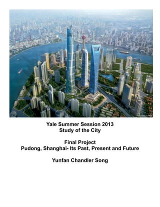
  • 1. Yale Summer Session 2013 Study of the City Final Project Pudong, Shanghai- Its Past, Present and Future Yunfan Chandler Song
  • 2. Study of the City Final Project: Pudong, Shanghai- Its Past, Present and Future 1 Introduction China, after Deng Xiaoping’s “Open Door Policy” during the 1980’s, has quickly become one of the world’s fastest growing nations. Shanghai as the most populous city in Mainland China and a world-renowned financial center embodies this swift growth of Chinese economy and technology. Over the last 30 years, central government of China as well as Shanghai local government have enforced effort on urban development, aiming to build Shanghai as a global city model. Pudonghas been the major beneficiary of this tide of developments and urban reforms. In this research paper, we are going to explore the historical background of Pudong, its current development as well as bright future it stands for. The main focus will be put on Lujiazui, the CBD in Pudong and its influence not only in Shanghai but also other major Chinese cities. Historical Background of Shanghai and Pudong In 1292, the county of Shanghai was founded in the current day Shanghai Old Town along the Shore of Huangpu River. In 1551, the town under the protection of fortification walls developed into a minor commercial distribution center. However, the Haijin Policy1 limited Shanghai’s transform into an influential commercial port even though the city sat on such a geographical advantage. After the Opium War and the Nanjing Treaty, the emperor of Qing Dynasty agreed to grant the British legal permission to rent and govern autonomously a piece of land north of the Old Town. Following the British were the Americans and the French. In 1862, the French concession dropped out of the arrangement and the British along with the American united to form the Shanghai International Settlement.During the one hundred year between 1843 and 1943, three administrative authorities existed in the metropolitan area of Shanghai: The Shanghai Municipal Council headed by the British, The Consul Général headed by the French and the Chinese local government. These authorities all focused on improving infrastructure such as roads and electricity, helping to build a basis for Shanghai to become the future metropolis. The application of “western” urbanization philosophy soon had desirable effects on Puxi, the West Bank. However, Pudong, the East Bank was still a large rural countryside. There used to be attempts to expand Shanghai urban area beyond Puxi. However, due to the Anti-Japan War (1937-1945) and the Civil War between Chinese Communist Party and Chinese Republic Party (1946-1949), these attempts were put into abeyance. 1The Haijin literally means “sea ban” and was a policy on maritime activities imposed during Ming Dynasty and Qing Dynasty.
  • 3. Study of the City Final Project: Pudong, Shanghai- Its Past, Present and Future 2 Issues of Pudong during Mao Era and Deng Era Chinese Urban developments had gone through a tough time under Mao’s radical policy trying to reduce the inequality between the urban and the rural. Especially during the Cultural Revolution, urban productions were distributed to remote areas, thus defeating the purpose of urban developments particularly in cities like Shanghai. In the General Regulatory Plan of 1949, some original rural areas including Pudong were to be developed with regards to the theory of organic dispersion. In contrast, most likely because of the high cost of connection across the Huangpu River, the urbanization process in Pudong remained isolated and moved at a very slow pace. After the Cultural Revolution, the central government led by Deng launched the “Open Door Policy” to reconnect Chinese coastal cities with the world. In the General Regulatory Plan of 1986, some development projects were planned for the Pudong riverfront due to the emergent demands for housing with higher living standards for the increasingly augmented metropolitan population. However, because Pudong could only be accessed by ferryboats across the river, its urbanization was still confronted by a lot of difficulties. Also, Deng’s policy focused mainly onSouthern cities like Guangzhou and Shenzhen in rivalry with Hong Kong and Macau. Thus, Pudong’s boost did not happen until late 1980’s. There used to be an old saying among Shanghai residents: “one would prefer a bed in Puxi to a house to Pudong”. This indicates how undeveloped Pudong was in time and how unwillingly the populations tend to move to Pudong. Pudong’s Opportunity Shanghai is the largest city by population in the People's Republic of China and the largest city proper by population in the world. It is one of the four province-level municipalities of the PRC along with Beijing, Tianjin and Chongqing and has a total population of over 23 million as of 2010. It is a major financial center and the busiest container port in the world. Pudong, literally means “East Bank”,is a state-level new area of Shanghai, China, situated along the east side of the Huangpu River, across from the historic city center of Shanghai in Puxi. Formerly a little-developed agricultural area that was linked only by ferries, Pudong has grown rapidly since the 1990s and emerged as China's financial and commercial hub. Pudong is distinguished from Puxi ("West Bank"), the older part of Shanghai. It has an area of 1210.4 km² and according to the 2010 Census, a population of 5,044,430 inhabitants, 1.9 million more than in 2000.
  • 4. Study of the City Final Project: Pudong, Shanghai- Its Past, Present and Future 3 A large factor of today’s Pudong’s success is its ideal geographical location at the Yangtze River Delta2. The central government after the launch of the “Open Door Policy” soon recognized the potentials Pudong would stand for. Pudong, for a long period of time, has been identified vaguely as the land east of Huangpu River. By 1990, the administrative boundaries had been identified clearly and the establishment of the Pudong New District was approved on an area of 350 square kilometers. Not long after, the area expanded to 522 square kilometers, following by a government decision of merging Nanhui District to Pudong New District, strengthening further the role of Pudong in Shanghai as well as the Yangtze River Delta. Figure 1 shows the trend of Pudong’s expansion indicated by the red lines (the longer red line indicates the boundary of Shanghai metropolitan area). Figure 1 Pudong's expansion: maps of Pudong in comparison to Shanghai metropolitan area in 1990, 1996 and 2006 respectively In fact, in 1918, Dr. Sun Yat-sen, the leader in the Chinese democratic revolution and the first president of the Republic of China, initiated the earliest thought to develop Pudong. Dr. Sun proposed in his writing of the Strategies of founding the Republic to “build a new city center in Pudong, and to create a new bund by constructing a canal in Pudong”. He envisioned Pudong being New York City in a distant future. Ultimately, the proposal was abandoned due to political as well as economic crisis. Nevertheless, Dr. Sun’s ideology at least influenced the core philosophy of Pudong development. Almost seven decades later, Chinese economy experienced a groundbreaking revolution, from a relatively conservative government distributed economy to a market-oriented one. Chinese central government initiated several campaign throughout China, calling “technology for victory” and “urbanization”, unintentionally attracting more and more people to the cities like Shanghai. 2The Yangtze River Delta, also called the Golden Triangle, generally comprises the triangular-shaped territory of one Direct-Controlled Municipality and two provinces, Shanghai, Jiangsu and Zhejiang, making it largest concentration of adjacent metropolitan areas in the world. 160 million people (13% of the national population) account for more than 27% of China’s industrial output. (Source: Wikipedia)
  • 5. Study of the City Final Project: Pudong, Shanghai- Its Past, Present and Future 4 Policies and Leaderships regarding Pudong Development Project In 1984, the Shanghai Municipal Government along with the State Council Research Group for Reviving Shanghai proposed A Report Outline on the Economic Development Strategy of Shanghai. This report was composed of three plans, one of which was concerning the expansion of Pudong to further eastward. SUPDI, Shanghai Urban Planning and Design Institute was assigned by the Municipal Government and soon started to work with experts in different fields such as economics and sociology to explore new ideas for dealing with appropriate urbanizations under a fast growing market. According to Yawei Chen, after replacing the old urban planning system with the new system, which eliminated the allocation system and introduced market mechanism, planners need to find sources to power the urban growth3. Admittedly, the researchers carefully studied American sociologies such as the Chicago School and the Los Angeles School, thus putting emphasis on the concept of Central Business District (CBD). Pudong was seen as an ideal location for this type of urban development. The river served as an important boundary to control the influence of the CBD even if it failed so that it would not spread to Puxi, the historic CBD. Seeing the success of Shenzhen emerging from a small village into a metropolis just in decades, Shanghai Municipal Government was rather confident about the Pudong Development Project. However, Shanghai aside from being a metropolis, also had political importance and was a revenue generator. Thus, experimenting such a project in Pudong could not allow failure, or it would harm both the politics and the economics. Under the leadership of Mayor Zhu Rongji, who later became the Chinese Premier, the Pudong Development Research Consultant Group (PDRCG) was formed to prepare for the final project plans. Political riots during late 1980’s did not affect the development negatively, as President Jiang Zemin and Premier Li Peng influenced by Deng Xiaoping decided to fully open up Shanghai to the western world in showing Chinese vision into the future. Their actions tightly followed the essence of the “Open Door Policy” and affirmed their goals on Pudong development as “Developing Pudong, Reviving Shanghai, Serving China, Facing the World”. Starting from Lujiazui Lujiazui is a peninsula formed by Huangpu River extending from Pudong into Puxi. This condense area was 3Source: Chen, Y.W., Shanghai Pudong, Urban Development in an Era of Global-local Interaction. Delft: Delft University Press. 2007
  • 6. Study of the City Final Project: Pudong, Shanghai- Its Past, Present and Future 5 where the government decided to build the Lujiazui Central Business District on. Planners aimed to link Shanghai with the rest of the world by building an internationally influential CBD in rivalry of other Asian mature CBD in Hong Kong, Taipei and Singapore. After the general ideas and the big picture had been laid out by 1980’s, the Preparatory Committee of Pudong New District held a competition in searching for the best urban design. Competitors included Richard Rogers from the UK, Dominique Perrault from France, Toyo Ito from Japan, Massimiliano Fuksas from Italy and the local Shanghai Urban Planning and Design Institute (SUPDI)4. While hoping to attract global attentions by competitions, the planners were also looking for a perfect fit of western model onto this special case of a Chinese growing metropolis. Ideally, structures designed by renowned architects would next be integrated into the market- oriented principles. Figure 2 Location of Lujiazui in Pudong, indicated by the red lines (Source: Stamen.com) Richard Roger’s model applied a concept with a perfect circular figure located in the center of the Lujiazui and from the circle’s center six radial roads extended centrifugally connecting the new center with the rest ofPudong. The building blocks followed the shape of the circulation form and theheight of towers ascends from outside to the core. Roger’s proposal adopted theclassic principles for creating an ideal town plan in the West. Similar to manyexamples in Europe, this circular pattern with its radial development proved to bethe most effective way of coping with the city’s expansion and can createconvenient connections to the surrounding spaces. This model was somewhat similar to the Concentric Ring Model developed by the Chicago School of Sociology. Figure 3 details Roger’s design. 4Source: Chen, Y.W., Shanghai Pudong, Urban Development in an Era of Global-local Interaction. Delft: Delft University Press. 2007
  • 7. Study of the City Final Project: Pudong, Shanghai Figure 35 Roger's Scheme is based on a circular configuration around a central park, with a general structure of varying heights that optimized access to daylight while creating open perspective angles to the river and the city. From the park six main road axes radiate out, the major part of the network giving priority to the circulation of pedestrians and cyclists in the district, and public transport to access the city center Other designs also attracted attention due their uniqueness in applying western ideas int According to Toyo Ito’s ideas, The skeleton of the city is defined by the infrastructure of the subway at the lowest underground level, and the road system above. A park formation was developed in which city trolley buses, bicycles and pedestrians moving on the ground can interact freely. Commercial, business, sports, residential, and other structures are arranged horizontally in 'bar code' formation. Lines of traffic are driven through the creek network destroying this parallel order6.Dominique Perrault’s Scheme sought architectural aesthetics, emphasizing a free expression of structure in order for a spectacular perspective from the Bund. However, while the competition was being held, some of the structures such as the “Oriental Pearl” te were already under construction. All of the international designs failed to recognize the were meant to serve as benchmarks for future plans. Finally, the local institute SUPDI became the winner for its holistic advantages from other international designs but well integrated existing buildings into the new system. The idea of having a central public park was dropped at first and was replaced by an extended avenue, “Centur passed the site and connected Puxi to Pudong through a tunnel under the river. around this “axis”. The zoning plan came along with the design also reserved specific areas in Lujiazui that were for different functions such as retail stores, finance, housing and trade (shown in Figure 4). 5Source: Rogers Stirk Harbor + Partners 6 Source: Toyo Ito (Architectural Monographs No Pudong, Shanghai- Its Past, Present and Future Roger's Scheme is based on a circular configuration around a central park, with a general structure of varying heights that optimized access to daylight while creating open perspective angles to the river and the city. From the park iate out, the major part of the network giving priority to the circulation of pedestrians and cyclists in the district, and public transport to access the city center Other designs also attracted attention due their uniqueness in applying western ideas int The skeleton of the city is defined by the infrastructure of the subway at the lowest underground level, and the road system above. A park formation was developed in which city trolley buses, bicycles estrians moving on the ground can interact freely. Commercial, business, sports, residential, and other structures are arranged horizontally in 'bar code' formation. Lines of traffic are driven through the creek network nique Perrault’s Scheme sought architectural aesthetics, emphasizing a free in order for a spectacular perspective from the Bund. However, while the competition was being held, some of the structures such as the “Oriental Pearl” te were already under construction. All of the international designs failed to recognize the existing architectures that for future plans. Finally, the local institute SUPDI became the winner for its holistic design. Their design absorbed all types of advantages from other international designs but well integrated existing buildings into the new system. The idea of having a central public park was dropped at first and was replaced by an extended avenue, “Centur passed the site and connected Puxi to Pudong through a tunnel under the river. Future developments were closely The zoning plan came along with the design also reserved specific areas in Lujiazui that were for functions such as retail stores, finance, housing and trade (shown in Figure 4). Toyo Ito (Architectural Monographs No 41) 6 Roger's Scheme is based on a circular configuration around a central park, with a general structure of varying heights that optimized access to daylight while creating open perspective angles to the river and the city. From the park iate out, the major part of the network giving priority to the circulation of pedestrians and cyclists Other designs also attracted attention due their uniqueness in applying western ideas into an Asian city. The skeleton of the city is defined by the infrastructure of the subway at the lowest underground level, and the road system above. A park formation was developed in which city trolley buses, bicycles estrians moving on the ground can interact freely. Commercial, business, sports, residential, and other structures are arranged horizontally in 'bar code' formation. Lines of traffic are driven through the creek network nique Perrault’s Scheme sought architectural aesthetics, emphasizing a free However, while the competition was being held, some of the structures such as the “Oriental Pearl” television tower existing architectures that Their design absorbed all types of advantages from other international designs but well integrated existing buildings into the new system. The idea of having a central public park was dropped at first and was replaced by an extended avenue, “Century Avenue”, that Future developments were closely The zoning plan came along with the design also reserved specific areas in Lujiazui that were for
  • 8. Study of the City Final Project: Pudong, Shanghai- Its Past, Present and Future 7 Figure 4 Lujiazui Zoning Plan Figure 5 View of Lujiazui from the Bund in 1900, 1990 and 2013respectively The Main purpose of developing Lujiazui was creating a “global” CBD in the context of a global city. Sassen defines global cities as strategic sites for the management of the global economy and the production of the most advanced services and financial operations. The word “globalization” had been extremely emphasized during the constructions and planning. By incorporating top companies and banks such as Citigroup and HSBC, Lujiazui targeted to interconnect the world by the most advanced and updated information. A core value in Lujiazui project was to build a self-sufficient city with the inclusion of over 80 financial institutions, more than 40 of which were under international and overseas investment. Skyscraper race The panoramic view of Lujiazui from the Bund has been the “face” of the fast growing Chinese economy and technology. Within 10 years, all types of skyscrapers boomed from flat land.After the completion of the “Oriental Pearl” in 1994, Jinmao building immediately started in 1995, aiming at a height of 420 meters. When completely, Jinmao received widespread praise not only for its new material and technique, but also the fact that Jinmao
  • 9. Study of the City Final Project: Pudong, Shanghai- Its Past, Present and Future 8 conveyed the image of a pagoda and played a major role in provoking the landmark architecture in China both morphologically and mentally. Soon, constructions of a group of skyscrapers of over 200 meters initiated. In 1998, two most architecturally interesting buildings, the Bank of China Tower and the Bocom Tower started to rise. The Bocom Tower then became the office building for China Bank of Communication headquartered in Shanghai. By 2002, not only had the Citi Group Tower and the Aurora Tower been completed, but also series of high-rise residential towers in south Lujiazui. In 2004, after 7 years of debate, the construction of the Shanghai World Financial Center was finally approved. The building was completed by 2008 and became a model of Chinese skyscraper being multi-functional. When finished, the SWFC was the second highest building in the world, at a height of 492 meters.Luxury hotel chains such as Hyatt and many other retail stores were introduced to these skyscrapers. By 2014, an even more ambitious skyscraper, the Shanghai Tower, will be topped out at 632 meters, making it the second tallest building by then, just behind the Burj Khalifa in Dubai. Shanghai now has the second most skyscrapers in the world after Hong Kong. Skyscrapers have occupied most of the usable land by 2013. Compared to a decade ago when a few skyscrapers were still standing among shipyards and slums, Pudong in 2013 has experienced a massive change. Many experts credited this series of constructions with the “China Speed”. The notion of creating a vertical city (Chicago School) rather than a horizontal one (Los Angeles School) works in Pudong well. This tide of building super-tall structures also influenced other cities around China including Guangzhou, Shenzhen and Nanjing. The architectural style in Pudong, especially that in Lujiazui, stimulated the new “Chinese” style combined post-modernism with pragmatism. One notable change in Pudong’s skyscrapers constructions is that, gradually, architects and managing companies of buildings started to realize the importance of environmental sustainability and aim to reduce consumption of energy and water. Nowadays, only “green” structure would be approved in Lujiazui. The CBD again becomes the leadership not only in Shanghai but also China in striving for environmentally friendly urban development.
  • 10. Study of the City Final Project: Pudong, Shanghai- Its Past, Present and Future 9 Figure 6 The night view of Lujiazui CBD from East Century Avenue in 2013 (the Shanghai Tower on the left is under construction) Criticism Though Lujiazui was and still is one of the most successful projects in China, criticisms still came after compliments. It is accused of being deprived of humanism and individuality under the shadows of monotonous architectural functions. The lacks of pedestrian pavements and cyclist paths have urged Lujiazui to be a motor- vehicle-dominated zone. This problem was not fully solved until a circular pedestrian bridge and underground systems were established in 2007 (shown in Figure 7). Also, not sufficient additional streets accompany Century Avenue, thus causing traffic jam often. As population grows, streets are overloaded with cars and buses and the tunnel from Puxi no longer is sufficient. Overall, the transportation inside the CBD zone as well as from Puxi remained a problem. Figure 7 the circular pedestrian bridge over the crossroad and the exit of the tunnel
  • 11. Study of the City Final Project: Pudong, Shanghai- Its Past, Present and Future 10 Beyond Lujiazui At the 14th Chinese Communist Party Congress in 1992, the central government formulated a strategy to “seize the opportunity to develop and open up Shanghai Pudong, to build Shanghai as the dragon head and become an international economic, financial, and trading center, so as to drive the growth of the Yangtze River Delta and, in turn, accelerate the whole economy of the east China coast”7. As the “dragon head” of Yangtze River, Shanghai should capture opportunities from Chinese enormous expanding industry and economy and in return influence the future of China. However, questions and concerns remained between people that Pudong would become purely “concrete mass” or an organic development that not only included architecture but also integrated people. Italian architect Vittorio Gregotti suggested that Lujiazui should be re-organized into smaller grids in order to connect buildings intimately with people and catch public interests. The developments in Pudong later were very mindful about these types of concerns. The circular pedestrian bridge shown in Figure 6 is also an example of integrating people into landscape. Not only does the pedestrian bridge provide convenience in crossing the street, it also becomes a famous tourist attraction for people to enjoy Lujiazui architectures. Beside Lujiazui, a few other projects started to rise around the same time. They included two bridges crossing Huangpu River, one bridge crossing Hangzhou Harbor, a free trade zone in Waigaoqiao, a new international airport as well as other communication system such as the subway and the maglev trains. Developing transportation was meant to closely connect the two sides of the river by having subway passing through tunnels or over bridges. Subway system really provides people who work in the city and live the suburban with convenience. Time and again the subway system expands to reach almost every corner of the metropolitan area. Figure 8 shows a subway map of Shanghai, taking into account of the maglev train. 7Source: Zhai Hailin, Pudong- A missed opportunity for Metropolitan China
  • 12. Study of the City Final Project: Pudong, Shanghai- Its Past, Present and Future 11 Figure 8 Shanghai Metro Map (Huangpu River indicated by a cyan-colored line) With improvement of transportation formed the three main axes in the big planning picture: Huangpu River axis, which connects the urban area along the river, and the riverside open spaces; Lujiazui CBD- Central Park- International Airport axis, which extends the traditional axis in the west of Shanghai into the hinterland of Pudong; Seaside axis, which connects the harbors in Waigaoqiao, International Airport, Lingang New City etc. Above expansion boosted series of constructions of large residential communities for working class. Between the CBD, residential communities, factories and harbors were vast areas of transition zones, which were later used to develop Zhangjiang High Technology Park and other advanced light industries such as Bose. Figure 9 Pudong International Airport and Waigaoqiao Free Trade Zone on the map of Shanghai Looking to the future Indeed, Pudong is a successful project, not only on the scale of Shanghai but also that of Mainland China. The idea of a plot land containing a CBD, ports, trade zones, an airport, high technology industry and sophisticated transportation system inspired the future development in other major Chinese city. Among these, the CBD has been the most influential, connecting Shanghai closely with the world by incorporating foreign companies and banks.
  • 13. Study of the City Final Project: Pudong, Shanghai- Its Past, Present and Future 12 Pudong is a fairly new project and has only gotten better during these years. Though faced with different types of difficulties, the planner successfully absorbed western ideas and intelligently combined with Shanghai’s special situation. The other three direct-controlled municipal cities, Beijing, Tianjin and Chongqing all initiated their new district developments aiming to imitate Pudong for its huge success. Other large cities, especially the one with riverfronts such as Guangzhou, Wuhan and Nanjing tried to learn from how Pudong is directly interlocked with the other side of the river. Conclusion Provided with the historical background and the earlier difficulties it faced, we are able to understand how policies and leaderships actually played roles in the Pudong Development Project. The introduction to some of the western ideas was indeed crucial to Pudong’s design as well as its ability to attract business in the future. But again, today’s Pudong does benefit from Lujiazui, a concentrated, multi-functional and efficient CBD. It is Lujiazui’s success that determined the direction of Pudong Development and laid foundation to other facilities such as Waigaoqiao Free Trade Zone, Zhangjiang High Tech Park and Pudong International Airport.
  • 14. Study of the City Final Project: Pudong, Shanghai- Its Past, Present and Future 13 Bibliography Chen, Yawei. Shanghai Pudong: Urban Development in an Era of Global-Local Interaction. N.p.: Delft University Press, 2007. "Lujiazui." In Wikipedia. Parra, Giovanny. Shanghai Pudong. Photograph. http://500px.com/photo/9414001. "Pudong." In Wikipedia. Shanghai Metro Map. Photograph. Exploremetro. http://www.exploremetro.com/static/pdf/en/shanghai.pdf. Shanghai Tower. Photograph. Archo2o. http://www.arch2o.com/shanghai-tower-marshall-strabala/#prettyPhoto/1/. Wei, Fang. Luijiazui Skyline. Photograph. http://www.flickr.com/photos/fangwei/8266468721/. Zhai, Hailin. "Observation of Urban Pudong." Shanghai Pudong- a Missed Opportunity for Metropolitan China, 2012.