3. CONTENTS
INTRODUCTION 04
THE VISION 05
THE PROPERTY 06
THE REGION 08
THE HISTORY 10
SITE INVENTORY & ANALYSIS 13
LANDSCAPE TYPOLOGY
TERRAIN
ECOLOGY
VEGETATION
ASPECT
WILDLIFE
SITE DESIGN ELEMENTS 23
ENTRANCE MEADOW
MEADOW PRECEDENTS
HOME SITE
HOME SITE PRECEDENTS
INTERVENTIONS
DISCOVERY & CONTEMPLATION
STEWARDSHIP
ATV TRAILS & AMENITIES
SITE AMENITY PRECEDENTS
SUMMARY 48
3
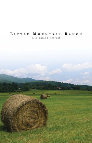
4. LITTLE MOUNTAIN RANCH, a H i g h l a n d R e t r e a t
INTRODUCTION
McKee Carson and Field Sport
Concepts, Ltd. are proud to provide the
family with the following inventory,
analysis, planning, and design
explorations for Little Mountain Ranch.
We have evaluated the property in
order to explore certain master plan
configurations regarding the program
vision. This report is a record of
our initial observations, inventories, From ridge top...
analyses, and recommendations. While
it is not a design document, it is our
intent that the initial concepts contained
herein, along with our research and
recommendations, serve to assist you
and your family with a vision and
future planning decisions for your
property.
The master planning process began
with a comprehensive analysis of the
site and its geographic, cultural, and
historical relationship to its context.
An understanding of these natural and
cultural influences, site context, existing
conditions, and programmatic goals
all contributed to the unique landscape
language that was developed for this
master plan.
Through the investigation of maps
and narratives of Highland County,
we chronicled the site’s cultural and
natural history. After numerous on-site
investigations we conducted a detailed
site inventory and analysis, including
site ecology, plant communities, terrain,
and solar aspect. Evaluation of the site’s
opportunities and constraints associated
with the programmatic goals led us
to further explore and reveal the site’s
unique character through a series of
design interventions.
This document is a record of that
process and the resulting design
recommendations we have developed
as a result. It is our sincere hope that
we not only meet your expectations but
exceed them, and that this book serves
to highlight the unlimited potential,
outstanding integrity and overall beauty
found at Little Mountain Ranch from
ridge top to river valley.
NORTH
ROUTE 220
JACKSON RIVER
RIDGE TOP
top...
ridge
From
4
5. THE VISION
The vision for Little Mountain Ranch
is to create a multi-functional retreat
for the owner; a place of respite and
recreation designed to meet the needs
of a growing family today, and into the
future. The property is impressive, with
places and features that give it a unique
identity. With very few exceptions, the
land, as a resource, lends itself well to
the envisioned programmatic elements
that will ultimately preserve the value
and ensure the family’s enjoyment
of the property. Its owners are
interested in preserving the property’s
integrity through the establishment
of conservation easements and
enhancement of ecologically sensitive
areas. The introduction of new rural
recreational pursuits, which can be
enjoyed by family, friends and visitors,
combined with ecologically sensitive
ranch operation will create a retreat
with few equals.
Those programs envisioned for the
property include:
CABINS AND CAMPSITES
To accommodate family and friends
TRAILS AND TRAIL DESTINATIONS
For passive and active recreation along
with the general enjoyment of the
properties unique elements.
PONDS
To enhance aesthetic, wildlife, and
agricultural uses.
WILDLIFE HABITAT AND HUSBANDRY
To be established in certain areas of the
property and enhanced in others.
AGRICULTURE AND TIMBER
To develop sustainable and ecologically
sensitive management of natural
resources.
SUBDIVISION OF THE PROPERTY
Solely for estate planning purposes and
for the ultimate creation of home sites
for family members.
As illustrated in this program, a
conservation easement will preserve the
site’s ecology and protect it for future
recreational enjoyment.
...to river valley
...t o
5
river valley
6. LITTLE MOUNTAIN RANCH, a H i g h l a n d R e t r e a t
THE PROPERTY
Little Mountain Ranch is located in The property is home to a large
Highland County, Virginia, along U.S. community of wildlife species
Route 220. A part of the once larger including mammals, fowl, and many
Tomahawk Ranch, Little Mountain types of aquatic life. Some are found
Ranch is grand in both appearance across the state and are commonplace
and size, with over 1800 acres in its at the Ranch, such as deer, turkey,
boundaries. The ranch sits on the and squirrel; while others have more
northwestern slope of Little Mountain, limited ranges, like the Snowshoe
literally spanning from ridge top to river Hare (Lepus americanus) and Golden RANCH PROPERTY
NW slope of Little Mountain,
valley. Roughly 2500 linear feet of the Eagle (Aquila chrysaetos), which are
1801.67 acres
property borders Route 220, while the exclusive to the mountains of western
Jackson River flows approximately 4500 Virginia.
feet through the property at the base of
Little Mountain. The site not only offers its natural
beauty, but also a host of recreational
Little Mountain is composed primarily opportunities. A network of existing
of sedimentary rock, as is most of the logging roadbeds offer an excellent
Ridge and Valley province. The ridge framework for developing trails for
line of Little Mountain is composed hiking, mountain biking, horseback
of particularly hard sandstone, pieces riding, and All Terrain Vehicles
of which have tumbled down and (ATV’s) all the while providing access
collected in various locations across to unique places throughout the ranch.
the mountain. A second outcropping The Jackson River hosts some of the
of sandstone can be seen along the state’s best fishing opportunities as
Jackson River near the river ford well as a place to swim, float, or relax
currently used by the family. This beside the water. The potential for
outcropping is part of a distinct layer sporting clays and/or skeet shooting
of sandstone which runs the length of exists in the open meadows on site.
the property at a relatively consistent Other active recreational opportunities
elevation. In between these two harder include hunting and camping, while
belts of sandstone, shale, limestone passive recreational opportunities,
and softer sandstones exist, which are such as picnicking or simply enjoying
the hallmarks of karst geography. An the scenery are almost limitless.
on-site cave and associated sinkhole are
evidence of this karst geography.
Because the property encompasses the
slopes of Little Mountain from ridge
top to river valley, there are a variety
of terrains on which the predominant
oak-hickory-maple forest is found.
Although the property is dominated by
steep rocky slopes, smaller areas of very
SANDSTONE RIDGE
gentle grade occur on the mountain side
as well.
In the river valley, fertile grasslands
compose the floodplain of the
Jackson River. These grasslands are
predominantly used for agricultural
purposes such as cattle farms. Only
about 100 acres of the ranch are open
grassland. The Jackson River, a typical
freestone stream, flows in a series of
rills and pools that meander along the
course of least resistance. Due to its
meandering nature, the river sometimes
cuts a new path through the valley floor
either forming an island or an oxbow
of water that is cut off from the main
channel. These will change over time
and are the creation of the dynamic KARST CAVE ENTRANCE
hydraulic force of the river.
JACKSON RIVER MEANDER
top...
ridge
From
6
7. tain
oun
ekM
k Cre
Bac
n
ai
0
. 22
nt
Rte
ou
M
tle
Lit
er
Riv
n
kso
Jac NORTH
NORTH
...t o
7
river valley
8. LITTLE MOUNTAIN RANCH, a H i g h l a n d R e t r e a t
THE REGION
Located in the Ridge and Valley
Province of the Appalachian Range,
Highland County encompasses 416
square miles of arguably, the most
beautiful and unique environments
east of the Mississippi River. Per
square mile, the county is one of the
least populated on the east coast. As a
result, the lack of development in the
county helps support a rich diversity
of plant and animal life unique to the
Appalachian Mountains.
The local economy is built around
the wealth of its natural resources
and agricultural businesses abound
here. Approximately 70% of the
county’s 260,000 acres is forested
with the dominant species being oak, HIGHLAND COUNTY, VIRGINIA
hickory, and maple. This has fueled Bordered to North and West by West Virginia
the timber industry in the area which
supports several local sawmills and
has contributed significantly to the
Highland County economy. Roughly
70,000 acres falls under the protection
of federal and state agencies, including
the United States Forest Service and
the Virginia Department of Game and
Inland Fisheries.
Highland County is quite high for
Virginia, averaging 2,800 feet in
elevation. As a result, it is almost
exclusively occupied by headwater
streams and rivers. Northwest of
Monterey (the county seat), the county
falls within the Potomac watershed;
all of the waterways here flow into the
South Branch of the Potomac River.
The southern and eastern portions
of the county, including the Jackson,
Bullpasture, and Cowpasture Rivers, fall
within the James River watershed. It
is said that there is a red roofed barn in
Monterey whose roof runoff falls to the
Potomac on one side and to the James
on the other.
The climate of Highland County offers
comfortably cool summers and chilly
winters. The coolest month has been
January with an average temperature of
26.6 degrees Fahrenheit and an average
snowfall of 11 inches. Conversely, the
warmest month is July averaging 68.1
degrees; it also represents the month LITTLE MOUNTAIN RANCH
SE portion of Highland County,
with the heaviest rainfall average at 3.95
inches. This is somewhat misleading Ridge + Valley Physiographic Region
however, as no month averages fewer
than 3.20 inches resulting in a total
annual precipitation of 42 inches for the
county.
top...
ridge
From
8
9. Ap
pa
lac
hia
nP
lat
ea
Rid u
ge
+V
all
ey
9
JACKSON RIVER
Ap
Mo pala
un ch
tai ian
ns
Sh
Monterey
en
an
do
Blu ah
eR Va
lle
idg y
WEST VIRGINIA
e
Pie
dm
on
t
VIRGINIA
NORTH
...t o
JAMES RIVER
river valley
10. LITTLE MOUNTAIN RANCH, a H i g h l a n d R e t r e a t
THE HISTORY
The Highland County area was Highland County, as it is known
populated by Native Americans well today, was formed in 1847. The
before European settlers arrived. As county seat of Monterey was founded
evidence, the discovery of a 3,000- the following year. Originally it was
year old settlement near McDowell is simply called “Highland,” but the
located to the east of the ranch in the name was changed in honor of the
Bullpasture Valley. When Europeans Mexican town where General Zachary
first arrived in the area they found Taylor defeated the Mexican Army
that the land was not claimed by any during the Spanish-American War.
particular tribe, but served as a common
hunting ground for the Shawnee, Historically, agriculture has been the
Cherokee and Delaware tribes. staple industry for economic gain in
Highland County. Sheep farming and
At the time Highland County was wool sales along with cattle ranching
teaming with buffalo, bear, deer and were, and still are, the main livestock
game birds, many of which are found industry. The harvesting, processing,
and seen here today. It is also believed and sale of wood products were and
that the Native Americans practiced continue to be a major contributor to
burning to maintain grass-land in the the economy of the county.
valleys in order to attract game to the
area. SHEEP DRIVE, HIGHLAND COUNTY
Although settlement had already begun
in the Bullpasture valley, the William
and Stephen Wilson families were
the first to settle in the Jackson River
valley in 1753. Originally from Dublin,
Ireland, the Wilson Brothers had moved
south to Virginia after living for a time
on Brandywine Creek in Pennsylvania.
Interestingly, their final stop was close
to Little Mountain Ranch where they
settled just south at the confluence of
Bolar Run and Jackson River.
Most early settlers were, like the
Wilsons, of Scotch-Irish or German
heritage. Unlike coastal settlers, they
often chose to abandon the Native
American place names in favor of CATTLE DRIVE, HIGHLAND COUNTY
more European names. The Native
American name for the Bullpasture and
Cowpasture Rivers was Wallawhatoola,
or “river that bends.” The native name
for the Jackson River is unknown, but
it is currently named for early pioneer
William Jackson, not the Civil War icon
Stonewall Jackson as one might suspect.
Bolar Run, in Big Valley to the east of
Little Mountain Ranch, was originally
known as Wilson’s Mill Run for the
Wilson family. The current name comes
from Colonel John Bolar of Bath whose
wife inherited the land from her father
William Wilson.
NORTH
CIVIL WAR ERA MAP OF HIGHLAND COUNTY WITH CURRENT
LOCATION OF LITTLE MOUNTAIN RANCH HIGHLIGHTED
top...
ridge
From
10
13. SITE INVENTORY & ANALYSIS
A number of inventory and Field visits and on-site reconnaissance
analysis studies were conducted was necessary to investigate design
pertaining to the physical opportunities and constraints and
elements of the ranch property. familiarize the team with the property.
These studies, and the resulting Assessment of wildlife habitat and
findings, assisted the team in corridors, terrain, solar aspect,
making solid, justified, and vegetation, scenic and historic values,
appropriate planning and design flood plain and surface drainage,
decisions for the project. and land uses were all part of the site
investigation. The following analysis
describes the implications and
characteristic of each physical element.
LANDSCAPE TYPOLOGY 14
TERRAIN 15
ECOLOGY 16
VEGETATION 18
ASPECT 19
WILDLIFE 20
13
14. LITTLE MOUNTAIN RANCH, a H i g h l a n d R e t r e a t
LANDSCAPE TYPOLOGY
The property covers a wide range of
elevation change, with approximately
1,390 feet of topographic change from
the highest point atop Little Mountain
at 3,493 feet, to the lowest point in the
Jackson River valley at 2,103 feet. There
are three distinct landscape typologies:
the flat riverine floodplain, the moderate
to steep transitional slopes, and the
rocky, steep ridge top.
RIVERINE FLOODPLAIN
Roughly 100 of the ranch’s 1,800
acres are located in the flood plain of
the Jackson River. This zone is level
with slopes ranging from 0-3% and is
characterized by silt and sandy loam
soils. The top of the seasonal high water
table is at 22 inches. Because of its 2200’ and lower
low banks, typically less than 5 feet in
height, this zone is prone to occasional
flooding. Given its rich organic content
the floodplain is ideal for farming and
wildlife husbandry practices.
TRANSITION SLOPE
The majority of the ranch’s acreage lies
in the moderate to steep transitional
slopes that span the mountain side
between the riverine floodplain and 2201’ - 2300’
ridge top typologies. This is where
most of the topographical variance of 2301’ - 2400’
the property is found, as some 1,100’
2401’ - 2500’
of elevation is gained. The geology
of Little Mountain is dominated by 2501’ - 2600’
two sandstone ridges, one atop the
mountain and one that forms the 2601’ - 2700’
uphill edge of the floodplain. These
two outcrops define the edges of the 2701’ - 2800’
transitional zone. The lower sandstone
formation provides a bench along the 2801’ - 2900’
mountain side where the topography
2901’ - 3000’
becomes more moderate (between
2,300’ to 2,500’ in elevation) allowing for 3001’ - 3100’
several potential building sites and trail
locations. The soil in this zone tends to 3101’ - 3200’
be shallow and well drained with a high
cobble and stone content.
RIDGE TOP
The ridge top is characterized by
its rocky, undulating topography
ranging from 200- 300’ from its highest
point (3,493’) along the ridge top to
the lowest elevation of 3,185’. This
typology is comprised of shallow, well 3201’ - 3300’
drained soil that occasionally presents
3301’ - 3400’
sandstone rock outcroppings. While
not hospitable to building, the ridge 3401’ - 3500’ NORTH
top offers excellent views to both the
Bullpasture and Jackson River valleys.
RIDGETOP ROCK OUTCROP
top... TRANSITION SLOPE
ridge
From
14
15. TERRAIN
Slopes on site were calculated and
grouped into six categories according
to development guidelines for trails,
roadways, and building sites. As shown
on the adjacent map, a majority of the
property contains slopes of 25% or
greater which directly correlates with
the transition zone between the riverine
floodplain and the ridge top. There is a
substantial amount of acreage that falls
in the 15-25% slope range and is suitable
for building and trail development.
In terms of analyzing the property for
programmatic elements, slope ranges
under 25% are the most conducive for
home sites and ATV trails. However,
some of the most interesting places
on site are the steep, rocky ridges and
ravines, and thus are given special
consideration in the design phases.
0-5% - Relatively flat, mostly found
in the flood plain meadows.
5-10% - Slightly steeper, but
easily walkable. Similar to slope of
handicap ramps.
10-15% - More difficult ATV
terrain, Dept. of Transportation
allows 14% max for roads.
15-20% - Too steep for ATVs to
ascend straight uphill, trails should
traverse slope.
20-25% - Maximum slope
recommended for buildings.
25+% - Very steep. Access between
roadways and building pads
difficult.
NORTH
RIVERINE FLOOD PLAIN
...t o
15
river valley
16. LITTLE MOUNTAIN RANCH, a H i g h l a n d R e t r e a t
ECOLOGY
Ecology is the scientific study of the supporting the animals that prey on
interactions of organisms with their them. Acting as wildlife “highways”
environment and with each other. for migratory species, riparian corridors
An ecosystem is a combination of and edges help connect isolated forest
relationships among living resources, stands.
habitats and residents of a region; it can
be a large geographic region, like the Healthy riparian edges assist in
Appalachian mountains, or something preventing stream bank erosion and
as small as a puddle. An ecological deterioration of water quality. Shaded
community is an assemblage of these river channels help to improve aquatic
species interacting in a specific habitat. habitat and contribute plant matter
We have categorized Little Mountain to the base of the aquatic food web.
Ranch into three main ecological Riparian edges also reduce flood
communities: forest, riparian edge, damage to surrounding land and filter
and meadow. While they can be seen pollutants from runoff before it reaches
as separate, the function of each is the stream.
inherently connected to the others and
to the larger ecosystems in which they The state of Virginia offers tax credits
are situated. and assistance programs for the
establishment and maintenance of this
ERODED RIPARIAN EDGE
FOREST valuable territory.
Forests are areas with a high density
of trees. They take in large amounts MEADOW
of carbon dioxide and are the best Meadows are characterized by plants
landscape for ensuring good water such as grasses, forbs (herbaceous plants
quality, preventing soil erosion and and wildflowers) and small shrubs.
providing important habitat for a wide They provide habitat for deer, turkey,
range of animals. It is claimed that rabbit, quail, mice, butterflies and a
one teaspoon of healthy forest soil may host of insects as well as forage areas
contain more than 10,000 organisms, for livestock. Predators such as hawks,
which many of the plants, such as owls, and fox depend on small meadow
mountain laurel, rely on to survive. animals for most of their food. Meadow
diversity is greatly affected by the types
Forests can be categorized into four of plants that grow in them and the
main layers: canopy, subcanopy, frequency of mowing or burning, since
understory, and groundplane (herb cover and food is limited in freshly
layer). Each layer is specifically mown or burned areas.
adapted for the level of shade and
moisture that it receives, and the There are two main types of grasses
presence of all layers is important to the typically found in a meadow: cool
health of the forest and its inhabitants. season grasses and warm season
grasses. As the names imply, cool
The forest community of Little season grasses do most of their growing
Mountain Ranch is termed an oak- when the weather is cooler in the spring
hickory or oak-hickory-maple and fall, while warm season grasses
complex, as they are the dominant tree are adapted to thrive in the heat of the
species. At one time it was an oak- summer.
chestnut forest, but a blight brought
in with the Chinese chestnut in the Native warm season grasses are taller
1940s and 50s killed off the American and grow in clumps. This is beneficial
chestnut, radically altering the forest for small animals that can move freely
landscape. Prior to their decimation, it and safely at ground level while
is estimated that one in every four trees remaining sheltered from above. Warm
in the Appalachian mountains was an season grasses typically keep their form
American chestnut. What was once a in the winter, providing year-round
100-foot tall canopy tree is now a small visual interest and cover for animals.
sapling that generally succumbs to the Because they do not crowd out other
blight within a few years, and there plants, warm season meadows are
are numerous examples all over the generally more diverse providing more
property. food and habitat for a wider variety of
animals.
RIPARIAN EDGE
A riparian edge is the area directly Cool season grasses can be bunch
adjacent to a river or stream. Because grasses, but most are non-native, sod-
this area is prone to flooding, the forming grasses. Tall fescue is the
plants found here are well adapted to most commonly found meadow grass
changing conditions. Healthy riparian because it is easy to maintain and good
edges are some of the most diverse pasturage for livestock. However,
ecosystems in nature supporting more fescues are undesirable in a meadow
species of plants and animals than because they start growing long
either forest or meadow. These edges before other grasses and form a dense
mat which keeps other plants from THE JACKSON RIVER HAS LOST RIPARIAN EDGE TO
also provide critical habitat for fish,
insects, reptiles, amphibians, small germinating, resulting in a monoculture PASTURE LAND
mammals and birds; thereby also that limits food and habitat for wildlife.
top...
ridge
From
16
17. MEADOW WETLAND DURING COOL SEASON (MARCH) SAME WETLAND DURING WARM SEASON (JUNE) SHOWING
DIVERSITY OF WARM SEASON PLANTS
LAYERED FOREST AT LITTLE MOUNTAIN RANCH
...t o
17
river valley
18. LITTLE MOUNTAIN RANCH, a H i g h l a n d R e t r e a t
VEGETATION
The vegetative community on Little Herbaceous composition varies
Mountain Ranch is considered part greatly but include species such
of the Central Appalachian Northern as joe-pye weed (Eupatorium
Hardwood Forests. These mixed fistulosum), jack-in-the-pulpit
hardwood forests are prevalent at high (Arisaema triphylum), and sensitive
elevations and can be further broken fern (Onoclea sensibilis). More CANOPY
down into three primary communities: frequently flooded areas along
terrestrial, alluvial, and riverine. The the stream channels support
terrestrial community occupies the some wetland species such as
entire mountain and is comprised of twisted sedge (Carex torta), hooked
the oak-hickory-maple complex, while buttercup (Ranunculus recurvatus),
the alluvial and riverine communities and marsh blue violet (Viola
include species located in the flood plain cucullata).
and Jackson River itself.
RIVERINE COMMUNITY
TERRESTRIAL COMMUNITY The floating and submergent
The terrestrial community includes herbaceous vegetation of this SUB - CANOPY
all upland (non-wetland) habitats and community inhabits the Jackson
occurs primarily on the mountainside River itself. Characteristic
of Little Mountain Ranch. The canopy species include waterweeds
in this community includes species (Elodea candensis), and horn-
such as: sugar maple (Acer saccharum), leaf riverweed (Podostemum
red maple (Acer rubrum), sweet birch ceratophyllum) that is often rooted
(Betula lenta), and northern red oak on shallow submerged boulders
(Quercus rubra), while American beech and rock outcrops.
(Fagus gradifolia), and eastern hemlock UNDERSTORY
(Tsuga Canadensis) are less frequent
co-dominants. The sub-canopy is
comprised of species such as black
cherry (Prunus serotina), striped maple
(Acer pensylvanicum), white pine (Pinus
strobes) and a host of other companions. GROUNDPLANE
The understory and ground plane
include a matrix of species ranging from
shrubs such as mountain laurel (Kalmia
latifolia), and rhododendron to herb
layers of haysented fern (Dennstaedita
punctilobula), and whorled aster (Aster
acuminatus).
The importance of red maple, sweet
birch, northern red oak, and black
cherry in contemporary Virginia
exemplifies this community and
reflects secondary succession
following catastrophic logging and
fire disturbance in the early part of the
twentieth century.
ALLUVIAL COMMUNITY
Species in this community occupy
temporarily flooded habitats including
the Jackson River floodplain.
Characteristic trees include sycamore
(Platanus occidentalis), boxelder (Acer
negundo), river birch (Betula nigra), black
walnut (Juglans nigra), and black willow
(Salix nigra). Shrubs include spicebush
(Lindera benzoin), alder (Alnus serrulata),
and witchhazel (Hamamelis virginiana).
FOREST LAYERS
top...
ridge
From
18
19. TERRESTRIAL
CANOPY
White oak | Quercus alba
Northern red oak | Quercus rubra
Red maple | Acer rubrum
Sugar maple | Acer saccarum ALLUVIAL / RIVERINE
Sweet birch | Betula lenta CANOPY
Eastern sycamore | Platanus occidentalis
Mockernut hickory | Carya tomentosa
Eastern hemlock | Tsuga canadensis
Shagbark hickory | Carya ovata
Green ash | Fraxinus pennsylvanica
Eastern hemlock | Tsuga canadensis
NORTHERN RED OAK
American elm – Ulmus Americana
American beech | Fagus grandifolia
Red maple | Acer rubrum
SUBCANOPY
Tulip poplar | Liriodendron tulipifera
White pine | Pinus strobus
Virginia pine | Pinus virginiana
Sassafras | Sassafras albidum EASTERN HEMLOCK
American chesnut | Castanea dentata
Black cherry | Prunus serotina SUBCANOPY
Black willow | Salix nigra
Box-elder | Acer negudo
River birch | Betula nigra
AMERICAN CHESTNUT
U N D E R S TO RY
Common witch-hazel | Hamamelis virginiana
Catawaba rhododendron |
Rhododendron catawbiense
BLACK WILLOW
Mountain laurel | Kalmia latifolia
Flowering dogwood | Cornus florida
UNDERSTORY
Eastern red bud | Cercis canadensis
Silky dogwood | Cornus amonum
Serviceberry | Amelanchier canadensis
American hornbeam | Carpinus caroliniana
Blackberry | Prunus sp.
Alder | Alnus serrulata
MOUNTAIN LAUREL Lowbush blueberry | Vaccinium angustifolium
Witch hazel | Hamamelis virginiana
Multiflora rose | Rosa multiflora (invasive)
GROUNDPLANE
Lady fern | Athyrium felix-femina
Striped wintergreen | Chimaphilia maculate
Evergreen wood-fern | Dryopteris intermedia
MULTIFLORA ROSE
Sweet white-viola | Viola blanda
Whorled aster | Aster acuminatus GROUNDPLANE
Tree clubmoss | Lycopodium dendroideum Joe-pye weed | Eupatorium fistulosum
Stiff clubmoss | Lycopodium annotinum Bugleweed | Lycopus sp.
Eastern twisted stalk | Streptopus lanceolatus Sensitive fern | Onoclea sensibilis
LADY FERN
Jack-in-the-pulpit |Arisaema triphylum
Golden ragwort | Packera aurea
Sedges | Carex sp.
Soft rush | Juncus effusus
Skunk cabbage | Symplocarpus foetidus
SOFT RUSH
...t o
19
river valley
20. LITTLE MOUNTAIN RANCH, a H i g h l a n d R e t r e a t
ASPECT
Aspect refers to the direction in which a
slope is oriented in relation to the solar N
position. This determines vegetative
plant growth, the plant species, and
microclimatic conditions throughout
the day and year. This positioning also
helps us understand the most useful
and valuable places to locate buildings.
The main ridge of Little Mountain
runs in a northeast to southwest W E
direction with smaller ridges projecting
perpendicularly from the main ridge.
These smaller ridges have primarily
northern and southern aspects.
Solar analyses, according to the slope E
aspect, were developed for the property V M
on three different days (corresponding E
to winter and summer solstice, and 6p O
spring/fall equinox), and at three
N Jun
e 21
R
different times of day. It is clear that I N
21
the northern slopes of the smaller ridges N Se
pt.
I
21 /
receive much less sunlight throughout G Ma
rch
N
the year in comparison to the southern 1p
slopes. 21
G
ember
Dec
JUNE 21 (summer solstice)
9 a.m. | 1 p.m. | 6 p.m. 9a
MARCH/SEPT. 21 (spring/fall equinox)
9 a.m. | 1 p.m. | 6 p.m.
DECEMBER 21 (winter solstice)
9 a.m. | 1 p.m. | 6 p.m
S
top...
ridge
From
20
21. WILDLIFE
Highland County is home to a wide
array of wildlife. Supporting over
500 species, the area includes an
incredible variety of both game and
non-game species. The Virginia
Department of Game and Inland
Fisheries and the Federal Government
have listed 49 of these species worthy
of special conservation efforts. A
small percentage of those are listed on
either the state or federal government
endangered species list. A few
examples of these rare species include
the Virginia big eared bat (Corynorhinus
townsendii virginianus); the Virginia
northern flying squirrel (Glaucomys
sabrinus fuscus) and the Snowshoe
Hare (Lepus americanus). Interestingly,
sightings of the squirrel and hare have
actually been limited statewide to the
far northwestern corner of Highland
County. That said, these species
represent only a small percentage of the
total species found in Highland, most
of which are abundant in number.
Some of the species include:
BIG GAME SPECIES
Whitetail Deer | Odocoileus virginianus
Wild Turkey | Meleagris gallopavo
Black Bear | Ursus americanus
SMALL GAME SPECIES
Ruffed Grouse | Bonasa umbellus
Waterfowl | Anatidae family
Dove | Columbidae family
Quail | Galliformes order
Eastern Cottontail Rabbit |
Sylvilagus floridanus
Gray, Fox, and Ground Squirrel |
Sciuridae family
AQUATIC SPECIES
Rainbow Trout | Oncorhynchus mykiss
Brown Trout | Salmo trutta
Smallmouth Bass | Micropterus dolomieu
Rock Bass | Ambloplites rupestris
RARE SPECIES
Snowshoe Hare | Lepus americanus
Golden Eagle | Aquila chrysaetos
Virginia Northern Flying Squirrel |
Glaucomys sabrinus
Bald Eagle | Haliaeetus leucocephalus
...t o
21
river valley
23. SITE DESIGN ELEMENTS
The richness of Little Mountain Ranch STEWARDSHIP: places where changes
is representative of the distinct, multi- in the long-term management of the
layered vernacular of Highland County. site help enhance, restore, and sustain
The following design recommendations the natural heritage, biodiversity, and
are intended to recognize and beauty of natural communities.
celebrate this unique diversity. We
feel that designing in an ecologically The common thread among these
conscientious manner that recognizes categories is the effort to design each
the landscape as a cohesive whole is element with an eye towards the
essential to the success of the ranch existing character of the site. The
as a multi-faceted family retreat. The sandstone ridge top, the oak- hickory-
following recommended site elements maple forest complex, the natural
are chosen to reflect the family’s views, and the essential importance and
envisioned program while weaving in pristine quality of water throughout
the preservation and enhancement of the site all offer the essential elements
the site’s ecology. for design. The character of a place
is conveyed through existence and
In generating the content for this abundance of these elements on site
section, we recognize that the treatments and became the catalyst for further
being proposed for each element fall design exploration and inspiration. This
into one of three categories: allowed us to connect the intervention,
discovery, and stewardship elements to
INTERVENTIONS: locations where we each other and to the property through
propose designed elements to improve a material palette driven in large part by
the use, function, and aesthetics of a the site itself.
place while highlighting its ecological
uniqueness and value. Overall, the goal of this section is to help
the family visualize potential outcomes
DISCOVERIES: places that are in need of for creating a modern, ecologically
minor improvement that also provide sound, place specific, and graciously
an opportunity for exploration. appointed family retreat to be treasured
and enjoyed for generations.
INTERVENTION
ENTRANCE MEADOW 24
MEADOW PRECEDENTS 28
HOME SITE 30
HOME SITE PRECEDENTS 32
CABIN & CAMP SITES 36
OLD HOMESTEADS 38
DISCOVERY & CONTEMPLATION
OVERLOOKS 40
SPRING CREEK CAVE 41
STEWARDSHIP
WILDLIFE PONDS & SPRINGS 42
CLEAR CUT EDGE & POWERLINE EASEMENT 43
ATV TRAILS & AMENITIES 44
SITE AMENITY PRECEDENTS 46
23
24. LITTLE MOUNTAIN RANCH, a H i g h l a n d R e t r e a t
INTERVENTION
ENTRANCE MEADOW
The journey through Little Mountain
Ranch begins dramatically. A ENTRANCE
picturesque floodplain meadow Existing stone walls to remain and enhanced by a new gate and plantings
represents one of the most unique
and biologically diverse areas on the
entire property. This space is treated
with a certain degree of reverence;
ROAD ALIGNMENT
More graceful curves follow the high points in the meadow, and orient the
interweaving human use and entrance towards the beautiful views of the site and down the valley.
occupation with the dynamic nature of
the site’s ecology.
Approaching the meadow from Rt.
220 you pass through the threshold FISHING REST STATION
of the existing stone entrance walls Assuming it would take about half a day to fish up-stream from the house site
signaling the arrival to Little Mountain to the north edge of the entrance meadow, a place to get out of the river and
Ranch. Beyond this threshold you have lunch makes the experience much more enjoyable.
enter the meadow where native
warm season grasses and wildflowers
fluctuate in concert with the changing
light, weather, and seasonal cycles, SPRING CHANNEL IMPOUNDMENT
which transform the floodplain into The current channel could be impounded with a series of small weirs to create
drop pools.
a didactic, biologically rich gateway
to the property. A realigned entrance
drive gracefully weaves through the
meadow while taking advantage of
the high points of the floodplain and
capturing views both into the site and
to the valley beyond. Enhancement of
the existing stream in the floodplain RIPARIAN BUFFERS - THE STREAMS
The degraded buffers could be improved and widened with flowering plants for
helps emphasize the ecological richness
the summer and more structured species to improve the winter aspect.
of the ranch while providing additional
layers of seasonal interest. The creation
of small pools along the stream recalls
the natural history of beaver occupation STREAM CROSSING
in the valley while serving as a place for Culverts and small bridges will be needed to cross streams and impoundments.
recreation and stormwater collection. They should reflect the entrance columns in the use of stone as the primary
Weir walls, built with local stone, act as material.
small dams for the creation of the pools
and further extend into the landscape THE BARN
becoming sculptural elements that Additional trees create a screen so that the barn is more incorporated into the
celebrate the ranch’s natural materials. meadow and less visible upon entrance to the property.
The selective placement of native
trees and shrubs helps to frame views,
stabilize the degraded stream and NATIVE GRASSES
river banks, and enhances the site’s The existing fescue pasture grass could be replaced, in whole or in part, with
ecological diversity and beauty. native warm season grasses to provde more color and texture to the meadow as
well as improve the habitat.
STRUCTURED PLANTING
Shrubs and trees create a hide-and-reveal effect that focus views and create a
rythm to the entrance experience.
RIPARIAN BUFFERS - THE RIVER
Native tree and shrub plantings along the river improve the trout habitat,
repair the bank erosion, and frame the meadow.
PICNIC SHELTER
The existing Sycamore grove can be augmented with wildflowers or more trees
to make an idyllic and private picnic setting that is screened from the road.
BRIDGE ACROSS THE RIVER
A bridge across the river ensures access year round and protects the river
bottom from erosion.
top...
ridge
From
24
25. 220
TE
ROU
R
RIVE
SON
JACK
NORTH
TO HOME SITE AND
TRAILS
...t o
25
river valley
26. LITTLE MOUNTAIN RANCH, a H i g h l a n d R e t r e a t
INTERVENTION
ENTRANCE MEADOW ALTERNATIVE
ENTRANCE ALLEE
Following the graceful curves of the new road alignment, an allee of trees
gives the entrance drive and sequence through the meadow a more formal and
enclosed feel.
RIPARIAN BUFFERS - THE STREAMS
Vegetative buffers along the streams and Jackson River are densely planted
with native plants that give the buffers texture, color, and seasonal interest
while also improving wildlife habitats.
MEADOW STRUCTURING
The edges and composition of the meadow native plant palette can be
structured so as to reveal views, buffer water bodies, and add seasonal color,
interest, and texture.
top...
ridge
From
26
27. 220
TE
ROU
R
RIVE
SON
JACK
NORTH
TO HOME SITE AND
TRAILS
...t o
27
river valley
28. LITTLE MOUNTAIN RANCH, a H i g h l a n d R e t r e a t
INTERVENTION
MEADOWN PRECEDENTS
The individual components of the
meadow design offer a great deal of
opportunity for customizing the entry
experience. It is in these details that
an overall feel for the space is created.
The details are a mixture of plantings
and materials that seek to augment
and improve the existing palette found
in the meadow. This page illustrates e
examples of design elements and
materials. f
w
m
sc
sc
f
sc
top...
ridge
From
28
29. ENTRANCE GATES
e
WEIR WALLS
w
MEADOWS
m
sc STREAM CROSSING
FENCE TYPES
f
...t o
29
river valley
30. LITTLE MOUNTAIN RANCH, a H i g h l a n d R e t r e a t
INTERVENTION
HOME SITE
Linking the meadow to the home
site is a bridge that spans the Jackson
River. Departing the bridge, the entry
drive penetrates the forest evoking a
realm of privacy and seclusion. As
you approache the home, the drive
enters an orchard that recalls the
historic settlement patterns of early
homesteaders. Leaving the orchard, the SPRING IMPOUNDMENT
drive terminates at an entrance court Spring-fed impoundment captures stream water in the drainage during high water periods
defined by a series of formal plantings while also providing a place for rest and reflection.
of native species. These plantings begin
to define the outdoor spaces around
the home and signal the transition ORCHARD
from nature to human inhabitance. As part of the entry sequence, the orchard signals the arrival to the home site while recalling
This progression of spaces to the historical settlement patterns.
front door is a conscious reduction
of scale allowing the home to act as
the mediator between the floodplain ROAD ALIGNMENT
Utilizing the existing road bed, the entry drive navigates the oak-hickory-maple forest and
meadow and the oak-hickory-maple orchard, which together connect the entrance meadow with the home site.
forest of Little Mountain.
HOME ORIENTATION
The home is oriented along a ridge The home is sited along a ridge that squares it and the auxillary structures to the predomi-
taking advantage of the flattest nant views of the valley and surrounding mountain rainges. Gardens, terraces, decks, and
topography, opening the home pavilions can all contribute to outdoor spaces that capture the grandeur of the valley views.
to the most expansive views, and
maximizing its passive solar aspect.
This orientation is further emphasized
by extending garden spaces along
the ridge which provides an elevated
promenade along this topographic
condition. Terrace retaining walls STRUCTURED PLANTING
form the edge between outdoor living Plantings of native trees and shrubs frame views of the valley, form outdoor rooms, and
space and meadow. The views here protect the home from chilling winter winds.
are expansive from the floodplain
meadow to the Jackson River, and the
surrounding Allegheny Mountains. RIPARIAN BUFFER - RIVER
The design of the home site provides Native tree and shrub plantings along the river improve the trout habitat, repair the bank
the type of outdoor rooms that expand erosion, and frame the meadow.
the living space of the home into the
landscape and provide, in concert with
the home, a retreat unlike any other.
NATIVE GRASSES
Native warm season grasses provide color and texture to the meadow and improve wildlife
habitat.
top...
ridge
From
30
31. OW ENTRANCE
TO MEAD
JAC
KS
ON
RIV
ER
NORTH
...t o
31
river valley
32. LITTLE MOUNTAIN RANCH, a H i g h l a n d R e t r e a t
INTERVENTION
HOME SITE PRECEDENTS
As with the meadow, individual
components and materials of the
home site design offer a great deal
of opportunity for tailoring your
living experience. There is a unique
opportunity to tie these materials into
the larger landscape that helps identify
the home as your personal mountain
retreat. This page illustrates examples
of these design elements and materials.
si
or
pg
pg
m
ev
top...
ridge
From
32
33. si SPRING IMPOUNDMENT
or ORCHARD
pg PRIVATE GARDENS
m MEADOWS
EXISTING VIEW
ev
...t o
33
river valley
34. LITTLE MOUNTAIN RANCH, a H i g h l a n d R e t r e a t
INTERVENTION
HOME SITE PRECEDENTS
pv
gp
gp
pt
po
gt
top...
ridge
From
34
36. LITTLE MOUNTAIN RANCH, a H i g h l a n d R e t r e a t
INTERVENTION
CABIN OR CAMP SITES:
The following sites have been selected
based on a certain set of criteria: they
require minimal clearing to begin
construction; they take advantage of
distant views; they are located at the
convergence of several habitats; and
they are relatively accessible. These
places may initially serve as camp sites
providing the opportunity to experience
them yearly and seasonally. Favorites
may arise as each place becomes more
familiar to the family. Once these
favorite spots are identified, the family
may then move towards developing
the camp sites into cabins. This, too,
could be a gradual process by building
more elaborate outdoor fireplaces or
shelters before finally constructing them
into cabins. Through this process, a
hierarchy of sites can be established
providing a range of experiences from
gracious private cabins to rustic outdoor
experiences. Whatever the case, these
elements, in keeping with the design
language generated thus far, should
take advantage of existing on-site
materials and the ecological context.
A FOREST CLEARING CABIN OR CAMPSITE FORESTED CABIN OR CAMPSITE
MEADOW EDGE CABIN OR CAMPSITE
top...
ridge
From
36
37. GRILL NOTCH
3’ - 6”
PLAN VIEW
STONE EDGE
1’ - 6”
SECTION VIEW
STEEL PIPE
STONE BASE
FIREPLACE EXAMPLE FIRE PIT DETIAL EXAMPLE
PLAN VIEW
SECTION VIEW
COUNCIL RING EXAMPLE LOG BENCH DETAIL EXAMPLE
CAMPFIRE OVERLOOK ON MOUNTAIN TOP FIRE RING EXAMPLE
...t o
37
river valley
38. LITTLE MOUNTAIN RANCH, a H i g h l a n d R e t r e a t
INTERVENTION
OLD HOMESTEADS:
The old homesteads are a particularly
intriguing piece of the property’s
history. The use of these elements as
picnic, camping, or cabin sites creates
a unique location/destination on the
ranch. Unfortunately, one of the relics
found itself in the way of the power
line and is therefore within the utility
easement. However, with its proximity
to Sinking Creek Cave it still provides
an excellent place for a picnic/camping
site.
Clearing away vines and weeds from
the homesteads help to further identify
these spaces as a symbolic part of the
property’s history. Proper care and
maintenance of the remnants is vital
to their longevity. It also may be of
interest to seek out an archaeologist
to analyze the homesteads and make
recommendations for their preservation.
This will also provide a better
understanding of the property’s history.
CHIMNEY RUIN AT MEADOW HOMESITE FOUNDATION STONES ON APPLE TREE AXIS
CHIMNEY RUIN IN POWERLINE CUT DETAIL OF CHIMNEY CONSTRUCTION
top...
ridge
From
38
39. CHIMNEY AND ORCHARD REMNANTS
CAMPFIRE SEATING EXAMPLE VIEW OF CHIMNEY RUIN AT OLD HOMESTEAD IN MEADOW CLEARING WITH FIRE PIT
FOREST AND MEADOW EDGE EXAMPLE EXAMPLE OF MEADOW GRASSES IN OPEN FOREST
...t o
39
river valley
40. LITTLE MOUNTAIN RANCH, a H i g h l a n d R e t r e a t
DISCOVERY & CONTEMPLATION
VIEW OVERLOOKS:
There are numerous places on the
property that fall under this category,
and with some selective clearing
the views from these points can be
magnificent. These opportunities exist
throughout the property, but certain
locations merit extra attention. Of
particular interest is the switchback
located near the top of the northernmost
black trail. A seat wall and picnic area
could be included in this location so
that the family can enjoy this view at a
leisurely pace.
It is important to note that selective
clearing is a process that must be
approached with care. It is not only
important to remove trees which block
views, but, just as important, is to leave
trees which frame views. This principle
applies throughout the property and ZONE OF SELECTIVE CLEARING
should be employed at the home site
and the entrance meadow, as framing
and revealing views is essential in both.
Any species selectively taken can be
used as site furniture, site steps, or for
trail erosion control measures.
SECTION SHOWING SELECTIVE CLEARING ZONE AND OVERLOOK OVERLOOK WALL AND PLATFORM
VIEW FROM HIGHEST POINT ON PROPERTY
(3,493’)
top...
ridge
From
40
41. SINKING CREEK CAVE
Sinking Creek Cave is arguably one of
the most unique and exciting elements
found on the property. This cave is
a form of karst topography which is
created when limestone is dissolved
from constant interactions with
underground water. The water carves
channels and caves that are susceptible
to collapse from the surface. When
enough limestone is eroded from
underground, a sinkhole develops, such
as the entrance to this cave. This effect
of water on limestone is clearly visible
near the mouth of the cave.
Descending the sinkhole the air
becomes inherently moist and cool.
This microclimate has lead to the
growth of a unique collection of plant
species such as: Jack-in-the-Pulpit,
Arisaema triphylum, a unique spring
wildflower; American hornbeam,
DISAPPEARING SPRING JACK IN THE PULPIT | Carpinus caroliniana, that is identifiable
ARISAEMA TRIPHYLUM by its smooth, twisted trunk; and a host
of ferns, mosses, and lichens.
Beyond this entrance we can only
imagine the network of channels and
caverns that exist and are ripe for
exploration. The cave itself should be
explored and mapped by a professional,
but could potentially offer the family
a recreational opportunity like
spelunking. Overall this is a unique
location and will offer, even on the
hottest day, a fine place to cool down.
CAVE ENTRACE
...t o
41
river valley
42. LITTLE MOUNTAIN RANCH, a H i g h l a n d R e t r e a t
STEWARDSHIP
POWERLINE CUT + CLEAR CUT EDGE: The American Chestnut Foundation
FOREST AND MEADOW STEWARDSHIP helps to restore the American chestnut
to its native woodlands.
These disturbed areas of the property
should not necessarily be viewed with Below is a link to their website:
disdain, as they offer many unique http://acf.org/
lessons and opportunities that are not
found elsewhere on the property. The
power lines, towers, and associated MEADOW STEWARDSHIP
easement are a permanent fixture on Burning and mowing your meadow
the property but offer some of the finest on a regular basis is a necessity for
views to the Jackson River Valley. It success. Burning and mowing are
also provides a rare opportunity for usually conducted in mid-spring.
native warm season grasses to grow Burning removes the accumulated
representing a meadow habitat. These plant litter from the previous year’s
rapidly vanishing landscapes offer growth and exposes the soil surface to
excellent habitat for ground nesting the warming rays of the sun. Burning
game birds such as the Bobwhite encourages earlier soil warming,
Quail, (Colinus virginanus), and Ruffled and typically increases growth, BOBWHITE QUAIL | COLINUS VIRGINIANUS WARM SEASON GRASSES AND
Grouse, (Bonasa umbellus). Quail flowering, and seed production of the VALLEY VIEW FROM POWERLINE
Unlimited, a conservation organization native flowers and grasses. A mid- EASEMENT
dedicated to quail recovery, recognizes spring fire also sets back undesirable
the potential that utility easements offer “cool season” weeds. Timing of the
for meadow species. They have worked burning is critical, and mid-spring is
with the power companies to generate recommended over early spring.
a program through which landowners
can create warm season meadows in In the event that burning your
easements on their properties. The meadow is not an option, mowing can
family may want to consider taking be substituted. Mowing should also
advantage of this opportunity to be done in mid-spring and raking off
increase the diversity of habitat on the the mowed material to expose the soil
property. This could supplement any surface is recommended. Do not mow
meadow restoration work performed in or burn after new plant growth has
the floodplain of the property. reached one foot or taller, as this could
damage some of your desirable plants.
The second area of disturbance is the Burning can usually be instituted at
clear cut which borders the northern the beginning of the third growing
boundary of the property. Although the season.
family has no control over this section,
the visual impact of the clear cut is hard Rotational burning of one-half or
to ignore. There is an opportunity here one-third of your meadow on an
not only to see the devastating effects annual basis generally recommended.
of clear cutting, but also to view and Once your prairie has become well
learn, over time, the restorative effects established, it will return year CLEAR CUT BORDERING PROPERTY
of nature and the cyclical process of after year with just a minimum of
succession. maintenance.
FOREST STEWARDSHIP
Proper forest management can provide
many long-term benefits to the ranch
by producing yields of timber for profit
and attracting an abundance of wildlife.
Specifically, sustainable forestry
integrates the regeneration, growing,
nurturing, and harvesting of trees for
useful products while conserving soil,
air, and water quality, wildlife and
fish habitat, and landscape aesthetic
quality. Consulting with the Virginia
Department of Forestry, a local forester,
or a forest ecologist would be essential
and beneficial in implementing this PRESCRIBED BURN CONTROLLED MEADOW BURN
stewardship objective.
The DOF offers financial assistance
to landowners willing to practice
sustainable forestry management.
Below is a link to their website:
http://www.dof.virginia.gov/info/index-
finance-assist.shtml
NATIVE WILDFLOWER MEADOW FOLLOWING PRESCRIBED BURN
top...
ridge
From
42
43. RIVERS, PONDS, AND SPRINGS:
RIPARIAN BUFFER STEWARDSHIP
The Jackson River, as mentioned in
previous sections, is the main body of
water on the ranch. We also identified
three small ponds on the property; one
of which is an Eastern vernal pool, a
depression that is filled by rainwater,
while the other two are spring-fed. The
ponds are limited in size due to their
topography and well drained soils,
making enlarging them potentially
difficult. However, slight enlargement
coupled with select planting can make
them a spectacular place to view
wildlife and look for tracks. The springs
at these locations could also serve as
JACKSON RIVER
watering stations along the ATV trails
and for the campsites.
RIPARIAN BUFFER STEWARDSHIP
Improving the riparian buffers along the
Jackson River and its floodplain streams
help prevent erosion improve water
quality. This will have a more specific
impact on the improvement of the
trout population in the Jackson River.
Typically, planting a 100 foot wide strip
of forest and/or native grasses can
reduce sediment by 97 percent, nitrogen
by 80 percent, and phosphorus by 77
percent. The state offers cost-share
incentives to aide in the restoration and
implementation of these buffers.
Below is a link to their website:
http://www.dcr.virginia.gov/sw//crep.htm
Other websites of interest:
http://www.dcr.virginia.gov/dnh/
SPRING FED POND EASTERN VERNAL POOL karsthome1.htm
http://www.dcr.virginia.gov/dnh/steward.
htm
RIPARIAN BUFFER ZONE
...t o
43
river valley
44. LITTLE MOUNTAIN RANCH, a H i g h l a n d R e t r e a t
ATV TRAILS
There are a myriad of logging roads
that criss-cross the property making
ideal ATV trails. Several trails have
a well compacted sub-base and are
clearly identifiable, while others are
more obscure and rough in nature.
This variation allows for a wide range
of experiences and skill as they lead
through old meadows, up rocky
slopes down bucolic hollows, past
small springs, wildlife ponds, and old
homesteads.
We suggest:
- Trails should stay out of easily
damaged natural areas such as
meadows, wetlands and streams.
- When necessary, stream crossings
should be designed to prevent bank TRAIL EROSION AT STREAM CROSSING EASY TRAIL ON PROPERTY
erosion and any adverse impact to
downstream water quality.
- Given the complex range of trails on
the property, both a trail map and on-
site navigation aids are recommended.
- There could be loop trails for day
rides, and destination trails which lead
to camp sites, overlooks, and picnic
spots.
The American Motorcycle Association
(AMA) rates trails into three categories:
Easiest, More Difficult and Most
Difficult. The following is AMA’s
definition of these categories:
EASIEST
No areas that are steeper than 15%
grade, and no long stretches of
moderate steepness greater than 8%.
The surface is relatively smooth and
compact with minor obstacles only.
Level ground for two to three feet on
either side of the ATV. STREAM ARMORING MORE DIFFICULT TRAIL ON PROPERTY
MORE DIFFICULT
Steeper, with long stretches up to 12%
grade and no areas steeper than 30%.
Some areas of relatively rough terrain,
loose or muddy soil, and/or obstacles.
Trail is narrower, may drop off on
downhill side or have more frequent
tight curves.
MOST DIFFICULT
Maximum sustained slopes of 15%,
with some areas at or past the limits
of ATV use. Surface is relatively
rough with areas that are very rough,
including loose soil and large obstacles.
Narrowest width of trail, with level
ground only one-and-a-half to two-and-
a-half feet on either side of the ATV.
These are more suited to motorbikes
than ATVs.
Most of the trails on the property fall
into the Easiest or More Difficult range
because they were designed for logging EROSION AND DRAINAGE CONTROL MOST DIFFICULT TRAIL ON PROPERTY
trucks. Additional trails could be EXAMPLES
designed as More Difficult to work with
the existing trail network.
top...
ridge
From
44
45. TRAIL AMENITIES
Trail amenities help express the
qualities and characteristics of the place
where they occur. The materials and
furnishings recommended for Little
Mountain Ranch should evoke a rustic
mountain retreat vernacular with the
simplicity of modern design. It is
important that future design decisions
stay in keeping with the vision of
the proposed master plan. We have
provided examples of precedent images
and custom ideas.
Possible amenities include, but are not
limited to:
- Trail wayfinding; these signs can be
simple arrows or more elaborate rock
etchings, as suggested in the graphic,
but ideally they would clearly identify
the trails without disturbing the natural
feel of them.
- Drinking source; spring basins
provide an accessible and clean source
of water. Custom built hand pumps or
simple stone enclosures help to capture
the water for ease of drinking.
- Shelters and pavilions; these may
occur on distant sections of the trail
and may be as simple as a lean-to rain
shelter or more structured places to
spend the night, and enjoy a fire. This
could be especially nice for winter rides!
TRAIL SHELTER
EXAMPLE OF AN ETCHED ROCK TRIAL MARKER LOCATED SPRING-FED BASIN
ALONG A CURRENT ATV TRAIL.
...t o
45
river valley
46. LITTLE MOUNTAIN RANCH, a H i g h l a n d R e t r e a t
SITE AMENITY PRECEDENTS
ATV STREAM CROSSINGS
WOODEN BENCHES
CISTERN & PUMP
FOOT BRIDGES
FENCES
top...
ridge
From
46
47. FIRE PITS
OVERLOOKS
TRAIL MARKERS
SHELTERS / PAVILIONS
STONE SEATING
...t o
47
river valley
49. SUMMARY
The purpose of this study is to provide
a master plan for the family of their
Highland County property, establishing
an overall design vision and planning
recommendations for future use.
The proposed recommendations
are programmed to function for the
enhancement, preservation, and
introduction of rural recreation pursuits.
Interweaving the programmatic
elements with the dynamic patterns of
the site’s ecological processes recognizes
Little Mountain Ranch as a unique,
meaningful, multi-functional family
retreat.
There are numerous projects that
can be executed on Little Mountain
Ranch. The phasing and subsequent
implementation of these projects will
depend on the family’s priorities. It
is important that future participating
parties work together and utilize
the recommendations and design
vocabulary outlined in this book. This,
coupled with the continued stewardship
of the site’s ecology, will help achieve
the goals of the family’s envisioned
program.
Speaking for the entire team, we
have seen few properties as unique
and distinctly Virginian as Little
Mountain Ranch. We are extremely
pleased to provide you with this
master plan and would be honored to
have the opportunity to continue our
involvement in realizing the vision for
your ranch.
DISCLAIMER:
The images in this document were
printed without the permission of their
owners. This document is intended
for the sole use of the client and the
offices of McKee Carson and Field
Sport Concepts, Ltd. It is to be used for
internal design discussions only and
therefore should not be reproduced for
anyone other than the client, McKee
Carson, or Field Sport Concepts, Ltd.
McKeeCarson
and
Field Sport Concepts, Ltd
301 East High Street
Charlottesville, VA 22902
p: 434 . 977 . 7522
f: 434 . 979 . 1194
w: www.mckeecarson.com
49