SlideShare une entreprise Scribd logo
1  sur  19
Télécharger pour lire hors ligne
1
The Pontbren Project
A farmer-led approach to sustainable land management in the uplands
Prosiect Pontbren
Dull o reoli tir yn gynaliadwy yn yr ucheldiroedd, sy’n cael ei lywio
gan ffermwyr
2 3
Foreword
by Roger Jukes, Pontbren farmer
Contents
Cynnwys
Foreword
Rhagair	3
What is the
Pontbren Project?
Beth yw Prosiect
Pontbren?	5
Farmer-led improvements
to livestock production
Gwelliannau i gynnyrch da
byw wedi eu harwain gan
y ffermwyr 	7
Woodland, wildlife and
landscape – achievements
of the first 10 years
Coetiroedd, bywyd
gwyllt a thirwedd
– llwyddiannau’r 10
mlynedd cyntaf 	 12
Innovative research
on the role of woodland
in catchment management
Ymchwil arloesol ar
rôl coetir wrth rheoli
dalgylch 	20
Is Pontbren a model for
other groups of livestock
farmers in the uplands?
A yw Pontbren yn fodel i
grwpiau eraill o ffermwyr
da byw ar yr ucheldir?	28
Key lessons from the
Pontbren Project
Gwersi allweddol o
Brosiect Pontbren	31
References
Cyfeiriadau	33
Acknowledgements
Diolchiadau	35
Helping to prepare this report has
allowed us to reflect on the origins
and progress of our project. Although
we have always known each other
as friends and neighbours, it was
only in 1997 that we first sat down
to consider what was happening to
our industry. Through our hard work
and willingness to embrace schemes
which encouraged higher production, we had increased
stock numbers and quality by introducing continental
breeds. We had drained and reseeded our pastures and
erected new buildings to feed and house them. It was at this
stage we realised that we were on a treadmill. Although we
were getting more for our stock our fertilizer and feed bills
were growing too. We were completely
dependent on the brown envelope and
we knew even then that this was not
sustainable. We began to explore ways
in which we could reduce our costs, add
value to our products and market them
more effectively.
We began by considering keeping hardier stock which could
spend less time indoors and require less supplementary
feeding. To do this, we knew we would need to restore and
extend the network of hedges and copses which provided
shelter on the farms. Each of us worked up a plan for our
farm then we all sat down to pull the ten plans together.
Our next step was to look for support for our programme
which by this stage was accurately mapped and costed.
It quickly became clear that none of the existing schemes
were appropriate. They were too inflexible and it was not
possible for us to enter as a group. We were left with no
other option than to develop our own scheme and seek
funding from other sources. We succeeded.
Working together through all the trials of foot and mouth
and TB has created a strength in our community which
extends far beyond the work described here. We have had
fun together and enjoyed bringing people to our farms to
see what has been achieved. Our one abiding frustration
is that we have not been able to make it easier for other
farmers to follow our lead.
WTPL/RoryFrancis
Pontbren
Rhagair
Gan Roger Jukes, un o ffermwyr Pontbren
Mae helpu i baratoi’r adroddiad hwn wedi caniatáu i ni
feddwl am ddechreuad a chynnydd ein prosiect. Er ein
bod bob amser wedi adnabod ein gilydd fel cyfeillion
a chymdogion, dim ond yn 1997 y gwnaethom eistedd i
lawr i ystyried beth oedd yn digwydd yn ein diwydiant.
Drwy ein gwaith caled a’n parodrwydd i gofleidio
cynlluniau oedd yn annog cynhyrchu mwy, roeddem
wedi codi niferoedd ac ansawdd y stoc drwy gyflwyno
bridiau tramor. Roeddem wedi draenio ac ail hadu ein
profa ac wedi codi adeiladau newydd i fwydo a diogelu
ein da byw. Yn y fan hon y gwnaethom sylweddoli ein
bod ar felin draed. Er ein bod yn cael mwy am ein stoc,
roedd ein biliau gwrtaith a bwydo hefyd yn cynyddu.
Roeddem yn gyfangwbl ddibynnol ar yr amlen frown ac
fe wyddem hyd yn eod yr adeg honno nad oedd hyn yn
gynaliadwy. Dechreuasom ymchwilio i
ffyrdd fyddai’n gostwng ein costau, yn
ychwanegu gwerth i’n cynnyrch ac yn ein
galluogi i’w marchnata’n fwy effeithiol.
Dechreuasom ystyried cadw stoc
wytnach allai dreulio llai o amser dan
do ac angen llai o fwydo ychwanegol.
Ond i wneud hyn gwyddem y byddai angen i ni adfer ac
ymestyn y rhwydwaith o wrychoedd a llennyrch oedd
yn darparu cysgod ar y ffermydd. Fe wnaeth pob un
ohonom weithio allan gynllun i’n ffermydd ein hunain ac
wedyn fe ddaethom â’r cwbl at ei gilydd. Ein cam nesaf
oedd chwilio am gymorth i’n rhaglen oedd erbyn hyn
wedi’i mapio a’i chostio’n ofalus. Yn fuan iawn, daeth
yn amlwg nad oedd yr un o’r cynlluniau presennol yn
addas. Roeddynt yn rhy anhyblyg ac nid oedd yn bosibl
i ni wneud cais fel grwp. Nid oedd gennym ddewis ond
datblygu ein cynllun ein hunain a chwilio am gyllid o
ffynonellau eraill. Llwyddasom.
Mae gweithio gyda’n gilydd drwy holl dreialon clwy’r
traed a’r genau a’r diciâu (TB) wedi rhoi nerth i’n
cymuned sy’n ymestyn ymhell y tu hwnt i’r gwaith a
ddisgrifir yma. Cawsom hwyl gyda’n gilydd ac rydym
wedi mwynhau dod â phobl i’n ffermydd i weld yr hyn a
gyflawnwyd. Ein un rhwystredigaeth fawr yw nad ydym
wedi gallu gwneud pethau’n haws i ffermwyr eraill ddilyn
ein hesiampl.
Roger Jukes
" We were left with
no other option
than to develop
our own scheme "
The Pontbren Project takes its name from
the stream which drains this small headwater
catchment of the River Severn.
Mae Prosiect Pontbren yn cael ei enw o’r
nant sy’n draenio dalgylch rhagnant fach o’r
Afon Hafren.
What is the
Pontbren Project?
Beth yw
Prosiect Pontbren?
The Pontbren Project is an innovative approach to
using woodland management and tree planting
to improve the efficiency of upland livestock
farming, led by a group of neighbouring farmers in
mid-Wales. They went on to develop new on-farm
uses for woodland products, and when it became
clear that tree planting had not just improved
farm businesses and wildlife habitats, but had
also reduced water run-off during heavy rain,
they invited scientists to investigate. Supported by
government funding, this internationally important
research has revealed why strategically located belts
of trees are so effective at reducing the amount of
water running off improved upland grasslands. The
scientific data from Pontbren is now being used to
study the effects of land use on bigger catchments
prone to flooding.
The Pontbren Project takes its name from the stream
which drains this small headwater catchment of the
River Severn. It is set in a rolling upland landscape of
predominantly grassland farms about 10 miles to the west
of Welshpool, in one of the wettest areas of the UK. Like
most of upland Wales, the structure of farming changed
during the 19th and 20th centuries. There was a shift
from small-scale mixed farming to predominantly sheep
farming on grassland, with suckler beef and a few
small dairy enterprises. The farms had become fewer and
larger, and the workforce had shrunk. This had the effect
of simplifying the landscape and providing fewer habitats
for wildlife, as field structures were rationalised and
farm woodland lay unused.
Mae Prosiect Pontbren yn ddull arloesol o ddefnyddio
rheoli coetir a phlannu coed i wella effeithlonrwydd
ffermio anifeiliaid pori yr ucheldir, wedi ei arwain gan
grŴp o ffermwyr sy’n gymdogion yng Nghanolbarth
Cymru. Aethant ymlaen i ddatblygu defnyddiau
newydd ar fferm i gynnyrch coetir, a phan ddaeth
yn amlwg fod plannu coed nid yn unig wedi gwella
busnes y fferm a chynefinoedd bywyd gwyllt, ond
hefyd wedi gostwng dŴr ffo yn ystod glaw trwm,
gwahoddwyd gwyddonwyr i ymchwilio i hyn. Wedi eu
cynorthwyo gan gyllid y llywodraeth, mae’r gwaith
ymchwil rhyngwladol pwysig hwn wedi dangos pam
fod lleiniau o goed wedi’u lleoli’n strategol mor
effeithil wrth ostwng faint o ddŴr ffo oedd yn rhedeg
oddi ar lastiroedd wedi’u gwella yn yr ucheldir.
Defnyddir y data gwyddonol o Pontbren ar hyn o bryd
i astudio effeithiau defnydd tir ar ddalgylchoedd mwy
sy’n dueddol o ddioddef llifogydd.
Mae Prosiect Pontbren yn cael ei enw o’r nant sy’n
draenio dalgylch rhagnant fach o’r Afon Hafren. Mae’n
sefyll yn nhirwedd tonnog yr ucheldir sy’n cynnwys
ffermydd glaswelltir yn bennaf tua 10 milltir i’r gorllewin
o’r Trallwng, yn un o ardaloedd gwlypaf y DU. Fel y rhan
fwyaf o ucheldir Cymru, mae strwythur ffermio wedi
newid yn ystod y 19eg a’r 20fed ganrif. Roedd symudiad o
ffermio cymysg ar raddfa fach i ffermio defaid yn bennaf ar
laswelltir, gyda gwartheg sugno eidion ac ychydig o fentrau
llaeth. Prinhau gwnaeth y nifer o ffermydd llai tra bod eu tir
yn cael eu llyncu gan ffermydd eraill i gynyddu erwau. Yn
sgil hyn bu buddsoddiad mewn technoleg a pheirianwaith
modern ac i’r perwyl hwn, lleihau ddaru’r gweithle.
4 5
The structure of farming changed during the
19th and 20th centuries.
Mae strwythur ffermio wedi newid yn ystod
y 19eg a’r 20fed ganrif.
Pontbren
Pontbren
Pontbren
Pontbren
1960s 1990s
1950s
We were left with no other option than to develop our own scheme.
Nid oedd gennym ddewis ond datblygu ein cynllun ein hunain.
At the end of the 1990s the first group of three
Pontbren livestock farmers decided to change the
way they farmed. The aim was to reduce costs, make
their farming systems more economically and
environmentally sustainable in the longer term,
and improve prospects for the next generation
on these family farms. The key to these changes
was to improve shelter by tree planting and
restoring neglected woodland and hedges. Since
then the collaborative efforts of the larger group
of ten Pontbren farmers have gone much further,
reinstating woodland management as an integral
part of successful modern upland livestock farming
systems, developing wood chip bedding systems
applicable throughout Wales, and improving
not just the economic value of their land but the
environment in which they live and work.
A key change was a shift from crossbred ewes to hardier,
local sheep breeds that would not always need to be
housed at lambing time or during the long winters.
Although breeds such as the improved Welsh Mountain,
Lleyn and Speckled Face are better adapted to grazing
improved upland grassland at 300m it was evident
that they would need more shelter on the pastures,
particularly for the lambs. Most of the shelter on the
farms had been removed decades earlier, as hedges were
taken out when farms were amalgamated and grassland
management intensified.
Gwelliannau i gynnyrch da byw wedi eu harwain gan
y ffermwyr.
Ar ddiwedd y 1990au penderfynodd tri o ffermwyr da
byw Pontbren newid eu dulliau ffermio. Y bwriad oedd
gostwng eu costau, gwneud eu systemau ffermio yn
fwy cynaliadwy yn economaidd ac amgylcheddol yn yr
hirdymor, a gwella’r rhagolygon i’r genhedlaeth nesaf
ar y ffermydd teuluol hyn. Yr allwedd i’r newidiadau
hyn oedd gwella cysgod drwy blannu coed ac adfer
coedlannau a gwrychoedd oedd wedi eu hesgeuluso.
Ers hynny mae ymdrechion cydweithio gan grŴp o
ddeg o ffermwyr Pontbren wedi mynd gryn dipyn
ymhellach. Maent wedi adfer rheoli coetir fel rhan
anhepgor o systemau ffermio da byw modern, sy’n
llwyddiannus yn yr ucheldir, datblygu systemau
haenau sglodion pren sy’n gymwys ledled Cymru, a
gwella nid yn unig gwerth economaidd y tir ond hefyd
yr amgylchedd ble maent yn byw ac yn gweithio.
Newid allweddol oedd symud o famogiaid a groes fridiwyd
i fridiau defaid lleol, gwytnach na fyddai angen eu rhoi dan
do bob amser yn ystod wyna neu yn ystod y gaeafau hir.
Er fod bridiau fel y Dafad Fynydd Cymru, Defaid Llŷn a’r
Wyneb Brych amgen wedi addasu’n well i bori ar laswelltir
yr ucheldir oedd wedi’i wella, roedd yn amlwg y byddent
angen mwy o gysgod ar y borfa, yn enwedig ar gyfer yr
Ŵyn. Roedd y mwyafrif o’r cysgod ar y ffermydd wedi ei
dynnu ddegawdau yn ôl wrth i’r gwrychoedd gael eu tynnu
pan oedd y ffermydd yn cael eu cyfuno a rheoli glaswelltir
yn cael ei ddwysau.
6
Gydag erwau’r fferm a niferoedd stoc yn cynyddu, y nod
oedd canolbwyntio ar effeithlonrwydd a hwylustod gwaith
y fferm. Effaith hyn oedd symleiddio’r dirwedd drwy
gynyddu maint y caeau a gyfrannodd at gynefinoedd fywyd
gwyllt yn lleihau a dirywio ac fel roedd strwythur y caeau
yn cael eu rhesymoli, hefyd, aeth defnydd ymarferol y
coedlannau yn angof.
Daeth yr ysgogiad i’r prosiect gan dri ffermwr oedd yn
gymdogion oedd, yn 1997 yn ceisio gwneud busnes eu
ffermydd yn fwy cynaliadwy drwy blannu gwrychoedd a
choed i ddarparu mwy o gysgod i’r anifeiliaid oedd yn pori’r
tir anghysbell a brochus ei thywydd. Y canlyniadau a lles
amlwg y dull cydweithrediadol hwn oedd denu ffermwyr
cyfagos, a ymunodd â’r tri cyntaf. Yn 2001 daeth ffermwyr
Pontbren at ei gilydd fel grŴp o ddeg, yn rheoli cyfanswm o
1000 ha o dir fferm ar draws yr ardal. Ers hynny maent wedi
gweithio ar amrywiaeth ehangach o fentrau amgylcheddol
cydweithrediadol ac maent yn parhau i gyfarfod fel grŴp a
gweithio gyda’i gilydd. Dros y 15 mlynedd mae menter coetir
fferm Pontbren wedi bod yn ffocws mwy o waith ymchwil
maes ar les amgylcheddol coetir fferm nag unrhyw le arall
yn y DU. Y ffactor allweddol yn llwyddiant Pontbren fu’r
ffermwyr – yn cydweithio fel grŴp, yn cydweithio gyda’r
gwyddonwyr, ond pob un yn gwneud eu penderfyniadau
rheoli tir eu hunain.
Mae coed a choetiroedd erbyn hyn yn rhan hanfodol o reoli
fferm ym Mhontbren ac mae corff o dystiolaeth wyddonol
gynyddol i’r lles wrth ffermio anifeiliaid pori’r ucheldir,
rheoli dŴr, bywyd gwyllt a thiriogaeth. Yma rydym yn
edrych ar lwyddiannau a chanlyniadau’r deng mlynedd
cyntaf ac yn dangos sut y gall dull Pontbren fod yn fodel i
ddalgylchoedd eraill yn yr ucheldir.
The impetus for the project came from three
neighbouring farmers, who in 1997 were trying to make
their farm businesses more sustainable by planting
hedges and trees to provide more shelter for livestock
grazing the steep, windswept land. The results and the
evident benefits of a collaborative approach attracted
neighbouring farmers, who joined the first three. In
2001 the Pontbren farmers came together as a group
of ten, managing a total of 1,000 ha of farmland across
the catchment. Since then they have worked on a
wider range of collaborative environmental ventures,
and continue to meet as a group and work together.
Over the past 15 years the Pontbren farm woodland
innovations have been the focus of more field research
on the environmental benefits of farm woodland than
anywhere else in the UK. The key factor in the success
of Pontbren has been the farmers – collaborating as
a group, cooperating with the scientists, but each
remaining firmly in control of the management
decisions on their own land.
Trees and woods are now an integral part of farm
management in Pontbren and there is a growing body of
scientific evidence confirming the benefits for upland
livestock farming, water management, wildlife and
landscape. Here we look at the achievements and results
of the first ten years and show how the Pontbren approach
could be the model for other upland catchments.
Farmer-led
improvements to
livestock production
Gwelliannau i gynnyrch da
byw wedi eu harwain gan
y ffermwyr
The impetus for the project came from three neighbouring farmers.
Daeth yr ysgogiad i’r prosiect gan dri ffermwr.
The key factor in the success of Pontbren has been the farmers.
Y ffactor allweddol yn llwynddiant Pontbren fu'r ffermwyr.
A key change was a shift to hardier stock which could
spend less time indoors and require less supplementary
feeding.
Newid allweddol oedd symud o famagiaid a groes
fridiwyd i fridiau defaid lleol, gwytnach a fyddai angen llai
o fwydo ychwanegol.
Pontbren
7
Pontbren
Pontbren
98
The farmers knew where shelter was needed, and either
did the fencing and planting themselves or employed
local contractors to ensure that they supported local jobs.
Suitable species of broadleaf shrubs and trees were chosen
which provided the effective, slightly wind-permeable
shelter needed throughout the year. Choosing locations
for the new shelterbelts and hedges was an opportunity
to rationalise some awkward field boundaries, fence out
land that was difficult to manage such as steep valley sides,
and improve access for stock gathering at the same time.
Biosecurity was also an important consideration, and
hedges or strips of woodland along farm boundaries had
the additional benefit of reducing the risks of contact with
other herds and flocks.
Rather than attempt to improve the drainage of
persistently wet patches of grassland where it was
difficult to harvest silage and there were risks of liver
fluke and foot rot, the farmers chose to fence off these
areas and excavate ponds. Now there are 12 ponds across
the Pontbren farms, which provide an additional supply
of water piped to troughs in nearby fields; in one case
the material excavated to create the pond was used to
construct the bank of a new hedge.
As more farmers joined the group the woodland and
hedgerow renovation work produced a steady supply
of woody material of varying quality. Where it was not
suitable for sawmilling or firewood, the waste wood
was chipped.
Y gwrychoedd oedd yn dilyn y cyfuchlinau oedd y cyntaf i
fynd fel rheol, gan ei gwneud yn haws i amaethu i fyny ac i
lawr y llechwedd. Er fod y ffermwyr wedi plannu rhai lleiniau
cysgod conifferaidd yn ystod y 1970au, roedd y rhain yn
fylchog ac yn tueddu i gael eu dymchwel gan y gwynt. Roedd
y da byw yn tueddu i chwilio am gysgod yn yr hen goetir oedd
heb ei ffensio ar lechweddau serth y dyffrynnoedd, ble roedd
yn anoddach i’w rheoli.
Roedd y broses cydweithredu yn syml ac effeithiol. Roedd y
ffermwyr yn cyfarfod bob wythnos, ac i ddechrau fe gawsant
fap ar raddfa fawr map o’r fferm eu hunain er mwyn iddynt
gynllunio gwelliannau. Arweiniodd hyn maes o law at y
grŴp yn ffurfio cwmni cydweithredol wnaeth gychwyn
mentrau busnes eraill fel marchnata cig, ond y brif elfen
oedd y cydweithio anffurfiol rhwng grŴp o gymdogion o’r
un feddylfryd, nid y broses gyfreithiol. Gyda’r mwyafrif o’r
gwelliannau amgylcheddol wedi eu cwblhau mae’r grŴp yn
dal i gyfarfod, ac maent nawr yn cydweithio ar ymchwilio i
hanes eu ffermydd.
Roedd y ffermwyr angen cymorth o’r tu allan gyda phlannu
coetir newydd a manylion am reoli coetir, sgiliau nad oedd y
mwyafrif ohonynt wedi bod eu hangen o’r blaen. Darparodd
staff Coed Cymru y cymorth sgiliau hwn drwy gydol y
prosiect ac, yn hanfodol, maent wedi arwain y ffermwyr
CoedCymru
drwy beth oedd ambell dro yn weinyddu cymhleth. Roedd
Coed Cymru yn aml yn ymddwyn fel canolwr rhwng y
ffermwyr ac awdurdodau’r llywodraeth oedd yn gyfrifol am
amaethyddiaeth a chyllido a rheoleiddio coedwigaeth.
Gwyddai’r ffermwyr ble roedd angen y cysgod, ac roeddynt
naill ai’n gwneud y ffensio a’r plannu eu hunain neu’n cyflogi
contractwyr lleol er mwyn sicrhau eu bod yn cefnogi swyddi
yn lleol. Dewiswyd rhywogaethau addas o lwyni a choed
oedd yn darparu cysgod effeithiol, oedd yn caniatáu ychydig o
wynt drwyddo oedd ei angen gydol y flwyddyn. Roedd dewis
lleoliadau newydd ar gyfer lleiniau cysgod a gwrychoedd newydd
yn gyfle i resymoli rhai ffiniau caeau anodd, i ffensio tir oedd
yn anodd i’w reoli fel llethrau dyffrynnoedd serth, a gwella
mynediad i gasglu stoc ar yr un pryd. Roedd bioddiogelwch hefyd
yn ystyriaeth bwysig, ac mae gwrychoedd neu lain o goed ar hyd
ffiniau fferm gyda’r lles ychwanegol o leihau y perygl o gyswllt â
buchesau a gyrroedd a diadelloedd eraill.
Yn hytrach na cheisio gwella draeniad clytiau gwlyb o laswelltir
ble roedd yn anodd cynaeafu silwair a ble roedd perygl o
lyngyr yr iau a chlwy’r traed, dewisodd y ffermwyr osod ffens o
gwmpas yr ardaloedd hyn a chloddio’r pyllau dŴr.
The hedges running along the contours were often the
first to go, to make it easier to cultivate up and down the
slope. Although the farmers had planted some coniferous
shelterbelts in the 1970s, these had become gappy and
prone to windblow, and the livestock tended to seek
shelter instead in the older unfenced woodland on steep-
sided valleys where they were more difficult to manage.
The collaborative process was simple and effective.
The farmers met every week and initially each was given
a large-scale map of their own farm on which to plan the
improvements. This eventually led to the group forming
a cooperative which took on other business ventures
such as meat marketing, but the key element has been
informal collaborative working among a group of like-
minded neighbours, not the legal processes. With most
of the environmental improvements completed the group
continues to meet, and they are now jointly researching
the history of their farms. The farmers did need outside
help with planning the new woodland and the details of
woodland management, skills which most of them had not
required before. Coed Cymru staff have provided this skilled
support throughout the project and, crucially, have guided
the farmers through the sometimes complex administration.
Often Coed Cymru has acted as mediator between the
farmers and the government authorities responsible for
agricultural and forestry funding and regulation.
Choosing locations for the new shelterbelts
and hedges was an opportunity to rationalise
some awkward field boundaries.
Roedd dewis lleoliadau newydd ar gyfer
lleiniau cysgod a gwrychoedd newydd yn
gyfle i resymoli rhai ffiniau caeau anodd.
Now there are 12 ponds across the Pontbren farms which
provide an additional supply of water.
Erbyn hyn mae 12 o byllau dwˆ r ar draws ffermydd Pontbren
sy’n darparu cyflenwad ychwanegol o ddwˆ r.
CoedCymru
CoedCymru
Woodland along farm boundaries had the additional benefit of
reducing the risks of contact with other herds and flocks.
Lain o goed ar hyd ffiniau fferm gyda’r lles ychwanegol o leihau
y perygl o gyswllt â buchesau a gyrroedd a diadelloedd eraill.
Pontbren
10
Opportunities for game shooting have improved at
Pontbren along with the woodland and wetland habitats,
and could be a potential source of additional income in
the future, if the farmers chose to let the shooting rights.
Erbyn hyn mae 12 o byllau dŴr ar draws ffermydd Pontbren,
sy’n darparu cyflenwad ychwanegol o ddŴr wedi ei gludo
â phibau i gafnau mewn caeau cyfagos; mewn un achos
defnyddiwyd y deunydd a gloddiwyd o’r pwll dŴr i adeiladu’r
clawdd i wrych newydd.
Wrth i fwy o ffermwyr ymuno â’r grŴp cynyddu wnaeth
y gwaith o adnewyddu’r coetir a’r cloddiau ac yn ei dro
ddarparodd gyflenwad cyson o gynnyrch a deunydd coediog
o wahanol ansawdd. Ble nad oedd yn addas ar gyfer melinau
llifio neu goed tân, roedd y coed gwastraff yn cael ei asglodi.
Fel gyda’r rhan fwyaf o ffermydd anifeiliaid pori eraill yng
Nghymru, roedd ffermwyr Pontbren yn dibynnu ar wellt wedi
ei brynu fel gwasarn gaeaf i wartheg a defaid, weithiau wedi
ei brynu o gyn belled â Swydd Lincoln. Penderfynwyd ceisio
defnyddio sglodion coed fel gwasarn i’r anifeiliaid. Nid oedd
hyn wedi ei wneud o’r blaen ond, ar ôl proses o brofi a methu,
profodd i fod yn ffordd amgen i wellt. Yr allwedd i lwyddiant
yw cynnwys lleithder a maint y sglodion, ond nid yw’r math o
goed yn bwysig. Rhaid i’r sglodion pren fod yn sych, llai na 20%
o leithder ac o’r maint cywir oherwydd os yw’n rhy fach mae’n
tueddu i grawennu, yn arbennig dan ddefaid, ac os yw’n rhy
fawr nid yw’n ddigon amsugnol. Un o fanteision mawr gwasarn
sglodion coed yw, yn annhebyg i wellt, y gellir ei gompostio,
ei sgrinio a’i ail ddefnyddio sawl gwaith. Mae gwres y broses
gompostio yn lladd pathogenau a hadau chwyn, a phan ei fod
yn y diwedd yn torri i lawr, ar ôl tri neu fwy o gylchrediadau
o faetholion sy’n cronni fel gwasarn anifeiliaid, mae’n darparu
deunydd tyfu ffrwythlon sy’n rhydd o fawn.
Dilynwyd yr ymdrechion arloesol hynny ym Mhontpren gan
brofion dan reolaeth o wasarn sglodion pren a chompost
gan brifysgolion a chanolfannau ymchwil mewn rhannau
eraill o Gymru, oedd yn cadarnhau ei fod yn ddewis
amgen da i wellt fel gwasarn i anifeiliaid, gan hybu safonau
iechyd a glendid uwch mewn defaid a gwartheg1
. Aeth
un o ffermwyr Pontbren gam ymhellach wrth ailgylchu, a
defnyddio’r compost sglodion pren olaf un fel sylfaen i’w
ddefnyddio mewn meithrinfa goed yn tyfu planhigion i
ffermwyr eraill yn y grŴp, a marchnata’r gweddill.
Ar gais Llywodraeth Cymru, cynhaliodd saith o’r ffermydd
arbrawf i asesu effaith gostwng niferoedd defaid ar gyllid
y ffermydd. Cadwodd y ffermwyr eu cyfrifon ar agor
drwy’r cyfnod hwn, gan ddangos costau integreiddio
rheoli coetir i ffermio’r ucheldir a’r manteision i’w busnes
fferm, ac roedd rhain ar gael i ymchwilwyr y llywodraeth.
CoedCymru
Pontbren
After a process of trial and error, woodchip bedding proved to be a successful alternative to straw.
Ar ôl proses o brofi a methu, profwyd fod sglodion coed yn ddewis amgen llwyddiannus fel gwasarn i'r anifeiliaid, yn lle gwellt.
Nid yw’r manteision busnes yn cael eu cyfyngu i wella
effeithiolrwydd y mentrau anifeiliaid pori. Mae’r ffermwyr
yn teimlo fod yr integreiddio llwyddiannus o reoli coetir i
ffermio anifeiliaid yr ucheldir wedi gwneud eu ffermydd yn
ddiogel i’r dyfodol, trwy wella gwerth cyfalaf y tir, ei wneud
yn fwy gwydn i effeithiau digwyddiadau eithafol y tywydd
fel mae’r hinsawdd yn newid, ac yn gostwng yn sylweddol
y risg o doriadau damweiniol yn safonau bioddiogelwch a
llygredd dŴr. Mae cyfleoedd helwriaeth wedi gwella ym
Mhontbren ynghyd â chynefinoedd coetir a gwlypdir, a gall
hyn fod yn ffynhonnell posibl o incwm ychwanegol yn y
dyfodol, pe bai’r ffermwyr yn dewis gosod yr hawliau saethu.
Like most other livestock farms in Wales, the Pontbren
farmers relied on bought-in straw as winter bedding for
cattle and sheep, sometimes brought from as far away
as Lincolnshire. They decided to try using woodchip
as livestock bedding. This had not been done before
but, after a process of trial and error, it proved to be
a successful alternative to straw. The keys to success
are the moisture content and size of the woodchips,
but the type of timber does not seem to matter. The
woodchip must be dry, less than 20% moisture content,
and of the right size because if too small it tends to cake
together, particularly under sheep, and if too large it is
not sufficiently absorbent. One of the big advantages
of woodchip bedding is that, unlike straw, it can be
composted, screened and reused several times. The
heat of the composting process kills pathogens and
weed seeds and when it finally breaks down, after three
or more cycles of accumulating nutrients as livestock
bedding, it provides a fertile peat-free growing material.
These pioneering efforts at Pontbren were followed up
by controlled trials of woodchip bedding and compost
by universities and research centres in other parts of
Wales, which confirmed it is a good alternative to straw
as livestock bedding, promoting high standards of health
and cleanliness in sheep and cattle1
. One of the Pontbren
farmers went a stage further in recycling, and used the
final woodchip compost as the basis of a tree nursery
growing plants for the other farmers in the group, and
marketing the surplus.
At the request of Welsh Government, seven of the
farms conducted an experiment to assess the effect of
reducing sheep numbers on farm finances. The farmers
kept open accounts during this period, showing the
costs of integrating woodland management into upland
farming and the benefits to their farm businesses,
and these have been made available to government
researchers. The business benefits are not confined to
the improved efficiency of the livestock enterprises. The
farmers feel that the successful integration of woodland
management into upland livestock farming has also
‘future-proofed’ their farms, by improving the capital
value of the land, making it more resilient to the effects
of severe weather events as the climate changes, and
substantially reducing the risk of accidental breaches of
biosecurity and water pollution standards.
EnvironmentAgencyWales
Growing conditions can be harsh in the uplands
ofWales, and planting shelterbelts and hedges is a
long-term investment.
Gall amgylchiadau tyfu fod yn llym yn
ucheldiroedd Cymru, ac mae plannu lleiniau
cysgodol a gwrychoedd yn fuddsoddiad hirdymor.
11
12
the requirements of standard grant schemes.
The wildlife benefits are impressive for both
woodland and wetlands, and the process of
landscape simplification has been reversed.
When the tree planting began only 1.5% of the
Pontbren land was woodland, mostly neglected
riparian woodland and small areas of larch, but
10 years later 120,000 new trees and shrubs have
been planted, 16.5 km of hedges have been created
or restored and nearly 5% of the Pontbren land is
now woodland. This is a major achievement in just
10 years, with no loss of agricultural productivity.
The Pontbren farmers have not finished yet. They
intend to continue planting trees and hedgerows
and managing their woodland, increasing the
potential for long-term environmental benefits on
these upland farms.
Growing conditions can be harsh in the uplands of
Wales, and planting shelterbelts and hedges is a long-term
investment. The Pontbren farmers realised that it was just as
important to choose hardy woodland plants well adapted to
the local conditions as it had been to invest in native sheep
breeds. With advice from Coed Cymru* the farmers planted
a range of broadleaf species suited to the ground conditions,
with the aim of creating more natural mixed woodland.
This would provide all-year-round shelter, new wildlife
habitats and landscape diversity, and be more resilient to the
challenges of a changing climate in future.
Coetiroedd, bywyd
gwyllt a thirwedd –
llwyddiannau’r 10
mlynedd cyntaf
Cynlluniwyd gwelliannau coetir ym Mhontbren yn
ofalus i gyflawni bwriadau amaethyddol y ffermwyr
trwy greu gorchudd coetir oedd mor naturiol â
phosibl, ac a fyddai’n byw’n hir ac yn hawdd
i’w gynnal ar ôl y cyfnod sefydlu cychwynnol.
Roedd plannu gwrychoedd a rheoli yn gofyn am yr
un dull, a chrëwyd pyllau dŴr newydd oedd er lles
ffermio a bioamrywiaeth. Roedd hyn yn gofyn am
ddull anghonfensiynol o sefydlu coetir, o anghenraid
yn wahanol iawn i goedwigwr yn plannu cnwd o goed.
Mae’r manylion wedi eu mireinio dros y blynyddoedd
ym Mhontbren, gan ddefnyddio stoc plannu wedi eu
tyfu gan y ffermwyr yn eu meithrinfa goed eu hunain
a gan gyflenwyr lleol eraill. Cefnogwyd y gwaith
amgylcheddol gan amrywiaeth o ffynonellau cyllido,
nad oedd yn ffitio’n hawdd i ofynion cynlluniau
grantiau safonol.
Pontbren
Mae’r manteision i fyd natur yn drawiadol i goetir a
gwlypdiroedd, ac mae’r broses o symleiddio’r tirwedd
wedi ei wrth-droi. Pan ddechreuwyd ar blannu coed
dim ond 1.5% o dir Pontbren oedd yn goetir, y rhan
fwyaf yn goetir glannau afon wedi ei esgeuluso
ac ardaloedd bach o goed llarwydden, ond ddeng
mlynedd yn ddiweddarach mae 120,000 o goed newydd
a llwyni wedi eu plannu. Mae 16.5 km o wrychoedd
wedi eu creu neu eu hadnewyddu ac mae bron i 5% o
dir Pontbren bellach yn goetir. Mae hyn yn llwyddiant
mawr mewn dim ond 10 mlynedd heb golli dim
cynnyrch amaethyddol. Nid yw ffermwyr Pontbren
wedi gorffen eto. Maent yn bwriadu plannu coed a
gwrychoedd a rheoli eu coetiroedd, gan gynyddu’r
potensial i fanteision amgylcheddol ar y ffermydd hyn
yn yr ucheldir.
Gall amgylchiadau tyfu fod yn llym yn ucheldiroedd Cymru,
ac mae plannu lleiniau cysgodol a gwrychoedd yn fuddsoddiad
hirdymor. Roedd ffermwyr Pontbren yn sylweddoli ei fod yr
un mor bwysig i ddewis planhigion coetir gwydn wedi eu
haddasu’n dda i amgylchiadau lleol, ag yr oedd i fuddsoddi
mewn bridiau defaid cynhenid. Gyda chyngor gan Goed Cymru*
plannodd y ffermwyr ystod o rywogaethau llydanddail oedd
yn gweddu i amodau’r tir, gyda’r bwriad o greu coetir mwy
naturiol gymysg. Fe fyddai hwn yn darparu gwarchodfa gydol
y flwyddyn, cynefinoedd byd natur newydd ac amrywiaeth
o dirwedd, ac fe fyddai hefyd yn fwy gwydn i her newid
hinsawdd yn y dyfodol.
Woodland, wildlife
and landscape –
achievements of the
first 10 years
The woodland improvements at Pontbren were
carefully designed to achieve the farmers’
agricultural objectives by creating woodland
cover that was as natural as possible, and would be
long-lived and easy to maintain after the initial
establishment period. The hedgerow planting
and management took a similar approach,
and new ponds were created which benefitted
both farming and biodiversity. This required a
rather unconventional approach to woodland
establishment, necessarily very different from that
of a forester planting a timber crop. The details
have been refined over the years at Pontbren, using
planting stock grown by the farmers in their own
tree nursery and other local suppliers. A range
of different sources of funding supported this
environmental work, which did not fit easily into
New ponds benefited both farming
and biodiversity.
Pyllau dwˆ r newydd lles ffermio a
bioamrywiaeth.
*http://www.coedcymru.org.uk/ 	 	 		 *http://www.coedcymru.org.uk/
13
High density mixed planting requires very careful
maintenance in the first three years.
Mae plannu cymysg, dwysedd uchel yn gofyn am
gynnal gofalus yn ystod y dair mlynedd gyntaf.
15
• Long-lived but slower-growing large trees that will
provide timber in 40–100 years’ time, for example
sessile oak (Quercus petrea), the native oak of the
western uplands of Wales, ash (Fraxinus excelsior)
an important woodland species which survives
at higher altitudes than oak in Wales, and sweet
chestnut (Castanea sativa);
• Easily coppiced shade tolerant shrubs that will
do well inside the wood, especially hazel (Corylus
avellana) and holly (Ilex aquifolium), and on the edges
where there is more light, bird cherry (Prunus padus),
field maple (Acer campestre), hawthorn (Crataegus
monogyna) and blackthorn (Prunus spinosa).
Experience has shown that these mixtures do best if
planted all at the same time, but high density mixed
planting of this type requires very careful maintenance
in the first three years, and particular attention to
weeding. The other critical issue is using planting stock
of the right provenance, suited to the more challenging
growing conditions above 240m.
• Coed sy’n byw’n hir ond sy’n goed mawr yn tyfu’n arafach
ac a fydd yn darparu coed mewn 40–100 o flynyddoedd,
er enghraifft derw digoes (Quercus petrea; sessile oak),
derwen gynhenid ucheldir gorllewinol Cymru, yr onnen
(Fraxinus excelsior; ash) rhywogaeth coetir pwysig sy’n
goroesi ar uchderau uwch na’r dderwen yng Nghymru, a’r
castanwydden bêr (Castanea sativa; sweet chesnut);
• Prysgwydd a wnaiff brysgoedio’n hawdd ac sy’n goddef
cysgod a fydd yn gwneud yn dda y tu fewn i’r coed, yn
arbennig y gollen (Corylus avellana; hazel) a’r celyn (Ilex
aquifolium; holly), ac ar yr ymylon ble mae mwy o olau,
coed ceirios yr adar (Prunus padus; bird cherry), masarnen
fach (Acer campestre; field maple), y ddraenen wen
(Crataegus monogyna; hawthorn) a’r ddraenen ddu
(Prunus spinosa; blackthorn).
Mae profiad yn dangos fod y cymysgedd hwn yn gwneud
orau os ydynt wedi eu plannu ar yr un pryd, ond mae
plannu cymysg, dwysedd uchel o’r math yma yn gofyn am
gynnal gofalus yn ystod y dair mlynedd gyntaf, a thalu sylw
arbennig i’r chwynnu. Y mater arall sydd o bwys mawr yw
defnyddio stoc plannu o’r tarddiad cywir, sy’n gweddu i
amodau tyfu mwy heriol uwchben 240m.
Because the primary aim was not to grow a crop of
timber there was no need to follow the traditional
geometry or silvicultural systems of plantation forests.
Instead, shelterbelts of mixed broadleaved trees were
planted at unconventionally high densities together with
a large proportion of shrubs.
Typical woodland species are planted in the centre, with
hedge species on either side to provide shelter quickly
before the new woodland understory develops. They are
easily coppiced to maintain this function in the longer
term. Species used in the mixed planting at Pontbren fall
into three broad groups, each with a particular role in
the woodland:
• Quick-growing pioneer tree species which thrive in
open conditions such as silver birch (Betula pendula),
downy birch (B. pubescens), rowan (Sorbus aucuparia) and
on wetter areas black alder (Alnus glutinosa), and for the
most exposed sites aspen (Populus tremula) and willow
(Salix spp.), but planting the latter away from field
drains which the roots might block;
Oherwydd mai nid y bwriad cyntaf oedd tyfu cnwd o goed
nid oedd angen dilyn geometreg traddodiadol neu systemau
coedamaeth fforestydd planhigfa.
Yn hytrach, plannwyd lleiniau cysgodol o goed cymysg
llydanddail ar ddwyster uchel iawn, anghonfensiynol
ynghyd â chyfartaledd uchel o lwyni. Mae cynefinoedd
coetiroedd nodweddiadol yn cael eu plannu yn y canol,
gyda rhywogaethau gwrychoedd ar bob ochr i gynnig
lloches cyflym cyn bod isdyfiant y coetir newydd wedi
datblygu ac wedyn gallant gael eu prysgoedio’n hawdd
i gynnal y swyddogaeth hon yn y tymor hir. Mae’r
rhywogaethau a ddefnyddir yn y plannu ym Mhontbren yn
syrthio i dri grŴp eang, bob un â rhan arbennig yn y coetir:
• Rhywogaeth coed arloesol sy’n tyfu’n gyflym ac yn
ffynnu mewn amgylchiadau agored er enghraifft y fedw
arian (Betula pendula; silver birch), y fedw lwyd (B. Pubescens;
downy birch), y griafolen (Sorbus aucuparia; rowan) ac ar
dir gwlypach y wernen (Alnus glutinosa; alder), ac ar gyfer y
mannau mwyaf agored yr aethnen (Populus tremula; aspen)
a’r helyg (Salix spp.), ond gan blannu’r olaf oddi wrth
traeniau’r cae gan y gall y gwreiddiau flocio traeniau;
CoedCymru
Administering the Enfys fund on behalf of
theWales Council forVoluntary Action
involved setting up a self-regulating system of
accounting and quality control.
Dderbynniodd y prosiect gyllid oddi wrth
Enfys, a symbylodd hyn y grwp i ffurfio
cwmni cydweithredol, a fu’n gweinyddu’r
cyllid ar ran Cyngor Gweithredu
Gwirfoddol Cymru.
14
CoedCymru
Funding from government grant schemes had to
be adjusted as a special case to accommodate the
innovative approach,in particular the high cost of
fencing long,narrow strips of woodland.
Bu’n rhaid addasu gofynion cynlluniau grant y
llywodraeth fel achos arbennig i ymgymhwyso ar gyfer
y dull arloesol yma o sefydlu coetir,yn arbennig y gost
uchel o ffensio lleiniau hir,cul o goetir.
2011
2005
y dull arloesol o sefydlu coetir ym Mhontpren, yn arbennig y
gost uchel o ffensio lleiniau hir, cul o goetir.
Teneuwyd coetiroedd oedd eisoes yn bodoli ble roedd
hynny’n angenrheidiol a chawsant eu cyfoethogi gan
rywogaethau cynhenid, er enghraifft coed derw, gyda’r
bwriad o reoli hirdymor fel yswiriant parhaol.
Prysgoediwyd yr hen wrychoedd drwy fôn docio, cau’r
bylchu a’u hadnewyddu fel terfynau diogel rhag anifeiliaid ac
fel lloches effeithiol.
Gwnaed ymdrechion sylweddol i ganfod y defnydd gorau
o’r coed a gynhyrchwyd o adnewyddu’r hen goetir a
gwrychoedd. Aeth peth i felin lifio, gan ddarparu digon o
ddeunydd i godi estyniad i un o’r tai fferm, a gwerthwyd
llawer o’r sycamorwydden i grefftwyr coed lleol. Ar ôl y
gormodedd ar y cychwyn dirywiodd cynnyrch y coetiroedd
yn arw, ond byddant yn parhau i ddarparu cyflenwad bach o
danwydd a sglodion coed o’r prysgoedio.
Daeth y manteision i fyd natur o’r cynefinoedd newydd a’r
rhai oedd wedi’u gwella ar dirwedd y ffermydd yn amlwg i’r
ffermwyr yn gyflym iawn, ac nid oeddent wedi’u cyfyngu i’r
coetir. Roedd ffensio y coetiroedd glannau’r afon yn golygu
nad oedd gan yr anifeiliaid bellach agoriad i’r nentydd. Roedd
yr ymyrraeth cyfyngedig yn caniatáu i lystyfiant glan yr afon
i ddatblygu ac i’r nentydd gael proffil mwy naturiol gyda
chrychdonnau a phyllau, a ddefnyddir gan frithyll a dyfrgwn.
16 17
had to be adjusted as a special case to accommodate
the innovative approach to woodland establishment at
Pontbren, in particular the high cost of fencing long,
narrow strips of woodland.
The existing woodland was thinned where necessary
and enriched with native species such as oak, with the
aim of long-term management as continuous cover.
The old hedges were coppiced, gapped up and restored
as stockproof boundaries and effective shelter.
Considerable efforts were made to find the best use
for the timber produced from restoring old woodland
and hedgerows. Some went for sawmilling, providing
enough material to build an extension to one of the
farmhouses, and much of the sycamore was sold to local
woodworking craftsmen. After this initial surplus the
productivity of the woodland declined sharply, but it will
continue to provide a small supply of fuel and woodchip
from coppiced material.
The wildlife benefits of the new and improved habitats
within the farmed landscape became evident to the
farmers very quickly, and were not confined to the
woodland. Fencing the riparian woodlands meant that
stock no longer had access to the streams. The reduced
disturbance allowed bankside vegetation to develop
and the streams to resume a more natural profile with
riffles and pools, which are used by trout and otters.
Problems with plants supplied of the wrong provenance,
which were not detected until these failed to establish,
was one of the reasons that encouraged the farmers
to set up their own tree nursery. Here they propagated
trees and shrubs from seed and vegetative material
gathered on the farms, successfully providing for their
own needs plus a surplus to sell. When central and local
government grants for tree and hedge planting on farms
were curtailed, the Pontbren and other small nurseries
supplying local farmers closed (although the nursery
beds of composted woodchip continue to produce fine
crops of vegetables at Pontbren).
The costs of the initial woodland planting and hedge
restoration projects were borne entirely by the
farm businesses, but scaling up the environmental
improvements across 10 farms was only possible with
additional funding. The first came from LEADER,
followed by Scottish Power’s Rural Care Scheme.
Funding for hedgerows, ponds and wetlands came
from the lottery-funded programme Enfys and this
prompted the group of 10 to form a cooperative, which
administered the Enfys fund on behalf of the Wales
Council for Voluntary Action. This involved setting
up a self-regulating system of accounting and quality
control. Woodland work was supported by funding
from government grant schemes, but the requirements
Un o’r rhesymau a hybodd y ffermwyr i ddechrau eu
meithrinfa goed eu hunain oedd y problemau gyda
phlanhigion a gyflenwyd o’r tarddiad anghywir na chawsant
eu canfod nes iddynt fethu â sefydlu. Yma roeddynt yn tyfu
a lluosogi coed a llwyni o hadau a deunydd llystyfiannol
a gasglwyd ar y ffermydd, gan ddarparu’n llwyddiannus ar
gyfer eu hanghenion eu hunain a gyda choed dros ben i’w
gwerthu. Pan gwtogwyd grantiau’r llywodraeth i blannu coed
a gwrychoedd ar ffermydd, caewyd meithrinfa Pontbren a
meithrinfeydd bach eraill oedd yn cyflenwi ffermwyr lleol (er
bod y gwelyau meithrinfa sglodion coed wedi eu compostio
yn parhau i gynhyrchu cnydau da o lysiau ym Mhontbren.
Busnesau’r fferm fu’n dwyn costau prosiect plannu
cychwynnol y coetir ac adnewyddu’r gwrychoedd yn
gyfangwbl, ond doedd mynd i’r afael â gwelliannau
amgylcheddol dros 10 fferm ddim ond yn bosibl gyda chyllid
ychwanegol. Daeth y cyntaf o LEADER, wedi ei ddilyn gan
gyllid Cynllun Gofal Gwledig Scottish Power. Daeth y cyllid ar
gyfer y gwrychoedd, y pyllau dŴr a’r gwlypdiroedd gan Enfys,
rhaglen wedi ei chyllido gan y loteri, a symbylodd hyn y grŴp
o 10 i ffurfio cwmni cydweithredol, a fu’n gweinyddu cyllid
Enfys ar ran Cyngor Gweithredu Gwirfoddol Cymru. Roedd
hyn yn golygu sefydlu system hunan-reoledig o gyfrifyddu
a rheoli ansawdd. Cafodd gwaith yn y coetir ei gynorthwyo
gan gyllid cynlluniau grantiau’r llywodraeth, ond bu’n rhaid
addasu’r gofynion fel achos arbennig i ymgymhwyso ar gyfer
The old hedges were coppiced, gapped up and restored as
stockproof boundaries and effective shelter.
Prysgoediwyd yr hen wrychoedd drwy fôn docio, cau’r bylchu
a’u hadnewyddu fel terfynau diogel rhag anifeiliaid ac fel
lloches effeithiol.
Pontbren
Pontbren
Pontbren
Problems with plants supplied of the
wrong provenance encouraged the
farmers to set up their own tree nursery.
Un o’r rhesymau a hybodd y ffermwyr i
ddechrau eu meithrinfa goed eu hunain
oedd y problemau gyda phlanhigion a
gyflenwyd o’r tarddiad anghywir.
18 19
There have also been sightings of one of the UK’s most
endangered mammals, the water vole. Pontbren is home
to many wild birds including 12 species of particular
conservation importance – hen harrier, skylark, linnet,
barn owl, lapwing, snipe, kingfisher, curlew, red
kite, cuckoo, stonechat and woodcock. The farmers
believe that their efforts to control some troublesome
predators, including magpies, have helped to improve
the breeding success of ground nesting birds.
The landscape changes at Pontbren are interesting
because the woods, hedges and ponds have restored
some of the landscape pattern and diversity that had
been lost during the 20th century. That said, the work
has formed a fully functioning 21st century landscape,
and was not an attempt to recreate an historic landscape
that was the product of a very different farming system
and social structure.
The farmers have researched the history of their farms
over the past 170 years and this shows just how much the
land use has changed.
At the time of the Tithe Survey in 1842, there were 26
farms and smallholdings in the Pontbren area. The land
that is now Pontbren was then owned mainly by two
large estates and, except for some areas of woodland,
was worked by tenant farmers. The census returns of 1841
give a total of 151 people living and working there.
By the early 20th century the pattern of land ownership
had changed, the large estates were breaking up and the
farm holdings were being sold off, very often to the
occupying tenants. The number of holdings decreased,
as the smaller ones were gradually amalgamated with
larger neighbours. The extensive areas of common
grazing, or sheep walks, were also divided up and added
to the individual holdings. This trend of increasing
size of farms has continued into the 21st century. Today
the average size of a Pontbren holding is 101 hectares,
compared to just 21.6 hectares in 1842. There are now
ten owner-occupied farms and 34 individuals living at
Pontbren. Half of the farms have been occupied by the
same family for generations.
Pontbren has not always been grassland. In 1842 around
40% of the Pontbren land was classed as arable, and oats
were grown to ‘fuel’ the working horses. Today there is
no arable land at Pontbren and no cereals are grown for
the local corn mills, and modern machinery and diesel
have replaced the horses and the oats.
Gwelwyd hefyd un o famaliaid sydd mewn mwyaf o berygl o
ddifodiant, y llygoden ddŴr. Mae Pontbren yn gartref i lawer
o adar gwyllt gan gynnwys 12 rhywogaeth o bwysigrwydd
cadwriaethol arbennig – boda tinwyn, ehedydd, llinos, tylluan
wen, cornchwiglen, gïach, glas y dorlan, gylfinir, barcud coch,
y gog, clochdar y cerrig a’r cyffylog.
Cred y ffermwyr fod eu hymdrechion i reoli rhai
ysglyfaethwyr trafferthus, gan gynnwys piod, wedi helpu i
wella llwyddiant magu adar sy’n nythu ar y llawr.
Mae’r newidiadau yn y tirwedd ym Mhontbren yn ddiddorol,
oherwydd mae’r coed, y gwrychoedd a’r pyllau dŴr wedi adfer
peth o batrwm ac amrywiaeth tirwedd a gafodd ei golli yn
ystod yr 20fed Ganrif. Ond, wedi dweud hynny, mae’r gwaith
wedi creu tirwedd ymarferol llawn ar gyfer yr 21ain Ganrif.
Nid oedd yn ymdrech i ail-greu tirwedd hanesyddol a oedd
yn gynnyrch system oes wahanol iawn o ffermio a strwythur
cymdeithasol. Mae’r ffermwyr wedi ymchwilio hanes eu
ffermydd dros y 170 mlynedd diwethaf ac mae hyn yn dangos
gymaint mae defnydd y tir wedi newid.
Adeg Arolwg y Degwm yn 1842 roedd 26 o ffermydd a
thyddynnod yn ardal Pontbren. Roedd y rhan fwyaf o’r tir
sydd bellach ym Mhontbren ym meddiant dwy stad fawr ac,
ar wahân i rai ardaloedd o goetir, yn cael eu gweithio gan
denantiaid o ffermwyr. Mae canlyniadau cyfrifiad 1841 yn rhoi
cyfanswm o 151 o bobl yn byw ac yn gweithio yno. Erbyn
blynyddoedd cynnar yr 20fed Ganrif roedd patrwm meddiant
y tir wedi newid, roedd y stadau mawr yn chwalu ac roedd
y tyddynnod yn cael eu gwerthu, yn aml iawn i’r tenantiaid
oedd yn byw ynddyn nhw. Aeth y nifer o dyddynnod yn llai
fel roedd y rhai lleiaf yn cael eu cyfuno â chymdogion mwy.
Roedd yr ardaloedd eang o dir comin neu’r cynefinoedd
defaid hefyd yn cael eu rhannu a’u hychwanegu at dyddynnod
unigol. Bu i’r duedd o faint ffermydd yn cynyddu barhau i’r
21ain Ganrif. Heddiw maint tyddyn Pontbren ar gyfartaledd
yw 101 hectar, o’i gymharu â dim ond 21.6 hectar yn 1842.
Erbyn hyn mae deg fferm yn berchen ddeiliad a 34 unigolyn
yn byw ym Mhontbren. Mae hanner y ffermydd wedi bod ym
meddiant yr un teulu ers cenedlaethau.
Nid yw Pontbren bob amser wedi bod yn lastir. Yn 1842 roedd
tua 40% o dir Pontbren yn cael ei ddosbarthu fel tir âr a
thyfwyd ceirch yno fel ‘tanwydd’ i geffylau gweithio. Heddiw
nid oes tir âr ym Mhontbren ac ni thyfir grawnfwyd ar gyfer
y melinau corn lleol, ac mae peiriannau cyfoes a disel wedi
cymryd lle’r ceffylau a’r ceirch.
Pontbren
Pontbren is home to many wild birds including 12 species of
particular conservation importance.
Mae Pontbren yn gartref i lawer o adar gwyllt gan gynnwys
12 rhywogaeth o bwysigrwydd cadwriaethol arbennig.
The wildlife benefits of the new and improved habitats within the
farmed landscape became evident to the farmers very quickly,
Ddaeth y manteision i fyd natur o’r cynefinoedd newydd a’r
rhai oedd wedi’u gwella ar dirwedd y ffermydd yn amlwg i’r
ffermwyr yn gyflym iawn
The changes at Pontbren have restored some of the landscape diversity lost during the 20th century while also creating a landscape
fit for farming today.
Mae’r newidiadau ym Mhontbren wedi adfer peth o batrwm ac amrywiaeth tirwedd a gafodd ei golli yn ystod yr 20fed ganrif tra’n creu
tirwedd ymarferol llawn ar gyfer yr 21ain ganrif.
Pontbren
WTPL/RoryFrancis
20 21
The farmers were closely involved throughout the
research work and helped to develop a GIS based
visualisation tool that can be used to support
discussions of how to optimise future land use
to deliver a range of ecosystem services from
productive upland farms.
After major floods in England and Wales during 2000 and
2001 there was concern that the causes might include soil
compaction as a result of modern farming practices. It was
thought the effect might be similar to that of additional
buildings and paving within urban areas, reducing the
capacity of the soil to absorb water in heavy rain. This in
turn can lead to rapid run-off into streams and rivers, and
local flooding. A comprehensive study of the scientific
literature in 2004 concluded that there was insufficient
evidence on the flood impacts of changes in rural land use
and management, and called for more research2
.
The huge research programme at Pontbren began with
a chance observation by Coed Cymru’s director, who
was walking across sheep grazed pasture during heavy
rain on a visit to one of the farms in 2001. He noticed
that water running downhill across the grazed fields
disappeared as soon as it reached the edge of the new
woodland, and the farmers confirmed that they too had
noticed this.
Dechreuodd rhaglen ymchwil enfawr ym Mhontbren
drwy sylw ar hap gan Gyfarwyddwr Coed Cymru, oedd
yn digwydd cerdded ar draws porfa defaid yn ystod glaw
trwm ar ymweliad ag un o’r ffermydd yn 2001. Sylwodd
fod y dŴr oedd yn llifo i lawr allt ar draws y caeau oedd
wedi’u pori yn diflannu cyn gynted ag y cyrhaeddodd
ymylon y coetir newydd, ac i’r ffermwyr gadarnhau eu bod
hwythau hefyd wedi sylwi ar hyn. Gwahoddwyd Canolfan
Ecoleg a Hydroleg Bangor i ddilyn hyn gydag ymchwil syml
o’r pridd, a chymerasant fesuriadau i gymharu cyflymder
roedd y pridd dan y borfa a’r pridd yn y coetir oedd wedi
ei ffensio, yn gallu amsugno’r dŴr. Roedd y canlyniadau’n
drawiadol, gan ddangos fod graddfeydd yr ymdreiddiad y tu
fewn i’r coetir yn 60 gwaith y rhai ar y borfa ddeng metr i
ffwrdd, a bod yr effeithiau manteisiol yn ymestyn y tu draw
i ymylon y coetir3
. Roedd y rhesymau’n aneglur, a doedd yr
ymchwil blaenorol fawr o help, oherwydd bod llawer ohono
yn ymwneud â’r trofannau. Roedd yr ymchwil cyfyngedig
yn Ewrop yn tueddu i ganolbwyntio ar goetir neu ar dir
fferm neu, yn y DU, ar blanhigfeydd conifferaidd ar bridd
mawnog wedi’i ddraenio. Roedd Pontbren yn gwbl wahanol,
oherwydd roedd lleiniau o goed llydanddail cynhenid
wedi’u plannu ar lastir ar ogwydd wedi ei wella. Cytunodd y
ffermwyr yn barod iawn i waith ymchwil mwy manwl, gydag
offer monitro wedi ei godi ac arbrofion wedi eu trefnu ar eu
tir, er y byddai hyn yn golygu peth ymyrraeth â’u gwaith a
mynediad rheolaidd gan y staff gwyddonol.
CentreforEcologyandHydrology
The infiltration rates inside the woodland were 60 times
those on the pasture ten metres away.
Graddfeydd yr ymdreiddiad y tu fewn i’r coetir yn 60 gwaith
y rhai ar y borfa ddeng metr i ffwrdd.
Innovative research on
the role of woods in
catchment management
The farmers observed that their tree planting had
unexpected benefits in reducing water run-off
from improved grassland, and they were keen to
have this confirmed by independent research.
Their interest led to a major hydrological research
programme at Pontbren, which has provided
important new evidence of the role of trees in
flood control. The Pontbren data is now being
used elsewhere in the UK to develop better ways
of predicting the impact of upland land use on
flooding. This is important because predictive
climate models suggest that in future Wales will
see more frequent storms with intense rainfall,
as well as an overall increase in precipitation. The
Pontbren results have shown conclusively that
strategically planted narrow, fenced shelterbelts
of trees across slopes capture surface run-off from
the pasture land above and allow it to soak more
rapidly into the soil. Detailed research is providing
new insights into how different species of tree
improve water absorption.
Ymchwil arloesol ar rôl
coetir wrth rheoli dalgylch
Sylwodd y ffermwyr fod plannu’r coed wedi cael
manteision annisgwyl wrth ostwng y dŴr ffo ar y glastir
oedd wedi’i wella, ac roeddent yn awyddus i gael hyn
wedi ei gadarnhau gan ymchwil annibynnol. Arweiniodd
eu diddordeb at brif raglen ymchwil hydrolegol ym
Mhontbren, a ddarparodd dystiolaeth bwysig newydd o
rôl coed yn y gwaith o reoli llifogydd. Mae data Pontbren
bellach yn cael eu defnyddio mewn mannau eraill yn y
DU i ddatblygu dulliau gwell o ragweld effaith defnydd
tir yr ucheldir ar lifogydd. Mae hyn yn bwysig oherwydd
mae modelau hinsawdd argymhellol yn awgrymu y bydd
Cymru yn y dyfodol yn gweld stormydd amlach gyda
glawiad trymach, yn ogystal â chynnydd cyffredinol
mewn gwlybaniaeth. Dangosodd ganlyniadau Pontbren
yn derfynol fod lleiniau cysgodol cul o goed wedi eu
ffensio a’u plannu’n strategol ar draws llethrau yn dal y
dŴr ffo oddi ar wyneb y borfa uwchben ac yn caniatáu
iddo amsugno’n gyflymach i’r pridd. Mae gwaith ymchwil
manwl yn darparu mewnwelediad newydd i sut mae
gwahanol rywogaethau o goed yn gwella amsugniad dŴr.
Bu’r ffermwyr ynghlwm wrth y gwaith ymchwil drwyddo
draw a buont o gymorth i ddatblygu’r offer delweddu
wedi’i seilio ar System Gwybodaeth Ddaearyddol (GIS)
y gellir ei ddefnyddio i gynorthwyo trafodaethau ar sut
i optimeiddio’r defnydd o dir yn y dyfodol i gynhyrchu
amrywiaeth o wasanaethau ecosystem o ffermydd
cynhyrchiol yr ucheldir.
Wedi’r llifogydd trwm yng Nghymru a Lloegr yn ystod 2000
a 20001 roedd pryder y gallai’r achosion gynnwys cywasgiad
pridd o ganlyniad i ddulliau ffermio cyfoes. Credwyd y gallai’r
effaith fod yn debyg i adeiladau a phalmentydd ychwanegol
mewn ardaloedd dinesig, gan leihau cynhwysedd y pridd i
amsugno dŴr mewn glaw trwm. Gall hyn yn ei dro arwain at
ddŴr ffo yn llifo’n gyflym i nentydd ac afonydd, ac at lifogydd
lleol. Daeth astudiaeth gynhwysfawr o lenyddiaeth wyddonol
yn 2004 i’r casgliad nad oedd digon o dystiolaeth ar effeithiau
llifogydd ar newidiadau mewn defnydd a rheoli tir gwledig, a
galwyd am fwy o waith ymchwil2.
The Flood Risk Management Research Consortium set up an
intensive hydrological research programme at Pontbren from
2004 to 2011 to build up a detailed picture of how rain falling
on the farmland moved into the streams.
Gosododd y ConsortiwmYmchwil Rheoli Perygl Llifogydd
(FRMRC) raglen ymchwil hydrolegol dwys ym Mhontbren o
2004 i 2011 er mwyn adeiladu darlun llawn o sut mae’r glaw sy’n
syrthio ar dir fferm yn symud i’r nentydd.
The Pontbren results have shown conclusively that
strategically planted narrow, fenced shelterbelts of trees
across slopes capture surface run-off from the pasture land
above and allow it to soak more rapidly into the soil.
Dangosodd ganlyniadau Pontbren yn derfynol fod lleiniau
cysgodol cul o goed wedi eu ffensio a’u plannu’n strategol
ar draws llethrau yn dal y dwˆ r ffo oddi ar wyneb y borfa
uwchben ac yn caniatáu iddo amsugno’n gyflymach i’r pridd.
CoedCymru
22 23
redeg y dŴr na thraeniau cae. Mae hyn yn digwydd ble mae
haen o bridd anhydraidd yn ymyl y wyneb sy’n achosi’r pridd
uwch ei ben i fynd yn soeglyd yn gyflym4
. Ym Mhontbren
gall hyn ddigwydd am gyfnodau hirfaith mewn blwyddyn
gyffredin (er yn haf poeth sych 2006 bu i’r pridd sych hollti,
gan agor gwahanol lwybrau i’r dŴr lifo dros dro). Oddi fewn
i’r ardaloedd ble plannwyd y coed, ble roedd defaid wedi eu
cau allan, roedd yn arwyddocaol llai o lif dros y tir ac roedd
80 cm uchaf y pridd yn llawer sychach, gyda nifer mwy o
fandyllau yn y pridd sy’n draenio’n hawdd ac sydd felly ar gael
i’r dŴr sy’n llifo i mewn. Roedd y lleiniau o goed a blannwyd
ar y borfa wedi gwella strwythur y pridd yn gyflym a gyrru’r
gwreiddiau’n ddyfnach i’r haenau o bridd. Roedd ymchwilwyr
wedi synnu i ganfod fod coed yn dechrau cael yr effaith hyn
mor gynnar â dwy flynedd ar ôl y plannu5
.
Mae mesuriadau gwreiddiol graddau treiddiad y dŴr ar y lleiniau
arbrofol wedi eu hailadrodd yn ystod 2012. Pan gyhoeddir y
canlyniadau hyn maent yn debyg o ddangos fod, o’i gymharu
â glastir a borwyd gan ddefaid, yr ardal cadw defaid allan yn
cynhyrchu ar gyfartaledd gwelliant o bum gwaith yng ngraddfeydd
yr ymdreiddiad, ond mae gadael y defaid allan a phlannu coed
llydanddail yn 67 gwaith mwy effeithiol na glastir wedi ei wella a’i
bori am amsugno dŴr sy’n llifo allan ar wyneb y tir6
.
CentreforEcologyandHydrology
The belts of trees planted on the pasture land had rapidly
improved the soil structure and sent roots deeper into the
soil. Researchers were surprised to find that trees begin to
have this effect as early as two years after planting.
Roedd y lleiniau o goed a blannwyd ar y borfa wedi gwella
strwythur y pridd yn gyflym a gyrru’r gwreiddiau’n ddyfnach.
Roedd ymchwilwyr wedi synnu i ganfod fod coed yn dechrau
cael yr effaith hyn mor gynnar â dwy flynedd ar ôl y plannu.
Strategic woodland planting may help to mitigate sediment loss
by reducing peak flows and hence erosion within the natural
channel network.
Mae plannu coetir strategol yn gallu helpu lliniaru colli gwaddod
drwy ostwng anterth y llif ac felly erydiad.
Gosododd y Consortiwm Ymchwil Rheoli Perygl Llifogydd
(FRMRC) sydd wedi ei gyllido gan y Llywodraeth, raglen
ymchwil hydrolegol dwys ym Mhontbren o 2004 i 2011, gan
gasglu data ar y rhyngweithio rhwng dŴr, priddoedd, llethr
a llystyfiant ar wahanol raddfeydd o leiniau 12 metr sgwâr i
ddalgylch 1,000 hectar, er mwyn adeiladu darlun llawn o sut
mae’r glaw sy’n syrthio ar dir fferm yn symud i nentydd, ac
i fesur effaith coed ar y prosesau hyn. Gofynnodd hyn am
fonitro dwys dŴr yn llifo drwy’r pridd ac mewn rhwydwaith
o ddraeniau, ffosydd a nentydd i ddeall cychwyn llif afonydd,
a chasglu data o arbrofion maes a gafodd eu cynllunio’n
ofalus. Ail fwriad y gwaith ymchwil oedd datblygu modelau
cyfrifiadurol yn seiliedig ar waith ymchwil a wnaed ar y tir,
yn atgynhyrchu’r arsylwadau o arbrofion ym Mhontbren, y
gellir eu defnyddio i ragweld effeithiau graddfeydd dalgylch
o newid defnydd tir. Roedd y data yn gofyn am osod rhes o
wahanol fathau o offer monitro. Roedd yr arbrofion maes yn
mesur graddau treiddiad pridd dros gyfnod o 18 mis ar leiniau
12m x 12m o dri math – glastir wedi ei bori gan ddefaid, glastir
ble roedd y defaid wedi’u cau allan, a choetir ble roedd coed
llydanddail wedi eu plannu a’r defaid wedi eu cau allan.
Dangosodd y data ar symudiad dŴr fod llif y dŴr dros y tir ar
lastir a borir gan ddefaid yn gallu bod yn llwybr pwysicach i
there is a relatively impermeable soil layer near the surface
that causes the soil above it to become saturated quickly4
. At
Pontbren this can happen for prolonged periods in a normal
year (although in the hot dry summer of 2006 the dried out
soil cracked, temporarily opening up quite different routes
for water flow). Within the tree-planted areas, from which
sheep were excluded, there was significantly less overland
flow and the upper 80 cm of soil was much drier, with a
greater number of larger soil pores which drain easily and are
thus available for incoming water. The belts of trees planted
on the pasture land had rapidly improved the soil structure
and sent roots deeper into the soil, allowing more water to
be absorbed, moving more quickly into deeper layers of soil.
Researchers were surprised to find that trees begin to have
this effect as early as two years after planting5
.
The original measurements of water infiltration rates on
the experimental plots have been repeated during 2012.
When these results are published they are likely to show
that, compared to sheep-grazed grassland, excluding sheep
produces on average a five fold improvement in infiltration
rates, but excluding sheep and planting broadleaved trees is
on average 67 times more effective than improved, grazed
grassland at absorbing surface run-off6
.
Other studies have investigated sediment transport and
the detailed relationship between tree growth and
water transport.
The data on water movement showed that in grassland grazed
by sheep, the overland water flow can be a more important
runoff pathway than the field drains.
Dangosodd y data fod llif y dŵr dros y tir ar lastir a borir gan
ddefaid yn gallu bod yn llwybr pwysicach i redeg y dŵr na
thraeniau cae.
CoedCymru
CoedCymru
Centre for Ecology and Hydrology (CEH) Bangor was
invited to follow this up with a simple soil investigation,
and they took measurements comparing the speed at
which the soils under the pasture and those in the fenced
off woodland could absorb water. The results were
striking, showing that the infiltration rates inside the
woodland were 60 times those on the pasture ten metres
away, and that the beneficial effect extended beyond
the edge of the woodland3
. The reasons were unclear,
and previous research was little help, because much of it
applied to the tropics, and the limited body of research in
Europe tended to focus on woodland or farmland or, in
the UK, on coniferous plantations on drained peat soils.
Pontbren was quite different, because strips of native
broadleaf woodland had been planted within sloping,
improved grassland. The farmers readily agreed to more
detailed research, with monitoring equipment installed
and experiments set up on their land, although this would
mean some disruption to their work and regular access by
the scientific staff.
The government-funded Flood Risk Management Research
Consortium (FRMRC) set up an intensive hydrological
research programme at Pontbren from 2004 to 2011,
collecting data on the interaction of water, soils, slope
and vegetation at several scales from 12 metre square plots
to the 1,000 hectare catchment to build up a detailed
picture of how rain falling on the farmland moved into
the streams, and to measure the effect of trees on these
processes. This required intensive monitoring of water
flows through the soil and in a network of drains, ditches,
and streams to understand the generation of river flows, and
data collection from specially designed field experiments.
The second aim of the research was to develop physically
based computer models, reproducing the experimental
observations at Pontbren, which could be used to predict
catchment scale effects of land-use change. The data
collection required installing an array of different types of
monitoring equipment. The field experiments measured soil
infiltration rates over a period of 18 months on 12m x 12m
plots of three types – grassland grazed by sheep, grassland
from which the sheep were excluded, and planted broadleaf
woodland from which sheep were excluded.
The data on water movement showed that in grassland grazed
by sheep the overland water flow can be a more important
runoff pathway than the field drains. This occurs where
24 25
Mae gwaith ymchwil Pontbren wedi codi nifer o gwestiynau
diddorol am goetiroedd ffermydd sydd eto i’w hateb, ac
mae ffermwyr yn awyddus i weld astudiaethau Pontbren
yn cael eu hymestyn i edrych ar effeithiau gwrychoedd ar
ymdreiddiad dŴr ar dir pori.
Bu tri phrosiect arwyddocaol yn monitro bioamrywiaeth ar
ffermydd Pontbren. Paratowyd rhestr fanwl o fywyd gwyllt yn y
caeau i gyd gan Ymddiriedolaeth Bywyd Gwyllt Sir Drefaldwyn,
gan ddarparu data gwaelodlin i waith ymchwil botanegol
yn y dyfodol. Archwiliodd dwy astudiaeth ddosbarthiad ac
amrywiaeth y ffawna yn y coetiroedd a’r glastiroedd, un
astudiaeth o chwilod carabid a’r llall o famaliaid bach26
.
Dechreuwyd ar raglen ymchwil ar fioamrywiaeth ddyfrol yn 2012.
Caniataodd natur aml raddfa arbrofion maes y modelau llif
dŴr i gael eu codi i lefel dalgylch gyda mwy o gywirdeb na’r
hyn a gyflawnwyd fel arfer. Mae cyfnod cyntaf yr ymchwil
yn dangos fod lefel yr is-dalgylch y tra-arglwyddiaethu arno
gan dir wedi’i wella’n amaethyddol, yn cael uchafbwynt
llifogydd uwch na’r rhai sydd â thirwedd mwy naturiol, ac
mae’r canlyniadau’n awgrymu petai lleiniau lloches o goed
yn cael eu lleoli yn y mannau iawn ar dir wedi’i wella, mae’n
bosibl cael gostyngiad o 40% yn y llif uchaf27
.
CoedCymru
Sediment in streams not only reduces their efficiency
but also interferes with biological processes and of
course represents an irreversible loss of soil from the
land. The Pontbren researchers found that sediment from
agriculturally improved pastures reached the streams via
surface water run-off and field drains, and also came
from eroding ditch and stream banks7
. FRMRC suggests
that strategic woodland planting may help to mitigate
sediment loss by reducing peak flows and hence erosion
within the natural channel network8
. Another study
examined the way rainwater flowed through small
channels in the soil (using simulated rain, coloured
blue with food dye) and found that water flowed along
the pathways provided by living tree roots, rather than
through earthworm channels and other cracks in the soil.
This overturned existing theories that suggested water
flowed only along channels left by dead tree roots. The
experiment with dyed water showed that the pathways
tree roots provided for water were strongly influenced
by tree species. Birch trees have a spherical root structure
and this caused the water to be channelled into a bulb-
like area at the top of the soil; ash trees have horizontal
surface roots from which vertical roots extend down into
the soil. Water here was channelled along these vertical
roots in finger-shaped patterns to a greater depth9
.
Another study investigated the influence of the tree
shelterbelts on the amounts and patterns of rainfall
reaching the ground both directly underneath, and on
the leeward side of the plantings. Differences in seasonal
Mae astudiaethau eraill wedi ymchwilio i drosglwyddo
gwaddod a’r berthynas fanwl rhwng tyfiant coed a
throsglwyddo dŴr. Mae gwaddod mewn nentydd nid yn unig
yn gostwng eu heffeithiolrwydd ond hefyd yn ymyrryd gyda’u
prosesau biolegol ac wrth gwrs yn golygu colled ddi-droi’n-
ôl o bridd o’r tir. Canfu ymchwilwyr Pontbren fod gwaddod
o borfeydd wedi eu gwella’n amaethyddol yn cyrraedd y
nentydd drwy ddŴr ffo yn llifo a draeniau caeau, a hefyd o
erydiad ffosydd a glannau afonydd7
.
Mae FRMRC yn awgrymu fod plannu coetir strategol yn gallu
helpu lliniaru colli gwaddod drwy ostwng anterth y llif ac
felly erydiad yn y rhwydwaith sianelau naturiol23
.
Archwiliodd astudiaeth arall y ffordd mae dŴr glaw yn llifo
drwy sianelau bach yn y pridd (gan ddefnyddio glaw ffug,
a liwiwyd yn las gyda lliw a ddefnyddir ar gyfer bwyd) a
chanfod fod dŴr yn llifo ar hyd llwybrau a ddarparwyd gan
wreiddiau byw'r coed, yn hytrach na thrwy sianelau pryf
genwair (neu fwydod) a chraciau eraill yn y pridd.
Fe wnaeth hyn wyrdroi’r damcaniaethau oedd yn bodoli ac yn
awgrymu nad oedd dŴr ddim ond yn llifo ar hyd sianelau oedd
wedi eu gadael gan wreiddiau coed marw. Dangosodd yr arbrawf
gyda dŴr wedi’i liwio fod llwybrau roedd gwreiddiau’r coed yn eu
darparu i ddŴr wedi eu dylanwadu’n gryf gan rywogaeth y coed.
Mae gan y fedwen strwythur sfferaidd i’w gwreiddyn ac
mae hyn wedi achosi i’r dŴr gael ei sianelu i le tebyg i fwlb
ar ben y pridd; mae gan yr onnen wreiddiau ar yr wyneb ac
o’r rhain mae gwreiddiau llorweddol yn ymestyn i lawr i’r
pridd. Roedd dŴr yma’n cael ei sianelu ar hyd y gwreiddiau
llorweddol hyn mewn patrymau siâp bys i ddyfnder mwy9
.
Archwiliodd astudiaeth arall ddylanwad lleiniau cysgodol y
coed ar y cyfansymiau a phatrymau glaw yn cyrraedd y tir yn
uniongyrchol oddi tan ac ar ochr gysgodol y planhigfeydd.
Sylwyd ar y gwahaniaethau ym mhatrymau glaw tymhorol ac
roedd y rhain yn perthyn i wahaniaethau yng nghyflymder
y gwynt a dwyster y glaw. Dangoswyd yn ystod y gaeaf fod
gwyntoedd uchel yn chwythu dafnau bach o law mewn
cyfeiriad bron yn llorweddol ar draws y llain gysgodol. Roedd
effaith y lloches hon yn arwain at lai o law yn uniongyrchol
dan ganopi’r coed a dros led sy’n gyfartal ag uchder coeden
arferol, o gwr yr ochr gysgodol. I’r gwrthwyneb, mae cyflymder
isel y gwynt a dafnau mawr o law yn ystod yr haf yn syrthio
bron yn fertigol yn uniongyrchol ar y canopi gan achosi ychydig
neu ddim disbyddiad o law ar yr ochr gysgodol10
.
rainfall patterns were observed and were related to
differences in wind speed and rainfall intensity. It was
shown that in winter, high wind speeds blow small
raindrops in an almost horizontal direction across the
shelterbelt. This sheltering effect led to less rainfall both
directly underneath the tree canopy and over a width
equal to the average tree height from the leeward edge. In
contrast, low wind speeds and large raindrops in summer
fall almost vertically, directly onto the canopy causing
little or no rainfall depletion on the leeward side10
.
The research at Pontbren has raised many interesting
questions about farm woodland that are still to be
answered, and farmers are keen to see the Pontbren
studies extended to look at the effects of hedgerows on
water infiltration on pastureland.
There have been three significant projects monitoring
biodiversity on the Pontbren farms. A detailed inventory
of the plant life in all of the fields was prepared by
Montgomeryshire Wildlife Trust, providing a baseline data
set for future botanical research. Two studies examined the
distribution and diversity of fauna in the woodlands and
grasslands, one of carabid beetles and the other of
small mammals11
.
CentreforEcologyandHydrology
A detailed inventory of the plant life in all
the fields was prepared by Montgomeryshire
Wildlife Trust.
Paratowyd rhestr fanwl o fywyd gwyllt yn y
caeau i gyd ganYmddiriedolaeth Bywyd Gwyllt
Sir Drefaldwyn.
The pathways tree roots provided for water were strongly
influenced by tree species.
Mae’r llwybrau roedd gwreiddiau’r coed yn eu darparu i
ddŵr wedi eu dylanwadu’n gryf gan rywogaeth y coed.
26 27
Mae offer mapio daearyddol Polyscape o gymorth i
flaenoriaethu ble y gall coed gael eu gosod yn y tirwedd i gael
effaith ar wahanol wasanaethau ecosystem. Gall rhain efallai
gynnwys, er enghraifft, cynnyrch fferm, perygl llifogydd,
trosglwyddo gwaddod, storio carbon mewn llystyfiant a
phriddoedd, a chysylltedd cynefinoedd coetir. Drwy gyfuno
gwahanol haenau GIS gall y synergedd a’r cyfaddawdu gael eu
dangos a’u trafod. Mae Polyscape wedi’i ddylunio’n fwriadol
fel offeryn trafod sy’n cynnwys gwybodaeth fanwl y ffermwyr
o’u tir gyda gwybodaeth arbenigwyr eraill, yn ogystal â
chymryd i ystyriaeth farn y ffermwyr ar ble y byddent neu na
fyddent yn dymuno cael coed15
.
CentreforEcologyandHydrologyEnvironmentAgencyWales
The time has come to consider the possibilities for managing
rainwater where it falls, before it creates a flood risk.
Daeth yr amser i ystyried hefyd y posibilrwydd o reoli dŵr glaw
ble mae’n syrthio, cyn iddo greu perygl o lifogydd.
A programme of research on the aquatic biodiversity
began in 2012.
The multi-scale nature of the field experiments allowed
the water flow models to be scaled up to catchment
level with greater accuracy than usually achieved.
The first phase of research shows that sub-catchments
dominated by agriculturally improved land have higher
flood peaks than those with more natural landscapes,
and the results suggest that if tree shelter belts are
located in the right place on improved land, reductions
in peak flow of around 40% may be achievable12
. The
second stage of the FRMRC project examined more
closely the reasons for these differences, looking at
sub-surface drainage, soil compaction, the role of
unimproved grassland and how flood peaks from upland
catchments combine as they move downriver.
There is an urgent need to find cost-effective ways of
reducing future flood risk in the UK. In Wales alone the
government already spends around £44 million each
year to improve and expand the network of 2,900km
of flood defences. The cost is expected to triple to
£135 million a year by 2035 to cope with the risks of
unsustainable land use and the changing climate13
. This
seems a high price to pay for what is essentially an
‘end of pipe’ solution, containing the problem where it
occurs, usually far downstream. The time has come to
consider the possibilities for managing rainwater where
it falls, before it creates a flood risk.
The research at Pontbren suggests that integrated tree
planting and agricultural management could have
an important role in creating more sustainable land
drainage systems in upland catchments. The modelling
tools developed at Pontbren were also tested at a
larger scale on the Hodder catchment in Lancashire
and the upper Severn catchment, contributing to the
development of a model that could be used throughout
the UK and beyond. The hydrological data collected at
Pontbren between 2004 and 2012 is now freely available
as a resource for other researchers14
.
The research work at Pontbren benefitted substantially
from the active interest and support of the farmers, who
not only offered their land for monitoring and setting up
experiments, but also provided detailed information on
past and current land management, which the scientists
Archwiliodd yr ail gam ym mhrosiect yr FRMRC yn agosach
y rhesymau dros y gwahaniaethau hyn, gan edrych ar is
wyneb draenio, cywasgiad pridd, rôl glastir heb ei wella, a
sut mae uchafbwynt llifogydd o ddalgylchoedd yr ucheldir
yn cyfuno wrth iddynt symud i lawr yr afon.
Mae brys i ganfod ffyrdd cost effeithiol o leihau perygl
llifogydd yn y dyfodol yn y DU.
Yng Nghymru’n unig mae’r llywodraeth yn gwario tua
£44 miliwn bob blwyddyn i wella ac ehangu rhwydwaith
o 2,900 km o amddiffynfeydd rhag llifogydd. Disgwylir i’r
gost dreblu i £135 miliwn y flwyddyn i ddygymod â risgiau
defnydd tir anghynaladwy a’r newid hinsawdd13
. Mae hyn yn
ymddangos yn bris uchel i’w dalu am yr hyn sy’n y pendraw
yn ‘ddatrysiad diwedd y lein’, yn dal y broblem ble mae’n
digwydd, fel arfer ymhell i lawr yr afon. Daeth yr amser i
ystyried hefyd y posibilrwydd o reoli dŴr glaw ble mae’n
syrthio, cyn iddo greu perygl o lifogydd.
Mae’r gwaith ymchwil ym Mhontpren yn awgrymu y gall
plannu coed a rheoli amaethyddol integredig fod â rôl
bwysig wrth greu systemau draenio tir mwy cynaliadwy
yn nalgylchoedd yr ucheldir. Profwyd hefyd offer modelu
a ddatblygwyd ym Mhontpren ar raddfa fwy yn nalgylch
Hodder yn Swydd Gaerhirfryn a dalgylch rhannau uchaf
yr Hafren, gan gyfrannu at ddatblygiad model y gellir ei
ddefnyddio drwy’r DU a thu hwnt. Mae’r data hydrolegol a
gasglwyd ym Mhontpren rhwng 2004 a 2012 ar gael bellach
yn rhad ac am ddim fel adnodd i ymchwilwyr eraill14
.
Bu i’r gwaith ymchwil ym Mhontpren elwa’n sylweddol o
ddiddordeb gweithredol a chefnogaeth y ffermwyr, a gynigiodd
nid yn unig eu tir i fonitro a sefydlu arbrofion, ond hefyd a
gynigiodd wybodaeth fanwl ar reoli’r tir yn y gorffennol a’r
presennol, na fyddai’r gwyddonwyr wedi gwybod amdano
oni bai amdanynt hwy. Datblygwyd y cydweithio hwn mewn
edefyn arall o waith ymchwil Pontpren wedi’i fwriadu i helpu
ffermwyr a gwneuthurwyr polisi i wneud penderfyniadau
ar ddefnydd tir yn y dyfodol. Mae’r 1.7 miliwn ha o dir yng
Nghymru mewn defnydd amaethyddol mewn rhyw ffurf neu’i
gilydd yn darparu ystod eang iawn o wasanaethau ecosystem yn
ogystal â chynhyrchu bwyd. Wrth benderfynu beth yw’r ffordd
orau i reoli ardal benodol mae cyfaddawdu a rhyngweithio
cymhleth rhwng gwahanol wasanaethau i’w cymryd i
ystyriaeth. Yn aml mae ffurfwedd ofodol o nodweddion er
enghraifft coetir, gwrychoedd, pyllau dŴr a gwlypdiroedd yn
dyngedfennol i gyflenwad llawer o wasanaethau.
would not otherwise have known. This collaboration
was developed in another strand of Pontbren research
aimed at assisting farmers and policy-makers to make
decisions on future land use. The 1.7 million ha of land
in Wales in some form of agricultural use provides a very
wide range of other ecosystem services in addition to
food production. When deciding how best to manage
a specific area of land there are complex trade-offs and
interactions between the different services to be taken
into account. Often the spatial configuration of features
such as woodland, hedgerows, ponds and wetlands is
critical to the supply of many services. The Polyscape
geographical mapping tool helps to prioritise where trees
might be placed in the landscape to have an impact on
different ecosystem services. These might include, for
example, farm productivity, flood risk, sediment transport,
carbon storage in vegetation and soils, and connectivity of
woodland habitats. By combining different GIS layers the
synergies and trade-offs can be illustrated and discussed.
Polyscape is designed deliberately as a negotiation tool
which incorporates farmers’ detailed knowledge of their
land with that of other experts, as well as taking into
account the farmers’ views on where they would or would
not want trees15
.
The research work at Pontbren
benefitted substantially from the active
interest and support of the farmers.
Bu i’r gwaith ymchwil ym Mhontpren
elwa’n sylweddol o ddiddordeb
gweithredol a chefnogaeth y ffermwyr.
29
Is Pontbren a model for
other groups of livestock
farmers in the uplands?
The undoubted success of Pontbren in agricultural,
environmental, scientific and social terms has
provided a well-tested new model for farmers and
policy makers seeking a better way of delivering
essential environmental services as part of
productive upland livestock farming in the UK.
The key to this lies in treating woodland and water
management as an integral part of the farm business,
and making strategic land use decisions based on
sound scientific evidence.
The Pontbren project worked because it was led
throughout by the farmers who actively took an
innovative approach, and who were willing and able
to interest and involve others in active collaboration,
If adopted more widely the Pontbren approach could
help to reach key government targets for water
management and greenhouse gas emissions.
Petai’n cael ei fabwysiadu’n ehangach byddai
dull Pontbren yn gallu helpu i gyrraedd targedau
allweddol y llywodraeth ar gyfer rheoli dŵr ac
allyriadau nwyon tŷ gwydr
A yw Pontbren yn fodel i
grwpiau eraill o ffermwyr
da byw ar yr ucheldir?
Mae llwyddiant diamheuol Pontbren yn nhermau
amaethyddol, amgylcheddol, gwyddonol a
chymdeithasol wedi darparu model newydd sydd
wedi’i brofi’n fodel da i ffermwyr a llunwyr polisïau
sy’n chwilio am ffyrdd gwell o gyflawni gwasanaethau
amgylcheddol hanfodol fel rhan o ffermio da byw
cynhyrchiol ar yr ucheldir yn y DU. Yr allwedd i hyn
yw trin y coetiroedd a rheoli dŴr fel rhan anhepgor o
fusnes y fferm, a gwneud penderfyniadau defnydd tir
strategol yn seiliedig ar dystiolaeth wyddonol gadarn.
Gweithiodd prosiect Pontbren am iddo gael ei arwain
drwy gydol yr amser gan ffermwyr oedd yn cymryd
agwedd arloesol, ac oedd yn gallu ac yn dymuno ennyn
28
diddordeb mewn eraill a’u cael i gydweithredu’n
weithredol, yn arbennig y gymuned ymchwil a’r
sefydliadau cyllido. Roedd swyddogaeth Coed Cymru
yn hanfodol i’w llwyddiant, cefnogaeth ac yn anad
dim arweiniad drwy’r rhwystrau gweinyddol oedd yn
wynebu’r prosiect ac nad oedd yn ffitio’n hollol â’r prif
fodel rhagnodol o’r top i lawr o wella amgylcheddol.
Petai’n cael ei fabwysiadu’n ehangach byddai dull Pontbren
yn gallu helpu i gyrraedd targedau allweddol y llywodraeth
ar gyfer rheoli dŴr ac allyriadau nwyon tŷ gwydr:
Rheoli’r perygl o lifogydd: gallai plannu coed a
gwrychoedd yn strategol gymedroli anterth y llif yn
y dalgylchoedd uchaf, a gallai hyn ostwng maint yr
amddiffynfeydd rhag llifogydd sydd eu hangen i lawr
yr afon neu, drwy eu cyfuno ag amddiffynfeydd rhag
llifogydd, gallent wella lefel diogelu rhag llifogydd.
Y Gyfarwyddeb Fframwaith DŴr: bydd plannu coed
sy’n gostwng dŴr ffo amaethyddol yn cario gwaddodion pridd,
maeth a phlaladdwyr yn helpu i ddarparu’r ‘statws cemegol
da’ mewn cyrsiau dŴr sydd ei angen gan y Gyfarwyddeb
Fframwaith DŴr. Bydd coed wedi eu plannu ar hyd ochrau.
particularly the research community and funding
organisations. The role of Coed Cymru was crucial
to their success, providing advice, support and
above all guidance through the administrative
obstacles facing a project which did not quite fit
with the prevailing top-down prescriptive model of
environmental improvement.
If adopted more widely the Pontbren approach could help
to reach key government targets for water management
and greenhouse gas emissions:
Flood risk management: strategic tree and hedgerow
planting that moderates peak flows in upper catchments
could reduce the scale of flood defences needed
downstream or, in combination with flood defences,
could improve the level of flood protection.
Water Framework Directive: tree planting that reduces
agricultural run-off carrying soil sediments, nutrients and
pesticides will help to deliver the ‘good chemical status’
of water courses that is required by the Water Framework
Directive. Trees planted along streams will contribute to
the required ‘good biological status’ by stabilising banks,
and offering shade and shelter for wildlife16
.
The Pontbren project worked
because it was lead throughout by
the farmers…
Fe lwyddodd Prosiect Pont am iddo
gael ei lywio trwy gydol yr amser gan
y ffermwyr...
Pontbren
CoedCymru
30 31
• Broadleaved woodland and shelterbelts can make
the management of upland farms more efficient, and
make them better places to live and work.
• Planting and management of woodland and hedgerows
on improved upland grasslands can have far wider
environmental benefits than was previously understood.
• A critical factor in achieving the potential
environmental benefits of tree and hedgerow planting
is the strategic and well-informed choice of locations,
species and management.
• The scale and level of research investment at Pontbren is
unusual, and the extensive evidence base it has provided
will help to inform land use and policy decisions far
beyond these 10 farms. The sometimes unexpected
research findings illustrated how important field-based
experiments and observations are in understanding
complex hydrological and biological processes and in
helping to develop and calibrate computer models that
can be used more widely.
Key lessons from the
Pontbren Project
CoedCymru
CoedCymru
Trees planted along streams will contribute to the
required ‘good biological status’ by stabilising banks,
and offering shade and shelter for wildlife.
Bydd coed wedi eu plannu ar hyd ochrau nentydd yn
cyfrannu tuag at y ‘statws biolegol da’ drwy sefydlogi’r
glannau, a chynnig cysgod a lloches i fyd natur.
• Gall coetir llydanddail a lleiniau cysgodol wneud rheoli
ffermydd yr ucheldir yn fwy effeithiol, a’u gwneud yn
llefydd gwell i fyw a gweithio ynddynt.
• Gall plannu a rheoli coetir a gwrychoedd ar laswelltiroedd
yr ucheldir sydd wedi’u gwella fod o fudd amgylcheddol
llawer ehangach nag oedd wedi’i ddeall yn flaenorol.
• Ffactor allweddol wrth gyflawni budd amgylcheddol
posibl plannu coed a gwrychoedd yw dewis strategol
a arweiniwyd ar sail gwybodaeth am leoliadau,
rhywogaeth a rheoli.
• Mae graddfa a lefel y buddsoddiad ymchwil ym Mhontbren
yn anarferol, a bydd y sail tystiolaeth eang a ddarparwyd
ganddo ein harwain ar sail gwybodaeth defnydd tir a
phenderfyniadau polisi ymhell y tu hwnt i’r 10 fferm
yma. Roedd canlyniadau’r ymchwil, oedd yn annisgwyl
ambell dro, yn dangos pa mor bwysig oedd arbrofion ac
arsylwadau yn y maes wrth ddeall prosesau hydrolegol a
biolegol cymhleth ac wrth helpu i ddatblygu a graddnodi
modelau cyfrifiadurol y gellir eu defnyddio’n ehangach.
Gwersi allweddol o
Brosiect Pontbren
nentydd yn cyfrannu tuag at y ‘statws biolegol da’ drwy
sefydlogi’r glannau, a chynnig cysgod a lloches i fyd natur16
.
Targedau nwyon tŷ gwydr: mae coed a llwyni a blennir
ar dir fferm yn codi storfeydd carbon uwchlaw a dan y
ddaear. Yn 2010 gosododd Strategaeth Cymru ar y Newid
yn yr Hinsawdd darged uchelgeisiol o blannu 5,000 ha o
goetir newydd mewn lleoliadau addas yng Nghymru bob
blwyddyn am 20 mlynedd35
. Mae hyn angen cynnydd o
ddengwaith mewn cyfraddau plannu diweddar, eto petai
holl ffermwyr Cymru yn dilyn esiampl Pontbren ac yn
plannu dim ond 4.5% o’u tir gyda choetir llydanddail
newydd, byddai hyn yn cyrraedd mwy na thri chwarter
targed Llywodraeth Cymru o 100,000 ha. Yn 2012
argymhellodd Comisiwn Cymru ar y Newid yn yr Hinsawdd
y dylai Llywodraeth Cymru ystyried defnyddio lifers ac
anogaeth cryfach os nad oedd derbyn grantiau Glastir a
chreu coetir yn unol â’r targedau hyn18
.
Greenhouse gas targets: trees and shrubs planted
within farmland increase carbon stores both above and
below ground. In 2010 the Climate Change Strategy for
Wales set an ambitious target of planting 5,000 ha of
new woodland in appropriate locations in Wales every
year for 20 years17
. This requires a tenfold increase
in recent planting rates, yet if all farmers in Wales
followed the Pontbren example and planted up just
4.5% of their land with new broadleaf woodland, this
would achieve more than three-quarters of the Welsh
Government’s 100,000 ha target. In 2012 the Climate
Change Commission recommended that the Welsh
Government should consider developing stronger levers
and incentives if the uptake of Glastir and woodland
creation grant are not in line with these targets18
.
The extensive evidence base gathered at Pontbren will help to inform land use and policy decisions far beyond these 10 farms.
Bydd y sail tystiolaeth eang a gasglwyd ym Mhontbren yn ddefnyddiol wrth lywio penderfyniadau defnydd tir a pholisi ymhell y tu
hwnt i’r 10 fferm yma.
32 33
• Nid oes gan gynlluniau grantiau confensiynol amaeth-
amgylcheddol a choetir ddigon o hyblygrwydd i gefnogi
mentrau amgylcheddol cydweithredol, penodol i safle,
wedi’u targedu a arweinir gan grwpiau o ffermwyr
a thirfeddianwyr.
	 Gall hyn fod yn broblem ddifrifol gan fod rheoli
amgylcheddol ar ‘raddfa tirwedd’ yn flaenoriaeth
allweddol i’r llywodraeth, yn arbennig ar gyfer
dalgylchoedd dŴr, cysyllteddau cynefinoedd ac addasu
coetiroedd i newid yn yr hinsawdd.
• Bydd y grwpiau a arweinir gan ffermwyr sy’n dilyn model
Pontbren angen mynediad i wasanaethau hwyluswyr
medrus a chynghorwyr technegol sy’n deall amcanion
busnes fferm ar un llaw, ac anghenion a chyfleoedd
amgylcheddol ar y llaw arall. Gall grwpiau Arwain sy’n
seiliedig ar ffermydd fod yn un ffordd o gyllido hyn, a
gallai profiadau rhaglenni cydweithredol ffermwyr sydd
wedi’u hen sefydlu yn yr Iseldiroedd oedd yn defnyddio
cyllid amaeth-amgylcheddol fod yn berthnasol19
.
Bydd pwyslais newydd ar brawfesur o safbwynt yr
hinsawdd, ac arloesi a chydweithredu amaethyddol yn
Rhaglenni Datblygu Gwledig 2014-20 sy’n darparu cyllid
amaeth-amgylcheddol a chyllid coedwigaeth yn y DU. Mae
hyn yn cynnig cyfle ardderchog i helpu ffermwyr eraill
yr ucheldir i fabwysiadu dull gweithredu Pontbren i wella
fferm ac amgylchedd.
1
Hybu Cig Cymru (2008) The woodchip for livestock bedding project final report.
http://hccmpw.org.uk/publications/farming_industry_development/
alternative_bedding_for_livestock/
2
O’Connell P E, Beven K J, Carney J N, Clements R O, Ewen J, Fowler
H, Harris G L, Hollis J, Morris J, O’Donnell G M, Packman J C, Parkin A,
Quinn P F, Rose S C, Shepherd M and Tellier S (2004) Review of impacts
of rural land use and management on flood generation: impact study report.
Joint Defra/EA Flood and Coastal Erosion Risk Management R&D
Programme. R&D Technical Report FD2114/TR.
http://sciencesearch.defra.gov.uk/Default.aspx?Menu=Menu&Module=FJ
PProjectView&Location=None&ProjectID=10718&FromSearch=Y&Fie
ldOfStudy=12&SearchBy=3&SearchText=2114&ShowDocuments=1&S
ortString=ProjectCode&SortOrder=Asc&Paging=10&FJP=1
3
Bird S B,Emmett BA,Sinclair F L,Stevens PA,Nicholson S and JonesT
(2003) Pontbren:Effects of tree planting on agricultural soils and their functions.
CEH Centre for Ecology and Hydrology,University ofWales,Bangor.
4
Marshall M R, Francis O J, Frogbrook Z L , Jackson B M, McIntyre
N, Reynolds B, Solloway I,Wheater S and Chell J (2009) The impact
of upland land management on flooding: results from an improved
pasture hillslope. Hydrological Processes 23 (3), 464–475.
5
Wheater H, Reynolds B, McIntyre N, Marshall M, Jackson B,
Frogbrook Z, Solloway I, Francis O, Chell J (2008) Impacts of upland
land management on flood risk: multi-scale modelling methodology
and results from the Pontbren experiment. Manchester, Flood Risk
Management Research Consortium, 126pp. (FRMC Research Report
UR16, CEH Project Number: CO2699)
See also:
McIntyre N and Marshall M (2010) Identification of rural land
management signals in runoff response. Hydrological Processes
(2010) DOI: 10.1002/hyp.7774
McIntyre N,Young P, Orellana B, Marshall M, Reynolds
B and Wheater H (2011) Identification of nonlinearity
in rainfall-flow response using data-based mechanistic
modeling. Water Resources ResearchVol. 47,W03515, doi:
10.1029/2010WR009851.
Bulygina N, McIntyre N and Wheater H (2009) Conditioning
rainfall-runoff model parameters for ungauged catchments and
land management impacts analysis Hydrology and Earth System
Sciences, 13, 893–904, 2009
6
McIntyre et al. (20 co-authors) Land Use Management Effects on Flood
Flows and Sediments – Guidance on Prediction CIRIA Report, 141pp,
under review by CIRIA.
Marshall M R, Ballard C E, Frogbrook Z L, Solloway I, McIntyre N,
Reynolds B,Wheater H S The impact of rural land management
changes on runoff processes: results from experimental plots in upland
Wales. In review in Hydrological Processes.
7
Henshaw A (2009) Impacts of land use changes and land management
practices on upland catchment sediment dynamics: Pontbren, Mid-Wales.
PhD Thesis University of Nottingham.
8
FRMRC (undated) Catchment sediment dynamics and flood risk: impacts
of upland agricultural land management on catchment sediment dynamics
at Pontbren, mid-Wales. Flood Risk Management Research Consortium
fact sheet, 2pp. http://web.sbe.hw.ac.uk/frmrc/summary_factsheets.
htm?pane=1
9
Christen B (2007) Tree root influences on soil physical properties under
shelterbelts on pasture: design and evaluation of an approach using dye
staining. MSc Thesis University of Wales, Bangor
10
Solloway I (2012) Effects of tree shelterbelts on the hydrology of
upland areas. PhD Thesis Imperial College London
11
McHugh R (2003) The influence of woodland patches on assemblages
of carabid beetles in a contemporaryWelsh agricultural landscape. Gadal S
(2004) Small mammal abundance and diversity among an agri-environment
scheme at Pont Bren,Wales. MSc Thesis University of Wales, Bangor.
12
Jackson B M,Wheater H S, McIntyre N R, Chell J, Francis O J,
Frogbrook Z, Marshall M, Reynolds B and Solloway I (2008) The
impact of upland land management on flooding: insights from a
multiscale experimental and modelling programme. Journal of Flood Risk
Management 1 (2008) 71–80
13
Environment Agency,Wales (undated). Future flooding inWales: flood
defences.Accessed 9 September 2012 from http://www.environment-
agency.gov.uk/research/library/publications/116654.aspx
14
Reynolds B, Marshall M Frogbrook Z, Solloway I, McIntyre N and
Wheater H (2012) The Pontbren Hydrological Database FRMRC
Research Report SWP5.1 www.floodrisk.org.uk
15
Jackson B, Pagella T, Sinclair F, Orellana B, Henshaw A, Reynolds B,
McIntyre N,Wheater H, Eycott A (in press). Polyscape: a GIS mapping
toolbox providing efficient and spatially explicit landscape-scale
valuation of multiple ecosystem services. Urban and Landscape Planning.
16
For more information on the EUWater Framework Directive see http://
ec.europa.eu/environment/water/water-framework/info/intro_en.htm
17
Welsh Assembly Government (2010) Climate Change Strategy for
Wales. Cardiff. http://wales.gov.uk/docs/desh/publications/101006ccstra
tfinalen.pdf [The 100,000 ha target was one of the recommendations
in the 2010 report of the Land Use and Climate Change Group.The
Group was reconvened in 2012 with a new remit to monitor and
report on progress against the 44 agreed recommendations which the
Welsh Government has developed in to an implementation plan http://
www.theccc.org.uk/topics/uk-and-regions/wales/climate-change-policy-
accessed on 7 September 2012.]
18
Welsh Government (2012) Climate Change Strategy forWales: first
annual progress report. Cardiff. http://wales.gov.uk/docs/desh/publication
s/120329climateannualreporten.pdf
References/Cyfeiriadau
Pontbren
• Conventional agri-environment and woodland grant
schemes do not have sufficient flexibility to support
targeted, site-specific, collaborative environmental
initiatives led by groups of farmers and landowners.
	 This is a potentially serious problem, given that
‘landscape-scale’ environmental management is a key
government priority, especially for water catchments,
habitat connectivity and the adaptation of woodland
to climate change.
• Farmer-led groups who follow the Pontbren model will
need access to the services of skilled facilitators and
technical advisers who understand the objectives of
the farm business on the one hand, and environmental
needs and opportunities on the other. Farm-based
Leader groups may be one way of funding this, and the
experiences of well-established farmer environmental
cooperatives in the Netherlands in using agri-
environment funds could be relevant19
.
There will be a new emphasis on climate proofing,
agricultural innovation and co-operation in the 2014-20
Rural Development Programmes, which provide
agri-environment and forestry funding in the UK.
This offers an excellent opportunity to help other
upland farmers adopt the Pontbren approach to farm
and environmental improvement.
Farmer-led groups who follow the Pontbren model will need access to the services of technical advisers like Coed Cymru who
understand the objectives of the farm business on the one hand, and environmental needs on the other.
Bydd y grwpiau a arweinir gan ffermwyr sy’n dilyn model Pontbren angen mynediad i wasanaethau hwyluswyr medrus a chynghorwyr
technegol fel Coed Cymru sy’n deall amcanion busnes fferm ar un llaw, ac anghenion a chyfleoedd amgylcheddol ar y llaw arall.
34 35
Acknowledgements
The author would like to thank all those who contributed to this account of the Pontbren Project,
for their time, enthusiasm and the information they provided: Roger Jukes, Gwyn and Aled Morris
(Pontbren farmers); David Jenkins (Coed Cymru); Zoe Frogbrook and BobVaughan (Environment
Agency Wales); Neil McIntyre and Imogen Solloway (Imperial College);Tim Pagella (University of
Bangor); and Mike Townsend (Woodland Trust).
Diolchiadau
Dymuna’r awdur ddiolch i bawb a gyfrannodd i’r adroddiad hwn ar brosiect Pontbren, am eu
hamser, eu brwdfrydedd a’r wybodaeth a ddarparwyd ganddynt: Roger Jukes, Gwyn ac Aled Morris
(Ffermwyr Pontbren ); David Jenkins (Coed Cymru); Zoe Frogbrook a BobVaughan (Asiantaeth yr
Amgylchedd, Cymru); Neil McIntyre ac Imogen Solloway (Coleg Imperial);Tim Pagella (Prifysgol
Bangor); a Mike Townsend (Coed Cadw).
Pontbren
The WoodlandTrust Wales (Coed Cadw), 3 Cooper'sYard, Curran Road, Cardiff, CF10 5NB.
Registered office:The WoodlandTrust, Kempton Way, Grantham, Lincolnshire NG31 6LL.
The Woodland Trust is a charity registered in England and Wales no. 294344 and in Scotland no. SC038885. A non-profit making company limited by guarantee.
Registered in England no. 1982873.The Woodland Trust logo is a registered trademark. ™ Trademark of Royal Bank of Canada. Photo front cover: Coed Cymru. 5472 02/13
Elusen gofrestredig yng Nghymru a Lloegr yw Coed Cadw (theWoodlandTrust), Rhif 294344. Cofrestrwyd yn Lloegr Rhif 1982873.
The Pontbren Project
A farmer-led approach to sustainable land management in the uplands
This report outlines how ten neighbouring farms in Powys, covering an area of over 1,000 ha
came together to improve the efficiency of their upland livestock farming, making innovative
use of woodland management and tree planting.
Roger Jukes, founder member of the Pontbren farmers group explains:
“Each of us worked up a plan for our farm. Our next step was to look for support for our programme. It quickly
became clear that none of the existing schemes were appropriate. They were too inflexible and it was not
possible for us to enter as a group. We were left with no other option than to develop our own scheme and seek
funding from other sources. We succeeded.”
The report explains how this remarkable feat was achieved and considers the lessons that
it offers to other farmers, to policy makers and all who are interested in finding a more
sustainable way of managing our environment.
Prosiect Pontbren
Dull o reoli tir yn gynaliadwy yn yr ucheldiroedd, sy’n cael ei lywio gan ffermwyr
Mae’r adroddiad hwn yn amlinelli hanes deg fferm ym Mhowys a ddaeth at ei gilydd i wella
effeithlonrwydd ffermio anifeiliaid pori yn yr ucheldir, a hynny trwy ddull
arloesol o rheoli coetir a phlannu coed. Mae’r ffermwyr yn gymdogion i’w gilydd
ac mae’r ffermydd fwy na 1,000 ha o ran maint.
Dywed Roger Jukes, un sefydlwyr Grwp Ffermwyr Pontbren:
“Fe wnaeth pob un ohonom weithio allan cynllun i’n ffermydd ein hunain. Ein cam nesaf oedd chwilio am gymorth
i’n rhaglen. Yn fuan iawn, daeth yn amlwg nad oedd yr un o’r cynlluniau amgylchedd amaeth presennol yn addas.
Roeddynt yn rhy anhyblyg ac nid oedd yn bosibl inni wneud cais fel tîm. Nid oedd gennym ddewis ond i ddatblygu ein
cynllun ein hunain a chwilio am gyllid o ffynonellau eraill. Llwyddasom.”
Mae’r adroddiad hwn yn amlinelli sut y cyflawniwyd y gamp hon, gan ystyried y gwersi
mae’n gynnig i amaethwyr eraill, i’r rhai sy’n llunio polisi ac i bawb sydd â’i fryd ar reoli’n
hamgylchedd ni’n fwy cynaliadwy.
This Report has been produced by the Woodland Trust in association with Coed Cymru
and the Pontbren Farmers’ Group, with support from the Royal Bank of Canada.
Author: Clunie Keenleyside, CREX
Cynhyrchwyd yr Adroddiad yma gan Goed Cadw mewn cydweithrediad â Coed Cymru a
Grwp Ffermwyr Pontbren, gyda chefnogaeth Banc Brenhinol Canada.
The Woodland Trust/Coed Cadw
Tel/Ffôn: 0845 293 5689
www.woodlandtrust.org.uk/farming
Coed Cymru
Tel/Ffôn: 01686 650 777
www.coedcymru.org.uk

Contenu connexe

Similaire à Pontbren report

Avon Wildlife Trust. Our Vision 2015-2020.
Avon Wildlife Trust. Our Vision 2015-2020.Avon Wildlife Trust. Our Vision 2015-2020.
Avon Wildlife Trust. Our Vision 2015-2020.Simon Martin
 
7 kathy hughes chalk streams & water stewardship
7 kathy hughes chalk streams & water stewardship7 kathy hughes chalk streams & water stewardship
7 kathy hughes chalk streams & water stewardshipobjectiveassociates
 
Nile Basin water productivity: Developing a shared vision for livestock produ...
Nile Basin water productivity: Developing a shared vision for livestock produ...Nile Basin water productivity: Developing a shared vision for livestock produ...
Nile Basin water productivity: Developing a shared vision for livestock produ...ILRI
 
Taken from KMIS folrer
Taken from KMIS folrerTaken from KMIS folrer
Taken from KMIS folrerabebadesta
 
Urban Farm Curriculum Guide
Urban Farm Curriculum GuideUrban Farm Curriculum Guide
Urban Farm Curriculum Guidebridgeny
 
Michael Tinoco Schaefer_MS Thesis
Michael Tinoco Schaefer_MS ThesisMichael Tinoco Schaefer_MS Thesis
Michael Tinoco Schaefer_MS ThesisMichael Schaefer
 
Energy Farmers - Bioenergy and Biomass
Energy Farmers - Bioenergy and BiomassEnergy Farmers - Bioenergy and Biomass
Energy Farmers - Bioenergy and BiomassEuan Beamont
 
answer_project_report-web
answer_project_report-webanswer_project_report-web
answer_project_report-webSian Farrar
 
ICRISAT Big ideas for partnership portfolio
ICRISAT Big ideas for partnership portfolioICRISAT Big ideas for partnership portfolio
ICRISAT Big ideas for partnership portfoliocropreg
 
Leave Some Nature for the Future by Amber O'Neill
Leave Some Nature for the Future by Amber O'NeillLeave Some Nature for the Future by Amber O'Neill
Leave Some Nature for the Future by Amber O'NeillArt4Agriculture
 
Whole of Government Approaches to NRM
Whole of Government Approaches to NRMWhole of Government Approaches to NRM
Whole of Government Approaches to NRMLandcareAustralia
 
WLE – Presentation for Discussion with Donors and Partners – June 2013
WLE – Presentation for Discussion with Donors and Partners – June 2013WLE – Presentation for Discussion with Donors and Partners – June 2013
WLE – Presentation for Discussion with Donors and Partners – June 2013CGIAR
 
Reap what you know – treatment
Reap what you know – treatmentReap what you know – treatment
Reap what you know – treatmentMattMaynard11
 
Spain Power Point Presentation
Spain Power Point PresentationSpain Power Point Presentation
Spain Power Point Presentationminicampusa
 
2018 Open Space Conference - The Importance of Working Lands in a Changing World
2018 Open Space Conference - The Importance of Working Lands in a Changing World2018 Open Space Conference - The Importance of Working Lands in a Changing World
2018 Open Space Conference - The Importance of Working Lands in a Changing WorldOpenSpaceCouncil
 

Similaire à Pontbren report (20)

Day2_SideEvent_David Howlett
Day2_SideEvent_David HowlettDay2_SideEvent_David Howlett
Day2_SideEvent_David Howlett
 
Avon Wildlife Trust. Our Vision 2015-2020.
Avon Wildlife Trust. Our Vision 2015-2020.Avon Wildlife Trust. Our Vision 2015-2020.
Avon Wildlife Trust. Our Vision 2015-2020.
 
7 kathy hughes chalk streams & water stewardship
7 kathy hughes chalk streams & water stewardship7 kathy hughes chalk streams & water stewardship
7 kathy hughes chalk streams & water stewardship
 
Nile Basin water productivity: Developing a shared vision for livestock produ...
Nile Basin water productivity: Developing a shared vision for livestock produ...Nile Basin water productivity: Developing a shared vision for livestock produ...
Nile Basin water productivity: Developing a shared vision for livestock produ...
 
Taken from KMIS folrer
Taken from KMIS folrerTaken from KMIS folrer
Taken from KMIS folrer
 
Urban Farm Curriculum Guide
Urban Farm Curriculum GuideUrban Farm Curriculum Guide
Urban Farm Curriculum Guide
 
Michael Tinoco Schaefer_MS Thesis
Michael Tinoco Schaefer_MS ThesisMichael Tinoco Schaefer_MS Thesis
Michael Tinoco Schaefer_MS Thesis
 
Energy Farmers - Bioenergy and Biomass
Energy Farmers - Bioenergy and BiomassEnergy Farmers - Bioenergy and Biomass
Energy Farmers - Bioenergy and Biomass
 
answer_project_report-web
answer_project_report-webanswer_project_report-web
answer_project_report-web
 
Grameen Sahara
Grameen SaharaGrameen Sahara
Grameen Sahara
 
5 farmers of mill creek watershed project swcs 8 2-17
5 farmers of mill creek watershed project swcs 8 2-175 farmers of mill creek watershed project swcs 8 2-17
5 farmers of mill creek watershed project swcs 8 2-17
 
ICRISAT Big ideas for partnership portfolio
ICRISAT Big ideas for partnership portfolioICRISAT Big ideas for partnership portfolio
ICRISAT Big ideas for partnership portfolio
 
Leave Some Nature for the Future by Amber O'Neill
Leave Some Nature for the Future by Amber O'NeillLeave Some Nature for the Future by Amber O'Neill
Leave Some Nature for the Future by Amber O'Neill
 
Whole of Government Approaches to NRM
Whole of Government Approaches to NRMWhole of Government Approaches to NRM
Whole of Government Approaches to NRM
 
Confluence 15: Autumn 12
Confluence 15: Autumn 12Confluence 15: Autumn 12
Confluence 15: Autumn 12
 
Cold Climate Greenhouse - A Manual for Designing and Building
Cold Climate Greenhouse - A Manual for Designing and Building Cold Climate Greenhouse - A Manual for Designing and Building
Cold Climate Greenhouse - A Manual for Designing and Building
 
WLE – Presentation for Discussion with Donors and Partners – June 2013
WLE – Presentation for Discussion with Donors and Partners – June 2013WLE – Presentation for Discussion with Donors and Partners – June 2013
WLE – Presentation for Discussion with Donors and Partners – June 2013
 
Reap what you know – treatment
Reap what you know – treatmentReap what you know – treatment
Reap what you know – treatment
 
Spain Power Point Presentation
Spain Power Point PresentationSpain Power Point Presentation
Spain Power Point Presentation
 
2018 Open Space Conference - The Importance of Working Lands in a Changing World
2018 Open Space Conference - The Importance of Working Lands in a Changing World2018 Open Space Conference - The Importance of Working Lands in a Changing World
2018 Open Space Conference - The Importance of Working Lands in a Changing World
 

Plus de colemanje1

Environmental sustainability in rural Wales: Richard Cowell
Environmental sustainability in rural Wales: Richard CowellEnvironmental sustainability in rural Wales: Richard Cowell
Environmental sustainability in rural Wales: Richard Cowellcolemanje1
 
Businesses in rural Wales: Evidence from a 2010-2011 survey
Businesses in rural Wales: Evidence from a 2010-2011 surveyBusinesses in rural Wales: Evidence from a 2010-2011 survey
Businesses in rural Wales: Evidence from a 2010-2011 surveycolemanje1
 
Farmers' Decision Making
Farmers' Decision MakingFarmers' Decision Making
Farmers' Decision Makingcolemanje1
 
Sustainable place making creating adaptive agri-food systems
Sustainable place making creating adaptive agri-food systemsSustainable place making creating adaptive agri-food systems
Sustainable place making creating adaptive agri-food systemscolemanje1
 
Keith Halfacree: Alternative’ communities in rural Wales
Keith Halfacree: Alternative’ communities in rural WalesKeith Halfacree: Alternative’ communities in rural Wales
Keith Halfacree: Alternative’ communities in rural Walescolemanje1
 
Jon Radcliffe: Changing services in rural Wales
Jon Radcliffe: Changing services in rural WalesJon Radcliffe: Changing services in rural Wales
Jon Radcliffe: Changing services in rural Walescolemanje1
 
Rural wales launch
Rural wales launchRural wales launch
Rural wales launchcolemanje1
 
Examining the impacts of the recession on the economies and the communities o...
Examining the impacts of the recession on the economies and the communities o...Examining the impacts of the recession on the economies and the communities o...
Examining the impacts of the recession on the economies and the communities o...colemanje1
 
Wro presentation Church in Wales roundtable discussion - Builth Wells, 7 Oc...
Wro presentation   Church in Wales roundtable discussion - Builth Wells, 7 Oc...Wro presentation   Church in Wales roundtable discussion - Builth Wells, 7 Oc...
Wro presentation Church in Wales roundtable discussion - Builth Wells, 7 Oc...colemanje1
 
Wro deep rural presentation sustainable regeneration for rural communities ...
Wro deep rural presentation   sustainable regeneration for rural communities ...Wro deep rural presentation   sustainable regeneration for rural communities ...
Wro deep rural presentation sustainable regeneration for rural communities ...colemanje1
 

Plus de colemanje1 (10)

Environmental sustainability in rural Wales: Richard Cowell
Environmental sustainability in rural Wales: Richard CowellEnvironmental sustainability in rural Wales: Richard Cowell
Environmental sustainability in rural Wales: Richard Cowell
 
Businesses in rural Wales: Evidence from a 2010-2011 survey
Businesses in rural Wales: Evidence from a 2010-2011 surveyBusinesses in rural Wales: Evidence from a 2010-2011 survey
Businesses in rural Wales: Evidence from a 2010-2011 survey
 
Farmers' Decision Making
Farmers' Decision MakingFarmers' Decision Making
Farmers' Decision Making
 
Sustainable place making creating adaptive agri-food systems
Sustainable place making creating adaptive agri-food systemsSustainable place making creating adaptive agri-food systems
Sustainable place making creating adaptive agri-food systems
 
Keith Halfacree: Alternative’ communities in rural Wales
Keith Halfacree: Alternative’ communities in rural WalesKeith Halfacree: Alternative’ communities in rural Wales
Keith Halfacree: Alternative’ communities in rural Wales
 
Jon Radcliffe: Changing services in rural Wales
Jon Radcliffe: Changing services in rural WalesJon Radcliffe: Changing services in rural Wales
Jon Radcliffe: Changing services in rural Wales
 
Rural wales launch
Rural wales launchRural wales launch
Rural wales launch
 
Examining the impacts of the recession on the economies and the communities o...
Examining the impacts of the recession on the economies and the communities o...Examining the impacts of the recession on the economies and the communities o...
Examining the impacts of the recession on the economies and the communities o...
 
Wro presentation Church in Wales roundtable discussion - Builth Wells, 7 Oc...
Wro presentation   Church in Wales roundtable discussion - Builth Wells, 7 Oc...Wro presentation   Church in Wales roundtable discussion - Builth Wells, 7 Oc...
Wro presentation Church in Wales roundtable discussion - Builth Wells, 7 Oc...
 
Wro deep rural presentation sustainable regeneration for rural communities ...
Wro deep rural presentation   sustainable regeneration for rural communities ...Wro deep rural presentation   sustainable regeneration for rural communities ...
Wro deep rural presentation sustainable regeneration for rural communities ...
 

Dernier

Call Girls Hebbal Just Call 👗 7737669865 👗 Top Class Call Girl Service Bangalore
Call Girls Hebbal Just Call 👗 7737669865 👗 Top Class Call Girl Service BangaloreCall Girls Hebbal Just Call 👗 7737669865 👗 Top Class Call Girl Service Bangalore
Call Girls Hebbal Just Call 👗 7737669865 👗 Top Class Call Girl Service Bangaloreamitlee9823
 
Business Model Canvas (BMC)- A new venture concept
Business Model Canvas (BMC)-  A new venture conceptBusiness Model Canvas (BMC)-  A new venture concept
Business Model Canvas (BMC)- A new venture conceptP&CO
 
Falcon's Invoice Discounting: Your Path to Prosperity
Falcon's Invoice Discounting: Your Path to ProsperityFalcon's Invoice Discounting: Your Path to Prosperity
Falcon's Invoice Discounting: Your Path to Prosperityhemanthkumar470700
 
Call Girls Ludhiana Just Call 98765-12871 Top Class Call Girl Service Available
Call Girls Ludhiana Just Call 98765-12871 Top Class Call Girl Service AvailableCall Girls Ludhiana Just Call 98765-12871 Top Class Call Girl Service Available
Call Girls Ludhiana Just Call 98765-12871 Top Class Call Girl Service AvailableSeo
 
Mysore Call Girls 8617370543 WhatsApp Number 24x7 Best Services
Mysore Call Girls 8617370543 WhatsApp Number 24x7 Best ServicesMysore Call Girls 8617370543 WhatsApp Number 24x7 Best Services
Mysore Call Girls 8617370543 WhatsApp Number 24x7 Best ServicesDipal Arora
 
Uneak White's Personal Brand Exploration Presentation
Uneak White's Personal Brand Exploration PresentationUneak White's Personal Brand Exploration Presentation
Uneak White's Personal Brand Exploration Presentationuneakwhite
 
Call Girls From Pari Chowk Greater Noida ❤️8448577510 ⊹Best Escorts Service I...
Call Girls From Pari Chowk Greater Noida ❤️8448577510 ⊹Best Escorts Service I...Call Girls From Pari Chowk Greater Noida ❤️8448577510 ⊹Best Escorts Service I...
Call Girls From Pari Chowk Greater Noida ❤️8448577510 ⊹Best Escorts Service I...lizamodels9
 
FULL ENJOY Call Girls In Majnu Ka Tilla, Delhi Contact Us 8377877756
FULL ENJOY Call Girls In Majnu Ka Tilla, Delhi Contact Us 8377877756FULL ENJOY Call Girls In Majnu Ka Tilla, Delhi Contact Us 8377877756
FULL ENJOY Call Girls In Majnu Ka Tilla, Delhi Contact Us 8377877756dollysharma2066
 
B.COM Unit – 4 ( CORPORATE SOCIAL RESPONSIBILITY ( CSR ).pptx
B.COM Unit – 4 ( CORPORATE SOCIAL RESPONSIBILITY ( CSR ).pptxB.COM Unit – 4 ( CORPORATE SOCIAL RESPONSIBILITY ( CSR ).pptx
B.COM Unit – 4 ( CORPORATE SOCIAL RESPONSIBILITY ( CSR ).pptxpriyanshujha201
 
Famous Olympic Siblings from the 21st Century
Famous Olympic Siblings from the 21st CenturyFamous Olympic Siblings from the 21st Century
Famous Olympic Siblings from the 21st Centuryrwgiffor
 
Russian Call Girls In Gurgaon ❤️8448577510 ⊹Best Escorts Service In 24/7 Delh...
Russian Call Girls In Gurgaon ❤️8448577510 ⊹Best Escorts Service In 24/7 Delh...Russian Call Girls In Gurgaon ❤️8448577510 ⊹Best Escorts Service In 24/7 Delh...
Russian Call Girls In Gurgaon ❤️8448577510 ⊹Best Escorts Service In 24/7 Delh...lizamodels9
 
How to Get Started in Social Media for Art League City
How to Get Started in Social Media for Art League CityHow to Get Started in Social Media for Art League City
How to Get Started in Social Media for Art League CityEric T. Tung
 
FULL ENJOY Call Girls In Mahipalpur Delhi Contact Us 8377877756
FULL ENJOY Call Girls In Mahipalpur Delhi Contact Us 8377877756FULL ENJOY Call Girls In Mahipalpur Delhi Contact Us 8377877756
FULL ENJOY Call Girls In Mahipalpur Delhi Contact Us 8377877756dollysharma2066
 
Phases of Negotiation .pptx
 Phases of Negotiation .pptx Phases of Negotiation .pptx
Phases of Negotiation .pptxnandhinijagan9867
 
Call Girls Kengeri Satellite Town Just Call 👗 7737669865 👗 Top Class Call Gir...
Call Girls Kengeri Satellite Town Just Call 👗 7737669865 👗 Top Class Call Gir...Call Girls Kengeri Satellite Town Just Call 👗 7737669865 👗 Top Class Call Gir...
Call Girls Kengeri Satellite Town Just Call 👗 7737669865 👗 Top Class Call Gir...amitlee9823
 
Quick Doctor In Kuwait +2773`7758`557 Kuwait Doha Qatar Dubai Abu Dhabi Sharj...
Quick Doctor In Kuwait +2773`7758`557 Kuwait Doha Qatar Dubai Abu Dhabi Sharj...Quick Doctor In Kuwait +2773`7758`557 Kuwait Doha Qatar Dubai Abu Dhabi Sharj...
Quick Doctor In Kuwait +2773`7758`557 Kuwait Doha Qatar Dubai Abu Dhabi Sharj...daisycvs
 
Call Girls Electronic City Just Call 👗 7737669865 👗 Top Class Call Girl Servi...
Call Girls Electronic City Just Call 👗 7737669865 👗 Top Class Call Girl Servi...Call Girls Electronic City Just Call 👗 7737669865 👗 Top Class Call Girl Servi...
Call Girls Electronic City Just Call 👗 7737669865 👗 Top Class Call Girl Servi...amitlee9823
 
A DAY IN THE LIFE OF A SALESMAN / WOMAN
A DAY IN THE LIFE OF A  SALESMAN / WOMANA DAY IN THE LIFE OF A  SALESMAN / WOMAN
A DAY IN THE LIFE OF A SALESMAN / WOMANIlamathiKannappan
 
Chandigarh Escorts Service 📞8868886958📞 Just📲 Call Nihal Chandigarh Call Girl...
Chandigarh Escorts Service 📞8868886958📞 Just📲 Call Nihal Chandigarh Call Girl...Chandigarh Escorts Service 📞8868886958📞 Just📲 Call Nihal Chandigarh Call Girl...
Chandigarh Escorts Service 📞8868886958📞 Just📲 Call Nihal Chandigarh Call Girl...Sheetaleventcompany
 

Dernier (20)

Call Girls Hebbal Just Call 👗 7737669865 👗 Top Class Call Girl Service Bangalore
Call Girls Hebbal Just Call 👗 7737669865 👗 Top Class Call Girl Service BangaloreCall Girls Hebbal Just Call 👗 7737669865 👗 Top Class Call Girl Service Bangalore
Call Girls Hebbal Just Call 👗 7737669865 👗 Top Class Call Girl Service Bangalore
 
Business Model Canvas (BMC)- A new venture concept
Business Model Canvas (BMC)-  A new venture conceptBusiness Model Canvas (BMC)-  A new venture concept
Business Model Canvas (BMC)- A new venture concept
 
Falcon's Invoice Discounting: Your Path to Prosperity
Falcon's Invoice Discounting: Your Path to ProsperityFalcon's Invoice Discounting: Your Path to Prosperity
Falcon's Invoice Discounting: Your Path to Prosperity
 
Call Girls Ludhiana Just Call 98765-12871 Top Class Call Girl Service Available
Call Girls Ludhiana Just Call 98765-12871 Top Class Call Girl Service AvailableCall Girls Ludhiana Just Call 98765-12871 Top Class Call Girl Service Available
Call Girls Ludhiana Just Call 98765-12871 Top Class Call Girl Service Available
 
Mysore Call Girls 8617370543 WhatsApp Number 24x7 Best Services
Mysore Call Girls 8617370543 WhatsApp Number 24x7 Best ServicesMysore Call Girls 8617370543 WhatsApp Number 24x7 Best Services
Mysore Call Girls 8617370543 WhatsApp Number 24x7 Best Services
 
(Anamika) VIP Call Girls Napur Call Now 8617697112 Napur Escorts 24x7
(Anamika) VIP Call Girls Napur Call Now 8617697112 Napur Escorts 24x7(Anamika) VIP Call Girls Napur Call Now 8617697112 Napur Escorts 24x7
(Anamika) VIP Call Girls Napur Call Now 8617697112 Napur Escorts 24x7
 
Uneak White's Personal Brand Exploration Presentation
Uneak White's Personal Brand Exploration PresentationUneak White's Personal Brand Exploration Presentation
Uneak White's Personal Brand Exploration Presentation
 
Call Girls From Pari Chowk Greater Noida ❤️8448577510 ⊹Best Escorts Service I...
Call Girls From Pari Chowk Greater Noida ❤️8448577510 ⊹Best Escorts Service I...Call Girls From Pari Chowk Greater Noida ❤️8448577510 ⊹Best Escorts Service I...
Call Girls From Pari Chowk Greater Noida ❤️8448577510 ⊹Best Escorts Service I...
 
FULL ENJOY Call Girls In Majnu Ka Tilla, Delhi Contact Us 8377877756
FULL ENJOY Call Girls In Majnu Ka Tilla, Delhi Contact Us 8377877756FULL ENJOY Call Girls In Majnu Ka Tilla, Delhi Contact Us 8377877756
FULL ENJOY Call Girls In Majnu Ka Tilla, Delhi Contact Us 8377877756
 
B.COM Unit – 4 ( CORPORATE SOCIAL RESPONSIBILITY ( CSR ).pptx
B.COM Unit – 4 ( CORPORATE SOCIAL RESPONSIBILITY ( CSR ).pptxB.COM Unit – 4 ( CORPORATE SOCIAL RESPONSIBILITY ( CSR ).pptx
B.COM Unit – 4 ( CORPORATE SOCIAL RESPONSIBILITY ( CSR ).pptx
 
Famous Olympic Siblings from the 21st Century
Famous Olympic Siblings from the 21st CenturyFamous Olympic Siblings from the 21st Century
Famous Olympic Siblings from the 21st Century
 
Russian Call Girls In Gurgaon ❤️8448577510 ⊹Best Escorts Service In 24/7 Delh...
Russian Call Girls In Gurgaon ❤️8448577510 ⊹Best Escorts Service In 24/7 Delh...Russian Call Girls In Gurgaon ❤️8448577510 ⊹Best Escorts Service In 24/7 Delh...
Russian Call Girls In Gurgaon ❤️8448577510 ⊹Best Escorts Service In 24/7 Delh...
 
How to Get Started in Social Media for Art League City
How to Get Started in Social Media for Art League CityHow to Get Started in Social Media for Art League City
How to Get Started in Social Media for Art League City
 
FULL ENJOY Call Girls In Mahipalpur Delhi Contact Us 8377877756
FULL ENJOY Call Girls In Mahipalpur Delhi Contact Us 8377877756FULL ENJOY Call Girls In Mahipalpur Delhi Contact Us 8377877756
FULL ENJOY Call Girls In Mahipalpur Delhi Contact Us 8377877756
 
Phases of Negotiation .pptx
 Phases of Negotiation .pptx Phases of Negotiation .pptx
Phases of Negotiation .pptx
 
Call Girls Kengeri Satellite Town Just Call 👗 7737669865 👗 Top Class Call Gir...
Call Girls Kengeri Satellite Town Just Call 👗 7737669865 👗 Top Class Call Gir...Call Girls Kengeri Satellite Town Just Call 👗 7737669865 👗 Top Class Call Gir...
Call Girls Kengeri Satellite Town Just Call 👗 7737669865 👗 Top Class Call Gir...
 
Quick Doctor In Kuwait +2773`7758`557 Kuwait Doha Qatar Dubai Abu Dhabi Sharj...
Quick Doctor In Kuwait +2773`7758`557 Kuwait Doha Qatar Dubai Abu Dhabi Sharj...Quick Doctor In Kuwait +2773`7758`557 Kuwait Doha Qatar Dubai Abu Dhabi Sharj...
Quick Doctor In Kuwait +2773`7758`557 Kuwait Doha Qatar Dubai Abu Dhabi Sharj...
 
Call Girls Electronic City Just Call 👗 7737669865 👗 Top Class Call Girl Servi...
Call Girls Electronic City Just Call 👗 7737669865 👗 Top Class Call Girl Servi...Call Girls Electronic City Just Call 👗 7737669865 👗 Top Class Call Girl Servi...
Call Girls Electronic City Just Call 👗 7737669865 👗 Top Class Call Girl Servi...
 
A DAY IN THE LIFE OF A SALESMAN / WOMAN
A DAY IN THE LIFE OF A  SALESMAN / WOMANA DAY IN THE LIFE OF A  SALESMAN / WOMAN
A DAY IN THE LIFE OF A SALESMAN / WOMAN
 
Chandigarh Escorts Service 📞8868886958📞 Just📲 Call Nihal Chandigarh Call Girl...
Chandigarh Escorts Service 📞8868886958📞 Just📲 Call Nihal Chandigarh Call Girl...Chandigarh Escorts Service 📞8868886958📞 Just📲 Call Nihal Chandigarh Call Girl...
Chandigarh Escorts Service 📞8868886958📞 Just📲 Call Nihal Chandigarh Call Girl...
 

Pontbren report

  • 1. 1 The Pontbren Project A farmer-led approach to sustainable land management in the uplands Prosiect Pontbren Dull o reoli tir yn gynaliadwy yn yr ucheldiroedd, sy’n cael ei lywio gan ffermwyr
  • 2. 2 3 Foreword by Roger Jukes, Pontbren farmer Contents Cynnwys Foreword Rhagair 3 What is the Pontbren Project? Beth yw Prosiect Pontbren? 5 Farmer-led improvements to livestock production Gwelliannau i gynnyrch da byw wedi eu harwain gan y ffermwyr 7 Woodland, wildlife and landscape – achievements of the first 10 years Coetiroedd, bywyd gwyllt a thirwedd – llwyddiannau’r 10 mlynedd cyntaf 12 Innovative research on the role of woodland in catchment management Ymchwil arloesol ar rôl coetir wrth rheoli dalgylch 20 Is Pontbren a model for other groups of livestock farmers in the uplands? A yw Pontbren yn fodel i grwpiau eraill o ffermwyr da byw ar yr ucheldir? 28 Key lessons from the Pontbren Project Gwersi allweddol o Brosiect Pontbren 31 References Cyfeiriadau 33 Acknowledgements Diolchiadau 35 Helping to prepare this report has allowed us to reflect on the origins and progress of our project. Although we have always known each other as friends and neighbours, it was only in 1997 that we first sat down to consider what was happening to our industry. Through our hard work and willingness to embrace schemes which encouraged higher production, we had increased stock numbers and quality by introducing continental breeds. We had drained and reseeded our pastures and erected new buildings to feed and house them. It was at this stage we realised that we were on a treadmill. Although we were getting more for our stock our fertilizer and feed bills were growing too. We were completely dependent on the brown envelope and we knew even then that this was not sustainable. We began to explore ways in which we could reduce our costs, add value to our products and market them more effectively. We began by considering keeping hardier stock which could spend less time indoors and require less supplementary feeding. To do this, we knew we would need to restore and extend the network of hedges and copses which provided shelter on the farms. Each of us worked up a plan for our farm then we all sat down to pull the ten plans together. Our next step was to look for support for our programme which by this stage was accurately mapped and costed. It quickly became clear that none of the existing schemes were appropriate. They were too inflexible and it was not possible for us to enter as a group. We were left with no other option than to develop our own scheme and seek funding from other sources. We succeeded. Working together through all the trials of foot and mouth and TB has created a strength in our community which extends far beyond the work described here. We have had fun together and enjoyed bringing people to our farms to see what has been achieved. Our one abiding frustration is that we have not been able to make it easier for other farmers to follow our lead. WTPL/RoryFrancis Pontbren Rhagair Gan Roger Jukes, un o ffermwyr Pontbren Mae helpu i baratoi’r adroddiad hwn wedi caniatáu i ni feddwl am ddechreuad a chynnydd ein prosiect. Er ein bod bob amser wedi adnabod ein gilydd fel cyfeillion a chymdogion, dim ond yn 1997 y gwnaethom eistedd i lawr i ystyried beth oedd yn digwydd yn ein diwydiant. Drwy ein gwaith caled a’n parodrwydd i gofleidio cynlluniau oedd yn annog cynhyrchu mwy, roeddem wedi codi niferoedd ac ansawdd y stoc drwy gyflwyno bridiau tramor. Roeddem wedi draenio ac ail hadu ein profa ac wedi codi adeiladau newydd i fwydo a diogelu ein da byw. Yn y fan hon y gwnaethom sylweddoli ein bod ar felin draed. Er ein bod yn cael mwy am ein stoc, roedd ein biliau gwrtaith a bwydo hefyd yn cynyddu. Roeddem yn gyfangwbl ddibynnol ar yr amlen frown ac fe wyddem hyd yn eod yr adeg honno nad oedd hyn yn gynaliadwy. Dechreuasom ymchwilio i ffyrdd fyddai’n gostwng ein costau, yn ychwanegu gwerth i’n cynnyrch ac yn ein galluogi i’w marchnata’n fwy effeithiol. Dechreuasom ystyried cadw stoc wytnach allai dreulio llai o amser dan do ac angen llai o fwydo ychwanegol. Ond i wneud hyn gwyddem y byddai angen i ni adfer ac ymestyn y rhwydwaith o wrychoedd a llennyrch oedd yn darparu cysgod ar y ffermydd. Fe wnaeth pob un ohonom weithio allan gynllun i’n ffermydd ein hunain ac wedyn fe ddaethom â’r cwbl at ei gilydd. Ein cam nesaf oedd chwilio am gymorth i’n rhaglen oedd erbyn hyn wedi’i mapio a’i chostio’n ofalus. Yn fuan iawn, daeth yn amlwg nad oedd yr un o’r cynlluniau presennol yn addas. Roeddynt yn rhy anhyblyg ac nid oedd yn bosibl i ni wneud cais fel grwp. Nid oedd gennym ddewis ond datblygu ein cynllun ein hunain a chwilio am gyllid o ffynonellau eraill. Llwyddasom. Mae gweithio gyda’n gilydd drwy holl dreialon clwy’r traed a’r genau a’r diciâu (TB) wedi rhoi nerth i’n cymuned sy’n ymestyn ymhell y tu hwnt i’r gwaith a ddisgrifir yma. Cawsom hwyl gyda’n gilydd ac rydym wedi mwynhau dod â phobl i’n ffermydd i weld yr hyn a gyflawnwyd. Ein un rhwystredigaeth fawr yw nad ydym wedi gallu gwneud pethau’n haws i ffermwyr eraill ddilyn ein hesiampl. Roger Jukes " We were left with no other option than to develop our own scheme " The Pontbren Project takes its name from the stream which drains this small headwater catchment of the River Severn. Mae Prosiect Pontbren yn cael ei enw o’r nant sy’n draenio dalgylch rhagnant fach o’r Afon Hafren.
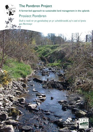
  • 3. What is the Pontbren Project? Beth yw Prosiect Pontbren? The Pontbren Project is an innovative approach to using woodland management and tree planting to improve the efficiency of upland livestock farming, led by a group of neighbouring farmers in mid-Wales. They went on to develop new on-farm uses for woodland products, and when it became clear that tree planting had not just improved farm businesses and wildlife habitats, but had also reduced water run-off during heavy rain, they invited scientists to investigate. Supported by government funding, this internationally important research has revealed why strategically located belts of trees are so effective at reducing the amount of water running off improved upland grasslands. The scientific data from Pontbren is now being used to study the effects of land use on bigger catchments prone to flooding. The Pontbren Project takes its name from the stream which drains this small headwater catchment of the River Severn. It is set in a rolling upland landscape of predominantly grassland farms about 10 miles to the west of Welshpool, in one of the wettest areas of the UK. Like most of upland Wales, the structure of farming changed during the 19th and 20th centuries. There was a shift from small-scale mixed farming to predominantly sheep farming on grassland, with suckler beef and a few small dairy enterprises. The farms had become fewer and larger, and the workforce had shrunk. This had the effect of simplifying the landscape and providing fewer habitats for wildlife, as field structures were rationalised and farm woodland lay unused. Mae Prosiect Pontbren yn ddull arloesol o ddefnyddio rheoli coetir a phlannu coed i wella effeithlonrwydd ffermio anifeiliaid pori yr ucheldir, wedi ei arwain gan grŴp o ffermwyr sy’n gymdogion yng Nghanolbarth Cymru. Aethant ymlaen i ddatblygu defnyddiau newydd ar fferm i gynnyrch coetir, a phan ddaeth yn amlwg fod plannu coed nid yn unig wedi gwella busnes y fferm a chynefinoedd bywyd gwyllt, ond hefyd wedi gostwng dŴr ffo yn ystod glaw trwm, gwahoddwyd gwyddonwyr i ymchwilio i hyn. Wedi eu cynorthwyo gan gyllid y llywodraeth, mae’r gwaith ymchwil rhyngwladol pwysig hwn wedi dangos pam fod lleiniau o goed wedi’u lleoli’n strategol mor effeithil wrth ostwng faint o ddŴr ffo oedd yn rhedeg oddi ar lastiroedd wedi’u gwella yn yr ucheldir. Defnyddir y data gwyddonol o Pontbren ar hyn o bryd i astudio effeithiau defnydd tir ar ddalgylchoedd mwy sy’n dueddol o ddioddef llifogydd. Mae Prosiect Pontbren yn cael ei enw o’r nant sy’n draenio dalgylch rhagnant fach o’r Afon Hafren. Mae’n sefyll yn nhirwedd tonnog yr ucheldir sy’n cynnwys ffermydd glaswelltir yn bennaf tua 10 milltir i’r gorllewin o’r Trallwng, yn un o ardaloedd gwlypaf y DU. Fel y rhan fwyaf o ucheldir Cymru, mae strwythur ffermio wedi newid yn ystod y 19eg a’r 20fed ganrif. Roedd symudiad o ffermio cymysg ar raddfa fach i ffermio defaid yn bennaf ar laswelltir, gyda gwartheg sugno eidion ac ychydig o fentrau llaeth. Prinhau gwnaeth y nifer o ffermydd llai tra bod eu tir yn cael eu llyncu gan ffermydd eraill i gynyddu erwau. Yn sgil hyn bu buddsoddiad mewn technoleg a pheirianwaith modern ac i’r perwyl hwn, lleihau ddaru’r gweithle. 4 5 The structure of farming changed during the 19th and 20th centuries. Mae strwythur ffermio wedi newid yn ystod y 19eg a’r 20fed ganrif. Pontbren Pontbren Pontbren Pontbren 1960s 1990s 1950s We were left with no other option than to develop our own scheme. Nid oedd gennym ddewis ond datblygu ein cynllun ein hunain.
  • 4. At the end of the 1990s the first group of three Pontbren livestock farmers decided to change the way they farmed. The aim was to reduce costs, make their farming systems more economically and environmentally sustainable in the longer term, and improve prospects for the next generation on these family farms. The key to these changes was to improve shelter by tree planting and restoring neglected woodland and hedges. Since then the collaborative efforts of the larger group of ten Pontbren farmers have gone much further, reinstating woodland management as an integral part of successful modern upland livestock farming systems, developing wood chip bedding systems applicable throughout Wales, and improving not just the economic value of their land but the environment in which they live and work. A key change was a shift from crossbred ewes to hardier, local sheep breeds that would not always need to be housed at lambing time or during the long winters. Although breeds such as the improved Welsh Mountain, Lleyn and Speckled Face are better adapted to grazing improved upland grassland at 300m it was evident that they would need more shelter on the pastures, particularly for the lambs. Most of the shelter on the farms had been removed decades earlier, as hedges were taken out when farms were amalgamated and grassland management intensified. Gwelliannau i gynnyrch da byw wedi eu harwain gan y ffermwyr. Ar ddiwedd y 1990au penderfynodd tri o ffermwyr da byw Pontbren newid eu dulliau ffermio. Y bwriad oedd gostwng eu costau, gwneud eu systemau ffermio yn fwy cynaliadwy yn economaidd ac amgylcheddol yn yr hirdymor, a gwella’r rhagolygon i’r genhedlaeth nesaf ar y ffermydd teuluol hyn. Yr allwedd i’r newidiadau hyn oedd gwella cysgod drwy blannu coed ac adfer coedlannau a gwrychoedd oedd wedi eu hesgeuluso. Ers hynny mae ymdrechion cydweithio gan grŴp o ddeg o ffermwyr Pontbren wedi mynd gryn dipyn ymhellach. Maent wedi adfer rheoli coetir fel rhan anhepgor o systemau ffermio da byw modern, sy’n llwyddiannus yn yr ucheldir, datblygu systemau haenau sglodion pren sy’n gymwys ledled Cymru, a gwella nid yn unig gwerth economaidd y tir ond hefyd yr amgylchedd ble maent yn byw ac yn gweithio. Newid allweddol oedd symud o famogiaid a groes fridiwyd i fridiau defaid lleol, gwytnach na fyddai angen eu rhoi dan do bob amser yn ystod wyna neu yn ystod y gaeafau hir. Er fod bridiau fel y Dafad Fynydd Cymru, Defaid Llŷn a’r Wyneb Brych amgen wedi addasu’n well i bori ar laswelltir yr ucheldir oedd wedi’i wella, roedd yn amlwg y byddent angen mwy o gysgod ar y borfa, yn enwedig ar gyfer yr Ŵyn. Roedd y mwyafrif o’r cysgod ar y ffermydd wedi ei dynnu ddegawdau yn ôl wrth i’r gwrychoedd gael eu tynnu pan oedd y ffermydd yn cael eu cyfuno a rheoli glaswelltir yn cael ei ddwysau. 6 Gydag erwau’r fferm a niferoedd stoc yn cynyddu, y nod oedd canolbwyntio ar effeithlonrwydd a hwylustod gwaith y fferm. Effaith hyn oedd symleiddio’r dirwedd drwy gynyddu maint y caeau a gyfrannodd at gynefinoedd fywyd gwyllt yn lleihau a dirywio ac fel roedd strwythur y caeau yn cael eu rhesymoli, hefyd, aeth defnydd ymarferol y coedlannau yn angof. Daeth yr ysgogiad i’r prosiect gan dri ffermwr oedd yn gymdogion oedd, yn 1997 yn ceisio gwneud busnes eu ffermydd yn fwy cynaliadwy drwy blannu gwrychoedd a choed i ddarparu mwy o gysgod i’r anifeiliaid oedd yn pori’r tir anghysbell a brochus ei thywydd. Y canlyniadau a lles amlwg y dull cydweithrediadol hwn oedd denu ffermwyr cyfagos, a ymunodd â’r tri cyntaf. Yn 2001 daeth ffermwyr Pontbren at ei gilydd fel grŴp o ddeg, yn rheoli cyfanswm o 1000 ha o dir fferm ar draws yr ardal. Ers hynny maent wedi gweithio ar amrywiaeth ehangach o fentrau amgylcheddol cydweithrediadol ac maent yn parhau i gyfarfod fel grŴp a gweithio gyda’i gilydd. Dros y 15 mlynedd mae menter coetir fferm Pontbren wedi bod yn ffocws mwy o waith ymchwil maes ar les amgylcheddol coetir fferm nag unrhyw le arall yn y DU. Y ffactor allweddol yn llwyddiant Pontbren fu’r ffermwyr – yn cydweithio fel grŴp, yn cydweithio gyda’r gwyddonwyr, ond pob un yn gwneud eu penderfyniadau rheoli tir eu hunain. Mae coed a choetiroedd erbyn hyn yn rhan hanfodol o reoli fferm ym Mhontbren ac mae corff o dystiolaeth wyddonol gynyddol i’r lles wrth ffermio anifeiliaid pori’r ucheldir, rheoli dŴr, bywyd gwyllt a thiriogaeth. Yma rydym yn edrych ar lwyddiannau a chanlyniadau’r deng mlynedd cyntaf ac yn dangos sut y gall dull Pontbren fod yn fodel i ddalgylchoedd eraill yn yr ucheldir. The impetus for the project came from three neighbouring farmers, who in 1997 were trying to make their farm businesses more sustainable by planting hedges and trees to provide more shelter for livestock grazing the steep, windswept land. The results and the evident benefits of a collaborative approach attracted neighbouring farmers, who joined the first three. In 2001 the Pontbren farmers came together as a group of ten, managing a total of 1,000 ha of farmland across the catchment. Since then they have worked on a wider range of collaborative environmental ventures, and continue to meet as a group and work together. Over the past 15 years the Pontbren farm woodland innovations have been the focus of more field research on the environmental benefits of farm woodland than anywhere else in the UK. The key factor in the success of Pontbren has been the farmers – collaborating as a group, cooperating with the scientists, but each remaining firmly in control of the management decisions on their own land. Trees and woods are now an integral part of farm management in Pontbren and there is a growing body of scientific evidence confirming the benefits for upland livestock farming, water management, wildlife and landscape. Here we look at the achievements and results of the first ten years and show how the Pontbren approach could be the model for other upland catchments. Farmer-led improvements to livestock production Gwelliannau i gynnyrch da byw wedi eu harwain gan y ffermwyr The impetus for the project came from three neighbouring farmers. Daeth yr ysgogiad i’r prosiect gan dri ffermwr. The key factor in the success of Pontbren has been the farmers. Y ffactor allweddol yn llwynddiant Pontbren fu'r ffermwyr. A key change was a shift to hardier stock which could spend less time indoors and require less supplementary feeding. Newid allweddol oedd symud o famagiaid a groes fridiwyd i fridiau defaid lleol, gwytnach a fyddai angen llai o fwydo ychwanegol. Pontbren 7 Pontbren Pontbren
  • 5. 98 The farmers knew where shelter was needed, and either did the fencing and planting themselves or employed local contractors to ensure that they supported local jobs. Suitable species of broadleaf shrubs and trees were chosen which provided the effective, slightly wind-permeable shelter needed throughout the year. Choosing locations for the new shelterbelts and hedges was an opportunity to rationalise some awkward field boundaries, fence out land that was difficult to manage such as steep valley sides, and improve access for stock gathering at the same time. Biosecurity was also an important consideration, and hedges or strips of woodland along farm boundaries had the additional benefit of reducing the risks of contact with other herds and flocks. Rather than attempt to improve the drainage of persistently wet patches of grassland where it was difficult to harvest silage and there were risks of liver fluke and foot rot, the farmers chose to fence off these areas and excavate ponds. Now there are 12 ponds across the Pontbren farms, which provide an additional supply of water piped to troughs in nearby fields; in one case the material excavated to create the pond was used to construct the bank of a new hedge. As more farmers joined the group the woodland and hedgerow renovation work produced a steady supply of woody material of varying quality. Where it was not suitable for sawmilling or firewood, the waste wood was chipped. Y gwrychoedd oedd yn dilyn y cyfuchlinau oedd y cyntaf i fynd fel rheol, gan ei gwneud yn haws i amaethu i fyny ac i lawr y llechwedd. Er fod y ffermwyr wedi plannu rhai lleiniau cysgod conifferaidd yn ystod y 1970au, roedd y rhain yn fylchog ac yn tueddu i gael eu dymchwel gan y gwynt. Roedd y da byw yn tueddu i chwilio am gysgod yn yr hen goetir oedd heb ei ffensio ar lechweddau serth y dyffrynnoedd, ble roedd yn anoddach i’w rheoli. Roedd y broses cydweithredu yn syml ac effeithiol. Roedd y ffermwyr yn cyfarfod bob wythnos, ac i ddechrau fe gawsant fap ar raddfa fawr map o’r fferm eu hunain er mwyn iddynt gynllunio gwelliannau. Arweiniodd hyn maes o law at y grŴp yn ffurfio cwmni cydweithredol wnaeth gychwyn mentrau busnes eraill fel marchnata cig, ond y brif elfen oedd y cydweithio anffurfiol rhwng grŴp o gymdogion o’r un feddylfryd, nid y broses gyfreithiol. Gyda’r mwyafrif o’r gwelliannau amgylcheddol wedi eu cwblhau mae’r grŴp yn dal i gyfarfod, ac maent nawr yn cydweithio ar ymchwilio i hanes eu ffermydd. Roedd y ffermwyr angen cymorth o’r tu allan gyda phlannu coetir newydd a manylion am reoli coetir, sgiliau nad oedd y mwyafrif ohonynt wedi bod eu hangen o’r blaen. Darparodd staff Coed Cymru y cymorth sgiliau hwn drwy gydol y prosiect ac, yn hanfodol, maent wedi arwain y ffermwyr CoedCymru drwy beth oedd ambell dro yn weinyddu cymhleth. Roedd Coed Cymru yn aml yn ymddwyn fel canolwr rhwng y ffermwyr ac awdurdodau’r llywodraeth oedd yn gyfrifol am amaethyddiaeth a chyllido a rheoleiddio coedwigaeth. Gwyddai’r ffermwyr ble roedd angen y cysgod, ac roeddynt naill ai’n gwneud y ffensio a’r plannu eu hunain neu’n cyflogi contractwyr lleol er mwyn sicrhau eu bod yn cefnogi swyddi yn lleol. Dewiswyd rhywogaethau addas o lwyni a choed oedd yn darparu cysgod effeithiol, oedd yn caniatáu ychydig o wynt drwyddo oedd ei angen gydol y flwyddyn. Roedd dewis lleoliadau newydd ar gyfer lleiniau cysgod a gwrychoedd newydd yn gyfle i resymoli rhai ffiniau caeau anodd, i ffensio tir oedd yn anodd i’w reoli fel llethrau dyffrynnoedd serth, a gwella mynediad i gasglu stoc ar yr un pryd. Roedd bioddiogelwch hefyd yn ystyriaeth bwysig, ac mae gwrychoedd neu lain o goed ar hyd ffiniau fferm gyda’r lles ychwanegol o leihau y perygl o gyswllt â buchesau a gyrroedd a diadelloedd eraill. Yn hytrach na cheisio gwella draeniad clytiau gwlyb o laswelltir ble roedd yn anodd cynaeafu silwair a ble roedd perygl o lyngyr yr iau a chlwy’r traed, dewisodd y ffermwyr osod ffens o gwmpas yr ardaloedd hyn a chloddio’r pyllau dŴr. The hedges running along the contours were often the first to go, to make it easier to cultivate up and down the slope. Although the farmers had planted some coniferous shelterbelts in the 1970s, these had become gappy and prone to windblow, and the livestock tended to seek shelter instead in the older unfenced woodland on steep- sided valleys where they were more difficult to manage. The collaborative process was simple and effective. The farmers met every week and initially each was given a large-scale map of their own farm on which to plan the improvements. This eventually led to the group forming a cooperative which took on other business ventures such as meat marketing, but the key element has been informal collaborative working among a group of like- minded neighbours, not the legal processes. With most of the environmental improvements completed the group continues to meet, and they are now jointly researching the history of their farms. The farmers did need outside help with planning the new woodland and the details of woodland management, skills which most of them had not required before. Coed Cymru staff have provided this skilled support throughout the project and, crucially, have guided the farmers through the sometimes complex administration. Often Coed Cymru has acted as mediator between the farmers and the government authorities responsible for agricultural and forestry funding and regulation. Choosing locations for the new shelterbelts and hedges was an opportunity to rationalise some awkward field boundaries. Roedd dewis lleoliadau newydd ar gyfer lleiniau cysgod a gwrychoedd newydd yn gyfle i resymoli rhai ffiniau caeau anodd. Now there are 12 ponds across the Pontbren farms which provide an additional supply of water. Erbyn hyn mae 12 o byllau dwˆ r ar draws ffermydd Pontbren sy’n darparu cyflenwad ychwanegol o ddwˆ r. CoedCymru CoedCymru Woodland along farm boundaries had the additional benefit of reducing the risks of contact with other herds and flocks. Lain o goed ar hyd ffiniau fferm gyda’r lles ychwanegol o leihau y perygl o gyswllt â buchesau a gyrroedd a diadelloedd eraill. Pontbren
  • 6. 10 Opportunities for game shooting have improved at Pontbren along with the woodland and wetland habitats, and could be a potential source of additional income in the future, if the farmers chose to let the shooting rights. Erbyn hyn mae 12 o byllau dŴr ar draws ffermydd Pontbren, sy’n darparu cyflenwad ychwanegol o ddŴr wedi ei gludo â phibau i gafnau mewn caeau cyfagos; mewn un achos defnyddiwyd y deunydd a gloddiwyd o’r pwll dŴr i adeiladu’r clawdd i wrych newydd. Wrth i fwy o ffermwyr ymuno â’r grŴp cynyddu wnaeth y gwaith o adnewyddu’r coetir a’r cloddiau ac yn ei dro ddarparodd gyflenwad cyson o gynnyrch a deunydd coediog o wahanol ansawdd. Ble nad oedd yn addas ar gyfer melinau llifio neu goed tân, roedd y coed gwastraff yn cael ei asglodi. Fel gyda’r rhan fwyaf o ffermydd anifeiliaid pori eraill yng Nghymru, roedd ffermwyr Pontbren yn dibynnu ar wellt wedi ei brynu fel gwasarn gaeaf i wartheg a defaid, weithiau wedi ei brynu o gyn belled â Swydd Lincoln. Penderfynwyd ceisio defnyddio sglodion coed fel gwasarn i’r anifeiliaid. Nid oedd hyn wedi ei wneud o’r blaen ond, ar ôl proses o brofi a methu, profodd i fod yn ffordd amgen i wellt. Yr allwedd i lwyddiant yw cynnwys lleithder a maint y sglodion, ond nid yw’r math o goed yn bwysig. Rhaid i’r sglodion pren fod yn sych, llai na 20% o leithder ac o’r maint cywir oherwydd os yw’n rhy fach mae’n tueddu i grawennu, yn arbennig dan ddefaid, ac os yw’n rhy fawr nid yw’n ddigon amsugnol. Un o fanteision mawr gwasarn sglodion coed yw, yn annhebyg i wellt, y gellir ei gompostio, ei sgrinio a’i ail ddefnyddio sawl gwaith. Mae gwres y broses gompostio yn lladd pathogenau a hadau chwyn, a phan ei fod yn y diwedd yn torri i lawr, ar ôl tri neu fwy o gylchrediadau o faetholion sy’n cronni fel gwasarn anifeiliaid, mae’n darparu deunydd tyfu ffrwythlon sy’n rhydd o fawn. Dilynwyd yr ymdrechion arloesol hynny ym Mhontpren gan brofion dan reolaeth o wasarn sglodion pren a chompost gan brifysgolion a chanolfannau ymchwil mewn rhannau eraill o Gymru, oedd yn cadarnhau ei fod yn ddewis amgen da i wellt fel gwasarn i anifeiliaid, gan hybu safonau iechyd a glendid uwch mewn defaid a gwartheg1 . Aeth un o ffermwyr Pontbren gam ymhellach wrth ailgylchu, a defnyddio’r compost sglodion pren olaf un fel sylfaen i’w ddefnyddio mewn meithrinfa goed yn tyfu planhigion i ffermwyr eraill yn y grŴp, a marchnata’r gweddill. Ar gais Llywodraeth Cymru, cynhaliodd saith o’r ffermydd arbrawf i asesu effaith gostwng niferoedd defaid ar gyllid y ffermydd. Cadwodd y ffermwyr eu cyfrifon ar agor drwy’r cyfnod hwn, gan ddangos costau integreiddio rheoli coetir i ffermio’r ucheldir a’r manteision i’w busnes fferm, ac roedd rhain ar gael i ymchwilwyr y llywodraeth. CoedCymru Pontbren After a process of trial and error, woodchip bedding proved to be a successful alternative to straw. Ar ôl proses o brofi a methu, profwyd fod sglodion coed yn ddewis amgen llwyddiannus fel gwasarn i'r anifeiliaid, yn lle gwellt. Nid yw’r manteision busnes yn cael eu cyfyngu i wella effeithiolrwydd y mentrau anifeiliaid pori. Mae’r ffermwyr yn teimlo fod yr integreiddio llwyddiannus o reoli coetir i ffermio anifeiliaid yr ucheldir wedi gwneud eu ffermydd yn ddiogel i’r dyfodol, trwy wella gwerth cyfalaf y tir, ei wneud yn fwy gwydn i effeithiau digwyddiadau eithafol y tywydd fel mae’r hinsawdd yn newid, ac yn gostwng yn sylweddol y risg o doriadau damweiniol yn safonau bioddiogelwch a llygredd dŴr. Mae cyfleoedd helwriaeth wedi gwella ym Mhontbren ynghyd â chynefinoedd coetir a gwlypdir, a gall hyn fod yn ffynhonnell posibl o incwm ychwanegol yn y dyfodol, pe bai’r ffermwyr yn dewis gosod yr hawliau saethu. Like most other livestock farms in Wales, the Pontbren farmers relied on bought-in straw as winter bedding for cattle and sheep, sometimes brought from as far away as Lincolnshire. They decided to try using woodchip as livestock bedding. This had not been done before but, after a process of trial and error, it proved to be a successful alternative to straw. The keys to success are the moisture content and size of the woodchips, but the type of timber does not seem to matter. The woodchip must be dry, less than 20% moisture content, and of the right size because if too small it tends to cake together, particularly under sheep, and if too large it is not sufficiently absorbent. One of the big advantages of woodchip bedding is that, unlike straw, it can be composted, screened and reused several times. The heat of the composting process kills pathogens and weed seeds and when it finally breaks down, after three or more cycles of accumulating nutrients as livestock bedding, it provides a fertile peat-free growing material. These pioneering efforts at Pontbren were followed up by controlled trials of woodchip bedding and compost by universities and research centres in other parts of Wales, which confirmed it is a good alternative to straw as livestock bedding, promoting high standards of health and cleanliness in sheep and cattle1 . One of the Pontbren farmers went a stage further in recycling, and used the final woodchip compost as the basis of a tree nursery growing plants for the other farmers in the group, and marketing the surplus. At the request of Welsh Government, seven of the farms conducted an experiment to assess the effect of reducing sheep numbers on farm finances. The farmers kept open accounts during this period, showing the costs of integrating woodland management into upland farming and the benefits to their farm businesses, and these have been made available to government researchers. The business benefits are not confined to the improved efficiency of the livestock enterprises. The farmers feel that the successful integration of woodland management into upland livestock farming has also ‘future-proofed’ their farms, by improving the capital value of the land, making it more resilient to the effects of severe weather events as the climate changes, and substantially reducing the risk of accidental breaches of biosecurity and water pollution standards. EnvironmentAgencyWales Growing conditions can be harsh in the uplands ofWales, and planting shelterbelts and hedges is a long-term investment. Gall amgylchiadau tyfu fod yn llym yn ucheldiroedd Cymru, ac mae plannu lleiniau cysgodol a gwrychoedd yn fuddsoddiad hirdymor. 11
  • 7. 12 the requirements of standard grant schemes. The wildlife benefits are impressive for both woodland and wetlands, and the process of landscape simplification has been reversed. When the tree planting began only 1.5% of the Pontbren land was woodland, mostly neglected riparian woodland and small areas of larch, but 10 years later 120,000 new trees and shrubs have been planted, 16.5 km of hedges have been created or restored and nearly 5% of the Pontbren land is now woodland. This is a major achievement in just 10 years, with no loss of agricultural productivity. The Pontbren farmers have not finished yet. They intend to continue planting trees and hedgerows and managing their woodland, increasing the potential for long-term environmental benefits on these upland farms. Growing conditions can be harsh in the uplands of Wales, and planting shelterbelts and hedges is a long-term investment. The Pontbren farmers realised that it was just as important to choose hardy woodland plants well adapted to the local conditions as it had been to invest in native sheep breeds. With advice from Coed Cymru* the farmers planted a range of broadleaf species suited to the ground conditions, with the aim of creating more natural mixed woodland. This would provide all-year-round shelter, new wildlife habitats and landscape diversity, and be more resilient to the challenges of a changing climate in future. Coetiroedd, bywyd gwyllt a thirwedd – llwyddiannau’r 10 mlynedd cyntaf Cynlluniwyd gwelliannau coetir ym Mhontbren yn ofalus i gyflawni bwriadau amaethyddol y ffermwyr trwy greu gorchudd coetir oedd mor naturiol â phosibl, ac a fyddai’n byw’n hir ac yn hawdd i’w gynnal ar ôl y cyfnod sefydlu cychwynnol. Roedd plannu gwrychoedd a rheoli yn gofyn am yr un dull, a chrëwyd pyllau dŴr newydd oedd er lles ffermio a bioamrywiaeth. Roedd hyn yn gofyn am ddull anghonfensiynol o sefydlu coetir, o anghenraid yn wahanol iawn i goedwigwr yn plannu cnwd o goed. Mae’r manylion wedi eu mireinio dros y blynyddoedd ym Mhontbren, gan ddefnyddio stoc plannu wedi eu tyfu gan y ffermwyr yn eu meithrinfa goed eu hunain a gan gyflenwyr lleol eraill. Cefnogwyd y gwaith amgylcheddol gan amrywiaeth o ffynonellau cyllido, nad oedd yn ffitio’n hawdd i ofynion cynlluniau grantiau safonol. Pontbren Mae’r manteision i fyd natur yn drawiadol i goetir a gwlypdiroedd, ac mae’r broses o symleiddio’r tirwedd wedi ei wrth-droi. Pan ddechreuwyd ar blannu coed dim ond 1.5% o dir Pontbren oedd yn goetir, y rhan fwyaf yn goetir glannau afon wedi ei esgeuluso ac ardaloedd bach o goed llarwydden, ond ddeng mlynedd yn ddiweddarach mae 120,000 o goed newydd a llwyni wedi eu plannu. Mae 16.5 km o wrychoedd wedi eu creu neu eu hadnewyddu ac mae bron i 5% o dir Pontbren bellach yn goetir. Mae hyn yn llwyddiant mawr mewn dim ond 10 mlynedd heb golli dim cynnyrch amaethyddol. Nid yw ffermwyr Pontbren wedi gorffen eto. Maent yn bwriadu plannu coed a gwrychoedd a rheoli eu coetiroedd, gan gynyddu’r potensial i fanteision amgylcheddol ar y ffermydd hyn yn yr ucheldir. Gall amgylchiadau tyfu fod yn llym yn ucheldiroedd Cymru, ac mae plannu lleiniau cysgodol a gwrychoedd yn fuddsoddiad hirdymor. Roedd ffermwyr Pontbren yn sylweddoli ei fod yr un mor bwysig i ddewis planhigion coetir gwydn wedi eu haddasu’n dda i amgylchiadau lleol, ag yr oedd i fuddsoddi mewn bridiau defaid cynhenid. Gyda chyngor gan Goed Cymru* plannodd y ffermwyr ystod o rywogaethau llydanddail oedd yn gweddu i amodau’r tir, gyda’r bwriad o greu coetir mwy naturiol gymysg. Fe fyddai hwn yn darparu gwarchodfa gydol y flwyddyn, cynefinoedd byd natur newydd ac amrywiaeth o dirwedd, ac fe fyddai hefyd yn fwy gwydn i her newid hinsawdd yn y dyfodol. Woodland, wildlife and landscape – achievements of the first 10 years The woodland improvements at Pontbren were carefully designed to achieve the farmers’ agricultural objectives by creating woodland cover that was as natural as possible, and would be long-lived and easy to maintain after the initial establishment period. The hedgerow planting and management took a similar approach, and new ponds were created which benefitted both farming and biodiversity. This required a rather unconventional approach to woodland establishment, necessarily very different from that of a forester planting a timber crop. The details have been refined over the years at Pontbren, using planting stock grown by the farmers in their own tree nursery and other local suppliers. A range of different sources of funding supported this environmental work, which did not fit easily into New ponds benefited both farming and biodiversity. Pyllau dwˆ r newydd lles ffermio a bioamrywiaeth. *http://www.coedcymru.org.uk/ *http://www.coedcymru.org.uk/ 13 High density mixed planting requires very careful maintenance in the first three years. Mae plannu cymysg, dwysedd uchel yn gofyn am gynnal gofalus yn ystod y dair mlynedd gyntaf.
  • 8. 15 • Long-lived but slower-growing large trees that will provide timber in 40–100 years’ time, for example sessile oak (Quercus petrea), the native oak of the western uplands of Wales, ash (Fraxinus excelsior) an important woodland species which survives at higher altitudes than oak in Wales, and sweet chestnut (Castanea sativa); • Easily coppiced shade tolerant shrubs that will do well inside the wood, especially hazel (Corylus avellana) and holly (Ilex aquifolium), and on the edges where there is more light, bird cherry (Prunus padus), field maple (Acer campestre), hawthorn (Crataegus monogyna) and blackthorn (Prunus spinosa). Experience has shown that these mixtures do best if planted all at the same time, but high density mixed planting of this type requires very careful maintenance in the first three years, and particular attention to weeding. The other critical issue is using planting stock of the right provenance, suited to the more challenging growing conditions above 240m. • Coed sy’n byw’n hir ond sy’n goed mawr yn tyfu’n arafach ac a fydd yn darparu coed mewn 40–100 o flynyddoedd, er enghraifft derw digoes (Quercus petrea; sessile oak), derwen gynhenid ucheldir gorllewinol Cymru, yr onnen (Fraxinus excelsior; ash) rhywogaeth coetir pwysig sy’n goroesi ar uchderau uwch na’r dderwen yng Nghymru, a’r castanwydden bêr (Castanea sativa; sweet chesnut); • Prysgwydd a wnaiff brysgoedio’n hawdd ac sy’n goddef cysgod a fydd yn gwneud yn dda y tu fewn i’r coed, yn arbennig y gollen (Corylus avellana; hazel) a’r celyn (Ilex aquifolium; holly), ac ar yr ymylon ble mae mwy o olau, coed ceirios yr adar (Prunus padus; bird cherry), masarnen fach (Acer campestre; field maple), y ddraenen wen (Crataegus monogyna; hawthorn) a’r ddraenen ddu (Prunus spinosa; blackthorn). Mae profiad yn dangos fod y cymysgedd hwn yn gwneud orau os ydynt wedi eu plannu ar yr un pryd, ond mae plannu cymysg, dwysedd uchel o’r math yma yn gofyn am gynnal gofalus yn ystod y dair mlynedd gyntaf, a thalu sylw arbennig i’r chwynnu. Y mater arall sydd o bwys mawr yw defnyddio stoc plannu o’r tarddiad cywir, sy’n gweddu i amodau tyfu mwy heriol uwchben 240m. Because the primary aim was not to grow a crop of timber there was no need to follow the traditional geometry or silvicultural systems of plantation forests. Instead, shelterbelts of mixed broadleaved trees were planted at unconventionally high densities together with a large proportion of shrubs. Typical woodland species are planted in the centre, with hedge species on either side to provide shelter quickly before the new woodland understory develops. They are easily coppiced to maintain this function in the longer term. Species used in the mixed planting at Pontbren fall into three broad groups, each with a particular role in the woodland: • Quick-growing pioneer tree species which thrive in open conditions such as silver birch (Betula pendula), downy birch (B. pubescens), rowan (Sorbus aucuparia) and on wetter areas black alder (Alnus glutinosa), and for the most exposed sites aspen (Populus tremula) and willow (Salix spp.), but planting the latter away from field drains which the roots might block; Oherwydd mai nid y bwriad cyntaf oedd tyfu cnwd o goed nid oedd angen dilyn geometreg traddodiadol neu systemau coedamaeth fforestydd planhigfa. Yn hytrach, plannwyd lleiniau cysgodol o goed cymysg llydanddail ar ddwyster uchel iawn, anghonfensiynol ynghyd â chyfartaledd uchel o lwyni. Mae cynefinoedd coetiroedd nodweddiadol yn cael eu plannu yn y canol, gyda rhywogaethau gwrychoedd ar bob ochr i gynnig lloches cyflym cyn bod isdyfiant y coetir newydd wedi datblygu ac wedyn gallant gael eu prysgoedio’n hawdd i gynnal y swyddogaeth hon yn y tymor hir. Mae’r rhywogaethau a ddefnyddir yn y plannu ym Mhontbren yn syrthio i dri grŴp eang, bob un â rhan arbennig yn y coetir: • Rhywogaeth coed arloesol sy’n tyfu’n gyflym ac yn ffynnu mewn amgylchiadau agored er enghraifft y fedw arian (Betula pendula; silver birch), y fedw lwyd (B. Pubescens; downy birch), y griafolen (Sorbus aucuparia; rowan) ac ar dir gwlypach y wernen (Alnus glutinosa; alder), ac ar gyfer y mannau mwyaf agored yr aethnen (Populus tremula; aspen) a’r helyg (Salix spp.), ond gan blannu’r olaf oddi wrth traeniau’r cae gan y gall y gwreiddiau flocio traeniau; CoedCymru Administering the Enfys fund on behalf of theWales Council forVoluntary Action involved setting up a self-regulating system of accounting and quality control. Dderbynniodd y prosiect gyllid oddi wrth Enfys, a symbylodd hyn y grwp i ffurfio cwmni cydweithredol, a fu’n gweinyddu’r cyllid ar ran Cyngor Gweithredu Gwirfoddol Cymru. 14 CoedCymru Funding from government grant schemes had to be adjusted as a special case to accommodate the innovative approach,in particular the high cost of fencing long,narrow strips of woodland. Bu’n rhaid addasu gofynion cynlluniau grant y llywodraeth fel achos arbennig i ymgymhwyso ar gyfer y dull arloesol yma o sefydlu coetir,yn arbennig y gost uchel o ffensio lleiniau hir,cul o goetir. 2011 2005
  • 9. y dull arloesol o sefydlu coetir ym Mhontpren, yn arbennig y gost uchel o ffensio lleiniau hir, cul o goetir. Teneuwyd coetiroedd oedd eisoes yn bodoli ble roedd hynny’n angenrheidiol a chawsant eu cyfoethogi gan rywogaethau cynhenid, er enghraifft coed derw, gyda’r bwriad o reoli hirdymor fel yswiriant parhaol. Prysgoediwyd yr hen wrychoedd drwy fôn docio, cau’r bylchu a’u hadnewyddu fel terfynau diogel rhag anifeiliaid ac fel lloches effeithiol. Gwnaed ymdrechion sylweddol i ganfod y defnydd gorau o’r coed a gynhyrchwyd o adnewyddu’r hen goetir a gwrychoedd. Aeth peth i felin lifio, gan ddarparu digon o ddeunydd i godi estyniad i un o’r tai fferm, a gwerthwyd llawer o’r sycamorwydden i grefftwyr coed lleol. Ar ôl y gormodedd ar y cychwyn dirywiodd cynnyrch y coetiroedd yn arw, ond byddant yn parhau i ddarparu cyflenwad bach o danwydd a sglodion coed o’r prysgoedio. Daeth y manteision i fyd natur o’r cynefinoedd newydd a’r rhai oedd wedi’u gwella ar dirwedd y ffermydd yn amlwg i’r ffermwyr yn gyflym iawn, ac nid oeddent wedi’u cyfyngu i’r coetir. Roedd ffensio y coetiroedd glannau’r afon yn golygu nad oedd gan yr anifeiliaid bellach agoriad i’r nentydd. Roedd yr ymyrraeth cyfyngedig yn caniatáu i lystyfiant glan yr afon i ddatblygu ac i’r nentydd gael proffil mwy naturiol gyda chrychdonnau a phyllau, a ddefnyddir gan frithyll a dyfrgwn. 16 17 had to be adjusted as a special case to accommodate the innovative approach to woodland establishment at Pontbren, in particular the high cost of fencing long, narrow strips of woodland. The existing woodland was thinned where necessary and enriched with native species such as oak, with the aim of long-term management as continuous cover. The old hedges were coppiced, gapped up and restored as stockproof boundaries and effective shelter. Considerable efforts were made to find the best use for the timber produced from restoring old woodland and hedgerows. Some went for sawmilling, providing enough material to build an extension to one of the farmhouses, and much of the sycamore was sold to local woodworking craftsmen. After this initial surplus the productivity of the woodland declined sharply, but it will continue to provide a small supply of fuel and woodchip from coppiced material. The wildlife benefits of the new and improved habitats within the farmed landscape became evident to the farmers very quickly, and were not confined to the woodland. Fencing the riparian woodlands meant that stock no longer had access to the streams. The reduced disturbance allowed bankside vegetation to develop and the streams to resume a more natural profile with riffles and pools, which are used by trout and otters. Problems with plants supplied of the wrong provenance, which were not detected until these failed to establish, was one of the reasons that encouraged the farmers to set up their own tree nursery. Here they propagated trees and shrubs from seed and vegetative material gathered on the farms, successfully providing for their own needs plus a surplus to sell. When central and local government grants for tree and hedge planting on farms were curtailed, the Pontbren and other small nurseries supplying local farmers closed (although the nursery beds of composted woodchip continue to produce fine crops of vegetables at Pontbren). The costs of the initial woodland planting and hedge restoration projects were borne entirely by the farm businesses, but scaling up the environmental improvements across 10 farms was only possible with additional funding. The first came from LEADER, followed by Scottish Power’s Rural Care Scheme. Funding for hedgerows, ponds and wetlands came from the lottery-funded programme Enfys and this prompted the group of 10 to form a cooperative, which administered the Enfys fund on behalf of the Wales Council for Voluntary Action. This involved setting up a self-regulating system of accounting and quality control. Woodland work was supported by funding from government grant schemes, but the requirements Un o’r rhesymau a hybodd y ffermwyr i ddechrau eu meithrinfa goed eu hunain oedd y problemau gyda phlanhigion a gyflenwyd o’r tarddiad anghywir na chawsant eu canfod nes iddynt fethu â sefydlu. Yma roeddynt yn tyfu a lluosogi coed a llwyni o hadau a deunydd llystyfiannol a gasglwyd ar y ffermydd, gan ddarparu’n llwyddiannus ar gyfer eu hanghenion eu hunain a gyda choed dros ben i’w gwerthu. Pan gwtogwyd grantiau’r llywodraeth i blannu coed a gwrychoedd ar ffermydd, caewyd meithrinfa Pontbren a meithrinfeydd bach eraill oedd yn cyflenwi ffermwyr lleol (er bod y gwelyau meithrinfa sglodion coed wedi eu compostio yn parhau i gynhyrchu cnydau da o lysiau ym Mhontbren. Busnesau’r fferm fu’n dwyn costau prosiect plannu cychwynnol y coetir ac adnewyddu’r gwrychoedd yn gyfangwbl, ond doedd mynd i’r afael â gwelliannau amgylcheddol dros 10 fferm ddim ond yn bosibl gyda chyllid ychwanegol. Daeth y cyntaf o LEADER, wedi ei ddilyn gan gyllid Cynllun Gofal Gwledig Scottish Power. Daeth y cyllid ar gyfer y gwrychoedd, y pyllau dŴr a’r gwlypdiroedd gan Enfys, rhaglen wedi ei chyllido gan y loteri, a symbylodd hyn y grŴp o 10 i ffurfio cwmni cydweithredol, a fu’n gweinyddu cyllid Enfys ar ran Cyngor Gweithredu Gwirfoddol Cymru. Roedd hyn yn golygu sefydlu system hunan-reoledig o gyfrifyddu a rheoli ansawdd. Cafodd gwaith yn y coetir ei gynorthwyo gan gyllid cynlluniau grantiau’r llywodraeth, ond bu’n rhaid addasu’r gofynion fel achos arbennig i ymgymhwyso ar gyfer The old hedges were coppiced, gapped up and restored as stockproof boundaries and effective shelter. Prysgoediwyd yr hen wrychoedd drwy fôn docio, cau’r bylchu a’u hadnewyddu fel terfynau diogel rhag anifeiliaid ac fel lloches effeithiol. Pontbren Pontbren Pontbren Problems with plants supplied of the wrong provenance encouraged the farmers to set up their own tree nursery. Un o’r rhesymau a hybodd y ffermwyr i ddechrau eu meithrinfa goed eu hunain oedd y problemau gyda phlanhigion a gyflenwyd o’r tarddiad anghywir.
  • 10. 18 19 There have also been sightings of one of the UK’s most endangered mammals, the water vole. Pontbren is home to many wild birds including 12 species of particular conservation importance – hen harrier, skylark, linnet, barn owl, lapwing, snipe, kingfisher, curlew, red kite, cuckoo, stonechat and woodcock. The farmers believe that their efforts to control some troublesome predators, including magpies, have helped to improve the breeding success of ground nesting birds. The landscape changes at Pontbren are interesting because the woods, hedges and ponds have restored some of the landscape pattern and diversity that had been lost during the 20th century. That said, the work has formed a fully functioning 21st century landscape, and was not an attempt to recreate an historic landscape that was the product of a very different farming system and social structure. The farmers have researched the history of their farms over the past 170 years and this shows just how much the land use has changed. At the time of the Tithe Survey in 1842, there were 26 farms and smallholdings in the Pontbren area. The land that is now Pontbren was then owned mainly by two large estates and, except for some areas of woodland, was worked by tenant farmers. The census returns of 1841 give a total of 151 people living and working there. By the early 20th century the pattern of land ownership had changed, the large estates were breaking up and the farm holdings were being sold off, very often to the occupying tenants. The number of holdings decreased, as the smaller ones were gradually amalgamated with larger neighbours. The extensive areas of common grazing, or sheep walks, were also divided up and added to the individual holdings. This trend of increasing size of farms has continued into the 21st century. Today the average size of a Pontbren holding is 101 hectares, compared to just 21.6 hectares in 1842. There are now ten owner-occupied farms and 34 individuals living at Pontbren. Half of the farms have been occupied by the same family for generations. Pontbren has not always been grassland. In 1842 around 40% of the Pontbren land was classed as arable, and oats were grown to ‘fuel’ the working horses. Today there is no arable land at Pontbren and no cereals are grown for the local corn mills, and modern machinery and diesel have replaced the horses and the oats. Gwelwyd hefyd un o famaliaid sydd mewn mwyaf o berygl o ddifodiant, y llygoden ddŴr. Mae Pontbren yn gartref i lawer o adar gwyllt gan gynnwys 12 rhywogaeth o bwysigrwydd cadwriaethol arbennig – boda tinwyn, ehedydd, llinos, tylluan wen, cornchwiglen, gïach, glas y dorlan, gylfinir, barcud coch, y gog, clochdar y cerrig a’r cyffylog. Cred y ffermwyr fod eu hymdrechion i reoli rhai ysglyfaethwyr trafferthus, gan gynnwys piod, wedi helpu i wella llwyddiant magu adar sy’n nythu ar y llawr. Mae’r newidiadau yn y tirwedd ym Mhontbren yn ddiddorol, oherwydd mae’r coed, y gwrychoedd a’r pyllau dŴr wedi adfer peth o batrwm ac amrywiaeth tirwedd a gafodd ei golli yn ystod yr 20fed Ganrif. Ond, wedi dweud hynny, mae’r gwaith wedi creu tirwedd ymarferol llawn ar gyfer yr 21ain Ganrif. Nid oedd yn ymdrech i ail-greu tirwedd hanesyddol a oedd yn gynnyrch system oes wahanol iawn o ffermio a strwythur cymdeithasol. Mae’r ffermwyr wedi ymchwilio hanes eu ffermydd dros y 170 mlynedd diwethaf ac mae hyn yn dangos gymaint mae defnydd y tir wedi newid. Adeg Arolwg y Degwm yn 1842 roedd 26 o ffermydd a thyddynnod yn ardal Pontbren. Roedd y rhan fwyaf o’r tir sydd bellach ym Mhontbren ym meddiant dwy stad fawr ac, ar wahân i rai ardaloedd o goetir, yn cael eu gweithio gan denantiaid o ffermwyr. Mae canlyniadau cyfrifiad 1841 yn rhoi cyfanswm o 151 o bobl yn byw ac yn gweithio yno. Erbyn blynyddoedd cynnar yr 20fed Ganrif roedd patrwm meddiant y tir wedi newid, roedd y stadau mawr yn chwalu ac roedd y tyddynnod yn cael eu gwerthu, yn aml iawn i’r tenantiaid oedd yn byw ynddyn nhw. Aeth y nifer o dyddynnod yn llai fel roedd y rhai lleiaf yn cael eu cyfuno â chymdogion mwy. Roedd yr ardaloedd eang o dir comin neu’r cynefinoedd defaid hefyd yn cael eu rhannu a’u hychwanegu at dyddynnod unigol. Bu i’r duedd o faint ffermydd yn cynyddu barhau i’r 21ain Ganrif. Heddiw maint tyddyn Pontbren ar gyfartaledd yw 101 hectar, o’i gymharu â dim ond 21.6 hectar yn 1842. Erbyn hyn mae deg fferm yn berchen ddeiliad a 34 unigolyn yn byw ym Mhontbren. Mae hanner y ffermydd wedi bod ym meddiant yr un teulu ers cenedlaethau. Nid yw Pontbren bob amser wedi bod yn lastir. Yn 1842 roedd tua 40% o dir Pontbren yn cael ei ddosbarthu fel tir âr a thyfwyd ceirch yno fel ‘tanwydd’ i geffylau gweithio. Heddiw nid oes tir âr ym Mhontbren ac ni thyfir grawnfwyd ar gyfer y melinau corn lleol, ac mae peiriannau cyfoes a disel wedi cymryd lle’r ceffylau a’r ceirch. Pontbren Pontbren is home to many wild birds including 12 species of particular conservation importance. Mae Pontbren yn gartref i lawer o adar gwyllt gan gynnwys 12 rhywogaeth o bwysigrwydd cadwriaethol arbennig. The wildlife benefits of the new and improved habitats within the farmed landscape became evident to the farmers very quickly, Ddaeth y manteision i fyd natur o’r cynefinoedd newydd a’r rhai oedd wedi’u gwella ar dirwedd y ffermydd yn amlwg i’r ffermwyr yn gyflym iawn The changes at Pontbren have restored some of the landscape diversity lost during the 20th century while also creating a landscape fit for farming today. Mae’r newidiadau ym Mhontbren wedi adfer peth o batrwm ac amrywiaeth tirwedd a gafodd ei golli yn ystod yr 20fed ganrif tra’n creu tirwedd ymarferol llawn ar gyfer yr 21ain ganrif. Pontbren WTPL/RoryFrancis
  • 11. 20 21 The farmers were closely involved throughout the research work and helped to develop a GIS based visualisation tool that can be used to support discussions of how to optimise future land use to deliver a range of ecosystem services from productive upland farms. After major floods in England and Wales during 2000 and 2001 there was concern that the causes might include soil compaction as a result of modern farming practices. It was thought the effect might be similar to that of additional buildings and paving within urban areas, reducing the capacity of the soil to absorb water in heavy rain. This in turn can lead to rapid run-off into streams and rivers, and local flooding. A comprehensive study of the scientific literature in 2004 concluded that there was insufficient evidence on the flood impacts of changes in rural land use and management, and called for more research2 . The huge research programme at Pontbren began with a chance observation by Coed Cymru’s director, who was walking across sheep grazed pasture during heavy rain on a visit to one of the farms in 2001. He noticed that water running downhill across the grazed fields disappeared as soon as it reached the edge of the new woodland, and the farmers confirmed that they too had noticed this. Dechreuodd rhaglen ymchwil enfawr ym Mhontbren drwy sylw ar hap gan Gyfarwyddwr Coed Cymru, oedd yn digwydd cerdded ar draws porfa defaid yn ystod glaw trwm ar ymweliad ag un o’r ffermydd yn 2001. Sylwodd fod y dŴr oedd yn llifo i lawr allt ar draws y caeau oedd wedi’u pori yn diflannu cyn gynted ag y cyrhaeddodd ymylon y coetir newydd, ac i’r ffermwyr gadarnhau eu bod hwythau hefyd wedi sylwi ar hyn. Gwahoddwyd Canolfan Ecoleg a Hydroleg Bangor i ddilyn hyn gydag ymchwil syml o’r pridd, a chymerasant fesuriadau i gymharu cyflymder roedd y pridd dan y borfa a’r pridd yn y coetir oedd wedi ei ffensio, yn gallu amsugno’r dŴr. Roedd y canlyniadau’n drawiadol, gan ddangos fod graddfeydd yr ymdreiddiad y tu fewn i’r coetir yn 60 gwaith y rhai ar y borfa ddeng metr i ffwrdd, a bod yr effeithiau manteisiol yn ymestyn y tu draw i ymylon y coetir3 . Roedd y rhesymau’n aneglur, a doedd yr ymchwil blaenorol fawr o help, oherwydd bod llawer ohono yn ymwneud â’r trofannau. Roedd yr ymchwil cyfyngedig yn Ewrop yn tueddu i ganolbwyntio ar goetir neu ar dir fferm neu, yn y DU, ar blanhigfeydd conifferaidd ar bridd mawnog wedi’i ddraenio. Roedd Pontbren yn gwbl wahanol, oherwydd roedd lleiniau o goed llydanddail cynhenid wedi’u plannu ar lastir ar ogwydd wedi ei wella. Cytunodd y ffermwyr yn barod iawn i waith ymchwil mwy manwl, gydag offer monitro wedi ei godi ac arbrofion wedi eu trefnu ar eu tir, er y byddai hyn yn golygu peth ymyrraeth â’u gwaith a mynediad rheolaidd gan y staff gwyddonol. CentreforEcologyandHydrology CentreforEcologyandHydrology The infiltration rates inside the woodland were 60 times those on the pasture ten metres away. Graddfeydd yr ymdreiddiad y tu fewn i’r coetir yn 60 gwaith y rhai ar y borfa ddeng metr i ffwrdd. Innovative research on the role of woods in catchment management The farmers observed that their tree planting had unexpected benefits in reducing water run-off from improved grassland, and they were keen to have this confirmed by independent research. Their interest led to a major hydrological research programme at Pontbren, which has provided important new evidence of the role of trees in flood control. The Pontbren data is now being used elsewhere in the UK to develop better ways of predicting the impact of upland land use on flooding. This is important because predictive climate models suggest that in future Wales will see more frequent storms with intense rainfall, as well as an overall increase in precipitation. The Pontbren results have shown conclusively that strategically planted narrow, fenced shelterbelts of trees across slopes capture surface run-off from the pasture land above and allow it to soak more rapidly into the soil. Detailed research is providing new insights into how different species of tree improve water absorption. Ymchwil arloesol ar rôl coetir wrth rheoli dalgylch Sylwodd y ffermwyr fod plannu’r coed wedi cael manteision annisgwyl wrth ostwng y dŴr ffo ar y glastir oedd wedi’i wella, ac roeddent yn awyddus i gael hyn wedi ei gadarnhau gan ymchwil annibynnol. Arweiniodd eu diddordeb at brif raglen ymchwil hydrolegol ym Mhontbren, a ddarparodd dystiolaeth bwysig newydd o rôl coed yn y gwaith o reoli llifogydd. Mae data Pontbren bellach yn cael eu defnyddio mewn mannau eraill yn y DU i ddatblygu dulliau gwell o ragweld effaith defnydd tir yr ucheldir ar lifogydd. Mae hyn yn bwysig oherwydd mae modelau hinsawdd argymhellol yn awgrymu y bydd Cymru yn y dyfodol yn gweld stormydd amlach gyda glawiad trymach, yn ogystal â chynnydd cyffredinol mewn gwlybaniaeth. Dangosodd ganlyniadau Pontbren yn derfynol fod lleiniau cysgodol cul o goed wedi eu ffensio a’u plannu’n strategol ar draws llethrau yn dal y dŴr ffo oddi ar wyneb y borfa uwchben ac yn caniatáu iddo amsugno’n gyflymach i’r pridd. Mae gwaith ymchwil manwl yn darparu mewnwelediad newydd i sut mae gwahanol rywogaethau o goed yn gwella amsugniad dŴr. Bu’r ffermwyr ynghlwm wrth y gwaith ymchwil drwyddo draw a buont o gymorth i ddatblygu’r offer delweddu wedi’i seilio ar System Gwybodaeth Ddaearyddol (GIS) y gellir ei ddefnyddio i gynorthwyo trafodaethau ar sut i optimeiddio’r defnydd o dir yn y dyfodol i gynhyrchu amrywiaeth o wasanaethau ecosystem o ffermydd cynhyrchiol yr ucheldir. Wedi’r llifogydd trwm yng Nghymru a Lloegr yn ystod 2000 a 20001 roedd pryder y gallai’r achosion gynnwys cywasgiad pridd o ganlyniad i ddulliau ffermio cyfoes. Credwyd y gallai’r effaith fod yn debyg i adeiladau a phalmentydd ychwanegol mewn ardaloedd dinesig, gan leihau cynhwysedd y pridd i amsugno dŴr mewn glaw trwm. Gall hyn yn ei dro arwain at ddŴr ffo yn llifo’n gyflym i nentydd ac afonydd, ac at lifogydd lleol. Daeth astudiaeth gynhwysfawr o lenyddiaeth wyddonol yn 2004 i’r casgliad nad oedd digon o dystiolaeth ar effeithiau llifogydd ar newidiadau mewn defnydd a rheoli tir gwledig, a galwyd am fwy o waith ymchwil2. The Flood Risk Management Research Consortium set up an intensive hydrological research programme at Pontbren from 2004 to 2011 to build up a detailed picture of how rain falling on the farmland moved into the streams. Gosododd y ConsortiwmYmchwil Rheoli Perygl Llifogydd (FRMRC) raglen ymchwil hydrolegol dwys ym Mhontbren o 2004 i 2011 er mwyn adeiladu darlun llawn o sut mae’r glaw sy’n syrthio ar dir fferm yn symud i’r nentydd. The Pontbren results have shown conclusively that strategically planted narrow, fenced shelterbelts of trees across slopes capture surface run-off from the pasture land above and allow it to soak more rapidly into the soil. Dangosodd ganlyniadau Pontbren yn derfynol fod lleiniau cysgodol cul o goed wedi eu ffensio a’u plannu’n strategol ar draws llethrau yn dal y dwˆ r ffo oddi ar wyneb y borfa uwchben ac yn caniatáu iddo amsugno’n gyflymach i’r pridd. CoedCymru
  • 12. 22 23 redeg y dŴr na thraeniau cae. Mae hyn yn digwydd ble mae haen o bridd anhydraidd yn ymyl y wyneb sy’n achosi’r pridd uwch ei ben i fynd yn soeglyd yn gyflym4 . Ym Mhontbren gall hyn ddigwydd am gyfnodau hirfaith mewn blwyddyn gyffredin (er yn haf poeth sych 2006 bu i’r pridd sych hollti, gan agor gwahanol lwybrau i’r dŴr lifo dros dro). Oddi fewn i’r ardaloedd ble plannwyd y coed, ble roedd defaid wedi eu cau allan, roedd yn arwyddocaol llai o lif dros y tir ac roedd 80 cm uchaf y pridd yn llawer sychach, gyda nifer mwy o fandyllau yn y pridd sy’n draenio’n hawdd ac sydd felly ar gael i’r dŴr sy’n llifo i mewn. Roedd y lleiniau o goed a blannwyd ar y borfa wedi gwella strwythur y pridd yn gyflym a gyrru’r gwreiddiau’n ddyfnach i’r haenau o bridd. Roedd ymchwilwyr wedi synnu i ganfod fod coed yn dechrau cael yr effaith hyn mor gynnar â dwy flynedd ar ôl y plannu5 . Mae mesuriadau gwreiddiol graddau treiddiad y dŴr ar y lleiniau arbrofol wedi eu hailadrodd yn ystod 2012. Pan gyhoeddir y canlyniadau hyn maent yn debyg o ddangos fod, o’i gymharu â glastir a borwyd gan ddefaid, yr ardal cadw defaid allan yn cynhyrchu ar gyfartaledd gwelliant o bum gwaith yng ngraddfeydd yr ymdreiddiad, ond mae gadael y defaid allan a phlannu coed llydanddail yn 67 gwaith mwy effeithiol na glastir wedi ei wella a’i bori am amsugno dŴr sy’n llifo allan ar wyneb y tir6 . CentreforEcologyandHydrology The belts of trees planted on the pasture land had rapidly improved the soil structure and sent roots deeper into the soil. Researchers were surprised to find that trees begin to have this effect as early as two years after planting. Roedd y lleiniau o goed a blannwyd ar y borfa wedi gwella strwythur y pridd yn gyflym a gyrru’r gwreiddiau’n ddyfnach. Roedd ymchwilwyr wedi synnu i ganfod fod coed yn dechrau cael yr effaith hyn mor gynnar â dwy flynedd ar ôl y plannu. Strategic woodland planting may help to mitigate sediment loss by reducing peak flows and hence erosion within the natural channel network. Mae plannu coetir strategol yn gallu helpu lliniaru colli gwaddod drwy ostwng anterth y llif ac felly erydiad. Gosododd y Consortiwm Ymchwil Rheoli Perygl Llifogydd (FRMRC) sydd wedi ei gyllido gan y Llywodraeth, raglen ymchwil hydrolegol dwys ym Mhontbren o 2004 i 2011, gan gasglu data ar y rhyngweithio rhwng dŴr, priddoedd, llethr a llystyfiant ar wahanol raddfeydd o leiniau 12 metr sgwâr i ddalgylch 1,000 hectar, er mwyn adeiladu darlun llawn o sut mae’r glaw sy’n syrthio ar dir fferm yn symud i nentydd, ac i fesur effaith coed ar y prosesau hyn. Gofynnodd hyn am fonitro dwys dŴr yn llifo drwy’r pridd ac mewn rhwydwaith o ddraeniau, ffosydd a nentydd i ddeall cychwyn llif afonydd, a chasglu data o arbrofion maes a gafodd eu cynllunio’n ofalus. Ail fwriad y gwaith ymchwil oedd datblygu modelau cyfrifiadurol yn seiliedig ar waith ymchwil a wnaed ar y tir, yn atgynhyrchu’r arsylwadau o arbrofion ym Mhontbren, y gellir eu defnyddio i ragweld effeithiau graddfeydd dalgylch o newid defnydd tir. Roedd y data yn gofyn am osod rhes o wahanol fathau o offer monitro. Roedd yr arbrofion maes yn mesur graddau treiddiad pridd dros gyfnod o 18 mis ar leiniau 12m x 12m o dri math – glastir wedi ei bori gan ddefaid, glastir ble roedd y defaid wedi’u cau allan, a choetir ble roedd coed llydanddail wedi eu plannu a’r defaid wedi eu cau allan. Dangosodd y data ar symudiad dŴr fod llif y dŴr dros y tir ar lastir a borir gan ddefaid yn gallu bod yn llwybr pwysicach i there is a relatively impermeable soil layer near the surface that causes the soil above it to become saturated quickly4 . At Pontbren this can happen for prolonged periods in a normal year (although in the hot dry summer of 2006 the dried out soil cracked, temporarily opening up quite different routes for water flow). Within the tree-planted areas, from which sheep were excluded, there was significantly less overland flow and the upper 80 cm of soil was much drier, with a greater number of larger soil pores which drain easily and are thus available for incoming water. The belts of trees planted on the pasture land had rapidly improved the soil structure and sent roots deeper into the soil, allowing more water to be absorbed, moving more quickly into deeper layers of soil. Researchers were surprised to find that trees begin to have this effect as early as two years after planting5 . The original measurements of water infiltration rates on the experimental plots have been repeated during 2012. When these results are published they are likely to show that, compared to sheep-grazed grassland, excluding sheep produces on average a five fold improvement in infiltration rates, but excluding sheep and planting broadleaved trees is on average 67 times more effective than improved, grazed grassland at absorbing surface run-off6 . Other studies have investigated sediment transport and the detailed relationship between tree growth and water transport. The data on water movement showed that in grassland grazed by sheep, the overland water flow can be a more important runoff pathway than the field drains. Dangosodd y data fod llif y dŵr dros y tir ar lastir a borir gan ddefaid yn gallu bod yn llwybr pwysicach i redeg y dŵr na thraeniau cae. CoedCymru CoedCymru Centre for Ecology and Hydrology (CEH) Bangor was invited to follow this up with a simple soil investigation, and they took measurements comparing the speed at which the soils under the pasture and those in the fenced off woodland could absorb water. The results were striking, showing that the infiltration rates inside the woodland were 60 times those on the pasture ten metres away, and that the beneficial effect extended beyond the edge of the woodland3 . The reasons were unclear, and previous research was little help, because much of it applied to the tropics, and the limited body of research in Europe tended to focus on woodland or farmland or, in the UK, on coniferous plantations on drained peat soils. Pontbren was quite different, because strips of native broadleaf woodland had been planted within sloping, improved grassland. The farmers readily agreed to more detailed research, with monitoring equipment installed and experiments set up on their land, although this would mean some disruption to their work and regular access by the scientific staff. The government-funded Flood Risk Management Research Consortium (FRMRC) set up an intensive hydrological research programme at Pontbren from 2004 to 2011, collecting data on the interaction of water, soils, slope and vegetation at several scales from 12 metre square plots to the 1,000 hectare catchment to build up a detailed picture of how rain falling on the farmland moved into the streams, and to measure the effect of trees on these processes. This required intensive monitoring of water flows through the soil and in a network of drains, ditches, and streams to understand the generation of river flows, and data collection from specially designed field experiments. The second aim of the research was to develop physically based computer models, reproducing the experimental observations at Pontbren, which could be used to predict catchment scale effects of land-use change. The data collection required installing an array of different types of monitoring equipment. The field experiments measured soil infiltration rates over a period of 18 months on 12m x 12m plots of three types – grassland grazed by sheep, grassland from which the sheep were excluded, and planted broadleaf woodland from which sheep were excluded. The data on water movement showed that in grassland grazed by sheep the overland water flow can be a more important runoff pathway than the field drains. This occurs where
  • 13. 24 25 Mae gwaith ymchwil Pontbren wedi codi nifer o gwestiynau diddorol am goetiroedd ffermydd sydd eto i’w hateb, ac mae ffermwyr yn awyddus i weld astudiaethau Pontbren yn cael eu hymestyn i edrych ar effeithiau gwrychoedd ar ymdreiddiad dŴr ar dir pori. Bu tri phrosiect arwyddocaol yn monitro bioamrywiaeth ar ffermydd Pontbren. Paratowyd rhestr fanwl o fywyd gwyllt yn y caeau i gyd gan Ymddiriedolaeth Bywyd Gwyllt Sir Drefaldwyn, gan ddarparu data gwaelodlin i waith ymchwil botanegol yn y dyfodol. Archwiliodd dwy astudiaeth ddosbarthiad ac amrywiaeth y ffawna yn y coetiroedd a’r glastiroedd, un astudiaeth o chwilod carabid a’r llall o famaliaid bach26 . Dechreuwyd ar raglen ymchwil ar fioamrywiaeth ddyfrol yn 2012. Caniataodd natur aml raddfa arbrofion maes y modelau llif dŴr i gael eu codi i lefel dalgylch gyda mwy o gywirdeb na’r hyn a gyflawnwyd fel arfer. Mae cyfnod cyntaf yr ymchwil yn dangos fod lefel yr is-dalgylch y tra-arglwyddiaethu arno gan dir wedi’i wella’n amaethyddol, yn cael uchafbwynt llifogydd uwch na’r rhai sydd â thirwedd mwy naturiol, ac mae’r canlyniadau’n awgrymu petai lleiniau lloches o goed yn cael eu lleoli yn y mannau iawn ar dir wedi’i wella, mae’n bosibl cael gostyngiad o 40% yn y llif uchaf27 . CoedCymru Sediment in streams not only reduces their efficiency but also interferes with biological processes and of course represents an irreversible loss of soil from the land. The Pontbren researchers found that sediment from agriculturally improved pastures reached the streams via surface water run-off and field drains, and also came from eroding ditch and stream banks7 . FRMRC suggests that strategic woodland planting may help to mitigate sediment loss by reducing peak flows and hence erosion within the natural channel network8 . Another study examined the way rainwater flowed through small channels in the soil (using simulated rain, coloured blue with food dye) and found that water flowed along the pathways provided by living tree roots, rather than through earthworm channels and other cracks in the soil. This overturned existing theories that suggested water flowed only along channels left by dead tree roots. The experiment with dyed water showed that the pathways tree roots provided for water were strongly influenced by tree species. Birch trees have a spherical root structure and this caused the water to be channelled into a bulb- like area at the top of the soil; ash trees have horizontal surface roots from which vertical roots extend down into the soil. Water here was channelled along these vertical roots in finger-shaped patterns to a greater depth9 . Another study investigated the influence of the tree shelterbelts on the amounts and patterns of rainfall reaching the ground both directly underneath, and on the leeward side of the plantings. Differences in seasonal Mae astudiaethau eraill wedi ymchwilio i drosglwyddo gwaddod a’r berthynas fanwl rhwng tyfiant coed a throsglwyddo dŴr. Mae gwaddod mewn nentydd nid yn unig yn gostwng eu heffeithiolrwydd ond hefyd yn ymyrryd gyda’u prosesau biolegol ac wrth gwrs yn golygu colled ddi-droi’n- ôl o bridd o’r tir. Canfu ymchwilwyr Pontbren fod gwaddod o borfeydd wedi eu gwella’n amaethyddol yn cyrraedd y nentydd drwy ddŴr ffo yn llifo a draeniau caeau, a hefyd o erydiad ffosydd a glannau afonydd7 . Mae FRMRC yn awgrymu fod plannu coetir strategol yn gallu helpu lliniaru colli gwaddod drwy ostwng anterth y llif ac felly erydiad yn y rhwydwaith sianelau naturiol23 . Archwiliodd astudiaeth arall y ffordd mae dŴr glaw yn llifo drwy sianelau bach yn y pridd (gan ddefnyddio glaw ffug, a liwiwyd yn las gyda lliw a ddefnyddir ar gyfer bwyd) a chanfod fod dŴr yn llifo ar hyd llwybrau a ddarparwyd gan wreiddiau byw'r coed, yn hytrach na thrwy sianelau pryf genwair (neu fwydod) a chraciau eraill yn y pridd. Fe wnaeth hyn wyrdroi’r damcaniaethau oedd yn bodoli ac yn awgrymu nad oedd dŴr ddim ond yn llifo ar hyd sianelau oedd wedi eu gadael gan wreiddiau coed marw. Dangosodd yr arbrawf gyda dŴr wedi’i liwio fod llwybrau roedd gwreiddiau’r coed yn eu darparu i ddŴr wedi eu dylanwadu’n gryf gan rywogaeth y coed. Mae gan y fedwen strwythur sfferaidd i’w gwreiddyn ac mae hyn wedi achosi i’r dŴr gael ei sianelu i le tebyg i fwlb ar ben y pridd; mae gan yr onnen wreiddiau ar yr wyneb ac o’r rhain mae gwreiddiau llorweddol yn ymestyn i lawr i’r pridd. Roedd dŴr yma’n cael ei sianelu ar hyd y gwreiddiau llorweddol hyn mewn patrymau siâp bys i ddyfnder mwy9 . Archwiliodd astudiaeth arall ddylanwad lleiniau cysgodol y coed ar y cyfansymiau a phatrymau glaw yn cyrraedd y tir yn uniongyrchol oddi tan ac ar ochr gysgodol y planhigfeydd. Sylwyd ar y gwahaniaethau ym mhatrymau glaw tymhorol ac roedd y rhain yn perthyn i wahaniaethau yng nghyflymder y gwynt a dwyster y glaw. Dangoswyd yn ystod y gaeaf fod gwyntoedd uchel yn chwythu dafnau bach o law mewn cyfeiriad bron yn llorweddol ar draws y llain gysgodol. Roedd effaith y lloches hon yn arwain at lai o law yn uniongyrchol dan ganopi’r coed a dros led sy’n gyfartal ag uchder coeden arferol, o gwr yr ochr gysgodol. I’r gwrthwyneb, mae cyflymder isel y gwynt a dafnau mawr o law yn ystod yr haf yn syrthio bron yn fertigol yn uniongyrchol ar y canopi gan achosi ychydig neu ddim disbyddiad o law ar yr ochr gysgodol10 . rainfall patterns were observed and were related to differences in wind speed and rainfall intensity. It was shown that in winter, high wind speeds blow small raindrops in an almost horizontal direction across the shelterbelt. This sheltering effect led to less rainfall both directly underneath the tree canopy and over a width equal to the average tree height from the leeward edge. In contrast, low wind speeds and large raindrops in summer fall almost vertically, directly onto the canopy causing little or no rainfall depletion on the leeward side10 . The research at Pontbren has raised many interesting questions about farm woodland that are still to be answered, and farmers are keen to see the Pontbren studies extended to look at the effects of hedgerows on water infiltration on pastureland. There have been three significant projects monitoring biodiversity on the Pontbren farms. A detailed inventory of the plant life in all of the fields was prepared by Montgomeryshire Wildlife Trust, providing a baseline data set for future botanical research. Two studies examined the distribution and diversity of fauna in the woodlands and grasslands, one of carabid beetles and the other of small mammals11 . CentreforEcologyandHydrology A detailed inventory of the plant life in all the fields was prepared by Montgomeryshire Wildlife Trust. Paratowyd rhestr fanwl o fywyd gwyllt yn y caeau i gyd ganYmddiriedolaeth Bywyd Gwyllt Sir Drefaldwyn. The pathways tree roots provided for water were strongly influenced by tree species. Mae’r llwybrau roedd gwreiddiau’r coed yn eu darparu i ddŵr wedi eu dylanwadu’n gryf gan rywogaeth y coed.
  • 14. 26 27 Mae offer mapio daearyddol Polyscape o gymorth i flaenoriaethu ble y gall coed gael eu gosod yn y tirwedd i gael effaith ar wahanol wasanaethau ecosystem. Gall rhain efallai gynnwys, er enghraifft, cynnyrch fferm, perygl llifogydd, trosglwyddo gwaddod, storio carbon mewn llystyfiant a phriddoedd, a chysylltedd cynefinoedd coetir. Drwy gyfuno gwahanol haenau GIS gall y synergedd a’r cyfaddawdu gael eu dangos a’u trafod. Mae Polyscape wedi’i ddylunio’n fwriadol fel offeryn trafod sy’n cynnwys gwybodaeth fanwl y ffermwyr o’u tir gyda gwybodaeth arbenigwyr eraill, yn ogystal â chymryd i ystyriaeth farn y ffermwyr ar ble y byddent neu na fyddent yn dymuno cael coed15 . CentreforEcologyandHydrologyEnvironmentAgencyWales The time has come to consider the possibilities for managing rainwater where it falls, before it creates a flood risk. Daeth yr amser i ystyried hefyd y posibilrwydd o reoli dŵr glaw ble mae’n syrthio, cyn iddo greu perygl o lifogydd. A programme of research on the aquatic biodiversity began in 2012. The multi-scale nature of the field experiments allowed the water flow models to be scaled up to catchment level with greater accuracy than usually achieved. The first phase of research shows that sub-catchments dominated by agriculturally improved land have higher flood peaks than those with more natural landscapes, and the results suggest that if tree shelter belts are located in the right place on improved land, reductions in peak flow of around 40% may be achievable12 . The second stage of the FRMRC project examined more closely the reasons for these differences, looking at sub-surface drainage, soil compaction, the role of unimproved grassland and how flood peaks from upland catchments combine as they move downriver. There is an urgent need to find cost-effective ways of reducing future flood risk in the UK. In Wales alone the government already spends around £44 million each year to improve and expand the network of 2,900km of flood defences. The cost is expected to triple to £135 million a year by 2035 to cope with the risks of unsustainable land use and the changing climate13 . This seems a high price to pay for what is essentially an ‘end of pipe’ solution, containing the problem where it occurs, usually far downstream. The time has come to consider the possibilities for managing rainwater where it falls, before it creates a flood risk. The research at Pontbren suggests that integrated tree planting and agricultural management could have an important role in creating more sustainable land drainage systems in upland catchments. The modelling tools developed at Pontbren were also tested at a larger scale on the Hodder catchment in Lancashire and the upper Severn catchment, contributing to the development of a model that could be used throughout the UK and beyond. The hydrological data collected at Pontbren between 2004 and 2012 is now freely available as a resource for other researchers14 . The research work at Pontbren benefitted substantially from the active interest and support of the farmers, who not only offered their land for monitoring and setting up experiments, but also provided detailed information on past and current land management, which the scientists Archwiliodd yr ail gam ym mhrosiect yr FRMRC yn agosach y rhesymau dros y gwahaniaethau hyn, gan edrych ar is wyneb draenio, cywasgiad pridd, rôl glastir heb ei wella, a sut mae uchafbwynt llifogydd o ddalgylchoedd yr ucheldir yn cyfuno wrth iddynt symud i lawr yr afon. Mae brys i ganfod ffyrdd cost effeithiol o leihau perygl llifogydd yn y dyfodol yn y DU. Yng Nghymru’n unig mae’r llywodraeth yn gwario tua £44 miliwn bob blwyddyn i wella ac ehangu rhwydwaith o 2,900 km o amddiffynfeydd rhag llifogydd. Disgwylir i’r gost dreblu i £135 miliwn y flwyddyn i ddygymod â risgiau defnydd tir anghynaladwy a’r newid hinsawdd13 . Mae hyn yn ymddangos yn bris uchel i’w dalu am yr hyn sy’n y pendraw yn ‘ddatrysiad diwedd y lein’, yn dal y broblem ble mae’n digwydd, fel arfer ymhell i lawr yr afon. Daeth yr amser i ystyried hefyd y posibilrwydd o reoli dŴr glaw ble mae’n syrthio, cyn iddo greu perygl o lifogydd. Mae’r gwaith ymchwil ym Mhontpren yn awgrymu y gall plannu coed a rheoli amaethyddol integredig fod â rôl bwysig wrth greu systemau draenio tir mwy cynaliadwy yn nalgylchoedd yr ucheldir. Profwyd hefyd offer modelu a ddatblygwyd ym Mhontpren ar raddfa fwy yn nalgylch Hodder yn Swydd Gaerhirfryn a dalgylch rhannau uchaf yr Hafren, gan gyfrannu at ddatblygiad model y gellir ei ddefnyddio drwy’r DU a thu hwnt. Mae’r data hydrolegol a gasglwyd ym Mhontpren rhwng 2004 a 2012 ar gael bellach yn rhad ac am ddim fel adnodd i ymchwilwyr eraill14 . Bu i’r gwaith ymchwil ym Mhontpren elwa’n sylweddol o ddiddordeb gweithredol a chefnogaeth y ffermwyr, a gynigiodd nid yn unig eu tir i fonitro a sefydlu arbrofion, ond hefyd a gynigiodd wybodaeth fanwl ar reoli’r tir yn y gorffennol a’r presennol, na fyddai’r gwyddonwyr wedi gwybod amdano oni bai amdanynt hwy. Datblygwyd y cydweithio hwn mewn edefyn arall o waith ymchwil Pontpren wedi’i fwriadu i helpu ffermwyr a gwneuthurwyr polisi i wneud penderfyniadau ar ddefnydd tir yn y dyfodol. Mae’r 1.7 miliwn ha o dir yng Nghymru mewn defnydd amaethyddol mewn rhyw ffurf neu’i gilydd yn darparu ystod eang iawn o wasanaethau ecosystem yn ogystal â chynhyrchu bwyd. Wrth benderfynu beth yw’r ffordd orau i reoli ardal benodol mae cyfaddawdu a rhyngweithio cymhleth rhwng gwahanol wasanaethau i’w cymryd i ystyriaeth. Yn aml mae ffurfwedd ofodol o nodweddion er enghraifft coetir, gwrychoedd, pyllau dŴr a gwlypdiroedd yn dyngedfennol i gyflenwad llawer o wasanaethau. would not otherwise have known. This collaboration was developed in another strand of Pontbren research aimed at assisting farmers and policy-makers to make decisions on future land use. The 1.7 million ha of land in Wales in some form of agricultural use provides a very wide range of other ecosystem services in addition to food production. When deciding how best to manage a specific area of land there are complex trade-offs and interactions between the different services to be taken into account. Often the spatial configuration of features such as woodland, hedgerows, ponds and wetlands is critical to the supply of many services. The Polyscape geographical mapping tool helps to prioritise where trees might be placed in the landscape to have an impact on different ecosystem services. These might include, for example, farm productivity, flood risk, sediment transport, carbon storage in vegetation and soils, and connectivity of woodland habitats. By combining different GIS layers the synergies and trade-offs can be illustrated and discussed. Polyscape is designed deliberately as a negotiation tool which incorporates farmers’ detailed knowledge of their land with that of other experts, as well as taking into account the farmers’ views on where they would or would not want trees15 . The research work at Pontbren benefitted substantially from the active interest and support of the farmers. Bu i’r gwaith ymchwil ym Mhontpren elwa’n sylweddol o ddiddordeb gweithredol a chefnogaeth y ffermwyr.
  • 15. 29 Is Pontbren a model for other groups of livestock farmers in the uplands? The undoubted success of Pontbren in agricultural, environmental, scientific and social terms has provided a well-tested new model for farmers and policy makers seeking a better way of delivering essential environmental services as part of productive upland livestock farming in the UK. The key to this lies in treating woodland and water management as an integral part of the farm business, and making strategic land use decisions based on sound scientific evidence. The Pontbren project worked because it was led throughout by the farmers who actively took an innovative approach, and who were willing and able to interest and involve others in active collaboration, If adopted more widely the Pontbren approach could help to reach key government targets for water management and greenhouse gas emissions. Petai’n cael ei fabwysiadu’n ehangach byddai dull Pontbren yn gallu helpu i gyrraedd targedau allweddol y llywodraeth ar gyfer rheoli dŵr ac allyriadau nwyon tŷ gwydr A yw Pontbren yn fodel i grwpiau eraill o ffermwyr da byw ar yr ucheldir? Mae llwyddiant diamheuol Pontbren yn nhermau amaethyddol, amgylcheddol, gwyddonol a chymdeithasol wedi darparu model newydd sydd wedi’i brofi’n fodel da i ffermwyr a llunwyr polisïau sy’n chwilio am ffyrdd gwell o gyflawni gwasanaethau amgylcheddol hanfodol fel rhan o ffermio da byw cynhyrchiol ar yr ucheldir yn y DU. Yr allwedd i hyn yw trin y coetiroedd a rheoli dŴr fel rhan anhepgor o fusnes y fferm, a gwneud penderfyniadau defnydd tir strategol yn seiliedig ar dystiolaeth wyddonol gadarn. Gweithiodd prosiect Pontbren am iddo gael ei arwain drwy gydol yr amser gan ffermwyr oedd yn cymryd agwedd arloesol, ac oedd yn gallu ac yn dymuno ennyn 28 diddordeb mewn eraill a’u cael i gydweithredu’n weithredol, yn arbennig y gymuned ymchwil a’r sefydliadau cyllido. Roedd swyddogaeth Coed Cymru yn hanfodol i’w llwyddiant, cefnogaeth ac yn anad dim arweiniad drwy’r rhwystrau gweinyddol oedd yn wynebu’r prosiect ac nad oedd yn ffitio’n hollol â’r prif fodel rhagnodol o’r top i lawr o wella amgylcheddol. Petai’n cael ei fabwysiadu’n ehangach byddai dull Pontbren yn gallu helpu i gyrraedd targedau allweddol y llywodraeth ar gyfer rheoli dŴr ac allyriadau nwyon tŷ gwydr: Rheoli’r perygl o lifogydd: gallai plannu coed a gwrychoedd yn strategol gymedroli anterth y llif yn y dalgylchoedd uchaf, a gallai hyn ostwng maint yr amddiffynfeydd rhag llifogydd sydd eu hangen i lawr yr afon neu, drwy eu cyfuno ag amddiffynfeydd rhag llifogydd, gallent wella lefel diogelu rhag llifogydd. Y Gyfarwyddeb Fframwaith DŴr: bydd plannu coed sy’n gostwng dŴr ffo amaethyddol yn cario gwaddodion pridd, maeth a phlaladdwyr yn helpu i ddarparu’r ‘statws cemegol da’ mewn cyrsiau dŴr sydd ei angen gan y Gyfarwyddeb Fframwaith DŴr. Bydd coed wedi eu plannu ar hyd ochrau. particularly the research community and funding organisations. The role of Coed Cymru was crucial to their success, providing advice, support and above all guidance through the administrative obstacles facing a project which did not quite fit with the prevailing top-down prescriptive model of environmental improvement. If adopted more widely the Pontbren approach could help to reach key government targets for water management and greenhouse gas emissions: Flood risk management: strategic tree and hedgerow planting that moderates peak flows in upper catchments could reduce the scale of flood defences needed downstream or, in combination with flood defences, could improve the level of flood protection. Water Framework Directive: tree planting that reduces agricultural run-off carrying soil sediments, nutrients and pesticides will help to deliver the ‘good chemical status’ of water courses that is required by the Water Framework Directive. Trees planted along streams will contribute to the required ‘good biological status’ by stabilising banks, and offering shade and shelter for wildlife16 . The Pontbren project worked because it was lead throughout by the farmers… Fe lwyddodd Prosiect Pont am iddo gael ei lywio trwy gydol yr amser gan y ffermwyr... Pontbren CoedCymru
  • 16. 30 31 • Broadleaved woodland and shelterbelts can make the management of upland farms more efficient, and make them better places to live and work. • Planting and management of woodland and hedgerows on improved upland grasslands can have far wider environmental benefits than was previously understood. • A critical factor in achieving the potential environmental benefits of tree and hedgerow planting is the strategic and well-informed choice of locations, species and management. • The scale and level of research investment at Pontbren is unusual, and the extensive evidence base it has provided will help to inform land use and policy decisions far beyond these 10 farms. The sometimes unexpected research findings illustrated how important field-based experiments and observations are in understanding complex hydrological and biological processes and in helping to develop and calibrate computer models that can be used more widely. Key lessons from the Pontbren Project CoedCymru CoedCymru Trees planted along streams will contribute to the required ‘good biological status’ by stabilising banks, and offering shade and shelter for wildlife. Bydd coed wedi eu plannu ar hyd ochrau nentydd yn cyfrannu tuag at y ‘statws biolegol da’ drwy sefydlogi’r glannau, a chynnig cysgod a lloches i fyd natur. • Gall coetir llydanddail a lleiniau cysgodol wneud rheoli ffermydd yr ucheldir yn fwy effeithiol, a’u gwneud yn llefydd gwell i fyw a gweithio ynddynt. • Gall plannu a rheoli coetir a gwrychoedd ar laswelltiroedd yr ucheldir sydd wedi’u gwella fod o fudd amgylcheddol llawer ehangach nag oedd wedi’i ddeall yn flaenorol. • Ffactor allweddol wrth gyflawni budd amgylcheddol posibl plannu coed a gwrychoedd yw dewis strategol a arweiniwyd ar sail gwybodaeth am leoliadau, rhywogaeth a rheoli. • Mae graddfa a lefel y buddsoddiad ymchwil ym Mhontbren yn anarferol, a bydd y sail tystiolaeth eang a ddarparwyd ganddo ein harwain ar sail gwybodaeth defnydd tir a phenderfyniadau polisi ymhell y tu hwnt i’r 10 fferm yma. Roedd canlyniadau’r ymchwil, oedd yn annisgwyl ambell dro, yn dangos pa mor bwysig oedd arbrofion ac arsylwadau yn y maes wrth ddeall prosesau hydrolegol a biolegol cymhleth ac wrth helpu i ddatblygu a graddnodi modelau cyfrifiadurol y gellir eu defnyddio’n ehangach. Gwersi allweddol o Brosiect Pontbren nentydd yn cyfrannu tuag at y ‘statws biolegol da’ drwy sefydlogi’r glannau, a chynnig cysgod a lloches i fyd natur16 . Targedau nwyon tŷ gwydr: mae coed a llwyni a blennir ar dir fferm yn codi storfeydd carbon uwchlaw a dan y ddaear. Yn 2010 gosododd Strategaeth Cymru ar y Newid yn yr Hinsawdd darged uchelgeisiol o blannu 5,000 ha o goetir newydd mewn lleoliadau addas yng Nghymru bob blwyddyn am 20 mlynedd35 . Mae hyn angen cynnydd o ddengwaith mewn cyfraddau plannu diweddar, eto petai holl ffermwyr Cymru yn dilyn esiampl Pontbren ac yn plannu dim ond 4.5% o’u tir gyda choetir llydanddail newydd, byddai hyn yn cyrraedd mwy na thri chwarter targed Llywodraeth Cymru o 100,000 ha. Yn 2012 argymhellodd Comisiwn Cymru ar y Newid yn yr Hinsawdd y dylai Llywodraeth Cymru ystyried defnyddio lifers ac anogaeth cryfach os nad oedd derbyn grantiau Glastir a chreu coetir yn unol â’r targedau hyn18 . Greenhouse gas targets: trees and shrubs planted within farmland increase carbon stores both above and below ground. In 2010 the Climate Change Strategy for Wales set an ambitious target of planting 5,000 ha of new woodland in appropriate locations in Wales every year for 20 years17 . This requires a tenfold increase in recent planting rates, yet if all farmers in Wales followed the Pontbren example and planted up just 4.5% of their land with new broadleaf woodland, this would achieve more than three-quarters of the Welsh Government’s 100,000 ha target. In 2012 the Climate Change Commission recommended that the Welsh Government should consider developing stronger levers and incentives if the uptake of Glastir and woodland creation grant are not in line with these targets18 . The extensive evidence base gathered at Pontbren will help to inform land use and policy decisions far beyond these 10 farms. Bydd y sail tystiolaeth eang a gasglwyd ym Mhontbren yn ddefnyddiol wrth lywio penderfyniadau defnydd tir a pholisi ymhell y tu hwnt i’r 10 fferm yma.
  • 17. 32 33 • Nid oes gan gynlluniau grantiau confensiynol amaeth- amgylcheddol a choetir ddigon o hyblygrwydd i gefnogi mentrau amgylcheddol cydweithredol, penodol i safle, wedi’u targedu a arweinir gan grwpiau o ffermwyr a thirfeddianwyr. Gall hyn fod yn broblem ddifrifol gan fod rheoli amgylcheddol ar ‘raddfa tirwedd’ yn flaenoriaeth allweddol i’r llywodraeth, yn arbennig ar gyfer dalgylchoedd dŴr, cysyllteddau cynefinoedd ac addasu coetiroedd i newid yn yr hinsawdd. • Bydd y grwpiau a arweinir gan ffermwyr sy’n dilyn model Pontbren angen mynediad i wasanaethau hwyluswyr medrus a chynghorwyr technegol sy’n deall amcanion busnes fferm ar un llaw, ac anghenion a chyfleoedd amgylcheddol ar y llaw arall. Gall grwpiau Arwain sy’n seiliedig ar ffermydd fod yn un ffordd o gyllido hyn, a gallai profiadau rhaglenni cydweithredol ffermwyr sydd wedi’u hen sefydlu yn yr Iseldiroedd oedd yn defnyddio cyllid amaeth-amgylcheddol fod yn berthnasol19 . Bydd pwyslais newydd ar brawfesur o safbwynt yr hinsawdd, ac arloesi a chydweithredu amaethyddol yn Rhaglenni Datblygu Gwledig 2014-20 sy’n darparu cyllid amaeth-amgylcheddol a chyllid coedwigaeth yn y DU. Mae hyn yn cynnig cyfle ardderchog i helpu ffermwyr eraill yr ucheldir i fabwysiadu dull gweithredu Pontbren i wella fferm ac amgylchedd. 1 Hybu Cig Cymru (2008) The woodchip for livestock bedding project final report. http://hccmpw.org.uk/publications/farming_industry_development/ alternative_bedding_for_livestock/ 2 O’Connell P E, Beven K J, Carney J N, Clements R O, Ewen J, Fowler H, Harris G L, Hollis J, Morris J, O’Donnell G M, Packman J C, Parkin A, Quinn P F, Rose S C, Shepherd M and Tellier S (2004) Review of impacts of rural land use and management on flood generation: impact study report. Joint Defra/EA Flood and Coastal Erosion Risk Management R&D Programme. R&D Technical Report FD2114/TR. http://sciencesearch.defra.gov.uk/Default.aspx?Menu=Menu&Module=FJ PProjectView&Location=None&ProjectID=10718&FromSearch=Y&Fie ldOfStudy=12&SearchBy=3&SearchText=2114&ShowDocuments=1&S ortString=ProjectCode&SortOrder=Asc&Paging=10&FJP=1 3 Bird S B,Emmett BA,Sinclair F L,Stevens PA,Nicholson S and JonesT (2003) Pontbren:Effects of tree planting on agricultural soils and their functions. CEH Centre for Ecology and Hydrology,University ofWales,Bangor. 4 Marshall M R, Francis O J, Frogbrook Z L , Jackson B M, McIntyre N, Reynolds B, Solloway I,Wheater S and Chell J (2009) The impact of upland land management on flooding: results from an improved pasture hillslope. Hydrological Processes 23 (3), 464–475. 5 Wheater H, Reynolds B, McIntyre N, Marshall M, Jackson B, Frogbrook Z, Solloway I, Francis O, Chell J (2008) Impacts of upland land management on flood risk: multi-scale modelling methodology and results from the Pontbren experiment. Manchester, Flood Risk Management Research Consortium, 126pp. (FRMC Research Report UR16, CEH Project Number: CO2699) See also: McIntyre N and Marshall M (2010) Identification of rural land management signals in runoff response. Hydrological Processes (2010) DOI: 10.1002/hyp.7774 McIntyre N,Young P, Orellana B, Marshall M, Reynolds B and Wheater H (2011) Identification of nonlinearity in rainfall-flow response using data-based mechanistic modeling. Water Resources ResearchVol. 47,W03515, doi: 10.1029/2010WR009851. Bulygina N, McIntyre N and Wheater H (2009) Conditioning rainfall-runoff model parameters for ungauged catchments and land management impacts analysis Hydrology and Earth System Sciences, 13, 893–904, 2009 6 McIntyre et al. (20 co-authors) Land Use Management Effects on Flood Flows and Sediments – Guidance on Prediction CIRIA Report, 141pp, under review by CIRIA. Marshall M R, Ballard C E, Frogbrook Z L, Solloway I, McIntyre N, Reynolds B,Wheater H S The impact of rural land management changes on runoff processes: results from experimental plots in upland Wales. In review in Hydrological Processes. 7 Henshaw A (2009) Impacts of land use changes and land management practices on upland catchment sediment dynamics: Pontbren, Mid-Wales. PhD Thesis University of Nottingham. 8 FRMRC (undated) Catchment sediment dynamics and flood risk: impacts of upland agricultural land management on catchment sediment dynamics at Pontbren, mid-Wales. Flood Risk Management Research Consortium fact sheet, 2pp. http://web.sbe.hw.ac.uk/frmrc/summary_factsheets. htm?pane=1 9 Christen B (2007) Tree root influences on soil physical properties under shelterbelts on pasture: design and evaluation of an approach using dye staining. MSc Thesis University of Wales, Bangor 10 Solloway I (2012) Effects of tree shelterbelts on the hydrology of upland areas. PhD Thesis Imperial College London 11 McHugh R (2003) The influence of woodland patches on assemblages of carabid beetles in a contemporaryWelsh agricultural landscape. Gadal S (2004) Small mammal abundance and diversity among an agri-environment scheme at Pont Bren,Wales. MSc Thesis University of Wales, Bangor. 12 Jackson B M,Wheater H S, McIntyre N R, Chell J, Francis O J, Frogbrook Z, Marshall M, Reynolds B and Solloway I (2008) The impact of upland land management on flooding: insights from a multiscale experimental and modelling programme. Journal of Flood Risk Management 1 (2008) 71–80 13 Environment Agency,Wales (undated). Future flooding inWales: flood defences.Accessed 9 September 2012 from http://www.environment- agency.gov.uk/research/library/publications/116654.aspx 14 Reynolds B, Marshall M Frogbrook Z, Solloway I, McIntyre N and Wheater H (2012) The Pontbren Hydrological Database FRMRC Research Report SWP5.1 www.floodrisk.org.uk 15 Jackson B, Pagella T, Sinclair F, Orellana B, Henshaw A, Reynolds B, McIntyre N,Wheater H, Eycott A (in press). Polyscape: a GIS mapping toolbox providing efficient and spatially explicit landscape-scale valuation of multiple ecosystem services. Urban and Landscape Planning. 16 For more information on the EUWater Framework Directive see http:// ec.europa.eu/environment/water/water-framework/info/intro_en.htm 17 Welsh Assembly Government (2010) Climate Change Strategy for Wales. Cardiff. http://wales.gov.uk/docs/desh/publications/101006ccstra tfinalen.pdf [The 100,000 ha target was one of the recommendations in the 2010 report of the Land Use and Climate Change Group.The Group was reconvened in 2012 with a new remit to monitor and report on progress against the 44 agreed recommendations which the Welsh Government has developed in to an implementation plan http:// www.theccc.org.uk/topics/uk-and-regions/wales/climate-change-policy- accessed on 7 September 2012.] 18 Welsh Government (2012) Climate Change Strategy forWales: first annual progress report. Cardiff. http://wales.gov.uk/docs/desh/publication s/120329climateannualreporten.pdf References/Cyfeiriadau Pontbren • Conventional agri-environment and woodland grant schemes do not have sufficient flexibility to support targeted, site-specific, collaborative environmental initiatives led by groups of farmers and landowners. This is a potentially serious problem, given that ‘landscape-scale’ environmental management is a key government priority, especially for water catchments, habitat connectivity and the adaptation of woodland to climate change. • Farmer-led groups who follow the Pontbren model will need access to the services of skilled facilitators and technical advisers who understand the objectives of the farm business on the one hand, and environmental needs and opportunities on the other. Farm-based Leader groups may be one way of funding this, and the experiences of well-established farmer environmental cooperatives in the Netherlands in using agri- environment funds could be relevant19 . There will be a new emphasis on climate proofing, agricultural innovation and co-operation in the 2014-20 Rural Development Programmes, which provide agri-environment and forestry funding in the UK. This offers an excellent opportunity to help other upland farmers adopt the Pontbren approach to farm and environmental improvement. Farmer-led groups who follow the Pontbren model will need access to the services of technical advisers like Coed Cymru who understand the objectives of the farm business on the one hand, and environmental needs on the other. Bydd y grwpiau a arweinir gan ffermwyr sy’n dilyn model Pontbren angen mynediad i wasanaethau hwyluswyr medrus a chynghorwyr technegol fel Coed Cymru sy’n deall amcanion busnes fferm ar un llaw, ac anghenion a chyfleoedd amgylcheddol ar y llaw arall.
  • 18. 34 35 Acknowledgements The author would like to thank all those who contributed to this account of the Pontbren Project, for their time, enthusiasm and the information they provided: Roger Jukes, Gwyn and Aled Morris (Pontbren farmers); David Jenkins (Coed Cymru); Zoe Frogbrook and BobVaughan (Environment Agency Wales); Neil McIntyre and Imogen Solloway (Imperial College);Tim Pagella (University of Bangor); and Mike Townsend (Woodland Trust). Diolchiadau Dymuna’r awdur ddiolch i bawb a gyfrannodd i’r adroddiad hwn ar brosiect Pontbren, am eu hamser, eu brwdfrydedd a’r wybodaeth a ddarparwyd ganddynt: Roger Jukes, Gwyn ac Aled Morris (Ffermwyr Pontbren ); David Jenkins (Coed Cymru); Zoe Frogbrook a BobVaughan (Asiantaeth yr Amgylchedd, Cymru); Neil McIntyre ac Imogen Solloway (Coleg Imperial);Tim Pagella (Prifysgol Bangor); a Mike Townsend (Coed Cadw). Pontbren
  • 19. The WoodlandTrust Wales (Coed Cadw), 3 Cooper'sYard, Curran Road, Cardiff, CF10 5NB. Registered office:The WoodlandTrust, Kempton Way, Grantham, Lincolnshire NG31 6LL. The Woodland Trust is a charity registered in England and Wales no. 294344 and in Scotland no. SC038885. A non-profit making company limited by guarantee. Registered in England no. 1982873.The Woodland Trust logo is a registered trademark. ™ Trademark of Royal Bank of Canada. Photo front cover: Coed Cymru. 5472 02/13 Elusen gofrestredig yng Nghymru a Lloegr yw Coed Cadw (theWoodlandTrust), Rhif 294344. Cofrestrwyd yn Lloegr Rhif 1982873. The Pontbren Project A farmer-led approach to sustainable land management in the uplands This report outlines how ten neighbouring farms in Powys, covering an area of over 1,000 ha came together to improve the efficiency of their upland livestock farming, making innovative use of woodland management and tree planting. Roger Jukes, founder member of the Pontbren farmers group explains: “Each of us worked up a plan for our farm. Our next step was to look for support for our programme. It quickly became clear that none of the existing schemes were appropriate. They were too inflexible and it was not possible for us to enter as a group. We were left with no other option than to develop our own scheme and seek funding from other sources. We succeeded.” The report explains how this remarkable feat was achieved and considers the lessons that it offers to other farmers, to policy makers and all who are interested in finding a more sustainable way of managing our environment. Prosiect Pontbren Dull o reoli tir yn gynaliadwy yn yr ucheldiroedd, sy’n cael ei lywio gan ffermwyr Mae’r adroddiad hwn yn amlinelli hanes deg fferm ym Mhowys a ddaeth at ei gilydd i wella effeithlonrwydd ffermio anifeiliaid pori yn yr ucheldir, a hynny trwy ddull arloesol o rheoli coetir a phlannu coed. Mae’r ffermwyr yn gymdogion i’w gilydd ac mae’r ffermydd fwy na 1,000 ha o ran maint. Dywed Roger Jukes, un sefydlwyr Grwp Ffermwyr Pontbren: “Fe wnaeth pob un ohonom weithio allan cynllun i’n ffermydd ein hunain. Ein cam nesaf oedd chwilio am gymorth i’n rhaglen. Yn fuan iawn, daeth yn amlwg nad oedd yr un o’r cynlluniau amgylchedd amaeth presennol yn addas. Roeddynt yn rhy anhyblyg ac nid oedd yn bosibl inni wneud cais fel tîm. Nid oedd gennym ddewis ond i ddatblygu ein cynllun ein hunain a chwilio am gyllid o ffynonellau eraill. Llwyddasom.” Mae’r adroddiad hwn yn amlinelli sut y cyflawniwyd y gamp hon, gan ystyried y gwersi mae’n gynnig i amaethwyr eraill, i’r rhai sy’n llunio polisi ac i bawb sydd â’i fryd ar reoli’n hamgylchedd ni’n fwy cynaliadwy. This Report has been produced by the Woodland Trust in association with Coed Cymru and the Pontbren Farmers’ Group, with support from the Royal Bank of Canada. Author: Clunie Keenleyside, CREX Cynhyrchwyd yr Adroddiad yma gan Goed Cadw mewn cydweithrediad â Coed Cymru a Grwp Ffermwyr Pontbren, gyda chefnogaeth Banc Brenhinol Canada. The Woodland Trust/Coed Cadw Tel/Ffôn: 0845 293 5689 www.woodlandtrust.org.uk/farming Coed Cymru Tel/Ffôn: 01686 650 777 www.coedcymru.org.uk