Northfield-Warrensville Multi-Modal Connectivity Plan
•
1 j'aime•1,723 vues

This document summarizes a community meeting for the Northfield-Warrensville Multi-Modal Connectivity Plan. It introduces the project and study area, discusses existing transportation and land use conditions, and identifies key stakeholders. Community input was sought through an online survey. The project aims to improve multi-modal access and connectivity to spur economic development through public agencies, consultants, and input from communities, organizations, and businesses in the area.

Recommandé
Recommandé
Contenu connexe
Tendances
Tendances (20)
Similaire à Northfield-Warrensville Multi-Modal Connectivity Plan
Similaire à Northfield-Warrensville Multi-Modal Connectivity Plan (20)
Plus de Cuyahoga County Planning Commission
Plus de Cuyahoga County Planning Commission (20)
Dernier
Dernier (20)
Northfield-Warrensville Multi-Modal Connectivity Plan
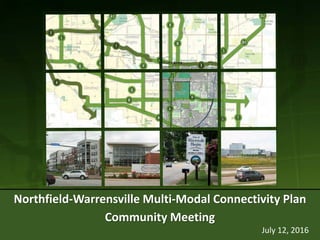
- 1. July 12, 2016 Northfield-Warrensville Multi-Modal Connectivity Plan Community Meeting
- 2. Northfield-Warrensville Center Corridor Multi-Modal Connectivity Plan
- 3. Why are we here today? • Understand the project • Existing conditions overview • Study area communities • Online survey • Community input
- 4. ESG: Proposed Greenways 4 • Warrensville Center (transformational) • Harvard • Miles
- 5. Project Vision & Purpose Vision: Develop a multi-modal connectivity plan that connects existing and planned developments, land uses and destinations in the project area and surrounding region, consistent with good environmental stewardship, to facilitate active transportation, economic investment and redevelopment. Purpose: Drive economic development, reinvestment and job creation by improving multimodal access to enhance livability and quality of life throughout the study area and connecting to the surrounding region.
- 6. Project Elements • Pedestrian Accommodations • Bicycle Facilities • Social Equity • Land Use (current & future) • Greenway Strategy • Transit Strategy • Traffic Analysis
- 7. Project Team • Cuyahoga County Planning Commission (CCPC) • City of Warrensville Heights • City of Shaker Heights • Village of North Randall • Village of Highland Hills • Office of Marcia L. Fudge • Greater Cleveland Regional Transit Authority (RTA) • Northeast Ohio Areawide Coordinating Agency (NOACA) • Consultants (WSP|Parsons Brinckerhoff & SmithGroupJJR)
- 8. Steering Committee The Steering Committee works closely with the Project Team in developing ideas, facilitating public outreach and engagement activities, and helps to advance the project within their constituent groups. – Bike Cleveland – Cleveland Planning Commission – Cleveland Clinic (South Pointe Hospital) – Cleveland Metroparks – Council representative – Highland Hills – Council representative – North Randall – Council representative – Shaker Heights – Council representative – Warrensville Heights – Cuyahoga County Dept of Public Works – Cuyahoga County Board of Health – Cuyahoga Community College (Tri-C) (Eastern Campus & Corporate College) – Developer – Pinecrest (Fairmount Properties) – Developer – Randall Park Mall (IRG) – Developer – Van Aken District (RMS Investments) – Eaton Corporation – RTA – Greater Cleveland Trails Leadership Network – Mill Creek Watershed Council – NOACA (stormwater management) – ODOT District 12 – JACK Thistledown Racino – Warrensville Heights Area Chamber of Commerce (Highland Hills, North Randall, Warrensville Heights) – University Hospitals (Ahuja, Rehabilitation Facility, Customer Service Ctr) – Warrensville City School District – Warrensville Heights YMCA
- 9. Jan Feb Mar Apr May Jun Jul Aug Sep Oct Nov Dec Phase 1 – Define the Vision Task 1: Project Initiation Task 2: Existing Conditions Inventory Phase 2 – Concept Development Task 3: Plan Elements Task 4: Community Engagement (Survey) Task 5: Refine Concepts, Assess Feasibility Phase 3 – Deliver the Plan Task 6: Plan, Recs & Implementation Task 7: Final Report Project Team Meeting Steering Committee Meeting Public Meeting Schedule
- 10. Transit – RTA System MapTransportation #34 to terminate at Green Road Station
- 13. Lanes vs. Volume 14 • Road Diet Candidates are roadways with 4-5 travel lanes with less than 15,000 vehicles/day • Need to consider peak hour volumes 4-5 lane roads with less than 15,000 AADT Transportation
- 14. ROW Width (outside of roadway) 15 • Current ROW width not allocated to vehicle travel lanes • Generally want ~15-feet per side (30-feet total) for sidewalks and amenity zone/buffer Transportation
- 15. Traffic Study / Complete Streets Traffic analysis Northfield • Harvard • Ellacott-Clarkwood • Emery • Miles Emery • Warrensville Center • Northfield • Granada-Derbyshire • Green
- 16. Traffic Analysis – Existing Conditions (AM/PM)Transportation D/D B/C C/E D/F B/C C/C C/C
- 17. Traffic Analysis – Existing Conditions (optimized timing & phasing) Transportation C/C B/C C/D C/ B/C A/A C/C • Optimize Signal Timing • Modify Signal Phasing Allow N-S protected/ permitted left turns at Northfield intersections at Harvard and at Ellacott-Clarkwood Capacity reductions are not advised until future land use and associated traffic impacts can be projected • Northfield south of Emery • Emery between Warrensville Center and Richmond
- 18. Sidewalk Network (NOACA) 19 • Critical gaps: Harvard and Miles • Partial sidewalks (gaps and/or one side): Northfield, Green, Chagrin, Emery Transportation Field View • Gaps in sidewalk network • Lack of pedestrian signal heads • ADA features (i.e., truncated dome strips at curb ramps)
- 19. NOACA Regional Priority Bikeway Network
- 20. Bicycle & Multi-use Facilities 21 • There are some planned routes near the study area (Van Aken) & Orange Side Paths • NOACA Priority Routes: Northfield, Miles, Chagrin, and Green • Eastside Greenway routes: Miles, Warrensville Center, and Harvard Transportation • Existing and planned do not show many bicycle facilities
- 21. Population Density 22 • Relatively low population density • 2010 Census: ~15,000 people in study area (~58,000 in map area) Demographics
- 22. Car Ownership Rates 23 • 1 Dot = ~10 people • Factor in possible demand for transit and non-motorized facilities Demographics
- 23. Land Cover 24 • Indicates degree of potential connectivity to natural areas for either preservation or restoration efforts. Environmental
- 24. Open Space & Schools/Libraries 25 Destinations # Open Space & Recreational 1. Green Road Park 2. Camp George Forbes 3. Cleveland Memorial Gardens Cemetery 4. Highland Park Golf Course 5. Highland Park Cemetery 6. Mill Creek 7. Warrenville Heights YMCA 8. Thornton Park Schools/Libraries 9. Cuyahoga Community College (Eastern Campus) 10. Cuyahoga County Library (Warrensville Heights) 11. Warrensville Heights High School 12. John Dewey Elementary 13. Corporate College 14. Cuyahoga Hills Boys School # 6 5 4 3 2 1 7 9 13 12 11 10 14 8
- 25. Health Care & Jobs 26 Destinations Office / Industrial 15. Commerce Park 16. Eaton Headquarters 17. Enterprise Park 18. Former Randall Park Mall site 19. Metropolitan Plaza (Titan Insurance) 20. PNC Bank 21. East Ohio Gas Services 22. Green Road National Guard Armory Health Care 23. Cleveland Clinic South Pointe Hospital 24. University Hospital Rehab 25. University Hospital Ahuja Medical Center 26. University Hospital Administrative Offices 27. University Hospital Medical Offices 28. University Hospital Customer Service 29. Suburban Pavilion Nursing Home 30. Highland Hills Behavioral Health Hospital 31. Brehn Family Center 32. Green Road Development Center # # 22 21 20 19 18 17 16 15 32 31 30 29 28 27 26 25 24 23
- 26. Shopping & Entertainment 27 Shopping & Mixed -Use Districts 33. Van Aken District 34. Pavilion Shopping Center 35. Village Square 36. Shops of Eton 37. Harvard Park 38. Chagrin Highlands 39. Pinecrest Development Entertainment 40. JACK Thistledown Racino Destinations # 40 39 38 37 36 35 3433 #
- 28. Eastside Health Corridors Source: Trails Leadership Network, 2014
- 29. Employment Centers (2014) 30 1. Van Aken District 2. Beachwood Commerce Park & Enterprise Place Business Park 3. Miles Road Business Corridor & Industrial Parks 4. Eastside Health Corridor (growing economic center) LandUse
- 30. EconomicGrowth&Development 31 1. Eastside Health Corridor 2. Former Randall Park Mall Site (industrial) 3. Van Aken District developments 4. JACK Thistledown Racino 1 2 3 4 Future Employment Centers
- 31. Jobs:Inflow/Outflow 32 • Study Area Boundary
- 32. Jobs:Inflow/Outflow 33 • Expanded Area Boundary
- 33. Warrensville Heights Active Projects • Heinen’s (60 KSF food production facility) • Lifebanc (20.8 KSF addition to existing facility) • Allen Renzi/ORG Mgt (20 KSF new gymnastics academy) • JACK Thistledown Racino (15 KSF horse barn) • Residential projects (Cinema Park, Chateaux of Emery Woods) • Demolition of car dealership (Bass Chevrolet)
- 34. Warrensville Heights Planned initiatives • New Town Center (by YMCA and library) • Warrensville Heights School District changes – Consolidate schools – Build new flagship High School – Build new Elementary School (Pre-K to Grade 5 ) – Reconstruct existing High School as new Middle School
- 35. North Randall 1. JACK Thistledown Racino (ongoing development) 2. Randall Park Mall site (redevelopment opportunities) 3. Power Sports Institute, Ohio Technical College 1 3 2
- 36. Highland Hills 1. Highland Park Golf Course 2. Highland Park Cemetery 3. Office park development along Harvard & Green 12 3
- 37. Shaker Heights Van Aken District, RMS redevelopment
- 38. Cleveland 1. Camp George Forbes 2. Cleveland House of Corrections 3. Cleveland Memorial Gardens Cemetery 4. Highland Park Golf Course 5. Chagrin Highlands 1 2 3 4 5
- 39. Key Stakeholders … and What We Learned • City of Beachwood • City of Cleveland • City of Warrensville Heights • Cleveland Clinic – South Pointe Hospital • Cuyahoga Community College (Tri-C) • Developer – Chagrin Highlands (Jacobs Group) • Developer – Van Aken District (RMS Investments) • Eaton Corporation • GCRTA • JACK Thistledown Racino • Power Sports Institute (with City of North Randall) • University Hospitals • Warrensville Heights Area Chamber of Commerce • Warrensville Heights School District Land Use Employees Transportation Future Plans Connectivity Access/Circulation
- 40. City of Beachwood 1. Chagrin Highlands 2. Eaton Corporation 3. Proposed connector road (Commerce Park to Harvard) Beachwood purchased 23456 Mercantile Road in Commerce Park to build a new road 4. Connector Trail Beachwood promoting complete and green streets Proposed trail connection at 24950 Chagrin, owned by First Catholic Slovak Ladies 1 23
- 41. 1. 53 acres in Chagrin Highlands 2. 900 staff on site 3. Sustainability Sustainable facility with sustainable initiatives, focus on safety, employee life style, amenities 4. Alternate Mode Connectivity a) Limited transit service; non-auto travel is not common b) Desired destinations: ‒ Blue Line & Van Aken District ‒ Chagrin Highlands/Highland Park ‒ Pinecrest and Eton shopping district Eaton Corporation
- 42. 1. Primary transit routes: #5, 15, 34, 41/41 F – Limited extensions of #19, 94 2. Severely financially constrained – Funding decreased 80% within past 20 years – Ohio is one of worst funded transit in nation 3. Proposed service cuts include stopping #34 at Green Road Station. 4. No current plans for new Bus Rapid Transit (BRT) or other new service in project area – RTA understands transit potential but lacks funding for new service – Long-range planning shows Warrensville Center Road is a priority corridor Greater Cleveland Regional Transit Authority (RTA)
- 43. 1. 750 employees at JACK Thistledown Racino – 7000 employees in JACK Entertainment 2. Plans to invest $70 million in next 5 years – New parking structure – Updated building façade – Primary entrance off Warrensville Center with new jumbotron – Potential new Starbucks – Potential new hotel 3. Alternate modes transportation is desired for staff (improves employee access) as well as guests JACK Thistledown Racino
- 44. 1. Master Agreement guided development from early 1990s 2. 600+ acres located in Orange, Beachwood, Highland Hills, Warrensville Heights 3. Managed by Jacobs Group 4. Development land use & size – Driven by end-users – Unknowns are a challenge to this project, notably impacts to transportation network Chagrin Highlands Jacobs Group and City of Cleveland
- 46. 1. 200 acre campus – Desire to connect to other Tri-C campuses – Partnerships with other colleges (Hiram), Warrensville Heights High School, Ahuja 2. Transportation – RTA bus primary student access – Desire to increase RTA service 3. Future development (2014 Master Plan) – Beyond education: work-heal-learn-shop-play – Walkable, accessible, trail network – Community resource (amphitheater, athletic facilities, programming, concerts, etc.) – On-campus housing for non-local students – Connect to jobs and medical centers in area Tri-C Eastern Campus
- 47. 1. Business owners in Warrensville Heights, North Randall and Highland Hills 2. Approximately 600-700 businesses 3. Chamber focus areas – Workforce development, job creation and livability (residential quality of life) 4. Study area connectivity impacts businesses – Want to engage hotels to improve transportation access for employees 5. Randall Park Mall redevelopment will influence business and worker access – Workers are biking long distances to get to jobs (from Maple Heights and Cleveland neighborhoods) Warrensville Heights Area Chamber of Commerce
- 48. 1. 173-bed acute care, teaching hospital – Serving southeast neighborhoods since 1957 – 1,200 employees 2. Patients – Admit ~600 in-patients per month – Approximately 50-100 appointments cancelled per week because of transportation related issues 3. Ohio University’s Heritage College of Osteopathic Medicine – Opened Medical School Extension, July 2015 – Many non-local students would benefit from nearby housing and alternate mode mobility South Pointe Hospital (Cleveland Clinic)
- 49. 1. Multiple facilities in/ near project area – Ahuja Medical Center, Beachwood – Management Services Center (MSC), Shaker Heights – Customer Service Center, Highland Hills – Harvard corridor 2. Step Up to University Hospital program – Works with community partners to prepare area residents for jobs with UH 3. Transit limitations hamper staff and patient access to/between UH facilities and other nearby destinations University Hospitals (UH)
- 50. Future changes… Planned change Potential change 1 1. Van Aken District 2. Warrensville Heights Schools 3. JACK Thistledown Racino 4. Warrensville Heights Town Center 5. Tri-C Master Plan 6. Highland Park Golf Course 7. Chagrin Highlands 8. Highland Hills 9. Randall Park Mall site 2 3 4 5 6 7 7 7 78 9
- 52. Online Survey
- 53. Online Survey
- 54. Online Survey
- 55. Online Survey
- 56. Now it’s time to … Take the survey!