
Recommandé
Contenu connexe
Tendances
Tendances (20)
En vedette
En vedette (10)
Similaire à Theory of Settlement : Navi Mumbai
Similaire à Theory of Settlement : Navi Mumbai (20)
Theory of Settlement : Navi Mumbai
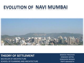
- 1. EVOLUTION OF NAVI MUMBAI THEORY OF SETTLEMENT BACHELOR OF ARCHITECTURE SCHOOL OF PLANNING AND ARCHITECTURE BAWESH PRADHAN DEBASKHI MITRA DEBASHISH BISWAS TRIPTI MAHASETH
- 2. MUMBAI Mumbai also called as Bombay is the capital of Indian state of Maharashtra. Estimated population is 19 million second most populous city in the world including Navi Mumbai and thane. It is the economic center of India.
- 4. The edge condition is a huge part of the experience of the city, also due to variety of human interventions like the urban rail and road transport corridors.N
- 5. SPATIAL GROWTH AND EVOLUTION OF NAVI MUMBAI 1508 – 1661 Portuguese Occupation. Creation of Fortified City. 1661 - 1775 England Occupation. Population grew from 10,000 to 60, 0000
- 6. 1708 1772 Land fill between Mahim and Sion Land fill between Mahalaxmi and Worli
- 7. Grid Housing Mid 18th century with British control of Bombay confirmed, city planning began and restrictions for heights.
- 8. Mid 18th century Segregation between British and Indian was enforced
- 9. 1853 First Rails were laid 1854 The first cotton mills was founded in Bombay.
- 10. 1899 – 1900 The suburbia development effected by the people’s movement 1890s The bubonic plague killed and scattered off Bombay’s population.
- 11. 1925 Electrified Suburban Trains. Completion of northern suburbs. 1945 – 47 Greater Bombay Was Established. India became a free country.
- 12. 1965 1957 Navi Mumbai 1950 Arabian sea 1910 Expansion of Bombay 1973 - today The Vashi Bridge was opened to Public. Bombay became Mumbai. Creation of Navi-mumbai.
- 14. POPULATION : 19 MILLION
- 15. 4 DISTRICTS : MUMBAI, SUB-URBAN, THANE AND RAIGADH
- 16. 7 MUNICIPAL CORPORATIONS: GREATER MUMBAI, THANE, KALYAN, NAVI-MUMBAI, ULHASNAGAR, MIRA-BHAYANDAR, BHIWANDI-NIZAMPUR.
- 18. 17 URBAN CENTERS
- 21. Absorb the immigrants who will otherwise go to Mumbai
- 22. Attract some of Mumbai’s present population so that overall population of Greater Mumbai can be contained within a manageable limit
- 23. To support the state-wide industrial location policy which will eventually lead to an efficient and rational distribution of industries over the state and a balanced development of urban centers in the hinterland
- 25. The implementation occurred through political and bureaucratic channels in 1969.
- 26. The site was finally chosen across the harbor from Bombay Island.
- 27. It was a narrow piece of land bounded by Western Ghat Mountain ranges on the north, south, east and Arabian sea on the west.
- 28. CIDCO was formed to plan and develop Navi Mumbai in 1970.New Growth Center Growth centers of Bombay Town center Arabian sea Harbor Twin city across the Harbor
- 30. This zone was surrounded by the transition zone which has factories and warehouses.
- 31. Older residential areas being taken over by expanding CBD.
- 32. The next zone had lower income levels and successive zones had higher income levelsAiroli Ghansoli KoparKhairane Vashi Sanpada Kharghar Nerul Jui Belapur RESIDENTIAL INDUSTRIES NhavaSheva CBD Dronagiri Concentric Zone Theory, Burges Model
- 34. Has a coastal stretch 34.2 kms.
- 35. Located at an altitude of 20oN and 73oE latitude.
- 36. The mean annual temperature ranges from 25oC to 280C.
- 37. The area has sub-tropical monsoonal climate of humid-per-humid to semi-arid and sub-humid type.
- 38. The area receives an annual rainfall of 2500 to 3500 mm.
- 41. The following principles were used in design:
- 42. Polycentric pattern of development
- 43. Acquisition of land to have control over development.
- 44. The site has following potential:
- 45. The MIDC at Taloja for industrial development.
- 46. The Bridge over the creek for transportation.
- 47. Two existing municipal corporations at Panvel and Uran.
- 48. The thane-pune national highway and railways link.Turbhe MIDC Industrial Estate Creek Bridge Taloja Arabian sea Nhava Sheva Panvel Development Potential of the site
- 51. Decentralization by the design of self sufficient townships (nodes).
- 53. Single use zoning as opposed to traditional multiple use zoning.
- 54. The total area of Navi Mumbai was divided into three townships. Each township has several sectors. Many were residential in nature.
- 55. Each node was planned to accommodate a range of some income groups.
- 56. Ponds were created to accumulate excess run off.Airoli Ghansoli KoparKhairane Kalomboli Vashi Sanpada Kharghar Nerul Jui Belapur Panvel NhavaSheva Dronagiri Nodes of Navi Mumbai
- 58. Growth in the other areas of Mumbai has an adverse effect on Navi Mumbai’s Growth.
- 59. Since 1990, the growth acclerated due to presence of NhavaSheva port.
- 60. CIDCO provided services for both government and private ownership.
- 61. Houses has been constructed for EWS, LIG, MIG and HIG.Landuse map of navimumbai
- 63. URBANISABLE ZONE - I
- 64. URBANISABLE ZONE – II
- 65. INDUSTRIAL ZONE
- 66. RECREATION AND TOURISM DEVELOPMENT ZONE
- 68. FOREST ZONE
- 69. GREEN ZONE – I
- 70. GREEN ZONE – II
- 71. QUARRY ZONE
- 73. MUMBAI AND NAVI MUMBAI – PRESENT STUATION Dharavi: organic development Navi Mumbai: structured development Local - “organic”/non-linear growth - indigenous settlements - City of Faith Global - “structures”/ linear growth - Colonial Period - City as machine City growth is structured between 2 types of development forces nurtured by trade and commerce, a constant dialogue between the City of Faith and The City as a Machine
- 74. VISUAL ELEMENTS OF THE CITY