A Round Trip Ticket to Google Earth and Sky

A Round Trip Ticket has been created as a training guide for both Google Earth and Google Sky. The 24 slide presentation includes all the major Google Earth tools with interactive video lessons. Viewers will learn how to create narratives, and imbed video hyperlinks within a place mark window as well as create thematic virtual trips. A special section has been provided for creating image layers through creative commons searches. Viewers will learn how to navigate, measure, search, set layers, create scripts with hyperlinks, save a tour as a kmz file, resize overlays with links, and embed kmz files into a presentation. At the end of the presentation you will “Vault into the Heavens” by taking a short tour of Google Sky and many of its features. Google has a new venture called Google Sky. The new feature allows users to get close views to 100 million galaxies and 200 million stars. To view the Google Sky, download the recent version Google earth software. To launch the Sky application, go to view and select to ‘switch to sky’. With Google Sky you can zoom in to see stars, planets, and constellations. Many reference resources have been added to the presentation including Google Earth and Sky virtual trips. In “Take A Tour of the Planets”, Einstein appears to introduce, Saturn, Mercury and Venus which are the predominated August planets now hovering over North America.
![Google Earth Defined ,[object Object],[object Object],From Wikipedia , the free encyclopedia 1](data:image/gif;base64,R0lGODlhAQABAIAAAAAAAP///yH5BAEAAAAALAAAAAABAAEAAAIBRAA7)
Recommandé
Contenu connexe
Tendances
Tendances (18)
En vedette
En vedette (19)
Similaire à A Round Trip Ticket to Google Earth and Sky
Similaire à A Round Trip Ticket to Google Earth and Sky (20)
Plus de Dodge City Public Schools
Plus de Dodge City Public Schools (20)
Dernier
Dernier (20)
A Round Trip Ticket to Google Earth and Sky
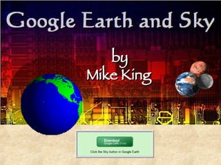
- 1. by Mike King
- 5. Google Earth Navigation The navigation compass allows you to manipulate the view in multiple ways. Drag the right slider up and down to zoom in and out. Drag the top slider left and right to tilt the view. To rotate the image, spin the navigator’s on-screen wheel. Click On Navigation Compass To See Video Guide
- 7. Find Directions Select Directions Tab Type From Address Type To Address Driving Directions Appear in Panel and on Google Map
- 8. Google Earth Measuring Tools The ruler allows you to measure distances from one given point to another using different units of measure. First select the unit of measure then click on two reference points on the map. The distance between the two points will appear next to the unit of measure box. Select Ruler Select Unit of Measure Measuring Line Distance
- 9. Google Earth Layers Use the Layers panel to select from a wide variety of information that will appear as images on Google Earth. The layers options allows users to view world geographical features from roads, geographic boundaries, and parks. Select from 1 to 21 different categories by clicking on the geographical feature of interest. Select Parks & Recreation
- 12. Conduct A Search Search by Typing Place or Address Example: Washington Monument Image Appears In Google Earth Window
- 13. Create A Project Tour Folder Select Add A Folder Example: Ctrl + Shift + N Select Add From Google Earth Menu Bar Creating a folder will identify the contents of the project and allows the tour to be sequenced by event.
- 14. Describe A Project Create A Title Example: Historical Places In America Describe Contents of Folder This folder contains a link to a flyby tour of Historical places to visit in America. Each placemark on you journey will include video links, audio files and information on each of the historical sites you visit. At the end of your journey you will be able to download a short quiz on place Historical Places in America.
- 15. Creating A Place mark A place mark allows viewers to travel to places in Google Earth as they are assigned in the project folder. Add a placemark by selecting Add in the Google menu bar then select Placemark or Ctrl + Shift + P
- 16. Adding Content To A Place mark Window Scripts can include links to audio and video files. Active Reference URL’s Copy & Paste Script From Word File Add A Title Select OK You can add a title and content to a place mark window.
- 17. Select An Icon Select An Icon Click Icon To Choose Options Menu Click Icon To Open Select an icon that fits the reference url, such as video or picture An Icon is an active Google Earth reference point and can be opened to reveal a content window.
- 18. Overlay Image Search To locate an overlay for the project & conduct a Washington Monument Creative Commons image search. Picture Reference Links: http://www.anders.com/pictures/public/04-views/45%20-%20Washington%20Monument_sm.jpg Photo is posted under a creative commons licences agreement and has been provided by Anders Brownworth at www.anders.com
- 19. Creative Commons Creative Commons is a nonprofit organization providing free legal mechanisms for learners inside and outside schools to share and remix content. A creative commons environment allows for an expanded range of creative work to be available for others to legally build upon and share. Hyper Link
- 20. Adding An Overlay To add an overlay image click on the project folder under My Places. To add an Image Overlay select Add from the Google Earth Menu and click on Image Overlay Or press (Ctrl+Shift+O) an overlay window will appear.
- 21. Adding An Image Link & Content Copy & paste the image url into the link line Overlay Image Appears Use Crosshair To Move Image Use Green Corner to Size Add creative commons credits to information window Add Title
- 22. First Stop Washington Monument Overlay Place mark
- 23. Saving A kmz Project When someone opens the .kmz file, Google Earth will automatically be launched or users will be encouraged to download the program. When you are ready to save your file. Highlight your folder, then click on “File” “Save” “Save Place as…”This will save it as a .kmz. This small file can be hyperlinked into a presentation. Go To File Save Save As
- 24. Take A kmz Hyperlink Tour Click on Selected Image Select Inset Select Hyperlink Click On kmz Select OK
- 25. Take A Round Trip Ticket Click on hyperlink Image Select Historical Places Play Tour To take a round trip ticket to the place marks, highlight the “Historical Places In America” folder and click the play button.
- 26. To view the star, on your window, download the recent version Google earth software, launch application, go to view and select to ‘switch to sky’, zoom in to see the blazing star, black hole, constellation. Aug 25: Google has a new venture called Google Sky. The beta version of earth now includes Google sky. The feature allows users to get close to over 100 million galaxies and 200 million star.
- 27. Open Google Earth Select View Switch to Sky Select Layer Click on icon for Google Sky Link
- 28. Google Sky Tools Select “The Planets” Select “Sky View” Play Motion Bar
- 29. Take A Planet Tour Click on photo above to launch kmz planet tour.
- 30. Google Tours Forbidden City http://www.shambles.net/pages/learning/GeogP/gearthplan/
- 32. Google Earth Resources Tour