Kano GIS Day 2014 - Opening remarks

We are excited to be holding our own GIS Day event on November 19th, 2014! GIS Day is a global grassroots educational event that enables Geographic Information Systems (GIS) users and vendors to showcase real-world applications of GIS to schools, businesses, and the general public. Organizations that utilize GIS around the world participate by holding or sponsoring an event of their own. The first formal GIS Day took place in 1999. In 2005, more than 700 GIS Day events were held in 74 countries around the globe. Esri president and co-founder Jack Dangermond credits Ralph Nader with inspiring the creation of GIS Day. He saw GIS Day as providing an opportunity for the world to learn about the uses of GIS in mapping geography, and what that mapping technology could provide. He wanted GIS Day to be a grassroots effort and open to everyone to participate. Recognizing the power that GIS technology could provide for healthcare, eHealth Africa as an NGO organization stepped to the forefront of using GIS applications to track polio in Nigeria. Using GIS technology, eHealth is able to map out areas previously unreached during immunization campaigns. Once the area is mapped, much-needed polio vaccinations are able to be distributed and the polio epidemic is brought another step closer to being controlled and eliminated. The theme of GIS Day is “Discovering the world through GIS.” GIS Day provides an international forum for users of GIS technology to demonstrate real-world applications that are making a difference in our society and around the world. We are excited to take part in GIS Day 2014 on November 19th. We look forward to joining with our community partners in discussing GIS usage, and to take a close look at the exciting contributions GIS provides around our world.

Recommandé
Recommandé
Contenu connexe
Tendances
Tendances (20)
Similaire à Kano GIS Day 2014 - Opening remarks
Similaire à Kano GIS Day 2014 - Opening remarks (20)
Dernier
Dernier (20)
Kano GIS Day 2014 - Opening remarks
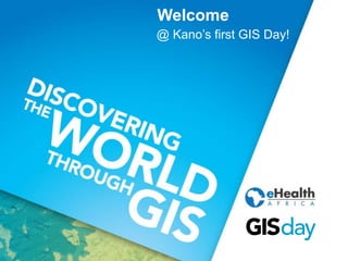
- 1. Welcome @ Kano’s first GIS Day!
- 2. GIS Day events around the world
- 3. Purpose of the day.. • Celebrate GIS with everyone • Discover and explore the benefits of GIS • Showcase the uses of GIS • Build and nurture our GIS community
- 4. Who is eHealth Systems Africa? • Mission: utilizing appropriate technology to effectively design, implement, manage, and evaluate health projects.
- 5. Agenda – Plenary sessions • Frank Salet: "Share your personal story“ • Oro-ghene Adia: "How Geospatial technology is transforming field data collection“ • Dr. Adamu Mustapha: "Application of multivariate Geostatistical analyses in environmental data“ • Dami Sonoiki: "General Trends in the Geospatial Industry“ • Owolabi Kazeem: "Direct Vaccine Delivery at your Doorstep"
- 6. Agenda - Activities • Map gallery • Poster presentations • Equipment demonstrations • Geography quiz • Sharing ideas and experiences
- 7. What is GIS? plus a brief history..
- 8. A way to explain GIS.. (1) Data Technology People
- 9. A way to explain GIS.. (2) Data collection & management Analysis Display
- 10. A way to explain GIS.. (3) Data Information Knowledge
- 11. Story maps Map-based storytelling is fun, compelling, and helps us all better understand our world.
- 12. Example story map – Ebola outbreaks Link: http://techsupportuk.maps. arcgis.com/apps/MapJourn al/?appid=deb9d5151d954 de5b3933294c911b67f
- 13. Cholera outbreak – 1832, Paris
- 14. Cholera outbreak – 1854, London
- 15. John Snow’s data in modern day GIS..
- 16. Sharing your personal story
- 20. GIS, health & Nigeria
- 21. GIS in Africa Some figures (worldwide): • 270 Billion dollar value for GIS Industry • 9.6% Growth rate of GIS Market
- 22. GIS in (northern) Nigeria • Sustainable development • Plan for future events • Understand resources & human conditions
- 23. Eradicating polio using GIS • Mapping northern Nigeria • Tracking vaccination teams • Support logistics & operations • Pinpoint where healthcare is needed
- 24. Detailed geodata for 10 states
Notes de l'éditeur
- Welcome. Greatest pleasure to welcome you today. Thank you so much for coming. Honoured to have everyone here. Give a special welcome to some of our guests. [List of honorable guests] / [students – key players for the future] Invite you to sit back, and relax. No formalities, there won’t be lecturing. Celebrate. First GIS day in Kano -> map
- Worldwide event. Pinpointed Kano on the map. The first GIS day in 1999, geography awareness week. Now annual event. Celebrate and promotes GIS and associated spatial technologies, bringing people together (students, professionals, business/non-profit). Day is to showcase the – exciting – future of spatial technology.
- ..: made a good start with that by being here today ..: health focus ..: use cases / demonstrations / real-life examples ..: Kano GIS community Why we organize this day? Huge passion (love to talk about it and share) Biggest GIS organisation in City (25 highly skilled) Feels like duty (to not only wok on proj + fulfill task), also spread vision, knowledge, discuss ideas, listen. Therefore really excited to organize.. But not everyone might know who eHealth is.. So..
- .. Focused on improving healthcare (strong focus on Kano), by implement reliable health information systems. We like to say that.. Combine technology, project management, local knowledge, and hard work, to serve and support health projects, that often have a direct impact on the peoples wellbeing. Work together with local partners, organisations+government, as well as large international, intergovernmental organisations. GIS plays important role. GIS is fundamental aspect. Other core aspects: GIS is vital to understand the area we work in. GIS is vital to understand the data. Name, role. 1.5 years in Kano. Involved in polio eradication. 6 years as professional. Quest for interesting and fascinating GIS projects. Accent. Hopefully you understand me well. Agenda
- Theme for today: sharing your story. Presenting projects: purpose is not showing off. But discussing and learning.
- Needed to go over this? We’re all very specialized (studied years); GIS relatively broad term. Can refer to different technologies, processes, methods. Attached to many operations, and has many applications (fields) Not keen of general definitions, like to give examples. Came up with three simple/abstract ways to explain what we do.
- GIS combines the three. Data perhaps most important. Relate tabular and geographical data. Gather data in-house, purchase, collect on the field. GIS will integrate the spatial data from different sources. Technology = combination: Hardware (computer systems on which a GIS operates) Software (provides functions/tools needed to work with data) Methods (models, policies, implementation plan, practices) People: GIS specialist vs. user (boss, client, colleague).
- Previous one more like stakeholder diagram, this is more activity process flow. 3 essential functions of GIS: Collection and making accessible Combine, process, use spatial analytices: answer geographical Q Visualisation, usually maps.
- Data – information is not the same thing. Flat data, raw. Spreadsheet. Does not have meaning of itself. Information.. Data is given meaning (e.g. by relational connection) Collection of information, with intent to be useful. This is something we do all the time. Understanding, wisdom.
- Map is not goal on itself. Story-maps: use geography as means of presenting information, for non-technical audience. Put story (place, event, issue, trend, pattern) in geographic context. Interactive way, accessible, easy. Combine rich content (text, photo, video, audio), Although story maps can incorporate analytical tasks, they are not intended to do the heavy lifting of geographic information systems. They use the tools of GIS, and often present the results of spatial analysis, but don’t require their users to have any special knowledge or skills in GIS.
- Tosin
- Let’s go a back in time – discuss history Heard story many times. Every time this John Snow map.. Popular in textbooks + courses Relevant! Charles Picquet, geographer, 182 years ago. First who used epidemiology / mapping. Percentage of deaths from cholera, normalized (districts colourcoded for every 1000 people). First known example of visual representation of such data. 22 years later…
- John Snow. Well known cholera map. Major cholera outbreak. Unknown how disease is transmitted. John (physician) investigated the outbreak – looking at probably means of transmission. He mapped the incidences, and found that they clustered around a public water pump. Broad Street (Soho) – he convinced with map to remove the handle of the water pump. Pump was contaminated, well had not been properly dug out. Close to old sewage. Classic example – map used to answer complex problem. Argument was presented. Repeat with modern day tools.
- Kernel denisty surface (heatmap) 5 meter cell size 75 meter radius What if data was collected in aggregated form?
- Started making maps on very young age. As soon as could hold pen.
- Even child understanding meaning of map. Universal. Areas represent countries, clarify the exact countries by labelling / writing name Scalebar Spelling mistakes, phonetically. Thematic map
- Mental map / point-of-view / perception of area of interaction How I saw the world as a child. Law of GIS: something closer is more important than something that’s farther away.