SlideShare une entreprise Scribd logo
1  sur  18
Télécharger pour lire hors ligne
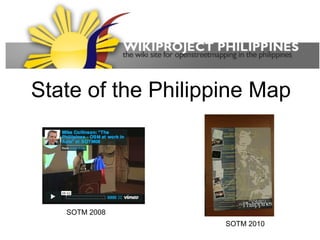
State of the Philippine Map


   SOTM 2008
                    SOTM 2010
Filipino

Located along the Pacific
Ring of Fire and a tropical
climate which makes prone
to earthquakes and
typhoons.

An archipelago with 7,107
islands(?).

Capital city is Manila.

About 94 million people
with multiple ethnicities
and cultures.

Crowdsource mapping is
popular.

 waypoints.ph

 roadguide.ph

 wikimapia

 google mapmaker
PH data stats
Data as of 20110815
XML file size : 489 MB
   197,617 ways
   2,161,875 nodes
   718 relations


~83,393 kilometers of highway=*


1,132 contributors (including 2 import
  accounts)
   80% of data by 18 mappers
   next 10% by 25 mappers
   last 10% the other 1,070 mappers
   new users editing every 2 days
   ~1,000 km of new highway=* are
    added every month (since Bing
    imagery).
How do we map?
How do we map?
walkingpapers


                   DIY
                   NAVTEQ van


                    map sketching
What do we map?


   Our neighborhoods,
        our towns,
   other people's towns,
       whole cities,
       whole islands
Outreach
           OSM-PH local
             chapter

       website, FB page,
             blogs

       organize mapping
     parties, skillshares and
               talks

                and
           eat cakes too
Data imports
                           Many possible data were evaluated
                           and rejected.

                           Community guidelines
                           
                            Planned imports should be announced
                           to the talk-ph list.
                           
                             Imports should NEVER delete or get in
                           the way with local mapper's
                           contributions
Node density of imported   
                            Public link should be provided to
POI in Makati              anyone willing to evaluate the quality.
                           
                            Community-consensus should be made
                           before imports.
                           
                            Another announcement will be made
                           when consensus was achieved.
                           
                            Another announcement after data
                           import.
                           
                            Document the process and progress in
                           the wiki.

Naga city import
Supporting the mappers
                  Handouts, flyers, 5-min videos
GPStoGo program
Supporting the mappers
Some QA Tools
                       Saw-tooth
                       coastline repair


 Custom garmin maps
Supporting the mappers
Imagery imports


 Imagery donations
                           DIY aerial imagery
 (Spot and DigitalGlobe)
Using the data


Openstreetmap.org.ph a simple interface for creating html map embeds
Using the data
Using the data
    Providing useful applications based on OSM
 is our super secret recruitment scheme to convert
                 users to mappers


http://vaes9.codedgraphic.com/posts/osm_davao_mapping_party
Emerging issues

    Too few mappers may lead to “volunteer
    fatigue”.

    More tools for easier ways to contribute.

    Weird variants of “tagging for the renderer”.

    Community privacy issues.
    
        Indigenous peoples resources

    Managing vandalism and copyrights.
    
        A more local control and discussion on possible
        copyrighted data in OSM
Future plans/activities

    Collaborate with local developers, local
    businesses and government agencies to use the
    data beyond the osm.org map tiles.

    Partnerships with schools.

    More gpstogo units.

    More imagery.

    Merging of common interest with other
    crowdsource groups

    Our very own conference. Sponsors are
    welcome. :)
Thank you to
Yahoo! Maps
 (2006-2011)
References

 http://openstreetmap.org/

 http://wiki.openstreetmap.org/

 http://wiki.openstreetmap.org/wiki/Philippines

 http://wiki.openstreetmap.org/wiki/Philippines/Timeline

 http://wiki.openstreetmap.org/wiki/WikiProject_Philippines
/Featured_images

 http://lists.openstreetmap.org/listinfo/talk-ph

 http://en.wikipedia.org/wiki/Philippines

 http://vaes9.codedgraphic.com/

 http://www.openstreetmap.org

 http://epsg4253.wordpress.com

 https://www.facebook.com/OSMPH

Contenu connexe

Tendances

GIS and Open Source
GIS and Open SourceGIS and Open Source
GIS and Open SourceHardeep Rai
 
Open Geo Data in Italy and the OpenStreetMap case
Open Geo Data in Italy and the OpenStreetMap caseOpen Geo Data in Italy and the OpenStreetMap case
Open Geo Data in Italy and the OpenStreetMap caseMaurizio Napolitano
 
WUN Global GIS Seminar - What\'s so new in Neogeography?
WUN Global GIS Seminar - What\'s so new in Neogeography?WUN Global GIS Seminar - What\'s so new in Neogeography?
WUN Global GIS Seminar - What\'s so new in Neogeography?Muki Haklay
 
Aurkene Alzua Sorzabal - The Smartphone Revolution
Aurkene Alzua Sorzabal - The Smartphone RevolutionAurkene Alzua Sorzabal - The Smartphone Revolution
Aurkene Alzua Sorzabal - The Smartphone RevolutionOscar4B
 
Smart CitySDK at Apps for Smart Cities
Smart CitySDK at Apps for Smart CitiesSmart CitySDK at Apps for Smart Cities
Smart CitySDK at Apps for Smart CitiesGregor Abbas
 
Mobilemonday
MobilemondayMobilemonday
Mobilemondaydiann
 
GIS and the Neogeographer
GIS and the NeogeographerGIS and the Neogeographer
GIS and the NeogeographerSchuyler Erle
 
OSM Philippines presentation
OSM Philippines presentationOSM Philippines presentation
OSM Philippines presentationesambale
 
Open streetmap response-to-ebola-crisis-geong-2014-09-23
Open streetmap response-to-ebola-crisis-geong-2014-09-23Open streetmap response-to-ebola-crisis-geong-2014-09-23
Open streetmap response-to-ebola-crisis-geong-2014-09-23Pierre Béland
 
Ieee 2014 tech_training_open_streetmap_20121011
Ieee 2014 tech_training_open_streetmap_20121011Ieee 2014 tech_training_open_streetmap_20121011
Ieee 2014 tech_training_open_streetmap_20121011ALCE Samuel Paul
 
Deamicis etal
Deamicis etalDeamicis etal
Deamicis etalthangqd
 
DistrictBuilder -- Syracuse Presentation
DistrictBuilder -- Syracuse PresentationDistrictBuilder -- Syracuse Presentation
DistrictBuilder -- Syracuse PresentationMicah Altman
 

Tendances (16)

GIS and Open Source
GIS and Open SourceGIS and Open Source
GIS and Open Source
 
Open Geo Data in Italy and the OpenStreetMap case
Open Geo Data in Italy and the OpenStreetMap caseOpen Geo Data in Italy and the OpenStreetMap case
Open Geo Data in Italy and the OpenStreetMap case
 
Shanty Town Prez
Shanty Town PrezShanty Town Prez
Shanty Town Prez
 
WUN Global GIS Seminar - What\'s so new in Neogeography?
WUN Global GIS Seminar - What\'s so new in Neogeography?WUN Global GIS Seminar - What\'s so new in Neogeography?
WUN Global GIS Seminar - What\'s so new in Neogeography?
 
Aurkene Alzua Sorzabal - The Smartphone Revolution
Aurkene Alzua Sorzabal - The Smartphone RevolutionAurkene Alzua Sorzabal - The Smartphone Revolution
Aurkene Alzua Sorzabal - The Smartphone Revolution
 
(Geo) Phone Tag v1
(Geo) Phone Tag v1(Geo) Phone Tag v1
(Geo) Phone Tag v1
 
Map Kibera
Map KiberaMap Kibera
Map Kibera
 
Smart CitySDK at Apps for Smart Cities
Smart CitySDK at Apps for Smart CitiesSmart CitySDK at Apps for Smart Cities
Smart CitySDK at Apps for Smart Cities
 
Mobilemonday
MobilemondayMobilemonday
Mobilemonday
 
GIS and the Neogeographer
GIS and the NeogeographerGIS and the Neogeographer
GIS and the Neogeographer
 
OSM Philippines presentation
OSM Philippines presentationOSM Philippines presentation
OSM Philippines presentation
 
Open streetmap response-to-ebola-crisis-geong-2014-09-23
Open streetmap response-to-ebola-crisis-geong-2014-09-23Open streetmap response-to-ebola-crisis-geong-2014-09-23
Open streetmap response-to-ebola-crisis-geong-2014-09-23
 
Open Green Map
Open Green MapOpen Green Map
Open Green Map
 
Ieee 2014 tech_training_open_streetmap_20121011
Ieee 2014 tech_training_open_streetmap_20121011Ieee 2014 tech_training_open_streetmap_20121011
Ieee 2014 tech_training_open_streetmap_20121011
 
Deamicis etal
Deamicis etalDeamicis etal
Deamicis etal
 
DistrictBuilder -- Syracuse Presentation
DistrictBuilder -- Syracuse PresentationDistrictBuilder -- Syracuse Presentation
DistrictBuilder -- Syracuse Presentation
 

En vedette

Philippine culture
Philippine culturePhilippine culture
Philippine culturewventura3
 
Philippine culture
Philippine culturePhilippine culture
Philippine cultureShee Luh
 
The philippine landforms
The philippine landformsThe philippine landforms
The philippine landformsElma Camion
 
Welcome To Geography!
Welcome To Geography!Welcome To Geography!
Welcome To Geography!Simon Jones
 
Bodies of water
Bodies of waterBodies of water
Bodies of waterubiquinone
 
Land forms of the Philippines - Grade 1-2
Land forms of the Philippines - Grade 1-2 Land forms of the Philippines - Grade 1-2
Land forms of the Philippines - Grade 1-2 Zee Na
 
State of the Word 2011
State of the Word 2011State of the Word 2011
State of the Word 2011photomatt
 

En vedette (11)

Llagas jenevie
Llagas jenevieLlagas jenevie
Llagas jenevie
 
Ethnic groups
Ethnic groupsEthnic groups
Ethnic groups
 
Philippine culture
Philippine culturePhilippine culture
Philippine culture
 
Philippine culture
Philippine culturePhilippine culture
Philippine culture
 
The landforms of the philippines
The landforms of the philippinesThe landforms of the philippines
The landforms of the philippines
 
Landforms
LandformsLandforms
Landforms
 
The philippine landforms
The philippine landformsThe philippine landforms
The philippine landforms
 
Welcome To Geography!
Welcome To Geography!Welcome To Geography!
Welcome To Geography!
 
Bodies of water
Bodies of waterBodies of water
Bodies of water
 
Land forms of the Philippines - Grade 1-2
Land forms of the Philippines - Grade 1-2 Land forms of the Philippines - Grade 1-2
Land forms of the Philippines - Grade 1-2
 
State of the Word 2011
State of the Word 2011State of the Word 2011
State of the Word 2011
 

Similaire à Ph lightning sotm2011

Snap4City November 2019 Course: Smart City IOT Data Ingestion Interoperabilit...
Snap4City November 2019 Course: Smart City IOT Data Ingestion Interoperabilit...Snap4City November 2019 Course: Smart City IOT Data Ingestion Interoperabilit...
Snap4City November 2019 Course: Smart City IOT Data Ingestion Interoperabilit...Paolo Nesi
 
OpenStreetMap Past, Present and Future
OpenStreetMap Past, Present and FutureOpenStreetMap Past, Present and Future
OpenStreetMap Past, Present and FuturePeter Batty
 
nsgic 2012 - your plumbing is done!
nsgic 2012 - your plumbing is done!nsgic 2012 - your plumbing is done!
nsgic 2012 - your plumbing is done!Marten Hogeweg
 
Eugene Lisovskiy, CEO, MAPS.ME | SotM Asia 2017 |The Future of OSM in Asia an...
Eugene Lisovskiy, CEO, MAPS.ME | SotM Asia 2017 |The Future of OSM in Asia an...Eugene Lisovskiy, CEO, MAPS.ME | SotM Asia 2017 |The Future of OSM in Asia an...
Eugene Lisovskiy, CEO, MAPS.ME | SotM Asia 2017 |The Future of OSM in Asia an...Kathmandu Living Labs
 
Mobile Social Location (Web 2.0 NYC edition)
Mobile Social Location (Web 2.0 NYC edition)Mobile Social Location (Web 2.0 NYC edition)
Mobile Social Location (Web 2.0 NYC edition)Matt Biddulph
 
Innovations for Open Development
Innovations for Open DevelopmentInnovations for Open Development
Innovations for Open DevelopmentSoren Gigler
 
Multi Layer GIS Platform in Digital India - Mr. Vishnu Chandra
Multi Layer GIS Platform in Digital India - Mr. Vishnu ChandraMulti Layer GIS Platform in Digital India - Mr. Vishnu Chandra
Multi Layer GIS Platform in Digital India - Mr. Vishnu ChandraNeGD Capacity Building
 
MAPS.ME Workshop on State of The Map Asia 2017 Conference
MAPS.ME Workshop on State of The Map Asia 2017 ConferenceMAPS.ME Workshop on State of The Map Asia 2017 Conference
MAPS.ME Workshop on State of The Map Asia 2017 ConferenceEugene Lisovskiy
 
Digital Broadcasting and ITS
Digital Broadcasting and ITSDigital Broadcasting and ITS
Digital Broadcasting and ITSFrancois Lefebvre
 
MapQuest: How OSM Benefits & Vice Versa
MapQuest: How OSM Benefits & Vice VersaMapQuest: How OSM Benefits & Vice Versa
MapQuest: How OSM Benefits & Vice VersaRandy Meech
 
Introduction to OpenStreetMap, its extracts, and relation to Project NOAH
Introduction to OpenStreetMap, its extracts, and relation to Project NOAHIntroduction to OpenStreetMap, its extracts, and relation to Project NOAH
Introduction to OpenStreetMap, its extracts, and relation to Project NOAHErvin Malicdem
 
Iati open aid presentation march 13 2013
Iati open aid presentation march 13 2013Iati open aid presentation march 13 2013
Iati open aid presentation march 13 2013Aleem Walji
 
Humanitarian OpenStreetMap Team [H.O.T.] Training for SBTF
Humanitarian OpenStreetMap Team [H.O.T.] Training for SBTFHumanitarian OpenStreetMap Team [H.O.T.] Training for SBTF
Humanitarian OpenStreetMap Team [H.O.T.] Training for SBTFStandby Task Force
 
Humanitarian Mapping - Interaction ICCC
Humanitarian Mapping - Interaction ICCCHumanitarian Mapping - Interaction ICCC
Humanitarian Mapping - Interaction ICCCAndrew Turner
 
Marta Civic Tech Summit - June 8, 2017
Marta Civic Tech Summit - June 8, 2017Marta Civic Tech Summit - June 8, 2017
Marta Civic Tech Summit - June 8, 2017Sandbox ATL
 
Week 8: The digital city
Week 8: The digital cityWeek 8: The digital city
Week 8: The digital cityGreg Wass
 

Similaire à Ph lightning sotm2011 (20)

Taarifa geomob
Taarifa   geomobTaarifa   geomob
Taarifa geomob
 
Snap4City November 2019 Course: Smart City IOT Data Ingestion Interoperabilit...
Snap4City November 2019 Course: Smart City IOT Data Ingestion Interoperabilit...Snap4City November 2019 Course: Smart City IOT Data Ingestion Interoperabilit...
Snap4City November 2019 Course: Smart City IOT Data Ingestion Interoperabilit...
 
OpenStreetMap Past, Present and Future
OpenStreetMap Past, Present and FutureOpenStreetMap Past, Present and Future
OpenStreetMap Past, Present and Future
 
nsgic 2012 - your plumbing is done!
nsgic 2012 - your plumbing is done!nsgic 2012 - your plumbing is done!
nsgic 2012 - your plumbing is done!
 
Beta transportation authority
Beta transportation authorityBeta transportation authority
Beta transportation authority
 
Eugene Lisovskiy, CEO, MAPS.ME | SotM Asia 2017 |The Future of OSM in Asia an...
Eugene Lisovskiy, CEO, MAPS.ME | SotM Asia 2017 |The Future of OSM in Asia an...Eugene Lisovskiy, CEO, MAPS.ME | SotM Asia 2017 |The Future of OSM in Asia an...
Eugene Lisovskiy, CEO, MAPS.ME | SotM Asia 2017 |The Future of OSM in Asia an...
 
Mobile Social Location (Web 2.0 NYC edition)
Mobile Social Location (Web 2.0 NYC edition)Mobile Social Location (Web 2.0 NYC edition)
Mobile Social Location (Web 2.0 NYC edition)
 
Innovations for Open Development
Innovations for Open DevelopmentInnovations for Open Development
Innovations for Open Development
 
Multi Layer GIS Platform in Digital India - Mr. Vishnu Chandra
Multi Layer GIS Platform in Digital India - Mr. Vishnu ChandraMulti Layer GIS Platform in Digital India - Mr. Vishnu Chandra
Multi Layer GIS Platform in Digital India - Mr. Vishnu Chandra
 
DfT data
DfT dataDfT data
DfT data
 
MAPS.ME Workshop on State of The Map Asia 2017 Conference
MAPS.ME Workshop on State of The Map Asia 2017 ConferenceMAPS.ME Workshop on State of The Map Asia 2017 Conference
MAPS.ME Workshop on State of The Map Asia 2017 Conference
 
Digital Broadcasting and ITS
Digital Broadcasting and ITSDigital Broadcasting and ITS
Digital Broadcasting and ITS
 
MapQuest: How OSM Benefits & Vice Versa
MapQuest: How OSM Benefits & Vice VersaMapQuest: How OSM Benefits & Vice Versa
MapQuest: How OSM Benefits & Vice Versa
 
Introduction to OpenStreetMap, its extracts, and relation to Project NOAH
Introduction to OpenStreetMap, its extracts, and relation to Project NOAHIntroduction to OpenStreetMap, its extracts, and relation to Project NOAH
Introduction to OpenStreetMap, its extracts, and relation to Project NOAH
 
Iati open aid presentation march 13 2013
Iati open aid presentation march 13 2013Iati open aid presentation march 13 2013
Iati open aid presentation march 13 2013
 
Humanitarian OpenStreetMap Team [H.O.T.] Training for SBTF
Humanitarian OpenStreetMap Team [H.O.T.] Training for SBTFHumanitarian OpenStreetMap Team [H.O.T.] Training for SBTF
Humanitarian OpenStreetMap Team [H.O.T.] Training for SBTF
 
Humanitarian Mapping - Interaction ICCC
Humanitarian Mapping - Interaction ICCCHumanitarian Mapping - Interaction ICCC
Humanitarian Mapping - Interaction ICCC
 
Marta Civic Tech Summit - June 8, 2017
Marta Civic Tech Summit - June 8, 2017Marta Civic Tech Summit - June 8, 2017
Marta Civic Tech Summit - June 8, 2017
 
Liveliness
LivelinessLiveliness
Liveliness
 
Week 8: The digital city
Week 8: The digital cityWeek 8: The digital city
Week 8: The digital city
 

Plus de esambale

Open data initiatives
Open data initiativesOpen data initiatives
Open data initiativesesambale
 
Contributing to OpenStreetMap (OSMPH)
Contributing to OpenStreetMap (OSMPH)Contributing to OpenStreetMap (OSMPH)
Contributing to OpenStreetMap (OSMPH)esambale
 
About osmph
About osmphAbout osmph
About osmphesambale
 
Map design
Map designMap design
Map designesambale
 
Geoladies 20140609
Geoladies 20140609Geoladies 20140609
Geoladies 20140609esambale
 
DepEd's Schools Mapping Initiative
DepEd's Schools Mapping InitiativeDepEd's Schools Mapping Initiative
DepEd's Schools Mapping Initiativeesambale
 
State of OpenStreetMap Indonesia
State of OpenStreetMap IndonesiaState of OpenStreetMap Indonesia
State of OpenStreetMap Indonesiaesambale
 
Using OSM, QGIS, and InaSAFE for Contingency Plan in Indonesia
Using OSM, QGIS, and InaSAFE for Contingency Plan in Indonesia Using OSM, QGIS, and InaSAFE for Contingency Plan in Indonesia
Using OSM, QGIS, and InaSAFE for Contingency Plan in Indonesia esambale
 
Participatory mapping and LGU decision support tools for Disaster Risk Reduct...
Participatory mapping and LGU decision support tools for Disaster Risk Reduct...Participatory mapping and LGU decision support tools for Disaster Risk Reduct...
Participatory mapping and LGU decision support tools for Disaster Risk Reduct...esambale
 
InaSAFE Development in the Philippines
InaSAFE Development in the Philippines InaSAFE Development in the Philippines
InaSAFE Development in the Philippines esambale
 
Maperitive
MaperitiveMaperitive
Maperitiveesambale
 
OpenStreetMap QA tools
OpenStreetMap QA toolsOpenStreetMap QA tools
OpenStreetMap QA toolsesambale
 
My GPS Stories
My GPS StoriesMy GPS Stories
My GPS Storiesesambale
 
OSM-Philippines and the Yolanda Crisis Mapping Response
OSM-Philippines and the Yolanda Crisis Mapping ResponseOSM-Philippines and the Yolanda Crisis Mapping Response
OSM-Philippines and the Yolanda Crisis Mapping Responseesambale
 
Free GEO Culture and OpenStreetMap
Free GEO Culture and OpenStreetMapFree GEO Culture and OpenStreetMap
Free GEO Culture and OpenStreetMapesambale
 
ESSC OSM-PH WB project
ESSC OSM-PH WB projectESSC OSM-PH WB project
ESSC OSM-PH WB projectesambale
 
Philippine Geospatial Forum Presentation 20130311
Philippine Geospatial Forum Presentation 20130311Philippine Geospatial Forum Presentation 20130311
Philippine Geospatial Forum Presentation 20130311esambale
 
OSM SFD2012
OSM SFD2012OSM SFD2012
OSM SFD2012esambale
 
FOSS4G 2011 Osaka
FOSS4G 2011 OsakaFOSS4G 2011 Osaka
FOSS4G 2011 Osakaesambale
 
foss4g 2011 tokyo
foss4g 2011 tokyofoss4g 2011 tokyo
foss4g 2011 tokyoesambale
 

Plus de esambale (20)

Open data initiatives
Open data initiativesOpen data initiatives
Open data initiatives
 
Contributing to OpenStreetMap (OSMPH)
Contributing to OpenStreetMap (OSMPH)Contributing to OpenStreetMap (OSMPH)
Contributing to OpenStreetMap (OSMPH)
 
About osmph
About osmphAbout osmph
About osmph
 
Map design
Map designMap design
Map design
 
Geoladies 20140609
Geoladies 20140609Geoladies 20140609
Geoladies 20140609
 
DepEd's Schools Mapping Initiative
DepEd's Schools Mapping InitiativeDepEd's Schools Mapping Initiative
DepEd's Schools Mapping Initiative
 
State of OpenStreetMap Indonesia
State of OpenStreetMap IndonesiaState of OpenStreetMap Indonesia
State of OpenStreetMap Indonesia
 
Using OSM, QGIS, and InaSAFE for Contingency Plan in Indonesia
Using OSM, QGIS, and InaSAFE for Contingency Plan in Indonesia Using OSM, QGIS, and InaSAFE for Contingency Plan in Indonesia
Using OSM, QGIS, and InaSAFE for Contingency Plan in Indonesia
 
Participatory mapping and LGU decision support tools for Disaster Risk Reduct...
Participatory mapping and LGU decision support tools for Disaster Risk Reduct...Participatory mapping and LGU decision support tools for Disaster Risk Reduct...
Participatory mapping and LGU decision support tools for Disaster Risk Reduct...
 
InaSAFE Development in the Philippines
InaSAFE Development in the Philippines InaSAFE Development in the Philippines
InaSAFE Development in the Philippines
 
Maperitive
MaperitiveMaperitive
Maperitive
 
OpenStreetMap QA tools
OpenStreetMap QA toolsOpenStreetMap QA tools
OpenStreetMap QA tools
 
My GPS Stories
My GPS StoriesMy GPS Stories
My GPS Stories
 
OSM-Philippines and the Yolanda Crisis Mapping Response
OSM-Philippines and the Yolanda Crisis Mapping ResponseOSM-Philippines and the Yolanda Crisis Mapping Response
OSM-Philippines and the Yolanda Crisis Mapping Response
 
Free GEO Culture and OpenStreetMap
Free GEO Culture and OpenStreetMapFree GEO Culture and OpenStreetMap
Free GEO Culture and OpenStreetMap
 
ESSC OSM-PH WB project
ESSC OSM-PH WB projectESSC OSM-PH WB project
ESSC OSM-PH WB project
 
Philippine Geospatial Forum Presentation 20130311
Philippine Geospatial Forum Presentation 20130311Philippine Geospatial Forum Presentation 20130311
Philippine Geospatial Forum Presentation 20130311
 
OSM SFD2012
OSM SFD2012OSM SFD2012
OSM SFD2012
 
FOSS4G 2011 Osaka
FOSS4G 2011 OsakaFOSS4G 2011 Osaka
FOSS4G 2011 Osaka
 
foss4g 2011 tokyo
foss4g 2011 tokyofoss4g 2011 tokyo
foss4g 2011 tokyo
 

Dernier

Connect Wave/ connectwave Pitch Deck Presentation
Connect Wave/ connectwave Pitch Deck PresentationConnect Wave/ connectwave Pitch Deck Presentation
Connect Wave/ connectwave Pitch Deck PresentationSlibray Presentation
 
Beyond Boundaries: Leveraging No-Code Solutions for Industry Innovation
Beyond Boundaries: Leveraging No-Code Solutions for Industry InnovationBeyond Boundaries: Leveraging No-Code Solutions for Industry Innovation
Beyond Boundaries: Leveraging No-Code Solutions for Industry InnovationSafe Software
 
CloudStudio User manual (basic edition):
CloudStudio User manual (basic edition):CloudStudio User manual (basic edition):
CloudStudio User manual (basic edition):comworks
 
Are Multi-Cloud and Serverless Good or Bad?
Are Multi-Cloud and Serverless Good or Bad?Are Multi-Cloud and Serverless Good or Bad?
Are Multi-Cloud and Serverless Good or Bad?Mattias Andersson
 
"Subclassing and Composition – A Pythonic Tour of Trade-Offs", Hynek Schlawack
"Subclassing and Composition – A Pythonic Tour of Trade-Offs", Hynek Schlawack"Subclassing and Composition – A Pythonic Tour of Trade-Offs", Hynek Schlawack
"Subclassing and Composition – A Pythonic Tour of Trade-Offs", Hynek SchlawackFwdays
 
The Future of Software Development - Devin AI Innovative Approach.pdf
The Future of Software Development - Devin AI Innovative Approach.pdfThe Future of Software Development - Devin AI Innovative Approach.pdf
The Future of Software Development - Devin AI Innovative Approach.pdfSeasiaInfotech2
 
Unleash Your Potential - Namagunga Girls Coding Club
Unleash Your Potential - Namagunga Girls Coding ClubUnleash Your Potential - Namagunga Girls Coding Club
Unleash Your Potential - Namagunga Girls Coding ClubKalema Edgar
 
Advanced Test Driven-Development @ php[tek] 2024
Advanced Test Driven-Development @ php[tek] 2024Advanced Test Driven-Development @ php[tek] 2024
Advanced Test Driven-Development @ php[tek] 2024Scott Keck-Warren
 
"Federated learning: out of reach no matter how close",Oleksandr Lapshyn
"Federated learning: out of reach no matter how close",Oleksandr Lapshyn"Federated learning: out of reach no matter how close",Oleksandr Lapshyn
"Federated learning: out of reach no matter how close",Oleksandr LapshynFwdays
 
Artificial intelligence in cctv survelliance.pptx
Artificial intelligence in cctv survelliance.pptxArtificial intelligence in cctv survelliance.pptx
Artificial intelligence in cctv survelliance.pptxhariprasad279825
 
Vector Databases 101 - An introduction to the world of Vector Databases
Vector Databases 101 - An introduction to the world of Vector DatabasesVector Databases 101 - An introduction to the world of Vector Databases
Vector Databases 101 - An introduction to the world of Vector DatabasesZilliz
 
My INSURER PTE LTD - Insurtech Innovation Award 2024
My INSURER PTE LTD - Insurtech Innovation Award 2024My INSURER PTE LTD - Insurtech Innovation Award 2024
My INSURER PTE LTD - Insurtech Innovation Award 2024The Digital Insurer
 
Integration and Automation in Practice: CI/CD in Mule Integration and Automat...
Integration and Automation in Practice: CI/CD in Mule Integration and Automat...Integration and Automation in Practice: CI/CD in Mule Integration and Automat...
Integration and Automation in Practice: CI/CD in Mule Integration and Automat...Patryk Bandurski
 
SAP Build Work Zone - Overview L2-L3.pptx
SAP Build Work Zone - Overview L2-L3.pptxSAP Build Work Zone - Overview L2-L3.pptx
SAP Build Work Zone - Overview L2-L3.pptxNavinnSomaal
 
Unraveling Multimodality with Large Language Models.pdf
Unraveling Multimodality with Large Language Models.pdfUnraveling Multimodality with Large Language Models.pdf
Unraveling Multimodality with Large Language Models.pdfAlex Barbosa Coqueiro
 
Dev Dives: Streamline document processing with UiPath Studio Web
Dev Dives: Streamline document processing with UiPath Studio WebDev Dives: Streamline document processing with UiPath Studio Web
Dev Dives: Streamline document processing with UiPath Studio WebUiPathCommunity
 
Kotlin Multiplatform & Compose Multiplatform - Starter kit for pragmatics
Kotlin Multiplatform & Compose Multiplatform - Starter kit for pragmaticsKotlin Multiplatform & Compose Multiplatform - Starter kit for pragmatics
Kotlin Multiplatform & Compose Multiplatform - Starter kit for pragmaticscarlostorres15106
 
"LLMs for Python Engineers: Advanced Data Analysis and Semantic Kernel",Oleks...
"LLMs for Python Engineers: Advanced Data Analysis and Semantic Kernel",Oleks..."LLMs for Python Engineers: Advanced Data Analysis and Semantic Kernel",Oleks...
"LLMs for Python Engineers: Advanced Data Analysis and Semantic Kernel",Oleks...Fwdays
 
Nell’iperspazio con Rocket: il Framework Web di Rust!
Nell’iperspazio con Rocket: il Framework Web di Rust!Nell’iperspazio con Rocket: il Framework Web di Rust!
Nell’iperspazio con Rocket: il Framework Web di Rust!Commit University
 

Dernier (20)

Connect Wave/ connectwave Pitch Deck Presentation
Connect Wave/ connectwave Pitch Deck PresentationConnect Wave/ connectwave Pitch Deck Presentation
Connect Wave/ connectwave Pitch Deck Presentation
 
Beyond Boundaries: Leveraging No-Code Solutions for Industry Innovation
Beyond Boundaries: Leveraging No-Code Solutions for Industry InnovationBeyond Boundaries: Leveraging No-Code Solutions for Industry Innovation
Beyond Boundaries: Leveraging No-Code Solutions for Industry Innovation
 
CloudStudio User manual (basic edition):
CloudStudio User manual (basic edition):CloudStudio User manual (basic edition):
CloudStudio User manual (basic edition):
 
Are Multi-Cloud and Serverless Good or Bad?
Are Multi-Cloud and Serverless Good or Bad?Are Multi-Cloud and Serverless Good or Bad?
Are Multi-Cloud and Serverless Good or Bad?
 
"Subclassing and Composition – A Pythonic Tour of Trade-Offs", Hynek Schlawack
"Subclassing and Composition – A Pythonic Tour of Trade-Offs", Hynek Schlawack"Subclassing and Composition – A Pythonic Tour of Trade-Offs", Hynek Schlawack
"Subclassing and Composition – A Pythonic Tour of Trade-Offs", Hynek Schlawack
 
The Future of Software Development - Devin AI Innovative Approach.pdf
The Future of Software Development - Devin AI Innovative Approach.pdfThe Future of Software Development - Devin AI Innovative Approach.pdf
The Future of Software Development - Devin AI Innovative Approach.pdf
 
Unleash Your Potential - Namagunga Girls Coding Club
Unleash Your Potential - Namagunga Girls Coding ClubUnleash Your Potential - Namagunga Girls Coding Club
Unleash Your Potential - Namagunga Girls Coding Club
 
Advanced Test Driven-Development @ php[tek] 2024
Advanced Test Driven-Development @ php[tek] 2024Advanced Test Driven-Development @ php[tek] 2024
Advanced Test Driven-Development @ php[tek] 2024
 
"Federated learning: out of reach no matter how close",Oleksandr Lapshyn
"Federated learning: out of reach no matter how close",Oleksandr Lapshyn"Federated learning: out of reach no matter how close",Oleksandr Lapshyn
"Federated learning: out of reach no matter how close",Oleksandr Lapshyn
 
DMCC Future of Trade Web3 - Special Edition
DMCC Future of Trade Web3 - Special EditionDMCC Future of Trade Web3 - Special Edition
DMCC Future of Trade Web3 - Special Edition
 
Artificial intelligence in cctv survelliance.pptx
Artificial intelligence in cctv survelliance.pptxArtificial intelligence in cctv survelliance.pptx
Artificial intelligence in cctv survelliance.pptx
 
Vector Databases 101 - An introduction to the world of Vector Databases
Vector Databases 101 - An introduction to the world of Vector DatabasesVector Databases 101 - An introduction to the world of Vector Databases
Vector Databases 101 - An introduction to the world of Vector Databases
 
My INSURER PTE LTD - Insurtech Innovation Award 2024
My INSURER PTE LTD - Insurtech Innovation Award 2024My INSURER PTE LTD - Insurtech Innovation Award 2024
My INSURER PTE LTD - Insurtech Innovation Award 2024
 
Integration and Automation in Practice: CI/CD in Mule Integration and Automat...
Integration and Automation in Practice: CI/CD in Mule Integration and Automat...Integration and Automation in Practice: CI/CD in Mule Integration and Automat...
Integration and Automation in Practice: CI/CD in Mule Integration and Automat...
 
SAP Build Work Zone - Overview L2-L3.pptx
SAP Build Work Zone - Overview L2-L3.pptxSAP Build Work Zone - Overview L2-L3.pptx
SAP Build Work Zone - Overview L2-L3.pptx
 
Unraveling Multimodality with Large Language Models.pdf
Unraveling Multimodality with Large Language Models.pdfUnraveling Multimodality with Large Language Models.pdf
Unraveling Multimodality with Large Language Models.pdf
 
Dev Dives: Streamline document processing with UiPath Studio Web
Dev Dives: Streamline document processing with UiPath Studio WebDev Dives: Streamline document processing with UiPath Studio Web
Dev Dives: Streamline document processing with UiPath Studio Web
 
Kotlin Multiplatform & Compose Multiplatform - Starter kit for pragmatics
Kotlin Multiplatform & Compose Multiplatform - Starter kit for pragmaticsKotlin Multiplatform & Compose Multiplatform - Starter kit for pragmatics
Kotlin Multiplatform & Compose Multiplatform - Starter kit for pragmatics
 
"LLMs for Python Engineers: Advanced Data Analysis and Semantic Kernel",Oleks...
"LLMs for Python Engineers: Advanced Data Analysis and Semantic Kernel",Oleks..."LLMs for Python Engineers: Advanced Data Analysis and Semantic Kernel",Oleks...
"LLMs for Python Engineers: Advanced Data Analysis and Semantic Kernel",Oleks...
 
Nell’iperspazio con Rocket: il Framework Web di Rust!
Nell’iperspazio con Rocket: il Framework Web di Rust!Nell’iperspazio con Rocket: il Framework Web di Rust!
Nell’iperspazio con Rocket: il Framework Web di Rust!
 

Ph lightning sotm2011

  • 1. State of the Philippine Map SOTM 2008 SOTM 2010
  • 2. Filipino Located along the Pacific Ring of Fire and a tropical climate which makes prone to earthquakes and typhoons. An archipelago with 7,107 islands(?). Capital city is Manila. About 94 million people with multiple ethnicities and cultures. Crowdsource mapping is popular.  waypoints.ph  roadguide.ph  wikimapia  google mapmaker
  • 3. PH data stats Data as of 20110815 XML file size : 489 MB  197,617 ways  2,161,875 nodes  718 relations ~83,393 kilometers of highway=* 1,132 contributors (including 2 import accounts)  80% of data by 18 mappers  next 10% by 25 mappers  last 10% the other 1,070 mappers  new users editing every 2 days  ~1,000 km of new highway=* are added every month (since Bing imagery).
  • 4. How do we map?
  • 5. How do we map? walkingpapers DIY NAVTEQ van map sketching
  • 6. What do we map? Our neighborhoods, our towns, other people's towns, whole cities, whole islands
  • 7. Outreach OSM-PH local chapter website, FB page, blogs organize mapping parties, skillshares and talks and eat cakes too
  • 8. Data imports Many possible data were evaluated and rejected. Community guidelines  Planned imports should be announced to the talk-ph list.  Imports should NEVER delete or get in the way with local mapper's contributions Node density of imported  Public link should be provided to POI in Makati anyone willing to evaluate the quality.  Community-consensus should be made before imports.  Another announcement will be made when consensus was achieved.  Another announcement after data import.  Document the process and progress in the wiki. Naga city import
  • 9. Supporting the mappers Handouts, flyers, 5-min videos GPStoGo program
  • 10. Supporting the mappers Some QA Tools Saw-tooth coastline repair Custom garmin maps
  • 11. Supporting the mappers Imagery imports Imagery donations DIY aerial imagery (Spot and DigitalGlobe)
  • 12. Using the data Openstreetmap.org.ph a simple interface for creating html map embeds
  • 14. Using the data Providing useful applications based on OSM is our super secret recruitment scheme to convert users to mappers http://vaes9.codedgraphic.com/posts/osm_davao_mapping_party
  • 15. Emerging issues  Too few mappers may lead to “volunteer fatigue”.  More tools for easier ways to contribute.  Weird variants of “tagging for the renderer”.  Community privacy issues.  Indigenous peoples resources  Managing vandalism and copyrights.  A more local control and discussion on possible copyrighted data in OSM
  • 16. Future plans/activities  Collaborate with local developers, local businesses and government agencies to use the data beyond the osm.org map tiles.  Partnerships with schools.  More gpstogo units.  More imagery.  Merging of common interest with other crowdsource groups  Our very own conference. Sponsors are welcome. :)
  • 17. Thank you to Yahoo! Maps (2006-2011)
  • 18. References  http://openstreetmap.org/  http://wiki.openstreetmap.org/  http://wiki.openstreetmap.org/wiki/Philippines  http://wiki.openstreetmap.org/wiki/Philippines/Timeline  http://wiki.openstreetmap.org/wiki/WikiProject_Philippines /Featured_images  http://lists.openstreetmap.org/listinfo/talk-ph  http://en.wikipedia.org/wiki/Philippines  http://vaes9.codedgraphic.com/  http://www.openstreetmap.org  http://epsg4253.wordpress.com  https://www.facebook.com/OSMPH