SlideShare une entreprise Scribd logo
1  sur  166
Télécharger pour lire hors ligne
Photocredit:Fehr&Peers
May 2012
PREPARED BY:
Alta Planning + Design
IN ASSOCIATION WITH:
Fehr & Peers
City of Emeryville Pedestrian
and Bicycle Plan
Adopted: May 15, 2012
City of Emeryville Pedestrian and Bicycle Plan
May, 2012
Prepared by:
Alta Planning + Design
2560 9th
Street, Suite 212
Berkeley, CA 94710
(510) 540-5008
In Partnership with:
Fehr & Peers
Prepared for:
City of Emeryville
This page intentionally left blank.
nnnnnnnnnnnn
ACKNOWLEDGMENTS
City Council
Jennifer West, Mayor
Kurt Brinkman, Vice Mayor
Jac Asher
Ruth Atkin
Nora Davis
Planning Commission
Gail Donaldson, Chair
Frank Flores, Vice Chair
Lawrence C. “Buzz” Cardoza,
Vice Chairperson
Vanessa Kuemmerle
Sean Moss
Steven Steinberg
John Scheuerman
Bicycle and Pedestrian Advisory Committee
Laura McCamy, Chair
Sean Moss, Vice Chair
Ryan Stahlman, Vice Chair
Heather Ashcroft
Jac Asher
Ruth Atkin
Celeste Burrows
Betsy Cooley
Scott Donahue*
Emily Howe*
David Kritzberg
Tom Modic
Robert Prinz*
Racheljoy Rodas
Svante Rodegard
Andrew Shiflet*
Ramsey Wright*
*former committee members
Technical Advisory Committee
Deborah Diamond, Project Manager
Maurice Kaufman, Public Works Director / City
Engineer
Charles S. Bryant, Planning & Building Director
Michael Roberts, Senior Civil Engineer
Joel Hannon, Sergeant, Police Department
Diana Keena, Associate Planner
Peter Schultze-Allen, Environmental Programs
Analyst
Arly Cassidy, Assistant Planner
Sara Billing, Planning Intern
Dominique B. Burton, ADA Coordinator
Consultant Team
Alta Staff
Brett Hondorp, Principal
Lauren Ledbetter, Project Manager
Lucas Woodward, Planner
Hannah Kapell, Planner
Fehr & Peers
Brooke Dubose, Transportation Planner
Matt Goyne, Transportation Engineer
Alta Planning + Design
2560 9th Street, Suite 212
Berkeley, CA 94710
(510) 540-5008 Phone
This page intentionally left blank.
City of Emeryville | i
Table of Contents
Part 1: Purpose, Vision and Existing Conditions
1. Introduction........................................................................................................................................................... 1-1
1.1. Purpose of Plan...................................................................................................................................................1-1
1.2. Benefits of Walking and Bicycling...............................................................................................................1-2
1.3. History of Bicycle and Pedestrian Planning in Emeryville....................................................................1-3
1.4. Summary of Public Outreach ........................................................................................................................1-4
1.5. Who is This Plan For?.....................................................................................................................................1-4
1.6. Plan Organization.............................................................................................................................................1-5
2. Vision, Goals and Policies...................................................................................................................................2-1
2.1. Vision Statement...............................................................................................................................................2-1
2.2. Goals and Policies.............................................................................................................................................2-1
3. Existing Conditions and Needs Analysis.......................................................................................................3-1
3.1. Walking Conditions in Emeryville..............................................................................................................3-1
3.2. Connections across Barriers.........................................................................................................................3-4
3.3. Paths.................................................................................................................................................................... 3-5
3.4. Bikeways and Bike Parking............................................................................................................................3-7
3.5. Walking, Biking, and Transit Patterns in Emeryville ..........................................................................3-12
3.6. Collision Analysis...........................................................................................................................................3-17
3.7. Education, Encouragement, and Enforcement Programs...................................................................3-22
3.8. Key Findings from Outreach......................................................................................................................3-22
Part 2: Implementation Strategy
4. Pedestrian and Bicycle Programs .....................................................................................................................4-1
4.1. Encouragement..................................................................................................................................................4-1
4.2. Enforcement......................................................................................................................................................4-4
4.3. Education...........................................................................................................................................................4-5
4.4. Evaluation..........................................................................................................................................................4-7
4.5. Maintenance......................................................................................................................................................4-8
4.6. Bicycle Sharing .................................................................................................................................................4-9
Table of Contents
ii | April 2012
5. Citywide Improvements.....................................................................................................................................5-1
5.1. Signalized Intersection Improvements.......................................................................................................5-1
5.2. Treatment Levels for Uncontrolled and Mid-Block Crossings ...........................................................5-1
5.3. Parklets............................................................................................................................................................... 5-5
5.4. Pedestrian Directional Signage.................................................................................................................... 5-5
5.5. Bikeway Destination Signage.......................................................................................................................5-6
5.6. Bike Parking......................................................................................................................................................5-6
5.7. Bicycle Maintenance Stations...................................................................................................................... 5-7
5.8. Signal Detection for Bicyclists ..................................................................................................................... 5-8
6. Bicycle Boulevards ................................................................................................................................................6-1
6.1. Bicycle Boulevard Standards and Best Practices......................................................................................6-1
6.2. Recommended Bicycle Boulevard Policies and Treatments for Emeryville ....................................6-6
6.3. Recommended Design Treatments for Emeryville’s Bicycle Boulevards ....................................... 6-10
7. Site-Specific Projects ...........................................................................................................................................7-1
7.1. Pedestrian Projects...........................................................................................................................................7-1
7.2. Overcrossings....................................................................................................................................................7-4
7.3. Paths.................................................................................................................................................................... 7-5
7.4. Bicycle Projects................................................................................................................................................. 7-6
7.5. Detailed Project Lists and Maps.................................................................................................................. 7-9
8. Funding and Implementation............................................................................................................................8-1
8.1. Cost Summary ...................................................................................................................................................8-1
8.2. Past Expenditures ........................................................................................................................................... 8-3
8.3. Estimated Revenue.......................................................................................................................................... 8-5
8.4. Funding Strategy ............................................................................................................................................8-12
8.5. Implementation Steps ...................................................................................................................................8-13
8.6. Action Plan.......................................................................................................................................................8-15
8.7. Priority Project Sheets..................................................................................................................................8-22
Companion Materials: Appendices
Appendix A. Resources for the Design of Pedestrian Facilities......................................................................A-1
Appendix B. Resources for the Design of Bicycle Facilities............................................................................. B-1
Appendix C. Bicycle Boulevard Treatments.........................................................................................................C-1
Emeryville Pedestrian and Bicycle Plan
City of Emeryville | iii
Appendix D. Bicycle Transportation Account Compliance.............................................................................D-1
Appendix E. Consistency with the General Plan ............................................................................................... E-1
Appendix F. Status of the 1998 Plan....................................................................................................................... F-1
List of Figures
Figure 3-1. Collisions Involving Pedestrians and Bicyclists, 2004-2009 .....................................................................3-17
Figure 3-2. Collision rates in Emeryville and nearby cities.............................................................................................3-18
Figure 3-3. Barriers to walking (Source: Emeryville Pedestrian and Bicycle Plan survey)....................................3-25
Figure 3-4. Barriers to bicycling.............................................................................................................................................3-26
Figure 6-1. Emeryville's existing and proposed bicycle boulevards............................................................................... 6-2
Figure 6-2. Likelihood of pedestrian fatality resulting from crash based on automobile impact speed. ............ 6-3
Figure 7-1. Caltrans Bikeway Classifications........................................................................................................................7-7
List of Maps
Map 3-1. Existing Pedestrian Conditions...............................................................................................................................3-3
Map 3-2. Existing Bicycle Conditions....................................................................................................................................3-11
Map 3-3. Weekday Peak Hour Pedestrian Counts............................................................................................................3-14
Map 3-4. Weekday Peak Hour Bicycle Counts..................................................................................................................3-15
Map 3-5. Pedestrian Collisions (2004-2009)......................................................................................................................3-19
Map 3-6. Bicycle Collisions (2004-2009)............................................................................................................................3-20
Map 4-1. Potential Bike Sharing Locations..........................................................................................................................4-13
Map 7-1. Recommended Pedestrian Improvements...........................................................................................................7-11
Map 7-2. Recommended Bicycle Improvements................................................................................................................7-12
List of Tables
Table 3-1. Existing Crossings of Railroad Tracks and I-80 .............................................................................................. 3-4
Table 3-2. Emeryville Existing Pedestrian Paths and Multi-Use Paths........................................................................ 3-5
Table 3-3. Existing On-Street Bikeways................................................................................................................................ 3-8
Table of Contents
iv | April 2012
Table 3-4. Bikeway Connections to Adjacent Communities........................................................................................... 3-9
Table 3-5. Journey to Work (Place of Residence)..............................................................................................................3-12
Table 3-6. Journey to Work (Place of Work) .....................................................................................................................3-13
Table 3-7. Primary Transit Stops............................................................................................................................................3-16
Table 3-8: San Pablo Avenue Collisions................................................................................................................................3-18
Table 3-9. Intersections with the Highest Pedestrian or Bicyclist Collision Risk ...................................................3-21
Table 4-1. Suggested Maintenance Schedule........................................................................................................................4-8
Table 5-1. Treatment Identification Matrix for Uncontrolled and Mid-Block Crossings.......................................5-4
Table 6-1. Posted Speeds and Speed Thresholds.................................................................................................................6-4
Table 6-2. Traffic Volume Guidelines.....................................................................................................................................6-4
Table 6-3. Emeryville’s Bicycle Boulevards ........................................................................................................................... 6-6
Table 6-4. Application of bicycle boulevard treatment levels.........................................................................................6-9
Table 6-5. Recommended Treatments for Existing and Proposed Bicycle Boulevards........................................... 6-11
Table 7-1. Recommended Bus Stop Amenities by Type of Stop...................................................................................... 7-2
Table 7-2. Transit Stop Types....................................................................................................................................................7-3
Table 7-3: Detailed Pedestrian Project List..........................................................................................................................7-13
Table 7-4. Detailed Bicycle Project List ...............................................................................................................................7-20
Table 8-1. Cost Summary ........................................................................................................................................................... 8-2
Table 8-2. Pedestrian and Bicycle Facility Maintenance Cost Estimates (Proposed Projects)............................. 8-3
Table 8-3. Action Steps for Implementation of PBP Goals and Policies......................................................................8-16
Executive Summary
Introduction
Emeryville is well-positioned to become
one of the Bay Area’s top walking and
bicycling cities due to the city’s loca-
tion, small size, dense development
patterns, mix of land uses, and access
to local and regional transit. Emeryville
benefits from a well-connected network
of existing sidewalks and an evolving
network of bikeways, including the Bay
Trail. The City is commited to developing
pedestrian and bicycle infrastructure,
investing in infill developments, and
engaging with the community to support
in-town and inter-jurisdictional walking
and bicycling.
Emeryville has the potential to further
encourage residents and visitors to walk
and bicycle to and through the city for
work, shopping, school, and recreational
trips. Bicycle commuters from other com-
munities and visitors traveling on the Bay
Trail may stop in Emeryville to shop, eat,
or play. As the East Bay’s portal to the Bay
Bridge into San Francisco, Emeryville
will be the bicyclist gateway to San
Francisco once the Bay Bridge bicycle
path is completed.
Purpose
The City has a long history of support-
ing walking and bicycling. Many of
the projects recommended in the City’s
first Bicycle and Pedestrian Plan in 1998
have been constructed, and others are
included in the Emeryville General Plan.
This updated Pedestrian and Bicycle Plan
leverages the work completed to date
and details recommended improvements,
implementation strategies, and project
prioritization, enabling the City to
focus on projects that will have the most
impact on improving safety and mobility
for pedestrians and bicyclists. This Plan
is a blueprint for improving pedestrian
and bicycle infrastructure and programs
over the next ten years. The document
complements the Emeryville General Plan
and guides the implementation of general
plan policies that support walking and
bicycling.
Why Walking & Bicycling?
Bicycling and walking are low-cost and
healthy transportation options that
provide economic and livability benefits
to communities. When Emeryville resi-
dents or visitors choose to walk or bicycle
the number of cars on the road is reduced,
congestion is alleviated, and greenhouse
gas emissions are reduced. Families that
can replace some of their driving trips
with walking or bicycling trips reduce
household expenses.
Replacing one daily car trip with
a walking or biking trip can help
Emeryville residents, workers or visi-
tors get physical activity, reducing their
risk of obesity, cardiovascular disease,
diabetes, cancer, and osteoporosis.1,2
The
health benefit of bicycling for exercise
can reduce the cost of employer spending
on health care, which provides a financial
incentive to businesses.
1 Centers for Disease Control and Prevention, How
muchdailyphysicalactivitydoyouneed?http://www.
cdc.gov/physical activity/everyone/guidelines/index.
html accessed August 2, 2011.
2 U.S. Department of Health and Human Services.
Surgeon General’s Vision for a Healthy and Fit
p ff
Nation. 2010.
The Bay Trail is a multi-use path running
through Emeryville, and is intended to
encircle San Francisco and San Pablo Bays.
Th B T il i lti th i
Bike lane striping on Shellmound Street
provides dedicated space for bicyclists.
Bik l t i i Sh ll d St t
Doyle Street has bicycle boulevard
markings and signs indicating that
bicyclists share the travel lane with cars.
D l St t h bi l b l d
Executive Summary
City of Emeryville Pedestrian and Bicycle Plan | v
Public Outreach
Emeryville’s citizen-based Bicycle and
Pedestrian Advisory Committee (BPAC)
closely guided the Plan’s development
through monthly meetings which were
open to the public. Residents, property
owners, business owners, and employees
were invited to participate via the plan
website, a community survey, walking
and bicycling tours, and two community
workshops.
The City also led classroom discus-
sions with students at Emery Secondary
School to consider walking and biking
issues and to identify potential improve-
ments that would benefit students’ travel
to and from school. Input from these
sources was used to understand barriers
to walking and bicycling, and to identify
projects and programs for inclusion in the
Plan.
Emeryville Pedestrian and Bicycle Plan Vision
The Guiding Principles of the Emeryville General Plan articulate a vision
of a livable and diverse city. Those principles are echoed in this Plan’s vision
statement:
Emeryville is a livable city, with a connected network of green
streetsandafine-grainedtransportationnetworkthatempha-
sizes and supports an active and healthy lifestyle. There are
new, safe, and enticing pedestrian and bicycle linkages within
theCityandtotheSanFranciscoBayandsurroundingcommu-
nities. Community members have a diversity of transportation
choices. Walking and bicycling are integral to daily life.
The goals that support this vision are drawn directly from the general plan,
and supported by more detailed policies and actions.
• Goal 1: Multi-modal: A trans-
portation system that eliminates
the necessity of owning and/or
driving personal vehicles because
of the availability of convenient
and accessible alternative modes of
transportation.
• Goal 2: A walkable city: A uni-
versally accessible, safe, pleasant,
convenient, and integrated pedes-
trian system that provides links
within the city and to surrounding
communities, and reduces vehicular
conflicts.
• Goal 3: A safe, comprehensive, and
integrated bicycle system: Develop
a safe, comprehensive, and integrated
bicycle system — a system and
support facilities throughout the city
that encourage accessible bicycling
for all community members.
• Goal 4: A regional bicycle and
pedestrian network: Collaborate
with countywide regional agencies
to coordinate planning and develop-
ment of County bikeways and trails
to support a regional bicycle and
pedestrian network.
• Goal 5: Education, encourage-
ment and enforcement to support
walking and bicycling: Increase
the safety of bicyclists and pedestri-
ans and the health of the community
through education, encouragement
and enforcement to promote walking
and bicycling.
• Goal 6: Funding for pedestrian
and bicycle projects and programs:
Fund pedestrian and bicycle projects
and programs through existing and
new sources of local, regional, state,
and federal funding programs.
Plan Goals
vi | May 2012
Emeryville supports bicycling by sponsoring events such as Bike to
Work Day.
Bicycle tour participants discuss a crossing. Emeryville supports bicycling by sponsoring events such as Bike toBicycle tour participants discuss a crossing
Pedestrian activity in Emeryville is
oriented around major shopping destina-
tions and transit hubs, while bicycling
activity is evenly spread along mul-
tiple corridors. The Bay Trail is a major
attractor and is almost continuous from
Richmond to Emeryville. In Emeryville,
the existing trail uses both on-street and
off-street alignments and could be sig-
nificantly improved.
The Union Pacific railroad tracks and
Interstate 80 present major barriers to
east-west travel, with few bicycle and
pedestrian crossings. The Powell Street
interchange, the only freeway crossing in
Emeryville, is a challenging environment
due to high speeds and low motorist
yielding rates. Future plans for this area
will provide better amenities for pedes-
trians, bicyclists and transit users, as
well as additional pedestrian and bicycle
connections. Oakland and Berkeley are
closely integrated with Emeryville, and
the bicycle plans for both cities include
connections to employment and shop-
ping destinations in Emeryville.
Education,
Encouragement, and
Enforcement Programs
Pedestrian and bicycle programs support
and encourage walking and biking and
complement Emeryville’s investments in
pedestrian and bicycle infrastructure.
TheCitycurrentlysupportsBiketoWork
Day; solicits public involvement in pedes-
trian and bicycle planning; maintains
facilities and pavement at a high quality;
and has strong, supportive design guide-
lines as well as policies and regulations
that support walking and bicycling.
Existing Conditions and Needs
City of Emeryville Pedestrian and Bicycle Plan | vii
• Maintenance issues can pose safety
hazards to pedestrians and bicy-
clists or make a route inaccessible.
The Plan recommends establishing a
maintenance schedule for pedestrian
and bicycle facilities.
• Bike sharing is a system that allows
users to check out bikes from pub-
licly accessible stations and return
them to other locations within the
service area. It may be appropri-
ate for Emeryville due to the city’s
small size and high concentration
of workplaces. A proposed system
in San Francisco could support bike
sharing in Emeryville through recip-
rocal memberships.
Citywide Improvements
Improvements to citywide systems are
recommended to facilitate and encour-
age walking and bicycling throughout
Emeryville. These range from updat-
ing signals to include countdown and
audible signal heads, to developing desti-
nation signage for both pedestrians and
bicyclists. Key citywide recommenda-
tions include the following:
• Signal detection for bicyclists:
Provide all signals with function-
ing bicycle detection and sufficient
signal timing for bicyclists to clear
the intersection, and mark loop
detectors with a bicycle stencil.
• Pedestrian directional signage and
maps: Develop a pedestrian signage
program that provides information
on direct and safe routes between
key origins and destinations.
• Bikeway destination signage:
Install signs with direction and
Implementation
Strategy
Pedestrian and Bicycle
Programs
The following recommended programs
will support a pedestrian and bicycle
friendly culture and encourage more
people to walk or bike in Emeryville:
• Encouragement programs provide
incentives for people to try walking
or bicycling. Examples include car-
free street events, applying for Bicycle
Friendly Community recognition,3
establishing a Safe Routes to School
Program,4
and developing a walk/
bike to work program.
• Enforcementprogramsenforcelegal
and respectful walking, bicycling,
and driving. The Plan recommends
a bicycle patrol, a community-
based traffic program, and targeted
enforcement.
• Education programs seek to
improve safety and awareness. The
Plan recommends pedestrian and
bicycle safety campaigns and adult
bicycling skills classes to provide
educational opportunities.
• Evaluation programs provide
support for investments and help
secure additional funding. The Plan
recommends counting pedestrians
and bicyclists annually and publish-
ing a report card with the results.
3 The League of American Bicyclists’ BFC award
program recognizes the efforts cities have made
g f
to improve the bicycling environment, including
programs.
4 Safe Routes to School (SR2S) is a program to help
children to get to school by walking and bicycling
)
through education, encouragement, enforcement, and
g g g
engineering.
Bike sharing is increasing in popularity as
many cities, including San Francisco, plan
to pilot systems.
Bike sharing is increasing in popularity as
San Francisco parklet
Source: http://sfpavementtoparks.sfplanning.org/
San Francisco parklet
distance to destinations on all
bikeways, particularly on bicycle
boulevards.
• Parklets: Establish a parklet
program to temporarily repurpose
underused street parking space cre-
ating space for pedestrian amenities
or outdoor seating for adjacent res-
taurants and cafes.
• Bike parking: Continue enforcing
the bicycle parking ordinance and
City bike rack and locker programs;
expand bicycle parking in public
spaces.
viii | May 2012
Site-Specific Improvements
Pedestrian Infrastructure
Upgrades to pedestrian infrastructure
for specific locations around the city
include sidewalk gap closures, sidewalk
upgrades, and new pedestrian-only
paths. Pedestrian crossing improve-
ments are recommended along San Pablo
Avenue, Powell Street, and 40th Street,
as well as selected locations on smaller
roadways.
Recommended corridor enhancements
on 53rd Street and San Pablo Avenue
could entail significant modifications
and incorporate a variety of techniques
to enhance the pedestrian environ-
ment. The Plan recommends transit stop
improvements that would provide appro-
priate amenities for each transit stop,
according to ridership, surrounding land
uses, and available space.
Bikeways
Once completed, the bikeway network
envisioned in the Plan will provide a
comprehensive, safe, and logical network
of facilities where all types of bicyclists
can ride to destinations within the city
or seamlessly connect into Oakland or
Berkeley.
Emeryville’s recommended bikeway
network consists of multi-use paths,
bike lanes, signed bike routes, bicycle
boulevards, and streets with shared lane
markings.
Bicycle Boulevards
The Plan provides design guidelines
and policies for improving bicycle bou-
levards in the city. Bicycle boulevards
are streets with low traffic volume that
are optimized for bicycle travel through
signage, pavement markings, intersection
crossing treatments, traffic calming, and
traffic diversion. They address the needs
of those who are interested in bicycling
but concerned about riding in traffic.
Improvements are recommended on sec-
tions of 45th Street, 53rd Street, Doyle
Street, Horton Street/Overland Avenue,
Stanford Avenue, and 59th Street.
Multi-use Paths
Multi-use paths permit both bicyclists
and pedestrians. Twelve multi-use path
projects are recommended, totaling 2.04
miles.
Recommendations include complet-
ing the Bay Trail within Emeryville as a
multi-use path with appropriate width,
signs, and crossings along its length.
Recommendations also include complet-
ingthenorth-southEmeryvilleGreenway
to provide a seamless bicycle-pedestrian
corridor from 9th Street in Berkeley to
40th Street, and creating an east-west
Temescal Greenway as prescribed in the
general plan.
Overcrossings
Bicycle and pedestrian travel in
Emeryville is significantly limited by two
major north-south barriers, Interstate 80
and the Union Pacific railroad tracks.
Recommended overcrossing improve-
ments include the South Bayfront Bridge
from Horton Landing Park to Ohlone
Way over the railroad tracks, the 65th
Street Bridge spanning Interstate-80, and
a feasibility study to evaluate options for
improving the pedestrian and bicycle
access on the Powell Street Pedestrian/
Bicycle Bridge over the railroad tracks.
Pedestrian improvements recommend
pavement markings, signs, beacons, and
signals to enhance major street crossings.
P d t i i t d
Confirmation signs display mileage to
destinations to help route finding.
C fi ti i di l il
East BayBridge Center 0.6
WestOaklandBART 2.3
The Emeryville Greenway is a north-south
linear park and pedestrian and bicycle path
woven through commercial and residential
areas utilizing an abandoned railroad.
Bicycle Boulevards include signs and
pavement markings, as well as crossing
treatments and traffic calming to
accommodate all types of bicyclists.
Th E ill G i th th
Bicycle Boulevards include signs and
City of Emeryville Pedestrian and Bicycle Plan | ix
Conclusion
This Pedestrian and Bicycle Plan pro-
vides Emeryville with a targeted strategy
to build upon the significant work and
planning that has already been com-
pleted, and primes the city to become the
foremost walking and bicycling commu-
nity in the East Bay.
As the Plan is implemented, Emeryville
will become a more livable city with a
connected network of green streets and
a fine-grained transportation network
that emphasizes and supports an active
and healthy lifestyle.
The City will have new, safe, and enticing
pedestrian and bicycle linkages within
the City and to the San Francisco Bay and
surrounding communities. Community
members will have a diversity of trans-
portation choices, and walking and
bicycling will be integral to daily life.
The innovative new strategies and dedi-
cation to encouraging non-motorized
transportationwillmaketheCityamodel
for pedestrian and bicycle planning.
This Plan is for people of all ages who walk or bicycle in Emeryville and anyone interested in the City s
efforts to make these modes safer and more enjoyable.
This Plan is for people of all ages who walk or bicycle in Emeryville and anyone interested in the City’s
Funding and
Implementation
The total cost of implementing the rec-
ommendations in this Plan is estimated
at $59.1 million including the construc-
tion of two major pedestrian/bicycle
bridges. As the costs of these projects and
programs exceed the City’s anticipated
bicycle and pedestrian funding, the Plan
lays out a strategy that will help the City
pursue high-priority projects and proj-
ects that cost little but have a big impact,
and integrate projects into larger planned
roadway and development projects.
The City of Emeryville has been
extremely resourceful and strategic in
pursuing funding for pedestrian and
bicycle expenditures. City staff have suc-
cessfully secured funds from a number
of sources, including the redevelopment
funds and the existing Transportation
Impact Fee program. Emeryville has
also implemented pedestrian and bicycle
facilities through a variety of means
including redevelopment and private
development, and other mechanisms. The
City will continue to fund pedestrian and
bicycle projects through these sources
and explore new sources, such as grant
funding and inclusion in the Regional
Transportation Plan, and in the Measure
B sales tax expenditure plan.
Action Plan
To fully achieve the vision set forth in
this Plan, close coordination among
City departments, neighboring jurisdic-
tions, and the community-at-large will be
required. The Plan defines specific action
steps for implementation of Pedestrian
and Bicycle Plan goals and policies, as
well as identifying the department or
agency responsible for implementing
each action and a timeframe to strategi-
cally develop the City’s pedestrian and
bicycle network and support programs.
Some action items will be completed in
the short term—within 2 years of adop-
tion of the Plan, whereas others will be
completed within the mid-term—2 to 5
years, or long term—5 to 10 years.
x | May 2012
May 2012
PREPARED BY:
Alta Planning + Design
IN ASSOCIATION WITH:
Fehr & Peers
City of Emeryville Pedestrian
and Bicycle Plan
Adopted: May 15, 2012
PART 1: PURPOSE, VISION AND EXISTING CONDITIONS
Part 1: Purpose, Vision and Existing Conditions
Part 1 of this Plan sets the background for the improvements recommended in Part 2 of the Plan. Part 1
outlines the importance of walking and bicycling, describes the City’s ongoing efforts to support walking and
bicycling, and sets a vision, goals and policies to guide the City’s future actions. It also summarizes the current
conditions for walking and bicycling in Emeryville, including physical conditions, collision statistics, the
number of people walking and bicycling, and the community’s opinions, needs, and desires related to walking
and bicycling.
Part 1 consists of the following chapters:
Chapter 1: Introduction
This chapter describes the purpose of the Plan, summarizes the numerous benefits of walking and bicycling,
describes the process of developing the Plan, and provides an outline of the Plan’s organization.
Chapter 2: Vision, Goals, and Policies
This chapter sets forth a vision of the City of Emeryville that expresses what walking and bicycling will be
like in the City upon implementation of the programs and projects recommended in this Plan. The chapter
includes goals and supporting policies that describe ways in which the City can realize the Plan’s vision.
Action items supporting these policies are listed in Part 2 of the plan, in Chapter 8.
Chapter 3: Existing Conditions and Needs Analysis
This chapter describes physical opportunities and barriers to walking and bicycling in the city, summarizes
travel patterns for Emeryville’s residents and workers, analyzes the past five years of pedestrian and bicyclist
related collisions, and describes the key findings of the extensive outreach process that was undertaken
during the development of this Plan.
This page intentionally left blank.
City of Emeryville | 1-1
Emeryville has a good network of sidewalks,
particularly in areas of newer development.
1. Introduction
Walking and bicycling are enjoyable, energizing,
environmentally friendly, and low-cost forms of
transportation. In a dense, urban community like
Emeryville, walking and bicycling are often the quickest
and most efficient ways to travel between destinations.
Since the late nineties, the City of Emeryville has been
committed to improving transportation choices by
developing the pedestrian and bicycle infrastructure, as
recommended in the City’s 1998 Bicycle and Pedestrian Plan,
encouraging mixed use development, and engaging with
the community to address concerns related to walking
and biking. The City has a growing network of
sidewalks, parks and open spaces, and an evolving
network of bikeways. Emeryville is also in the process of
designing and constructing major pedestrian and bicycle projects, which will significantly improve
connectivity and enhance walking and bicycling.
This updated Pedestrian and Bicycle Plan (Plan) continues the City’s work and leverages previous investments by
taking stock of current conditions and identifying opportunities for improvements. This Plan sets forth a
vision for an Emeryville where walking and biking are integral to daily life.
Emeryville has invested significantly in infill developments, resulting in large employers and major retail
centers in a dense urban environment that can support walking and bicycling. The city’s location, small size
(1.2 square miles), development patterns, and access to local and regional transit, support both in-town and
inter-jurisdictional bicycling and walking.
Emeryville has further potential to encourage residents and visitors to walk and bicycle to and through the
city for work, shopping, and recreational trips. Bicycle commuters from other communities and visitors
traveling on the Bay Trail may stop in Emeryville to shop, eat, or play. As the East Bay’s portal to the Bay
Bridge into San Francisco, Emeryville will be the bicyclist gateway to San Francisco once the Bay Bridge
bicycle path is completed.
1.1. Purpose of Plan
This Plan provides a blueprint for improving pedestrian and bicycle infrastructure and programs in Emeryville
over the next ten years. The document complements the Emeryville General Plan (2009) and guides the
implementation of General Plan policies that support walking and bicycling. The improvements recommended
in this Plan will ultimately be implemented through the City’s Capital Improvement Program (CIP).
1 Introduction
1-2 | May 2012
1.2. Benefits of Walking and
Bicycling
Walking and biking help address increasing traffic congestion
and deteriorating air quality, and improve public health.
Supporting walking and bicycling makes environmental
sense. When Emeryville residents or visitors choose to walk
or bicycle the number of cars on the road is reduced,
congestion is alleviated, and greenhouse gas emissions are
reduced.
Supporting walking and bicycling makes economic sense. The
average cost of owning and operating a new car is almost
$8,000 per year.5
Pedestrian and bicycle infrastructure
provides transportation choices to those who cannot or do
not drive, such as people with disabilities, youth, seniors, and
people with limited incomes. Families that can replace some
of their driving trips with walking or bicycling trips spend a
lower proportion of their income on transportation, compared
to households that rely on cars, freeing additional income for
local goods and services.6
In addition, patrons who walk and
bike to local stores have been found to spend more money at
local businesses than patrons who drive.7
Supporting walking and bicycling makes public health sense.
Replacing one daily car trip with a walking or biking trip can
help Emeryville residents, workers or visitors get the
recommended 150 minutes of weekly physical activity, and
reduce their risk of obesity, cardiovascular disease, diabetes,
cancer, and osteoporosis.8,9
The health benefit of bicycling for
exercise can reduce the cost of employer spending on health
care by as much as $500 a year (by decreased sick leave and
compensation), which provides a financial incentive to
businesses that provide health coverage to their employees.10
5
Livable Places. (No Date). The Cost of Car Ownership. http://www.livableplaces.org/policy/carownership.html
6
Center for Neighborhood Technology. (2005). Driven to Spend: Pumping Dollars out of Our Households and Communities.
7
The Clean Air Partnership. (2009). Bike Lanes, On-Street Parking and Business: A Study of Bloor Street in Toronto’s Annex Neighborhood.
8
Centers for Disease Control and Prevention, How much daily physical activity do you need?
http://www.cdc.gov/physicalactivity/everyone/guidelines/index.html accessed August 2, 2011.
9
U.S. Department of Health and Human Services. Surgeon General’s Vision for a Healthy and Fit Nation. 2010.
10
Feifei, W., McDonald, T., Champagne, L.J., and Edington, D.W. (2004). Relationship of Body Mass Index and Physical Activity to Health Care Costs
Among Employees. Journal of Occupational and Environmental Medicine. 46(5):428-436
Can Walking and Bicycling Improve Air
Quality?
The San Francisco Bay Area has adopted challenging
but critical greenhouse gas emissions targets: 7 percent
per capita reduction by 2020 and 15 percent per capita
reduction by 2035. Walking and bicycling can help
realize these goals by replacing short trips and trips to
transit.
Most trips in the Bay Area are short; according to the
Bay Area Air Quality Management District (BAAQMD), 40
percent of trips are two miles or less.Pollution doesn’t
increase directly with trip length; a one-mile trip emits
up to 70 percent as much pollution as a 10-mile
excursion due to cold starts (i.e., when a car hasn’t been
driven in a few hours and the engine is cool).
BAAQMD estimates that 75 percent of air pollution
emissions in the Bay Area are from mobile sources,
particularly cars and light duty trucks. Reducing reliance
on motor vehicles, particularly for short trips, can
significantly reduce greenhouse gas emissions.
Emeryville Pedestrian and Bicycle Plan
City of Emeryville | 1-3
Proposed pedestrian pathway along Powell Street.
Source: Powell Street Urban Design Plan
1.3. History of Bicycle and Pedestrian Planning in Emeryville
The City adopted its first Bicycle and Pedestrian
Plan in 1998 and has since constructed many of
the recommended facilities. The pedestrian and
bicycle projects identified in the 1998 plan
were reevaluated and incorporated into the
Emeryville General Plan. The status of the projects
in the 1998 Bicycle and Pedestrian Plan is
summarized in Appendix F.
The General Plan provides the framework for the
projects and programs described in Chapters 4
through 7. This Plan adds detail to the General
Plan projects by designating specific facility
type classifications for bikeways and by identifying specific sidewalk and crossing treatments within the
General Plan’s pedestrian priority zones. The recommended projects include some projects not identified in the
General Plan and exclude or modify others.
Several other plans are closely related to this Plan. Components of these plans have been incorporated into the
improvement strategy contained in Part 2 as follows:
• The City’s Capital Improvement Program (CIP) lists specific infrastructure projects that the City
will pursue over a five-year timeframe. All pedestrian and bicycle projects identified in the 2006-2011
CIP have been incorporated into this Plan. New projects identified here will need to be incorporated
into future CIPs for implementation. Chapter 8, Funding and Implementation, discusses project
implementation in more detail.
• In 2010, the City completed an Americans with Disabilities (ADA) Self Survey identifying locations
in the public rights-of-way that do not meet the Americans with Disabilities Act (ADA). The survey
considers midblock locations, intersections, and pedestrian signals, and it establishes priorities for
improvements. The issues identified in the Survey are currently being incorporated into an ADA
Transition Plan, which will guide the planning and implementation of program, facility, and sidewalk
modifications to meet ADA standards. This Plan incorporates ADA-related improvements into the
recommendations, but defers to the Self Survey and the ADA Transition Plan for a comprehensive list of
ADA-related right-of-way improvements.
• The Powell Street Urban Design Plan presents conceptual streetscape designs for Powell Street
from Frontage Road to Christie Avenue, one of the most challenging locations in the city for
pedestrians and bicyclists. The improvements would be implemented in phases. This Plan
incorporates the pedestrian and bicycle-related improvements put forth in the Powell Street Urban
Design Plan.
• County and Regional Plans: Recommendations from several county and regional plans have been
incorporated into this plan: the Alameda Countywide Strategic Pedestrian Plan (2006), the Alameda
Countywide Bicycle Plan (2006), and the Metropolitan Transportation Commission Regional Bicycle Plan for the
San Francisco Bay Area (2009).
1 Introduction
1-4 | May 2012
Postcards announcing public outreach events and resources were
sent to every resident, property owner and business in Emeryville.
The City is also developing a Sustainable Transportation Plan and updating the Traffic Facilities Impact Fee.
1.4. Summary of Public Outreach
Public outreach was essential to developing
this Plan. Emeryville’s citizen-based Bicycle
and Pedestrian Advisory Committee (BPAC)
closely guided the Plan’s development, through
monthly meetings which were open to the
public. In addition, the broader community
was invited to participate through several
outlets, which were publicized through
postcards sent to every resident, property
owner, and business in the City.
Components of the public outreach included:
• Website to keep the Emeryville
community informed at every stage of
Plan development and to invite
comments.
• Survey. Nearly 120 community members responded to a walking and bicycling survey.
• Tours. The City hosted one walking and one biking tour with City staff, elected officials, and
interested community members.
• Outreach to Students. The City led classroom discussions with 6th
through 9th
grade students at
Emery Secondary School to consider walking and biking issues and to identify potential
improvements that would benefit students’ travel to and from school.
• Community Workshops. The City publicized and held two citywide public workshops to provide
additional opportunity for comment.
Insights and recommendations from outreach have informed all aspects of the Plan. Findings from these
efforts are summarized at the end of Chapter 3.
1.5. Who is This Plan For?
This Plan is for people of all ages that walk or bicycle in Emeryville and anyone interested in the City’s efforts
to make these modes safer and more enjoyable. Community members may be most interested in Chapters 4
through 7, which describe improvement projects and programmatic recommendations.
Developers and designers of private property will also be interested in Chapters 4 through 7, and Priority
Project Sheets in Chapter 8, to identify projects that may be required as a condition of development, and
Appendices A and B, which provide resources for the design of pedestrian and bicycle infrastructure.
The Emeryville City Council and committee members will be interested in the recommendations contained in
Chapters 4 through 7, as well as the prioritization and phasing also included in Chapter 4, and the funding
and implementation plan described in Chapter 8.
Emeryville Pedestrian and Bicycle Plan
City of Emeryville | 1-5
City staff, who are ultimately responsible for the Plan’s implementation will be most interested in Chapters 4
through 8 and Appendices A and B.
1.6. Plan Organization
This Plan is divided into two parts. Part 1, Purpose, Vision, and Existing Conditions, sets the background for
the recommendations contained in Part 2: Implementation Strategy.
Part 1 consists of the following chapters:
• Chapter 1, Introduction, describes the purpose of this Plan, the history of pedestrian and bicycle
planning in the City of Emeryville, and describes the overall structure of this Plan.
• Chapter 2, Vision, Goals, and Policies, describes the future vision for walking and bicycling in
Emeryville and supportive goals and specific policies that the City will take to meet this vision.
• Chapter 3, Existing Conditions, describes existing pedestrian and bicycle infrastructure;
summarizes transit counts and travel patterns; presents a historical analysis of pedestrian and
bicycle-related collisions; and identifies gaps in pedestrian and bicycle infrastructure. Chapter 3 also
includes a summary of the results of the public outreach program, documenting insights, concerns,
and suggestions provided by community members.
Part 2 consists of the following chapters:
• Chapter 4, Pedestrian and Bicycle Programs, describes programmatic improvements, such as
education and enforcement programs, that are essential to increasing the desirability and safety of
walking and biking.
• Chapter 5: Citywide Improvements, describes citywide infrastructure projects that should be
implemented throughout the city to improve pedestrian and bicycle travel.
• Chapter 6: Bicycle Boulevards, describes the City’s policy for designating, constructing, and
monitoring bicycle boulevards. It includes infrastructure improvements that will enhance the City’s
bicycle boulevard network.
• Chapter 7: Site-Specific Projects, describes specific infrastructure projects that are needed to make
it safer and more convenient to walk and bike in Emeryville. The chapter includes maps of projects
and a prioritized list of recommendations, including cost estimates for individual projects.
• Chapter 8 Funding and Implementation, presents a discussion of the tools for implementing the
plan including a funding strategy, phasing and grouping of projects, and an action plan to help the
City achieve this Plan’s goals.
This Plan is supported by the following appendices that provide information for implementing the
recommendations enumerated in the Plan:
• Appendix A, Resources for the Design of Pedestrian Facilities, provides guidelines for streets,
sidewalks and intersection crossing treatments. The appendix also suggests a design review and
implementation checklist for providing pedestrian facilities.
• Appendix B, Resources for the Design of Bicycle Facilities, outlines design standards and best
practices for bicycle facilities, including on-street bikeways, intersections, innovative facilities, and
1 Introduction
1-6 | May 2012
bicycle parking. The appendix also suggests a design review and implementation checklist for
providing bicycle facilities.
• Appendix C, Bicycle Boulevard Treatments, provides the bicycle boulevard best practice research
and recommendations for Emeryville’s bicycle boulevard network.
• Appendix D, BTA Compliance, outlines the information required for the Caltrans Bicycle
Transportation Account for funding eligibility.
• Appendix E, Consistency with the General Plan, summarizes how this Plan's recommendations
differ from the recommendations presented in the Emeryville General Plan.
• Appendix F, Status of Bikeways from 1998 Plan, summarizes the implementation status of
bikeways recommended for the 1998 Bicycle Plan.
City of Emeryville | 2-1
2. Vision, Goals and Policies
The vision, goals and policies presented in this Plan are drawn largely from the Emeryville General Plan, which
contains numerous policy statements that are supportive of walking and bicycling. The General Plan’s Guiding
Principles articulate a vision of a livable and diverse city. Four of these principles directly relate to the
encouragement of walking and bicycling as everyday activities.
General Plan Guiding Principles related to pedestrian and bicycle connectivity are paraphrased as follows:
• A connected place: New and safe bicycle and pedestrian linkages to the San Francisco Bay
• Enhanced and connected open space network and green streets: Building on the strength and
connectivity of the city’s greenways
• A walkable, fine-grained city, emphasizing pedestrians: Through improved sidewalks, pathways
and streetscapes
• A diversity of transportation modes and choices: Fosters and provides incentives for alternative
transportation modes.
2.1.Vision Statement
The vision statement expresses what walking and bicycling will be like in Emeryville in the future if the City
successfully implements this Pedestrian and Bicycle Plan. The vision statement is:
Emeryville is a livable city, with a connected network of green streets and a fine-grained
transportation network that emphasizes and supports an active and healthy lifestyle. There are
new, safe, and enticing pedestrian and bicycle linkages within the City and to the San Francisco
Bay and surrounding communities. Community members have a diversity of transportation
choices. Walking and bicycling are integral to daily life.
2.2.Goals and Policies
Goals expand on the vision with more detail, while policies provide more specific direction to implement the
goals. Most of the goals and policies identified here are from the General Plan’s Transportation Element and are
noted with the specific General Plan Goal and Policy numbers. New goals and policies that supplement the
General Plan policies are underlined. All projects and programs recommended by this Plan flow from these
vision, goals and policies. An action plan to implement these goals and policies is provided in Chapter 8:
Funding and Implementation.
2 Vision, Goals and Policies
2-2 | May 2012
Crosswalks with good pedestrian access are critical to
the pedestrian environment.
Goal 1: Multi-modal
A transportation system that eliminates the necessity of owning and/or driving personal vehicles because of
the availability of convenient and accessible alternative modes of transportation. (General Plan T-G-3)
Policies:
P1.1 The design, construction, operation, and maintenance of city streets shall be based on a “complete
streets” concept that enables safe, comfortable, and attractive access and travel for pedestrians,
bicyclists, motorists, and transit users of all ages and abilities. (General Plan T-P-2)
P1.2 To the extent allowed by law, the City’s Traffic Impact Fee shall include bicycle, pedestrian, transit,
and road improvements so that development pays its fair share toward a circulation system that
optimizes travel by all modes. (General Plan T-P-6)
P1.3 The City will strive for most trips within Emeryville to occur on foot, on bike, or on transit by
providing enticing, safe, and direct pedestrian and bicycle connections to all major destinations and
transit, and by making bicycling and walking the easiest and least expensive way to travel within the
city.
P1.4 The City will strive to balance the needs of pedestrians, bicyclists, and motorists in all roadway and
reconstruction projects.
P1.5 The City will consider health issues in the community design process and in promoting walking and
biking as a form of transportation and recreation.
P1.6 The City will implement strategies that manage traffic speed in order to improve safety for
pedestrians, bicyclists, and motorists.
P1.7 The City will evaluate the suitability of providing a citywide bicycle sharing system and if feasible,
work with local employers, transit agencies, and neighboring communities to plan, fund, and
implement a bicycle sharing system.
P1.8 Emeryville will remain up to date on new laws and practice pertaining to pedestrian and bicycle
transportation.
P1.9 The City will seek to develop San Pablo Avenue as a green, multi-modal corridor.
Goal 2: A walkable city
A universally accessible, safe, pleasant, convenient, and
integrated pedestrian system that provides links within
the city and to surrounding communities, and reduces
vehicular conflicts. (General Plan T-G-4)
Policies:
P2.1 The pedestrian circulation system shall be as set
forth in this Plan and the General Plan and based on
the typologies described in the General Plan.
(General Plan T-P-10)
Emeryville Pedestrian and Bicycle Plan
City of Emeryville | 2-3
P2.2 Sidewalks shall be provided on both sides of all streets; pedestrian connections between new and
existing development is required. (General Plan T-P-11)
P2.3 Sidewalks shall be safe, comfortable, and accessible for pedestrians. (General Plan UD-P-42)
P2.4 The City will plan, upgrade, and maintain pedestrian crossings at intersections and mid-block
locations by providing safe, well-marked crosswalks with audio/visual warnings, bulb-outs, and
median refuges that reduce crossing widths. (General Plan T-P-12)
P2.5 Pedestrian routes will be provided across large blocks, pursuing creative options if necessary such as
purchasing private alleys, designating pathways through buildings, and acquiring public access
easements. (General Plan T-P-13)
P2.6 Establish Pedestrian Priority Zones in Neighborhood Centers, around schools, and in other locations
as indicated in the General Plan, where wider sidewalks, street lighting, crosswalks, and other
pedestrian amenities are emphasized. Link these zones to adjacent land uses to ensure that building
frontages respect pedestrians and truck loading takes place on adjacent streets wherever possible.
(General Plan T-P-14)
P2.7 Walking will be encouraged through building design and ensuring that automobile parking facilities
are designed to facilitate convenient pedestrian access within the parking area and between nearby
buildings and adjacent sidewalks. Primary pedestrian entries to nonresidential buildings should be
from the sidewalk, not from parking facilities. (General Plan T-P-15)
P2.8 Safe and direct pedestrian access to Aquatic Park and the peninsula will be provided and maintained.
(General Plan T-P-20)
P2.9 Safe pedestrian walkways that link to streets and adjacent bus stops will be required of new
development. (General Plan T-P-16)
P2.10 The City will require new development to minimize the number and width of curb cuts for vehicles to
reduce vehicle conflicts with pedestrians. (General Plan T-P-17)
P2.11 The City will use the best possible technology as feasible to create the shortest possible wait time for
pedestrians at signalized intersections. Particularly, where pedestrian volumes are high, automatic
pedestrian walk signals will be provided, where timing allows. Where activation is needed to get a
walk signal, a mechanism will be provided to show activation and pedestrian countdown.
P2.12 Where feasible, the City will provide drinking fountains, public toilets, benches, and other pedestrian
amenities on public property.
P2.13 The City will evaluate and improve existing and proposed uncontrolled marked crosswalks with the
purpose of improving pedestrian safety and, in doing so, enhance pedestrian accessibility and
mobility.
P2.14 The City will provide pedestrian-oriented destination signs and walking maps, especially at the
transit hubs.
2 Vision, Goals and Policies
2-4 | May 2012
Pedestrian and bicycle facilities can be integrated to
improve awareness and visibility of all modes.
Goal 3: A safe, comprehensive, and integrated bicycle system
Develop a safe, comprehensive, and integrated bicycle system— A system and support facilities throughout
the city that encourage accessible bicycling for all community members. (General Plan T-G-5)
Policies:
P3.1 The City will develop the bicycle circulation
system set forth in the General Plan and based on
the typologies described in the General Plan.
(General Plan T-P-21)
P3.2 On-street bike routes in the City’s Bicycle and
Pedestrian Plan shall be designated as either Class
II (bike lanes) or Class III (signed routes without
lanes), as appropriate. (General Plan T-P-23)
P3.3 The City will construct the network of bicycle
boulevards and monitor them for performance
goals, as indicated in Chapter 6 of this Plan.
P3.4 Safe, secure, and convenient short- and long-term
bicycle parking shall be provided near
destinations for all users, including commuters, residents, shoppers, students, and other bicycle
travelers. Retail businesses in regional retail areas are encouraged to provide valet bicycle parking.
(General Plan T-P-24)
P3.5 The City will provide showers and changing facilities in civic buildings for employees and, where
practical, support the development of such facilities in commercial buildings.
P3.6 A numbered bike route system with destination signs, consistent with the regional bike route
numbering system, shall be developed and implemented with clear signage to bicycle boulevards.
(General Plan T-P-25)
P3.7 The City will seek to attract a bicycle store, community bicycle shop, bicycle station, and/or other
gathering/retail/shop space for bicyclists.
P3.8 The City will improve intersection crossings of bikeways and busy streets and ensure bicycle paths,
lanes and routes have good accommodations for crossing high-volume or high-speed roadways.
P3.9 All signals shall have functioning bicycle detection and signal timing should be long enough to allow
bicyclists to clear the intersection. The City will use the best technology as feasible to create the
shortest possible delay for bicyclists.
Emeryville Pedestrian and Bicycle Plan
City of Emeryville | 2-5
The Emeryville Greenway is a north-south linear park
and pedestrian and bicycle path woven through
commercial and residential areas utilizing an
abandoned railroad.
Goal 4: A regional bicycle and pedestrian network
Collaborate with countywide regional agencies to coordinate planning and development of County bikeways and
trails to support a regional bicycle and pedestrian network.
Policies:
P4.1 The City’s preferred Bay Trail route through
Emeryville is set forth in the General Plan,
including the main trail between Frontage Road
in Berkeley and Mandela Parkway in Oakland,
and spur trails to the Marina along Powell Street
and to the Bay Bridge along the east side of
Interstate 80. (General Plan T-P-22)
P4.2 The City will provide bikeways, bike parking,
and pedestrian walkways to support
connections with transit, including Amtrak,
Emery Go Round, AC Transit, and MacArthur,
West Oakland, and Ashby BART Stations.
P4.3 The City, in collaboration with stakeholders and
interested agencies and parties, will study the
feasibility of a pedestrian/bicycle trail along the
west side of I-80, east of the Emeryville Crescent, to provide access from the Bay Trail to the eastern
span of the Bay Bridge. (General Plan T-P-18)
P4.4 Following completion of the new east span of the Bay Bridge, the west span should be retrofitted
with a pathway to provide continuous pedestrian and bicycle access between San Francisco and the
East Bay. (General Plan T-P-19)
Goal 5: Education, encouragement and enforcement to support walking and bicycling
Increase the safety of bicyclists and pedestrians and the health of the community through education,
encouragement and enforcement to promote walking and bicycling.
Policies:
P5.1 Bicycling will be promoted through public education, including the publication of literature
concerning bicycle safety and the travel, health and environmental benefits of bicycling. (General Plan
T-P-26)
P5.2 The City will promote programs that teach people good walking and bicycling habits to last a
lifetime. Examples include “Safe Routes to School,” children’s bicycle safety rodeos, adult bicycle
education courses, and traffic citation diversion programs.
P5.3 The City will continue to develop materials that increase public awareness of available facilities for
safe walking and bicycling, such as a walking/biking map, walking tours/bike tours of the city, street
2 Vision, Goals and Policies
2-6 | May 2012
fairs, and pedestrian/bicyclist safety pamphlets, and promote these materials on the City website and
at special events.
P5.4 The City will support special events that encourage people to bike or walk instead of drive, such as
Bike to Work Day, International Walk and Bike to School Day, and the Bike Commute Challenge.
P5.5 The City will establish a bicycle/pedestrian route around the city, which highlights locations relevant
to Emeryville’s history and art.
Goal 6: Funding for pedestrian and bicycle projects and programs
Fund pedestrian and bicycle projects and programs through existing and new sources of local, regional, state,
and federal funding programs
Policies:
P6.1 The City will continue to apply for county, regional, state and federal funding opportunities, continue
to collect Transportation Improvement Fees, include pedestrian and bicycling facilities as conditions
of development, and include pedestrian and bicycle projects and programs in the City Capital
Improvement Program.
P6.2 The City will update its Pedestrian and Bicycle Plan at least every ten years, or as changing conditions
warrant, to maintain eligibility for Caltrans funding.
City of Emeryville | 3-1
San Pablo Avenue provides wide sidewalks with
retail, trees, lights, and transit accommodations.
Sidewalk blocked by building face and parked
vehicles.
3. Existing Conditions and Needs Analysis
This chapter describes and analyzes the existing conditions for walking and bicycling in Emeryville. It begins
by discussing pedestrian facilities, multi-use paths and overcrossings, and on-street bikeways, and then
presents travel patterns of pedestrians, bicyclists, and transit users in Emeryville. It summarizes pedestrian
and bicyclist collision data, key network gaps and opportunities, and the City’s existing education,
encouragement, and enforcement programs that support walking and bicycling. It concludes with a summary
of insights, concerns, and suggestions identified by community members during the development of this Plan.
3.1. Walking Conditions in Emeryville
Emeryville’s small size makes it an ideal city for walking. This
section reviews the existing pedestrian facilities and amenities
and identifies opportunities for improvement. The following
review of walking conditions is drawn from fieldwork, the
draft ADA Transition Plan (2010), and input from City staff, the
Bicycle and Pedestrian Advisory Committee, and members of
the public. Map 3-1 shows Emeryville’s existing pedestrian
conditions.
3.1.1 Sidewalks
Sidewalks exist along both sides of most streets in Emeryville,
with the exception of a few locations in the northeast
industrial area of the city, on one side of Shellmound Street,
and in the Park Avenue District. Sidewalk design varies from
wide sidewalks with street trees— such as along San Pablo
Avenue— to narrow sidewalks cluttered with facilities—such
as along 40th Street and the North Bayfront area. Traditional
residential neighborhoods and areas that have seen recent
redevelopment generally have street trees and landscaping,
while other areas provide only basic pedestrian amenities.
In some locations sidewalk design is governed by area plans
including the Shellmound Streetscape Design Guidelines (2007), Park
Avenue District Plan (2006), North Hollis Urban Design Program
(2002), and the Powell Street Urban Design Plan (2010). In 2010
the City adopted citywide design guidelines, the Emeryville
Design Guidelines, which include guidelines for sidewalk design
for all areas of the city. Off-street pathways provide additional
pedestrian connections through the city, and are described in
Section 3.3.
3 Existing Conditions
3-2 | May 2012
The Powell Street Interchange presents long
crossing distances and high vehicle speeds.
A high-visibility continental-style crosswalk for the
Emeryville Greenway crossing at 66th
Street.
3.1.2 Intersections
There are a variety of intersection and mid-block crossing
treatments throughout Emeryville, including parallel striped
crosswalks at signals, countdown signals, pedestrian-actuated
signals with audio/visual warnings, bulb-outs, and median
refuges that reduce crossing distances.
Prior to the development of this Plan, Emeryville did not have
an established crosswalk policy for when, where, and how to
mark crossings. However, the City has been generally
consistent in marking crosswalks at intersections and key mid-
block locations. For busier intersections or mid-block
crossings, continental-style crosswalks are often used. These
consist of two-foot bars spaced two feet apart. At schools,
crosswalks are yellow, as required by the California
Department of Transportation (Caltrans).
Innovative Intersection Treatments
The traffic signals at the intersections of Powell Street and
Christie Avenue and Shellmound Street and Ohlone Way
include a leading pedestrian interval. At these intersections,
pedestrians are given a walk signal before parallel traffic is
given a green light, which allows pedestrians to enter the
crosswalk before the turning vehicles may proceed, thereby
reducing the chance that pedestrians will be cut off by turning
motorists.
The City has installed an all-way pedestrian phase at the
intersection of Christie Avenue and Shellmound Street. While
this phase is typically used as a pedestrian scramble, where
pedestrians can cross in all directions at once including
diagonally, diagonal crossing is not permitted at the Christie
Avenue/Shellmound Street intersection. While this treatment
allows safer pedestrian movements by limiting conflicts with
turning motor vehicles, it also increases the time a pedestrian
must wait before they are given a walk signal.
Traffic Signals
All of the traffic signals in Emeryville require pedestrians to push a button to activate the walk signal. At most
signals, a pedestrian arriving immediately after the light turns green must wait a full cycle to get a walk signal.
Most pedestrian crossings at signalized intersections use an audible beeper to guide pedestrians with visual
impairments across the intersection.
Map 3-1 shows the existing and proposed pedestrian circulation system and identifies sidewalk gaps.
Marked vs. Unmarked Crossings
In California, it is legal for pedestrians to
cross at any intersection, whether or not a
crosswalk is painted, except where
crossing is expressly prohibited. Marked
crossings reinforce the location and
legitimacy of a crossing.
Emeryville Pedestrian and Bicycle Plan
City of Emeryville | 3-3
Map 3-1. Existing Pedestrian Conditions
3 Existing Conditions
3-4 | May 2012
3.2. Connections across Barriers
Because the railroad tracks and I-80 present major barriers to east-west travel in Emeryville, pedestrian and
bicycle crossings are especially important. Grade-separated railroad crossings are located at 40th
Street,
Powell Street, and the Amtrak station. At-grade railroad crossings are located at 65th
, 66th
, and 67th
Streets.
The proposed South Bayfront Bridge would connect 53rd
Street with Ohlone Way and Bay Street and provide
a much-needed connection across the railroad tracks in southern Emeryville. Plans for a transit center (Emery
Station West) include improvements to the approach to the existing Amtrak overcrossing.
Currently there is only one freeway crossing in the city, at Powell Street. The Powell Street interchange is a
challenging environment for pedestrians and bicyclists due to the on- and off-ramps, high speeds and limited
visibility throughout the area. Fortunately, the City has extensive plans to redesign the area to provide better
amenities for pedestrians, bicyclists and transit users. The City also has plans to construct a bicycle and
pedestrian bridge over I-80, connecting 65th
Street with the Bay Trail. Emeryville is working with Caltrans
and the City of Oakland to develop a pedestrian and bicycle undercrossing of I-80 connecting the Bay Trail on
Shellmound Street at the IKEA entrance to the proposed pathway to the Bay Bridge East Span. This project
would be built within Oakland city limits.
Table 3-1 summarizes existing crossings of the railroad tracks and freeway.
Table 3-1. Existing Crossings of Railroad Tracks and I-80
Name Type of
Crossing
Notes
Railroad Crossings
40th
Street Roadway Crossing
• Buffered bike lanes provided on both sides
• Sidewalk provided on north side
Powell Street Bridge
Roadway Crossing
Pedestrian-Only
Overcrossing
• Roadway crossing has no bike lanes or sidewalks
• Pedestrian-only overcrossing only accessible by several flights of
stairs, making it inaccessible to bicyclists, people using mobility
assistive devices (e.g. wheelchairs)
• Can be difficult to find; personal safety concerns due to the poor
lighting and sightlines
Bridge at Amtrak
Station
Ped/Bike
Overcrossing
• Connects Horton Street with the Public Market on Shellmound Street
• Has stairs and an elevator
• Not easily identifiable from 59th
and Horton Streets
• Connection to Shellmound Street passes through a parking lot
• Plans for the Emery Station West transit center and the Market Place
include improvements to the approaches
65th Street At-Grade
• Class II bike lanes provide bicycle access
• Sidewalks on both sides
66th Street At-Grade • No sidewalks
67th Street At-Grade • No sidewalks
I-80 Crossings
Powell Street Undercrossing
• Narrow sidewalks provided on north side, bike path on south side
• Ramp and intersection modifications to improve pedestrian and
bicycle safety are currently under construction. The Powell Street
Urban Design Plan (2010) proposes comprehensive redesign of the
area to provide better amenities for pedestrians, bicyclists and transit
users
Emeryville Pedestrian and Bicycle Plan
City of Emeryville | 3-5
3.3. Paths
Paths include pedestrian-only paths, which are intended only for pedestrians—including people using
wheelchairs or other assistive devices—and multi-use paths, which permit bicyclists, pedestrians and other
non-motorized uses. Pedestrian-only paths can be paved, hard-packed dirt or decomposed granite, while
multi-use paths must be paved, and may include a yellow striped centerline or other pavement markings.
Multi-use path design should meet Caltrans standards, which are described briefly in Section 3.4.
Table 3-2 lists Emeryville’s existing paths. The City’s two major paths, the Bay Trail and the Emeryville
Greenway, are described in more detail below.
Table 3-2. Emeryville Existing Pedestrian Paths and Multi-Use Paths
Name
Type of
Path
Location Mileage Notes
Bay Trail Multi-use
Along bay side
of Frontage
Road from north
city limit to
Powell Street,
then to
Shellmound St 1.2
• Continues north into Berkeley
• The entire Bay Trail alignment through
Emeryville includes both multi-use paths and
bike lane segments. See Map 3-2 for the
alignment.
Joseph Emery
Park Path Multi-use
West of San
Pablo Avenue
from Park
Avenue to 45th
Street 0.2
Marina Park
Path
Pedestrian
Path
Along Powell
Street on
peninsula 2.8
North-South
Greenway
Multi-use/
Pedestrian
Path
Along former
railroad right of
way from north
city limit to
Powell Street at
Hollis Street
0.5 (0.2
multi-
use)
• Alignment follows railroad right of way and
includes Doyle Street Bicycle Boulevard
• Between Ocean Avenue and 59th
Street, bicyclists
are routed to Doyle Street Bicycle Boulevard and
pedestrians use sidewalk.
• Between 59th
Street and Powell Street, the path
becomes pedestrian-only and is incomplete
• Plans are in place to continue the path to the
south
Temescal
Creek Park
Path
Pedestrian
Path
Along Temescal
Creek from 48th
Street to Adeline
Street
0.2
3 Existing Conditions
3-6 | May 2012
Textured pavement on the Bay Trail at Frontage Road.
Bay Trail
The Bay Trail is a planned recreational corridor that is
intended to encircle San Francisco and San Pablo Bays,
with 500 miles of continuous off-street trails. Within
Emeryville, the Bay Trail includes both on-street
bikeways and off-street paths. Along Powell Street and
north of Powell Street, the Bay Trail is a multi-use path
that continues north into Berkeley and provides access
to Point Emery, the Berkeley Marina, and The Towers
office complex. South of Powell Street, the Bay Trail
transitions to bike lanes and a sidewalk and travels along
Shellmound Street and 40th
Street and connects to
Mandela Parkway in Oakland. The connection between the multi-use path on Powell Street and the bike
lanes on Shellmound Street is convoluted and includes a segment along an easement through the Sheraton
Four Points Hotel parking lot.
Emeryville Greenway
The City has plans to complete a Greenway composed of
paths, green streets, bicycle boulevards and parks which
would extend from the 9th
Street bicycle boulevard
connection in Berkeley to the Bay Trail at the southern
City limits. The Greenway is a Rails-to-Trails project that
follows the alignment of former railroad right of way. The
City has constructed portions of this greenway, including
a multi-use path extending from Ocean Avenue at the
terminus of the Doyle Street Bicycle Boulevard north to
the Berkeley border above 67th
Street. The path continues
in Berkeley to Murray Street. South of Doyle Street, the
Greenway continues as a pedestrian-only pathway to the
intersection of Powell and Hollis Streets.
The multi-use path includes separate bicycle and
pedestrian paths, landscaping, pedestrian-scale lighting, benches and bicycle racks. Adjacent apartments front
the greenway, providing “eyes on the street.” Crossings at 65th
, 66th
, and 67th
Streets include curb extensions,
advance yield markings, and striped crosswalks.
The path will connect north across Ashby Avenue to the 9th
Street Bicycle Boulevard in Berkeley and south to
the planned Horton Landing Park and then to Bay Street via the planned South Bayfront bridge. In Emeryville,
the long-term plan is to extend the pedestrian-only path south to Horton Street (adjacent to bike lanes on
Stanford Avenue), then continuing it as a multi-use path to Halleck or Hubbard Streets at Sherwin Avenue.
Sections of the Emeryville Greenway include a soft-
surface pedestrian path and adjacent paved multi-use
path.
Emeryville Pedestrian and Bicycle Plan
City of Emeryville | 3-7
3.4. Bikeways and Bike Parking
The California Highway Design Manual (HDM) and the
California Manual of Uniform Traffic Control Devices (CA
MUTCD) present standards that the City of Emeryville is
required to follow when designing bikeways. The term
“bikeways” refers to three Caltrans defined classifications:
Class I bike paths/multi-use paths, Class II bike lanes, and
Class III bike routes. Existing bikeways are listed in Table 3-3
and shown in Map 3-2.
3.4.1 Class I Multi-Use Paths
Class I bikeways or multi-use paths provide bicycle travel on
a paved right of way completely separate from any street or
highway. These paths are commonly used by bicyclists,
pedestrians, joggers, in-line skaters, and others. Multi-use
paths are separated from roadways, paved and at least eight
feet wide. Emeryville has 1.6 miles of Class I multi-use paths.
The city’s multi-use paths are described in Section 3.3.
3.4.2 Class II Bicycle Lanes
Class II bike lanes are striped lanes on roadways for one-way
bicycle travel. Bike lanes are at least five feet wide and also
include bicycle lane signage. Bike lanes are primarily striped
along streets with higher traffic volumes. The buffered bike
lane on the 40th
Street Bridge is the only one of its kind in the
city. It provides crucial protection for bicyclists travelling
between destinations along Shellmound Street and residential
neighborhoods. Emeryville has 4.0 miles of striped bike lanes.
3.4.3 Class III Bike Routes
Class III bike routes are roadways where bicyclists and
motorists share a travel lane, and are designated by bike route
signs. Bicycle routes typically fill in the bicycle network where
Class II facilities or bicycle boulevards may not be
appropriate. Shared lane markings may be used on Class III
bike routes. Emeryville has 0.4 miles of Class III bike routes.
Class I Multi-Use Path.
Class II Bike Lane striping.
Class III Bike Route sign.
Designated Bikeways
In California, unless it is expressly
forbidden, bicyclists are legally allowed
to ride on any roadway, regardless of
whether that roadway has bike lanes or
bike route signs.
3 Existing Conditions
3-8 | May 2012
3.4.4 Bicycle Boulevards
Bicycle boulevards are streets with low traffic volume that have
been optimized for bicycle travel through traffic calming,
diversion, signage, pavement markings, and intersection crossing
treatments. When correctly implemented, they are shared
roadway facilities that are comfortable and attractive to bicyclists
with a wide range of abilities and ages. Through automobile use is
discouraged on bicycle boulevards. Bicycle boulevards are not
recognized by Caltrans. Emeryville has 2.0 miles of bicycle
boulevards.
Table 3-3. Existing On-Street Bikeways
Name Start End Mileage
Class I Multi-Use Paths
See Table 3-2 on page 3-5 1.6
Class II Bike Lanes
40th
Street Shellmound St San Pablo Ave 0.6
65th
Street Shellmound St Greenway 0.3
Adeline Street N. City Limit S City Limits 0.7
Emery Street 40th
Street Macarthur Blvd 0.2
Powell Street Frontage Rd Marina Area 0.6
Shellmound Street N City Limits S City Limits 1.5
Stanford Avenue Horton St Hollis St 0.1
Class II Bike Lanes Total 4.0
Class III Bike Routes
Spur Alley 53rd
Street 45th
Street 0.2
Hollis Street 40th St S. City Limit 0.1
53rd
Street Horton St Hollis Street 0.1
Class III Bike Routes Total 0.4
Bicycle Boulevards
45th
Street Hollis St San Pablo Ave 0.3
59th
Street Horton St Doyle St 0.2
Doyle Street 59th St Ocean St 0.3
Horton Street/ Overland
Avenue 65th St 40th St 1.2
Bicycle Boulevards Total 2.0
Bikeways Total 8.2
Bicycle Boulevards include signs and pavement
markings.
Emeryville Pedestrian and Bicycle Plan
City of Emeryville | 3-9
3.4.5 Signage
Emeryville uses standard Caltrans signage on bike lanes and
bike routes, as well as purple bicycle boulevard signage along
the bicycle boulevards. The bicycle boulevard signing
conforms with signs used on bicycle boulevards in Berkeley,
which indicate direction and distance to key destinations.
With the exception of the bicycle boulevard signage, the City
has not installed bicycle destination signage. There are no
walking maps or pedestrian-oriented destination signs.
3.4.6 Connections to Adjacent
Communities
Oakland and Berkeley are closely integrated with Emeryville and the bicycle plans for both cities include
connections to employment and shopping destinations in Emeryville, shown in Table 3-4. Routes identified
as countywide corridors in the Alameda Countywide Bicycle Plan (2006) are noted in the table.
Table 3-4. Bikeway Connections to Adjacent Communities
Road in Emeryville Road in Adjacent Community Notes
Connections in Berkeley
Shellmound Street (Class II) Bay Street in Berkeley (no facility) Access to the Berkeley Aquatic Park, the ped/bike
bridge over I-80, and west Berkeley
Hollis Street (no facility) Folger Avenue (Class III) Route somewhat confusing. The 9th Street
Bikeway will provide a better connection along
this corridor
Bay Trail (Class I) Bay Trail (Class I) Alameda Countywide Corridor 5 Planned to
encircle the San Francisco and San Pablo Bays
Greenway (Class I), 59th
Street, Horton Street
Bicycle Boulevard
9th
Street Bicycle Boulevard Alameda Countywide Corridor 25
Connections in Oakland
40th Street (Class II) 40th Street (proposed Class III) Connects Emeryville to the MacArthur BART
station and is slated for restriping in the Oakland
Bicycle Master Plan.
65th Street (Class II) Mabel Street (proposed Class III)/
Russell Street Bicycle Boulevard
Alameda Countywide Corridor 45 connecting
Russell Street to the Bay Trail
Bay Trail (Class I) & Horton
Street(Class II)
Mandela Parkway (Class II) Access to the Port of Oakland and the West
Oakland BART station
Adeline Street (Class II) Adeline Street (proposed on-
street)
Oakland plans to install bike lanes similar to
Emeryville’s at some point in the future
Hollis Street (Class III) Hollis Street (proposed on-street)
53rd Street (Bicycle
Boulevard)
53rd Street (proposed Bicycle
Boulevard)
Crosses San Pablo Avenue at a traffic signal.
Connects with Oakland bike route on 55th
St
which goes to Rockridge BART
Regional Connections
Bay Trail (Corridor 5) Bay Trail (Class I) in Berkeley and
Mandela Parkway (Class II) in
Oakland
Connections to Albany, San Leandro, Alameda
Countywide corridors, Hayward, Union City,
Newark, and Fremont. Partially connected
segments
66th
and 65th
Street,
planned I-80 Overcrossing
Russell Street Bicycle Boulevard to
the Bay Trail
Via the Emeryville Greenway and 9th Street
Bicycle boulevard signs are purple to correspond
with the Berkeley signs.
3 Existing Conditions
3-10 | May 2012
3.4.7 Bicycle Parking
Bicycle parking is provided at many destinations in Emeryville.
Parks and public buildings have bicycle racks, though they may be
undesirable models in some cases. Most new multi-unit residential
buildings and mixed-use or commercial developments include
facilities for cyclists pursuant to the City’s Bicycle Parking
Ordinance. The City has a free bike rack installation program for
businesses and a street furniture catalog was recently approved.
Community members have expressed concern about the lack of
bicycle parking in Emeryville, in some neighborhood locations as
well as at large retail areas such as the East BayBridge Shopping
Center and Powell Street Plaza and recently opened cafes. Community members noted that more bike parking
was needed at Bay Street.
A staple-style bicycle rack provides two points
of contact.
Emeryville Pedestrian and Bicycle Plan
City of Emeryville | 3-11
Map 3-2. Existing Bicycle Conditions
3 Existing Conditions
3-12 | May 2012
3.5. Walking, Biking, and Transit Patterns in Emeryville
Understanding transportation trends and travel patterns enables the City of Emeryville to craft policies and
identify priority projects that will best serve pedestrians and bicyclists. This section incorporates information
from the City’s 2010 multimodal counts, the Walking and Biking Survey conducted for this Plan, the U.S. Census
and American Community Survey, and transit ridership data.
3.5.1 Walking and Bicycling Demand
Existing bicycling and walking levels are estimated from available Census data and from counts of motor
vehicle traffic and bicycles and pedestrians that were performed in August and September 2010.
Emeryville Residents Journey to Work Mode Split
Table 3-5 presents journey to work data for Emeryville and compares it to Alameda County, California, and
the United States. In 2000, approximately 56 residents in Emeryville bicycled to work and approximately 268
residents walked to work. This represents 1.4 percent and 6.7 percent of commuters, respectively. Emeryville’s
bicycle commuting rate is similar to Alameda County’s, and its pedestrian commuting rate is much higher
than Alameda County.
Table 3-5. Journey to Work (Place of Residence)
Location Bike Walk
Drive
Alone Transit
Carpool and
Other
Emeryville 1.4% 6.7% 60.1% 20.1% 11.7%
Alameda County 1.3% 3.4% 68.8% 11.0% 15.5%
California 0.9% 3.0% 74.7% 5.3% 16.1%
United States 0.4% 3.0% 78.2% 4.9% 13.5%
Source: US Census 2000
Given the high level of transit use among Emeryville residents, improving pedestrian and bicycle connections
to transit will sustain the high level of transit ridership. Providing convenient and safe bicycle connections to
employment in downtown Oakland, south Berkeley, and other nearby employment centers may further
improve the bicycle and walking mode share.
Emeryville Workers Journey to Work Mode Split
The 2000 Census also provides data according to employment locations. The data show that Emeryville
workers are less likely to use alternative forms of transportation than Emeryville residents. Of 18,100 workers
in Emeryville, 250 (1.4 percent) bicycled to work and 505 (2.8 percent) walked. Table 3-6 shows Journey to
Work data for workers in Emeryville and nearby cities. Emeryville workers are more likely to bicycle than
Oakland workers, but both walking and biking are much more common in Berkeley. This data suggests that
there is potential for Emeryville to shift people toward walking and biking, as has been done in neighboring
communities.
Emeryville Pedestrian and Bicycle Plan
City of Emeryville | 3-13
Table 3-6. Journey to Work (Place of Work)
Location Bike Walk
Drive
Alone Transit
Carpool and
Other
Emeryville 1.4% 2.8% 75.2% 6.0% 14.6%
Berkeley 5.0% 10.7% 54.4% 11.8% 18.1%
Oakland 0.8% 3.2% 64.1% 5.3% 26.6%
Source: US Census 2000
3.5.2 Pedestrian Activity
Pedestrian activity in Emeryville is oriented around major shopping destinations and transit hubs: Bay Street,
the 40th Street Transit Hub (between San Pablo Avenue and Adeline Street), Hollis Street, Shellmound Street
and 59th
Street. Count results are shown in Map 3-3.
Providing higher quality pedestrian and bicycle connections between activity centers and constructing new
connections across barriers will encourage residents and non-residents alike to consider alternate modes of
transportation to their shopping and transit destinations.
3.5.3 Bicycle Activity
As shown in Map 3-4, most of the bicycling activity is evenly
spread along several corridors. This pattern is likely due to less
bicycling activity in Emeryville as compared to walking and
longer trip lengths for bicycle trips; bicyclists primarily travel
cross-town and between neighboring cities.
It is likely that as bicycle connections to neighboring
communities are improved, bicyclists will concentrate along
specific corridors. In the meantime, improvements should
address bicycling throughout the city, with particular attention
paid to the corridors that connect across barriers—40th
Street,
59th
Street, 65th
Street—and those that connect to adjacent
communities: San Pablo Avenue and Adeline Street.
Pedestrian and Bicycle Counts
The City conducted pedestrian and bicycle
counts at 47 intersections in Emeryville in
August and September, 2010.
Areas with the most weekday pedestrians
include:
• Ohlone Way at Bay St (833 peds)
• 40th St at San Pablo Ave (217 peds)
• Ashby Ave at San Pablo Ave (160 peds)
Areas with the most weekday bicyclists
include:
• 40th St at San Pablo Ave (95 bikes)
• Adeline St at San Pablo Ave (78 bikes)
• 40th St at Adeline St (76 bikes)
3 Existing Conditions
3-14 | May 2012
Map 3-3. Weekday Peak Hour Pedestrian Counts
Emeryville Pedestrian and Bicycle Plan
City of Emeryville | 3-15
Map 3-4. Weekday Peak Hour Bicycle Counts
3 Existing Conditions
3-16 | May 2012
3.5.4 Transit Trips
High-quality, high-frequency, dense transit supports walking and bicycling. Transit extends the reach of
pedestrians and bicyclists, and makes it easier for people to live their day-to-day life without needing to drive.
Emeryville‘s transit services are summarized below.
• Alameda-Contra Costa Transit District (AC Transit) provides local and transbay buses, including
the 72R Rapid along San Pablo Avenue. All buses have bike racks and wheelchair lifts.
• Bay Area Rapid Transit (BART) stations do not directly serve Emeryville, but MacArthur Station on
40th
Street in Oakland is only two-thirds of a mile from Emeryville. Electronic bicycle lockers are
available for rent.
• The Emery Go-Round is a free shuttle that operates three routes in Emeryville, connecting the
MacArthur BART with the city’s employers and shopping centers. Buses have a front-mounted
bicycle racks, and bicycles are permitted inside buses at the driver’s discretion if the rack is full.
• The Emeryville Amtrak Station at Horton and 59th
Streets serves four Amtrak routes, including
Capitol Corridor trains connecting to Sacramento and San Jose. Passengers traveling to San Francisco
transfer to Amtrak busses at this station. Bicycles are permitted on cars and lockers are available at
the station. The approved Emery Station West project will include a multi-modal transit center
serving the Amtrak station, AC Transit, and Emery Go-Round. A bike station will also be included
on-site.
Table 3-7 provides ridership data for primary stops—those with the highest transit ridership, multi-modal
transit connections or key shopping and work destinations within the City of Emeryville. (Table C in
Appendix D defines bus stops in more detail.)
Table 3-7. Primary Transit Stops
Location Description Daily Ridership
40th Street Transit Hub and Rapid Bus Stop on San
Pablo Avenue (two stops)
Transit Hub 1,230
Bay Street / Shellmound Street / Ikea (two stops) Shopping Center 1,100
Amtrak Station / 59th Street / Horton Street /Hollis
(three stops)
Transit Hub 620
Towers / Hilton Garden Inn (two stops) Offices / Hotel 480
40th
Street / Emery Street Shopping Center / Transit
Hub
418
Christie Avenue / Shellmound Way / Public Market
(four stops)
Offices / Retail 424
Shellmound Street / Christie Avenue / Bay Street /
Hotel (3 stops)
Shopping Center/ Retail 440
65th Street / Shellmound Street (three stops) Housing/College 300
Emeryville Pedestrian and Bicycle Plan
City of Emeryville | 3-17
3.6. Collision Analysis
An understanding of pedestrian and bicycle collisions enables the City to identify hot spots and implement
countermeasures that will improve pedestrian and bicyclist safety. The most readily available historical
collision data is available through the California Highway Patrol’s Statewide Integrated Traffic Records
System (SWITRS). This database provides detailed information about all types of traffic collisions, but only
includes collisions on public roadways reported by police officers. Near misses and unreported collisions, and
collisions on private property or on paths are not included, thus under-representing the true number of
incidents.
Figure 3-1 shows pedestrian- and bicycle-related collisions in Emeryville between 2004 and 2009. While
there were approximately the same number of pedestrian and bicyclist collisions over the study period,
pedestrian collisions tended to be more severe, resulting in three fatalities and 36 injuries. The number of
bicycle collisions is trending upward, but there is no clear trend to pedestrian-related collisions.
Figure 3-1. Collisions Involving Pedestrians and Bicyclists, 2004-2009
Figure 3-2 shows pedestrian and bicycle collision rates per 1,000 population in Emeryville and neighboring
cities. Rates are calculated from the population of each city and therefore do not account for the generally
higher rates of walking and biking that occur in Berkeley or the significant number of workers in Emeryville.
However, the rates do provide a general comparison of pedestrian and bicycle safety. Emeryville’s pedestrian
and bicycle collision rates are somewhat higher than those of Oakland and Albany, and lower than those of
Berkeley.
3 Existing Conditions
3-18 | May 2012
Figure 3-2. Collision rates in Emeryville and nearby cities
3.6.1 Fault of Collisions Involving Pedestrians and Bicyclists
In 67 percent of pedestrian-related collisions in Emeryville, the motorist was deemed to be at fault. For 17 of
the 27 such collisions, the motorist was cited for violation of the pedestrian right-of-way. In 12 of the 13
collisions where the pedestrian was deemed responsible, the officer cited a pedestrian violation.
Bicyclists and motorists were deemed to be at fault equally. The most common violation among bicyclists was
wrong-way riding, which occurred in 44 percent of bicyclist-at-fault collisions. Improper turning was the
most common violation among motorists at fault in a bicycle collision, accounting for 41 percent of motorist-
at-fault collisions.
3.6.2 Location of Pedestrian and Bicycle Collisions
Maps 3-5 and 3-6 show the locations with the most collisions involving pedestrians or bicyclists. Many
intersections along San Pablo Avenue have experienced crashes involving both types of users. Fortieth Street
also has several high-frequency collision intersections, including at Horton Street and at Harlan Street. Several
bicycle collisions have been reported adjacent to underpasses and may be a result of reduced visibility.
Table 3-8 compares the number of pedestrian and bicycle collisions on San Pablo Avenue to neighboring
jurisdictions from 2004 – 2009. While Emeryville and Berkeley have a similar number of pedestrian collisions
per mile, Emeryville has more bicycle collisions, perhaps due to a lack of alternative routes. Oakland, where
traffic volumes are generally lower, has fewer pedestrian and bicycle crashes than either neighboring city.
Table 3-8: San Pablo Avenue Collisions
City
Pedestrian
Crashes
Bicycle
Crashes
Length
(miles)
Ped. Crashes
per Mile
Bicycle Crashes
per Mile
Emeryville 17 18 0.71 23.9 25.4
Berkeley 58 49 2.35 24.7 20.9
Oakland 41 38 2.44 16.8 15.6
4.7
5.8
4.8
3.6
4.3
9.5
3.1 3.0
0.0
2.0
4.0
6.0
8.0
10.0
Emeryville Berkeley Oakland Albany
Pedestrian
Collision Rate*
Bicycle
Collision Rate*
*per 1,000 population
Emeryville Pedestrian and Bicycle Plan
City of Emeryville | 3-19
Map 3-5. Pedestrian Collisions (2004-2009)
3 Existing Conditions
3-20 | May 2012
Map 3-6. Bicycle Collisions (2004-2009)
City of Emeryville Pedestrian and Bicycle Plan

Contenu connexe

Similaire à City of Emeryville Pedestrian and Bicycle Plan

Making the City of Wyoming Bicycle Friendly
Making the City of Wyoming Bicycle FriendlyMaking the City of Wyoming Bicycle Friendly
Making the City of Wyoming Bicycle Friendlywethe1ma
 
LSCOG Bike and Pedestrian Regional Plan Executive Summary
LSCOG Bike and Pedestrian Regional Plan Executive SummaryLSCOG Bike and Pedestrian Regional Plan Executive Summary
LSCOG Bike and Pedestrian Regional Plan Executive SummaryLSCOG
 
CRIS, GPS, and BLOS data collection tools for effective bicycle and pedestri...
CRIS, GPS, and BLOS  data collection tools for effective bicycle and pedestri...CRIS, GPS, and BLOS  data collection tools for effective bicycle and pedestri...
CRIS, GPS, and BLOS data collection tools for effective bicycle and pedestri...BikeTexas
 
Session 57 - Southern Success Stories - Lexington, KY
Session 57 - Southern Success Stories - Lexington, KYSession 57 - Southern Success Stories - Lexington, KY
Session 57 - Southern Success Stories - Lexington, KYSharon Roerty
 
University Park and Jefferson Boulevard Street Plan 2014 - 12.13.2014 - Low Res
University Park and Jefferson Boulevard Street Plan 2014 - 12.13.2014 - Low ResUniversity Park and Jefferson Boulevard Street Plan 2014 - 12.13.2014 - Low Res
University Park and Jefferson Boulevard Street Plan 2014 - 12.13.2014 - Low ResNicholas Armour
 
Cover introduction toc
Cover introduction tocCover introduction toc
Cover introduction tocVitor Matias
 
project report on flodable bicycle
project report  on flodable bicycleproject report  on flodable bicycle
project report on flodable bicycleugeee
 
Burlington Bike Path Improvement Public Forum
Burlington Bike Path Improvement Public ForumBurlington Bike Path Improvement Public Forum
Burlington Bike Path Improvement Public Forumchapinspencer
 
NFRMPO Regional Bicycle Plan
NFRMPO Regional Bicycle PlanNFRMPO Regional Bicycle Plan
NFRMPO Regional Bicycle PlanShawn Monk
 
Bike Facility Design and Creating an All Ages and Abilites Network
Bike Facility Design and Creating an All Ages and Abilites NetworkBike Facility Design and Creating an All Ages and Abilites Network
Bike Facility Design and Creating an All Ages and Abilites Networkbikeed
 
PedBike Master Plan Draft
PedBike Master Plan DraftPedBike Master Plan Draft
PedBike Master Plan DraftIan Haas
 
ama_public_input_toolkit_Sept2014
ama_public_input_toolkit_Sept2014ama_public_input_toolkit_Sept2014
ama_public_input_toolkit_Sept2014Cathy Clarke
 

Similaire à City of Emeryville Pedestrian and Bicycle Plan (20)

Civic Master Plan - Nov. 4, 2013 Version
Civic Master Plan - Nov. 4, 2013 VersionCivic Master Plan - Nov. 4, 2013 Version
Civic Master Plan - Nov. 4, 2013 Version
 
Civic Master Plan - Oct. 3, 2013 Draft
Civic Master Plan - Oct. 3, 2013 DraftCivic Master Plan - Oct. 3, 2013 Draft
Civic Master Plan - Oct. 3, 2013 Draft
 
Making the City of Wyoming Bicycle Friendly
Making the City of Wyoming Bicycle FriendlyMaking the City of Wyoming Bicycle Friendly
Making the City of Wyoming Bicycle Friendly
 
LSCOG Bike and Pedestrian Regional Plan Executive Summary
LSCOG Bike and Pedestrian Regional Plan Executive SummaryLSCOG Bike and Pedestrian Regional Plan Executive Summary
LSCOG Bike and Pedestrian Regional Plan Executive Summary
 
CRIS, GPS, and BLOS data collection tools for effective bicycle and pedestri...
CRIS, GPS, and BLOS  data collection tools for effective bicycle and pedestri...CRIS, GPS, and BLOS  data collection tools for effective bicycle and pedestri...
CRIS, GPS, and BLOS data collection tools for effective bicycle and pedestri...
 
Session 57 - Southern Success Stories - Lexington, KY
Session 57 - Southern Success Stories - Lexington, KYSession 57 - Southern Success Stories - Lexington, KY
Session 57 - Southern Success Stories - Lexington, KY
 
University Park and Jefferson Boulevard Street Plan 2014 - 12.13.2014 - Low Res
University Park and Jefferson Boulevard Street Plan 2014 - 12.13.2014 - Low ResUniversity Park and Jefferson Boulevard Street Plan 2014 - 12.13.2014 - Low Res
University Park and Jefferson Boulevard Street Plan 2014 - 12.13.2014 - Low Res
 
Bike Friendly Summit presentation package with video.
Bike Friendly Summit presentation package with video.Bike Friendly Summit presentation package with video.
Bike Friendly Summit presentation package with video.
 
Dan Goodman: STATE OF THE LANE: PROTECTED BIKE LANES IN THE U.S.
Dan Goodman: STATE OF THE LANE: PROTECTED BIKE LANES IN THE U.S.Dan Goodman: STATE OF THE LANE: PROTECTED BIKE LANES IN THE U.S.
Dan Goodman: STATE OF THE LANE: PROTECTED BIKE LANES IN THE U.S.
 
Civic Master Plan Draft - August 5, 2013
Civic Master Plan Draft - August 5, 2013Civic Master Plan Draft - August 5, 2013
Civic Master Plan Draft - August 5, 2013
 
Become a community
Become a communityBecome a community
Become a community
 
Become a Road Respect community
Become a Road Respect communityBecome a Road Respect community
Become a Road Respect community
 
Cover introduction toc
Cover introduction tocCover introduction toc
Cover introduction toc
 
project report on flodable bicycle
project report  on flodable bicycleproject report  on flodable bicycle
project report on flodable bicycle
 
Burlington Bike Path Improvement Public Forum
Burlington Bike Path Improvement Public ForumBurlington Bike Path Improvement Public Forum
Burlington Bike Path Improvement Public Forum
 
NFRMPO Regional Bicycle Plan
NFRMPO Regional Bicycle PlanNFRMPO Regional Bicycle Plan
NFRMPO Regional Bicycle Plan
 
Bike Facility Design and Creating an All Ages and Abilites Network
Bike Facility Design and Creating an All Ages and Abilites NetworkBike Facility Design and Creating an All Ages and Abilites Network
Bike Facility Design and Creating an All Ages and Abilites Network
 
Complete Freeways: Evaluation of Florida's Bicycles on Limited Access Facilit...
Complete Freeways: Evaluation of Florida's Bicycles on Limited Access Facilit...Complete Freeways: Evaluation of Florida's Bicycles on Limited Access Facilit...
Complete Freeways: Evaluation of Florida's Bicycles on Limited Access Facilit...
 
PedBike Master Plan Draft
PedBike Master Plan DraftPedBike Master Plan Draft
PedBike Master Plan Draft
 
ama_public_input_toolkit_Sept2014
ama_public_input_toolkit_Sept2014ama_public_input_toolkit_Sept2014
ama_public_input_toolkit_Sept2014
 

Plus de E'ville Eye

legal-Complaint-emery-unified-assault.pdf
legal-Complaint-emery-unified-assault.pdflegal-Complaint-emery-unified-assault.pdf
legal-Complaint-emery-unified-assault.pdfE'ville Eye
 
EUSD Superintendent Goals 2021-2023.pdf
EUSD Superintendent Goals 2021-2023.pdfEUSD Superintendent Goals 2021-2023.pdf
EUSD Superintendent Goals 2021-2023.pdfE'ville Eye
 
SeaWallsMap-UPDATE.pdf
SeaWallsMap-UPDATE.pdfSeaWallsMap-UPDATE.pdf
SeaWallsMap-UPDATE.pdfE'ville Eye
 
EGR-WOAK_BART_Preso_1024.pdf
EGR-WOAK_BART_Preso_1024.pdfEGR-WOAK_BART_Preso_1024.pdf
EGR-WOAK_BART_Preso_1024.pdfE'ville Eye
 
City of Emeryville 2023-2031 Housing Element [Public Draft]
City of Emeryville 2023-2031 Housing Element [Public Draft]City of Emeryville 2023-2031 Housing Element [Public Draft]
City of Emeryville 2023-2031 Housing Element [Public Draft]E'ville Eye
 
Wood Street Engagement Sessions FAQ.pdf
Wood Street Engagement Sessions FAQ.pdfWood Street Engagement Sessions FAQ.pdf
Wood Street Engagement Sessions FAQ.pdfE'ville Eye
 
Item 9.2 bay street emeryville grocery store staff report
Item 9.2 bay street emeryville grocery store staff reportItem 9.2 bay street emeryville grocery store staff report
Item 9.2 bay street emeryville grocery store staff reportE'ville Eye
 
2021 Emeryville Special Election Petition
2021 Emeryville Special Election Petition2021 Emeryville Special Election Petition
2021 Emeryville Special Election PetitionE'ville Eye
 
Wdwg press packet
Wdwg press packetWdwg press packet
Wdwg press packetE'ville Eye
 
8 6 updated_reopeningschoolsdata_0
8 6 updated_reopeningschoolsdata_08 6 updated_reopeningschoolsdata_0
8 6 updated_reopeningschoolsdata_0E'ville Eye
 
History and Innovation in Emeryville
History and Innovation in EmeryvilleHistory and Innovation in Emeryville
History and Innovation in EmeryvilleE'ville Eye
 
Onni deemed withdrawn letter 07 22-20
Onni deemed withdrawn letter 07 22-20Onni deemed withdrawn letter 07 22-20
Onni deemed withdrawn letter 07 22-20E'ville Eye
 
Item 7.1 art center study session
Item 7.1   art center study sessionItem 7.1   art center study session
Item 7.1 art center study sessionE'ville Eye
 
Lpas rcs-3600-san-pablo
Lpas rcs-3600-san-pabloLpas rcs-3600-san-pablo
Lpas rcs-3600-san-pabloE'ville Eye
 
Tejada retirement notice
Tejada retirement noticeTejada retirement notice
Tejada retirement noticeE'ville Eye
 
Fy 2019 21 mid-cycle budget review 5-14-2020
Fy 2019 21 mid-cycle budget review 5-14-2020Fy 2019 21 mid-cycle budget review 5-14-2020
Fy 2019 21 mid-cycle budget review 5-14-2020E'ville Eye
 
Biomed realty-emeryville-center-innovation
Biomed realty-emeryville-center-innovationBiomed realty-emeryville-center-innovation
Biomed realty-emeryville-center-innovationE'ville Eye
 
2020.03.19 covid-19 emergency rental assistance program
2020.03.19   covid-19 emergency rental assistance program2020.03.19   covid-19 emergency rental assistance program
2020.03.19 covid-19 emergency rental assistance programE'ville Eye
 
Dec 3 2019 cc meeting proposed sales tax measure
Dec 3 2019 cc meeting   proposed sales tax measureDec 3 2019 cc meeting   proposed sales tax measure
Dec 3 2019 cc meeting proposed sales tax measureE'ville Eye
 
Ac fr ogdxe1o77gyvrw6rruvtw7lusdahpeh-u_k0fz0g0qzdx80n9wtveg4_p2c17d1b-r2m4zv...
Ac fr ogdxe1o77gyvrw6rruvtw7lusdahpeh-u_k0fz0g0qzdx80n9wtveg4_p2c17d1b-r2m4zv...Ac fr ogdxe1o77gyvrw6rruvtw7lusdahpeh-u_k0fz0g0qzdx80n9wtveg4_p2c17d1b-r2m4zv...
Ac fr ogdxe1o77gyvrw6rruvtw7lusdahpeh-u_k0fz0g0qzdx80n9wtveg4_p2c17d1b-r2m4zv...E'ville Eye
 

Plus de E'ville Eye (20)

legal-Complaint-emery-unified-assault.pdf
legal-Complaint-emery-unified-assault.pdflegal-Complaint-emery-unified-assault.pdf
legal-Complaint-emery-unified-assault.pdf
 
EUSD Superintendent Goals 2021-2023.pdf
EUSD Superintendent Goals 2021-2023.pdfEUSD Superintendent Goals 2021-2023.pdf
EUSD Superintendent Goals 2021-2023.pdf
 
SeaWallsMap-UPDATE.pdf
SeaWallsMap-UPDATE.pdfSeaWallsMap-UPDATE.pdf
SeaWallsMap-UPDATE.pdf
 
EGR-WOAK_BART_Preso_1024.pdf
EGR-WOAK_BART_Preso_1024.pdfEGR-WOAK_BART_Preso_1024.pdf
EGR-WOAK_BART_Preso_1024.pdf
 
City of Emeryville 2023-2031 Housing Element [Public Draft]
City of Emeryville 2023-2031 Housing Element [Public Draft]City of Emeryville 2023-2031 Housing Element [Public Draft]
City of Emeryville 2023-2031 Housing Element [Public Draft]
 
Wood Street Engagement Sessions FAQ.pdf
Wood Street Engagement Sessions FAQ.pdfWood Street Engagement Sessions FAQ.pdf
Wood Street Engagement Sessions FAQ.pdf
 
Item 9.2 bay street emeryville grocery store staff report
Item 9.2 bay street emeryville grocery store staff reportItem 9.2 bay street emeryville grocery store staff report
Item 9.2 bay street emeryville grocery store staff report
 
2021 Emeryville Special Election Petition
2021 Emeryville Special Election Petition2021 Emeryville Special Election Petition
2021 Emeryville Special Election Petition
 
Wdwg press packet
Wdwg press packetWdwg press packet
Wdwg press packet
 
8 6 updated_reopeningschoolsdata_0
8 6 updated_reopeningschoolsdata_08 6 updated_reopeningschoolsdata_0
8 6 updated_reopeningschoolsdata_0
 
History and Innovation in Emeryville
History and Innovation in EmeryvilleHistory and Innovation in Emeryville
History and Innovation in Emeryville
 
Onni deemed withdrawn letter 07 22-20
Onni deemed withdrawn letter 07 22-20Onni deemed withdrawn letter 07 22-20
Onni deemed withdrawn letter 07 22-20
 
Item 7.1 art center study session
Item 7.1   art center study sessionItem 7.1   art center study session
Item 7.1 art center study session
 
Lpas rcs-3600-san-pablo
Lpas rcs-3600-san-pabloLpas rcs-3600-san-pablo
Lpas rcs-3600-san-pablo
 
Tejada retirement notice
Tejada retirement noticeTejada retirement notice
Tejada retirement notice
 
Fy 2019 21 mid-cycle budget review 5-14-2020
Fy 2019 21 mid-cycle budget review 5-14-2020Fy 2019 21 mid-cycle budget review 5-14-2020
Fy 2019 21 mid-cycle budget review 5-14-2020
 
Biomed realty-emeryville-center-innovation
Biomed realty-emeryville-center-innovationBiomed realty-emeryville-center-innovation
Biomed realty-emeryville-center-innovation
 
2020.03.19 covid-19 emergency rental assistance program
2020.03.19   covid-19 emergency rental assistance program2020.03.19   covid-19 emergency rental assistance program
2020.03.19 covid-19 emergency rental assistance program
 
Dec 3 2019 cc meeting proposed sales tax measure
Dec 3 2019 cc meeting   proposed sales tax measureDec 3 2019 cc meeting   proposed sales tax measure
Dec 3 2019 cc meeting proposed sales tax measure
 
Ac fr ogdxe1o77gyvrw6rruvtw7lusdahpeh-u_k0fz0g0qzdx80n9wtveg4_p2c17d1b-r2m4zv...
Ac fr ogdxe1o77gyvrw6rruvtw7lusdahpeh-u_k0fz0g0qzdx80n9wtveg4_p2c17d1b-r2m4zv...Ac fr ogdxe1o77gyvrw6rruvtw7lusdahpeh-u_k0fz0g0qzdx80n9wtveg4_p2c17d1b-r2m4zv...
Ac fr ogdxe1o77gyvrw6rruvtw7lusdahpeh-u_k0fz0g0qzdx80n9wtveg4_p2c17d1b-r2m4zv...
 

Dernier

Night 7k to 12k Call Girls Service In Navi Mumbai 👉 BOOK NOW 9833363713 👈 ♀️...
Night 7k to 12k  Call Girls Service In Navi Mumbai 👉 BOOK NOW 9833363713 👈 ♀️...Night 7k to 12k  Call Girls Service In Navi Mumbai 👉 BOOK NOW 9833363713 👈 ♀️...
Night 7k to 12k Call Girls Service In Navi Mumbai 👉 BOOK NOW 9833363713 👈 ♀️...aartirawatdelhi
 
Climate change and safety and health at work
Climate change and safety and health at workClimate change and safety and health at work
Climate change and safety and health at workChristina Parmionova
 
Zechariah Boodey Farmstead Collaborative presentation - Humble Beginnings
Zechariah Boodey Farmstead Collaborative presentation -  Humble BeginningsZechariah Boodey Farmstead Collaborative presentation -  Humble Beginnings
Zechariah Boodey Farmstead Collaborative presentation - Humble Beginningsinfo695895
 
Climate change and occupational safety and health.
Climate change and occupational safety and health.Climate change and occupational safety and health.
Climate change and occupational safety and health.Christina Parmionova
 
2024 Zoom Reinstein Legacy Asbestos Webinar
2024 Zoom Reinstein Legacy Asbestos Webinar2024 Zoom Reinstein Legacy Asbestos Webinar
2024 Zoom Reinstein Legacy Asbestos WebinarLinda Reinstein
 
(DIVYA) Call Girls Wakad ( 7001035870 ) HI-Fi Pune Escorts Service
(DIVYA) Call Girls Wakad ( 7001035870 ) HI-Fi Pune Escorts Service(DIVYA) Call Girls Wakad ( 7001035870 ) HI-Fi Pune Escorts Service
(DIVYA) Call Girls Wakad ( 7001035870 ) HI-Fi Pune Escorts Serviceranjana rawat
 
The Most Attractive Pune Call Girls Handewadi Road 8250192130 Will You Miss T...
The Most Attractive Pune Call Girls Handewadi Road 8250192130 Will You Miss T...The Most Attractive Pune Call Girls Handewadi Road 8250192130 Will You Miss T...
The Most Attractive Pune Call Girls Handewadi Road 8250192130 Will You Miss T...ranjana rawat
 
The Economic and Organised Crime Office (EOCO) has been advised by the Office...
The Economic and Organised Crime Office (EOCO) has been advised by the Office...The Economic and Organised Crime Office (EOCO) has been advised by the Office...
The Economic and Organised Crime Office (EOCO) has been advised by the Office...nservice241
 
Call Girls Chakan Call Me 7737669865 Budget Friendly No Advance Booking
Call Girls Chakan Call Me 7737669865 Budget Friendly No Advance BookingCall Girls Chakan Call Me 7737669865 Budget Friendly No Advance Booking
Call Girls Chakan Call Me 7737669865 Budget Friendly No Advance Bookingroncy bisnoi
 
Fair Trash Reduction - West Hartford, CT
Fair Trash Reduction - West Hartford, CTFair Trash Reduction - West Hartford, CT
Fair Trash Reduction - West Hartford, CTaccounts329278
 
Postal Ballots-For home voting step by step process 2024.pptx
Postal Ballots-For home voting step by step process 2024.pptxPostal Ballots-For home voting step by step process 2024.pptx
Postal Ballots-For home voting step by step process 2024.pptxSwastiRanjanNayak
 
↑VVIP celebrity ( Pune ) Serampore Call Girls 8250192130 unlimited shot and a...
↑VVIP celebrity ( Pune ) Serampore Call Girls 8250192130 unlimited shot and a...↑VVIP celebrity ( Pune ) Serampore Call Girls 8250192130 unlimited shot and a...
↑VVIP celebrity ( Pune ) Serampore Call Girls 8250192130 unlimited shot and a...ranjana rawat
 
EDUROOT SME_ Performance upto March-2024.pptx
EDUROOT SME_ Performance upto March-2024.pptxEDUROOT SME_ Performance upto March-2024.pptx
EDUROOT SME_ Performance upto March-2024.pptxaaryamanorathofficia
 
Top Rated Pune Call Girls Hadapsar ⟟ 6297143586 ⟟ Call Me For Genuine Sex Se...
Top Rated  Pune Call Girls Hadapsar ⟟ 6297143586 ⟟ Call Me For Genuine Sex Se...Top Rated  Pune Call Girls Hadapsar ⟟ 6297143586 ⟟ Call Me For Genuine Sex Se...
Top Rated Pune Call Girls Hadapsar ⟟ 6297143586 ⟟ Call Me For Genuine Sex Se...Call Girls in Nagpur High Profile
 
Global debate on climate change and occupational safety and health.
Global debate on climate change and occupational safety and health.Global debate on climate change and occupational safety and health.
Global debate on climate change and occupational safety and health.Christina Parmionova
 
PPT Item # 4 - 231 Encino Ave (Significance Only)
PPT Item # 4 - 231 Encino Ave (Significance Only)PPT Item # 4 - 231 Encino Ave (Significance Only)
PPT Item # 4 - 231 Encino Ave (Significance Only)ahcitycouncil
 
Booking open Available Pune Call Girls Shukrawar Peth 6297143586 Call Hot In...
Booking open Available Pune Call Girls Shukrawar Peth  6297143586 Call Hot In...Booking open Available Pune Call Girls Shukrawar Peth  6297143586 Call Hot In...
Booking open Available Pune Call Girls Shukrawar Peth 6297143586 Call Hot In...tanu pandey
 

Dernier (20)

Call Girls Service Connaught Place @9999965857 Delhi 🫦 No Advance VVIP 🍎 SER...
Call Girls Service Connaught Place @9999965857 Delhi 🫦 No Advance  VVIP 🍎 SER...Call Girls Service Connaught Place @9999965857 Delhi 🫦 No Advance  VVIP 🍎 SER...
Call Girls Service Connaught Place @9999965857 Delhi 🫦 No Advance VVIP 🍎 SER...
 
Night 7k to 12k Call Girls Service In Navi Mumbai 👉 BOOK NOW 9833363713 👈 ♀️...
Night 7k to 12k  Call Girls Service In Navi Mumbai 👉 BOOK NOW 9833363713 👈 ♀️...Night 7k to 12k  Call Girls Service In Navi Mumbai 👉 BOOK NOW 9833363713 👈 ♀️...
Night 7k to 12k Call Girls Service In Navi Mumbai 👉 BOOK NOW 9833363713 👈 ♀️...
 
Rohini Sector 37 Call Girls Delhi 9999965857 @Sabina Saikh No Advance
Rohini Sector 37 Call Girls Delhi 9999965857 @Sabina Saikh No AdvanceRohini Sector 37 Call Girls Delhi 9999965857 @Sabina Saikh No Advance
Rohini Sector 37 Call Girls Delhi 9999965857 @Sabina Saikh No Advance
 
Climate change and safety and health at work
Climate change and safety and health at workClimate change and safety and health at work
Climate change and safety and health at work
 
Zechariah Boodey Farmstead Collaborative presentation - Humble Beginnings
Zechariah Boodey Farmstead Collaborative presentation -  Humble BeginningsZechariah Boodey Farmstead Collaborative presentation -  Humble Beginnings
Zechariah Boodey Farmstead Collaborative presentation - Humble Beginnings
 
Climate change and occupational safety and health.
Climate change and occupational safety and health.Climate change and occupational safety and health.
Climate change and occupational safety and health.
 
2024 Zoom Reinstein Legacy Asbestos Webinar
2024 Zoom Reinstein Legacy Asbestos Webinar2024 Zoom Reinstein Legacy Asbestos Webinar
2024 Zoom Reinstein Legacy Asbestos Webinar
 
(DIVYA) Call Girls Wakad ( 7001035870 ) HI-Fi Pune Escorts Service
(DIVYA) Call Girls Wakad ( 7001035870 ) HI-Fi Pune Escorts Service(DIVYA) Call Girls Wakad ( 7001035870 ) HI-Fi Pune Escorts Service
(DIVYA) Call Girls Wakad ( 7001035870 ) HI-Fi Pune Escorts Service
 
Delhi Russian Call Girls In Connaught Place ➡️9999965857 India's Finest Model...
Delhi Russian Call Girls In Connaught Place ➡️9999965857 India's Finest Model...Delhi Russian Call Girls In Connaught Place ➡️9999965857 India's Finest Model...
Delhi Russian Call Girls In Connaught Place ➡️9999965857 India's Finest Model...
 
The Most Attractive Pune Call Girls Handewadi Road 8250192130 Will You Miss T...
The Most Attractive Pune Call Girls Handewadi Road 8250192130 Will You Miss T...The Most Attractive Pune Call Girls Handewadi Road 8250192130 Will You Miss T...
The Most Attractive Pune Call Girls Handewadi Road 8250192130 Will You Miss T...
 
The Economic and Organised Crime Office (EOCO) has been advised by the Office...
The Economic and Organised Crime Office (EOCO) has been advised by the Office...The Economic and Organised Crime Office (EOCO) has been advised by the Office...
The Economic and Organised Crime Office (EOCO) has been advised by the Office...
 
Call Girls Chakan Call Me 7737669865 Budget Friendly No Advance Booking
Call Girls Chakan Call Me 7737669865 Budget Friendly No Advance BookingCall Girls Chakan Call Me 7737669865 Budget Friendly No Advance Booking
Call Girls Chakan Call Me 7737669865 Budget Friendly No Advance Booking
 
Fair Trash Reduction - West Hartford, CT
Fair Trash Reduction - West Hartford, CTFair Trash Reduction - West Hartford, CT
Fair Trash Reduction - West Hartford, CT
 
Postal Ballots-For home voting step by step process 2024.pptx
Postal Ballots-For home voting step by step process 2024.pptxPostal Ballots-For home voting step by step process 2024.pptx
Postal Ballots-For home voting step by step process 2024.pptx
 
↑VVIP celebrity ( Pune ) Serampore Call Girls 8250192130 unlimited shot and a...
↑VVIP celebrity ( Pune ) Serampore Call Girls 8250192130 unlimited shot and a...↑VVIP celebrity ( Pune ) Serampore Call Girls 8250192130 unlimited shot and a...
↑VVIP celebrity ( Pune ) Serampore Call Girls 8250192130 unlimited shot and a...
 
EDUROOT SME_ Performance upto March-2024.pptx
EDUROOT SME_ Performance upto March-2024.pptxEDUROOT SME_ Performance upto March-2024.pptx
EDUROOT SME_ Performance upto March-2024.pptx
 
Top Rated Pune Call Girls Hadapsar ⟟ 6297143586 ⟟ Call Me For Genuine Sex Se...
Top Rated  Pune Call Girls Hadapsar ⟟ 6297143586 ⟟ Call Me For Genuine Sex Se...Top Rated  Pune Call Girls Hadapsar ⟟ 6297143586 ⟟ Call Me For Genuine Sex Se...
Top Rated Pune Call Girls Hadapsar ⟟ 6297143586 ⟟ Call Me For Genuine Sex Se...
 
Global debate on climate change and occupational safety and health.
Global debate on climate change and occupational safety and health.Global debate on climate change and occupational safety and health.
Global debate on climate change and occupational safety and health.
 
PPT Item # 4 - 231 Encino Ave (Significance Only)
PPT Item # 4 - 231 Encino Ave (Significance Only)PPT Item # 4 - 231 Encino Ave (Significance Only)
PPT Item # 4 - 231 Encino Ave (Significance Only)
 
Booking open Available Pune Call Girls Shukrawar Peth 6297143586 Call Hot In...
Booking open Available Pune Call Girls Shukrawar Peth  6297143586 Call Hot In...Booking open Available Pune Call Girls Shukrawar Peth  6297143586 Call Hot In...
Booking open Available Pune Call Girls Shukrawar Peth 6297143586 Call Hot In...
 

City of Emeryville Pedestrian and Bicycle Plan

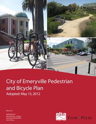
  • 1. Photocredit:Fehr&Peers May 2012 PREPARED BY: Alta Planning + Design IN ASSOCIATION WITH: Fehr & Peers City of Emeryville Pedestrian and Bicycle Plan Adopted: May 15, 2012
  • 2.
  • 3. City of Emeryville Pedestrian and Bicycle Plan May, 2012 Prepared by: Alta Planning + Design 2560 9th Street, Suite 212 Berkeley, CA 94710 (510) 540-5008 In Partnership with: Fehr & Peers Prepared for: City of Emeryville
  • 5. nnnnnnnnnnnn ACKNOWLEDGMENTS City Council Jennifer West, Mayor Kurt Brinkman, Vice Mayor Jac Asher Ruth Atkin Nora Davis Planning Commission Gail Donaldson, Chair Frank Flores, Vice Chair Lawrence C. “Buzz” Cardoza, Vice Chairperson Vanessa Kuemmerle Sean Moss Steven Steinberg John Scheuerman Bicycle and Pedestrian Advisory Committee Laura McCamy, Chair Sean Moss, Vice Chair Ryan Stahlman, Vice Chair Heather Ashcroft Jac Asher Ruth Atkin Celeste Burrows Betsy Cooley Scott Donahue* Emily Howe* David Kritzberg Tom Modic Robert Prinz* Racheljoy Rodas Svante Rodegard Andrew Shiflet* Ramsey Wright* *former committee members Technical Advisory Committee Deborah Diamond, Project Manager Maurice Kaufman, Public Works Director / City Engineer Charles S. Bryant, Planning & Building Director Michael Roberts, Senior Civil Engineer Joel Hannon, Sergeant, Police Department Diana Keena, Associate Planner Peter Schultze-Allen, Environmental Programs Analyst Arly Cassidy, Assistant Planner Sara Billing, Planning Intern Dominique B. Burton, ADA Coordinator Consultant Team Alta Staff Brett Hondorp, Principal Lauren Ledbetter, Project Manager Lucas Woodward, Planner Hannah Kapell, Planner Fehr & Peers Brooke Dubose, Transportation Planner Matt Goyne, Transportation Engineer Alta Planning + Design 2560 9th Street, Suite 212 Berkeley, CA 94710 (510) 540-5008 Phone
  • 7. City of Emeryville | i Table of Contents Part 1: Purpose, Vision and Existing Conditions 1. Introduction........................................................................................................................................................... 1-1 1.1. Purpose of Plan...................................................................................................................................................1-1 1.2. Benefits of Walking and Bicycling...............................................................................................................1-2 1.3. History of Bicycle and Pedestrian Planning in Emeryville....................................................................1-3 1.4. Summary of Public Outreach ........................................................................................................................1-4 1.5. Who is This Plan For?.....................................................................................................................................1-4 1.6. Plan Organization.............................................................................................................................................1-5 2. Vision, Goals and Policies...................................................................................................................................2-1 2.1. Vision Statement...............................................................................................................................................2-1 2.2. Goals and Policies.............................................................................................................................................2-1 3. Existing Conditions and Needs Analysis.......................................................................................................3-1 3.1. Walking Conditions in Emeryville..............................................................................................................3-1 3.2. Connections across Barriers.........................................................................................................................3-4 3.3. Paths.................................................................................................................................................................... 3-5 3.4. Bikeways and Bike Parking............................................................................................................................3-7 3.5. Walking, Biking, and Transit Patterns in Emeryville ..........................................................................3-12 3.6. Collision Analysis...........................................................................................................................................3-17 3.7. Education, Encouragement, and Enforcement Programs...................................................................3-22 3.8. Key Findings from Outreach......................................................................................................................3-22 Part 2: Implementation Strategy 4. Pedestrian and Bicycle Programs .....................................................................................................................4-1 4.1. Encouragement..................................................................................................................................................4-1 4.2. Enforcement......................................................................................................................................................4-4 4.3. Education...........................................................................................................................................................4-5 4.4. Evaluation..........................................................................................................................................................4-7 4.5. Maintenance......................................................................................................................................................4-8 4.6. Bicycle Sharing .................................................................................................................................................4-9
  • 8. Table of Contents ii | April 2012 5. Citywide Improvements.....................................................................................................................................5-1 5.1. Signalized Intersection Improvements.......................................................................................................5-1 5.2. Treatment Levels for Uncontrolled and Mid-Block Crossings ...........................................................5-1 5.3. Parklets............................................................................................................................................................... 5-5 5.4. Pedestrian Directional Signage.................................................................................................................... 5-5 5.5. Bikeway Destination Signage.......................................................................................................................5-6 5.6. Bike Parking......................................................................................................................................................5-6 5.7. Bicycle Maintenance Stations...................................................................................................................... 5-7 5.8. Signal Detection for Bicyclists ..................................................................................................................... 5-8 6. Bicycle Boulevards ................................................................................................................................................6-1 6.1. Bicycle Boulevard Standards and Best Practices......................................................................................6-1 6.2. Recommended Bicycle Boulevard Policies and Treatments for Emeryville ....................................6-6 6.3. Recommended Design Treatments for Emeryville’s Bicycle Boulevards ....................................... 6-10 7. Site-Specific Projects ...........................................................................................................................................7-1 7.1. Pedestrian Projects...........................................................................................................................................7-1 7.2. Overcrossings....................................................................................................................................................7-4 7.3. Paths.................................................................................................................................................................... 7-5 7.4. Bicycle Projects................................................................................................................................................. 7-6 7.5. Detailed Project Lists and Maps.................................................................................................................. 7-9 8. Funding and Implementation............................................................................................................................8-1 8.1. Cost Summary ...................................................................................................................................................8-1 8.2. Past Expenditures ........................................................................................................................................... 8-3 8.3. Estimated Revenue.......................................................................................................................................... 8-5 8.4. Funding Strategy ............................................................................................................................................8-12 8.5. Implementation Steps ...................................................................................................................................8-13 8.6. Action Plan.......................................................................................................................................................8-15 8.7. Priority Project Sheets..................................................................................................................................8-22 Companion Materials: Appendices Appendix A. Resources for the Design of Pedestrian Facilities......................................................................A-1 Appendix B. Resources for the Design of Bicycle Facilities............................................................................. B-1 Appendix C. Bicycle Boulevard Treatments.........................................................................................................C-1
  • 9. Emeryville Pedestrian and Bicycle Plan City of Emeryville | iii Appendix D. Bicycle Transportation Account Compliance.............................................................................D-1 Appendix E. Consistency with the General Plan ............................................................................................... E-1 Appendix F. Status of the 1998 Plan....................................................................................................................... F-1 List of Figures Figure 3-1. Collisions Involving Pedestrians and Bicyclists, 2004-2009 .....................................................................3-17 Figure 3-2. Collision rates in Emeryville and nearby cities.............................................................................................3-18 Figure 3-3. Barriers to walking (Source: Emeryville Pedestrian and Bicycle Plan survey)....................................3-25 Figure 3-4. Barriers to bicycling.............................................................................................................................................3-26 Figure 6-1. Emeryville's existing and proposed bicycle boulevards............................................................................... 6-2 Figure 6-2. Likelihood of pedestrian fatality resulting from crash based on automobile impact speed. ............ 6-3 Figure 7-1. Caltrans Bikeway Classifications........................................................................................................................7-7 List of Maps Map 3-1. Existing Pedestrian Conditions...............................................................................................................................3-3 Map 3-2. Existing Bicycle Conditions....................................................................................................................................3-11 Map 3-3. Weekday Peak Hour Pedestrian Counts............................................................................................................3-14 Map 3-4. Weekday Peak Hour Bicycle Counts..................................................................................................................3-15 Map 3-5. Pedestrian Collisions (2004-2009)......................................................................................................................3-19 Map 3-6. Bicycle Collisions (2004-2009)............................................................................................................................3-20 Map 4-1. Potential Bike Sharing Locations..........................................................................................................................4-13 Map 7-1. Recommended Pedestrian Improvements...........................................................................................................7-11 Map 7-2. Recommended Bicycle Improvements................................................................................................................7-12 List of Tables Table 3-1. Existing Crossings of Railroad Tracks and I-80 .............................................................................................. 3-4 Table 3-2. Emeryville Existing Pedestrian Paths and Multi-Use Paths........................................................................ 3-5 Table 3-3. Existing On-Street Bikeways................................................................................................................................ 3-8
  • 10. Table of Contents iv | April 2012 Table 3-4. Bikeway Connections to Adjacent Communities........................................................................................... 3-9 Table 3-5. Journey to Work (Place of Residence)..............................................................................................................3-12 Table 3-6. Journey to Work (Place of Work) .....................................................................................................................3-13 Table 3-7. Primary Transit Stops............................................................................................................................................3-16 Table 3-8: San Pablo Avenue Collisions................................................................................................................................3-18 Table 3-9. Intersections with the Highest Pedestrian or Bicyclist Collision Risk ...................................................3-21 Table 4-1. Suggested Maintenance Schedule........................................................................................................................4-8 Table 5-1. Treatment Identification Matrix for Uncontrolled and Mid-Block Crossings.......................................5-4 Table 6-1. Posted Speeds and Speed Thresholds.................................................................................................................6-4 Table 6-2. Traffic Volume Guidelines.....................................................................................................................................6-4 Table 6-3. Emeryville’s Bicycle Boulevards ........................................................................................................................... 6-6 Table 6-4. Application of bicycle boulevard treatment levels.........................................................................................6-9 Table 6-5. Recommended Treatments for Existing and Proposed Bicycle Boulevards........................................... 6-11 Table 7-1. Recommended Bus Stop Amenities by Type of Stop...................................................................................... 7-2 Table 7-2. Transit Stop Types....................................................................................................................................................7-3 Table 7-3: Detailed Pedestrian Project List..........................................................................................................................7-13 Table 7-4. Detailed Bicycle Project List ...............................................................................................................................7-20 Table 8-1. Cost Summary ........................................................................................................................................................... 8-2 Table 8-2. Pedestrian and Bicycle Facility Maintenance Cost Estimates (Proposed Projects)............................. 8-3 Table 8-3. Action Steps for Implementation of PBP Goals and Policies......................................................................8-16
  • 11. Executive Summary Introduction Emeryville is well-positioned to become one of the Bay Area’s top walking and bicycling cities due to the city’s loca- tion, small size, dense development patterns, mix of land uses, and access to local and regional transit. Emeryville benefits from a well-connected network of existing sidewalks and an evolving network of bikeways, including the Bay Trail. The City is commited to developing pedestrian and bicycle infrastructure, investing in infill developments, and engaging with the community to support in-town and inter-jurisdictional walking and bicycling. Emeryville has the potential to further encourage residents and visitors to walk and bicycle to and through the city for work, shopping, school, and recreational trips. Bicycle commuters from other com- munities and visitors traveling on the Bay Trail may stop in Emeryville to shop, eat, or play. As the East Bay’s portal to the Bay Bridge into San Francisco, Emeryville will be the bicyclist gateway to San Francisco once the Bay Bridge bicycle path is completed. Purpose The City has a long history of support- ing walking and bicycling. Many of the projects recommended in the City’s first Bicycle and Pedestrian Plan in 1998 have been constructed, and others are included in the Emeryville General Plan. This updated Pedestrian and Bicycle Plan leverages the work completed to date and details recommended improvements, implementation strategies, and project prioritization, enabling the City to focus on projects that will have the most impact on improving safety and mobility for pedestrians and bicyclists. This Plan is a blueprint for improving pedestrian and bicycle infrastructure and programs over the next ten years. The document complements the Emeryville General Plan and guides the implementation of general plan policies that support walking and bicycling. Why Walking & Bicycling? Bicycling and walking are low-cost and healthy transportation options that provide economic and livability benefits to communities. When Emeryville resi- dents or visitors choose to walk or bicycle the number of cars on the road is reduced, congestion is alleviated, and greenhouse gas emissions are reduced. Families that can replace some of their driving trips with walking or bicycling trips reduce household expenses. Replacing one daily car trip with a walking or biking trip can help Emeryville residents, workers or visi- tors get physical activity, reducing their risk of obesity, cardiovascular disease, diabetes, cancer, and osteoporosis.1,2 The health benefit of bicycling for exercise can reduce the cost of employer spending on health care, which provides a financial incentive to businesses. 1 Centers for Disease Control and Prevention, How muchdailyphysicalactivitydoyouneed?http://www. cdc.gov/physical activity/everyone/guidelines/index. html accessed August 2, 2011. 2 U.S. Department of Health and Human Services. Surgeon General’s Vision for a Healthy and Fit p ff Nation. 2010. The Bay Trail is a multi-use path running through Emeryville, and is intended to encircle San Francisco and San Pablo Bays. Th B T il i lti th i Bike lane striping on Shellmound Street provides dedicated space for bicyclists. Bik l t i i Sh ll d St t Doyle Street has bicycle boulevard markings and signs indicating that bicyclists share the travel lane with cars. D l St t h bi l b l d Executive Summary City of Emeryville Pedestrian and Bicycle Plan | v
  • 12. Public Outreach Emeryville’s citizen-based Bicycle and Pedestrian Advisory Committee (BPAC) closely guided the Plan’s development through monthly meetings which were open to the public. Residents, property owners, business owners, and employees were invited to participate via the plan website, a community survey, walking and bicycling tours, and two community workshops. The City also led classroom discus- sions with students at Emery Secondary School to consider walking and biking issues and to identify potential improve- ments that would benefit students’ travel to and from school. Input from these sources was used to understand barriers to walking and bicycling, and to identify projects and programs for inclusion in the Plan. Emeryville Pedestrian and Bicycle Plan Vision The Guiding Principles of the Emeryville General Plan articulate a vision of a livable and diverse city. Those principles are echoed in this Plan’s vision statement: Emeryville is a livable city, with a connected network of green streetsandafine-grainedtransportationnetworkthatempha- sizes and supports an active and healthy lifestyle. There are new, safe, and enticing pedestrian and bicycle linkages within theCityandtotheSanFranciscoBayandsurroundingcommu- nities. Community members have a diversity of transportation choices. Walking and bicycling are integral to daily life. The goals that support this vision are drawn directly from the general plan, and supported by more detailed policies and actions. • Goal 1: Multi-modal: A trans- portation system that eliminates the necessity of owning and/or driving personal vehicles because of the availability of convenient and accessible alternative modes of transportation. • Goal 2: A walkable city: A uni- versally accessible, safe, pleasant, convenient, and integrated pedes- trian system that provides links within the city and to surrounding communities, and reduces vehicular conflicts. • Goal 3: A safe, comprehensive, and integrated bicycle system: Develop a safe, comprehensive, and integrated bicycle system — a system and support facilities throughout the city that encourage accessible bicycling for all community members. • Goal 4: A regional bicycle and pedestrian network: Collaborate with countywide regional agencies to coordinate planning and develop- ment of County bikeways and trails to support a regional bicycle and pedestrian network. • Goal 5: Education, encourage- ment and enforcement to support walking and bicycling: Increase the safety of bicyclists and pedestri- ans and the health of the community through education, encouragement and enforcement to promote walking and bicycling. • Goal 6: Funding for pedestrian and bicycle projects and programs: Fund pedestrian and bicycle projects and programs through existing and new sources of local, regional, state, and federal funding programs. Plan Goals vi | May 2012
  • 13. Emeryville supports bicycling by sponsoring events such as Bike to Work Day. Bicycle tour participants discuss a crossing. Emeryville supports bicycling by sponsoring events such as Bike toBicycle tour participants discuss a crossing Pedestrian activity in Emeryville is oriented around major shopping destina- tions and transit hubs, while bicycling activity is evenly spread along mul- tiple corridors. The Bay Trail is a major attractor and is almost continuous from Richmond to Emeryville. In Emeryville, the existing trail uses both on-street and off-street alignments and could be sig- nificantly improved. The Union Pacific railroad tracks and Interstate 80 present major barriers to east-west travel, with few bicycle and pedestrian crossings. The Powell Street interchange, the only freeway crossing in Emeryville, is a challenging environment due to high speeds and low motorist yielding rates. Future plans for this area will provide better amenities for pedes- trians, bicyclists and transit users, as well as additional pedestrian and bicycle connections. Oakland and Berkeley are closely integrated with Emeryville, and the bicycle plans for both cities include connections to employment and shop- ping destinations in Emeryville. Education, Encouragement, and Enforcement Programs Pedestrian and bicycle programs support and encourage walking and biking and complement Emeryville’s investments in pedestrian and bicycle infrastructure. TheCitycurrentlysupportsBiketoWork Day; solicits public involvement in pedes- trian and bicycle planning; maintains facilities and pavement at a high quality; and has strong, supportive design guide- lines as well as policies and regulations that support walking and bicycling. Existing Conditions and Needs City of Emeryville Pedestrian and Bicycle Plan | vii
  • 14. • Maintenance issues can pose safety hazards to pedestrians and bicy- clists or make a route inaccessible. The Plan recommends establishing a maintenance schedule for pedestrian and bicycle facilities. • Bike sharing is a system that allows users to check out bikes from pub- licly accessible stations and return them to other locations within the service area. It may be appropri- ate for Emeryville due to the city’s small size and high concentration of workplaces. A proposed system in San Francisco could support bike sharing in Emeryville through recip- rocal memberships. Citywide Improvements Improvements to citywide systems are recommended to facilitate and encour- age walking and bicycling throughout Emeryville. These range from updat- ing signals to include countdown and audible signal heads, to developing desti- nation signage for both pedestrians and bicyclists. Key citywide recommenda- tions include the following: • Signal detection for bicyclists: Provide all signals with function- ing bicycle detection and sufficient signal timing for bicyclists to clear the intersection, and mark loop detectors with a bicycle stencil. • Pedestrian directional signage and maps: Develop a pedestrian signage program that provides information on direct and safe routes between key origins and destinations. • Bikeway destination signage: Install signs with direction and Implementation Strategy Pedestrian and Bicycle Programs The following recommended programs will support a pedestrian and bicycle friendly culture and encourage more people to walk or bike in Emeryville: • Encouragement programs provide incentives for people to try walking or bicycling. Examples include car- free street events, applying for Bicycle Friendly Community recognition,3 establishing a Safe Routes to School Program,4 and developing a walk/ bike to work program. • Enforcementprogramsenforcelegal and respectful walking, bicycling, and driving. The Plan recommends a bicycle patrol, a community- based traffic program, and targeted enforcement. • Education programs seek to improve safety and awareness. The Plan recommends pedestrian and bicycle safety campaigns and adult bicycling skills classes to provide educational opportunities. • Evaluation programs provide support for investments and help secure additional funding. The Plan recommends counting pedestrians and bicyclists annually and publish- ing a report card with the results. 3 The League of American Bicyclists’ BFC award program recognizes the efforts cities have made g f to improve the bicycling environment, including programs. 4 Safe Routes to School (SR2S) is a program to help children to get to school by walking and bicycling ) through education, encouragement, enforcement, and g g g engineering. Bike sharing is increasing in popularity as many cities, including San Francisco, plan to pilot systems. Bike sharing is increasing in popularity as San Francisco parklet Source: http://sfpavementtoparks.sfplanning.org/ San Francisco parklet distance to destinations on all bikeways, particularly on bicycle boulevards. • Parklets: Establish a parklet program to temporarily repurpose underused street parking space cre- ating space for pedestrian amenities or outdoor seating for adjacent res- taurants and cafes. • Bike parking: Continue enforcing the bicycle parking ordinance and City bike rack and locker programs; expand bicycle parking in public spaces. viii | May 2012
  • 15. Site-Specific Improvements Pedestrian Infrastructure Upgrades to pedestrian infrastructure for specific locations around the city include sidewalk gap closures, sidewalk upgrades, and new pedestrian-only paths. Pedestrian crossing improve- ments are recommended along San Pablo Avenue, Powell Street, and 40th Street, as well as selected locations on smaller roadways. Recommended corridor enhancements on 53rd Street and San Pablo Avenue could entail significant modifications and incorporate a variety of techniques to enhance the pedestrian environ- ment. The Plan recommends transit stop improvements that would provide appro- priate amenities for each transit stop, according to ridership, surrounding land uses, and available space. Bikeways Once completed, the bikeway network envisioned in the Plan will provide a comprehensive, safe, and logical network of facilities where all types of bicyclists can ride to destinations within the city or seamlessly connect into Oakland or Berkeley. Emeryville’s recommended bikeway network consists of multi-use paths, bike lanes, signed bike routes, bicycle boulevards, and streets with shared lane markings. Bicycle Boulevards The Plan provides design guidelines and policies for improving bicycle bou- levards in the city. Bicycle boulevards are streets with low traffic volume that are optimized for bicycle travel through signage, pavement markings, intersection crossing treatments, traffic calming, and traffic diversion. They address the needs of those who are interested in bicycling but concerned about riding in traffic. Improvements are recommended on sec- tions of 45th Street, 53rd Street, Doyle Street, Horton Street/Overland Avenue, Stanford Avenue, and 59th Street. Multi-use Paths Multi-use paths permit both bicyclists and pedestrians. Twelve multi-use path projects are recommended, totaling 2.04 miles. Recommendations include complet- ing the Bay Trail within Emeryville as a multi-use path with appropriate width, signs, and crossings along its length. Recommendations also include complet- ingthenorth-southEmeryvilleGreenway to provide a seamless bicycle-pedestrian corridor from 9th Street in Berkeley to 40th Street, and creating an east-west Temescal Greenway as prescribed in the general plan. Overcrossings Bicycle and pedestrian travel in Emeryville is significantly limited by two major north-south barriers, Interstate 80 and the Union Pacific railroad tracks. Recommended overcrossing improve- ments include the South Bayfront Bridge from Horton Landing Park to Ohlone Way over the railroad tracks, the 65th Street Bridge spanning Interstate-80, and a feasibility study to evaluate options for improving the pedestrian and bicycle access on the Powell Street Pedestrian/ Bicycle Bridge over the railroad tracks. Pedestrian improvements recommend pavement markings, signs, beacons, and signals to enhance major street crossings. P d t i i t d Confirmation signs display mileage to destinations to help route finding. C fi ti i di l il East BayBridge Center 0.6 WestOaklandBART 2.3 The Emeryville Greenway is a north-south linear park and pedestrian and bicycle path woven through commercial and residential areas utilizing an abandoned railroad. Bicycle Boulevards include signs and pavement markings, as well as crossing treatments and traffic calming to accommodate all types of bicyclists. Th E ill G i th th Bicycle Boulevards include signs and City of Emeryville Pedestrian and Bicycle Plan | ix
  • 16. Conclusion This Pedestrian and Bicycle Plan pro- vides Emeryville with a targeted strategy to build upon the significant work and planning that has already been com- pleted, and primes the city to become the foremost walking and bicycling commu- nity in the East Bay. As the Plan is implemented, Emeryville will become a more livable city with a connected network of green streets and a fine-grained transportation network that emphasizes and supports an active and healthy lifestyle. The City will have new, safe, and enticing pedestrian and bicycle linkages within the City and to the San Francisco Bay and surrounding communities. Community members will have a diversity of trans- portation choices, and walking and bicycling will be integral to daily life. The innovative new strategies and dedi- cation to encouraging non-motorized transportationwillmaketheCityamodel for pedestrian and bicycle planning. This Plan is for people of all ages who walk or bicycle in Emeryville and anyone interested in the City s efforts to make these modes safer and more enjoyable. This Plan is for people of all ages who walk or bicycle in Emeryville and anyone interested in the City’s Funding and Implementation The total cost of implementing the rec- ommendations in this Plan is estimated at $59.1 million including the construc- tion of two major pedestrian/bicycle bridges. As the costs of these projects and programs exceed the City’s anticipated bicycle and pedestrian funding, the Plan lays out a strategy that will help the City pursue high-priority projects and proj- ects that cost little but have a big impact, and integrate projects into larger planned roadway and development projects. The City of Emeryville has been extremely resourceful and strategic in pursuing funding for pedestrian and bicycle expenditures. City staff have suc- cessfully secured funds from a number of sources, including the redevelopment funds and the existing Transportation Impact Fee program. Emeryville has also implemented pedestrian and bicycle facilities through a variety of means including redevelopment and private development, and other mechanisms. The City will continue to fund pedestrian and bicycle projects through these sources and explore new sources, such as grant funding and inclusion in the Regional Transportation Plan, and in the Measure B sales tax expenditure plan. Action Plan To fully achieve the vision set forth in this Plan, close coordination among City departments, neighboring jurisdic- tions, and the community-at-large will be required. The Plan defines specific action steps for implementation of Pedestrian and Bicycle Plan goals and policies, as well as identifying the department or agency responsible for implementing each action and a timeframe to strategi- cally develop the City’s pedestrian and bicycle network and support programs. Some action items will be completed in the short term—within 2 years of adop- tion of the Plan, whereas others will be completed within the mid-term—2 to 5 years, or long term—5 to 10 years. x | May 2012
  • 17. May 2012 PREPARED BY: Alta Planning + Design IN ASSOCIATION WITH: Fehr & Peers City of Emeryville Pedestrian and Bicycle Plan Adopted: May 15, 2012 PART 1: PURPOSE, VISION AND EXISTING CONDITIONS
  • 18.
  • 19. Part 1: Purpose, Vision and Existing Conditions Part 1 of this Plan sets the background for the improvements recommended in Part 2 of the Plan. Part 1 outlines the importance of walking and bicycling, describes the City’s ongoing efforts to support walking and bicycling, and sets a vision, goals and policies to guide the City’s future actions. It also summarizes the current conditions for walking and bicycling in Emeryville, including physical conditions, collision statistics, the number of people walking and bicycling, and the community’s opinions, needs, and desires related to walking and bicycling. Part 1 consists of the following chapters: Chapter 1: Introduction This chapter describes the purpose of the Plan, summarizes the numerous benefits of walking and bicycling, describes the process of developing the Plan, and provides an outline of the Plan’s organization. Chapter 2: Vision, Goals, and Policies This chapter sets forth a vision of the City of Emeryville that expresses what walking and bicycling will be like in the City upon implementation of the programs and projects recommended in this Plan. The chapter includes goals and supporting policies that describe ways in which the City can realize the Plan’s vision. Action items supporting these policies are listed in Part 2 of the plan, in Chapter 8. Chapter 3: Existing Conditions and Needs Analysis This chapter describes physical opportunities and barriers to walking and bicycling in the city, summarizes travel patterns for Emeryville’s residents and workers, analyzes the past five years of pedestrian and bicyclist related collisions, and describes the key findings of the extensive outreach process that was undertaken during the development of this Plan.
  • 20. This page intentionally left blank.
  • 21. City of Emeryville | 1-1 Emeryville has a good network of sidewalks, particularly in areas of newer development. 1. Introduction Walking and bicycling are enjoyable, energizing, environmentally friendly, and low-cost forms of transportation. In a dense, urban community like Emeryville, walking and bicycling are often the quickest and most efficient ways to travel between destinations. Since the late nineties, the City of Emeryville has been committed to improving transportation choices by developing the pedestrian and bicycle infrastructure, as recommended in the City’s 1998 Bicycle and Pedestrian Plan, encouraging mixed use development, and engaging with the community to address concerns related to walking and biking. The City has a growing network of sidewalks, parks and open spaces, and an evolving network of bikeways. Emeryville is also in the process of designing and constructing major pedestrian and bicycle projects, which will significantly improve connectivity and enhance walking and bicycling. This updated Pedestrian and Bicycle Plan (Plan) continues the City’s work and leverages previous investments by taking stock of current conditions and identifying opportunities for improvements. This Plan sets forth a vision for an Emeryville where walking and biking are integral to daily life. Emeryville has invested significantly in infill developments, resulting in large employers and major retail centers in a dense urban environment that can support walking and bicycling. The city’s location, small size (1.2 square miles), development patterns, and access to local and regional transit, support both in-town and inter-jurisdictional bicycling and walking. Emeryville has further potential to encourage residents and visitors to walk and bicycle to and through the city for work, shopping, and recreational trips. Bicycle commuters from other communities and visitors traveling on the Bay Trail may stop in Emeryville to shop, eat, or play. As the East Bay’s portal to the Bay Bridge into San Francisco, Emeryville will be the bicyclist gateway to San Francisco once the Bay Bridge bicycle path is completed. 1.1. Purpose of Plan This Plan provides a blueprint for improving pedestrian and bicycle infrastructure and programs in Emeryville over the next ten years. The document complements the Emeryville General Plan (2009) and guides the implementation of General Plan policies that support walking and bicycling. The improvements recommended in this Plan will ultimately be implemented through the City’s Capital Improvement Program (CIP).
  • 22. 1 Introduction 1-2 | May 2012 1.2. Benefits of Walking and Bicycling Walking and biking help address increasing traffic congestion and deteriorating air quality, and improve public health. Supporting walking and bicycling makes environmental sense. When Emeryville residents or visitors choose to walk or bicycle the number of cars on the road is reduced, congestion is alleviated, and greenhouse gas emissions are reduced. Supporting walking and bicycling makes economic sense. The average cost of owning and operating a new car is almost $8,000 per year.5 Pedestrian and bicycle infrastructure provides transportation choices to those who cannot or do not drive, such as people with disabilities, youth, seniors, and people with limited incomes. Families that can replace some of their driving trips with walking or bicycling trips spend a lower proportion of their income on transportation, compared to households that rely on cars, freeing additional income for local goods and services.6 In addition, patrons who walk and bike to local stores have been found to spend more money at local businesses than patrons who drive.7 Supporting walking and bicycling makes public health sense. Replacing one daily car trip with a walking or biking trip can help Emeryville residents, workers or visitors get the recommended 150 minutes of weekly physical activity, and reduce their risk of obesity, cardiovascular disease, diabetes, cancer, and osteoporosis.8,9 The health benefit of bicycling for exercise can reduce the cost of employer spending on health care by as much as $500 a year (by decreased sick leave and compensation), which provides a financial incentive to businesses that provide health coverage to their employees.10 5 Livable Places. (No Date). The Cost of Car Ownership. http://www.livableplaces.org/policy/carownership.html 6 Center for Neighborhood Technology. (2005). Driven to Spend: Pumping Dollars out of Our Households and Communities. 7 The Clean Air Partnership. (2009). Bike Lanes, On-Street Parking and Business: A Study of Bloor Street in Toronto’s Annex Neighborhood. 8 Centers for Disease Control and Prevention, How much daily physical activity do you need? http://www.cdc.gov/physicalactivity/everyone/guidelines/index.html accessed August 2, 2011. 9 U.S. Department of Health and Human Services. Surgeon General’s Vision for a Healthy and Fit Nation. 2010. 10 Feifei, W., McDonald, T., Champagne, L.J., and Edington, D.W. (2004). Relationship of Body Mass Index and Physical Activity to Health Care Costs Among Employees. Journal of Occupational and Environmental Medicine. 46(5):428-436 Can Walking and Bicycling Improve Air Quality? The San Francisco Bay Area has adopted challenging but critical greenhouse gas emissions targets: 7 percent per capita reduction by 2020 and 15 percent per capita reduction by 2035. Walking and bicycling can help realize these goals by replacing short trips and trips to transit. Most trips in the Bay Area are short; according to the Bay Area Air Quality Management District (BAAQMD), 40 percent of trips are two miles or less.Pollution doesn’t increase directly with trip length; a one-mile trip emits up to 70 percent as much pollution as a 10-mile excursion due to cold starts (i.e., when a car hasn’t been driven in a few hours and the engine is cool). BAAQMD estimates that 75 percent of air pollution emissions in the Bay Area are from mobile sources, particularly cars and light duty trucks. Reducing reliance on motor vehicles, particularly for short trips, can significantly reduce greenhouse gas emissions.
  • 23. Emeryville Pedestrian and Bicycle Plan City of Emeryville | 1-3 Proposed pedestrian pathway along Powell Street. Source: Powell Street Urban Design Plan 1.3. History of Bicycle and Pedestrian Planning in Emeryville The City adopted its first Bicycle and Pedestrian Plan in 1998 and has since constructed many of the recommended facilities. The pedestrian and bicycle projects identified in the 1998 plan were reevaluated and incorporated into the Emeryville General Plan. The status of the projects in the 1998 Bicycle and Pedestrian Plan is summarized in Appendix F. The General Plan provides the framework for the projects and programs described in Chapters 4 through 7. This Plan adds detail to the General Plan projects by designating specific facility type classifications for bikeways and by identifying specific sidewalk and crossing treatments within the General Plan’s pedestrian priority zones. The recommended projects include some projects not identified in the General Plan and exclude or modify others. Several other plans are closely related to this Plan. Components of these plans have been incorporated into the improvement strategy contained in Part 2 as follows: • The City’s Capital Improvement Program (CIP) lists specific infrastructure projects that the City will pursue over a five-year timeframe. All pedestrian and bicycle projects identified in the 2006-2011 CIP have been incorporated into this Plan. New projects identified here will need to be incorporated into future CIPs for implementation. Chapter 8, Funding and Implementation, discusses project implementation in more detail. • In 2010, the City completed an Americans with Disabilities (ADA) Self Survey identifying locations in the public rights-of-way that do not meet the Americans with Disabilities Act (ADA). The survey considers midblock locations, intersections, and pedestrian signals, and it establishes priorities for improvements. The issues identified in the Survey are currently being incorporated into an ADA Transition Plan, which will guide the planning and implementation of program, facility, and sidewalk modifications to meet ADA standards. This Plan incorporates ADA-related improvements into the recommendations, but defers to the Self Survey and the ADA Transition Plan for a comprehensive list of ADA-related right-of-way improvements. • The Powell Street Urban Design Plan presents conceptual streetscape designs for Powell Street from Frontage Road to Christie Avenue, one of the most challenging locations in the city for pedestrians and bicyclists. The improvements would be implemented in phases. This Plan incorporates the pedestrian and bicycle-related improvements put forth in the Powell Street Urban Design Plan. • County and Regional Plans: Recommendations from several county and regional plans have been incorporated into this plan: the Alameda Countywide Strategic Pedestrian Plan (2006), the Alameda Countywide Bicycle Plan (2006), and the Metropolitan Transportation Commission Regional Bicycle Plan for the San Francisco Bay Area (2009).
  • 24. 1 Introduction 1-4 | May 2012 Postcards announcing public outreach events and resources were sent to every resident, property owner and business in Emeryville. The City is also developing a Sustainable Transportation Plan and updating the Traffic Facilities Impact Fee. 1.4. Summary of Public Outreach Public outreach was essential to developing this Plan. Emeryville’s citizen-based Bicycle and Pedestrian Advisory Committee (BPAC) closely guided the Plan’s development, through monthly meetings which were open to the public. In addition, the broader community was invited to participate through several outlets, which were publicized through postcards sent to every resident, property owner, and business in the City. Components of the public outreach included: • Website to keep the Emeryville community informed at every stage of Plan development and to invite comments. • Survey. Nearly 120 community members responded to a walking and bicycling survey. • Tours. The City hosted one walking and one biking tour with City staff, elected officials, and interested community members. • Outreach to Students. The City led classroom discussions with 6th through 9th grade students at Emery Secondary School to consider walking and biking issues and to identify potential improvements that would benefit students’ travel to and from school. • Community Workshops. The City publicized and held two citywide public workshops to provide additional opportunity for comment. Insights and recommendations from outreach have informed all aspects of the Plan. Findings from these efforts are summarized at the end of Chapter 3. 1.5. Who is This Plan For? This Plan is for people of all ages that walk or bicycle in Emeryville and anyone interested in the City’s efforts to make these modes safer and more enjoyable. Community members may be most interested in Chapters 4 through 7, which describe improvement projects and programmatic recommendations. Developers and designers of private property will also be interested in Chapters 4 through 7, and Priority Project Sheets in Chapter 8, to identify projects that may be required as a condition of development, and Appendices A and B, which provide resources for the design of pedestrian and bicycle infrastructure. The Emeryville City Council and committee members will be interested in the recommendations contained in Chapters 4 through 7, as well as the prioritization and phasing also included in Chapter 4, and the funding and implementation plan described in Chapter 8.
  • 25. Emeryville Pedestrian and Bicycle Plan City of Emeryville | 1-5 City staff, who are ultimately responsible for the Plan’s implementation will be most interested in Chapters 4 through 8 and Appendices A and B. 1.6. Plan Organization This Plan is divided into two parts. Part 1, Purpose, Vision, and Existing Conditions, sets the background for the recommendations contained in Part 2: Implementation Strategy. Part 1 consists of the following chapters: • Chapter 1, Introduction, describes the purpose of this Plan, the history of pedestrian and bicycle planning in the City of Emeryville, and describes the overall structure of this Plan. • Chapter 2, Vision, Goals, and Policies, describes the future vision for walking and bicycling in Emeryville and supportive goals and specific policies that the City will take to meet this vision. • Chapter 3, Existing Conditions, describes existing pedestrian and bicycle infrastructure; summarizes transit counts and travel patterns; presents a historical analysis of pedestrian and bicycle-related collisions; and identifies gaps in pedestrian and bicycle infrastructure. Chapter 3 also includes a summary of the results of the public outreach program, documenting insights, concerns, and suggestions provided by community members. Part 2 consists of the following chapters: • Chapter 4, Pedestrian and Bicycle Programs, describes programmatic improvements, such as education and enforcement programs, that are essential to increasing the desirability and safety of walking and biking. • Chapter 5: Citywide Improvements, describes citywide infrastructure projects that should be implemented throughout the city to improve pedestrian and bicycle travel. • Chapter 6: Bicycle Boulevards, describes the City’s policy for designating, constructing, and monitoring bicycle boulevards. It includes infrastructure improvements that will enhance the City’s bicycle boulevard network. • Chapter 7: Site-Specific Projects, describes specific infrastructure projects that are needed to make it safer and more convenient to walk and bike in Emeryville. The chapter includes maps of projects and a prioritized list of recommendations, including cost estimates for individual projects. • Chapter 8 Funding and Implementation, presents a discussion of the tools for implementing the plan including a funding strategy, phasing and grouping of projects, and an action plan to help the City achieve this Plan’s goals. This Plan is supported by the following appendices that provide information for implementing the recommendations enumerated in the Plan: • Appendix A, Resources for the Design of Pedestrian Facilities, provides guidelines for streets, sidewalks and intersection crossing treatments. The appendix also suggests a design review and implementation checklist for providing pedestrian facilities. • Appendix B, Resources for the Design of Bicycle Facilities, outlines design standards and best practices for bicycle facilities, including on-street bikeways, intersections, innovative facilities, and
  • 26. 1 Introduction 1-6 | May 2012 bicycle parking. The appendix also suggests a design review and implementation checklist for providing bicycle facilities. • Appendix C, Bicycle Boulevard Treatments, provides the bicycle boulevard best practice research and recommendations for Emeryville’s bicycle boulevard network. • Appendix D, BTA Compliance, outlines the information required for the Caltrans Bicycle Transportation Account for funding eligibility. • Appendix E, Consistency with the General Plan, summarizes how this Plan's recommendations differ from the recommendations presented in the Emeryville General Plan. • Appendix F, Status of Bikeways from 1998 Plan, summarizes the implementation status of bikeways recommended for the 1998 Bicycle Plan.
  • 27. City of Emeryville | 2-1 2. Vision, Goals and Policies The vision, goals and policies presented in this Plan are drawn largely from the Emeryville General Plan, which contains numerous policy statements that are supportive of walking and bicycling. The General Plan’s Guiding Principles articulate a vision of a livable and diverse city. Four of these principles directly relate to the encouragement of walking and bicycling as everyday activities. General Plan Guiding Principles related to pedestrian and bicycle connectivity are paraphrased as follows: • A connected place: New and safe bicycle and pedestrian linkages to the San Francisco Bay • Enhanced and connected open space network and green streets: Building on the strength and connectivity of the city’s greenways • A walkable, fine-grained city, emphasizing pedestrians: Through improved sidewalks, pathways and streetscapes • A diversity of transportation modes and choices: Fosters and provides incentives for alternative transportation modes. 2.1.Vision Statement The vision statement expresses what walking and bicycling will be like in Emeryville in the future if the City successfully implements this Pedestrian and Bicycle Plan. The vision statement is: Emeryville is a livable city, with a connected network of green streets and a fine-grained transportation network that emphasizes and supports an active and healthy lifestyle. There are new, safe, and enticing pedestrian and bicycle linkages within the City and to the San Francisco Bay and surrounding communities. Community members have a diversity of transportation choices. Walking and bicycling are integral to daily life. 2.2.Goals and Policies Goals expand on the vision with more detail, while policies provide more specific direction to implement the goals. Most of the goals and policies identified here are from the General Plan’s Transportation Element and are noted with the specific General Plan Goal and Policy numbers. New goals and policies that supplement the General Plan policies are underlined. All projects and programs recommended by this Plan flow from these vision, goals and policies. An action plan to implement these goals and policies is provided in Chapter 8: Funding and Implementation.
  • 28. 2 Vision, Goals and Policies 2-2 | May 2012 Crosswalks with good pedestrian access are critical to the pedestrian environment. Goal 1: Multi-modal A transportation system that eliminates the necessity of owning and/or driving personal vehicles because of the availability of convenient and accessible alternative modes of transportation. (General Plan T-G-3) Policies: P1.1 The design, construction, operation, and maintenance of city streets shall be based on a “complete streets” concept that enables safe, comfortable, and attractive access and travel for pedestrians, bicyclists, motorists, and transit users of all ages and abilities. (General Plan T-P-2) P1.2 To the extent allowed by law, the City’s Traffic Impact Fee shall include bicycle, pedestrian, transit, and road improvements so that development pays its fair share toward a circulation system that optimizes travel by all modes. (General Plan T-P-6) P1.3 The City will strive for most trips within Emeryville to occur on foot, on bike, or on transit by providing enticing, safe, and direct pedestrian and bicycle connections to all major destinations and transit, and by making bicycling and walking the easiest and least expensive way to travel within the city. P1.4 The City will strive to balance the needs of pedestrians, bicyclists, and motorists in all roadway and reconstruction projects. P1.5 The City will consider health issues in the community design process and in promoting walking and biking as a form of transportation and recreation. P1.6 The City will implement strategies that manage traffic speed in order to improve safety for pedestrians, bicyclists, and motorists. P1.7 The City will evaluate the suitability of providing a citywide bicycle sharing system and if feasible, work with local employers, transit agencies, and neighboring communities to plan, fund, and implement a bicycle sharing system. P1.8 Emeryville will remain up to date on new laws and practice pertaining to pedestrian and bicycle transportation. P1.9 The City will seek to develop San Pablo Avenue as a green, multi-modal corridor. Goal 2: A walkable city A universally accessible, safe, pleasant, convenient, and integrated pedestrian system that provides links within the city and to surrounding communities, and reduces vehicular conflicts. (General Plan T-G-4) Policies: P2.1 The pedestrian circulation system shall be as set forth in this Plan and the General Plan and based on the typologies described in the General Plan. (General Plan T-P-10)
  • 29. Emeryville Pedestrian and Bicycle Plan City of Emeryville | 2-3 P2.2 Sidewalks shall be provided on both sides of all streets; pedestrian connections between new and existing development is required. (General Plan T-P-11) P2.3 Sidewalks shall be safe, comfortable, and accessible for pedestrians. (General Plan UD-P-42) P2.4 The City will plan, upgrade, and maintain pedestrian crossings at intersections and mid-block locations by providing safe, well-marked crosswalks with audio/visual warnings, bulb-outs, and median refuges that reduce crossing widths. (General Plan T-P-12) P2.5 Pedestrian routes will be provided across large blocks, pursuing creative options if necessary such as purchasing private alleys, designating pathways through buildings, and acquiring public access easements. (General Plan T-P-13) P2.6 Establish Pedestrian Priority Zones in Neighborhood Centers, around schools, and in other locations as indicated in the General Plan, where wider sidewalks, street lighting, crosswalks, and other pedestrian amenities are emphasized. Link these zones to adjacent land uses to ensure that building frontages respect pedestrians and truck loading takes place on adjacent streets wherever possible. (General Plan T-P-14) P2.7 Walking will be encouraged through building design and ensuring that automobile parking facilities are designed to facilitate convenient pedestrian access within the parking area and between nearby buildings and adjacent sidewalks. Primary pedestrian entries to nonresidential buildings should be from the sidewalk, not from parking facilities. (General Plan T-P-15) P2.8 Safe and direct pedestrian access to Aquatic Park and the peninsula will be provided and maintained. (General Plan T-P-20) P2.9 Safe pedestrian walkways that link to streets and adjacent bus stops will be required of new development. (General Plan T-P-16) P2.10 The City will require new development to minimize the number and width of curb cuts for vehicles to reduce vehicle conflicts with pedestrians. (General Plan T-P-17) P2.11 The City will use the best possible technology as feasible to create the shortest possible wait time for pedestrians at signalized intersections. Particularly, where pedestrian volumes are high, automatic pedestrian walk signals will be provided, where timing allows. Where activation is needed to get a walk signal, a mechanism will be provided to show activation and pedestrian countdown. P2.12 Where feasible, the City will provide drinking fountains, public toilets, benches, and other pedestrian amenities on public property. P2.13 The City will evaluate and improve existing and proposed uncontrolled marked crosswalks with the purpose of improving pedestrian safety and, in doing so, enhance pedestrian accessibility and mobility. P2.14 The City will provide pedestrian-oriented destination signs and walking maps, especially at the transit hubs.
  • 30. 2 Vision, Goals and Policies 2-4 | May 2012 Pedestrian and bicycle facilities can be integrated to improve awareness and visibility of all modes. Goal 3: A safe, comprehensive, and integrated bicycle system Develop a safe, comprehensive, and integrated bicycle system— A system and support facilities throughout the city that encourage accessible bicycling for all community members. (General Plan T-G-5) Policies: P3.1 The City will develop the bicycle circulation system set forth in the General Plan and based on the typologies described in the General Plan. (General Plan T-P-21) P3.2 On-street bike routes in the City’s Bicycle and Pedestrian Plan shall be designated as either Class II (bike lanes) or Class III (signed routes without lanes), as appropriate. (General Plan T-P-23) P3.3 The City will construct the network of bicycle boulevards and monitor them for performance goals, as indicated in Chapter 6 of this Plan. P3.4 Safe, secure, and convenient short- and long-term bicycle parking shall be provided near destinations for all users, including commuters, residents, shoppers, students, and other bicycle travelers. Retail businesses in regional retail areas are encouraged to provide valet bicycle parking. (General Plan T-P-24) P3.5 The City will provide showers and changing facilities in civic buildings for employees and, where practical, support the development of such facilities in commercial buildings. P3.6 A numbered bike route system with destination signs, consistent with the regional bike route numbering system, shall be developed and implemented with clear signage to bicycle boulevards. (General Plan T-P-25) P3.7 The City will seek to attract a bicycle store, community bicycle shop, bicycle station, and/or other gathering/retail/shop space for bicyclists. P3.8 The City will improve intersection crossings of bikeways and busy streets and ensure bicycle paths, lanes and routes have good accommodations for crossing high-volume or high-speed roadways. P3.9 All signals shall have functioning bicycle detection and signal timing should be long enough to allow bicyclists to clear the intersection. The City will use the best technology as feasible to create the shortest possible delay for bicyclists.
  • 31. Emeryville Pedestrian and Bicycle Plan City of Emeryville | 2-5 The Emeryville Greenway is a north-south linear park and pedestrian and bicycle path woven through commercial and residential areas utilizing an abandoned railroad. Goal 4: A regional bicycle and pedestrian network Collaborate with countywide regional agencies to coordinate planning and development of County bikeways and trails to support a regional bicycle and pedestrian network. Policies: P4.1 The City’s preferred Bay Trail route through Emeryville is set forth in the General Plan, including the main trail between Frontage Road in Berkeley and Mandela Parkway in Oakland, and spur trails to the Marina along Powell Street and to the Bay Bridge along the east side of Interstate 80. (General Plan T-P-22) P4.2 The City will provide bikeways, bike parking, and pedestrian walkways to support connections with transit, including Amtrak, Emery Go Round, AC Transit, and MacArthur, West Oakland, and Ashby BART Stations. P4.3 The City, in collaboration with stakeholders and interested agencies and parties, will study the feasibility of a pedestrian/bicycle trail along the west side of I-80, east of the Emeryville Crescent, to provide access from the Bay Trail to the eastern span of the Bay Bridge. (General Plan T-P-18) P4.4 Following completion of the new east span of the Bay Bridge, the west span should be retrofitted with a pathway to provide continuous pedestrian and bicycle access between San Francisco and the East Bay. (General Plan T-P-19) Goal 5: Education, encouragement and enforcement to support walking and bicycling Increase the safety of bicyclists and pedestrians and the health of the community through education, encouragement and enforcement to promote walking and bicycling. Policies: P5.1 Bicycling will be promoted through public education, including the publication of literature concerning bicycle safety and the travel, health and environmental benefits of bicycling. (General Plan T-P-26) P5.2 The City will promote programs that teach people good walking and bicycling habits to last a lifetime. Examples include “Safe Routes to School,” children’s bicycle safety rodeos, adult bicycle education courses, and traffic citation diversion programs. P5.3 The City will continue to develop materials that increase public awareness of available facilities for safe walking and bicycling, such as a walking/biking map, walking tours/bike tours of the city, street
  • 32. 2 Vision, Goals and Policies 2-6 | May 2012 fairs, and pedestrian/bicyclist safety pamphlets, and promote these materials on the City website and at special events. P5.4 The City will support special events that encourage people to bike or walk instead of drive, such as Bike to Work Day, International Walk and Bike to School Day, and the Bike Commute Challenge. P5.5 The City will establish a bicycle/pedestrian route around the city, which highlights locations relevant to Emeryville’s history and art. Goal 6: Funding for pedestrian and bicycle projects and programs Fund pedestrian and bicycle projects and programs through existing and new sources of local, regional, state, and federal funding programs Policies: P6.1 The City will continue to apply for county, regional, state and federal funding opportunities, continue to collect Transportation Improvement Fees, include pedestrian and bicycling facilities as conditions of development, and include pedestrian and bicycle projects and programs in the City Capital Improvement Program. P6.2 The City will update its Pedestrian and Bicycle Plan at least every ten years, or as changing conditions warrant, to maintain eligibility for Caltrans funding.
  • 33. City of Emeryville | 3-1 San Pablo Avenue provides wide sidewalks with retail, trees, lights, and transit accommodations. Sidewalk blocked by building face and parked vehicles. 3. Existing Conditions and Needs Analysis This chapter describes and analyzes the existing conditions for walking and bicycling in Emeryville. It begins by discussing pedestrian facilities, multi-use paths and overcrossings, and on-street bikeways, and then presents travel patterns of pedestrians, bicyclists, and transit users in Emeryville. It summarizes pedestrian and bicyclist collision data, key network gaps and opportunities, and the City’s existing education, encouragement, and enforcement programs that support walking and bicycling. It concludes with a summary of insights, concerns, and suggestions identified by community members during the development of this Plan. 3.1. Walking Conditions in Emeryville Emeryville’s small size makes it an ideal city for walking. This section reviews the existing pedestrian facilities and amenities and identifies opportunities for improvement. The following review of walking conditions is drawn from fieldwork, the draft ADA Transition Plan (2010), and input from City staff, the Bicycle and Pedestrian Advisory Committee, and members of the public. Map 3-1 shows Emeryville’s existing pedestrian conditions. 3.1.1 Sidewalks Sidewalks exist along both sides of most streets in Emeryville, with the exception of a few locations in the northeast industrial area of the city, on one side of Shellmound Street, and in the Park Avenue District. Sidewalk design varies from wide sidewalks with street trees— such as along San Pablo Avenue— to narrow sidewalks cluttered with facilities—such as along 40th Street and the North Bayfront area. Traditional residential neighborhoods and areas that have seen recent redevelopment generally have street trees and landscaping, while other areas provide only basic pedestrian amenities. In some locations sidewalk design is governed by area plans including the Shellmound Streetscape Design Guidelines (2007), Park Avenue District Plan (2006), North Hollis Urban Design Program (2002), and the Powell Street Urban Design Plan (2010). In 2010 the City adopted citywide design guidelines, the Emeryville Design Guidelines, which include guidelines for sidewalk design for all areas of the city. Off-street pathways provide additional pedestrian connections through the city, and are described in Section 3.3.
  • 34. 3 Existing Conditions 3-2 | May 2012 The Powell Street Interchange presents long crossing distances and high vehicle speeds. A high-visibility continental-style crosswalk for the Emeryville Greenway crossing at 66th Street. 3.1.2 Intersections There are a variety of intersection and mid-block crossing treatments throughout Emeryville, including parallel striped crosswalks at signals, countdown signals, pedestrian-actuated signals with audio/visual warnings, bulb-outs, and median refuges that reduce crossing distances. Prior to the development of this Plan, Emeryville did not have an established crosswalk policy for when, where, and how to mark crossings. However, the City has been generally consistent in marking crosswalks at intersections and key mid- block locations. For busier intersections or mid-block crossings, continental-style crosswalks are often used. These consist of two-foot bars spaced two feet apart. At schools, crosswalks are yellow, as required by the California Department of Transportation (Caltrans). Innovative Intersection Treatments The traffic signals at the intersections of Powell Street and Christie Avenue and Shellmound Street and Ohlone Way include a leading pedestrian interval. At these intersections, pedestrians are given a walk signal before parallel traffic is given a green light, which allows pedestrians to enter the crosswalk before the turning vehicles may proceed, thereby reducing the chance that pedestrians will be cut off by turning motorists. The City has installed an all-way pedestrian phase at the intersection of Christie Avenue and Shellmound Street. While this phase is typically used as a pedestrian scramble, where pedestrians can cross in all directions at once including diagonally, diagonal crossing is not permitted at the Christie Avenue/Shellmound Street intersection. While this treatment allows safer pedestrian movements by limiting conflicts with turning motor vehicles, it also increases the time a pedestrian must wait before they are given a walk signal. Traffic Signals All of the traffic signals in Emeryville require pedestrians to push a button to activate the walk signal. At most signals, a pedestrian arriving immediately after the light turns green must wait a full cycle to get a walk signal. Most pedestrian crossings at signalized intersections use an audible beeper to guide pedestrians with visual impairments across the intersection. Map 3-1 shows the existing and proposed pedestrian circulation system and identifies sidewalk gaps. Marked vs. Unmarked Crossings In California, it is legal for pedestrians to cross at any intersection, whether or not a crosswalk is painted, except where crossing is expressly prohibited. Marked crossings reinforce the location and legitimacy of a crossing.
  • 35. Emeryville Pedestrian and Bicycle Plan City of Emeryville | 3-3 Map 3-1. Existing Pedestrian Conditions
  • 36. 3 Existing Conditions 3-4 | May 2012 3.2. Connections across Barriers Because the railroad tracks and I-80 present major barriers to east-west travel in Emeryville, pedestrian and bicycle crossings are especially important. Grade-separated railroad crossings are located at 40th Street, Powell Street, and the Amtrak station. At-grade railroad crossings are located at 65th , 66th , and 67th Streets. The proposed South Bayfront Bridge would connect 53rd Street with Ohlone Way and Bay Street and provide a much-needed connection across the railroad tracks in southern Emeryville. Plans for a transit center (Emery Station West) include improvements to the approach to the existing Amtrak overcrossing. Currently there is only one freeway crossing in the city, at Powell Street. The Powell Street interchange is a challenging environment for pedestrians and bicyclists due to the on- and off-ramps, high speeds and limited visibility throughout the area. Fortunately, the City has extensive plans to redesign the area to provide better amenities for pedestrians, bicyclists and transit users. The City also has plans to construct a bicycle and pedestrian bridge over I-80, connecting 65th Street with the Bay Trail. Emeryville is working with Caltrans and the City of Oakland to develop a pedestrian and bicycle undercrossing of I-80 connecting the Bay Trail on Shellmound Street at the IKEA entrance to the proposed pathway to the Bay Bridge East Span. This project would be built within Oakland city limits. Table 3-1 summarizes existing crossings of the railroad tracks and freeway. Table 3-1. Existing Crossings of Railroad Tracks and I-80 Name Type of Crossing Notes Railroad Crossings 40th Street Roadway Crossing • Buffered bike lanes provided on both sides • Sidewalk provided on north side Powell Street Bridge Roadway Crossing Pedestrian-Only Overcrossing • Roadway crossing has no bike lanes or sidewalks • Pedestrian-only overcrossing only accessible by several flights of stairs, making it inaccessible to bicyclists, people using mobility assistive devices (e.g. wheelchairs) • Can be difficult to find; personal safety concerns due to the poor lighting and sightlines Bridge at Amtrak Station Ped/Bike Overcrossing • Connects Horton Street with the Public Market on Shellmound Street • Has stairs and an elevator • Not easily identifiable from 59th and Horton Streets • Connection to Shellmound Street passes through a parking lot • Plans for the Emery Station West transit center and the Market Place include improvements to the approaches 65th Street At-Grade • Class II bike lanes provide bicycle access • Sidewalks on both sides 66th Street At-Grade • No sidewalks 67th Street At-Grade • No sidewalks I-80 Crossings Powell Street Undercrossing • Narrow sidewalks provided on north side, bike path on south side • Ramp and intersection modifications to improve pedestrian and bicycle safety are currently under construction. The Powell Street Urban Design Plan (2010) proposes comprehensive redesign of the area to provide better amenities for pedestrians, bicyclists and transit users
  • 37. Emeryville Pedestrian and Bicycle Plan City of Emeryville | 3-5 3.3. Paths Paths include pedestrian-only paths, which are intended only for pedestrians—including people using wheelchairs or other assistive devices—and multi-use paths, which permit bicyclists, pedestrians and other non-motorized uses. Pedestrian-only paths can be paved, hard-packed dirt or decomposed granite, while multi-use paths must be paved, and may include a yellow striped centerline or other pavement markings. Multi-use path design should meet Caltrans standards, which are described briefly in Section 3.4. Table 3-2 lists Emeryville’s existing paths. The City’s two major paths, the Bay Trail and the Emeryville Greenway, are described in more detail below. Table 3-2. Emeryville Existing Pedestrian Paths and Multi-Use Paths Name Type of Path Location Mileage Notes Bay Trail Multi-use Along bay side of Frontage Road from north city limit to Powell Street, then to Shellmound St 1.2 • Continues north into Berkeley • The entire Bay Trail alignment through Emeryville includes both multi-use paths and bike lane segments. See Map 3-2 for the alignment. Joseph Emery Park Path Multi-use West of San Pablo Avenue from Park Avenue to 45th Street 0.2 Marina Park Path Pedestrian Path Along Powell Street on peninsula 2.8 North-South Greenway Multi-use/ Pedestrian Path Along former railroad right of way from north city limit to Powell Street at Hollis Street 0.5 (0.2 multi- use) • Alignment follows railroad right of way and includes Doyle Street Bicycle Boulevard • Between Ocean Avenue and 59th Street, bicyclists are routed to Doyle Street Bicycle Boulevard and pedestrians use sidewalk. • Between 59th Street and Powell Street, the path becomes pedestrian-only and is incomplete • Plans are in place to continue the path to the south Temescal Creek Park Path Pedestrian Path Along Temescal Creek from 48th Street to Adeline Street 0.2
  • 38. 3 Existing Conditions 3-6 | May 2012 Textured pavement on the Bay Trail at Frontage Road. Bay Trail The Bay Trail is a planned recreational corridor that is intended to encircle San Francisco and San Pablo Bays, with 500 miles of continuous off-street trails. Within Emeryville, the Bay Trail includes both on-street bikeways and off-street paths. Along Powell Street and north of Powell Street, the Bay Trail is a multi-use path that continues north into Berkeley and provides access to Point Emery, the Berkeley Marina, and The Towers office complex. South of Powell Street, the Bay Trail transitions to bike lanes and a sidewalk and travels along Shellmound Street and 40th Street and connects to Mandela Parkway in Oakland. The connection between the multi-use path on Powell Street and the bike lanes on Shellmound Street is convoluted and includes a segment along an easement through the Sheraton Four Points Hotel parking lot. Emeryville Greenway The City has plans to complete a Greenway composed of paths, green streets, bicycle boulevards and parks which would extend from the 9th Street bicycle boulevard connection in Berkeley to the Bay Trail at the southern City limits. The Greenway is a Rails-to-Trails project that follows the alignment of former railroad right of way. The City has constructed portions of this greenway, including a multi-use path extending from Ocean Avenue at the terminus of the Doyle Street Bicycle Boulevard north to the Berkeley border above 67th Street. The path continues in Berkeley to Murray Street. South of Doyle Street, the Greenway continues as a pedestrian-only pathway to the intersection of Powell and Hollis Streets. The multi-use path includes separate bicycle and pedestrian paths, landscaping, pedestrian-scale lighting, benches and bicycle racks. Adjacent apartments front the greenway, providing “eyes on the street.” Crossings at 65th , 66th , and 67th Streets include curb extensions, advance yield markings, and striped crosswalks. The path will connect north across Ashby Avenue to the 9th Street Bicycle Boulevard in Berkeley and south to the planned Horton Landing Park and then to Bay Street via the planned South Bayfront bridge. In Emeryville, the long-term plan is to extend the pedestrian-only path south to Horton Street (adjacent to bike lanes on Stanford Avenue), then continuing it as a multi-use path to Halleck or Hubbard Streets at Sherwin Avenue. Sections of the Emeryville Greenway include a soft- surface pedestrian path and adjacent paved multi-use path.
  • 39. Emeryville Pedestrian and Bicycle Plan City of Emeryville | 3-7 3.4. Bikeways and Bike Parking The California Highway Design Manual (HDM) and the California Manual of Uniform Traffic Control Devices (CA MUTCD) present standards that the City of Emeryville is required to follow when designing bikeways. The term “bikeways” refers to three Caltrans defined classifications: Class I bike paths/multi-use paths, Class II bike lanes, and Class III bike routes. Existing bikeways are listed in Table 3-3 and shown in Map 3-2. 3.4.1 Class I Multi-Use Paths Class I bikeways or multi-use paths provide bicycle travel on a paved right of way completely separate from any street or highway. These paths are commonly used by bicyclists, pedestrians, joggers, in-line skaters, and others. Multi-use paths are separated from roadways, paved and at least eight feet wide. Emeryville has 1.6 miles of Class I multi-use paths. The city’s multi-use paths are described in Section 3.3. 3.4.2 Class II Bicycle Lanes Class II bike lanes are striped lanes on roadways for one-way bicycle travel. Bike lanes are at least five feet wide and also include bicycle lane signage. Bike lanes are primarily striped along streets with higher traffic volumes. The buffered bike lane on the 40th Street Bridge is the only one of its kind in the city. It provides crucial protection for bicyclists travelling between destinations along Shellmound Street and residential neighborhoods. Emeryville has 4.0 miles of striped bike lanes. 3.4.3 Class III Bike Routes Class III bike routes are roadways where bicyclists and motorists share a travel lane, and are designated by bike route signs. Bicycle routes typically fill in the bicycle network where Class II facilities or bicycle boulevards may not be appropriate. Shared lane markings may be used on Class III bike routes. Emeryville has 0.4 miles of Class III bike routes. Class I Multi-Use Path. Class II Bike Lane striping. Class III Bike Route sign. Designated Bikeways In California, unless it is expressly forbidden, bicyclists are legally allowed to ride on any roadway, regardless of whether that roadway has bike lanes or bike route signs.
  • 40. 3 Existing Conditions 3-8 | May 2012 3.4.4 Bicycle Boulevards Bicycle boulevards are streets with low traffic volume that have been optimized for bicycle travel through traffic calming, diversion, signage, pavement markings, and intersection crossing treatments. When correctly implemented, they are shared roadway facilities that are comfortable and attractive to bicyclists with a wide range of abilities and ages. Through automobile use is discouraged on bicycle boulevards. Bicycle boulevards are not recognized by Caltrans. Emeryville has 2.0 miles of bicycle boulevards. Table 3-3. Existing On-Street Bikeways Name Start End Mileage Class I Multi-Use Paths See Table 3-2 on page 3-5 1.6 Class II Bike Lanes 40th Street Shellmound St San Pablo Ave 0.6 65th Street Shellmound St Greenway 0.3 Adeline Street N. City Limit S City Limits 0.7 Emery Street 40th Street Macarthur Blvd 0.2 Powell Street Frontage Rd Marina Area 0.6 Shellmound Street N City Limits S City Limits 1.5 Stanford Avenue Horton St Hollis St 0.1 Class II Bike Lanes Total 4.0 Class III Bike Routes Spur Alley 53rd Street 45th Street 0.2 Hollis Street 40th St S. City Limit 0.1 53rd Street Horton St Hollis Street 0.1 Class III Bike Routes Total 0.4 Bicycle Boulevards 45th Street Hollis St San Pablo Ave 0.3 59th Street Horton St Doyle St 0.2 Doyle Street 59th St Ocean St 0.3 Horton Street/ Overland Avenue 65th St 40th St 1.2 Bicycle Boulevards Total 2.0 Bikeways Total 8.2 Bicycle Boulevards include signs and pavement markings.
  • 41. Emeryville Pedestrian and Bicycle Plan City of Emeryville | 3-9 3.4.5 Signage Emeryville uses standard Caltrans signage on bike lanes and bike routes, as well as purple bicycle boulevard signage along the bicycle boulevards. The bicycle boulevard signing conforms with signs used on bicycle boulevards in Berkeley, which indicate direction and distance to key destinations. With the exception of the bicycle boulevard signage, the City has not installed bicycle destination signage. There are no walking maps or pedestrian-oriented destination signs. 3.4.6 Connections to Adjacent Communities Oakland and Berkeley are closely integrated with Emeryville and the bicycle plans for both cities include connections to employment and shopping destinations in Emeryville, shown in Table 3-4. Routes identified as countywide corridors in the Alameda Countywide Bicycle Plan (2006) are noted in the table. Table 3-4. Bikeway Connections to Adjacent Communities Road in Emeryville Road in Adjacent Community Notes Connections in Berkeley Shellmound Street (Class II) Bay Street in Berkeley (no facility) Access to the Berkeley Aquatic Park, the ped/bike bridge over I-80, and west Berkeley Hollis Street (no facility) Folger Avenue (Class III) Route somewhat confusing. The 9th Street Bikeway will provide a better connection along this corridor Bay Trail (Class I) Bay Trail (Class I) Alameda Countywide Corridor 5 Planned to encircle the San Francisco and San Pablo Bays Greenway (Class I), 59th Street, Horton Street Bicycle Boulevard 9th Street Bicycle Boulevard Alameda Countywide Corridor 25 Connections in Oakland 40th Street (Class II) 40th Street (proposed Class III) Connects Emeryville to the MacArthur BART station and is slated for restriping in the Oakland Bicycle Master Plan. 65th Street (Class II) Mabel Street (proposed Class III)/ Russell Street Bicycle Boulevard Alameda Countywide Corridor 45 connecting Russell Street to the Bay Trail Bay Trail (Class I) & Horton Street(Class II) Mandela Parkway (Class II) Access to the Port of Oakland and the West Oakland BART station Adeline Street (Class II) Adeline Street (proposed on- street) Oakland plans to install bike lanes similar to Emeryville’s at some point in the future Hollis Street (Class III) Hollis Street (proposed on-street) 53rd Street (Bicycle Boulevard) 53rd Street (proposed Bicycle Boulevard) Crosses San Pablo Avenue at a traffic signal. Connects with Oakland bike route on 55th St which goes to Rockridge BART Regional Connections Bay Trail (Corridor 5) Bay Trail (Class I) in Berkeley and Mandela Parkway (Class II) in Oakland Connections to Albany, San Leandro, Alameda Countywide corridors, Hayward, Union City, Newark, and Fremont. Partially connected segments 66th and 65th Street, planned I-80 Overcrossing Russell Street Bicycle Boulevard to the Bay Trail Via the Emeryville Greenway and 9th Street Bicycle boulevard signs are purple to correspond with the Berkeley signs.
  • 42. 3 Existing Conditions 3-10 | May 2012 3.4.7 Bicycle Parking Bicycle parking is provided at many destinations in Emeryville. Parks and public buildings have bicycle racks, though they may be undesirable models in some cases. Most new multi-unit residential buildings and mixed-use or commercial developments include facilities for cyclists pursuant to the City’s Bicycle Parking Ordinance. The City has a free bike rack installation program for businesses and a street furniture catalog was recently approved. Community members have expressed concern about the lack of bicycle parking in Emeryville, in some neighborhood locations as well as at large retail areas such as the East BayBridge Shopping Center and Powell Street Plaza and recently opened cafes. Community members noted that more bike parking was needed at Bay Street. A staple-style bicycle rack provides two points of contact.
  • 43. Emeryville Pedestrian and Bicycle Plan City of Emeryville | 3-11 Map 3-2. Existing Bicycle Conditions
  • 44. 3 Existing Conditions 3-12 | May 2012 3.5. Walking, Biking, and Transit Patterns in Emeryville Understanding transportation trends and travel patterns enables the City of Emeryville to craft policies and identify priority projects that will best serve pedestrians and bicyclists. This section incorporates information from the City’s 2010 multimodal counts, the Walking and Biking Survey conducted for this Plan, the U.S. Census and American Community Survey, and transit ridership data. 3.5.1 Walking and Bicycling Demand Existing bicycling and walking levels are estimated from available Census data and from counts of motor vehicle traffic and bicycles and pedestrians that were performed in August and September 2010. Emeryville Residents Journey to Work Mode Split Table 3-5 presents journey to work data for Emeryville and compares it to Alameda County, California, and the United States. In 2000, approximately 56 residents in Emeryville bicycled to work and approximately 268 residents walked to work. This represents 1.4 percent and 6.7 percent of commuters, respectively. Emeryville’s bicycle commuting rate is similar to Alameda County’s, and its pedestrian commuting rate is much higher than Alameda County. Table 3-5. Journey to Work (Place of Residence) Location Bike Walk Drive Alone Transit Carpool and Other Emeryville 1.4% 6.7% 60.1% 20.1% 11.7% Alameda County 1.3% 3.4% 68.8% 11.0% 15.5% California 0.9% 3.0% 74.7% 5.3% 16.1% United States 0.4% 3.0% 78.2% 4.9% 13.5% Source: US Census 2000 Given the high level of transit use among Emeryville residents, improving pedestrian and bicycle connections to transit will sustain the high level of transit ridership. Providing convenient and safe bicycle connections to employment in downtown Oakland, south Berkeley, and other nearby employment centers may further improve the bicycle and walking mode share. Emeryville Workers Journey to Work Mode Split The 2000 Census also provides data according to employment locations. The data show that Emeryville workers are less likely to use alternative forms of transportation than Emeryville residents. Of 18,100 workers in Emeryville, 250 (1.4 percent) bicycled to work and 505 (2.8 percent) walked. Table 3-6 shows Journey to Work data for workers in Emeryville and nearby cities. Emeryville workers are more likely to bicycle than Oakland workers, but both walking and biking are much more common in Berkeley. This data suggests that there is potential for Emeryville to shift people toward walking and biking, as has been done in neighboring communities.
  • 45. Emeryville Pedestrian and Bicycle Plan City of Emeryville | 3-13 Table 3-6. Journey to Work (Place of Work) Location Bike Walk Drive Alone Transit Carpool and Other Emeryville 1.4% 2.8% 75.2% 6.0% 14.6% Berkeley 5.0% 10.7% 54.4% 11.8% 18.1% Oakland 0.8% 3.2% 64.1% 5.3% 26.6% Source: US Census 2000 3.5.2 Pedestrian Activity Pedestrian activity in Emeryville is oriented around major shopping destinations and transit hubs: Bay Street, the 40th Street Transit Hub (between San Pablo Avenue and Adeline Street), Hollis Street, Shellmound Street and 59th Street. Count results are shown in Map 3-3. Providing higher quality pedestrian and bicycle connections between activity centers and constructing new connections across barriers will encourage residents and non-residents alike to consider alternate modes of transportation to their shopping and transit destinations. 3.5.3 Bicycle Activity As shown in Map 3-4, most of the bicycling activity is evenly spread along several corridors. This pattern is likely due to less bicycling activity in Emeryville as compared to walking and longer trip lengths for bicycle trips; bicyclists primarily travel cross-town and between neighboring cities. It is likely that as bicycle connections to neighboring communities are improved, bicyclists will concentrate along specific corridors. In the meantime, improvements should address bicycling throughout the city, with particular attention paid to the corridors that connect across barriers—40th Street, 59th Street, 65th Street—and those that connect to adjacent communities: San Pablo Avenue and Adeline Street. Pedestrian and Bicycle Counts The City conducted pedestrian and bicycle counts at 47 intersections in Emeryville in August and September, 2010. Areas with the most weekday pedestrians include: • Ohlone Way at Bay St (833 peds) • 40th St at San Pablo Ave (217 peds) • Ashby Ave at San Pablo Ave (160 peds) Areas with the most weekday bicyclists include: • 40th St at San Pablo Ave (95 bikes) • Adeline St at San Pablo Ave (78 bikes) • 40th St at Adeline St (76 bikes)
  • 46. 3 Existing Conditions 3-14 | May 2012 Map 3-3. Weekday Peak Hour Pedestrian Counts
  • 47. Emeryville Pedestrian and Bicycle Plan City of Emeryville | 3-15 Map 3-4. Weekday Peak Hour Bicycle Counts
  • 48. 3 Existing Conditions 3-16 | May 2012 3.5.4 Transit Trips High-quality, high-frequency, dense transit supports walking and bicycling. Transit extends the reach of pedestrians and bicyclists, and makes it easier for people to live their day-to-day life without needing to drive. Emeryville‘s transit services are summarized below. • Alameda-Contra Costa Transit District (AC Transit) provides local and transbay buses, including the 72R Rapid along San Pablo Avenue. All buses have bike racks and wheelchair lifts. • Bay Area Rapid Transit (BART) stations do not directly serve Emeryville, but MacArthur Station on 40th Street in Oakland is only two-thirds of a mile from Emeryville. Electronic bicycle lockers are available for rent. • The Emery Go-Round is a free shuttle that operates three routes in Emeryville, connecting the MacArthur BART with the city’s employers and shopping centers. Buses have a front-mounted bicycle racks, and bicycles are permitted inside buses at the driver’s discretion if the rack is full. • The Emeryville Amtrak Station at Horton and 59th Streets serves four Amtrak routes, including Capitol Corridor trains connecting to Sacramento and San Jose. Passengers traveling to San Francisco transfer to Amtrak busses at this station. Bicycles are permitted on cars and lockers are available at the station. The approved Emery Station West project will include a multi-modal transit center serving the Amtrak station, AC Transit, and Emery Go-Round. A bike station will also be included on-site. Table 3-7 provides ridership data for primary stops—those with the highest transit ridership, multi-modal transit connections or key shopping and work destinations within the City of Emeryville. (Table C in Appendix D defines bus stops in more detail.) Table 3-7. Primary Transit Stops Location Description Daily Ridership 40th Street Transit Hub and Rapid Bus Stop on San Pablo Avenue (two stops) Transit Hub 1,230 Bay Street / Shellmound Street / Ikea (two stops) Shopping Center 1,100 Amtrak Station / 59th Street / Horton Street /Hollis (three stops) Transit Hub 620 Towers / Hilton Garden Inn (two stops) Offices / Hotel 480 40th Street / Emery Street Shopping Center / Transit Hub 418 Christie Avenue / Shellmound Way / Public Market (four stops) Offices / Retail 424 Shellmound Street / Christie Avenue / Bay Street / Hotel (3 stops) Shopping Center/ Retail 440 65th Street / Shellmound Street (three stops) Housing/College 300
  • 49. Emeryville Pedestrian and Bicycle Plan City of Emeryville | 3-17 3.6. Collision Analysis An understanding of pedestrian and bicycle collisions enables the City to identify hot spots and implement countermeasures that will improve pedestrian and bicyclist safety. The most readily available historical collision data is available through the California Highway Patrol’s Statewide Integrated Traffic Records System (SWITRS). This database provides detailed information about all types of traffic collisions, but only includes collisions on public roadways reported by police officers. Near misses and unreported collisions, and collisions on private property or on paths are not included, thus under-representing the true number of incidents. Figure 3-1 shows pedestrian- and bicycle-related collisions in Emeryville between 2004 and 2009. While there were approximately the same number of pedestrian and bicyclist collisions over the study period, pedestrian collisions tended to be more severe, resulting in three fatalities and 36 injuries. The number of bicycle collisions is trending upward, but there is no clear trend to pedestrian-related collisions. Figure 3-1. Collisions Involving Pedestrians and Bicyclists, 2004-2009 Figure 3-2 shows pedestrian and bicycle collision rates per 1,000 population in Emeryville and neighboring cities. Rates are calculated from the population of each city and therefore do not account for the generally higher rates of walking and biking that occur in Berkeley or the significant number of workers in Emeryville. However, the rates do provide a general comparison of pedestrian and bicycle safety. Emeryville’s pedestrian and bicycle collision rates are somewhat higher than those of Oakland and Albany, and lower than those of Berkeley.
  • 50. 3 Existing Conditions 3-18 | May 2012 Figure 3-2. Collision rates in Emeryville and nearby cities 3.6.1 Fault of Collisions Involving Pedestrians and Bicyclists In 67 percent of pedestrian-related collisions in Emeryville, the motorist was deemed to be at fault. For 17 of the 27 such collisions, the motorist was cited for violation of the pedestrian right-of-way. In 12 of the 13 collisions where the pedestrian was deemed responsible, the officer cited a pedestrian violation. Bicyclists and motorists were deemed to be at fault equally. The most common violation among bicyclists was wrong-way riding, which occurred in 44 percent of bicyclist-at-fault collisions. Improper turning was the most common violation among motorists at fault in a bicycle collision, accounting for 41 percent of motorist- at-fault collisions. 3.6.2 Location of Pedestrian and Bicycle Collisions Maps 3-5 and 3-6 show the locations with the most collisions involving pedestrians or bicyclists. Many intersections along San Pablo Avenue have experienced crashes involving both types of users. Fortieth Street also has several high-frequency collision intersections, including at Horton Street and at Harlan Street. Several bicycle collisions have been reported adjacent to underpasses and may be a result of reduced visibility. Table 3-8 compares the number of pedestrian and bicycle collisions on San Pablo Avenue to neighboring jurisdictions from 2004 – 2009. While Emeryville and Berkeley have a similar number of pedestrian collisions per mile, Emeryville has more bicycle collisions, perhaps due to a lack of alternative routes. Oakland, where traffic volumes are generally lower, has fewer pedestrian and bicycle crashes than either neighboring city. Table 3-8: San Pablo Avenue Collisions City Pedestrian Crashes Bicycle Crashes Length (miles) Ped. Crashes per Mile Bicycle Crashes per Mile Emeryville 17 18 0.71 23.9 25.4 Berkeley 58 49 2.35 24.7 20.9 Oakland 41 38 2.44 16.8 15.6 4.7 5.8 4.8 3.6 4.3 9.5 3.1 3.0 0.0 2.0 4.0 6.0 8.0 10.0 Emeryville Berkeley Oakland Albany Pedestrian Collision Rate* Bicycle Collision Rate* *per 1,000 population
  • 51. Emeryville Pedestrian and Bicycle Plan City of Emeryville | 3-19 Map 3-5. Pedestrian Collisions (2004-2009)
  • 52. 3 Existing Conditions 3-20 | May 2012 Map 3-6. Bicycle Collisions (2004-2009)