2017 VDOT Repaving and Restriping-Springfield, VA: Bicycle, Pedestrian, and Traffic Safety Improvements
•Télécharger en tant que PPT, PDF•
1 j'aime•1,485 vues

2017 VDOT Repaving and Restriping-Springfield, VA: Bicycle, Pedestrian, and Traffic Safety Improvements

Recommandé
Recommandé
Contenu connexe
Tendances
Tendances (20)
En vedette
En vedette (20)
Similaire à 2017 VDOT Repaving and Restriping-Springfield, VA: Bicycle, Pedestrian, and Traffic Safety Improvements
Similaire à 2017 VDOT Repaving and Restriping-Springfield, VA: Bicycle, Pedestrian, and Traffic Safety Improvements (20)
Plus de Fairfax County
Plus de Fairfax County (20)
Dernier
Dernier (20)
2017 VDOT Repaving and Restriping-Springfield, VA: Bicycle, Pedestrian, and Traffic Safety Improvements
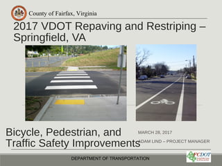
- 1. County of Fairfax, Virginia 2017 VDOT Repaving and Restriping – Springfield, VA MARCH 28, 2017 ADAM LIND – PROJECT MANAGER DEPARTMENT OF TRANSPORTATION Bicycle, Pedestrian, and Traffic Safety Improvements
- 2. County of Fairfax, Virginia Overview •Why are we here? •What projects are being proposed? •Where are we in the process? •What are we asking from the community? •What are the next steps? DEPARTMENT OF TRANSPORTATION 2
- 3. County of Fairfax, Virginia VDOT Annual Repaving •VDOT Summer repaving includes several roads in the Hunter Mill District. Opportunity to review pavement markings and street design. Proposals are limited to restriping the existing pavement. •Opportunity to slow speeding traffic, provide transportation options, and improve traffic, bicycle, and pedestrian safety •No additional cost for the County •Want to hear from the community about issues/concerns • Some concerns may be addressed through restriping For information on all paving in Lee District visit: www.virginiaroads.org DEPARTMENT OF TRANSPORTATION 3
- 4. County of Fairfax, Virginia •Commerce Street ◦Old Keene Mill to Franconia Road – 1.2 mi •Loisdale Road ◦Franconia Road to Spring Mall Dr – 0.4 mi DEPARTMENT OF TRANSPORTATION 4 Streets Under Review
- 5. County of Fairfax, Virginia DEPARTMENT OF TRANSPORTATION 5 Bicycle Master Plan Adopted by the Board of Supervisors October 28, 2014 Bike Lanes Bike Lanes Bike Lanes Sharrow
- 6. County of Fairfax, Virginia Bicycle Facility Types •Sharrow •Climbing Lane •Striped Shoulder •Bike Lane •Buffered Bike Lane More dedicated space and comfort Less dedicated space and comfort
- 7. County of Fairfax, Virginia Bicycle Facility Types Sharrow-Shared Lane Markings (SLMs), or “sharrows,” are road markings used to indicate a shared lane environment for bicycles and automobiles. Among other benefits shared lane markings reinforce the legitimacy of bicycle traffic on the street, recommend proper bicyclist positioning, and may be configured to offer directional and wayfinding guidance
- 8. County of Fairfax, Virginia Bicycle Facility Types Striped Shoulder-Creates dedicated space to be used by people bicycling. 3’-4’ in width, but not the full width of a bike lane (5’). Added benefit of creating additional buffer space between vehicles and people walking on the sidewalk.
- 9. County of Fairfax, Virginia Bicycle Facility Types Bike Lane-Bike lanes designate an exclusive space for bicyclists through the use of pavement markings and signage. The bike lane is located adjacent to motor vehicle travel lanes and flows in the same direction as motor vehicle traffic.
- 10. County of Fairfax, Virginia Bicycle Facility Types Climbing Lane-A climbing lane incorporates two different facilities on the same roadway segment; a bike lane is provided in the uphill direction to accommodate slower moving bicyclists and a sharrow is provided in the downhill direction, where bicyclists can typically travel at a speed closer to motorists.
- 11. County of Fairfax, Virginia Bicycle Facility Types Buffered Bike Lane-Buffered bike lanes are conventional bicycle lanes paired with a designated buffer space separating the bicycle lane from the adjacent motor vehicle travel lane and/or parking lane.
- 12. County of Fairfax, Virginia Lane Diets DEPARTMENT OF TRANSPORTATION 12 A Lane Diet is generally described as narrowing travel lanes from a roadway and utilizing the space for other uses and travel modes. Does not involve reducing the number of travel lanes Benefits ◦Providing transportation alternatives and options ◦Increasing safety for non-motorized users ◦Reduce speeding
- 13. County of Fairfax, Virginia Lane Width and Vehicle Speeds DEPARTMENT OF TRANSPORTATION 13
- 14. County of Fairfax, Virginia Road Diet •Removing travel lanes from a roadway and reallocating the space for other uses •Rule of thumb: Roads with less than 20,000 vehicles per day don’t need four (or more) travel lanes •Have now implemented road diets in several places in Fairfax County ◦Lawyers Rd, Soapstone Dr, Kingstowne Village Parkway, Westbranch Dr, Greensboro Dr, Park Run Dr, Beacon Hill Road, Ravensworth Rd DEPARTMENT OF TRANSPORTATION 14
- 15. County of Fairfax, Virginia Commerce Street- Existing DEPARTMENT OF TRANSPORTATION 15 •Old Keene Mill to Franconia Rd •Fall 2016 Traffic Count: 10,500 vehicles per day (vpd) • VDOT 2015: 23,000 vpd between Backlick Rd and Franconia Rd •Speed Limit: 35 MPH •Three segments: • 1) Old Keene Mill to Amherst Avenue • 2) Amherst Avenue to Brandon Avenue • 3) Brandon Avenue to Old Keene Mill
- 16. County of Fairfax, Virginia DEPARTMENT OF TRANSPORTATION 16 •Section 1) Old Keene Mill to Amherst Avenue Commerce Street - Existing
- 17. County of Fairfax, Virginia DEPARTMENT OF TRANSPORTATION 17 Segment 1 Old Keene Mill to Amherst Avenue: 10,500 vpd Commerce St– Traffic & Speed Data Southbound Direction Speed Limit: 35 mph 85th Percentile: 37 mph 76% Traffic: ≤ 35 mph 19% Traffic: 36-40 mph 4% Traffic: 41-45 mph 0.5% Traffic: 46-50 mph Northbound Direction Speed Limit: 35 mph 85th Percentile: 38 mph 67% Traffic: ≤ 35 mph 24% Traffic: 36-40 mph 7% Traffic: 41-45 mph 1% Traffic: 46-50 mph
- 18. County of Fairfax, Virginia DEPARTMENT OF TRANSPORTATION 18 •1) Old Keene Mill to Amherst Avenue • Convert the outside travel lane in each direction to a buffered bike lane • Evaluate the addition of two new crosswalks with potential concrete refuge island (funded, but separate from repaving and restriping) •2) Amherst Avenue to Brandon Avenue • Narrow the existing travel lanes to 11’ • Add bike lane east bound towards the bridge • Shared lane/sharrow west bound away from the bridge •3) Brandon Avenue to Old Keene Mill • Narrow the existing travel lanes to 11’ • Create 4’ shoulder for bicycle use
- 19. County of Fairfax, Virginia DEPARTMENT OF TRANSPORTATION 19 •Section 1) Old Keene Mill to Amherst Avenue • Convert the outside travel lane in each direction to a buffered bike lane • Evaluate the addition of two new crosswalks with potential concrete refuge island (funded, but separate from repaving and restriping) •Section 2) Amherst Avenue to Brandon Avenue • Narrow the existing travel lanes to 11’ • Add bike lane east bound towards the bridge • Shared lane/sharrow west bound away from the bridge •Section 3) Brandon Avenue to Old Keene Mill • Narrow the existing travel lanes to 11’ • Create 4’ shoulder for bicycle use Commerce Street- Proposed
- 20. County of Fairfax, Virginia DEPARTMENT OF TRANSPORTATION 20 •Section 1) Old Keene Mill to Amherst Avenue (street width varies) Commerce Street- Proposed Existing Proposed
- 21. County of Fairfax, Virginia DEPARTMENT OF TRANSPORTATION 21 •Section 1) Old Keene Mill to Amherst Avenue Commerce Street- Proposed
- 22. County of Fairfax, Virginia DEPARTMENT OF TRANSPORTATION 22 •Section 1) Old Keene Mill to Amherst Avenue Commerce Street- Proposed
- 23. County of Fairfax, Virginia DEPARTMENT OF TRANSPORTATION 23 •Old Keene Mill Intersection • No changes to the lane configuration approaching the intersection Commerce Street- Proposed
- 24. County of Fairfax, Virginia DEPARTMENT OF TRANSPORTATION 24 •Amherst Avenue Intersection Commerce Street- Proposed Existing Proposed Through + right Through + right
- 25. County of Fairfax, Virginia DEPARTMENT OF TRANSPORTATION 25 •Section 1) Old Keene Mill to Amherst Avenue •Road Diet benefits everyone by: • Improving sight distance • Shortening crossing distance • Reducing # of travel lanes to cross in a vehicle or on foot • Providing refuge space • Creating buffer between travel cars and vehicles • Creating dedicated space for people to safely bicycle • Reducing top end speeding Commerce Street- Proposed
- 26. County of Fairfax, Virginia Traffic Impacts • Intersections evaluated on average delay or Level of Service (LOS) • Intersections grade A-F, based off LOS • Proposed changing of signal timing to mitigate loss of one through lane EB Level of Service Average Delay A <10 sec B >10-20 sec C >20-35 sec D >35-55 sec E >55-80 sec F >80 sec
- 27. County of Fairfax, Virginia Traffic Impacts – Commerce St AM LOS Existing AM LOS Road Diet PM LOS Existing PM LOS Road Diet Amherst Ave D (42.5 sec) D (44.2 sec) D (47.5 sec) D (50.5 sec) • Eastbound Commerce St at Amherst Avenue • Eastbound Commerce St 50% que length changed from 74’ to 151’ (AM) and 84’ to 196’ (PM) • VDOT has ability to change signal timing to mitigate delay impact from changing lane configuration
- 28. County of Fairfax, Virginia DEPARTMENT OF TRANSPORTATION 28 •Section 2) Amherst Avenue to Brandon Avenue •Amherst Avenue to Backlick Rd • Was repaved in 2015 when Amherst Ave and Backlick Ave were repaved • No proposed changes at this time, but may be able to add sharrows sharrows Commerce Street- Proposed
- 29. County of Fairfax, Virginia DEPARTMENT OF TRANSPORTATION 29 •Backlick Rd to Brandon Avenue • Narrow Travel Lanes, EB bike lane, WB sharrow Existing Proposed Commerce Street- Proposed
- 30. County of Fairfax, Virginia DEPARTMENT OF TRANSPORTATION 30 •Section 3) Brandon Avenue to Old Keene Mill • Narrow Travel Lanes, 4’ striped shoulder in each direction (5’ in some places) Existing Proposed Commerce Street- Proposed Should er Should er
- 31. County of Fairfax, Virginia DEPARTMENT OF TRANSPORTATION 31 •1) Old Keene Mill to Amherst Avenue • Convert the outside travel lane in each direction to a buffered bike lane • Evaluate the addition of two new crosswalks with potential concrete refuge island (funded, but separate from repaving and restriping) •2) Amherst Avenue to Brandon Avenue • Narrow the existing travel lanes to 11’ • Add bike lane east bound towards the bridge • Shared lane/sharrow west bound away from the bridge •3) Brandon Avenue to Old Keene Mill • Narrow the existing travel lanes to 11’ • Create 4’ shoulder for bicycle use
- 32. County of Fairfax, Virginia Loisdale Road - Existing DEPARTMENT OF TRANSPORTATION 32 •Franconia Rd to Spring Mall Dr •VDOT 2015: 23,000 vpd •Speed Limit: 35 MPH •Two segments: • 1) Franconia Rd to Loisdale Ct • 2) Loisdale Ct to Spring Mall Dr
- 33. County of Fairfax, Virginia DEPARTMENT OF TRANSPORTATION 33 •Section 1) Franconia Road to Loisdale Ct Loisdale Road - Existing
- 34. County of Fairfax, Virginia DEPARTMENT OF TRANSPORTATION 34 •Section 1) Franconia Road to Loisdale Ct • Narrow Travel Lanes, 5’ bike lanes in each direction Existing Proposed Loisdale Road - Proposed
- 35. County of Fairfax, Virginia DEPARTMENT OF TRANSPORTATION 35 •Section 2) Loisdale Ct to Spring Mall Drive Loisdale Road - Existing
- 36. County of Fairfax, Virginia DEPARTMENT OF TRANSPORTATION 36 •Section 2) Loisdale Ct to Spring Mall Drive • Keep travel lanes at same width, add sharrows Loisdale Road - Existing Existing Proposed
- 37. County of Fairfax, Virginia Past Repaving Projects 2015 Road Diet Project – Westbranch Drive •Pre-Project Conditions •Five travel lanes 12’ wide •Post-Project Conditions •Three travel lanes 12’ wide •Two buffered (6’) bike lanes 6’ wide DEPARTMENT OF TRANSPORTATION 37
- 38. County of Fairfax, Virginia 2015 Project – Westbranch Drive: Before DEPARTMENT OF TRANSPORTATION 38
- 39. County of Fairfax, Virginia 2015 Project – Westbranch Drive: After DEPARTMENT OF TRANSPORTATION 39
- 40. County of Fairfax, Virginia Past Repaving Projects 2015 Lane Diet Project-Annandale Road •Pre-Project Conditions •Two travel lanes 16’+ wide •Two parking lanes 8’ wide •Post-Project Conditions •Two travel lanes 11’ wide •Two bike lanes 5’ wide •Two parking lanes 8’ wide DEPARTMENT OF TRANSPORTATION 40
- 41. County of Fairfax, Virginia 2015 Project-Annandale Road: Before DEPARTMENT OF TRANSPORTATION 41
- 42. County of Fairfax, Virginia 2015 Project-Annandale Road: After DEPARTMENT OF TRANSPORTATION 42
- 43. County of Fairfax, Virginia After – Annandale Rd DEPARTMENT OF TRANSPORTATION 43 Post Lane Diet + Bike Lanes •Speed/Traffic counts at two locations in Fall 2016 •Highest average speed was 35 mph •No 85% percentile speed over 39 mph
- 44. County of Fairfax, Virginia Big Picture DEPARTMENT OF TRANSPORTATION 44 “Safety in numbers: more walkers and bicyclists, safer walking and bicycling” Peter Jacobsen, 2000 •Research in the US and internationally shows that when more people walk/bike the safer it becomes
- 45. County of Fairfax, Virginia Big Picture DEPARTMENT OF TRANSPORTATION 45
- 46. County of Fairfax, Virginia Next Steps •Comment period open for two weeks • April 14, 2017 •FCDOT and VDOT will review input and update designs •Finalize design plans spring 2017 and repaving occurs in summer/fall 2017 DEPARTMENT OF TRANSPORTATION 46
- 47. County of Fairfax, Virginia How to Comment •Fill out comment sheets and submit tonight •Mail comment sheets in over next three weeks •E-mail comments to DOTBicyclePrograms@fairfaxcounty.gov •Presentation will be available online: http:// www.fairfaxcounty.gov/fcdot/bike/commerce-loisda Thank You for Participating DEPARTMENT OF TRANSPORTATION 47