Levee stats
•Télécharger en tant que PPTX, PDF•
1 j'aime•1,369 vues

This presentation discusses the importance of levees in protecting lives and property in Fort Bend County, Texas. There are 19 levee improvement districts and municipal utility districts in the county, encompassing over 50 square miles and protecting over $10 billion in structures and $14 billion total in structures and land. The levee systems total over 99 miles, protecting over 27 miles of the Brazos River frontage. Over 141,000 people, or about a quarter of the county's population, benefit from the flood protection provided by the levee systems.

Recommandé
Recommandé
Contenu connexe
Plus de Fort Bend County Office of Emergency Management
Plus de Fort Bend County Office of Emergency Management (20)
Levee stats
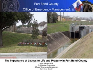
- 1. Fort Bend County Office of Emergency Management The Importance of Levees to Life and Property in Fort Bend County Doug Barnes, GISP Sr. Planning Coordinator Office of Emergency Management Fort Bend County
- 2. Fort Bend County Office of Emergency Management Presentation Overview • Levees at the national level • Levees at the county level • Interesting statistics about levees and LIDs • How levees relate to lives and property in Fort Bend County
- 3. Fort Bend County Office of Emergency Management
- 4. Fort Bend County Office of Emergency Management In other words, 881 counties account for: • 28% of all U.S. counties, or about 1 in 4 counties • 37% of the U.S. land area • 55% of the U.S. population, or about 156 million people
- 5. Fort Bend County Office of Emergency Management Levee Districts in Fort Bend County: Unincorporated Split Incorporated/Unincorporated Incorporated • LID 6 (River Park West) • LID 15 (Sugar Land) • First Colony LID 1 • LID 7 (New Territory) • Sienna Plantation (Mo City) • First Colony LID 2 • LID 11 (Greatwood) • LID 2 (Sugar Land) • LID 19 (Riverstone) • LID 10 (Sugar Land) • LID 20 (Kingdom Heights) • LID 14 (Sugar Land) • MUD 121 (River Park West) • LID 17 (Sugar Land) • Pecan Grove MUD • MUD 46 (Missouri City) • MUD 49 (Missouri City) • Palmer Plantation MUD 1 (Mo City) • Palmer Plantation MUD 2 (Mo City)
- 6. Fort Bend County Office of Emergency Management Levee Districts in Fort Bend County:
- 7. Fort Bend County Office of Emergency Management GIS-Calculated Statistics for Levee Districts in Fort Bend County: • 19 LIDs/MUDs • Account for 53.29 Sq. Miles (885.44 Sq. Miles in Fort Bend) • 54,447 parcels located within FBC levee districts (258,428 parcels in the County, or about 1 in 5)
- 8. Fort Bend County Office of Emergency Management Levees in Fort Bend County:
- 9. Fort Bend County Office of Emergency Management GIS-Calculated Statistics for Levees in Fort Bend County: • Fort Bend Levees • 99 miles of levee if Fort Bend County • 27.4 miles of the Brazos River frontage is protected by levee in Fort Bend County
- 10. Fort Bend County Office of Emergency Management How Does This Relate to Lives and Property? • Total value of structures protected by levees in Fort Bend County? $10.6 billion $10,595,767,533.00 to be exact!!! • Total value of structures + land protected by levees in Fort Bend County? $14.1 billion $14,110,898,663.00 to be exact!!! • Total number of lives protected by levees in Fort bend County? 141,895 or, about 1 in 4 people
- 11. Fort Bend County Office of Emergency Management Questions? Doug Barnes, GISP Sr. Planning Coordinator Office of Emergency Management Fort Bend County douglas.barnes@co.fort-bend.tx.us