SlideShare une entreprise Scribd logo
1  sur  25
GeoServer
Interoperabilita' a la carte


   I ng . S im one G ia nnec c hini,
 I ng . A ndrea A im e (O penG eo )

         GFOSS.IT, Pontedera
         November 28th, 2008
Outline
●   Cosa è GeoServer
●   Come è fatto GeoServer
●   Cosa fa GeoServer
●   Cosa fara' GeoServer
●   Chi fa GeoServer


                  GFOSS.IT, Pontedera
                  November 28th, 2008
Cosa è GeoServer
●   GeoSpatial enterprise gateway
       –   Management dati raster e vettoriali
●   Standards compliant
       –   OGC WCS 1.0 - 1.1.1 (RI)
       –   OGC WFS 1.0 - 1.1 (RI)
       –   OGC WMS 1.1.1
●   Google support
       –   KML, GeoSearch, etc..
●   Enterprise ready (almost!)
                      GFOSS.IT, Pontedera
                      November 28th, 2008
Chi è GeoServer
GeoWeb 2.0
                KML         WCS
              WFSv               WFS
             GeoSearch           WMS
                REST

Enterprise
                                       Oracle
         PostGIS
                        ArcSDE
              GeoTiff                  MrSID,ECW
                 GFOSS.IT, Pontedera
                 November 28th, 2008
----------
                                  ----------
                                      ----------
Cosa fa GeoServer
                    Shapefile      ---------
                                      ----------
                                  ----------
                                                                                              Shapefile.zip
                                       ---------
                                      ----------                       WFSv*                  GML2
                                                                                              GML3
                                 Vector files                                                 GeoRSS
                    PostGIS                                            WFS 1.0   Raw vector
                                                                                   data
                                                                                              GeoJSON
                    DB2                                                                       CSV/XLS
                    Oracle                                             WFS 1.1
                    MySql                                                                     PNG, GIF


                                                           GeoServer
                                                                                              JPEG
                                    DBMS                                WMS                   TIFF,
                                                                        1.1.1
                                                                                              GeoTIFF
                                                                                              SVG, PDF
                    ArcSDE                                             Google*    Styled      KML/KMZ
                                                                                  maps
                    WFS
                                                                        WCS                   GeoTIFF
                                  Servers                                1.0
                    GeoTIFF                                                                   ArcGrid
                    ArcGrid                                             WCS                   GTopo30
                    GTopo30                                             1.1.1    Raw raster
                                                                                              Img+World
                    Img+world                                                      data
                    Mosaic    Raster files                                        KML superoverlays
                    MrSID                                               GWC       Google maps tiles
                    JPEG 2000
                    ECW,Pyramid
                                                          1.7.1
                                                   GFOSS.IT, Pontedera
                                                   November 28th, 2008
Come è fatto GeoServer

WCS WMS WFS WFSv REST Google GWC

                          GeoTools
Spring
Spring


         ImageIO              JAI           JTS

          GDAL            JMagick

           Vector              Style      Raster
                    GFOSS.IT, Pontedera
                    November 28th, 2008
Formati Input/Output
●   Input
       –    Postgis, ORACLE, MySQL, Shapefile
       –    Geotiff, image+worldfile, ESRI ascii grid,
             GRASS ascii grid, GTOPO30 (DEM)
       –    JPEG2K, MrSID, ECW, ARCINFO binary
             GRID, Erdas Image, ENVISAT, HDF4,
             netCDF-CF, GriB1
●   Output
       –    GeoRSS, GML 2.0, GML 3.1, shapefile, png,
             GeoTiff, KML

                        GFOSS.IT, Pontedera
                        November 28th, 2008
Protocolli
●   OGC WCS 1.0 – 1.1.1 (RI)
●   OGC WFS 1.0 - 1.1(RI)
●   OGC WMS 1.1.1
●   WFSv*
●   KML
●   GeoSearch*
●   WMS-C
●   RESTFul configuration

                  GFOSS.IT, Pontedera
                  November 28th, 2008
Per-layer Security
●   Specificare regole su singoli layer
●   Configurazione semplificata con liste di
    regole

         namespace.layer.mode=role1,role2,...


         A name, or * to            r: read      The roles that will
         mean “any”                 w: write     be authorized to
                                                 access the data
                                                 under this rule

                           GFOSS.IT, Pontedera
                           November 28th, 2008
Per-layer Security
*.*.r=*
                                                                     RDONLY
*.*.w=NO_ONE                                                        lock down

private.*.r=TRUSTED_ROLE
private.*.w=TRUSTED_ROLE                                            Per-layer
                                                                    override
topp.districts.w=LEGISLATORS

                                                   topp.      Other
                            private.*    topp.*   districts   layers
      TRUSTED_ROLE             r/w         r          r         r
      LEGISLATORS          (no access)     r        r/w         r
      (all other users)    (no access)     r         r          r


                               GFOSS.IT, Pontedera
                               November 28th, 2008
Integrazione GDAL
●   Started with GSOC 2006-2007
●   ImageIO integration via ImageIO-ext
       –   Estensione SUN ImageIO framework
       –   JPEG2000,MrSID, ECW, BigTIFF*, ERDAS
            Image, HDF4,etc...
       –   Non (ancora!) facile configurazione
●   Problemi di licenza con ECW (?)


                      GFOSS.IT, Pontedera
                      November 28th, 2008
RasterSymbolizer
●   Supporto tematizzazione raster con SLD

                          256 colori


         64
            K
                co
                  lo
                     ri


                            GFOSS.IT, Pontedera
                            November 28th, 2008
RasterSymbolizer


    GFOSS.IT, Pontedera
    November 28th, 2008
Ingestion Engine*


    >> Shapefile added … New element processed … Sending shapefile to GeoServer
                 ..
    …… …… DONE: Vector Layer Successfully published in GeoServer
    >> New raster to mosaic … Creating grid … Create tiles … Sending mosaic to
    GeoServer   …… …… DONE
    >> File to convert … converting SRS … Processing coordinates
    …… …… Conversion DONE
    >> Creating WCS Services … pick up SRS .. Generate Boundings …
    …… …… DONE: WCS shared
    >> Creating WMS Services … pick up SRS .. Generate Boundings … Applying style
    …… …… DONE: WMS shared
    >> Cataloguing … writing metadata … adding contents … publishing …
    …… …… DONE: Metadata published


    GFOSS.IT, Pontedera
    November 28th, 2008
GeoWeb 2.0 – KML wows

                TEMPORAL SERIES


                KML EXTRUDE

                              KML SUPEROVERLAY


      GFOSS.IT, Pontedera
      November 28th, 2008
GeoWeb 2.0 – Google Search
●   Esponi i tuoi dati sul web!


                   GFOSS.IT, Pontedera
                   November 28th, 2008
GeoWeb 2.0 – Google Search
●   Esponi i tuoi dati sul web!


                   GFOSS.IT, Pontedera
                   November 28th, 2008
GeoWeb 2.0 - GeoWebCache
        GeoServer             ●   Sistema di tile cache
                                  per WMS
                              ●   Layer statici
      GeoWebCache
                              ●   Fornisce KML/raster
                                  tiles
                                       Gmap, Gearth
                                       –
                                     – OpenLayers
                                     – Vearth

 Persistent raster/KML        ●   Speed up fattore 10/100
       tile cache

                         GFOSS.IT, Pontedera
                         November 28th, 2008
Labeling(++)


 GFOSS.IT, Pontedera
 November 28th, 2008
RESTFul Configuration
●   Prototipo iniziale → 2008
●   Configurazione programmatica
       –   Nuovi layer
       –   Stili
●   Esposizione struttura interna
       –   Ajax-JavaScript friendly
●   Expect more in 2009


                         GFOSS.IT, Pontedera
                         November 28th, 2008
Futuro prossimo: Nuova UI


        GFOSS.IT, Pontedera
        November 28th, 2008
Futuro prossimo: nD Raster
●   Raster sono intrinsecamente
    multidimensionali
       –   (x,y,z,t) → [(fieldA1,fieldA2),(fieldB1)]


                       GFOSS.IT, Pontedera
                       November 28th, 2008
Futuro prossimo: WPS
●   WPS 1.0 plugin
●   Process back-end in GeoTools
●   Integrazione in GeoServer in corso
●   Obiettivi
       –   Raster Processing (WCPS)
       –   Sextante Integration
       –   JGrass integration


                      GFOSS.IT, Pontedera
                      November 28th, 2008
Chi fa GeoServer


   GFOSS.IT, Pontedera
   November 28th, 2008
The End


         Domande?

simone.giannecchini@geo-solutions.it


            GFOSS.IT, Pontedera
            November 28th, 2008

Contenu connexe

Tendances

Using GeoServer for spatio-temporal data management with examples for MetOc a...
Using GeoServer for spatio-temporal data management with examples for MetOc a...Using GeoServer for spatio-temporal data management with examples for MetOc a...
Using GeoServer for spatio-temporal data management with examples for MetOc a...GeoSolutions
 
GeoSolutions contributions to the CUSTOM Project
GeoSolutions contributions to the CUSTOM ProjectGeoSolutions contributions to the CUSTOM Project
GeoSolutions contributions to the CUSTOM ProjectGeoSolutions
 
GeoServer, an introduction for beginners
GeoServer, an introduction for beginnersGeoServer, an introduction for beginners
GeoServer, an introduction for beginnersGeoSolutions
 
Spatiotemporal Raster Improvements in GeoServer
Spatiotemporal Raster Improvements in GeoServerSpatiotemporal Raster Improvements in GeoServer
Spatiotemporal Raster Improvements in GeoServerGeoSolutions
 
GeoServer The Open Source Solution for the interoperable management of geos...
GeoServer The Open Source Solution  for the interoperable management  of geos...GeoServer The Open Source Solution  for the interoperable management  of geos...
GeoServer The Open Source Solution for the interoperable management of geos...GeoSolutions
 
Raster data in GeoServer and GeoTools: Achievements, issues and future develo...
Raster data in GeoServer and GeoTools: Achievements, issues and future develo...Raster data in GeoServer and GeoTools: Achievements, issues and future develo...
Raster data in GeoServer and GeoTools: Achievements, issues and future develo...GeoSolutions
 
GeoNetwork, The Open Source Solution for the interoperable management of ge...
GeoNetwork, The Open Source Solution  for the interoperable management  of ge...GeoNetwork, The Open Source Solution  for the interoperable management  of ge...
GeoNetwork, The Open Source Solution for the interoperable management of ge...GeoSolutions
 
GeoServer, The Open Source Solution for the interoperable management of geo...
GeoServer, The Open Source Solution  for the interoperable management  of geo...GeoServer, The Open Source Solution  for the interoperable management  of geo...
GeoServer, The Open Source Solution for the interoperable management of geo...GeoSolutions
 
GeoServer on Steroids
GeoServer on SteroidsGeoServer on Steroids
GeoServer on SteroidsGeoSolutions
 
GeoServer in Production: we do it, here is how!
GeoServer in Production: we do it, here is how!GeoServer in Production: we do it, here is how!
GeoServer in Production: we do it, here is how!GeoSolutions
 
Geosolutions FOSS4g 2009 Redux
Geosolutions FOSS4g 2009 ReduxGeosolutions FOSS4g 2009 Redux
Geosolutions FOSS4g 2009 ReduxGeoSolutions
 
GFOSS DAY 2012 GeoNetwork Presentation
GFOSS DAY 2012 GeoNetwork PresentationGFOSS DAY 2012 GeoNetwork Presentation
GFOSS DAY 2012 GeoNetwork PresentationGeoSolutions
 
GeoServer an introduction for beginners
GeoServer an introduction for beginnersGeoServer an introduction for beginners
GeoServer an introduction for beginnersGeoSolutions
 
Mastering Security with GeoServer and GeoFence - FOSS4G EU 2017
Mastering Security with GeoServer and GeoFence - FOSS4G EU 2017Mastering Security with GeoServer and GeoFence - FOSS4G EU 2017
Mastering Security with GeoServer and GeoFence - FOSS4G EU 2017GeoSolutions
 
Enterprise class deployment for GeoServer and GeoWebcache Optimizing perform...
Enterprise class deployment  for GeoServer and GeoWebcache Optimizing perform...Enterprise class deployment  for GeoServer and GeoWebcache Optimizing perform...
Enterprise class deployment for GeoServer and GeoWebcache Optimizing perform...GeoSolutions
 
Creating Stunning Maps in GeoServer: mastering SLD and CSS styles
Creating Stunning Maps in GeoServer: mastering SLD and CSS stylesCreating Stunning Maps in GeoServer: mastering SLD and CSS styles
Creating Stunning Maps in GeoServer: mastering SLD and CSS stylesGeoSolutions
 
Advanced GeoServer Security with GeoFence
Advanced GeoServer Security with GeoFenceAdvanced GeoServer Security with GeoFence
Advanced GeoServer Security with GeoFenceGeoSolutions
 
State of GeoServer - FOSS4G 2016
State of GeoServer - FOSS4G 2016State of GeoServer - FOSS4G 2016
State of GeoServer - FOSS4G 2016GeoSolutions
 

Tendances (20)

Gfoss 2010
Gfoss 2010Gfoss 2010
Gfoss 2010
 
Osgis 2010
Osgis 2010Osgis 2010
Osgis 2010
 
Using GeoServer for spatio-temporal data management with examples for MetOc a...
Using GeoServer for spatio-temporal data management with examples for MetOc a...Using GeoServer for spatio-temporal data management with examples for MetOc a...
Using GeoServer for spatio-temporal data management with examples for MetOc a...
 
GeoSolutions contributions to the CUSTOM Project
GeoSolutions contributions to the CUSTOM ProjectGeoSolutions contributions to the CUSTOM Project
GeoSolutions contributions to the CUSTOM Project
 
GeoServer, an introduction for beginners
GeoServer, an introduction for beginnersGeoServer, an introduction for beginners
GeoServer, an introduction for beginners
 
Spatiotemporal Raster Improvements in GeoServer
Spatiotemporal Raster Improvements in GeoServerSpatiotemporal Raster Improvements in GeoServer
Spatiotemporal Raster Improvements in GeoServer
 
GeoServer The Open Source Solution for the interoperable management of geos...
GeoServer The Open Source Solution  for the interoperable management  of geos...GeoServer The Open Source Solution  for the interoperable management  of geos...
GeoServer The Open Source Solution for the interoperable management of geos...
 
Raster data in GeoServer and GeoTools: Achievements, issues and future develo...
Raster data in GeoServer and GeoTools: Achievements, issues and future develo...Raster data in GeoServer and GeoTools: Achievements, issues and future develo...
Raster data in GeoServer and GeoTools: Achievements, issues and future develo...
 
GeoNetwork, The Open Source Solution for the interoperable management of ge...
GeoNetwork, The Open Source Solution  for the interoperable management  of ge...GeoNetwork, The Open Source Solution  for the interoperable management  of ge...
GeoNetwork, The Open Source Solution for the interoperable management of ge...
 
GeoServer, The Open Source Solution for the interoperable management of geo...
GeoServer, The Open Source Solution  for the interoperable management  of geo...GeoServer, The Open Source Solution  for the interoperable management  of geo...
GeoServer, The Open Source Solution for the interoperable management of geo...
 
GeoServer on Steroids
GeoServer on SteroidsGeoServer on Steroids
GeoServer on Steroids
 
GeoServer in Production: we do it, here is how!
GeoServer in Production: we do it, here is how!GeoServer in Production: we do it, here is how!
GeoServer in Production: we do it, here is how!
 
Geosolutions FOSS4g 2009 Redux
Geosolutions FOSS4g 2009 ReduxGeosolutions FOSS4g 2009 Redux
Geosolutions FOSS4g 2009 Redux
 
GFOSS DAY 2012 GeoNetwork Presentation
GFOSS DAY 2012 GeoNetwork PresentationGFOSS DAY 2012 GeoNetwork Presentation
GFOSS DAY 2012 GeoNetwork Presentation
 
GeoServer an introduction for beginners
GeoServer an introduction for beginnersGeoServer an introduction for beginners
GeoServer an introduction for beginners
 
Mastering Security with GeoServer and GeoFence - FOSS4G EU 2017
Mastering Security with GeoServer and GeoFence - FOSS4G EU 2017Mastering Security with GeoServer and GeoFence - FOSS4G EU 2017
Mastering Security with GeoServer and GeoFence - FOSS4G EU 2017
 
Enterprise class deployment for GeoServer and GeoWebcache Optimizing perform...
Enterprise class deployment  for GeoServer and GeoWebcache Optimizing perform...Enterprise class deployment  for GeoServer and GeoWebcache Optimizing perform...
Enterprise class deployment for GeoServer and GeoWebcache Optimizing perform...
 
Creating Stunning Maps in GeoServer: mastering SLD and CSS styles
Creating Stunning Maps in GeoServer: mastering SLD and CSS stylesCreating Stunning Maps in GeoServer: mastering SLD and CSS styles
Creating Stunning Maps in GeoServer: mastering SLD and CSS styles
 
Advanced GeoServer Security with GeoFence
Advanced GeoServer Security with GeoFenceAdvanced GeoServer Security with GeoFence
Advanced GeoServer Security with GeoFence
 
State of GeoServer - FOSS4G 2016
State of GeoServer - FOSS4G 2016State of GeoServer - FOSS4G 2016
State of GeoServer - FOSS4G 2016
 

En vedette

SIG Libre 2013 Girona. Cuso Online de SIG y Cooperación
SIG Libre 2013 Girona. Cuso Online de SIG y CooperaciónSIG Libre 2013 Girona. Cuso Online de SIG y Cooperación
SIG Libre 2013 Girona. Cuso Online de SIG y CooperaciónFrancisco Puga
 
Advanced Security with GeoServer - FOSS4G 2015
Advanced Security with GeoServer - FOSS4G 2015Advanced Security with GeoServer - FOSS4G 2015
Advanced Security with GeoServer - FOSS4G 2015GeoSolutions
 
Mapping the world beyond web mercator - FOSS4G 2015
Mapping the world beyond web mercator - FOSS4G 2015Mapping the world beyond web mercator - FOSS4G 2015
Mapping the world beyond web mercator - FOSS4G 2015GeoSolutions
 
GeoServer beginners gwf_2015
GeoServer beginners gwf_2015GeoServer beginners gwf_2015
GeoServer beginners gwf_2015GeoSolutions
 
GeoServer on steroids
GeoServer on steroidsGeoServer on steroids
GeoServer on steroidsGeoSolutions
 
GeoServer on Steroids
GeoServer on Steroids GeoServer on Steroids
GeoServer on Steroids GeoSolutions
 
Serving earth observation data with GeoServer: addressing real world requirem...
Serving earth observation data with GeoServer: addressing real world requirem...Serving earth observation data with GeoServer: addressing real world requirem...
Serving earth observation data with GeoServer: addressing real world requirem...GeoSolutions
 
How to perform trouble shooting based on counters
How to perform trouble shooting based on countersHow to perform trouble shooting based on counters
How to perform trouble shooting based on countersAbdul Muin
 
State of GeoServer, GeoTools and Friends 2014
State of GeoServer, GeoTools and Friends 2014State of GeoServer, GeoTools and Friends 2014
State of GeoServer, GeoTools and Friends 2014Jody Garnett
 

En vedette (11)

SIG Libre 2013 Girona. Cuso Online de SIG y Cooperación
SIG Libre 2013 Girona. Cuso Online de SIG y CooperaciónSIG Libre 2013 Girona. Cuso Online de SIG y Cooperación
SIG Libre 2013 Girona. Cuso Online de SIG y Cooperación
 
Advanced Security with GeoServer - FOSS4G 2015
Advanced Security with GeoServer - FOSS4G 2015Advanced Security with GeoServer - FOSS4G 2015
Advanced Security with GeoServer - FOSS4G 2015
 
Mapping the world beyond web mercator - FOSS4G 2015
Mapping the world beyond web mercator - FOSS4G 2015Mapping the world beyond web mercator - FOSS4G 2015
Mapping the world beyond web mercator - FOSS4G 2015
 
GeoServer beginners gwf_2015
GeoServer beginners gwf_2015GeoServer beginners gwf_2015
GeoServer beginners gwf_2015
 
GeoServer on steroids
GeoServer on steroidsGeoServer on steroids
GeoServer on steroids
 
GeoServer on Steroids
GeoServer on Steroids GeoServer on Steroids
GeoServer on Steroids
 
Serving earth observation data with GeoServer: addressing real world requirem...
Serving earth observation data with GeoServer: addressing real world requirem...Serving earth observation data with GeoServer: addressing real world requirem...
Serving earth observation data with GeoServer: addressing real world requirem...
 
How to perform trouble shooting based on counters
How to perform trouble shooting based on countersHow to perform trouble shooting based on counters
How to perform trouble shooting based on counters
 
Umts Kpi
Umts KpiUmts Kpi
Umts Kpi
 
State of GeoServer, GeoTools and Friends 2014
State of GeoServer, GeoTools and Friends 2014State of GeoServer, GeoTools and Friends 2014
State of GeoServer, GeoTools and Friends 2014
 
Channel element
Channel elementChannel element
Channel element
 

Similaire à GeoServer presentation @ Italian GFOSS day 2008

FOSS4G 2010 PostGIS Raster: an Open Source alternative to Oracle GeoRaster
FOSS4G 2010 PostGIS Raster: an Open Source alternative to Oracle GeoRasterFOSS4G 2010 PostGIS Raster: an Open Source alternative to Oracle GeoRaster
FOSS4G 2010 PostGIS Raster: an Open Source alternative to Oracle GeoRasterJorge Arevalo
 
Open source based software ‘gxt’ mangosystem
Open source based software ‘gxt’ mangosystemOpen source based software ‘gxt’ mangosystem
Open source based software ‘gxt’ mangosystemHaNJiN Lee
 
Geoserver introduction, GeoBusiness 2015
Geoserver introduction, GeoBusiness 2015Geoserver introduction, GeoBusiness 2015
Geoserver introduction, GeoBusiness 2015GeoSolutions
 
GeoServer Ecosystem 2018
GeoServer Ecosystem 2018GeoServer Ecosystem 2018
GeoServer Ecosystem 2018Jody Garnett
 
GeoServer intro for SDI Days 2013
GeoServer intro for SDI Days 2013GeoServer intro for SDI Days 2013
GeoServer intro for SDI Days 2013GeoSolutions
 
State of GeoServer 2.14
State of GeoServer 2.14State of GeoServer 2.14
State of GeoServer 2.14Jody Garnett
 
GEO Gridの過去・現在・未来 @FOSS4G 2011 Tokyo
GEO Gridの過去・現在・未来 @FOSS4G 2011 TokyoGEO Gridの過去・現在・未来 @FOSS4G 2011 Tokyo
GEO Gridの過去・現在・未来 @FOSS4G 2011 TokyoNaotaka YAMAMOTO CHIKASADA
 
Realini go gps_foss4g2011_small2
Realini go gps_foss4g2011_small2Realini go gps_foss4g2011_small2
Realini go gps_foss4g2011_small2masarunarazaki
 
gvSIG Mobile at the 2nd gvSIG users meeting in Trieste (Italy)
gvSIG Mobile at the  2nd gvSIG users meeting in  Trieste (Italy)gvSIG Mobile at the  2nd gvSIG users meeting in  Trieste (Italy)
gvSIG Mobile at the 2nd gvSIG users meeting in Trieste (Italy)adelrey
 
The Construction of the Internet Geological Data System Using WWW+Java+DB Tec...
The Construction of the Internet Geological Data System Using WWW+Java+DB Tec...The Construction of the Internet Geological Data System Using WWW+Java+DB Tec...
The Construction of the Internet Geological Data System Using WWW+Java+DB Tec...Channy Yun
 
IMGS Local Gov User Group Presentation
IMGS Local Gov User Group PresentationIMGS Local Gov User Group Presentation
IMGS Local Gov User Group PresentationIMGS
 
Raster Data In GeoServer And GeoTools: Achievements, Issues And Future Develo...
Raster Data In GeoServer And GeoTools: Achievements, Issues And Future Develo...Raster Data In GeoServer And GeoTools: Achievements, Issues And Future Develo...
Raster Data In GeoServer And GeoTools: Achievements, Issues And Future Develo...GeoSolutions
 
Kopss Open API 단위테스트 이슈사항
Kopss Open API 단위테스트 이슈사항Kopss Open API 단위테스트 이슈사항
Kopss Open API 단위테스트 이슈사항MinPa Lee
 
Thames Tunnel: GIS Leads Information Integration
Thames Tunnel: GIS Leads Information IntegrationThames Tunnel: GIS Leads Information Integration
Thames Tunnel: GIS Leads Information IntegrationEsri
 
MapStore 2, modern mashups with OL3, Leaflet and React
MapStore 2, modern mashups with OL3, Leaflet and ReactMapStore 2, modern mashups with OL3, Leaflet and React
MapStore 2, modern mashups with OL3, Leaflet and ReactGeoSolutions
 
Location based services for Nokia X and Nokia Asha using Geo2tag
Location based services for Nokia X and Nokia Asha using Geo2tagLocation based services for Nokia X and Nokia Asha using Geo2tag
Location based services for Nokia X and Nokia Asha using Geo2tagMicrosoft Mobile Developer
 
Overview of Geomajas plug-ins and faces
Overview of Geomajas plug-ins and facesOverview of Geomajas plug-ins and faces
Overview of Geomajas plug-ins and facesJoachim Van der Auwera
 
ENVI 5 Matriz de Funcionalidad
ENVI 5 Matriz de FuncionalidadENVI 5 Matriz de Funcionalidad
ENVI 5 Matriz de FuncionalidadEsri
 
MapServer Project Status 2013
MapServer Project Status 2013MapServer Project Status 2013
MapServer Project Status 2013Jeff McKenna
 

Similaire à GeoServer presentation @ Italian GFOSS day 2008 (20)

Phnom penh mapping meetup #15
Phnom penh mapping meetup #15Phnom penh mapping meetup #15
Phnom penh mapping meetup #15
 
FOSS4G 2010 PostGIS Raster: an Open Source alternative to Oracle GeoRaster
FOSS4G 2010 PostGIS Raster: an Open Source alternative to Oracle GeoRasterFOSS4G 2010 PostGIS Raster: an Open Source alternative to Oracle GeoRaster
FOSS4G 2010 PostGIS Raster: an Open Source alternative to Oracle GeoRaster
 
Open source based software ‘gxt’ mangosystem
Open source based software ‘gxt’ mangosystemOpen source based software ‘gxt’ mangosystem
Open source based software ‘gxt’ mangosystem
 
Geoserver introduction, GeoBusiness 2015
Geoserver introduction, GeoBusiness 2015Geoserver introduction, GeoBusiness 2015
Geoserver introduction, GeoBusiness 2015
 
GeoServer Ecosystem 2018
GeoServer Ecosystem 2018GeoServer Ecosystem 2018
GeoServer Ecosystem 2018
 
GeoServer intro for SDI Days 2013
GeoServer intro for SDI Days 2013GeoServer intro for SDI Days 2013
GeoServer intro for SDI Days 2013
 
State of GeoServer 2.14
State of GeoServer 2.14State of GeoServer 2.14
State of GeoServer 2.14
 
GEO Gridの過去・現在・未来 @FOSS4G 2011 Tokyo
GEO Gridの過去・現在・未来 @FOSS4G 2011 TokyoGEO Gridの過去・現在・未来 @FOSS4G 2011 Tokyo
GEO Gridの過去・現在・未来 @FOSS4G 2011 Tokyo
 
Realini go gps_foss4g2011_small2
Realini go gps_foss4g2011_small2Realini go gps_foss4g2011_small2
Realini go gps_foss4g2011_small2
 
gvSIG Mobile at the 2nd gvSIG users meeting in Trieste (Italy)
gvSIG Mobile at the  2nd gvSIG users meeting in  Trieste (Italy)gvSIG Mobile at the  2nd gvSIG users meeting in  Trieste (Italy)
gvSIG Mobile at the 2nd gvSIG users meeting in Trieste (Italy)
 
The Construction of the Internet Geological Data System Using WWW+Java+DB Tec...
The Construction of the Internet Geological Data System Using WWW+Java+DB Tec...The Construction of the Internet Geological Data System Using WWW+Java+DB Tec...
The Construction of the Internet Geological Data System Using WWW+Java+DB Tec...
 
IMGS Local Gov User Group Presentation
IMGS Local Gov User Group PresentationIMGS Local Gov User Group Presentation
IMGS Local Gov User Group Presentation
 
Raster Data In GeoServer And GeoTools: Achievements, Issues And Future Develo...
Raster Data In GeoServer And GeoTools: Achievements, Issues And Future Develo...Raster Data In GeoServer And GeoTools: Achievements, Issues And Future Develo...
Raster Data In GeoServer And GeoTools: Achievements, Issues And Future Develo...
 
Kopss Open API 단위테스트 이슈사항
Kopss Open API 단위테스트 이슈사항Kopss Open API 단위테스트 이슈사항
Kopss Open API 단위테스트 이슈사항
 
Thames Tunnel: GIS Leads Information Integration
Thames Tunnel: GIS Leads Information IntegrationThames Tunnel: GIS Leads Information Integration
Thames Tunnel: GIS Leads Information Integration
 
MapStore 2, modern mashups with OL3, Leaflet and React
MapStore 2, modern mashups with OL3, Leaflet and ReactMapStore 2, modern mashups with OL3, Leaflet and React
MapStore 2, modern mashups with OL3, Leaflet and React
 
Location based services for Nokia X and Nokia Asha using Geo2tag
Location based services for Nokia X and Nokia Asha using Geo2tagLocation based services for Nokia X and Nokia Asha using Geo2tag
Location based services for Nokia X and Nokia Asha using Geo2tag
 
Overview of Geomajas plug-ins and faces
Overview of Geomajas plug-ins and facesOverview of Geomajas plug-ins and faces
Overview of Geomajas plug-ins and faces
 
ENVI 5 Matriz de Funcionalidad
ENVI 5 Matriz de FuncionalidadENVI 5 Matriz de Funcionalidad
ENVI 5 Matriz de Funcionalidad
 
MapServer Project Status 2013
MapServer Project Status 2013MapServer Project Status 2013
MapServer Project Status 2013
 

Plus de GeoSolutions

MapStore 2 - The Story
MapStore 2 - The StoryMapStore 2 - The Story
MapStore 2 - The StoryGeoSolutions
 
One GeoNode, many GeoNodes
One GeoNode, many GeoNodesOne GeoNode, many GeoNodes
One GeoNode, many GeoNodesGeoSolutions
 
Introduction to GeoNode
Introduction to GeoNodeIntroduction to GeoNode
Introduction to GeoNodeGeoSolutions
 
Serving earth observation data with GeoServer: addressing real world requirem...
Serving earth observation data with GeoServer: addressing real world requirem...Serving earth observation data with GeoServer: addressing real world requirem...
Serving earth observation data with GeoServer: addressing real world requirem...GeoSolutions
 
GeoServer Feature FRENZY
GeoServer Feature FRENZYGeoServer Feature FRENZY
GeoServer Feature FRENZYGeoSolutions
 
State of GeoServer 2.12
State of GeoServer 2.12State of GeoServer 2.12
State of GeoServer 2.12GeoSolutions
 
Crunching Data In GeoServer: Mastering Rendering Transformations, WPS Process...
Crunching Data In GeoServer: Mastering Rendering Transformations, WPS Process...Crunching Data In GeoServer: Mastering Rendering Transformations, WPS Process...
Crunching Data In GeoServer: Mastering Rendering Transformations, WPS Process...GeoSolutions
 
Raster Data In GeoServer and GeoTools: Achievements, Issues And Future Develo...
Raster Data In GeoServer and GeoTools: Achievements, Issues And Future Develo...Raster Data In GeoServer and GeoTools: Achievements, Issues And Future Develo...
Raster Data In GeoServer and GeoTools: Achievements, Issues And Future Develo...GeoSolutions
 
GeoServer for Spatio-temporal Data Handling With Examples For MetOc And Remot...
GeoServer for Spatio-temporal Data Handling With Examples For MetOc And Remot...GeoServer for Spatio-temporal Data Handling With Examples For MetOc And Remot...
GeoServer for Spatio-temporal Data Handling With Examples For MetOc And Remot...GeoSolutions
 
Advanced Cartographic Map Rendering in GeoServer
Advanced Cartographic Map Rendering in GeoServerAdvanced Cartographic Map Rendering in GeoServer
Advanced Cartographic Map Rendering in GeoServerGeoSolutions
 
Spatio-temporal Data Handling With GeoServer for MetOc And Remote Sensing
Spatio-temporal Data Handling With GeoServer for MetOc And Remote SensingSpatio-temporal Data Handling With GeoServer for MetOc And Remote Sensing
Spatio-temporal Data Handling With GeoServer for MetOc And Remote SensingGeoSolutions
 
GeoSolutions Keynote at WebMGS 2015
GeoSolutions Keynote at WebMGS 2015GeoSolutions Keynote at WebMGS 2015
GeoSolutions Keynote at WebMGS 2015GeoSolutions
 
Geosolutions gwf-2015-v01.04
Geosolutions gwf-2015-v01.04Geosolutions gwf-2015-v01.04
Geosolutions gwf-2015-v01.04GeoSolutions
 
Introduzione a GeoServer ed ai servizi OGC
Introduzione a GeoServer ed ai servizi OGCIntroduzione a GeoServer ed ai servizi OGC
Introduzione a GeoServer ed ai servizi OGCGeoSolutions
 
Raster data in GeoServer and GeoTools: Achievements, issues and future devel...
Raster data in GeoServer and GeoTools:  Achievements, issues and future devel...Raster data in GeoServer and GeoTools:  Achievements, issues and future devel...
Raster data in GeoServer and GeoTools: Achievements, issues and future devel...GeoSolutions
 
Advanced Security With GeoServer
Advanced Security With GeoServerAdvanced Security With GeoServer
Advanced Security With GeoServerGeoSolutions
 
GeoServer on Steroids at FOSS4G Europe 2014
GeoServer on Steroids at FOSS4G Europe 2014GeoServer on Steroids at FOSS4G Europe 2014
GeoServer on Steroids at FOSS4G Europe 2014GeoSolutions
 

Plus de GeoSolutions (17)

MapStore 2 - The Story
MapStore 2 - The StoryMapStore 2 - The Story
MapStore 2 - The Story
 
One GeoNode, many GeoNodes
One GeoNode, many GeoNodesOne GeoNode, many GeoNodes
One GeoNode, many GeoNodes
 
Introduction to GeoNode
Introduction to GeoNodeIntroduction to GeoNode
Introduction to GeoNode
 
Serving earth observation data with GeoServer: addressing real world requirem...
Serving earth observation data with GeoServer: addressing real world requirem...Serving earth observation data with GeoServer: addressing real world requirem...
Serving earth observation data with GeoServer: addressing real world requirem...
 
GeoServer Feature FRENZY
GeoServer Feature FRENZYGeoServer Feature FRENZY
GeoServer Feature FRENZY
 
State of GeoServer 2.12
State of GeoServer 2.12State of GeoServer 2.12
State of GeoServer 2.12
 
Crunching Data In GeoServer: Mastering Rendering Transformations, WPS Process...
Crunching Data In GeoServer: Mastering Rendering Transformations, WPS Process...Crunching Data In GeoServer: Mastering Rendering Transformations, WPS Process...
Crunching Data In GeoServer: Mastering Rendering Transformations, WPS Process...
 
Raster Data In GeoServer and GeoTools: Achievements, Issues And Future Develo...
Raster Data In GeoServer and GeoTools: Achievements, Issues And Future Develo...Raster Data In GeoServer and GeoTools: Achievements, Issues And Future Develo...
Raster Data In GeoServer and GeoTools: Achievements, Issues And Future Develo...
 
GeoServer for Spatio-temporal Data Handling With Examples For MetOc And Remot...
GeoServer for Spatio-temporal Data Handling With Examples For MetOc And Remot...GeoServer for Spatio-temporal Data Handling With Examples For MetOc And Remot...
GeoServer for Spatio-temporal Data Handling With Examples For MetOc And Remot...
 
Advanced Cartographic Map Rendering in GeoServer
Advanced Cartographic Map Rendering in GeoServerAdvanced Cartographic Map Rendering in GeoServer
Advanced Cartographic Map Rendering in GeoServer
 
Spatio-temporal Data Handling With GeoServer for MetOc And Remote Sensing
Spatio-temporal Data Handling With GeoServer for MetOc And Remote SensingSpatio-temporal Data Handling With GeoServer for MetOc And Remote Sensing
Spatio-temporal Data Handling With GeoServer for MetOc And Remote Sensing
 
GeoSolutions Keynote at WebMGS 2015
GeoSolutions Keynote at WebMGS 2015GeoSolutions Keynote at WebMGS 2015
GeoSolutions Keynote at WebMGS 2015
 
Geosolutions gwf-2015-v01.04
Geosolutions gwf-2015-v01.04Geosolutions gwf-2015-v01.04
Geosolutions gwf-2015-v01.04
 
Introduzione a GeoServer ed ai servizi OGC
Introduzione a GeoServer ed ai servizi OGCIntroduzione a GeoServer ed ai servizi OGC
Introduzione a GeoServer ed ai servizi OGC
 
Raster data in GeoServer and GeoTools: Achievements, issues and future devel...
Raster data in GeoServer and GeoTools:  Achievements, issues and future devel...Raster data in GeoServer and GeoTools:  Achievements, issues and future devel...
Raster data in GeoServer and GeoTools: Achievements, issues and future devel...
 
Advanced Security With GeoServer
Advanced Security With GeoServerAdvanced Security With GeoServer
Advanced Security With GeoServer
 
GeoServer on Steroids at FOSS4G Europe 2014
GeoServer on Steroids at FOSS4G Europe 2014GeoServer on Steroids at FOSS4G Europe 2014
GeoServer on Steroids at FOSS4G Europe 2014
 

Dernier

Scanning the Internet for External Cloud Exposures via SSL Certs
Scanning the Internet for External Cloud Exposures via SSL CertsScanning the Internet for External Cloud Exposures via SSL Certs
Scanning the Internet for External Cloud Exposures via SSL CertsRizwan Syed
 
TeamStation AI System Report LATAM IT Salaries 2024
TeamStation AI System Report LATAM IT Salaries 2024TeamStation AI System Report LATAM IT Salaries 2024
TeamStation AI System Report LATAM IT Salaries 2024Lonnie McRorey
 
DevEX - reference for building teams, processes, and platforms
DevEX - reference for building teams, processes, and platformsDevEX - reference for building teams, processes, and platforms
DevEX - reference for building teams, processes, and platformsSergiu Bodiu
 
Transcript: New from BookNet Canada for 2024: BNC CataList - Tech Forum 2024
Transcript: New from BookNet Canada for 2024: BNC CataList - Tech Forum 2024Transcript: New from BookNet Canada for 2024: BNC CataList - Tech Forum 2024
Transcript: New from BookNet Canada for 2024: BNC CataList - Tech Forum 2024BookNet Canada
 
WordPress Websites for Engineers: Elevate Your Brand
WordPress Websites for Engineers: Elevate Your BrandWordPress Websites for Engineers: Elevate Your Brand
WordPress Websites for Engineers: Elevate Your Brandgvaughan
 
"Subclassing and Composition – A Pythonic Tour of Trade-Offs", Hynek Schlawack
"Subclassing and Composition – A Pythonic Tour of Trade-Offs", Hynek Schlawack"Subclassing and Composition – A Pythonic Tour of Trade-Offs", Hynek Schlawack
"Subclassing and Composition – A Pythonic Tour of Trade-Offs", Hynek SchlawackFwdays
 
"Debugging python applications inside k8s environment", Andrii Soldatenko
"Debugging python applications inside k8s environment", Andrii Soldatenko"Debugging python applications inside k8s environment", Andrii Soldatenko
"Debugging python applications inside k8s environment", Andrii SoldatenkoFwdays
 
Human Factors of XR: Using Human Factors to Design XR Systems
Human Factors of XR: Using Human Factors to Design XR SystemsHuman Factors of XR: Using Human Factors to Design XR Systems
Human Factors of XR: Using Human Factors to Design XR SystemsMark Billinghurst
 
Artificial intelligence in cctv survelliance.pptx
Artificial intelligence in cctv survelliance.pptxArtificial intelligence in cctv survelliance.pptx
Artificial intelligence in cctv survelliance.pptxhariprasad279825
 
Tampa BSides - Chef's Tour of Microsoft Security Adoption Framework (SAF)
Tampa BSides - Chef's Tour of Microsoft Security Adoption Framework (SAF)Tampa BSides - Chef's Tour of Microsoft Security Adoption Framework (SAF)
Tampa BSides - Chef's Tour of Microsoft Security Adoption Framework (SAF)Mark Simos
 
From Family Reminiscence to Scholarly Archive .
From Family Reminiscence to Scholarly Archive .From Family Reminiscence to Scholarly Archive .
From Family Reminiscence to Scholarly Archive .Alan Dix
 
New from BookNet Canada for 2024: BNC CataList - Tech Forum 2024
New from BookNet Canada for 2024: BNC CataList - Tech Forum 2024New from BookNet Canada for 2024: BNC CataList - Tech Forum 2024
New from BookNet Canada for 2024: BNC CataList - Tech Forum 2024BookNet Canada
 
Designing IA for AI - Information Architecture Conference 2024
Designing IA for AI - Information Architecture Conference 2024Designing IA for AI - Information Architecture Conference 2024
Designing IA for AI - Information Architecture Conference 2024Enterprise Knowledge
 
"LLMs for Python Engineers: Advanced Data Analysis and Semantic Kernel",Oleks...
"LLMs for Python Engineers: Advanced Data Analysis and Semantic Kernel",Oleks..."LLMs for Python Engineers: Advanced Data Analysis and Semantic Kernel",Oleks...
"LLMs for Python Engineers: Advanced Data Analysis and Semantic Kernel",Oleks...Fwdays
 
Unraveling Multimodality with Large Language Models.pdf
Unraveling Multimodality with Large Language Models.pdfUnraveling Multimodality with Large Language Models.pdf
Unraveling Multimodality with Large Language Models.pdfAlex Barbosa Coqueiro
 
Vertex AI Gemini Prompt Engineering Tips
Vertex AI Gemini Prompt Engineering TipsVertex AI Gemini Prompt Engineering Tips
Vertex AI Gemini Prompt Engineering TipsMiki Katsuragi
 
Streamlining Python Development: A Guide to a Modern Project Setup
Streamlining Python Development: A Guide to a Modern Project SetupStreamlining Python Development: A Guide to a Modern Project Setup
Streamlining Python Development: A Guide to a Modern Project SetupFlorian Wilhelm
 
SIP trunking in Janus @ Kamailio World 2024
SIP trunking in Janus @ Kamailio World 2024SIP trunking in Janus @ Kamailio World 2024
SIP trunking in Janus @ Kamailio World 2024Lorenzo Miniero
 

Dernier (20)

E-Vehicle_Hacking_by_Parul Sharma_null_owasp.pptx
E-Vehicle_Hacking_by_Parul Sharma_null_owasp.pptxE-Vehicle_Hacking_by_Parul Sharma_null_owasp.pptx
E-Vehicle_Hacking_by_Parul Sharma_null_owasp.pptx
 
Scanning the Internet for External Cloud Exposures via SSL Certs
Scanning the Internet for External Cloud Exposures via SSL CertsScanning the Internet for External Cloud Exposures via SSL Certs
Scanning the Internet for External Cloud Exposures via SSL Certs
 
TeamStation AI System Report LATAM IT Salaries 2024
TeamStation AI System Report LATAM IT Salaries 2024TeamStation AI System Report LATAM IT Salaries 2024
TeamStation AI System Report LATAM IT Salaries 2024
 
DevEX - reference for building teams, processes, and platforms
DevEX - reference for building teams, processes, and platformsDevEX - reference for building teams, processes, and platforms
DevEX - reference for building teams, processes, and platforms
 
Transcript: New from BookNet Canada for 2024: BNC CataList - Tech Forum 2024
Transcript: New from BookNet Canada for 2024: BNC CataList - Tech Forum 2024Transcript: New from BookNet Canada for 2024: BNC CataList - Tech Forum 2024
Transcript: New from BookNet Canada for 2024: BNC CataList - Tech Forum 2024
 
WordPress Websites for Engineers: Elevate Your Brand
WordPress Websites for Engineers: Elevate Your BrandWordPress Websites for Engineers: Elevate Your Brand
WordPress Websites for Engineers: Elevate Your Brand
 
"Subclassing and Composition – A Pythonic Tour of Trade-Offs", Hynek Schlawack
"Subclassing and Composition – A Pythonic Tour of Trade-Offs", Hynek Schlawack"Subclassing and Composition – A Pythonic Tour of Trade-Offs", Hynek Schlawack
"Subclassing and Composition – A Pythonic Tour of Trade-Offs", Hynek Schlawack
 
"Debugging python applications inside k8s environment", Andrii Soldatenko
"Debugging python applications inside k8s environment", Andrii Soldatenko"Debugging python applications inside k8s environment", Andrii Soldatenko
"Debugging python applications inside k8s environment", Andrii Soldatenko
 
Human Factors of XR: Using Human Factors to Design XR Systems
Human Factors of XR: Using Human Factors to Design XR SystemsHuman Factors of XR: Using Human Factors to Design XR Systems
Human Factors of XR: Using Human Factors to Design XR Systems
 
Artificial intelligence in cctv survelliance.pptx
Artificial intelligence in cctv survelliance.pptxArtificial intelligence in cctv survelliance.pptx
Artificial intelligence in cctv survelliance.pptx
 
Tampa BSides - Chef's Tour of Microsoft Security Adoption Framework (SAF)
Tampa BSides - Chef's Tour of Microsoft Security Adoption Framework (SAF)Tampa BSides - Chef's Tour of Microsoft Security Adoption Framework (SAF)
Tampa BSides - Chef's Tour of Microsoft Security Adoption Framework (SAF)
 
From Family Reminiscence to Scholarly Archive .
From Family Reminiscence to Scholarly Archive .From Family Reminiscence to Scholarly Archive .
From Family Reminiscence to Scholarly Archive .
 
New from BookNet Canada for 2024: BNC CataList - Tech Forum 2024
New from BookNet Canada for 2024: BNC CataList - Tech Forum 2024New from BookNet Canada for 2024: BNC CataList - Tech Forum 2024
New from BookNet Canada for 2024: BNC CataList - Tech Forum 2024
 
Designing IA for AI - Information Architecture Conference 2024
Designing IA for AI - Information Architecture Conference 2024Designing IA for AI - Information Architecture Conference 2024
Designing IA for AI - Information Architecture Conference 2024
 
"LLMs for Python Engineers: Advanced Data Analysis and Semantic Kernel",Oleks...
"LLMs for Python Engineers: Advanced Data Analysis and Semantic Kernel",Oleks..."LLMs for Python Engineers: Advanced Data Analysis and Semantic Kernel",Oleks...
"LLMs for Python Engineers: Advanced Data Analysis and Semantic Kernel",Oleks...
 
Unraveling Multimodality with Large Language Models.pdf
Unraveling Multimodality with Large Language Models.pdfUnraveling Multimodality with Large Language Models.pdf
Unraveling Multimodality with Large Language Models.pdf
 
Vertex AI Gemini Prompt Engineering Tips
Vertex AI Gemini Prompt Engineering TipsVertex AI Gemini Prompt Engineering Tips
Vertex AI Gemini Prompt Engineering Tips
 
DMCC Future of Trade Web3 - Special Edition
DMCC Future of Trade Web3 - Special EditionDMCC Future of Trade Web3 - Special Edition
DMCC Future of Trade Web3 - Special Edition
 
Streamlining Python Development: A Guide to a Modern Project Setup
Streamlining Python Development: A Guide to a Modern Project SetupStreamlining Python Development: A Guide to a Modern Project Setup
Streamlining Python Development: A Guide to a Modern Project Setup
 
SIP trunking in Janus @ Kamailio World 2024
SIP trunking in Janus @ Kamailio World 2024SIP trunking in Janus @ Kamailio World 2024
SIP trunking in Janus @ Kamailio World 2024
 

GeoServer presentation @ Italian GFOSS day 2008

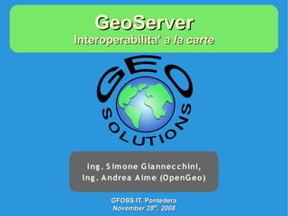
  • 1. GeoServer Interoperabilita' a la carte I ng . S im one G ia nnec c hini, I ng . A ndrea A im e (O penG eo ) GFOSS.IT, Pontedera November 28th, 2008
  • 2. Outline ● Cosa è GeoServer ● Come è fatto GeoServer ● Cosa fa GeoServer ● Cosa fara' GeoServer ● Chi fa GeoServer GFOSS.IT, Pontedera November 28th, 2008
  • 3. Cosa è GeoServer ● GeoSpatial enterprise gateway – Management dati raster e vettoriali ● Standards compliant – OGC WCS 1.0 - 1.1.1 (RI) – OGC WFS 1.0 - 1.1 (RI) – OGC WMS 1.1.1 ● Google support – KML, GeoSearch, etc.. ● Enterprise ready (almost!) GFOSS.IT, Pontedera November 28th, 2008
  • 4. Chi è GeoServer GeoWeb 2.0 KML WCS WFSv WFS GeoSearch WMS REST Enterprise Oracle PostGIS ArcSDE GeoTiff MrSID,ECW GFOSS.IT, Pontedera November 28th, 2008
  • 5. ---------- ---------- ---------- Cosa fa GeoServer Shapefile --------- ---------- ---------- Shapefile.zip --------- ---------- WFSv* GML2 GML3 Vector files GeoRSS PostGIS WFS 1.0 Raw vector data GeoJSON DB2 CSV/XLS Oracle WFS 1.1 MySql PNG, GIF GeoServer JPEG DBMS WMS TIFF, 1.1.1 GeoTIFF SVG, PDF ArcSDE Google* Styled KML/KMZ maps WFS WCS GeoTIFF Servers 1.0 GeoTIFF ArcGrid ArcGrid WCS GTopo30 GTopo30 1.1.1 Raw raster Img+World Img+world data Mosaic Raster files KML superoverlays MrSID GWC Google maps tiles JPEG 2000 ECW,Pyramid 1.7.1 GFOSS.IT, Pontedera November 28th, 2008
  • 6. Come è fatto GeoServer WCS WMS WFS WFSv REST Google GWC GeoTools Spring Spring ImageIO JAI JTS GDAL JMagick Vector Style Raster GFOSS.IT, Pontedera November 28th, 2008
  • 7. Formati Input/Output ● Input – Postgis, ORACLE, MySQL, Shapefile – Geotiff, image+worldfile, ESRI ascii grid, GRASS ascii grid, GTOPO30 (DEM) – JPEG2K, MrSID, ECW, ARCINFO binary GRID, Erdas Image, ENVISAT, HDF4, netCDF-CF, GriB1 ● Output – GeoRSS, GML 2.0, GML 3.1, shapefile, png, GeoTiff, KML GFOSS.IT, Pontedera November 28th, 2008
  • 8. Protocolli ● OGC WCS 1.0 – 1.1.1 (RI) ● OGC WFS 1.0 - 1.1(RI) ● OGC WMS 1.1.1 ● WFSv* ● KML ● GeoSearch* ● WMS-C ● RESTFul configuration GFOSS.IT, Pontedera November 28th, 2008
  • 9. Per-layer Security ● Specificare regole su singoli layer ● Configurazione semplificata con liste di regole namespace.layer.mode=role1,role2,... A name, or * to r: read The roles that will mean “any” w: write be authorized to access the data under this rule GFOSS.IT, Pontedera November 28th, 2008
  • 10. Per-layer Security *.*.r=* RDONLY *.*.w=NO_ONE lock down private.*.r=TRUSTED_ROLE private.*.w=TRUSTED_ROLE Per-layer override topp.districts.w=LEGISLATORS topp. Other private.* topp.* districts layers TRUSTED_ROLE r/w r r r LEGISLATORS  (no access) r r/w r (all other users)  (no access) r r r GFOSS.IT, Pontedera November 28th, 2008
  • 11. Integrazione GDAL ● Started with GSOC 2006-2007 ● ImageIO integration via ImageIO-ext – Estensione SUN ImageIO framework – JPEG2000,MrSID, ECW, BigTIFF*, ERDAS Image, HDF4,etc... – Non (ancora!) facile configurazione ● Problemi di licenza con ECW (?) GFOSS.IT, Pontedera November 28th, 2008
  • 12. RasterSymbolizer ● Supporto tematizzazione raster con SLD 256 colori 64 K co lo ri GFOSS.IT, Pontedera November 28th, 2008
  • 13. RasterSymbolizer GFOSS.IT, Pontedera November 28th, 2008
  • 14. Ingestion Engine* >> Shapefile added … New element processed … Sending shapefile to GeoServer .. …… …… DONE: Vector Layer Successfully published in GeoServer >> New raster to mosaic … Creating grid … Create tiles … Sending mosaic to GeoServer …… …… DONE >> File to convert … converting SRS … Processing coordinates …… …… Conversion DONE >> Creating WCS Services … pick up SRS .. Generate Boundings … …… …… DONE: WCS shared >> Creating WMS Services … pick up SRS .. Generate Boundings … Applying style …… …… DONE: WMS shared >> Cataloguing … writing metadata … adding contents … publishing … …… …… DONE: Metadata published GFOSS.IT, Pontedera November 28th, 2008
  • 15. GeoWeb 2.0 – KML wows TEMPORAL SERIES KML EXTRUDE KML SUPEROVERLAY GFOSS.IT, Pontedera November 28th, 2008
  • 16. GeoWeb 2.0 – Google Search ● Esponi i tuoi dati sul web! GFOSS.IT, Pontedera November 28th, 2008
  • 17. GeoWeb 2.0 – Google Search ● Esponi i tuoi dati sul web! GFOSS.IT, Pontedera November 28th, 2008
  • 18. GeoWeb 2.0 - GeoWebCache GeoServer ● Sistema di tile cache per WMS ● Layer statici GeoWebCache ● Fornisce KML/raster tiles Gmap, Gearth – – OpenLayers – Vearth Persistent raster/KML ● Speed up fattore 10/100 tile cache GFOSS.IT, Pontedera November 28th, 2008
  • 19. Labeling(++) GFOSS.IT, Pontedera November 28th, 2008
  • 20. RESTFul Configuration ● Prototipo iniziale → 2008 ● Configurazione programmatica – Nuovi layer – Stili ● Esposizione struttura interna – Ajax-JavaScript friendly ● Expect more in 2009 GFOSS.IT, Pontedera November 28th, 2008
  • 21. Futuro prossimo: Nuova UI GFOSS.IT, Pontedera November 28th, 2008
  • 22. Futuro prossimo: nD Raster ● Raster sono intrinsecamente multidimensionali – (x,y,z,t) → [(fieldA1,fieldA2),(fieldB1)] GFOSS.IT, Pontedera November 28th, 2008
  • 23. Futuro prossimo: WPS ● WPS 1.0 plugin ● Process back-end in GeoTools ● Integrazione in GeoServer in corso ● Obiettivi – Raster Processing (WCPS) – Sextante Integration – JGrass integration GFOSS.IT, Pontedera November 28th, 2008
  • 24. Chi fa GeoServer GFOSS.IT, Pontedera November 28th, 2008
  • 25. The End Domande? simone.giannecchini@geo-solutions.it GFOSS.IT, Pontedera November 28th, 2008